
Warner Peak Fire Update Daily Update August 14 2024 08 14 2024
Related Incident: Warner Peak Fire
Publication Type: News
Warner Peak Fire Update
Daily Update August 14, 2024
Acres: 61,330
Start Date: 08/05/24
Location: Lake County, OR
Personnel: 500
Containment: 19%
Highlights: Additional resources continue to arrive to support the suppression efforts. Crews are patrolling and securing fire lines on the northwest portion of the fire. Containment continues to increase on the Warner Peak Fire as firefighters push forward constructing new fire lines and secure existing fire lines. At this time, the fire is 19% contained.
Fire Activity: Air and ground resources are being used to reinforce fire lines around the perimeter of the fire. Challenges remain on the western and southwestern portions of the fire, where hotshot crews are working in rough and hard-to-access terrain, improving existing road systems as containment line. Burnout in the area of Hart Lake has been successful. On the southern side of the fire, crews are responding directly. Success will restrict fire spread to the south. Unmanned Aerial Systems (UAS/drones) and infrared (IR) technology will be used within the fire area to identify heat signatures. Resources continue to patrol and monitor the area for smoke.
Firefighters will continue to work through the night providing suppression efforts throughout the fire – with increased resources in the southeast where the fire is most active. Crews and air operations will inspect the perimeter for any signs of reignition, smoke, or hotspots, and taking immediate action to address any identified issues.
Closures: The Hart Mountain National Antelope Refuge is closed for public and firefighter safety. In coordination with the Southwest Area Incident Management Team, the Lake County Sheriff’s Office has issued evacuation orders for the Hart Mountain area in support of firefighting efforts on the Warner Peak Fire. For detailed information visit www.lakecountyor.org.
Weather: Temperatures will be in the mid 80’s today. Humidities are expected to be slightly higher ranging between 17%-20%. West to southwest gusts are expected to be as high as 30 mph.
Smoke: Wildfire smoke from the Warner Peak Fire may impact the community of Plush. Go to fire.airnow.gov/ to see the latest smoke conditions in your community.
More Information:
Information Phone Line: 541.208.1770
Email: 2024.warnerpeak@firenet.gov
Facebook: https://www.facebook.com/warnerpeakfire
Inciweb: https://inciweb.wildfire.gov/incident-information/orshr-warner-peak
Crazy Creek Fire Daily Update for August 14 2024 08 14 2024
Related Incident: Crazy Creek
Publication Type: News
Interior burning increases Crazy Creek Fire acreage; spot fires extinguished over northeast perimeter
Daily Update August 14, 2024
Fire Information Phone: 541-208-1768 (8 a.m.-8 p.m.)
Email: 2024.crazycreek@firenet.gov
Acres: Crazy Creek – 86,603; 63% contained
Kitty Creek – 73; 100% contained
Location: Crazy Creek: 5 miles north of Paulina, Oregon; 498/Kitty Creek: 7 miles south of Mitchell, Oregon
Start Date: July 22, 2024 Personnel: 721
Resources: 20 crews | 1 helicopter | 38 engines | 12 bulldozers | 18 water tenders | 3 masticators |
36 skid steers
Highlights: Lower temperatures and increased humidity subdued fire behavior within the Crazy Creek Fire, now at 86,603 acres and 63 percent containment. Infrared monitoring showed decreasing amounts of hot spots across the entire fire footprint, with the greatest intensities still concentrated within the northeast section of the fire.
Overnight temperatures in the upper 30s, along with relative humidity as high as 80 percent, is adding moisture to smaller-sized vegetation and debris, making them more resistant to ignitions or advancing active flames. However, larger-sized logs and stumps continue to hold heat and are a focus for firefighters seeking out isolated hot spots near containment lines.
Possible thunderstorms over the fire, starting around midnight, are expected to drop minimal rain, but could result in lightning strikes outside the fire’s perimeter, where vegetation is still susceptible for ignition. With six to eight weeks remaining in Central Oregon’s typical fire season, firefighters are constructing contingency lines outside the fire’s perimeter as a precautionary measure.
Evacuations: The Crook County Sheriff’s Office has lowered the evacuation level from Level 3 (recommended evacuation) to Level 2 (set for evacuation) from Highway 380 north to SE Puett Road. The area north of SE Puett Road around the perimeter of the fire remains at a Level 3. The area south of Highway 380 has been lowered to Level 1 (prepare for possible evacuation). An evacuation map is available online through the Crook County Emergency Management Office website.
Weather: Today and into next week hot, dry weather will persist throughout the area with temperatures in the high 80s to low 90s, light winds gusting to 21 mph and low humidity.
Importance of Fire Prevention: All public lands in Central Oregon, including the Ochoco National Forest, are in Stage 2 Public Use (Fire) Restrictions. All open flames, including woodstoves and charcoal briquette fires, are prohibited. In times of high fire danger, it is crucial for everyone to follow prevention measures to avoid additional strain on overburdened resources.
Fire Restrictions and Closures: The Ochoco National Forest has implemented a forest closure for the Paulina Ranger District. The Bureau of Land Management has issued a temporary closure for public lands in Crook and Grant Counties.
More Information:
InciWeb: https://inciweb.wildfire.gov/incident-information/orocf-crazy-creek
Facebook: Facebook.com/Crazy Creek Fire
Central Oregon Wildfire Information: https://centraloregonfire.org/
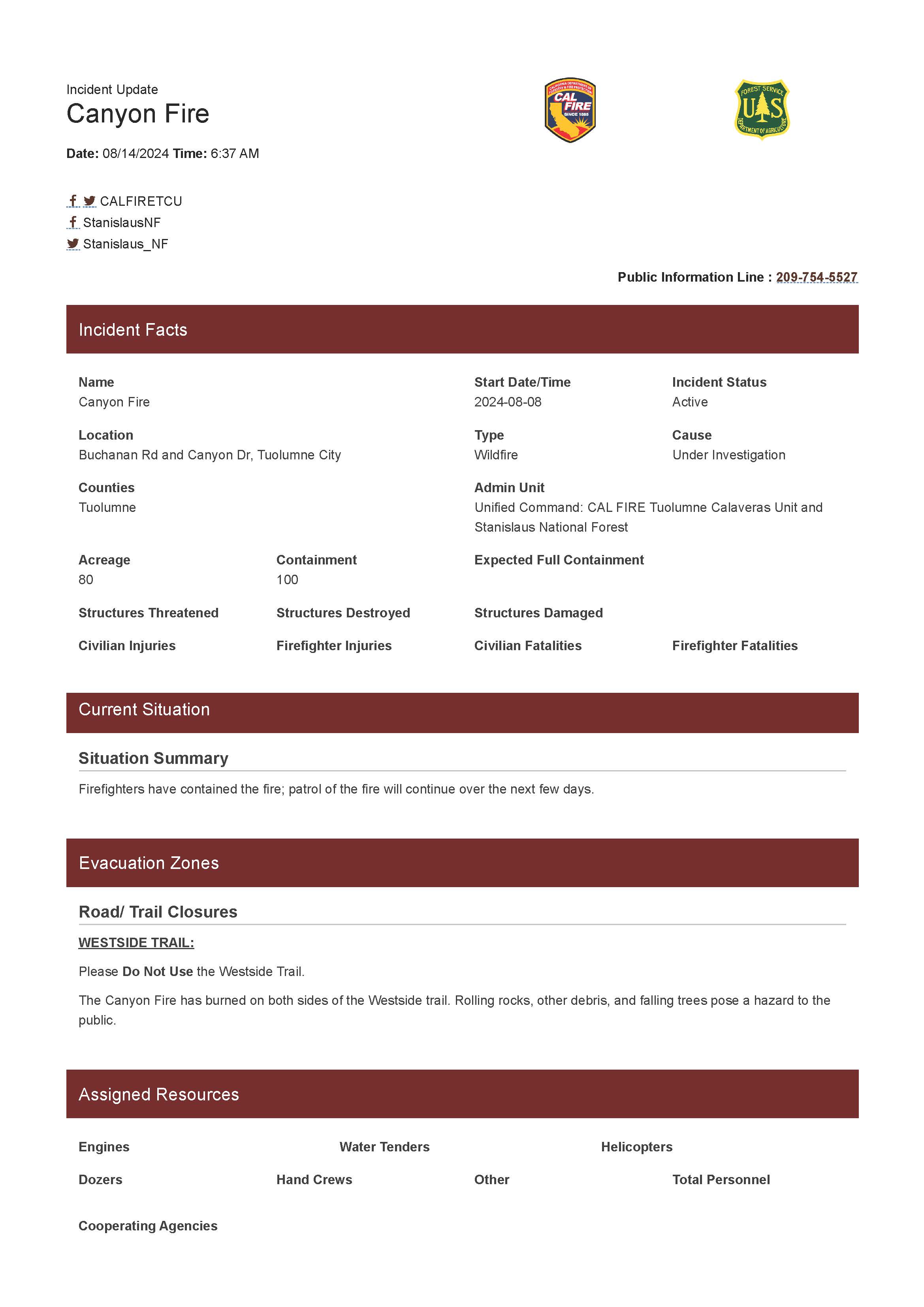
Canyon Fire Update 08 14 2024
Related Incident: Canyon Fire
Publication Type: News
The Canyon Fire is 100% contained.
Fire personnel will continue to patrol the area for the next few days.
Buchanan Road opens this morning at 9 am.
Please do not use the Westside Trail. Rolling rocks, other debris, and falling trees pose a hazard to the public. The estimated date of opening is August 21st.
Limepoint and Cliff Mountain Fires Update Wednesday 08 14 2024
Related Incident: Limepoint Fire
Publication Type: News
Limepoint and Cliff Mountain Fires
Wednesday, August 14, 2024
Contact Fire Information: 208-992-3032
Limepoint: https://inciweb.wildfire.gov/incident-information/idpaf-limepoint-fire
Cliff Mountain: https://inciweb.wildfire.gov/incident-information/idpaf-cliff-mountain https://www.facebook.com/payettenationalforest/
Cool and dry weather continues today after yesterday’s thunderstorms. Both fires did receive some rainfall, but it was not a wetting rain. Firefighters will continue to check the fireline for hazards that appeared after yesterday’s erratic wind. On the north side of the fire near Lockwood Saddle embers blew from the main fire and started several small fires adjacent to Sheep Rock Road which was being utilized as fireline. Firefighters were able to secure the small fires with support from helicopter water drops and by constructing handline around the fires. Crews will continue working the area and cooling any hotspots.
Containment has increased near Oxbow in the south, Hells Canyon Road to the west, and on the eastern side near Wildhorse Canyon, resulting in fire managers feeling confident that the fireline is secure in these areas.
Calmer weather enabled firefighters to safely return to the firefighter camp to the north near Horse Mountain. On Monday, the firefighters were temporarily moved from their camp to a second camp in Bear ahead of erratic wind and lightning. Being back in the Horse Mountain camp allows crews to be closer to their work in the most active part of the fire.
Incident Commander Steve Shaw said, “Coordination between the incident management team, the Payette National Forest, and community has worked well.” Shaw acknowledged, “There is still plenty of work to be done on this fire, but we have good momentum.”
The Cliff Mountain Fire started by lightning on July 25th in Hells Canyon National Recreation Area just east of Hells Canyon Dam. It is 1,108 acres with 20 percent containment, burning mostly in wilderness. No smoke was observed yesterday, and no personnel are assigned. Aviation continues to actively assess the fire.
Evacuations: Cuprum is at a Level 2 (SET) evacuation level, per the Adams County Sheriff. Bear and Wildhorse are in a Level 1 (READY) evacuation. For your safety and the safety of firefighters, please stay away from the fire area. Only residents and property owners are allowed in the area until further notice.
Closures: The Payette National Forest issued a Forest Closure to protect public safety and includes, but is not limited to, the following recreation areas: Big Bar, Black Lake, Sheep Rock, Kinney Point and Horse Mountain Lookout. Huckleberry Campground is inaccessible due to county road restrictions. For more information, about the closure visit https://inciweb.wildfire.gov/incident-information/idpaf-limepoint-fire. County roads within the Forest Closure area are accessible to firefighters and local residents only. Forest Road 454, which runs along the Snake River is open, but please drive with caution due to rolling debris.
Restrictions: Stage 1 Fire Restrictions are in effect for the Payette National Forest and all state, private and BLM lands in the fire area. Under these restrictions, campfires are allowed only in recreation sites within metal fire pits. Fires of any kind are not allowed in any dispersed camping areas.
How to Find Fire Information After 08 14 2024
Related Incident:
Publication Type: Announcement
With the fire currently less active and producing little smoke, there have been fewer questions from the visiting public and local community about the status of the fire. As a result, further updates noting any change in fire activity will primarily be posted on Inciweb on an as-needed basis beginning on Thursday, August 15.
Inciweb information may be posted in various locations on the website, depending on the type of information being shared. These tabs are located near the top of the Clearwater Fire Inciweb page:
- News tab - generally for longer summaries of fire activity and operations
- Closure tab - for changes in access to public resources such as roads, trails and campgrounds
- Announcements tab - relevant related information such as Forest restrictions, temporary flight restrictions, safety announcements, etc.
As of Wednesday, August 14, phone inquiries related to the Clearwater Fire can be directed to the Shoshone National Forest, Wapiti Ranger District at 307-527-6921. Written requests can be sent to the Shoshone Public Affairs Officer, Evan Guzik, at evan.guzik@usda.gov.
Daily Update on Clearwater Fire for Wednesday 08 14 2024
Related Incident:
Publication Type: News
Fire Location: 11 miles west of Wapiti, WY
Size: 1,896 acres
Containment: 62%
Personnel: 78
Start Date: 7/19/24
Cause: Lightning
Incident Commander (IC): Ron Steffens, Wyoming Type 3 Team
Operations – No fire growth was reported yesterday. The most recent aerial mapping showed the fire is holding heat primarily on the northern and western edges. As the fire is likely to burn and smolder for some time in heavy fuels and steep terrain, the incident management team will continue requests for aerial mapping as needed to accurately report updated acreage and areas of heat. Fire managers will continue work on the Clearwater Fire and take appropriate action based on factors such as complexity, fire behavior, weather, and safety.
Continued Fire Information – This is the final daily update that will be regularly posted. Further updates noting any change in fire activity or operations will primarily be posted on InciWeb on an as-needed basis.
Beginning Wednesday, August 14, phone inquiries related to the Clearwater Fire can be directed to the Shoshone National Forest, Wapiti Ranger District at 307-527-6921. Written requests can be sent to the Shoshone Public Affairs Officer, Evan Guzik, at evan.guzik@usda.gov.
Closures – Wapiti Campground reopens today; Elk Fork Campground and Clearwater Campground are closed until fire conditions allow otherwise. A road and trail closure are in effect at NFS Road #424, Elk Fork Road and NFS Trail # 760, Elk Fork Trail. Click here to view the closure order (#021404-24-03). For safety reasons, the public is asked to respect closed campgrounds and trails. A temporary flight restriction (TFR) is in effect until August 19.
Weather | Anticipated Fire Behavior – Remote weather stations recorded .25 inches of rain on the fire area yesterday. Today’s weather shows a continued chance of showers throughout the day, with thunderstorms possible in the afternoon.
Safety Information - Stage 1 fire restrictions are still in effect on the Shoshone National Forest. Click here to view a copy of Stage 1 Fire Restrictions order (#02-14-04-24-04).
There have been no recent smoke impacts to Highway 14/16/20.
Falls and Telephone Fires Update for Aug 14 2024 08 14 2024
Related Incident: Falls FireTelephone Fire
Publication Type: News
Falls and Telephone Fires Update for August 14, 2024
Total Personnel Across All Fires: 1,051
Total Resources Assigned: 28 hand crews, 36 engines, 11 bulldozers, 31 water tenders, 1 masticator, 12 skidgines
Aerial resources assigned: One Type 1 helicopter
Telephone Fire Quick Facts:
Size: 53,999
Start Date: July 22, 2024
Location: 12 miles NE of Burns, OR
Containment: 65% Cause: Lightning/Natural
Falls Fire Quick Facts:
Size: 151,666
Start Date: July 10, 2024
Location: 13 miles NW of Burns, OR
Containment: 89% Cause: Human-caused, under investigation
Structures Triaged:
Residences: 386 / Commercial: 119 / Outbuildings: 760
Sand Mountain Fire Quick Facts:
Size: 7,582
Start Date: July 25, 2024
Location: 17 miles SW of Seneca, OR
Containment: 100% Cause: Lightning/Natural
Priorities for Wednesday, August 14
• Initial Attack (IA) is the highest priority to keep all new fires as small as possible.
• Northeast portion of the Falls Fire; increasing mop up depth and spot containment.
• Northwest portion of the Telephone Fire near Gobbler’s Knob and King Mountain; increasing mop up depth and spot containment.
Telephone Fire: Yesterday, work to construct a shaded fuel break on the 2830 and 28 Roads neared completion. Firefighters in the southwest and west cleaned up pockets and conducted burn operations to remove unburned fuels that contribute to continued fire activity. Today, the eastern side of the fire will be monitored and patrolled. Additionally, ranchers, firefighters and cooperators will be working together to drive cattle across 395 to safer, unburned areas for grazing. Mastication on the 2830 Road continues along with work on the 28 Road shaded fuel break.
Falls/Sand Mountain Fires: Yesterday, crews worked on backhaul on the west side of the fire. Backhaul—the process of returning equipment and supplies on a wildfire to a central point for redistribution—is an essential part of wildfire logistics and ensures that resources are efficiently managed and available for changing fire conditions or future incidents. Today, firefighters in the northeast will focus on securing the fire’s edge through burning out small pockets of unburned fuels using an unmanned aerial system in the Five Hundred Flat Area. Crews will continue felling operations to remove hazardous trees on the 37 Road. With increased containment across the fire, more of the perimeter is in patrol and monitor status.
Weather: Temperatures are expected to be seasonable with relative humidities in the low teens. Winds will be breezy and light out of the west-southwest. Late this evening, there is a chance of thunderstorms with abundant lightning and possible gusty outflow winds.
Evacuations: There were changes yesterday to the evacuation orders for Grant and Harney Counties. For the most accurate evacuation information, visit the Harney County Sheriff’s evacuation map: https://bit.ly/FallsFireEvac, or the Grant County Emergency Management Facebook page: https://www.facebook.com/profile.php?id=100068819321423
Closures: National Forest has reduced the South Area Closure. Due to control and containment measures the Malheur National Forest is able to reduce portions of the Forest previously under the South Area Closure. However, to continue protecting public health and safety, fire managers will maintain a portion of the southern part of the forest under closure due to fire activity and fire suppression operations. This closure will be effective August 6, 2024, through December 31, 2024, unless rescinded sooner. This Forest Order rescinds and replaces the previous southern area closure. A closure map and the closure order are available on the Malheur National Forest website (https://www.fs.usda.gov/detail/malheur/news-events/?cid=FSEPRD1198892) and in local U.S. Forest Service offices.
Investigation: The U.S. Forest Service is seeking the public’s assistance with any information pertinent to the start of the Falls Fire on the Malheur National Forest. Submit any relevant information to SM.FS.R6TipHotLine@usda.gov.
Temporary Flight Restriction (TFR): TFRs in the area have been changing; pilots should check the latest information on the Federal Aviation Administration TFR website prior to flying: https://tfr.faa.gov/tfr_map_ims/html/index.html
Facebook: https://www.facebook.com/p/Falls-Fire-2024-61562126623985/
Falls Fire InciWeb: https://inciweb.wildfire.gov/incident-information/ormaf-falls-fire
Telephone Fire InciWeb: https://inciweb.wildfire.gov/incident-information/ormaf-telephone-fire
Fire Information Line: 541-208-4370, staffed 8 a.m. to 8 p.m.
Email: 2024.Falls@firenet.gov
Harney County Non-emergency Evacuation Questions: 541-589-5579
Air Quality Questions: 541-573-2271. Air quality information, searchable by zip code: https://fire.airnow.gov/
Smoke Outlooks: https://outlooks.airfire.org/outlook
Tuesday Evening Update for the Park Fire 08 13 2024
Related Incident: Park Fire
Publication Type: News
Evening of Tuesday, August 13, 2024
For more information on the Park Fire, please visit: https://inciweb.wildfire.gov/incident-information/calnf-park-fire
Size: 429,263 acres with 40% containment | Personnel: 5,579
Lassen National Forest:
Today, firefighting resources continued focused mop-up and tactical patrol around the fire's perimeter with an emphasis on hazard tree removal along roadways and near the fire perimeter's edge. Crews are also engaging in suppression repair to return remove any damage created by suppression efforts. There was no perimeter growth, however interior pockets of unburned fuels will continue to produce smoke and smolder, as well.
Tonight’s weather brings a return to normal levels of humidity recovery, aiding firefighters.
Overnight on the Park Fire, personnel are patrolling all perimeter lines assisted by the infrared capabilities of Unmanned Aircraft Systems (UAS) and aircraft to locate remaining hot spots and extinguish them.
The #ParkFire has burned 113,736 acres on the Lassen National Forest.
CAL FIRE:
Today more favorable weather conditions limited threat of spotting and fire spread. Interior islands continued to burn within the fire perimeter.
Firefighters are improving and constructing direct and indirect lines in the northern parts of the fire area as well as removing dead trees and protecting the highways and communications infrastructure nearby.
In some areas, repopulations are occurring where it is safe to do so, with multiple orders also reduced to warnings recently. Please stay diligent while on the roads as crews and equipment may be working in the area.
For more information on the Park Fire please visit:
- CALFIRE Park Fire: https://www.fire.ca.gov/incidents/2024/7/24/park-fire
- CAL FIRE Shasta-Trinity Unit/Shasta County Fire Department: https://www.facebook.com/CALFIRESHU
- CAL FIRE Tehama-Glenn Unit/ Tehama County Fire Dept: https://www.facebook.com/CALFIRETGU
- Butte County, CA: https://www.facebook.com/ButteCounty
- Butte County Sheriff: https://www.facebook.com/bcsonews
- Plumas County Sheriff: https://www.facebook.com/plumascountysheriff
- Shasta County Sheriff: https://www.facebook.com/ShastaSheriff
- Tehama County Sheriff: https://www.facebook.com/profile.php?id=100088640404140
Dixon Fire Evening Update 8132024 08 13 2024
Related Incident: Dixon Fire
Publication Type: News
Portions of the Dixon Fire Remain Active, While Mop Up Begins on Northern Edge
DAYS CREEK, Ore. – Firefighters, heavy equipment, and air assets are holding the fire line along FSRD 1610, Devils Knob Rd and the 100-spur road. Crews in this area are also working to address unburned pockets of fuel within the fire perimeter to assist with fire control.
The transition to mop up started in less active areas of the fire today, with firefighters working to cool hot spots and extinguish burning debris. Falling modules also made good progress today, removing hazardous trees along Tiller Trail Highway.
Tomorrow, crews will extend mop up operations further into the fire perimeter. Hose lays and portable water sources have been installed to assist with this task, and additional equipment is on order to plumb similar systems on the southern edge of the fire.
In addition to the uninhabited home lost during the fire, three outbuildings were destroyed on Saturday as well. These structures were located on a single property. This information was collected during structural assessments.
Community Meeting: There will be a community meeting tomorrow, Wednesday, August 14th at 7pm at the South Umpqua Community Church. Address: 27292 Tiller Trail Hwy, Days Creek, OR 97429
Evacuations: Evacuation levels are managed by the Douglas County Sheriff and were updated this morning. Please stay up to date here: https://www.dcso.com/270/Evacuations
The official Red Cross call-in shelter is now at:
Days Creek Charter School
11381 Tiller Trail Hwy, Days Creek, OR 97429
This new location was established to better meet the needs of community members. Please call (541) 580-1867 or (541) 801-4971 if you need access.
Forest Closures: There is a forest closure in place. Order: https://www.fs.usda.gov/Internet/FSE_DOCUMENTS/fseprd1200029.pdf
Map: https://www.fs.usda.gov/Internet/FSE_DOCUMENTS/fseprd1200030.pdf
Fire Information Board Locations: https://www.google.com/maps/d/edit?mid=13vb6f48bmfpMszOGMdkoVLIIgXQd4s0&usp=sharing
Smoke Outlook: A smoke condition warning has been issued for the immediate area.
For updates check: https://fire.airnow.gov/#
Infrastructure Update: Pacific Power crews are in the community doing fire hardening measures, inspections and repair work. They will continue to provide updates to impacted customers via phone/email/text.
For information on current outages, visit:
https://www.pacificpower.net/outages-safety.html
En español: https://www.pacificpower.net/es/apagones.html
For information on wildfire mitigation and safety efforts, visit:
https://www.pacificpower.net/outages-safety/wildfire-safety.html
For questions, please reach out to the Pacific Power Customer Service team at 1-888-221-7070
Settings - change map background and toggle additional layers
Filter - control incident types displayed on map.
Zoom to your location
Reset map zoom and position
Could not determine your location.
Show Legend
 Wildfire
 Prescribed Fire
 Burned Area
Response
Burned Area
Response Other
Other