
Falls and Telephone Fires Update for Aug 14 2024 08 14 2024
Related Incident: Falls FireTelephone Fire
Publication Type: News
Falls and Telephone Fires Update for August 14, 2024
Total Personnel Across All Fires: 1,051
Total Resources Assigned: 28 hand crews, 36 engines, 11 bulldozers, 31 water tenders, 1 masticator, 12 skidgines
Aerial resources assigned: One Type 1 helicopter
Telephone Fire Quick Facts:
Size: 53,999
Start Date: July 22, 2024
Location: 12 miles NE of Burns, OR
Containment: 65% Cause: Lightning/Natural
Falls Fire Quick Facts:
Size: 151,666
Start Date: July 10, 2024
Location: 13 miles NW of Burns, OR
Containment: 89% Cause: Human-caused, under investigation
Structures Triaged:
Residences: 386 / Commercial: 119 / Outbuildings: 760
Sand Mountain Fire Quick Facts:
Size: 7,582
Start Date: July 25, 2024
Location: 17 miles SW of Seneca, OR
Containment: 100% Cause: Lightning/Natural
Priorities for Wednesday, August 14
• Initial Attack (IA) is the highest priority to keep all new fires as small as possible.
• Northeast portion of the Falls Fire; increasing mop up depth and spot containment.
• Northwest portion of the Telephone Fire near Gobbler’s Knob and King Mountain; increasing mop up depth and spot containment.
Telephone Fire: Yesterday, work to construct a shaded fuel break on the 2830 and 28 Roads neared completion. Firefighters in the southwest and west cleaned up pockets and conducted burn operations to remove unburned fuels that contribute to continued fire activity. Today, the eastern side of the fire will be monitored and patrolled. Additionally, ranchers, firefighters and cooperators will be working together to drive cattle across 395 to safer, unburned areas for grazing. Mastication on the 2830 Road continues along with work on the 28 Road shaded fuel break.
Falls/Sand Mountain Fires: Yesterday, crews worked on backhaul on the west side of the fire. Backhaul—the process of returning equipment and supplies on a wildfire to a central point for redistribution—is an essential part of wildfire logistics and ensures that resources are efficiently managed and available for changing fire conditions or future incidents. Today, firefighters in the northeast will focus on securing the fire’s edge through burning out small pockets of unburned fuels using an unmanned aerial system in the Five Hundred Flat Area. Crews will continue felling operations to remove hazardous trees on the 37 Road. With increased containment across the fire, more of the perimeter is in patrol and monitor status.
Weather: Temperatures are expected to be seasonable with relative humidities in the low teens. Winds will be breezy and light out of the west-southwest. Late this evening, there is a chance of thunderstorms with abundant lightning and possible gusty outflow winds.
Evacuations: There were changes yesterday to the evacuation orders for Grant and Harney Counties. For the most accurate evacuation information, visit the Harney County Sheriff’s evacuation map: https://bit.ly/FallsFireEvac, or the Grant County Emergency Management Facebook page: https://www.facebook.com/profile.php?id=100068819321423
Closures: National Forest has reduced the South Area Closure. Due to control and containment measures the Malheur National Forest is able to reduce portions of the Forest previously under the South Area Closure. However, to continue protecting public health and safety, fire managers will maintain a portion of the southern part of the forest under closure due to fire activity and fire suppression operations. This closure will be effective August 6, 2024, through December 31, 2024, unless rescinded sooner. This Forest Order rescinds and replaces the previous southern area closure. A closure map and the closure order are available on the Malheur National Forest website (https://www.fs.usda.gov/detail/malheur/news-events/?cid=FSEPRD1198892) and in local U.S. Forest Service offices.
Investigation: The U.S. Forest Service is seeking the public’s assistance with any information pertinent to the start of the Falls Fire on the Malheur National Forest. Submit any relevant information to SM.FS.R6TipHotLine@usda.gov.
Temporary Flight Restriction (TFR): TFRs in the area have been changing; pilots should check the latest information on the Federal Aviation Administration TFR website prior to flying: https://tfr.faa.gov/tfr_map_ims/html/index.html
Facebook: https://www.facebook.com/p/Falls-Fire-2024-61562126623985/
Falls Fire InciWeb: https://inciweb.wildfire.gov/incident-information/ormaf-falls-fire
Telephone Fire InciWeb: https://inciweb.wildfire.gov/incident-information/ormaf-telephone-fire
Fire Information Line: 541-208-4370, staffed 8 a.m. to 8 p.m.
Email: 2024.Falls@firenet.gov
Harney County Non-emergency Evacuation Questions: 541-589-5579
Air Quality Questions: 541-573-2271. Air quality information, searchable by zip code: https://fire.airnow.gov/
Smoke Outlooks: https://outlooks.airfire.org/outlook
Tuesday Evening Update for the Park Fire 08 13 2024
Related Incident: Park Fire
Publication Type: News
Evening of Tuesday, August 13, 2024
For more information on the Park Fire, please visit: https://inciweb.wildfire.gov/incident-information/calnf-park-fire
Size: 429,263 acres with 40% containment | Personnel: 5,579
Lassen National Forest:
Today, firefighting resources continued focused mop-up and tactical patrol around the fire's perimeter with an emphasis on hazard tree removal along roadways and near the fire perimeter's edge. Crews are also engaging in suppression repair to return remove any damage created by suppression efforts. There was no perimeter growth, however interior pockets of unburned fuels will continue to produce smoke and smolder, as well.
Tonight’s weather brings a return to normal levels of humidity recovery, aiding firefighters.
Overnight on the Park Fire, personnel are patrolling all perimeter lines assisted by the infrared capabilities of Unmanned Aircraft Systems (UAS) and aircraft to locate remaining hot spots and extinguish them.
The #ParkFire has burned 113,736 acres on the Lassen National Forest.
CAL FIRE:
Today more favorable weather conditions limited threat of spotting and fire spread. Interior islands continued to burn within the fire perimeter.
Firefighters are improving and constructing direct and indirect lines in the northern parts of the fire area as well as removing dead trees and protecting the highways and communications infrastructure nearby.
In some areas, repopulations are occurring where it is safe to do so, with multiple orders also reduced to warnings recently. Please stay diligent while on the roads as crews and equipment may be working in the area.
For more information on the Park Fire please visit:
- CALFIRE Park Fire: https://www.fire.ca.gov/incidents/2024/7/24/park-fire
- CAL FIRE Shasta-Trinity Unit/Shasta County Fire Department: https://www.facebook.com/CALFIRESHU
- CAL FIRE Tehama-Glenn Unit/ Tehama County Fire Dept: https://www.facebook.com/CALFIRETGU
- Butte County, CA: https://www.facebook.com/ButteCounty
- Butte County Sheriff: https://www.facebook.com/bcsonews
- Plumas County Sheriff: https://www.facebook.com/plumascountysheriff
- Shasta County Sheriff: https://www.facebook.com/ShastaSheriff
- Tehama County Sheriff: https://www.facebook.com/profile.php?id=100088640404140
Dixon Fire Evening Update 8132024 08 13 2024
Related Incident: Dixon Fire
Publication Type: News
Portions of the Dixon Fire Remain Active, While Mop Up Begins on Northern Edge
DAYS CREEK, Ore. – Firefighters, heavy equipment, and air assets are holding the fire line along FSRD 1610, Devils Knob Rd and the 100-spur road. Crews in this area are also working to address unburned pockets of fuel within the fire perimeter to assist with fire control.
The transition to mop up started in less active areas of the fire today, with firefighters working to cool hot spots and extinguish burning debris. Falling modules also made good progress today, removing hazardous trees along Tiller Trail Highway.
Tomorrow, crews will extend mop up operations further into the fire perimeter. Hose lays and portable water sources have been installed to assist with this task, and additional equipment is on order to plumb similar systems on the southern edge of the fire.
In addition to the uninhabited home lost during the fire, three outbuildings were destroyed on Saturday as well. These structures were located on a single property. This information was collected during structural assessments.
Community Meeting: There will be a community meeting tomorrow, Wednesday, August 14th at 7pm at the South Umpqua Community Church. Address: 27292 Tiller Trail Hwy, Days Creek, OR 97429
Evacuations: Evacuation levels are managed by the Douglas County Sheriff and were updated this morning. Please stay up to date here: https://www.dcso.com/270/Evacuations
The official Red Cross call-in shelter is now at:
Days Creek Charter School
11381 Tiller Trail Hwy, Days Creek, OR 97429
This new location was established to better meet the needs of community members. Please call (541) 580-1867 or (541) 801-4971 if you need access.
Forest Closures: There is a forest closure in place. Order: https://www.fs.usda.gov/Internet/FSE_DOCUMENTS/fseprd1200029.pdf
Map: https://www.fs.usda.gov/Internet/FSE_DOCUMENTS/fseprd1200030.pdf
Fire Information Board Locations: https://www.google.com/maps/d/edit?mid=13vb6f48bmfpMszOGMdkoVLIIgXQd4s0&usp=sharing
Smoke Outlook: A smoke condition warning has been issued for the immediate area.
For updates check: https://fire.airnow.gov/#
Infrastructure Update: Pacific Power crews are in the community doing fire hardening measures, inspections and repair work. They will continue to provide updates to impacted customers via phone/email/text.
For information on current outages, visit:
https://www.pacificpower.net/outages-safety.html
En español: https://www.pacificpower.net/es/apagones.html
For information on wildfire mitigation and safety efforts, visit:
https://www.pacificpower.net/outages-safety/wildfire-safety.html
For questions, please reach out to the Pacific Power Customer Service team at 1-888-221-7070
Settings - change map background and toggle additional layers
Filter - control incident types displayed on map.
Zoom to your location
Reset map zoom and position
Could not determine your location.
Show Legend
 Wildfire
 Prescribed Fire
 Burned Area
Response
Burned Area
Response Other
Other
Lodgepole
Unit Information
Incident Contacts
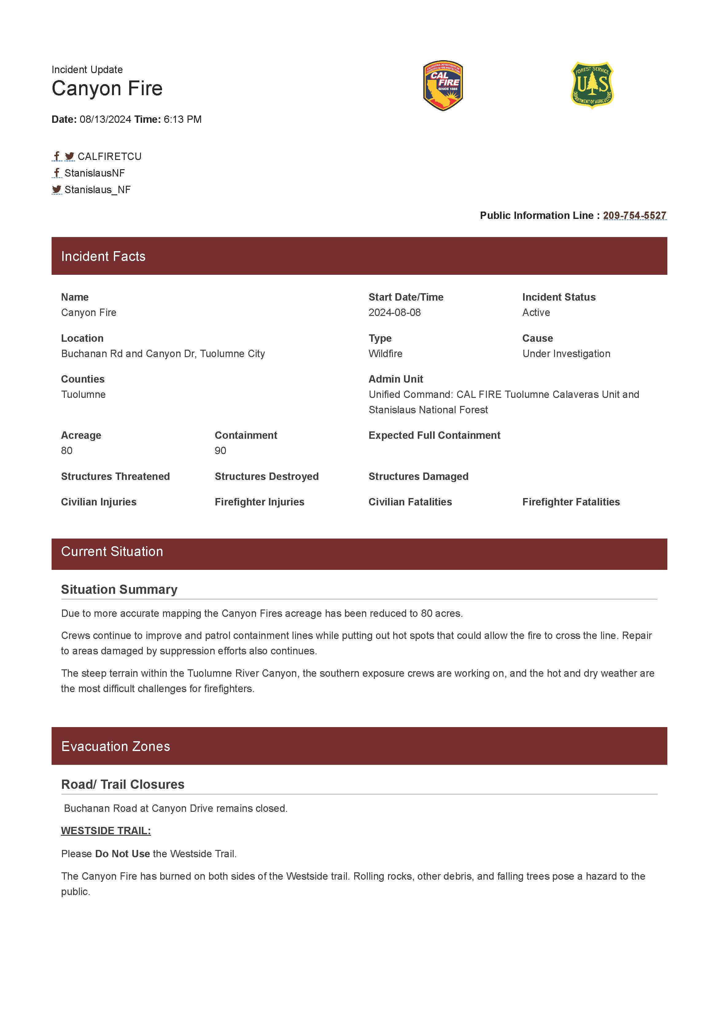
Canyon Fire Evening Update 08 13 2024
Related Incident: Canyon Fire
Publication Type: News
Due to more accurate mapping, the Canyon Fire's acreage has been reduced to 80 acres.
Crews continue to improve and patrol containment lines while putting out hot spots that could allow the fire to cross the line. Repair to areas damaged by suppression efforts also continues.
The steep terrain within the Tuolumne River Canyon, the southern exposure crews are working on, and the hot and dry weather are the most difficult challenges for firefighters.
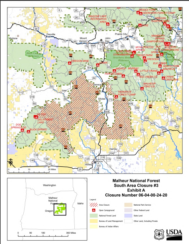
Malheur National Forest Closure Order Amended 8132024 08 13 2024
Related Incident: Falls FireTelephone Fire
Publication Type: Closures
Malheur National Forest Reduces South Area Closure
Closure Order 06-04-00-24-20
Release Date: Aug 13, 2024
Contact: Amy Franklin (541) 620-3365
SM.FS.malpubinfo@usda.gov www.fs.usda.gov/malheur
X: @MalheurNF
Facebook: www.facebook.com/MalheurNationalForest
The Malheur National Forest has reduced the South Area Closure, once more. Due to control and containment measures the Malheur National Forest is reducing portions of the forest previously under the South Area Closure #2. However, to continue protecting public health and safety, fire managers will maintain a portion of the southern part of the forest under closure due to fire activity and fire suppression operations. This closure will be effective August 13, 2024, through December 31, 2024, unless fire situations warrant recension sooner. This Forest Order rescinds and replaces the previous southern area closure #2 (06-04-00-24-19). This reduction of the South Area Closure will open Malheur National Forest west of the Forest Service Road 4100, including Delintment Lake and campground. .
Closure Area Description:
- Grant County Road 63 following the National Forest boundary to Highway 395C, south of Seneca.
- Highway 395C south of Seneca following the National Forest Boundary to Forest Service Road 1600 to the Forest Service Road 1601.
- Following Forest Service Road 1601southeast to the intersection of Forest Service Road 1700.
- Following Forest Service Road 1700 to the intersection of Forest Service Road 1500.
- Following Forest Service Road 1500 to the Malheur National Forest Service Boundary.
- Follow the southern portion of the Emigrant Creek Ranger District around to Forest Service Road 4100.
- Follow Forest Service Road 4100 to the National Forest boundary.
- Follow the National Forest boundary to Grant County Road 63.
A detailed map of the closure is included.
Rogue River Siskyou Emergency Area and Road Closure 08 13 2024
Related Incident: Middle Fork Fire
Publication Type: Closures
Pursuant to 16 USC§ 551 and 36 CFR § 261.50 (a) and (b), and to provide for public safety, the following acts are prohibited upon trails and general forest areas within the Rogue River-Siskiyou National Forest as described below and shown in Exhibit A. This Order is effective beginning August 12, 2024, and ending January 15, 2025, unless rescinded sooner.
1. Being on a road. [36 CFR § 261.54 (e)]
2. Going into or being upon an area closed for the protection of public health and safety. [36 CFR § 261.52 ( e )]
3. Being on a trail. [36 CFR § 261.55(a)]
The fire closure is described as an area starting at T30S, R03E, Sec. 35 at the intersection of Highway 62 and Highway 230, following Highway 62 east to the Rogue River - Siskiyou National Forest and Crater Lake National Park Boundary, following the Rogue River-Siskiyou National Forest Boundary and Crater Lake National Park boundary north, then northeast to Highway 230, following the Rogue River-Siskiyou and Umpqua National Forests Boundary northwest, west, then south west to Forest Service Road 37 (FSR), then south along Forest Service Road 37 (FSR)to Highway 230, following Highway 230 southwest to intersection of Highway 62.
EXCEPTIONS TO CLOSURE AREA: Roads Under Oregon Department of Transportation Jurisdiction: Highway 230 and Highway 62 Cattle allotments will remain accessible to permit holders with a signed exemption.
EXEMPTIONS: Pursuant to 36 CFR § 261. 50( e ), the following persons are exempt from this order:
1. Persons with Forest Service Permit No. FS-7700-48 (permit for Use of Roads, Trails, or Areas Restricted by Regulation or Order), specifically exempting them from this order.
2. Any Federal, State, or local officer, or member of any organized rescue or fire fighting force in the performance of an official duty.
These prohibitions are in addition to the general prohibitions in 36 C.F.R. Part 261, Subpart A. Violations of this prohibition are punishable by a fine of not more than $5,000 for an individual or $10,000 for an organization, or imprisonment for not more than 6 months, or both (16 U.S.C. § 551; 18 U.S.C. §§ 3351, 3559, 3571, and 3581).
Executed on August 12, 2024, 2024 in Medford, Oregon.
North Entrance to Crater Lake National Park Closed Beginning Tuesday August 13 08 13 2024
Related Incident: Middle Fork Fire
Publication Type: Closures
The North Entrance Road in the park will be closed for approximately seven days beginning Tuesday, August 13th for firefighters to prepare control lines. Visit https://www.nps.gov/crla/learn/news/crater-lake-temporarily-closes-north-entrance-for-the-middle-fork-fire.htm for details.
Settings - change map background and toggle additional layers
Filter - control incident types displayed on map.
Zoom to your location
Reset map zoom and position
Could not determine your location.
Show Legend
- Wildfire
- Prescribed Fire
- Burned Area
Response
- Other
Coffee Pot Fire
Unit Information
Incident Contacts
Grant County Falls Fire Evacuation Zone Downgrades 08 13 2024
Related Incident: Falls FireTelephone Fire
Publication Type: Announcement
Grant County Media Release:
Falls Fire Evacuation zone downgrades:
The Level 3 “Go now” zone North of the Harney County line, East of Hwy 395, but extending West to Silvies Valley Ranch Resort has been downgraded to Level 2.
The Level 2 “Be Set” evacuation zones, West of the FS 24 Rd, North of County roads 63 and 67, North of the Harney County line have been downgraded to Level 1 “Be Ready”.
Izee Hwy / County Rd 63 has been opened to all traffic. The Burns-Izee Rd / County Rd 67 and FS Rd 31 remain closed South of the Izee Hwy.
*** See Attachment for details MAP ***