
Settings - change map background and toggle additional layers
Filter - control incident types displayed on map.
Zoom to your location
Reset map zoom and position
Could not determine your location.
Show Legend
 Wildfire
 Prescribed Fire
 Burned Area
Response
Burned Area
Response Other
Other
Tyee Ridge Complex
Unit Information
Incident Contacts
Happy Camp Complex Incident Update August 26 2023 800 pm
Related Incident: 2023 Happy Camp Complex Klamath NF
Publication Type: News
Another active day occurred on the Happy Camp Complex, as weather conditions remained dry and fuels burned easily. A southwest wind aided firefighters by blowing the active fire front back into the area already burned. On the Head Fire, water-dropping helicopters were used on the north flank to support the firefighters on the ground.
WEST SIDE OVERVIEW (ACRES/CONTAINMENT): Elliot (4,967 acres, 3%), Swillup (1,895 acres, 0%), Malone (438 acres, 7%), Ufish (1,372 acres, 0%)
The southwest wind pushed the fire’s southern edge away from Dillon Creek and back into burned areas. Fire lines on the north edge held, where firefighters had completed a strategic firing operation. On the Swillup Fire, activity increased and crews conducted a strategic fire operation along the 24 Road. Efforts will continue tonight to secure the area along the 24 Road. Just to the east and across the river, the Ufish Fire activity increased. The fire backed toward the Klamath River to the west and Titus Creek to the southeast. Firefighters worked to strengthen the primary and contingency lines around the fire. Contingency lines are constructed beyond the primary line to provide an additional barrier if the primary fire lines do not hold. The Malone Fire remained inactive today.
EAST SIDE OVERVIEW (ACRES/CONTAINMENT): Head (6,739 acres, 29%), Block (0.1 acres, 100%), Townsend (81 acres, 100%), Den (294 acres, 95%), Scott (1,862 acres, 50%), Lake (199/ acres, 5%)
The southwest flank of the Head Fire became active as the wind fanned the flames today. Crews working at the fire’s edge were forced to withdraw due to increased activity. An unmanned aircraft system (drone) will fly the east side of the fire tonight checking for spot fires across the line.
A large pocket of vegetation burned in the interior of the Scott Fire. As the fuel was consumed, the fire backed down to the Scott River. CAL FIRE resources will continue through the night holding the fire at the Scott River and Scott Bar Road. To the south of the Scott Fire, a fire line has been completed around the Lake Fire. An additional crew hiked in to assist with mop-up operations, which are expected to take several days.
EVACUATIONS: View current Siskiyou County evacuation orders, warnings by visiting: community.zonehaven.com. Siskiyou County residents are encouraged to sign up for rapid emergency notifications using the CodeRED emergency alert system. https://www.co.siskiyou.ca.us/emergencyservices/page/codered-emergency-alert
An evacuation center has been established at the Kahtishraam Wellness Center, 1403 Kahtishraam, Yreka, CA 95097. Call (530) 340-3539 if you have questions regarding the shelter.
ROAD CONDITIONS: State Route 96 is now open. One-way traffic control remains in place in several areas while crews work to repair damaged infrastructure, remove debris, and stabilize slopes. Delays at the locations with one-way traffic control will be up to 15 minutes. The road will be closed to the public east of Seiad daily from 8:00 a.m. to 9:00 a.m. and from 6:30 p.m. to 8:00 p.m. to facilitate fire traffic. For the exact locations of where this work is taking place, please use quickmap.dot.ca.gov. County Road closures will be listed on the Siskiyou County Public Works website: https://www.co.siskiyou.ca.us/publicworks/page/closures-and-delays.
FOREST CLOSURE: Two closure orders have been implemented: Happy Camp Complex Emergency Fire Closure, No.05-05-23-06; Happy Camp Complex Emergency Fire Closure, No. 05-05-23-07. Please refer to https://www.fs.usda.gov/alerts/klamath/alerts-notices to view the orders and maps.
TEMPORARY FLIGHT RESTRICTION (TFR): A TFR has been established over the fire area. Flight restrictions include the use of drones. The operation of drones under the TFR is prohibited.
PACIFIC CREST TRAIL: The area within the Forest Orders, including the PCT from the Shelly Fork junction to Seiad Valley, is a hard closure. The PCT from Etna Summit to the Oregon border is a soft closure intended to prevent long-distance hikers from entering the official closure area. Incidental PCT use outside the Forest Closure area is not officially prohibited. Visitors should be aware that conditions can change rapidly regardless of where they are recreating on the Forest.
AIR QUALITY: For information regarding smoke impacts and what you can do to protect yourself, visit: https://www.airnow.gov/
- Fire Information:
- Public Phone: (530) 330-5441
- Media Phone: (530) 330-5452
- Hours: 8:00 a.m. to 8:00 p.m. daily
- Email: 2023.happycampcomplex@firenet.gov
- Incident Website: inciweb.wildfire.gov
PostWildfire Hydrology
Related Incident: 2023 - York Fire Burned Area Emergency Response (BAER)
Publication Type: News
Hydrologists are important members of a successful Burned Area Emergency Response (BAER). These specialists support post-wildfire land management decisions by developing analytical tools that integrate remote sensing and environmental modeling.
This is where Mary Ellen comes in. She is a research engineer at Michigan Technological University and was introduced to BAER when she was working for the United States Forest Service (USFS). At the time, part of her job was to validate satellite fire imagery. Soon after she graduated with her doctorate in environmental engineering, a friend’s home burned in a wildfire. Motivated to help her friend and the community, she participated in the BAER by measuring burn severity and modeling post-fire hydrologic events.
On the York Fire BAER, Mary Ellen guides post-fire remediation by creating a physically based model for predicting burn severity and watershed effects like flooding and erosion. The York Fire removed vegetation, which exposes the soil to erosion and can increase runoff.
Her first few days on this assignment were spent creating a soil burn severity map. She collected field observations and compared them to satellite imagery to create a map of low, moderate and high soil burn severity levels within the York Fire footprint. The data included the amount of remaining vegetation, ash depth, ash color, and soil structure. She conducted hydrophobicity tests, which measure the rate at which water penetrates and is absorbed into the soil. She collected data using an application built by Michigan Tech’s Human-Computer Interaction course. This application times data readings, compiles results, and generates maps for hydrological modeling. She also used the National Aeronautics and Space Administration (NASA) Earth Observations application to map retardant drops on the York Fire. This informed plans to mitigate increased invasive plant growth caused by fertilizers in the retardant.
Mary Ellen used hydrologic maps to model increased runoff and erosion and how it might impact life, property, and resources. These models simulate peak flows, runoff volume, erosion, and sediment movement. This data enables land managers to predict and assess potential hazards like flash floods and debris flows so that they can plan mitigation projects like ground mulching.
Ground cover is what makes a watershed healthy. Human activity like illegal off-road vehicle use can damage public waterways by eroding soil, compacting soil, and damaging vegetation. This can increase sediment runoff into nearby water bodies, which can clog bodies of water, hinder aquatic insect populations, and increase water temperature. The introduction of oil and other pollutants from off-road vehicles can also contribute to water contamination. Animals rely on healthy water. Poor water quality directly affects wildlife and the plants they eat. The public can minimize the negative impacts of off-road vehicles by remaining on designated vehicle routes.
State Route 20 Immediate Road Closure As of 330 PM Aug 26 Due to multiple fires near the roadway
Related Incident:
Publication Type: Closures
ALERT: SR 20 North Cascades Highway is now once again CLOSED between Newhalem (milepost 120) and Silver Star Campground (milepost 171, east end winter closure gate) as of 3:30 p.m. Saturday, August 26 due to multiple wildfires near the highway. There is no ETA for reopening. As we (WSDOT) said the last few days, unexpected closures are always possible given the nature of these fires. Our crews in partnership with the Incident Management Teams are on scene as active firefighting continues. Please do not disregard closures, they are in place for your safety and the safety of our crews and firefighters. These fires are in the area of the ongoing Blue Lake fire, not the Sourdough fire that is further west near Newhalem. For current updates go to: https://www.facebook.com/WSDOT/posts/pfbid024Hzu3avx2bh37yJTAc6XHXkRH6sCQAV7mKVKfS7TBe7mxJeB54D7BBo41xQZVDM5l
Deep Fire Meet Greet August 27 2023
Related Incident: Deep Fire
Publication Type: Announcement
DeepFire Meet & Greet on 8.27.2023
Join U.S. Forest Service - Shasta-Trinity National Forest District Ranger Tara Jones and Deep Fire incident information staff on August 27, 2023 at 5:00 pm at the USFS Coffee Creek Station for a Meet & Greet.
USFS Coffee Creek Station
2017 S. Derrick Flat Road
Trinity Center, CA 96091
This is an opportunity for the public to meet with the District Ranger and incident public information officers to get information and ask questions regarding the Deep Fire.
State Route 20 Immediate Road Closure As of 330 PM Aug 26 Due to multiple fires near the roadway
Related Incident:
Publication Type: Announcement
ALERT: SR 20 North Cascades Highway is now once again CLOSED between Newhalem (milepost 120) and Silver Star Campground (milepost 171, east end winter closure gate) as of 3:30 p.m. Saturday, August 26 due to multiple wildfires near the highway. There is no ETA for reopening. As we (WSDOT) said the last few days, unexpected closures are always possible given the nature of these fires. Our crews in partnership with the Incident Management Teams are on scene as active firefighting continues. Please do not disregard closures, they are in place for your safety and the safety of our crews and firefighters. These fires are in the area of the ongoing Blue Lake fire, not the Sourdough fire that is further west near Newhalem. For current updates go to https://www.facebook.com/WSDOT/posts/pfbid024Hzu3avx2bh37yJTAc6XHXkRH6sCQAV7mKVKfS7TBe7mxJeB54D7BBo41xQZVDM5l
Informacin al da del Incendio Smith River Complex North 26 de agosto 2023
Related Incident: Smith River Complex
Publication Type: News
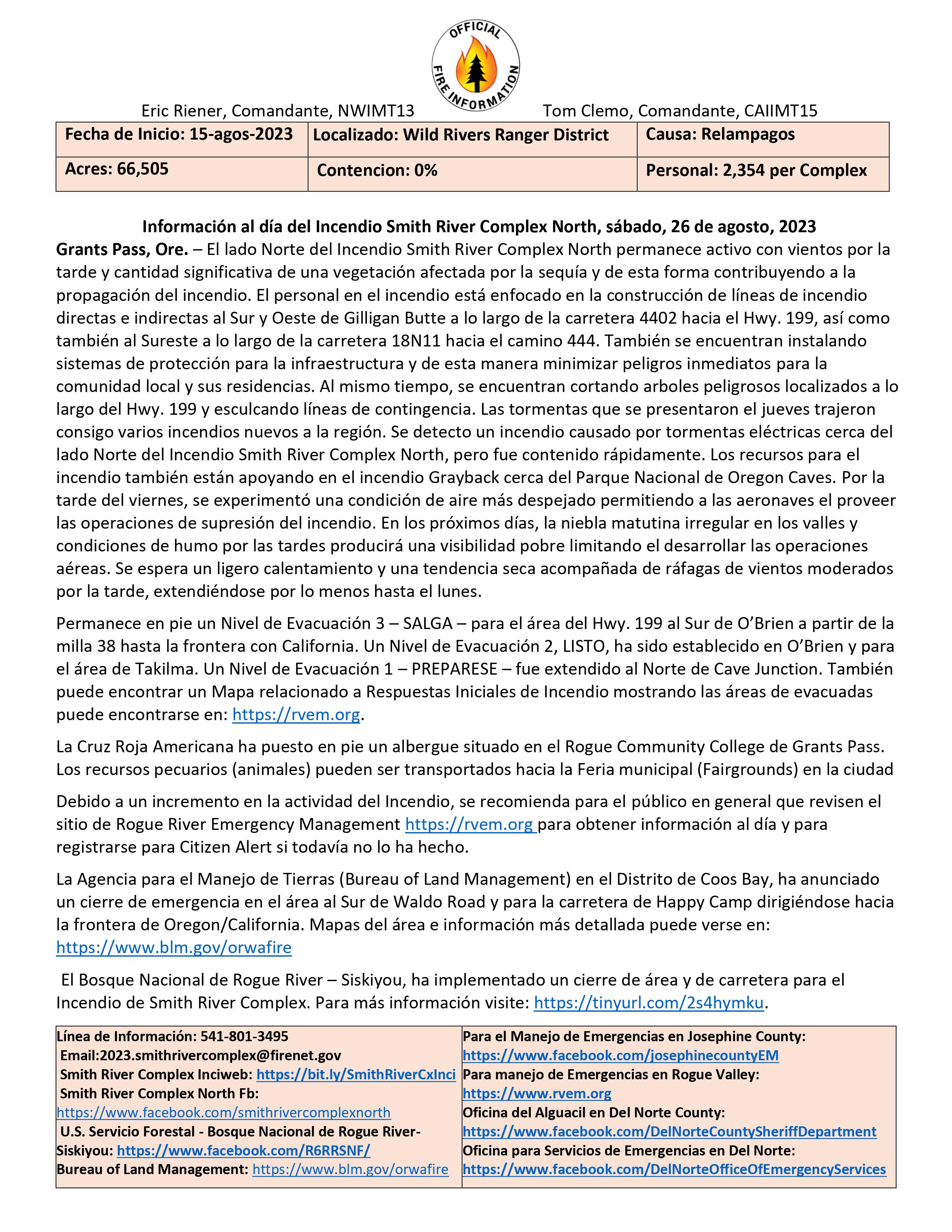
Información al día del Incendio Smith River Complex North, sábado, 26 de agosto, 2023
Grants Pass, Ore. – El lado Norte del Incendio Smith River Complex North permanece activo con vientos por la tarde y cantidad significativa de una vegetación afectada por la sequía y de esta forma contribuyendo a la propagación del incendio. El personal en el incendio está enfocado en la construcción de líneas de incendio directas e indirectas al Sur y Oeste de Gilligan Butte a lo largo de la carretera 4402 hacia el Hwy. 199, así como también al Sureste a lo largo de la carretera 18N11 hacia el camino 444. También se encuentran instalando sistemas de protección para la infraestructura y de esta manera minimizar peligros inmediatos para la comunidad local y sus residencias. Al mismo tiempo, se encuentran cortando arboles peligrosos localizados a lo largo del Hwy. 199 y esculcando líneas de contingencia. Las tormentas que se presentaron el jueves trajeron consigo varios incendios nuevos a la región. Se detecto un incendio causado por tormentas eléctricas cerca del lado Norte del Incendio Smith River Complex North, pero fue contenido rápidamente. Los recursos para el incendio también están apoyando en el incendio Grayback cerca del Parque Nacional de Oregon Caves. Por la tarde del viernes, se experimentó una condición de aire más despejado permitiendo a las aeronaves el proveer las operaciones de supresión del incendio. En los próximos días, la niebla matutina irregular en los valles y condiciones de humo por las tardes producirá una visibilidad pobre limitando el desarrollar las operaciones aéreas. Se espera un ligero calentamiento y una tendencia seca acompañada de ráfagas de vientos moderados por la tarde, extendiéndose por lo menos hasta el lunes.
Permanece en pie un Nivel de Evacuación 3 – SALGA – para el área del Hwy. 199 al Sur de O’Brien a partir de la milla 38 hasta la frontera con California. Un Nivel de Evacuación 2, LISTO, ha sido establecido en O’Brien y para el área de Takilma. Un Nivel de Evacuación 1 – PREPARESE – fue extendido al Norte de Cave Junction. También puede encontrar un Mapa relacionado a Respuestas Iniciales de Incendio mostrando las áreas de evacuadas puede encontrarse en: https://rvem.org.
La Cruz Roja Americana ha puesto en pie un albergue situado en el Rogue Community College de Grants Pass. Los recursos pecuarios (animales) pueden ser transportados hacia la Feria municipal (Fairgrounds) en la ciudad
Debido a un incremento en la actividad del Incendio, se recomienda para el público en general que revisen el sitio de Rogue River Emergency Management https://rvem.org para obtener información al día y para registrarse para Citizen Alert si todavía no lo ha hecho.
La Agencia para el Manejo de Tierras (Bureau of Land Management) en el Distrito de Coos Bay, ha anunciado un cierre de emergencia en el área al Sur de Waldo Road y para la carretera de Happy Camp dirigiéndose hacia la frontera de Oregon/California. Mapas del área e información más detallada puede verse en: https://www.blm.gov/orwafire
El Bosque Nacional de Rogue River – Siskiyou, ha implementado un cierre de área y de carretera para el Incendio de Smith River Complex. Para más información visite: https://tinyurl.com/2s4hymku.
Settings - change map background and toggle additional layers
Filter - control incident types displayed on map.
Zoom to your location
Reset map zoom and position
Could not determine your location.
Show Legend
- Wildfire
- Prescribed Fire
- Burned Area
Response
- Other
Camp Creek Fire
Unit Information
Incident Contacts
Klamath National Forest Fire Activity Update August 26 2023
Related Incident:
Publication Type: News
Klamath National Forest Fire Activity Update – August 26, 2023
Yreka, Calif. – Four additional new fires were reported on the Klamath National Forest since the last report on Friday. This brings the total number of confirmed fires not associated with the Happy Camp Complex to 26 since August 15th. High temperatures and clear skies could result in additional new fire reports in the coming days. A fixed wing reconnaissance plane, also known as a Fire Watch, will patrol the western portion of the Klamath National Forest to search for additional new starts in the vicinity of recent lightning activity. This reconnaissance plane is responsible for discovering three of the new fires reported since yesterday.
Fire officials have declared the following fires out. They will no longer be reported on: Garden Fire, and Titmouse Fire.
Happy Camp/Oak Knoll District:
• The newly reported Red Fire is south of Red Hill. Acreage is unknown and crews are enroute.
• The newly reported Vann Fire is three miles west of Elbow Springs in the Vann Creek Drainage. Acreage is unknown and crews are enroute.
• The newly reported Dillon Fire is northwest of the North Fork of Dillon Creek. Acreage is unknown and heli-rappelers have been ordered. Access to this fire has been hampered due to heavy smoke from the Elliot Fire.
• The newly reported Donkey Fire is near Pony Peak and adjacent to the Elliot Fire. Acreage is unknown and fire officials are weighing options for safely accessing this fire due to its proximity to the Elliot Fire.
• The Berry Fire near Huckleberry Mountain is approximately 0.2 acres. The fire is controlled and in patrol status.
• The Capitan Fire near Capitan Mountain is approximately 2 acres. The fire is controlled and in patrol status.
• The Titus Fire in the Marble Mountain Wilderness south of Norcross Campground is approximately 64 acres. Acreage is lower than previously reported due to more accurate mapping. The fire is in difficult to reach terrain with low probability of continuing to spread due to natural barriers, sparse fuels, and residing in an old burn scar. Fire officials are using a confine and contain strategy and developing a management plan for the incident. Aviation resources are being used to keep the fire in its current footprint.
Salmon/Scott River Ranger District:
• The Box Fire near Box Camp Trailhead is approximately 0.5 acre. The fire is contained and in patrol status.
• The Browns Fire near Browns Gulch is approximately 0.1 acres. The fire is contained and controlled.
• The Grizzly Fire in the Russian Wilderness is approximately 1.5 acres. The fire is contained and in patrol status.
Goosenest Ranger District:
• No active fires to report.
Evacuation Orders and Warnings: Evacuation orders and warnings remain in effect. Monitor CodeRED and the Siskiyou County Sheriff Facebook Page for current information.
Forest Closures: The Klamath National Forest has issued an emergency closure order for two portions of the forest. The purpose of the closure is to provide for public safety in response to ongoing wildfire activity across the forest, including the Happy Camp Complex. The closure prohibits the public from entering portions of the forest in or near the vicinity of ongoing wildfire activity. The closure order also prohibits the use of roads, trails, and developed recreation sites within the closure.
Happy Camp Ranger District Closure Location: The closure order extends from Happy Camp south to the Marble Mountain Wilderness boundary at Norcross Recreation Area. The closure continues west along the edge of the Marble Mountain Wilderness to the Siskiyou Wilderness boundary. From there, the closure runs north along the Siskiyou Wilderness, down Clear Creek to Highway 96, and then north back to Happy Camp near Curly Jack Campground.
• Oak Knoll and Scott River Ranger Districts Closure Area: The closure order is generally northwest of Scott Valley and includes some of the Marble Mountain Wilderness near Lover’s Camp. From the Wilderness boundary, the closure continues along Grider Creek north to Seiad Valley. The closure extends northeast of Seiad Valley to areas north of the Klamath River.
• A map of the closure order, including specific roads, trails, and recreation sites can be found on the Klamath National Forest Website:
- Happy Camp District Closure: https://www.fs.usda.gov/Internet/FSE_DOCUMENTS/fseprd1132183.pdf
- Oak Knoll and Scott River Districts Closure: https://www.fs.usda.gov/Internet/FSE_DOCUMENTS/fseprd1132187.pdf
The Pacific Crest Trail: The area within the Forest Orders, including the PCT from the Shelly Fork junction to Seiad Valley, is a hard closure. The PCT from Etna Summit to the Oregon border is a soft closure, intended to prevent long distance hikers entering the official closure area. Incidental use of the PCT outside of the
Forest Closure area is not officially prohibited. Visitors should be aware conditions can change rapidly regardless of where they are recreating on the Forest.
Highway 96 is now open with one-way traffic control.
Scott River Road is a hard closure.
Information on Klamath National Forest fires that are not part of the Happy Camp Complex can be found at: https://inciweb.nwcg.gov/incident-information/caknf-2023-klamath-national-forest-august-lightning-fires
Information on the Happy Camp Complex can be found at: https://inciweb.nwcg.gov/incident-information//caknf-2023-happy-camp-complex-klamath-nf
Fire Restrictions:
Fire restrictions are in place on the Klamath National Forest. Campfires are only permitted in developed campgrounds and designated wilderness areas. Area closures are in place for the Happy Camp Complex, effective today. Full descriptions of restrictions and closures are available at: https://www.fs.usda.gov/alerts/klamath/alerts-notices
*Please obey any evacuation Orders and Warnings that have been issued*
Lolo National Forest Area Road Trail Closures
Related Incident:
Publication Type: Closures
Order Number: # 23-010-Lolo-D5
U.S. Department of Agriculture, U.S. Forest Service
Lolo National Forest
Plains/Thompson Falls & Superior Ranger Districts
Area, Road & Trail Closures
PROHIBITIONS
Pursuant to 16 U.S.C. § 551 and 36 C.F.R. § 261.50(a & b), the following is prohibited on the National Forest System (NFS) lands, roads, trails in the Plains/Thompson Falls and Superior Ranger Districts of the Lolo National Forest, described below and shown on the attached map incorporated into this Order as Exhibit A (River Road East Fire Closure):
- 36 C.F.R. § 261.53(e). It is prohibited to go into the area closed for public safety
- 36 CFR § 261.54(e). Being on the described roads.
- 36 CFR § 261.55(a). Being on the described trails.
EXEMPTIONS
Pursuant to 36 C.F.R. § 261.50(e), the following persons are exempt from this Order:
- Persons with Forest Service Permit No. FS-7700-48 (Permit for Use of Roads, Trails, or Areas Restricted by Regulation or Order), specifically exempting them from this Order or a written determination by a Forest Service authorized officer that a permit is not required under 36 C.F.R. § 251.50(e)(1) or (2).
- Any Federal, State, or Local Officer, or member of an organized rescue or firefighting resource in the performance of an official duty.
DESCRIBED AREA/ROADS/TRAILS
NORTHERN CLOSED AREA: All Forest Service land contained south of Henry Creek Road from the junction of Henry Creek Road NFSR* #661 and MT Hwy* 200 (T19N, R26W, Sect. 1) west to the boundary with the Flathead Reservation (T20N, R25W, Sect. 25). Forest Service lands contained west of the Flathead Reservation boundary stopping to the south at the Flathead River (T18N, R24W, Sect. 6). Returning northwest along the Flathead River to the junction of MT Hwy 200 and Henry Creek Road #661.
SOUTHERN CLOSED AREA: All Forest Service Land contained north of MT Hwy #135 (T18N, R25W, Sect. 4) to the junction of Donlon Trail #205 Trailhead and MT Hwy #135
W. (T18N, R26W, Sect. 9). From that point Forest Service lands east of Donlon Trail #205 to the junction with Combest Creek Road NFSR #508 (T19N. R26W, Sect. 34) are included. The closure area continues east of Combest Creek Road running north to the Lolo National Forest administrative boundary (northern boundary of T19N, R26W, Sect. 15). Moving east along sect. 15’s northern boundary, Forest Service lands south of the northern boundaries of sect. 15, 23, and 13 (T19N, R26W) and stopping at junction with River Road East (T19N, R25W, Sect.07) are included. Eastern boundary of closure area continues on the west side of River Road East back south to junction with MT Hwy #135.
CLOSED ROADS: All roads within the closure area boundary including but not limited to: NFSR #3838 (Patrick Creek Road), NFSR #18262 (Fourteen Mile Road), NFSR #7698 (High Ridge Road), NFSR #508 (Combest Creek Road), NFSR #661 (Henry Creek Road.), NFSR #7591 (Combest High Ridge Road)
CLOSED TRAILS: Trail #205 (Donlon), Trail #1714 (Fourteen Mile)
CLOSED RECREATION SITES: Ferry Landing Day Use Area, Muchwater Dispersed Campground, and Cascade Landing.
*NFSR – National Forest System Road, Hwy - Highway
PURPOSE
The purpose of this order is for public health and safety due to hazardous conditions resulting from fire activities.
IMPLEMENTATION
- This Order will be in effect on August 21, 2023, 0:01 hours (12:01 am) and shall remain in effect until October 31st, 2023, or until rescinded, whichever comes first.
- A map identifying the Described Area is attached and made part of this Order as Exhibit A. For a digital version of this Order and Exhibit A, go to: https://www.fs.usda.gov/alerts/lolo/alerts-notices
- Unless otherwise expressly defined in this Order, the terms used in this Order are defined by the regulations of the Secretary of Agriculture, 36 C.F.R. Chapter II, Parts 200-299. If there are terms in this Order that are not expressly defined in the Order or 36 C.F.R. Chapter II, Parts 200-299, their meaning shall be determined by their plain language definitions.
- A violation of the above prohibitions is punishable as a Class B misdemeanor by a fine of not more than $5,000 for individuals and $10,000 for organizations, or by imprisonment for not more than six months, or both. 16 U.S.C. § 551; 18 U.S.C.§§ 3559, 3571, and 3581.
- Contact the Lolo National Forest Supervisor’s Office in Missoula, MT, (406) 329- 3750 for more information about this Order.
- This Order supersedes any previous Orders prohibiting the same or similar acts on the same Described Area.
Signed and issued on
08/25/2023 .
Digitally signed
by CAROLYN UPTON, Forest Supervisor
Date: 2023.08.25
11:47:10 -06'00'