
Highlighted Media
News | Photos | Maps | Closures |
Barring an increase in activity, this page will no longer be updated.
A series of thunderstorms moved across the Klamath National Forest the night of Monday, August 14, 2023, bringing abundant lightning and igniting roughly 20 fires over the western side of the forest. Only scattered precipitation was received with these storms.
The most active of the resulting fires was the Head Fire, burning at the confluence of the Klamath and Scott rivers. The fire was fanned by strong winds from thunderstorms that developed in the area and burned actively throughout Tuesday afternoon, growing to 3,500 acres by nightfall.
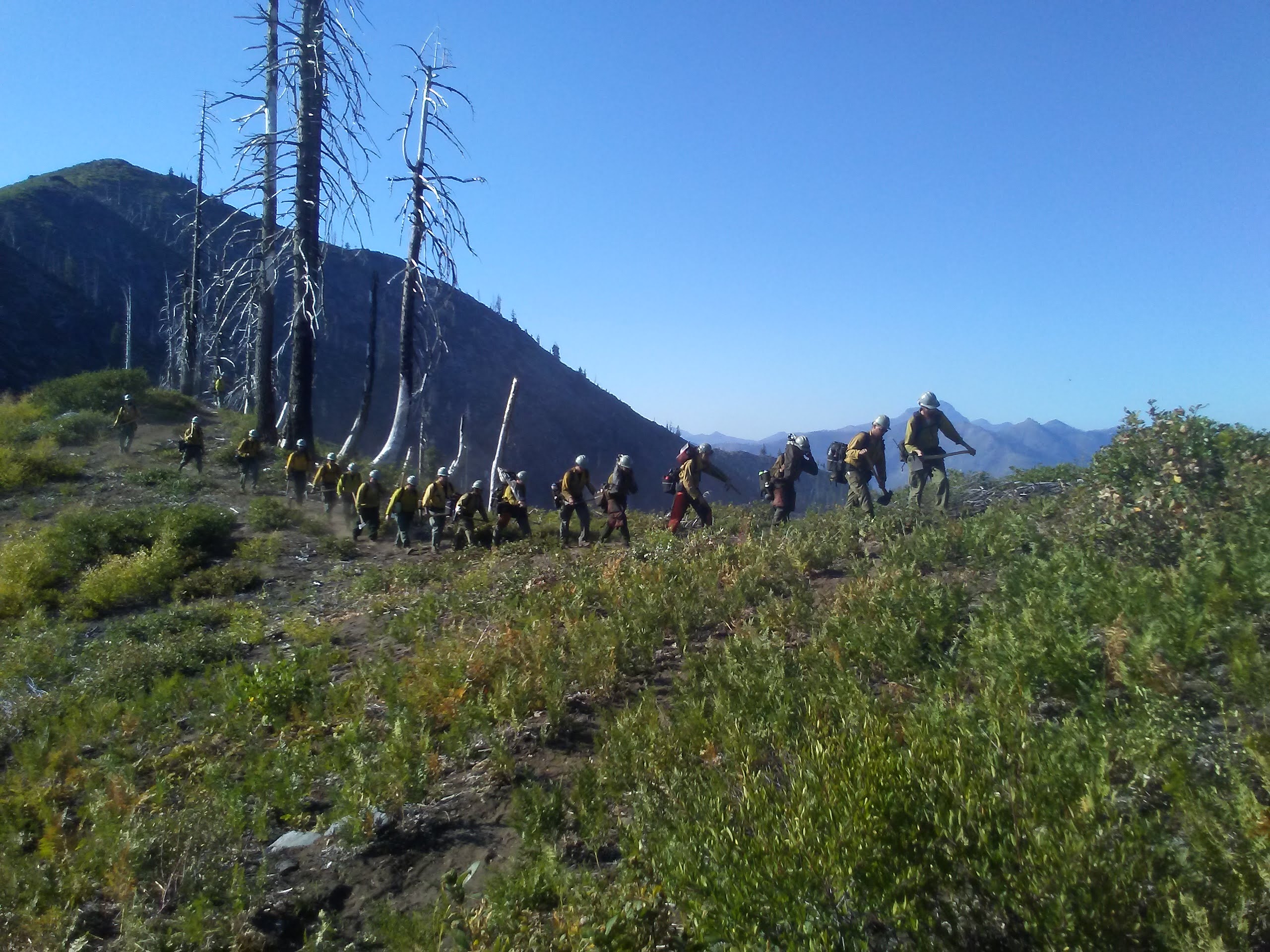
Several of the fires were being managed together as the Happy Camp Complex. The Northern Rockies Complex Incident Management Team 2, under the command of Incident Commander Scott Schuster was assigned to the complex and took over management as of 6:00 am on Thursday, August 08, 2023.
On September 20, 2023 at 0700 the Happy Camp Complex transitioned command to California Interagency Team 11 which began managing the Elliot and UFish Fires. The management of all other fires that were formerly part of the Happy Camp Complex (Scott, Malone, Head, Lake, Block).
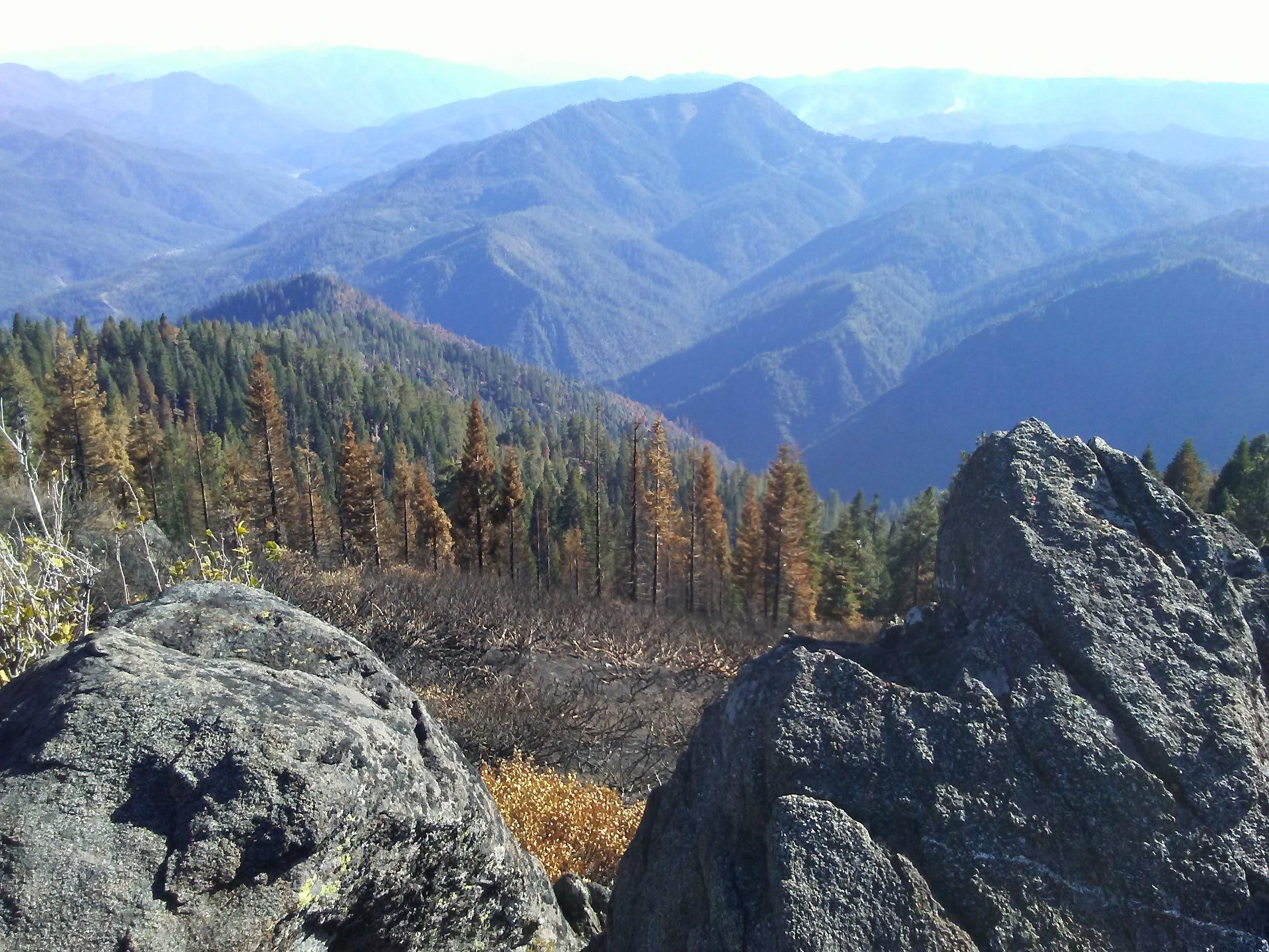
Significant moisture over the fire area during the last week in September and reduced the ability for live and dead fuels to carry fire. The fire has not moved out of its perimeter in the last few weeks. Minimal fire behavior is expected.
Command of the Happy Camp Complex transitioned back to the Klamath National Forest on October 1, 2023 at 1800 hrs to be managed by a local ICS organization.
Air Quality: For information regarding smoke impacts and what you can do to protect yourself, visit the Siskiyou County Air Pollution Control District Fire and Smoke Information website at: https://bit.ly/Siskiyouairquality or https://AirNow.gov.
Fire Restrictions: Fire restrictions on the Klamath National Forest were lifted effective September 28, 2023 across the forest. https://bit.ly/KlamathNFAlertsNotices
Temporary Flight Restriction (TFR): The flight restriction expired October 1, 2023 at 6pm.
PACIFIC CREST TRAIL: All Pacific Crest Trail closures within the Klamath National Forest have been lifted!
All evacuation orders and warnings associated with the Happy Camp Complex have been lifted. https://protect.genasys.com/search
View current road conditions for state roads from CalTrans at https://roads.dot.ca.gov/ County road closures are listed on the Siskiyou County Public Works website: https://www.co.siskiyou.ca.us/publicworks/page/closures-and-delays.
The #KlamathNF has reduced the area under emergency closure order. For current closure orders and maps, go to https://www.fs.usda.gov/alerts/klamath/alerts-notices
News | Photos | Maps | Closures |
Barring an increase in activity, this page will no longer be updated.
A series of thunderstorms moved across the Klamath National Forest the night of Monday, August 14, 2023, bringing abundant lightning and igniting roughly 20 fires over the western side of the forest. Only scattered precipitation was received with these storms.
The most active of the resulting fires was the Head Fire, burning at the confluence of the Klamath and Scott rivers. The fire was fanned by strong winds from thunderstorms that developed in the area and burned actively throughout Tuesday afternoon, growing to 3,500 acres by nightfall.
Several of the fires were being managed together as the Happy Camp Complex. The Northern Rockies Complex Incident Management Team 2, under the command of Incident Commander Scott Schuster was assigned to the complex and took over management as of 6:00 am on Thursday, August 08, 2023.
On September 20, 2023 at 0700 the Happy Camp Complex transitioned command to California Interagency Team 11 which began managing the Elliot and UFish Fires. The management of all other fires that were formerly part of the Happy Camp Complex (Scott, Malone, Head, Lake, Block).
Significant moisture over the fire area during the last week in September and reduced the ability for live and dead fuels to carry fire. The fire has not moved out of its perimeter in the last few weeks. Minimal fire behavior is expected.
Command of the Happy Camp Complex transitioned back to the Klamath National Forest on October 1, 2023 at 1800 hrs to be managed by a local ICS organization.
Air Quality: For information regarding smoke impacts and what you can do to protect yourself, visit the Siskiyou County Air Pollution Control District Fire and Smoke Information website at: https://bit.ly/Siskiyouairquality or https://AirNow.gov.
Fire Restrictions: Fire restrictions on the Klamath National Forest were lifted effective September 28, 2023 across the forest. https://bit.ly/KlamathNFAlertsNotices
Temporary Flight Restriction (TFR): The flight restriction expired October 1, 2023 at 6pm.
PACIFIC CREST TRAIL: All Pacific Crest Trail closures within the Klamath National Forest have been lifted!
All evacuation orders and warnings associated with the Happy Camp Complex have been lifted. https://protect.genasys.com/search
View current road conditions for state roads from CalTrans at https://roads.dot.ca.gov/ County road closures are listed on the Siskiyou County Public Works website: https://www.co.siskiyou.ca.us/publicworks/page/closures-and-delays.
The #KlamathNF has reduced the area under emergency closure order. For current closure orders and maps, go to https://www.fs.usda.gov/alerts/klamath/alerts-notices
| Current as of | Mon, 11/06/2023 - 18:36 |
|---|---|
| Incident Type | Wildfire |
| Cause | Under investigation |
| Date of Origin | |
| Location | Klamath National Forest |
| Incident Commander | A Klamath National Forest type 4 organization is managing the Happy Camp Complex. |
| Coordinates |
41° 46' 5'' Latitude
-123° 2' 46
'' Longitude
|
| Total Personnel: | 72 |
|---|---|
| Size | 21,725 Acres |
| Percent of Perimeter Contained | 100% |
| Fuels Involved | Timber (Litter and Understory) Brush (2 feet)
|
| Significant Events | Minimal Smoldering Significant moisture over the fire area has reduced the ability for live and dead fuels to carry fire. Fire indices are below average and unlikely to rebound to a level that would allow for significant fire growth. |
| Planned Actions |
Resources will continue to monitor the Happy Camp Complex for any remaining heat or smoldering. Suppression repair and hazard tree mitigation is nearing completion. |
|---|---|
| Remarks |
The Elliott Fire merged with the Canyon Fire, Three Creeks Fire, and Swillup Fire which have retained their acreage and have been marked as 100% contained. Additional acreage and actual containment percentage for the new, larger fire is reflected in the data for the Elliot Fire.
The Ufish fire merged with the Malone Fire, which has retained its acreage and has been marked as 100% contained. Additional acreage and actual containment for the new, larger fire is reflected in the Ufish Fire.
Elliot Fire total acreage: 13,875 acres Ufish Fire total acreage: 7,850 acres Acreage is calculated from a combination of IR and GPS ground reconnaissance. Resources on the incident:
|