
Bedrock Daily Update August 26 2023
Related Incident: Bedrock Fire
Publication Type: News
Bedrock Fire Quick Facts
Size: 31,570 acres Origin: Willamette National Forest Resources: 46 engines;
Containment: 50% Cause: Under Investigation 12 crews; 11 helicopters;
Total personnel: 746 Start Date: July 22, 2023 9 dozers, 30 water tenders
Bedrock Fire: Firefighters, engines and helicopters assigned to the Bedrock Fire assisted with initial attack on new fires around the region yesterday. This was possible because fire activity on the Bedrock was light and containment lines continued to hold. “We’re glad we were able to help our neighbors and help keep these new fires small,” said Chris Hutsell, one of the incident commanders. With two large fires already burning on the Willamette National Forest, fire personnel and equipment are in limited supply. “It’s to everyone’s advantage to nip new fire starts in the bud,” Hutsell added. While helicopters did not fly over the Bedrock Fire Friday, hundreds of firefighters continue to work, both day and night, to complete containment lines. They have also started the large task of hauling in hose, pumps and other equipment that is no longer needed, and repairing damage done to the land during the firefighting efforts of the last month.
The Incident Management Team on the Bedrock Fire, Pacific Northwest Team 2 (PNW2), will take over management of the Lookout Fire today at 6:00 p.m from Northwest Team 6. This will allow Northwest Team 6 to get some time off and be ready for another fire assignment, if needed. PNW2 will continue to manage the Bedrock Fire and will manage the new, 25-acre Horse Creek Fire, starting later today.
Evacuations: Level 2 evacuation notifications remain in place for portions of Lane County because of these multiple fires. A searchable evacuation map with fire perimeters is available through the county’s website: (https://bit.ly/44rF8Gd) Bedrock Fire Evacuation Areas.
Smoke: The daily West-Central Oregon Smoke Outlook provides a detailed air quality forecast for the Bedrock Fire, as well as other nearby fires. The Fire and Smoke Map (fire.airnow.gov) is another source for air quality information.
Weather: A temperature inversion is expected to lift around noon today, giving way to sunny skies and warm temperatures. Fuels remain very dry and humidity levels at higher elevations may drop to critically low levels. The potential for rapid fire growth still exists, with a warm and dry pattern through the weekend.
Safety and Closures: The Willamette National Forest implemented an Emergency Area Closure to ensure the safety of the public and personnel working on the fire. The closure maps for the Bedrock Fire are available on InciWeb. A Temporary Flight Restriction remains in place over the Bedrock Fire area.
InciWeb Bedrock: https://inciweb.wildfire.gov/incident-information/orwif-bedrock-fire
Facebook: https://www.facebook.com/BedrockFire2023/
Fire Information: (541) 414-6272, 8:00 AM – 8:00 PM Email: 2023.bedrock@firenet.gov
Gray Fire Daily Update 082623
Related Incident: Gray Fire
Publication Type: News
Cloudy conditions kept temperatures mild throughout the afternoon yesterday, leading to minimal fire behavior and smoke production. Heavy fire traffic continues in and around the Gray Fire area. Please be respectful as community members return to homes and property.
To help with the location of hotspots within the fire area, Unmanned Aerial Systems (UAS, or “drones”) are being utilized to locate areas of remaining heat. Use is coordinated with local air traffic control and require Federal Aviation Administration (FAA) clearance. Private drones should not be flown in or around fire areas, as any activity is a safety risk that can halt firefighting efforts.
Today’s Activities: Firefighters are working to secure the remainder of the perimeter. Mop up operations continue today with use of handheld infrared and UAS systems assisting firefighters. Mop up is when firefighters extinguish or remove burning material and standing dead trees near the fire perimeter. They also work on extinguishing hot spots, or isolated spots of smoldering material located on or within the fire perimeter. Crews are also working along the interior of the fire to suppress hot spots, including near the I-90 corridor.
Weather: The Gray Fire area will see temperatures in the 90s today through Sunday. Warmer temperatures will dry out fuels as humidity levels drop near 20%. Light NE winds are present with infrequent gusts up to 15 mph.
Evacuations: Evacuation maps are posted on the Gray Fire Inciweb page and Spokane County’s Emergency Management Facebook page: https://www.facebook.com/GEGEmergencyMgt.
Interstate 90: I-90 is open in both directions. State Route (SR) 904 and 902 are also open.
Reduce wildfire risk at home: www.dnr.wa.gov/wildfireprevention.
Be wildfire aware! Avoid activities that can cause an accidental spark.
https://www.readyforwildfire.org/prevent-wildfire.
The Gray Fire is a No Drone Zone. Remember, if you fly, we can’t! https://www.faa.gov/uas/resources/community_engagement/no_drone_zone
The Gray Fire Incident Command Post is located at Pine Lodge in Medical Lake. Thank you to the Washington State Department of Social and Health Services for allowing us to use these facilities.
Gray Fire Information and Links
Phone: 509-903-5563, 8:00 a.m. to 8:00 p.m.
Inciweb: https://inciweb.nwcg.gov/incident-information/wanes-gray-fire
Facebook: https://www.facebook.com/newfireinfo
Interactive Evacuation Map: https://arcg.is/1z98v10
WA DOT Highway Updates: https://wsdot.com/Travel/Real-time/Map/
Washington Smoke Blog: https://wasmoke.blogspot.com/
Spokane Co. Emergency Management: 1121 W. Gardner Ave., Spokane; 509-477-3046
https://www.spokanecounty.org/4579/Emergency-Management
Red Cross: 315 W. Nora Ave., Spokane; 509-326-3330
https://www.redcross.org/local/washington/get-help.html
Avista Power & Gas: 1411 E. Mission Ave, Spokane; 800-227-9187
https://www.myavista.com/outages/outage-faqs
Inland Power: 10110 W. Hallett Rd, Spokane: 509-747-7151
https://www.inlandpower.com/outages-emergencies
City of Medical Lake Public Utilities: 851 S. Lefevre St, 509-299-7715
https://medical-lake.org/utilities/
WA Dept. of Social and Health Services: 877-501-2233
https://www.dshs.wa.gov/esa/community-services-offices/community-services-office
Spokane County Sheriff: 1100 W. Mallon Ave, Spokane; 509-477-2240
https://www.spokanecounty.org/938/Sheriff-Services
Spokane County Fire, Dist. 3: 10 S. Presley Dr, Spokane; 509-235-6645
South Fork Daily Update for August 26 2023
Related Incident: South Fork Complex
Publication Type: News
People and Equipment: 703 personnel, crews, engines, dozers, water tenders and air support
Current Situation: 3-9 Fire: 1,714 acres with 0% containment; Pilot Fire: 1,057 acres with 64% containment; Pellitreau Fire: 3 acres with 100% containment; Sulphur Fire: 31 acres with 100% containment
25% overall containment for the Complex
3-9 Fire The northern division of the 3-9 Fire has 100% handline completed around the perimeter. Crews will continue to strengthen the containment line by mopping up and adding depth to prevent rollout of burned fuels in the interior of the fire perimeter. Along the southern perimeter crews are working along the Berry Summit- Mad River Road, a completed dozer line to the south and Road 03N06 increasing and strengthening control lines around the 30 acre slop-over from Sunday night. Smoke is visible from interior torching posing no threat to the fire perimeter. Helicopters are supporting the firefighting efforts with water and retardant drops. Crews are also working along the Dan East trail going direct on the fire when safe to do so. On the southeast portion of the fire, dozers and excavators are opening road systems in closer proximity to the fire perimeter to encompass the spot fires and allow crews opportunity to go direct along the fire perimeter.
Pilot Fire crews have successfully finished 100% containment line around the perimeter of the fire. Crews will focus on mopping up and adding depth. The contingency lines along the eastern flank have been completed to protect Grouse Creek. Operational plans for today continue to be secure and mop up the perimeter of the Pilot Fire and finish the contingency lines.
The Pellitreau fire and the Sulfur fire are100% contained. Crews will continue to monitor and patrol to ensure fire remains within the containment lines. Most equipment has been pulled from these fires to assist the Pilot and 3-9 Fires.
Weather:
The temperature will be 70-75 degrees with RH minimum 32 to 36% with winds 5 to 8 mph gusting to 14 mph.
Quartz Ridge and Bear Creek Fires Daily Update August 26 2023
Related Incident: Quartz Ridge FireBear Creek Fire
Publication Type: News
August 26, 2023
Type 3 Team, Incident Commander: Nick Collard ICT3, Grif Cochran ICT3 (T)
Daily Update – 9:00 AM
Highlights: Critical fire weather conditions are not expected through Tuesday. Fire activity is expected to be minimal with smoldering, creeping, and backing where pockets of heat remain. Crews and air resources are available to respond quickly if conditions change. Winds will be generally light and less than 10 mph with gusts to 15-18 mph.
Quartz Ridge Fire: 1799 acres, no change in acreage | 70% of objectives achieved | 77 personnel assigned
The southeastern and eastern edges of the fire continue to have pockets of heat with minimal to moderate fire behavior with some backing and movement in steep terrain. The pocket of fire on the east side of Quartz Creek is within a rocky area and constrained by natural features. Direct control lines are being utilized to suppress accessible parts of the fire and indirect control lines are providing confinement on remote areas that present high safety risks to firefighters.
Bear Creek Fire: 415 acres, no change in acreage | 71% of objectives achieved | 21 personnel assigned
The Bear Creek Fire has continued to be inactive with some isolated spots of smoldering. The fire has received precipitation within the last few days and remains quiet with a few smokes visible. Hose lays and sprinklers kits were removed from structures due to reduced fire risk in the southern Weminuche Valley. The fire size has remained steady at 415 acres for several days, and no growth is expected over the next few days.
Weather: High temperatures will be from the mid 60s to mid 70s with afternoon minimum relative humidity of 40 to 50%. Light winds of less than 10 mph are forecast. Overnight humidity recovery will be good with relative humidity increasing to 80% or higher.
San Juan National Forest Temporary Area Closures: Closure orders are in effect and additional information can be found at Closure Orders and Maps are available here. Roads and trails within area closures are Quartz Meadows Rd (NFSR#685), Mosca (Piedra) Road (NFS #631), Quartz Ridge Trail (NFST#570), Quartz Creek Trail (NFST#571), Weminuche Trail (NFS #592), Sand Creek Trail (NFS #593), NFS Trail #591, NFS Trail #524, NFS Trail #584; and NFS Trail # 673.
Restrictions: Stage 1 Fire Restrictions are in place for the San Juan National Forest and additional information is available here.
Fire Information
Office Hours: 8:00 AM – 8:00 PM
Phone: 970-426-5370
Quartz Ridge Fire
Email: 2023.QuartzRidge@firenet.gov
InciWeb:
https://inciweb.nwcg.gov/incident-information/cosjf-quartz-ridge-fire
https://www.facebook.com/profile.php?id=100095556640621
Bear Creek Fire
Email: 2023.BearCreek@firenet.gov
Inciweb
https://inciweb.nwcg.gov/incident-information/cosjf-bear-creek-fire
https://www.facebook.com/profile.php?id=100095241777192
Black Feather Fire Information Update 08262023
Related Incident: Black Feather Fire
Publication Type: News
Great progress is being made on The Black Feather Fire
Acres: 2,198 acres
Start Date: August 5, 2023
Cause: Lightning
Fuels: Timber, Brush, Understory
Containment: 28%
Resources: 119 personnel
Location: Approximately 9 miles south of Gallina, NM, on the Santa Fe National Forest, Coyote Ranger District. Near the Peñas Negras Trail in the San Pedro Parks Wilderness.
Highlights: Hand crews and repellers worked along the wilderness boundary and progressed line construction to the West. While the repellers and hand crews were working, the helicopter aided with bucket work extinguishing hot spots. The grader and water tender are working to improve the road conditions. Use caution while traveling in this area.
Hand crews gained more progress in the wilderness in continuing and securing the fires edge. Engine crews outside of the wilderness have been patrolling and monitoring the fires edge along with securing any hotspots or smoke showing within the fire's perimeter.
Operations: Suppression efforts are continuing within the wilderness and along the Eastern edge of the fire. As most of the fire is located in the wilderness, firefighters are working in steep terrain with heavy dead and down logs and fire weakened trees. Crews and engines are actively suppressing and monitoring activities in relation to weather and fire behavior to ensure incident objectives are met while remaining focused on firefighter safety.
Safety: Equipment and fire crews are actively moving in and around the fire area. Please use caution when traveling around the Black Feather Fire. The Temporary Flight Restriction is still in place. Please do not fly drones anywhere near the fire. If you fly, we can’t fly.
Weather: Showers and thunderstorms are expected to start prior to the noon hour on Saturday over or very near the Black Feather fire. Showers and thunderstorms may be periodic through the mid evening hours. Heavy rainfall will be possible. Showers and thunderstorms remain possible on Sunday, but confidence that it will impact the burn area is lower.
Restrictions/Closures: Effective Monday, August 21, the Santa Fe National Forest has issued an updated area, road, and trail closure in part of the Coyote Ranger District. See https://bit.ly/BlackFeatherClosureUpdate for information and a corresponding map. Forest Road 103 is now open. Closures will be adjusted based on fire activity.
Smoke: Variations in temperatures, humidity & fire activity will impact smoke conditions in the coming days and weeks. Smoke may be visible in the area as active smoldering takes place. Smoke-sensitive individuals and people with respiratory problems or heart disease are encouraged to take precautionary measures. Air quality information is available at https://www.airnow.gov/.
Evacuations: The communities of Mesa Pinabetal, Mesa Poleo, and Wetherill remain in ‘Ready’ status. The Coyote Senior Center is open to evacuees, and livestock can be taken to the Rio Arriba Rural Event Center near Abiquiu. The Rio Arriba County Sheriff’s Office will coordinate evacuations if they go into effect. For more information, use the QR code below and visit the Sheriff’s Office Facebook page: https://www.facebook.com/profile.php?id=100079688263048.
![]()
Fire Information: 505-460-0499 – 2023.blackfeather@firenet.gov
InciWeb: https://inciweb.nwcg.gov/incident-information/nmsnf-black-feather-fire
Facebook: https://www.facebook.com/blackfeatherfireinfo
New Mexico Fire Information: https://nmfireinfo.com/
McKinney Fire Information Update 08262023
Related Incident: McKinney Fire
Publication Type: News
McKinney Fire Information Update –
Start date – 08/20/2023
Size – 43 Acres
Containment – 40%
Firefighters continue to suppress and repair the McKinney Fire
Santa Fe, NM (8/26/23) – The 43-acre McKinney Fire started August, 20th, within 15 miles North of Jemez Spring, NM. The fire is burning in remote terrain and due to its location, fire managers are developing a plan to manage the fire in a full suppression Strategy, by creating containment lines utilizing hand crews. Resources were able to get additional 15% of containment around the fire yesterday.
Containment efforts on the East flank have been a challenge due to steep and inaccessible terrain.
Fire is burning in the area with no fire history or fuels treatment. As with all incidents, firefighter and public safety remains the highest priority over all other incident objectives. While managing this incident, resources are expected to utilize deliberate risk management processes to ensure they are committed to successful operations under conditions where important values at risk are protected with the least exposure necessary.
A strategic plan is in place to ensure resources limit activities that may disturb eco-sensitive areas, sensitive cultural sites, along with threatened and endangered species and their habitats. Fire personnel are taking proactive measures during any fire management activities to protect water quality.
Precipitation over the fire last night for a brief period. Thunderstorm development across the fire area with potential for downdrafts and lightning is a concern.
Smoke may be more or less visible in the area as active smoldering takes place. Variations in temperatures, humidity & fire activity will impact smoke conditions in the coming days. Smoke-sensitive individuals and people with respiratory problems or heart disease are encouraged to take precautionary measures.
Fire Information –
Inciweb: https://inciweb.nwcg.gov/incident-information/nmsnf-mckinney-fire
New Mexico Fire Information: https://nmfireinfo.com/
Air quality information is available at https://www.airnow.gov/
Bowles Creek Fire Update August 26 2023
Related Incident: Bowles Creek Fire
Publication Type: News
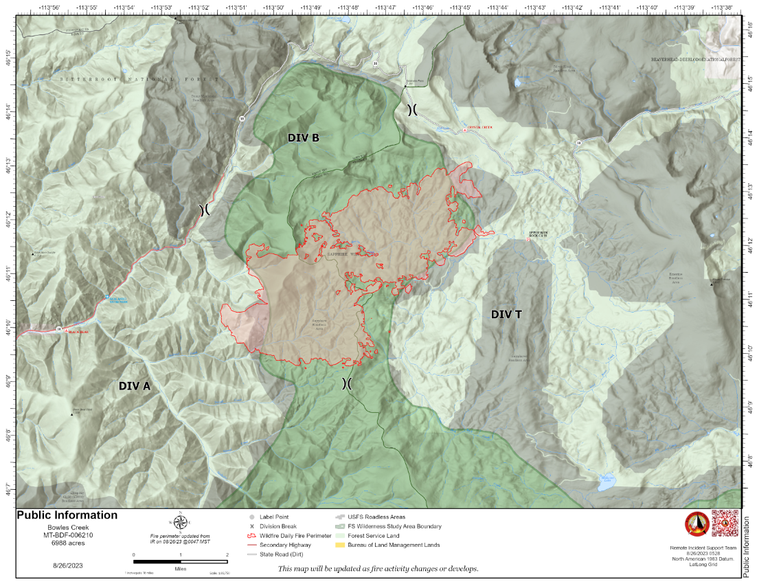
The Bowles Creek Fire is currently at 6,988 acres. Fire crews remain present along Hwy 38, Skalkaho Road. Motorists traveling on the road are urged to drive with caution as firefighters will be present along the roadway. Additionally, because of the increased precipitation and winds in the area, multiple trees have fallen along Hwy 38. Motorists should remain vigilant while driving.
Completion of fire management objectives remains at 23%. Fire personnel continue to work on confinement and point zone protection to protect values at risk. Structure protection remains a priority as fire personnel and cooperators develop contingency plans to mitigate any future fire risk. Firefighters continue to construct fuel breaks and monitor fire behavior and improve indirect line as needed.
2023 Six Rivers National Forest Lightning Complex and Redwood Lightning Complex Forest Closure Order Updated 82623
Related Incident: 2023 SRF Lightning Complex and Redwood Lightning Complex
Publication Type: Closures
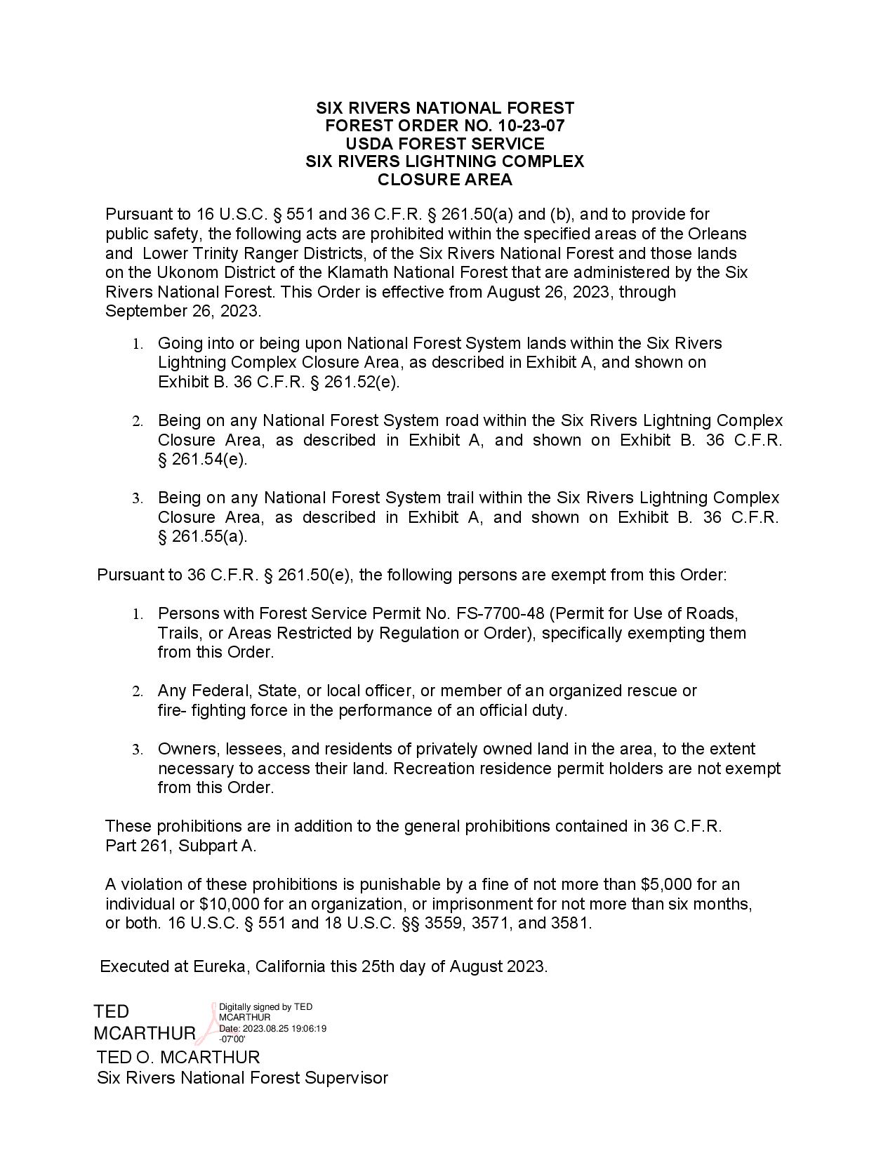
SIx RIVERS NATIONAL FOREST FOREST ORDER NO. 10-23-07 USDA FOREST SERVICE SIX RIVERS LIGHTNING COMPLEX CLOSURE AREA Pursuant to 16 U.S.C. S 551 and 36 C.F.R. $ 261.50(a) and (b), and to provide for public safety, the following acts are prohibited within the specified areas of the Orleans and Lower Trinity Ranger Districts, of the Six Rivers National Forest and those lands on the Ukonom District of the Klamath National Forest that are administered by the Six Rivers National Forest. This Order is effective from August 26, 2023, through September 26, 2023. 1. Going into or being upon National Forest System lands within the Six Rivers Lightning Complex Closure Area, as described in Exhibit A, and shown on Exhibit B. 36 C.F.R. s 261. 52(e). 2. Being on any National Forest System road within the Six Rivers Lightning Complex Closure Area, as described in Exhibit A, and shown on Exhibit B. 36 C.F.R. s 261.54(e). 3. Being on any National Forest System trail within the Six Rivers Lightning Complex Closure Area, as described in Exhibit A, and shown on Exhibit B. 36 C.F.R. s 261 .55(a). Pursuant to 36 C.F.R. $ 261.50(e), the following persons are exempt from this Order: 1. Persons with Forest Service Permit No. FS-7700-48 (Permit for Use of Roads, Trails, or Areas Restricted by Regulation or Order), specifically exempting them from this Order. 2. Any Federal, State, or local officer, or member of an organized rescue or fire- fighting force in the performance of an official duty. 3. Owners, lessees, and residents of privately owned land in the area, to the extent necessary to access their land. Recreation residence permit holders are not exempt from this Order. These prohibitions are in addition to the general prohibitions contained in 36 C.F.R. Part 261, Subpart A. A violation of these prohibitions is punishable by a fine of not more than $5,000 for an individual or $10,000 for an organization, or imprisonment for not more than six months, or both. 16 U.S.C. $ 551 and 18 U.S.C. ss 3559, 3571, and 3581. Executed at Eureka, California this 25th day of August 2023. Digitally signed by TED TED MCARTHUR Date: 2023.08. 25 19:06:19 MCARTHUR -07'O0' TED o. MCARTHUR Six Rivers National Forest Supervisor
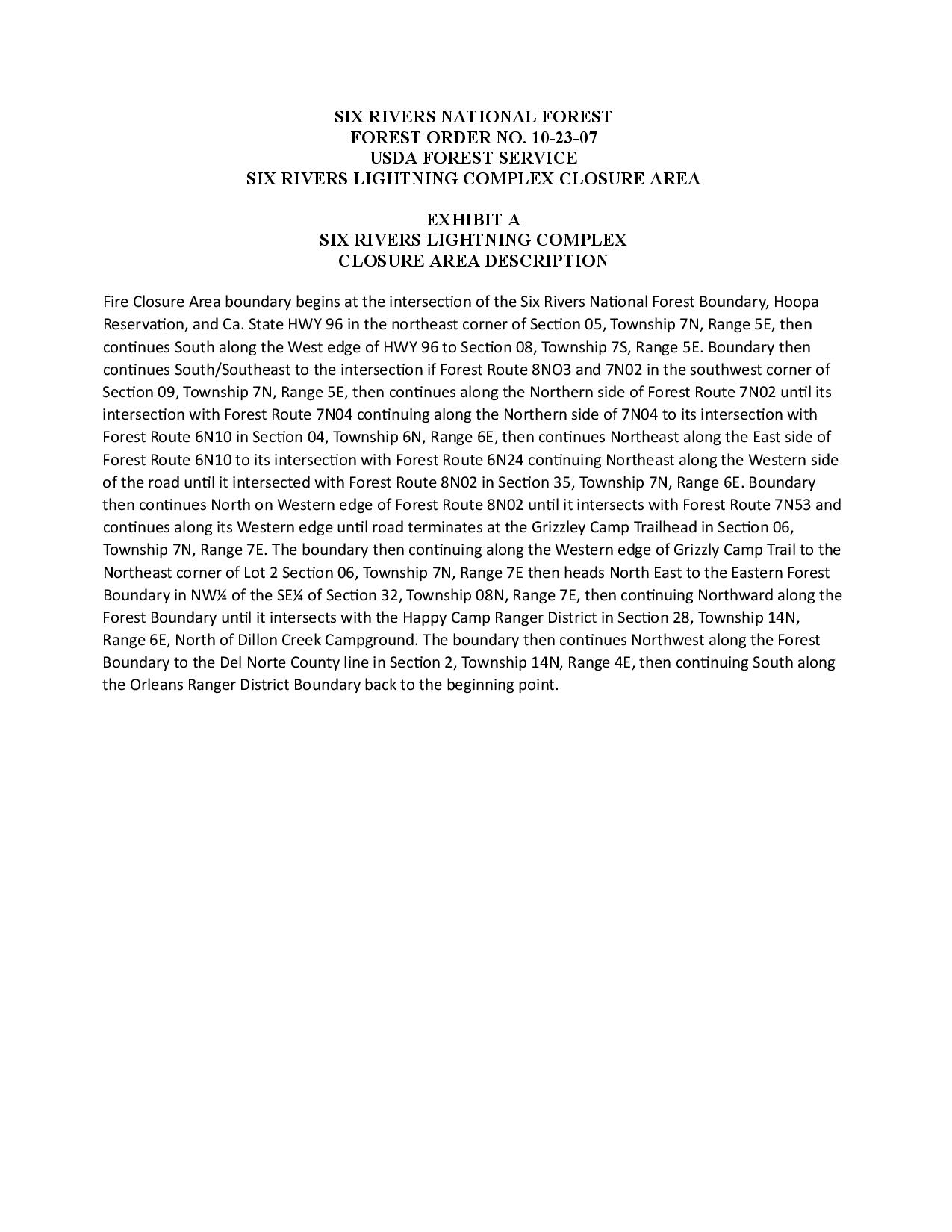
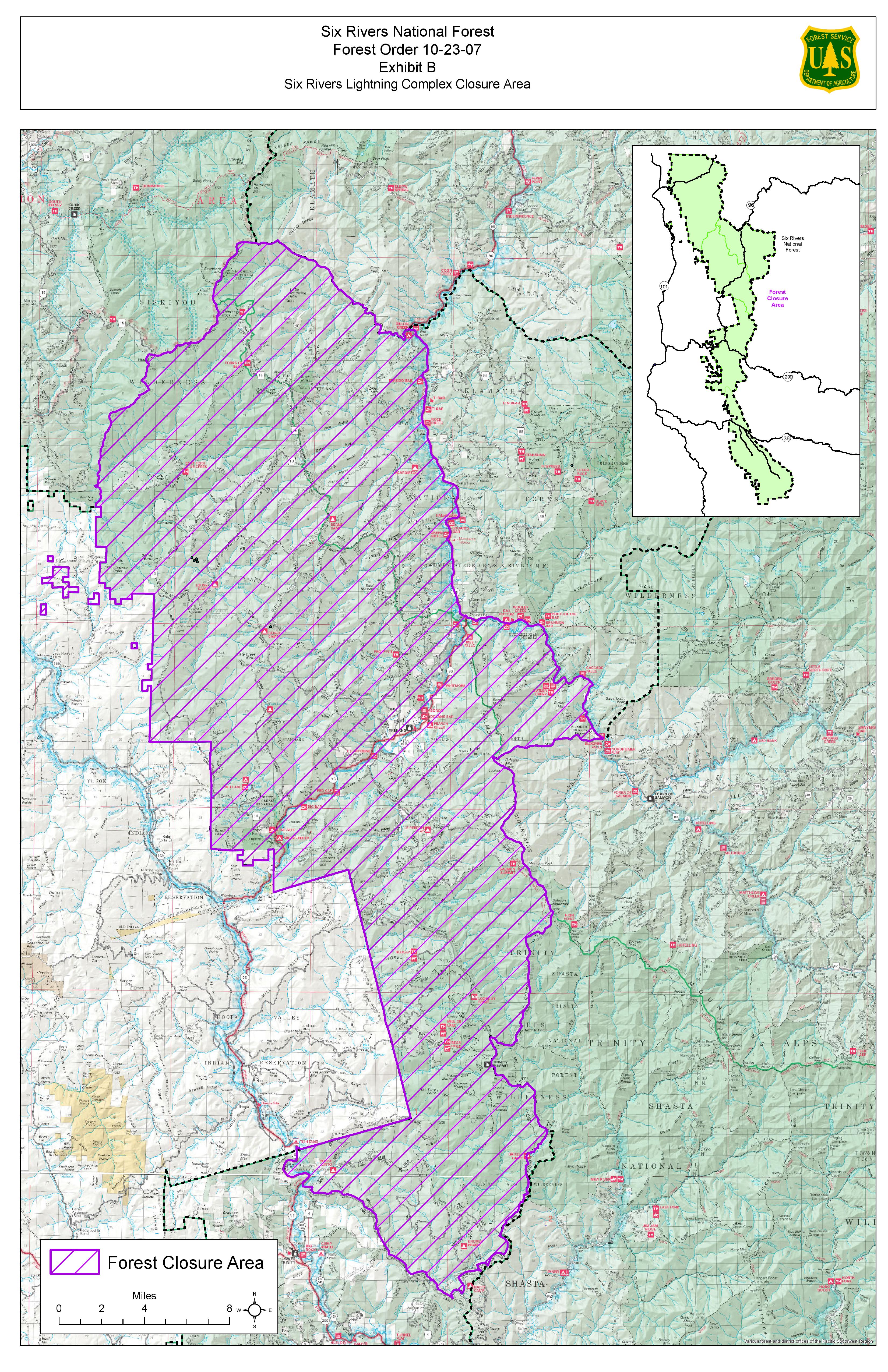
SIX RIVERS NATIONAL FOREST FOREST ORDER NO. 10-23-07 USDA FOREST SERVICE SIX RIVERS LIGHTNING COMPLEX CLOSURE AREA EXHIBIT A SIX RIVERS LIGHTNING COMPLEX CLOSURE AREA DESCRIPTION Fire Closure Area boundary begins at the intersection of the Six Rivers National Forest Boundary, Hoopa Reservation, and Ca. State HWY 96 in the northeast corner of Section o5, Township 7N, Range 5E, then continues South along the West edge of HWY 96 to Section 08, Township 7S, Range 5E. Boundary then continues South/Southeast to the intersection if Forest Route 8NO3 and 7NO2 in the southwest corner of Section 09, Township 7N, Range 5E, then continues along the Northern side of Forest Route 7NO2 until its intersection with Forest Route 7NO4 continuing along the Northern side of 7NO4 to its intersection with Forest Route 6N1O in Section 04 , Township 6N, Range 6E, then continues Northeast along the East side of Forest Route 6N1O to its intersection with Forest Route 6N24 continuing Northeast along the Western side of the road until it intersected with Forest Route 8NO2 in Section 35, Township 7N, Range 6E. Boundary then continues North on Western edge of Forest Route 8NO2 until it intersects with Forest Route 7N53 and continues along its Western edge until road terminates at the Grizzley Camp Trailhead in Section O6, Township 7N, Range 7E. The boundary then continuing along the Western edge of Grizzly Camp Trail to the Northeast corner of Lot 2 Section 06, Township 7N, Range 7E then heads North East to the Eastern Forest Boundary in NW% of the SE% of Section 32, Township O8N, Range 7E, then continuing Northward along the Forest Boundary until it intersects with the Happy Camp Ranger District in Section 28, Township 14N, Range 6E, North of Dillon Creek Campground. The boundary then continues Northwest along the Forest Boundary to the Del Norte County line in Section 2 ,Township 14N, Range 4E, then continuing South along the Orleans Ranger District Boundary back to the beginning point. Six Rivers National Forest Forest Order 10-23-07 Exhibit B Six Rivers Lightning Complex Closure Area.
Sourdough Fire Update August 26 2023
Related Incident:
Publication Type: News
Resources: 205 Total Personnel | 2 Hand Crews | 3 Engines | 3 Water Tenders | 3 Helicopters
**State Route 20 (SR 20) is open to through-travel only (no stopping or pulling over). Area, trail, and camp closures remain in effect between mile 120 (Newhalem) and 139 (east NPS boundary), as well as other areas along SR 20 due to the Blue Lake Fire. Diablo Lake, Diablo Lake Overlook, Maple Pass, and other areas are not accessible.
As we head into the weekend, we urge everyone traveling on SR 20 to exercise extra caution. Firefighters are actively working in the area, and potential gravity hazards like falling rocks and debris may still pose a risk. Please remain vigilant and adhere to all posted signage.**For more information, go to: https://www.nps.gov/noca/planyourvisit/fire-closures.htm
(Newhalem, Wash.) -- The Sourdough Fire started with a lightning strike on July 29 near Diablo in the Ross Lake National Recreation Area, 7 miles northeast of Newhalem. The size of the fire remains at approximately 6,138 acres with 25% containment.
The current suppression strategy involves obtaining full containment along the southern portion of the fire that includes SR 20 as well as other infrastructure such as buildings, utility corridors, and other values at risk. In the remote areas of the fire to the north, where the fire continues to burn through drought-stricken forest, the strategy is to keep the fire confined on the west and eastern flanks using natural features and past fire scars. Firefighters are prepared to take action if the fire endangers any values. Incident managers continuously evaluate and refine these management strategies, working toward a clear end state of ensuring the safety and protection of communities, infrastructure, and resources.
Yesterday: The cloud coverage and cooler temperatures decreased fire activity. This aided reconnaissance flights to monitor the fire’s progression, focusing on the east and west flanks. No concerns were found along the perimeters. Mop-up operations continued with the intention of reinforcing existing containment lines. Incident managers, division heads, park specialists, and resource advisors (READs) met to discuss and evaluate ongoing suppression repair strategies and guidelines for their effectiveness at returning damaged or disturbed areas to natural conditions.
Today’s planned activities: With SR 20 now open to through-travel, firefighters will continue to take appropriate safety precautions around traffic while conducting patrol and mop-up operations. Equipment no longer needed on the fireline is being backhauled or transported back to the fire camp to be prepared for future use on other incidents. Suppression repair operations will continue today along the secured fireline. Reconnaissance flights will be flown with a key focus on the Sourdough drainage and 2015 Goodell burn scar perimeters.
Weather: The fire area received light showers, but precipitation had minimal effect on overall fire behavior. East winds are predicted over the fire area this morning (Saturday), with southerly winds taking over in the afternoon. This weekend, increased temperatures and critical fire conditions arising from hot, dry, and unstable atmospheric conditions are expected. Another front moving in early next week brings the potential for more precipitation.
Safety: Firefighter and public safety will be a priority as SR 20 is now open to through-travel in the fire area. Fire danger remains extremely high. The public can help prevent the next wildland fire by observing outdoor burning bans and avoiding other common ignition causes. This is a no-recreation drone zone. Recreational drones pose serious risks to firefighter and public safety and the effectiveness of wildfire suppression efforts. Aerial firefighting is suspended when recreational drones are in the air.
Smoke: Information about current conditions and a smoke forecast is located at: https://wasmoke.blogspot.com.
For information on how you can prepare for wildfire smoke, go to: https://www.cdc.gov/air/wildfire-smoke/default.htm and https://www.wildlandfiresmoke.net/smoke-ready
Closures and Evacuations: Area, trail, and camp closures remain in effect. For more information, go to: https://www.nps.gov/noca/planyourvisit/fire-closures.htm
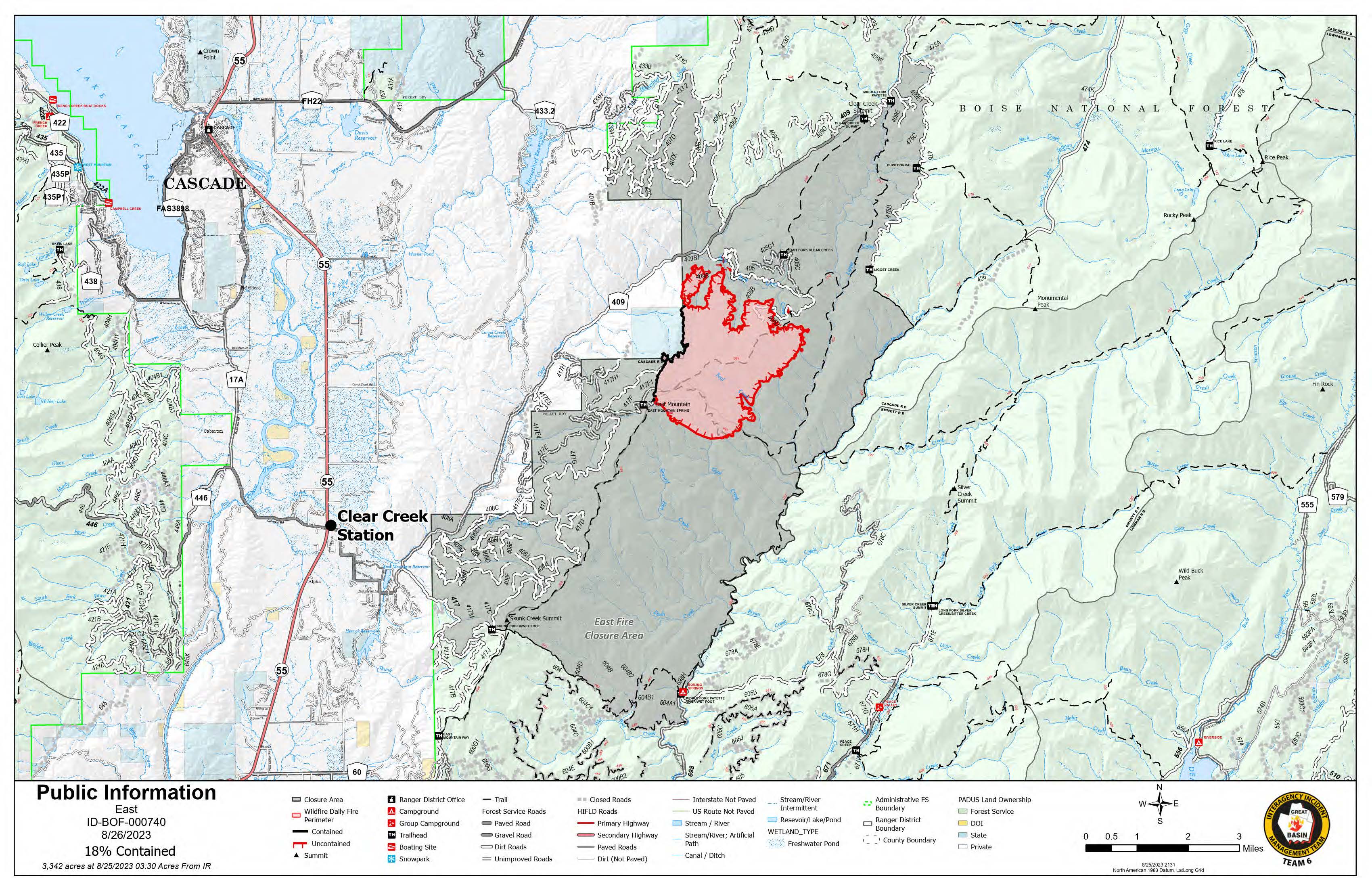
August 26 2023 Daily Update
Related Incident:
Publication Type: News
Saturday, August 26, 2023 – 8:00 a.m.
- 3,342 acres
- 18 percent contained
- Location: 10 miles East of Cascade, Idaho
- Cause: Undetermined
- Personnel: 407
- Currently no evacuation orders
On Friday, we saw moderate fire activity and, with the cooler temps came light precipitation that moved through the fire area early yesterday morning. Crews were able to go direct and secure the western edge of the fire area. Mop-up operations were started on the western edge and will continue today.
Crews completed the fuel break north of the fire area and will be directly attacking some of the remaining hot spots on the north and northeast fire area where safe to do so today. Mastication and saw cutting operations will continue on the northern side of the fire where crews continue constructing firelines.
Crews also continue to construct firelines south from East Mountain.
Weather: The chance for showers and thunderstorms continues today and tomorrow, with monsoonal moisture lingering over the region. High temperatures will be in the 60-70s with 30-40 percent relative humidity. Winds could be gusty and erratic near thunderstorms, otherwise winds are expected to remain light overall.
Closure Area: In place for public safety and details including a map can be found on the East Fire InciWeb page.
Air Quality: http://idsmoke.blogspot.com/
Web: https://www.fs.usda.gov/boise/
Facebook: https://www.facebook.com/BoiseNationalForest
InciWeb: https://inciweb.nwcg.gov/incident-information/idbof-east.
Information Phone: 208-781-6134
Email: 2023.East@firenet.gov
Information Staffing Hours: 8 a.m. to 8 p.m.