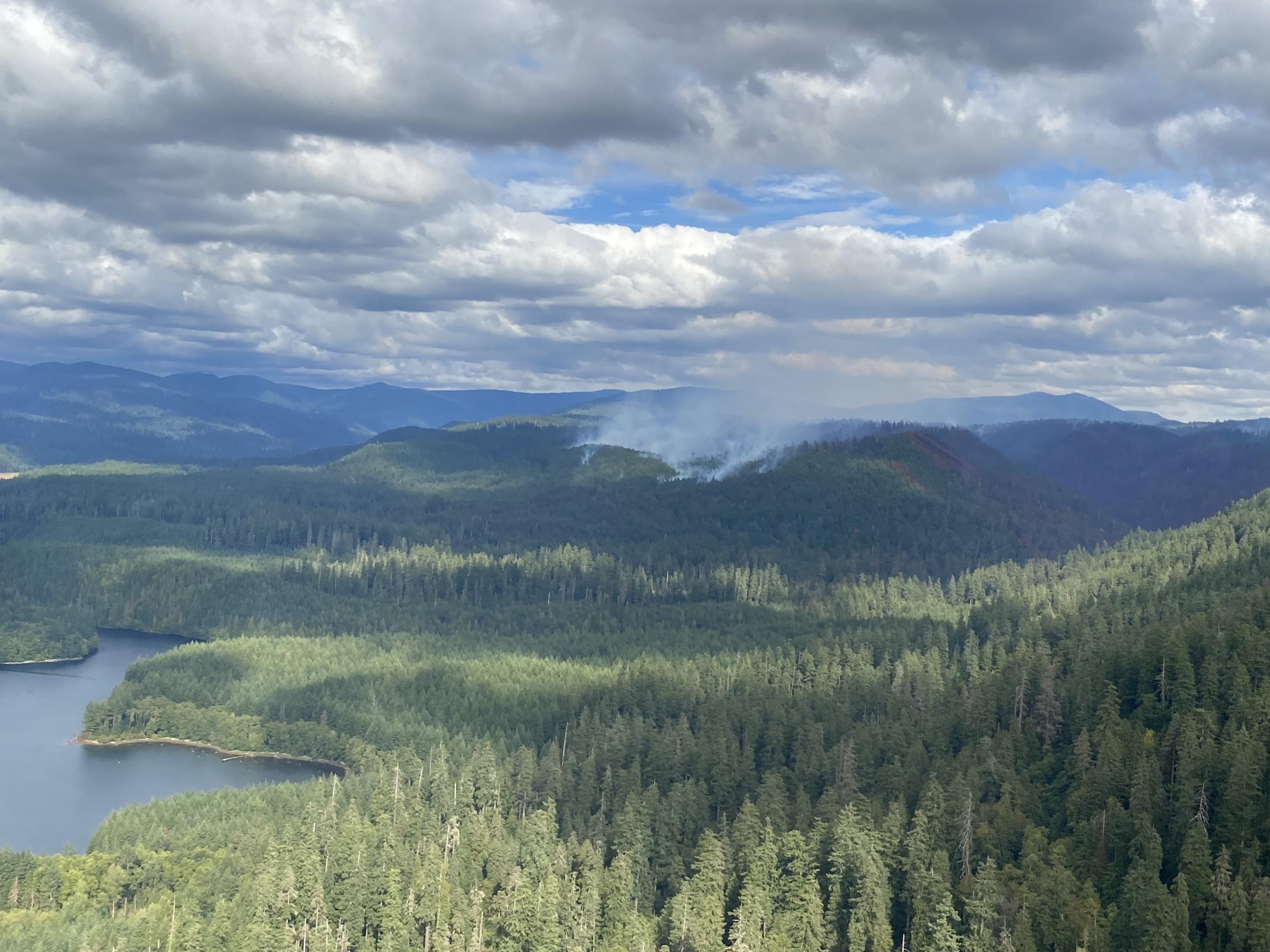
The Camp Creek Fire in the Bull Run Watershed northeast of Sandy started in the early morning hours of August 25, 2023 by lightning that moved across Oregon and Washington. The fire began near the junction of Forest Road 1210 and Forest Road 12. Firefighters responded quickly. The Great Basin Incident Management Team 1 was ordered to assist with suppression efforts and management of the fire. Command of the Camp Creek Fire was transferred to Pacific Northwest Team 3 Incident Management Team at 8:00 pm on September 11. Command of the Camp Creek Fire was transferred to the Mt. Hood Local Type 3 team at 6:30 am on September 21. Command of the Camp Creek Fire was transfered to the Mt. Hood National Forest ICT4 at 0700 on October 4, 2023.
Bull Run Watershed is closed to the public but is the primary source of drinking water for approximately 1 million people.
| Current as of | Wed, 10/04/2023 - 11:18 |
|---|---|
| Incident Type | Wildfire |
| Cause | Lightning |
| Date of Origin | |
| Location | Zigzag Ranger District, 10 miles east of Sandy, OR |
| Incident Commander | Michael Bobic, Incident Commander, Mt. Hood ICT4 |
| Incident Description | 10 miles east of Sandy, OR |
| Coordinates |
45° 27' 23'' Latitude
-122° 04' 56
'' Longitude
|
| Total Personnel: | 74 |
|---|---|
| Size | 2,055 Acres |
| Percent of Perimeter Contained | 62% |
| Estimated Containment Date | 10/31/2023 |
| Fuels Involved | Fire is burning in very heavy surface fuels under a partially/fully sheltered timber canopy. Heavy |
| Significant Events | The fire continues to smolder in deep duff and concentrations of dead and down fuels sheltered from rain. |
| Planned Actions |
Resources will continue to monitor consumption of interior fuels within the north flank. Suppression repair will occur at specific sites on the Division. The south and east flanks will be patrolled. |
|---|---|
| Projected Incident Activity |
12 hours: Little to no fire spread is expected. 24 hours: Little to no fire spread is expected. |
| Weather Concerns | Weak low pressure will exit the region tonight and a ridge of high pressure will build through the day. This ridge will amplify through the remainder of the week. Some post frontal showers will linger on Wednesday before it truly takes hold. While warming and drying is expected, not looking at a prolonged period enough that significant fire weather becomes a concern. 75% chance of exceeding 80 degrees on Friday, and 10% chance of exceeding 85 degrees. Overnight humidity recoveries will be favorable even though daytime drying is expected. Winds will be light and northerly becoming east-northeast Thursday evening. |
|---|

 InciWeb