
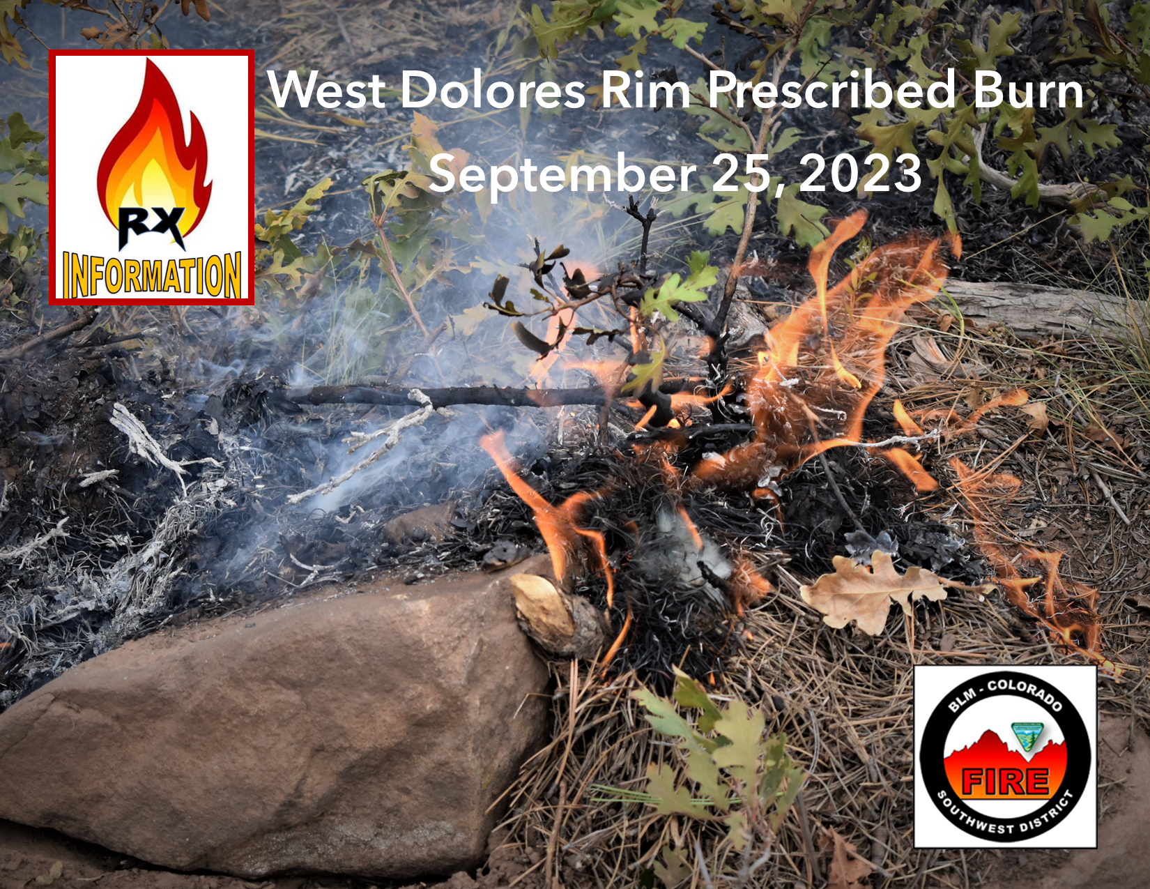
West Dolores Rim prescribed burn resumes Monday September 25 2023
Related Incident:
Publication Type: Announcement
Firefighters on the West Dolores Rim Prescribed Burn have good conditions to resume ignition operations today, Monday, September 25, 2023. They will use drip torches to ignite the perimeter and an unmanned aircraft system (UAS) drone with PSD (plastic sphere dispenser) for aerial ignition in the interior area of the burn unit. Smoke may be visible east of Egnar, CO.
The BLM obtained smoke permits from the Colorado State Air Pollution Control Division, which identify atmospheric conditions under which the burns can be implemented. Prescribed fire smoke may affect your health. For more information, visit https://www.colorado.gov/pacific/cdphe/wood-smoke-and-health.
For more information on BLM Southwest District prescribed burn treatments visit, InciWeb-Southwest District BLM Prescribed Fire https://inciweb.wildfire.gov/ and follow BLM Southwest District Facebook and Twitter @SWD_Fire
Smith River Complex North Daily Update Monday September 25 2023
Related Incident: Smith River Complex
Publication Type: News
Size: 94,508 acres (12,460 ac. in Oregon); Location: Grants Pass, OR; Cause: Lightning
Containment: 85%; Start date: August 15, 2023; Total personnel: 1,199
Resources: 26 crews 6 helicopters 29 engines 8 dozers 17 water tenders 4 masticators 1 Skid Steer
Yesterday: Fire suppression repair and backhauling operations continued on the north end of the fire. Construction progressed on the secondary control line that is situated northwest of the fire along the FS 1106 road. To the southwest of the fire, the other secondary line is now in the final stages of clean-up.
Today’s Activities: Fire managers are monitoring the progress of the weather system that is predicted to be in full force today and lasting into Tuesday. Heavy rains are predicted; flood warnings and a wind advisory will also be in effect. This impending event has implications for the safety of firefighters, contractors, and support staff. Operational contingencies are in place that include directing fire personnel to stand down for safety for up to 24 hours until weather conditions improve. Firefighters remain prepared to respond to natural resource related hazards, such as downed trees, rock falls and mudslides.
Evacuations: The Josephine County Sheriff has set the evacuation status to Level 1-BE READY. Levels will be reevaluated on a recurring basis. This includes the area west of US-199 in Josephine County, including the community of O’Brien and to the Oregon-California border. Monitor the Rogue Valley Emergency Management site and also sign up for evacuation alerts, updates and an interactive Fire First Response Map with evacuation areas here: https://rvem.org/.
Smoke: Southerly to southwest winds will usher smoke northward and inland into Sunday. Smoke from active fires in northern California will contribute to reduced air quality before arrival of rains. The most impacted communities will be along and east of the US-101 corridor of Curry County, inland to Grants Pass and the US-42 corridor. Early smoke in drainages should begin to dissipate by early afternoon. Check current conditions at: https://bit.ly/SWORsmoke
Area Closures: A closure is in place on the Rogue River-Siskiyou National Forest for Forest Road 1106 (South Elk Mountain Road), Forest Road 1205 (Lower Wheeler Road), and Forest Road 1983 (Mt. Emily Road) until October 31, 2023 or until rescinded. The closure allows for safe operations related to the Smith River Complex North. Closures on BLM land are in place as well. Visit bit.ly/RRSNFAlerts or https://www.blm.gov/orwafire for additional information.
Road Closures and Delays: Caltrans in Del Norte County issued a schedule of road closures and lane restrictions on US-199. Weekdays will have a combination of road closure and lane restrictions. Over the weekend, the road will remain open, but with lane restrictions and pilot cars. Expect delays. For specific information on road access, please see the Caltrans QuickMap site https://quickmap.dot.ca.gov/ and Oregon Department of Transportation’s https://www.tripcheck.com/. Local law enforcement cautions against any non-essential traffic along this route. Navigation apps and mapping programs have been routing travelers into active fire areas. Do not use forest roads as alternate routes.
Restrictions: Please respect the temporary flight restriction (TFR) established for the Smith River Complex. Keep drones away from firefighting operations and the TFR. If you fly, we can’t. Don’t be the reason a firefighting air mission has to divert! For more information on the TFR, visit https://tfr.faa.gov/.
SW Oregon Smoke Outlook September 2526
Related Incident: Anvil FireFlat Fire
Publication Type: News
Heavy rainfall and gusty winds have cleared the area of smoke and dampened fire behavior. With prolonged wind and rain, GOOD air quality is expected until drier conditions allow increased fire activity and new smoke production. Low-lying areas in the immediate vicinity of the fire perimeter will have intermittent smoke impacts during breaks in the weather.
Update Chilcoot Fire September 25 2023
Related Incident: 2023 Chilcoot Fire UNF
Publication Type: News
Northwest Team 6 will be transferring command to Northwest Team 13 today at 6 pm. This will allow continued strategic management of all the Umpqua Fires as personnel time out. Updates for the Chilcoot Fire are posted on Mondays, Wednesdays, Fridays, and Sundays unless a significant event or situation change warrant more frequent updates.
Current Situation: Suppression work and weather have moderated fire activity on the Chilcoot Fire. Operations on the fire are moving into a suppression repair phase. Suppression repair includes restoring hand and dozer line, back hauling equipment, chipping, and other resource mitigations. Limited fire personnel will be out in the field today. Due to expected heavy rain and winds most firefighters will be held back from the line to mitigate risk of getting vehicles and equipment stuck or having trees fall near crews.
Weather: Heavy rain is expected with gusty conditions up 35 mph. Temperatures will be in the upper 50s to mid 60s.
Safety and Closures: There is a forest closure for portions of the Umpqua National Forest in response to fire activity in the area to protect public and wildland firefighter safety. A Closure Order for the Canton Creek area has been issued by Bureau of Land Management (BLM).
Facebook: https://www.facebook.com/chilcootridgefires2023
Fire Information: (541) 900-5862, 8:00 AM – 7:00 PM Email: 2023.chilcoot@firenet.gov
2023 SRF Lightning Complex Update September 25 2023
Related Incident: 2023 SRF Lightning Complex and Redwood Lightning Complex
Publication Type: News
Fire Update
2023 SRF Lightning Complex
Monday, September 25, 2023 – 9:00 a.m.
Eastern Area Gold Team
Brian Jenkins, Incident Commander
Information Phone: 530-536-0767
Email: 2023.lightningcomplex@firenet.gov
Information Staffing Hours: 8 am to 8 pm
This update covers 5 of the 14 fires being managed as part of the SRF Lightning Complex. The Copper Fire (2184 acres) was absorbed by the Blue Creek #2 Fire. On September 22, 2023, the Bluff #1 Fire (4270 acres) and Blue Creek #2 Fire (9751 acres) were absorbed by the Mosquito Fire. The combination of Blue Creek #2 Fire, Bluff #1 Fire, and Mosquito Fire is now referred to as the Mosquito Fire. The remaining 6 fires (Big Foot, Blue Creek, Creek, Flat, Iron, and Merrill) totaling 34 acres, are contained and in patrol status. They are checked daily, and their size and containment are unlikely to change.
Current Situation: The 14 fires on this incident total 42,517 acres and overall containment is 8%. In total, 770 personnel are assigned to the incident. Due to the forecasted precipitation of up to two inches of rain, firefighting crews are checking containment lines and monitoring fire conditions ahead of the weather change. Gusty winds can present dangerous conditions for firefighters as fire-weakened trees may not withstand the wind speeds and fall. Additionally, fire-weakened tree roots and soil can easily dislodge in heavy rain, increasing the risk of trees falling and debris rolling down steep slopes. Firefighters are adjusting their operations and monitoring fire activity as well as the potential impacts of the precipitation within the fire area.
Firefighting tactics are reassessed daily and tailored to the conditions on the fire line like weather, fire behavior, existing hazards like dead standing trees, and the time and distance to definitive medical care, etc. There is a decision-making process around risk at the strategic level that evaluates and balances risk to firefighters with the critical values like homes and infrastructure that are at risk from the fire. If the level of risk to firefighters is deemed unacceptable, the strategic risk assessment process examines and provides alternatives that may better balance outcomes between risk to critical values and to responders.
Pearch Fire (11,131 acres, 6% contained) – Crews continue to work to stay ahead of the rolling debris and rocks falling onto both the Salmon River Road and Highway 96. Siskiyou County brought a backhoe and bladed plow truck and aided the crews by removing fallen rocks on Salmon River Road. CalTrans continues to monitor Highway 96 with two crew shifts working to clear it of debris as needed. The amounts of debris falling onto the road is expected to increase with the precipitation today. Please drive with caution and consider alternate routes. The Structure Protection Group has continued the point protection of structures in several areas around this fire. An Evacuation Warning is in place for those residents in the Butler Creek area (SIS-1704) which means persons in the area need to be prepared to evacuate if conditions warrant.
Mosquito Fire (29,266 acres, 6% contained) – Crews continue the work south along the Bluff Creek and Slate Creek Roads with mastication and chipping equipment. Hand crews improved containment line in preparation for the rain, making it less susceptible to runoff. Firefighters are focusing on holding and patrolling the containment lines. Crews felled some hazardous standing dead trees along the fire edge before the strong wind gusts arrived.
Marlow Fire (1,988 acres, 0% contained) – There has been minimal activity on the Marlow Fire. This fire is in a remote area and is bounded by indirect control lines to the east and south and prior fire footprints where fuels are lighter. No values are threatened by the Marlow Fire. A Wildland Fire Module continues to monitor and assess conditions on the ground and air resources will monitor from above. Fire managers from the 2023 SRF Lightning Complex continue to coordinate with managers on the Happy Camp Complex due to the proximity of the Elliot Fire.
Monument (2 acres, 0% contained) and Let er-Buck (96 acres, 0% contained) Fires – A confinement strategy is being used to address these two fires due to limited values at risk and the remote, steep terrain with associated safety concerns for the firefighters. Terrain, natural fire barriers such as rock outcroppings, and old fire footprints where fuels are limited will be used to confine fire growth until season ending precipitation extinguishes the fires. These fires are checked regularly by aerial patrols to ensure they remain within acceptable bounds.
Weather: Yesterday brought a storm system over the fire area with showers early in the day and a drier afternoon. Gusts of 30 mph were observed yesterday evening on higher elevation ridges. Winds are forecasted to maintain higher speeds throughout the day: 9-19 mph in the valleys and up to 25 mph on ridgelines, with gusts up to 35 mph. The fire area will experience wetting rain throughout the day with temperatures in the 50s and 60s. The precipitation levels are forecasted to continue through tonight and taper off by Tuesday evening.
Evacuation Information
Siskiyou County Office of Emergency Services: https://www.co.siskiyou.ca.us/emergencyservices
Closures
Six Rivers National Forest: Area and campground closures are in effect on portions of Six Rivers National Forest. They can be found at: https://www.fs.usda.gov/detail/srnf/notices/?cid=FSEPRD1096395.
Additional Fire Information
Facebook: https://www.facebook.com/2023SRFRedwoodLightning
More Fire Information Links: www.linktr.ee/srffirepio
For Air Quality Information: www.airnow.gov
NOTE: For information about the Elliot or Hancock Fires which are part of the
Happy Camp Complex, please visit https://linktr.ee/happycampcomplex2023 .
Update Brice Creek and Grizzly Fires September 25 2023
Related Incident: Brice Creek FireGrizzly Fire
Publication Type: News
Rain impacted operations yesterday when native surface roads and dozer lines became impassable due to mud. This resulted in crews being positioned only on hard surfaced roads after noon. Today, it is expected that rain and wind will impact the fire area. In the interest of fire fighter safety and to prevent resource damage, operations will be suspended today.
Members of Northwest Incident Management Team 13 will shadow Team 6 today and will take command of the incident at 1800 hours (6PM) today.
Brice Creek Fire: Size: 571 acres | Start Date: August 24, 2023 | Cause: Lightning | Containment: 95%
Yesterday, crews focused on patrols and repair. Repair and water bar installation are complete, some additional woody debris may be needed later to mitigate erosion. Operations are suspended today. All future work assignments will be based on rain accumulation and duration. This will be the last update for Brice Creek Fire unless significant activity occurs.
Grizzly Fire: Size: 324 acres | Start Date: August 24, 2023 | Cause: Lightning | Containment: 0%
Yesterday only a small amount of heat was detected in the southwest corner of the fire; no movement to the west or north was detected. Resources were pulled from the fire in the early afternoon due to muddy roads. Operations are suspended today; the fire will be monitored from pre-determined observation points.
Weather: Periods of moderate to heavy rain Monday morning through mid-afternoon. Gusty south-southwest winds, strongest after 1200, gusting 25-35 on ridges. Temperature near 56 degrees, humidity 65%.
Evacuations: Lane County issued a Level 2 Evacuation (Be Set) for all private lands and mining claims in the Bohemia areas within the Cottage Grove Ranger District of the Umpqua National Forest.
Safety and Closures: Please remember to stay out of the fire area. There is a forest closure for portions of the Umpqua National Forest in response to fire activity in the area to protect public and firefighter safety.
Facebook: https://www.facebook.com/bricecreekdinnergrizzlyfires2023/
Fire Information: (541) 900-5862, 8:00 AM – 7:00 PM Email: 2023.dinner@firenet.gov
Olympic National Park Fire Update September 24
Related Incident: 2023 Olympic National Park Lightning Fires
Publication Type: News
Port Angeles, Wash. – The fire area did not receive the predicted rainfall totals on Sunday. The Delabarre, Low Divide, and Martin’s Lake fires showed minimal growth, while the other fires showed no signs of growth. All crews were extracted from the fire area to reduce the risk of accidents in steep, remote terrain with the coming weather system.
Weather forecasts for the next 48 hours predict increased precipitation over the fire area with 2-4 inches of rainfall and thunderstorms expected. However, warmer temperatures and drier conditions may return by the end of this coming week.
Fire Name
Initial Report
Estimated Size
Location
Hurricane
8/28/23
4 acres
2,000 ft below Hurricane Ridge parking area
Eagle Point
8/28/23
123 acres
~5 miles out Obstruction Point Road
Diamond Mountain
9/1/23
30 acres
3.3 miles NE of
Anderson Pass
Low Divide
9/1/23
340 acres
N. Fork Quinault drainage
Delabarre
9/1/23
4,165 acres
3 miles SE of Mount Christie
Martins Lake
9/2/23
122 acres
2 miles NE of Mount Christie
Mount Queets
9/14/23
7 acres
Summit of Mount Queets
Fires in the wilderness are a natural part of the ecosystems on the Olympic Peninsula; these plants and animals have evolved with fire for thousands of years. Fire can increase favorable habitat for the wildlife. When appropriate, allowing this natural process to continue lowers the risk of catastrophic fires in the future. Naturally occurring fires thin forests, open the canopy, and reduce competition for resources for plant and tree growth. Fire returns nutrients to the soil while reducing the amount of dead, woody debris. It only takes a short time after a fire for the forest to regenerate.
Background Information
All seven active fires in Olympic National Park ignited when a series of lightning strikes occurred on the Olympic Peninsula in the afternoon on August 28.
Closures
Due to wildfire activity the following closures are in effect until further notice:
- Elwha River Trail from Whiskey Bend Trailhead to Low Divide
- Bailey Range Traverse beyond Cat Basin
- Long Ridge Trail to Dodger Point
- Hayden Pass Trail
- Dosewallips River Trail from Dose Meadows to Hayden Pass
- Dodger Point Way Trail
- North Fork Quinault Trail from Elip Creek trail junction to Low Divide
- Skyline Trail from Elip Creek Trail junction to Low Divide
- Martin Park Trail
- Obstruction Point Road and Trailhead
Olympic National Park Wilderness Information Center (WIC) will be notifying backcountry permit holders who may be impacted by these closures. Any permit holders who plan to backpack in the above impacted areas should contact the WIC at 360-565-2992 or by emailing OLYM_WIC@nps.gov.
Weather and Fire Behavior
The fire area did not receive rainfall on Sunday. Rain and thunderstorms are expected to increase Monday and Tuesday. Forecasters anticipate rainfall accumulations to range from 2 to 4 inches. Thunderstorms may form over the fire area in the first half of this week.
Information for the 2023 Olympic National Park Lightning Fires can be found at: https://inciweb.wildfire.gov/incident-information/waolp-2023-olympic-national-park-lightning-fires
Olympic National Park information: www.nps.gov/olym
Olympic National Forest information: www.fs.usda.gov/olympic
State and county area burn bans: https://ecology.wa.gov/Air-Climate/Air-quality/Smoke-fire/Burn-bans
Morning Update Monday September 25 2023
Related Incident: Lookout FireBedrock FirePetes Lake Fire2023 Horse Creek Fire
Publication Type: News
Lookout, Bedrock, Petes Lake, Horse Creek, and Pothole Fires
Monday, September 25, 2023 - Morning Update
Current Status:
Lookout Fire: Size: 25,751 acres l Start Date: August 5 l Cause: Lightning l Containment: 50%
Bedrock Fire: Size: 31,590 acres l Start Date: July 22 l Cause: under investigation l Containment: 98%
Petes Lake Fire: Size: 3,254 acres l Start Date: August 25 l Cause: Lightning l Completion: 50%
Horse Creek Fire: Size: 763 acres l Start Date: August 24 l Cause: Lightning l Containment: 100%
Pothole Fire: Size: 109 acres l Start Date: August 25 l Cause: Lightning l Containment: 100%
Total Personnel: 712
Total Assigned Resources: 21 engines l 18 crews l 4 dozers l 19 water tenders l 4 masticators l 3 helicopters
Suppression: With the cool weather and wetting rain further decreasing fire behavior to creeping and smoldering even extinguishing some areas of remaining heat within the fires’ perimeters, most firefighting resources are focused on suppression repair. However, crews working on the Petes Lake Fire expect to finalize mastication efforts to reduce fuels between the fire and Forest Service Road 4628 on Monday.
Suppression Repair: Crews continue to work on chipping small diameter trees and other vegetation cut during the fire suppression efforts. Larger trees are being hauled offsite to remove the fuel for potential future fires. As the rainfall amounts and wind speeds increase, the environment that firefighters are working in becomes more dangerous. Saturated soils and wind gusts can further weaken trees and put firefighters at increased risk for fatal injuries. However, they continue to make risk-informed decisions in the field to complete the necessary suppression repair work while remaining safe.
On the Bedrock Fire, 6.6 miles of handline created by firefighters to limit fire spread have been repaired. Another one mile of handline repair is needed on the Bedrock Fire. In comparison, only two miles of the nearly nine miles of handline constructed on the Lookout Fire have been repaired thus far. About half of the handline miles constructed on the Horse Creek Fire have been repaired. Across all five fires, nine miles of handline have been repaired. Efforts are wrapping up throughout the Horse Creek Fire, with 0.6 miles of handline repair to complete in the northern end of the fire footprint. Suppression repair efforts on the Pothole Fire should be completed today.
Additional suppression repair work includes removing supplies firefighters used in the suppression efforts on each of the fires. To date, firefighters have backhauled more than four semi-truck loads of supplies used in the field – including 30 miles of hose that were deployed in the event it was needed. When returned, these supplies are refurbished and made available for another incident across the region or country.
Weather: Cloudy skies and widespread rain persisted throughout last night and into this morning as a cold front moved into the region. Heavy rain and scattered showers are expected throughout the day with high temperatures in 50s. Winds along ridgetops near the Lookout Fire and Petes Lake Fire will be from the south-southwest, with gusts up to 25-30 miles per hour. More light to moderate rainfall is expected throughout the week.
Linn County Evacuations: Visit the Linn County Wildfire map for current evacuation information.
Lane County Evacuations: Visit the Lane County Lookout Fire Evacuation Areas map for current evacuation information.
Deschutes County Evacuations: Visit the Deschutes County Emergency Information map for current evacuations information.
Forest Closures: Emergency closure orders remain in place for the Willamette National Forest and the Deschutes National Forest. For information on Oregon hunting regulations and these forest closures, contact Oregon Department of Fish and Wildlife at (503) 947-6000.
Restrictions: Fire Restrictions are in place on the Willamette National Forest and Deschutes National Forest. Temporary Flight Restrictions remain in place over the Bedrock and Lookout Fire areas.
Smoke Outlook: A smoke outlook for West-Central Oregon includes the Lookout, Bedrock, Petes Lake, Horse Creek, and Pothole Fires. Another source for air quality information is the Fire and Smoke map from airnow.gov.
Fire Information:
Email: 2023.lookout@firenet.gov
Phone: 541-215-6735 (8 a.m. - 8 p.m.)
Facebook:
InciWeb:
- Lookout Fire
- Horse Creek Fire (includes Pothole Fire)
- Bedrock Fire
- Petes Lake Fire
Monday September 25 Update Southwest Idaho Wildfire Crisis Strategy Prescribed Burn
Related Incident: Southwest Idaho Wildfire Crisis Strategy Prescribed Fire
Publication Type: News
Southwest Idaho Wildfire Crisis Strategy Prescribed Burn
Monday, September 25th Active unit/projects
Each prescribed burn project in the Southwest Idaho Wildfire Crisis Strategy Prescribed Burn area is divided into smaller units for fire operations, allowing firefighters to manage and control the burning area.
Council Ranger District:
Weasel (13 miles Northwest of Council) – Saturday and Sunday helicopter and hand ignitions resulted in firefighters successfully treating 250 acres in the Pike Mtn. area. Today crews will clean up in the targeted area and intend to burn approximately 50 acres.
Weiser Ranger District:
Robinson (22 miles Northwest of Weiser) – Weekend work resulted in an additional 75 acres of prescribed burn treatment. Windy conditions today will have crews patrolling and monitoring. No burning is planned for today.
New Meadows Ranger District:
Brush (10 miles Northwest of New Meadows) – Approximately 65 acres were covered over the weekend. Windy conditions on Sunday had crews holding off on extensive burning. With exterior “black line” in place, today’s plan is to use helicopter ignitions on the interior of the targeted burn area with the potential to treat 300 acres.
Cold (Lost Valley Reservoir area) – Patrol and Monitoring continues. A human-caused wildfire occurred next to the burn area; it was successfully contained.
Goose Creek –Weekend patrols reported the prescribed burn area is stable. Daily periodic checking is planned.
An overview of all the planned prescribed burn areas in the Payette National Forests is available here: bit.ly/PNFprescribedburn2023
For the most current information about prescribed burning projects please visit the Payette Facebook page or visit the Payette National Forest planned fuels treatments map at https://tinyurl.com/Payette-Prescribed-Fire-Map
For more information on the Forest Service Wildfire Crisis Strategy and the Southwest Idaho Landscape project, visit this link: Southwest Idaho Landscape Project
South Fork Complex Update September 25 2023
Related Incident: South Fork Complex
Publication Type: News
South Fork Complex Update
Monday, September 25, 2023
Fire Information: 916-261-6756, 8 a.m. to 8 p.m.
Email: 2023.southforkcomplex@firenet.gov
Linktree: https://linktr.ee/2023southforkcomplex
3-9 Fire: 2,840 acres with 85% containment
Pellitreau Fire: 3 acres with 100% containment
Pilot Fire: 1,055 acres with 100% containment
Sulphur Fire: 31 acres with 100% containment
3,929 acres and 90% overall containment for the South Fork Complex
A total of 181 personnel, crews, air support, engines, dozers, and water tenders support the incident.
3-9 Fire – Crews are wrapping up repair activities. Operations to fall snags and hazardous trees continue. Engines are monitoring the interior smoke and heat. United States Forest Service Resource Advisors (READs) are monitoring these activities, and addressing any potential concerns to tribal, cultural, and natural resources. Heavy equipment and crews are engaged with chipping operations along Route 1. The public can expect to see large dump trucks transporting the chips along Route 1 and Highway 36.
The Pilot Fire is 100% contained. Crews continue to patrol the fire perimeter while actively engaged in suppression repair.
The Pellitreau Fire and the Sulfur Fire are 100% contained. Firefighters continue to patrol the fires periodically to ensure fire remains within containment lines.
Weather: Moderate to heavy rain and windy Monday, with isolated thunderstorms possible in the afternoon. Winds from the south gusting around to 25 to 35 mph, locally up to 40 mph on highest ridges. Afternoon highs in the 50s to around 60, with afternoon humidity only dropping to around 60 to 70%. Storm total rainfall around 1 to 1½ inches.
Forest Closure: Forest Closure Order for the South Fork Complex Fire continues to be in effect and is posted on the Six Rivers National Forest website. Please avoid closed areas.
@U.S. Forest Service - Shasta-Trinity National Forest
@U.S. Forest Service - Six Rivers National Forest