
The Horse Creek Fire was started by lightning the 25th of August about one mile south of McKenzie Bridge, OR on the Willamette National Forest (WNF). This wildfire is currently 100% contained. A Type 3 WNF incident management team assumes command of the incident at 6 p.m. on October 10, 2023.
The Horse Creek Fire was started by lightning the 25th of August about one mile south of McKenzie Bridge, OR on the Willamette National Forest (WNF). This wildfire is currently 100% contained. A Type 3 WNF incident management team assumes command of the incident at 6 p.m. on October 10, 2023.
| Current as of | Tue, 10/10/2023 - 18:17 |
|---|---|
| Incident Type | Wildfire |
| Cause | Lightning |
| Date of Origin | |
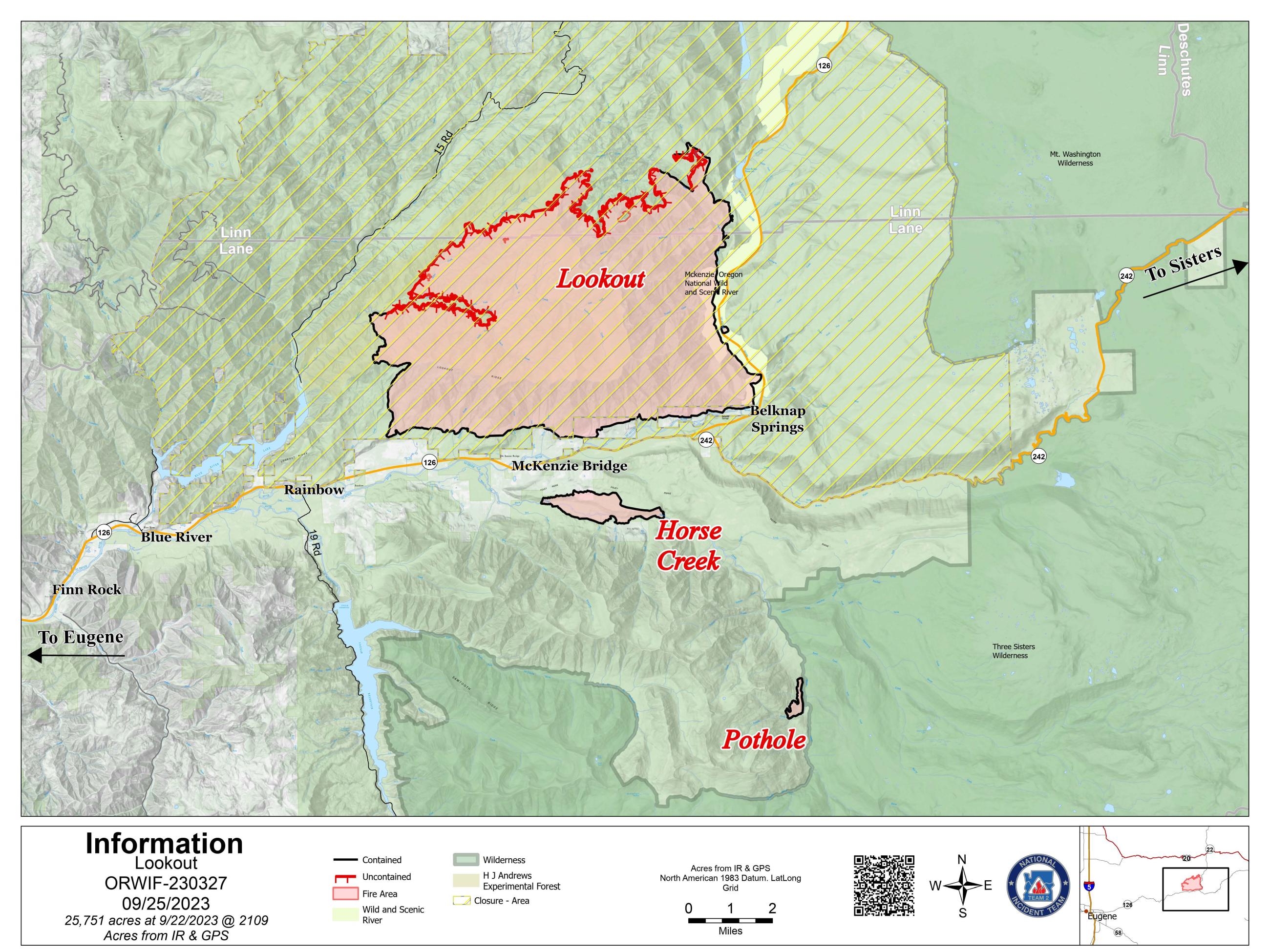
| Location | 1 mile southeast McKenzie Bridge |
| Incident Commander | Jason Loomis - Pacific Northwest Incident Management Team 2 John Szulc- trainee Chris Hutsell- trainee |
| Coordinates |
44° 9' 42'' Latitude
-122° 8' 35
'' Longitude
|
| Total Personnel: | 0 |
|---|---|
| Size | 763 Acres |
| Percent of Perimeter Contained | 100% |
| Estimated Containment Date | 09/15/2023 |
| Fuels Involved | Timber (Litter and Understory), Closed Timber Litter, Brush (2 feet) Mixed stands of varying age classes exist throughout the fire area. Old growth stands contain heavy surface fuel loading with an abundance of moss and lichen in the canopy. Younger managed stands have an understory of brush/shrub component. Youngest stands of forest regeneration have a heavy slash component from prior harvest. Primary carrier in old growth stands is 100 -1000 hour fuels with spread accelerated by short range spotting from lichen. Primary carrier in managed stands is timber litter and slash. |
| Significant Events | Minimal Creeping, Smoldering Continue creeping and smoldering as well as consumption of heavy concentrations fuels today. |
| Planned Actions |
Fire is 100% contained. Resources will continue to patrol and mop up where needed. Fireline repair will continue on all non primary lines. |
|---|---|
| Projected Incident Activity |
24 hours: Cooler and wetter weather pattern for the extended forecast will decrease amount of smoldering and potentially extinguish some of the remaining heat over the next couple of days. 48 hours: Temps will cool and RH's will increase, which may limit consumption of smoldering fuels. |
| Weather Concerns | Thanks to a trough moving through the area last night, we experienced much cooler conditions today across the fire. Mid- afternoon temperatures are 10-15 degrees lower compared to this time yesterday, and are currently in the mid 60s to mid 70s. RHs have also drastically increased by as much as 10-20%, and are currently between 35-50%. Cloud cover stuck around until around noon, with a more shallow inversion this morning due to those overnight clouds. Another weak, dry cold front will pass through the region tonight into Tuesday. This will bring increasing cloud cover as the night progresses along with much higher RH recoveries. We'll see additional cooling tomorrow, with high temperatures mostly in the mid to upper 60s in the valleys and mid to upper 50s along the ridges and slightly higher minimum RHs. |
|---|