
South Fork Complex Update September 24 2023
Related Incident: South Fork Complex
Publication Type: News
South Fork Complex Update
Sunday, September 24, 2023
Fire Information: 916-261-6756, 8 a.m. to 8 p.m.
Email: 2023.southforkcomplex@firenet.gov
Linktree: https://linktr.ee/2023southforkcomplex
3-9 Fire: 2,840 acres with 85% containment Pellitreau Fire: 3 acres with 100% containment
Pilot Fire: 1,055 acres with 100% containment Sulphur Fire: 31 acres with 100% containment
3,929 acres and 90% overall containment for the South Fork Complex
A total of 181 personnel, crews, air support, engines, dozers, and water tenders support the incident.
3-9 Fire – Crews are continuing repair activities, falling snags and trees to reduce fuel loads, by removing hazardous trees. Engines are monitoring the interior smoke and heat. Heavy equipment operators continue repairing roads and installing water bars while the United States Forest Service Resource Advisors (READs) monitor these activities and address any potential concerns with tribal, cultural, and natural resources in the area. Heavy equipment and crews are beginning to prepare for chipping operations along Route 1. The public can expect to see large dump trucks transporting the chips along Route 1 and Highway 36.
Weather: Cloudy and cooler Sunday with a chance (25%) of light rain in the afternoon, with a better chance (40%) of rain in the evening. Moderate to heavy rain overnight. Winds from the south in the afternoon 7 to 12 mph, with gusts to 20 mph over ridges, becoming southeast winds in the evening with gusts to 30 mph. Afternoon highs in the mid 50s to around 60, with afternoon humidity only dropping to around 50 to 60%.
Forest Closure: Forest Closure orders for the South Fork Complex Fire continue to be in effect and are posted on the Shasta-Trinity National Forest and the Six Rivers National Forest websites. Please avoid closed areas.
@U.S. Forest Service - Shasta-Trinity National Forest
@U.S. Forest Service - Six Rivers National Forest
Sunday September 24 2023 Valentine Fire Update and Maps
Related Incident:
Publication Type: News
Size: 6,500 acres
Start Date: August 16, 2023
Cause: Lightning
Completion: 75%
Total personnel: 198
Location: 11 miles northeast of Young, Arizona and 27 miles
east of Payson, Arizona
Fuels:Ponderosa Pine, Hardwood litterand timber
Highlights: With cloud cover and the rain received yesterday, hand and aerial ignitions were suspended until weather conditions improve. Today, with sunnier weather, the crews will be able to continue to progress the fire’s edge to the south towards FSRD 411.
Operations: Due to the moisture received yesterday, no ignitions were performed. Crews continued prep on the southern portion of FSRD 200 and did some mastication work on FSRD 848. Another crew prepped an unburned 30-acre section for treatment. Today will be dryer allowing crews to continue hand and aerial ignitions, creating more depth towards the southern containment line. Scouting will continue to the north side of Haigler Creek for future access routes.
Fire Ecology: High-severity fire effects are occurring in small patches across the landscape where the Valentine Fire has been burning. Historically, there would always have been small patches of high severity scattered across the forest, usually less than an acre. This patchy burning maintains a ‘mosaic’ of vegetation conditions across the landscape which affects the behavior and severity patterns of future fires. This also helps to create and maintain ideal habitat for a variety of plant and animal species.
Weather: Yesterday, cloud cover remained all day with trace amounts of precipitation. Today will be dry, sunny, and warmer weather is expected to increase through the middle of the week.
Closures: An emergency closure order for the Valentine Fire has gone into effect as of 6 a.m. Sept. 5, 2023. The public is asked to avoid the fire area. The purpose of the closure order is to protect public health and safety during the Valentine Fire, and to protect assigned firefighting personnel engaging in wildland firefighting operations. Signs and gates will be in place to remind the public not to enter the fire area. Please visit the Alerts and Notices page for more information. https://www.fs.usda.gov/alerts/tonto/alerts-notices.
Safety: The health and safety of firefighters, and the public are always the highest priority. Members of the public are asked to avoid the fire area.
Smoke: The fire will produce considerable amounts of smoke due to excessive fuel accumulation. Smoke from the Valentine Fire may be visible in the surrounding areas for many days. Smoke-sensitive individuals and people with respiratory problems or heart disease are encouraged to take precautionary measures. An interactive smoke map available at, https://www.airnow.gov/wildfires/ allows you to zoom into your area to see the latest smoke conditions.
Information Links and Contacts:
Tonto National Forest https://www.fs.usda.gov/main/tonto/fire
InciWeb https://inciweb.nwcg.gov/incident-information/aztnf-valentine-fire Fire Email 2023.valentine@firenet.gov
Fire Information Line (928)-421-4579 • Office Hours: 8:00 AM – 8:00 PM
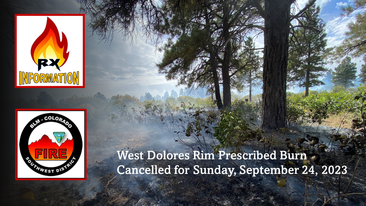
West Dolores Rim prescribed burn cancelled for Sunday September 24 2023
Related Incident:
Publication Type: Announcement
The West Dolores Rim Prescribed Burn has been cancelled for Sunday, September 24, 2023, due to poor smoke forecast and cooler temperatures. Firefighters will patrol units burned yesterday. Burning will resume on Monday, September 25, 2023, if conditions are good.
For more information on BLM Southwest District prescribed burn treatments visit, InciWeb-Southwest District BLM Prescribed Fire https://inciweb.wildfire.gov/ and follow BLM Southwest District Facebook and Twitter @SWD_Fire
Firefighters burned 340 acres on West Dolores Rim Prescribed Burn September 23 2023
Related Incident:
Publication Type: News
Firefighters had a very successful day on the West Dolores Rim Prescribed Burn. The conditions allowed them to treat 340 acres and complete Units 37A and 30, along with black lining the north end of 37B. Low severity burning is used to clean-up pine needle cast and mountain brush leaf litter. Firefighters will continue to burn the next two days to finish Units 37B, 23, and 24 if conditions are good. Smoke may be visible east of Egnar, CO.
For more information on BLM Southwest District prescribed burn treatments visit, InciWeb-Southwest District BLM Prescribed Fire https://inciweb.wildfire.gov/ and follow BLM Southwest District Facebook and Twitter @SWD_Fire
Olympic National Park Fire Update September 23
Related Incident: 2023 Olympic National Park Lightning Fires
Publication Type: News
Port Angeles, Wash. – The fire area received some light precipitation on Saturday, allowing crews to continue fuel reduction around the structures near the Delabarre fire. Crews continued to monitor the Eagle Point Fire.
Forecasted weather over the fire area is expected to see increased rainfall Sunday and early next week with possible precipitation of several inches. All fires are being closely monitored.
Fire Name
Initial Report
Estimated Size
Location
Hurricane
8/28/23
4 acres
2,000 ft below Hurricane Ridge parking area
Eagle Point
8/28/23
123 acres
~5 miles out Obstruction Point Road
Diamond Mountain
9/1/23
30 acres
3.3 miles NE of
Anderson Pass
Low Divide
9/1/23
332 acres
N. Fork Quinault drainage
Delabarre
9/1/23
4,088 acres
3 miles SE of Mount Christie
Martins Lake
9/2/23
108 acres
2 miles NE of Mount Christie
Mount Queets
9/14/23
7 acres
Summit of Mount Queets
Fires in the wilderness are a natural part of the forest ecosystem and the benefits of fire will increase favorable habitat for the forest population and will reduce competition for resources for plant and tree growth. Over time, the forest floor gets cluttered with undergrowth and down and dead material making it more difficult for wildlife. It only takes a short time after a fire for the forest to regenerate.
The seven fires in the Olympic Wilderness are being managed to provide the optimum benefit to the landscape, while protecting the assets within the management area.
Background Information
All seven active fires in Olympic National Park ignited when a series of lightning strikes occurred on the Olympic Peninsula in the afternoon on August 28.
Closures
Due to wildfire activity the following closures are in effect until further notice:
- Elwha River Trail from Elkhorn to Low Divide
- Hayden Pass Trail
- Dosewallips River Trail from Dose Meadows to Hayden Pass
- Dodger Point Way Trail
- North Fork Quinault Trail from Elip Creek trail junction to Low Divide
- Skyline Trail from Elip Creek Trail junction to Low Divide
- Martin Park Trail
- Obstruction Point Road and Trailhead
Olympic National Park Wilderness Information Center (WIC) will be notifying backcountry permit holders who may be impacted by these closures. Any permit holders who plan to backpack in the above impacted areas should contact the WIC at 360-565-2992 or by emailing OLYM_WIC@nps.gov.
Weather and Fire Behavior
Light rain fell over the fire area on Saturday and rain is expected to increase over the weekend. Forecasters are anticipating rainfall accumulations to be in the range of 2 to 4 inches. There is a possibility of thunderstorms over the fire area through the first half of next week.
Information for the 2023 Olympic National Park Lightning Fires can be found at: https://inciweb.wildfire.gov/incident-information/waolp-2023-olympic-national-park-lightning-fires
Olympic National Park information: www.nps.gov/olym
Olympic National Forest information: www.fs.usda.gov/olympic
State and county area burn bans: https://ecology.wa.gov/Air-Climate/Air-quality/Smoke-fire/Burn-bans
FOREST SERVICE BAER TEAM BEGINS POSTFIRE ASSESSMENT OF HAPPY CAMP COMPLEX WILDFIRES
Related Incident: 2023 Happy Camp Complex BAER Assessment
Publication Type: Announcement
FOREST SERVICE BAER TEAM BEGINS
POST-FIRE ASSESSMENT OF HAPPY CAMP COMPLEX WILDFIRES
A Forest Service Burned Area Emergency Response (BAER) team has been established by the Klamath National Forest (KNF) to begin a post-fire burned area emergency assessment of the wildfires within the 2023 Happy Camp Complex. The BAER assessment team is coordinating with other federal, state, and county agencies, as well as local Tribes to assess potential post-fire impacts to these burned watersheds. Forest Service BAER team assessments typically take approximately two weeks to complete.
These rapid assessments evaluate the burned area to identify watersheds having increased potential for post-fire flooding, sediment flows and rockslides. The team focus is on potential emergency impacts to life and property on federal land.
BAER teams generally consist of scientists and specialists including hydrologists, geologists, soil scientists, road engineers, botanists, biologists, archaeologists, and geographic information specialists. BAER teams conduct surveys to collect field data within burned areas to analyze through mapping (GIS) and computer models. Findings are presented along with recommended emergency stabilization treatments in a BAER assessment report.
The team utilizes satellite imagery and specialist data to analyze and produce a runoff map that shows the levels of hydrological potential flows during rain events. This is the first step in assessing potential watershed impacts from wildfires to any federal values that may be at risk from potential increased flooding, sedimentation, debris flows, and rockslides. The BAER team will produce a report that describes potential threats associated with the burned area’s post-fire conditions and often include recommended emergency stabilization measures and actions. BAER emergency response efforts are focused on the protection of human life, safety, and property, as well as critical cultural and natural resource values such as the water quality of streams and wetlands on federal lands.
BAER reports are shared with interagency cooperators such as California Office of Emergency Services (CalOES), NRCS, and Siskiyou County who work with downstream private home and landowners to prepare for potential post-fire flooding and debris flow impacts. Homes or businesses that could be impacted by flooding from federal land burned in wildfires may be eligible for flood insurance coverage from the National Flood Insurance Program (NFIP). Information about NFIP is available through FEMA at www.fema.gov/national-flood-insurance-program, or www.floodsmart.gov/wildfires. Other flood preparedness information is available at www.ready.gov/floods at www.floodsmart.gov/.
BAER SAFETY MESSAGE: Everyone near and downstream from the burned areas should remain alert and stay updated on weather conditions that may result in heavy rains and increased water runoff. Flash flooding may occur quickly during heavy rain events – be prepared to act. Current weather and emergency notifications can be found at the National Weather Service website: https://www.weather.gov/mfr/.
Settings - change map background and toggle additional layers
Filter - control incident types displayed on map.
Zoom to your location
Reset map zoom and position
Could not determine your location.
Show Legend
 Wildfire
 Prescribed Fire
 Burned Area
Response
Burned Area
Response Other
Other
2023 Happy Camp Complex BAER Assessment
Unit Information
Incident Contacts
SW Oregon Smoke Outlook September 2324
Related Incident: Anvil FireFlat Fire
Publication Type: News
Southerly to Southwest winds will usher smoke northward and inland into Sunday. Additionally, smoke from active fires in Northern California will contribute to reduced AQ before arrival of rains late Sunday. The most impacted communities will be along and east of the Highway 101 corridor in Curry County, and inland to Grants Pass and the Highway 42 corridor.
Informacin diaria para los Incendios Anvil y Flat 23 de septiembre
Related Incident: Anvil FireFlat Fire
Publication Type: News
Incendio Anvil
Área: 20,657 acres | Fecha de Inicio: 25 de agosto, 2023 | Localizado: 8 millas Este de Port Orford, OR |
Contención: 9% | Personal: 1,321 | Recursos: 37 escuadrillas, 8 helicópteros, 47 camiones de bomberos
Los manejadores del Incendio están preparados para la precipitación pronosticada para este fin de semana. Mas de 1300 personas han sido asignadas al Incendio, permitiendo desplegar los recursos a través de los múltiples frentes activos en el Incendio Anvil. Entre las zonas encendidas al sur de Elk River entre los campamentos de Sunshine Bar y Butler Bar, los buldóceres y escuadrillas de bomberos trabajando a mano, no se han detenido en el trabajo continuo de la construcción de líneas sobre dicha área. La Asociación para la Protección del Bosque Coos junto con otras escuadrillas de bomberos, lograron retroceder el fuego cuando este se aproximaba a las líneas de contención, en la parte superior de la bifurcación Norte de Dry Creek. Una vez más, el derramamiento de agua hizo una gran diferencia en el apoyo a los bomberos, apagando las llamas con mas de 172,000 galones de agua. Durante la noche, el sistema Aéreo Automatizado (UAS) patrullo el área de Anvil, recibiendo a los trabajadores del turno diurno con información al día acerca de ciertas brasas encendidas en las afueras del centro del incendio o ciertas zonas problemáticas que necesitan ser priorizadas. El día de hoy, condiciones del tiempo más favorables, proveerán la oportunidad a los bomberos para reforzar y extender líneas de contención, las cuales se verán retadas por las condiciones climáticas este fin de semana. En la tarde del domingo, existe una alta posibilidad de lluvia, pero los manejadores del incendio están preparados para los vientos fuertes que podrían arribar antes de aparecer la humedad que es extremadamente necesitada. El Campamento Base de Anvil se encuentra localizado cerca del Parque Estatal Cape Blanco al Norte de Port Orford, fuera del US Highway 101. Varias escuadrillas de bomberos y la maquinaria asignada al Incendio se encuentran operando fuera de este campamento. Se le pide al público en general que manejen a baja velocidad y con las luces encendidas en estas áreas bien transitadas.
Evacuaciones: La Oficina del Alguacil para el Condado de curry, ha identificado cuatro zonas de evacuación alrededor del incendio Anvil. Puede encontrar información en un mapa interactivo: https://bit.ly/45UIh2E. Zonas 1 y 4 se encuentran en un Nivel de Evacuación 3 “SALGA”. Zonas 2 y 3 en un Nivel de Evacuacion 2 “PREPARESE” “Get Set“. Puede registrarse en el sistema de Alertas de emergencias para el condado: https://bit.ly/CurryCoEM
Ordenes de Cierres para ciertas áreas y carreteras: Para la seguridad de los bomberos y para el público en general, el Bosque Nacional de Rogue River-Siskiyou y la Agencia para el Manejo de Tierras en el distrito de Coos Bay, han dictado una orden de cierre para el Incendio Anvil. Puede encontrar mapas e información más detallada en: https://inciweb.wildfire.gov/incident-closures/orrsf-anvil-fire.
Incendio Flat
Extensión: 34,242 acres | Fecha de Inicio: 15 de julio, 2023 | Localizado: 2 millas Sureste de Agness, OR | Contención: 75% | Personal: 11 | Recursos: 3 camiones de bomberos
Permanece en efecto la Orden de Cierre para el Bosque nacional de Rogue River-Siskiyou. Informacion: https://inciweb.wildfire.gov/incident-closures/xx1002-flat-fire.
Información General
Condiciones climáticas: Existe una baja posibilidad en la presencia de una ligera precipitación para el sábado. Prevalecerán vientos ligeros provenientes del Oeste y Suroeste, y se podría observar neblina en ciertas zonas. En horas del atardecer del domingo, es muy probable que se den lluvias fuertes hasta el lunes por la mañana, lo cual pondrá en alerta a la Agencia Nacional de Meteorología para emitir una Alerta de Inundaciones. Los vientos se cambiarán hacia el sur con ráfagas de 35 a 55 mph.
Un experto en meteorología se encuentra trabajando cercanamente con los manejadores del incendio para monitorear las condiciones climáticas y así compartir la información para apoyar en el planeamiento y ajustes necesarios en los planes con el objetivo de asegurar la vida de los bomberos en cualquier tipo de clima, tanto aquel que causa un incremento en la actividad del fuego como aquellos que pueden producir escorrentías o inundaciones.
Condiciones del humo: Para información al día en la presencia del humo y la calidad del aire, visite: https://bit.ly/SWORsmoke. La presencia del humo y la capa de nubes marina están mezclándose y estableciéndose en las elevaciones bajas durante la noche, causando una baja visibilidad en las carreteras. Por favor conduzca despacio y con las luces encendidas al conducir su vehículo en cualquier área de incendio.
Caltrans ha publicado un horario del cierre de carreteras y restricciones en las líneas de tráfico, para el Hwy. US 199. Las autoridades locales recomiendan no utilizar esta ruta si no es realmente necesario. Para encontrar información específica en el acceso de carreteras, por favor lea el sitio de Caltrans QuickMap en: https://quickmap.dot.ca.gov/ y también el sitio de Oregon Department of Transportation site en: https://www.tripcheck.com/. No utilize las carreteras forestales como una ruta alternativa.
Actualizacin del Incendio del Complejo Cowlitz 23 de septiembre de 2023
Related Incident: Cowlitz Complex
Publication Type: News
Facebook:https://www.facebook.com/cowlitzcomplex/ Twitter: https://twitter.com/GPNF
Bosque Nacional Gifford Pinchot: https://www.fs.usda.gov/giffordpinchot
Actualización del Incendio del Complejo Cowlitz
23 de septiembre de 2023
Situación actual: El complejo Cowlitz está contenido en un 39%, con un total de 724 acres y 252 efectivos. Continúan los trabajos de reparación en el complejo para devolver las actividades de extinción a un estado más natural. Se sigue retirando el equipo contra incendios que ya no es necesario para el incidente. El incendio de Grassy Mountain sigue manteniéndose en el lugar. El incendio de Pothole ya no tiene calor y ahora se encuentra en estado de patrulla. Todavía hay manguera alrededor del Jackpot Fire donde el calor sigue apareciendo en la capa de mantillo. Estos focos de calor pueden tener hasta metro y medio de profundidad y su extinción requiere mucha excavación y agua.
Mensaje de seguridad: Recuerde que es temporada de cacería. Tenga cuidado si se desplaza fuera de los senderos o por zonas remotas. Cuando vaya de excursión, lleve colores brillantes para que los cazadores puedan verle. Sea cortés con los demás excursionistas, ya que todos están allí para divertirse.
Antecedentes: Hubo 30 incendios en el complejo. Los incendios se iniciaron el 25 de agosto tras un rayo en el bosque nacional de Gifford Pinchot. La mayoría han sido contenidos. El incendio de Grassy Mountain sigue siendo la principal prioridad.
Restricciones de incendios: Con un tiempo cada vez más fresco, y las recientes precipitaciones en todo el noroeste de Oregón y Washington, los gestores de incendios de los Bosques Nacionales de Mount Hood y Gifford Pinchot han rescindido las restricciones de incendios de uso público, efectivas a las 12:01 a.m. del viernes 22 de septiembre.
El Jefe de Bomberos del Condado de Lewis o Lewis County Fire Marshal modifica las restricciones de quema: Una prohibición de quemar en la zona no incorporada del condado de Lewis se ha modificado, efectiva a las 12:01 a.m. el sábado, 23 de septiembre. Sólo se permiten fuegos recreativos y barbacoas de carbón o madera. Para obtener información sobre las restricciones de quema en las tierras reguladas por el Departamento de Recursos Naturales del Estado de Washington (DNR) ir a https://burnportal.dnr.wa.gov
Cierres: Debido a la actividad del fuego en curso, los siguientes caminos y senderos están cerrados al público para ayudar a garantizar la seguridad pública y de los bomberos: Carreteras forestales 25, 9300 y 9341, Boundary Trail #1 (desde Elk Pass hasta la intersección con Summit Prairie), Summit Prairie #2, Craggy Peak #3, Snagtooth #4, Quartz #5, Stabler Camp #17, Wright Meadows #80, Basin Camp #3A, Quartz #5B, Quartz #5C (French Creek), Snyder Pasture #80A.
Restricciones Temporales de Vuelo: El TFR se reduce a una sola área que abarca un radio de 5 millas al este de Randle. El TFR está en vigor durante las horas diurnas para incluir el apoyo al incendio de Grassy Mountain. La respuesta de la aviación contra incendios se detiene o retrasa si una aeronave no autorizada entra en el TFR. Las restricciones temporales de vuelo también se aplican a los sistemas de aeronaves no tripuladas o drones. Para más información: https://tfr.faa.gov/save_pages/detail_3_3758.html