
Effective immediately, all of the subdivisions in the READY and SET status from the Blue 2 Fire will be lifted. 06 05 2024
Related Incident: Blue 2 Fire
Publication Type: Closures
Evacuation Status Update: Effective immediately, all of the subdivisions in the READY and SET status from the Blue 2 Fire will be lifted.
Actualización del día: Contención añadida, continúan los trabajos de reparación 06 05 2024
Related Incident: Blue 2 Fire
Publication Type: News
Contención añadida, continúan los trabajos de reparación
Actualización del día: 5 de junio de 2024
Acres: 7,532 Fecha de inicio: 16 de Mayo de 2024
Ubicación: White Mountain Wilderness aproximadamente a 8 millas al norte de Ruidoso
Personal total: 399 Causa: Rayo
Combustibles: Arboles/ Hierba/Arbustos Contención: 77%
Recursos: 5 cuadrillas |14 vehículos de bomberos | 2 helicópteros | 2 buldóceres | 5 licitaciones de agua
Puntos destacados: Los bomberos lograron una contención adicional justo al sur del lago Bonito mientras se sigue trabajando en el incendio. Está prevista una reunión pública virtual el jueves 6 de junio a las 19.30 horas. La reunión se retransmitirá en directo en la página de Facebook del incendio Blue 2 Fire.
Operaciones: Los bomberos siguen centrándose en reparar las líneas de dozer y las líneas de mano creadas durante el apogeo de los esfuerzos de extinción de incendios. A medida que se completan los trabajos de reparación, se inspeccionan para garantizar que se cumplen las normas establecidas por el Servicio Forestal y la División Forestal de Nuevo México. La maleza cortada para eliminar los combustibles ha sido desmenuzada. Las excavadoras están trabajando a lo largo de la línea de excavación desde la carretera 131 hasta la 108, instalando elementos de control de la erosión y retirando la maleza de la parte superior del suelo alterado. Los equipos están comprobando si hay más puntos calientes en la Montaña del Soldado y utilizando herramientas manuales para crear pequeñas crestas que desvíen el agua y reduzcan el potencial de erosión futura a lo largo de la línea. También se está reparando la línea de dozer al oeste de las comunidades, a lo largo del límite con el Servicio Forestal. Los masticadores, una máquina que funciona masticando y escupiendo los restos de los árboles caídos para que se descompongan en el suelo del bosque, han estado trabajando a lo largo de esta línea y han creado un cortafuegos que ayudará a reducir el riesgo para las comunidades en futuros incendios forestales. Los bomberos siguen centrándose en reparar las líneas de dozer y las líneas manuales creadas durante el apogeo de las labores de extinción. Se han pedido semillas y se volverán a sembrar las líneas de fuego. Las fuerzas del orden siguen imponiendo el cierre de los bosques para que los bomberos puedan completar su trabajo con seguridad.
El tiempo: Se espera que hoy entre humedad en la zona del incendio con posibilidad de tormentas aisladas por la tarde. Se espera humedad significativa en los próximos días con mayor humedad y tormentas diarias.
Humo: El fuego está produciendo humo mínimo. Las comunidades circundantes verán buen aire. El humo transportado de otros incendios activos en los estados a barlovento o México puede crear algunos cielos brumosos en ocasiones. El mapa de humo interactivo todavía se puede encontrar en fire.airnow.gov/
Cierres: En interés de la seguridad pública, la acampada y otras actividades recreativas en la zona del lago Bonito siguen restringidas debido a las actividades de extinción de incendios en curso. La orden de cierre del bosque seguirá en vigor en la zona de White Mountain Wilderness.
Evacuaciones: Todos los estados de evacuación "Go" se han levantado. Para ver un mapa de evacuación interactivo, visite tinyurl.com/Blue2Evacs
Seguridad: Sobre la zona hay una Restricción Temporal de Vuelo (TFR), que incluye los sistemas de aeronaves sin tripulación o drones. Encuentre el TFR en tfr.faa.gov/tfr_map_ims/html/
Daily Update 06 05 2024
Related Incident: Adams Fire
Publication Type: News
Highlights: Yesterday, firefighters continued to patrol control lines and search for heat remaining around the fire perimeter. Today, fire crews will mop up smoldering hot spots and monitor the fire area. There is still very high fire danger throughout the Tonto National Forest. Almost 23,500 acres have burned so far this year, largely by human-caused fires. View more statistics at Tonto National Forest’s fire dashboard here.
Operations: Firefighters will continue strengthening and mopping up control lines. Containment increased to the south and east yesterday due to effective mop up. Mop up describes the hard physical labor process of extinguishing or removing burning material near control lines down to the mineral soil, felling damaged trees and cooling ash pits to prevent fire from spreading outside the containment lines.
Weather: The fire area will be hotter today, with highs of 107 degrees and humidity in the single digits. Winds will be light out of the east. This warming trend continues through the weekend, which will increase fire danger and the possibility of new wildfires.
Closures: There are closure orders on the Tonto National Forest for the Adams and Spring Fires, as well as Stage 1 Fire restrictions in effect. Stage 1 fire restrictions will be in place across the entire forest beginning Thursday, June 6. View current restrictions and closures here: https://www.fs.usda.gov/alerts/tonto/alerts-notices/?aid=87846
Safety: The health and safety of firefighters and the public are always the highest priority. Please avoid the area while crews conduct fire suppression operations. Citizens are urged to sign up for the Maricopa County Emergency Notification System. The system allows you to be quickly notified of emergency evacuations. To learn more about the Arizona Emergency Information Network visit: https://ein.az.gov/ready-set-go. Firefighting aircraft and drones are a dangerous combination. Drones in the area could lead to accidents or slow down wildfire suppression operations. If you fly…we can’t.
Smoke: Smoke from the Adams Fire has decreased; however, it may be visible in the surrounding areas for many days. Smoke will drift to the north and east due to prevailing winds. Individuals who are sensitive to smoke or have conditions aggravated by smoke are encouraged to take precautionary measures. An interactive smoke map at https://fire.airnow.gov/ allows you to zoom into your area to see the latest smoke conditions.
Location: 1 mile east of Fort McDowell, AZ
Start Date: June 2, 2024
Size: Approximately 5,029 acres
Percent Contained: 49%
Cause: Human
Vegetation: The fire is burning grass and brush.
Resources: 3 Type-1 Handcrews, 1 Type-2 Handcrew, 4 Helicopters, 13 Engines, and 3 Water Tenders.
Number of Personnel Assigned: 268
Information Links and Contacts:
Tonto National Forest: https://www.fs.usda.gov/main/tonto/fire
InciWeb: Adams Fire
Fire email: 2024.adams@firenet.gov Information Phone: 928-275-8205
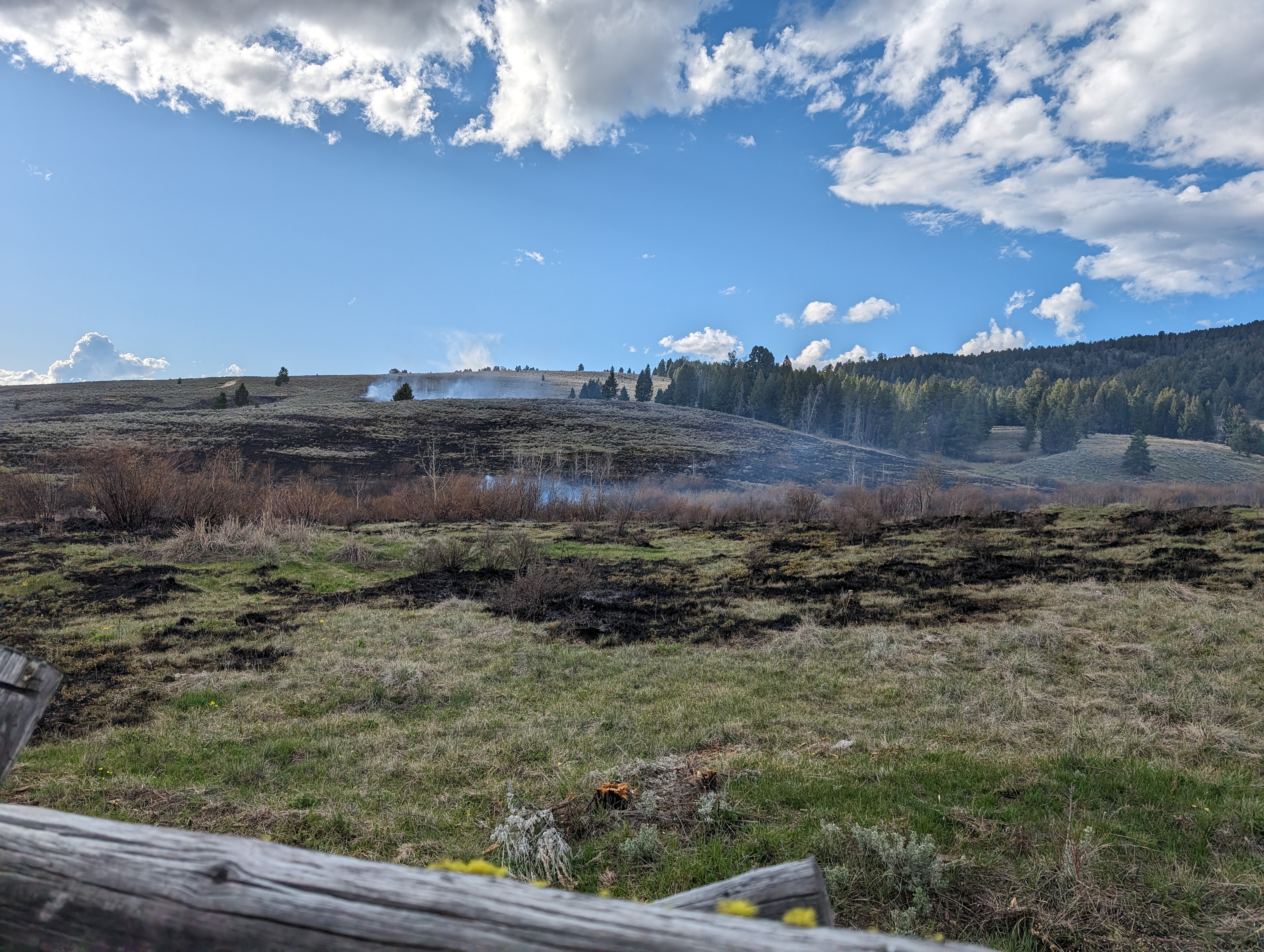
Daily Update: Containment added, repair work continues 06 05 2024
Related Incident: Blue 2 Fire
Publication Type: News
Containment added, repair work continues
Daily Update: June 5, 2024
Acres: 7,532 Start Date: May 16, 2024
Location: 8 miles North of Ruidoso, White Mountain Wilderness Area Cause: Lightning
Personnel: 399 Fuels: Timber/Grass/Brush
Containment: 77%
Resources: 5 crews | 14 engines | 2 helicopters | 2 bulldozers | 5 Water Tenders
Highlights: Firefighters achieved additional containment just south of Bonito Lake as work on the fire continues. A virtual public meeting is planned for Thursday, June 6 at 7:30 pm. The meeting will be broadcast live on the Blue 2 Fire Facebook page.
Operations: Firefighters continue to focus on repairing dozer lines and hand lines created during the height of fire suppression efforts. As repair work is completed, it is inspected to ensure the standards identified by the Forest Service and New Mexico Forestry Division are met. Brush cut to remove fuels has been chipped. Excavators are working along the dozer line from the 131 road to the 108 road, installing erosion control features and pulling brush on top of disturbed soil. Crews are checking for any additional hot spots on Soldier Mountain and using hand tools to create small ridges that will divert water and reduce future erosion potential along the handline. The dozer line west of the communities along the Forest Service boundary is also being repaired. Masticators working along this dozer line have created a fuel break that will help reduce risk to the communities during future wildfires. Seed has been ordered and fire lines will be re-seeded. Law enforcement continues to enforce the forest closure so firefighters can safely complete their work.
Weather: Moisture is expected to enter the fire area today with potential for isolated afternoon storms. Significant moisture is expected in the coming days with higher humidity and daily storms.
Smoke: The fire is producing minimal smoke. Surrounding communities will see good air. Transported smoke from other active fires in upwind states or Mexico, may create some hazy skies on occasion. The interactive smoke map can still be found at fire.airnow.gov/
Closures: In the interest of public safety, camping and other recreation activities in the Bonito Lake Area are still restricted due to ongoing firefighting activities. The Forest closure order will continue to remain in effect for the White Mountain Wilderness Area.
Evacuations: All “Go” evacuation statuses have been lifted. For an interactive evacuation map go to tinyurl.com/Blue2Evacs
Safety: A Temporary Flight Restriction (TFR) is in place over the area, which includes uncrewed aircraft systems or drones. Find the TFR at tfr.faa.gov/tfr_map_ims/html/
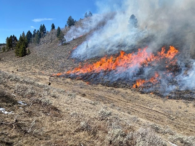
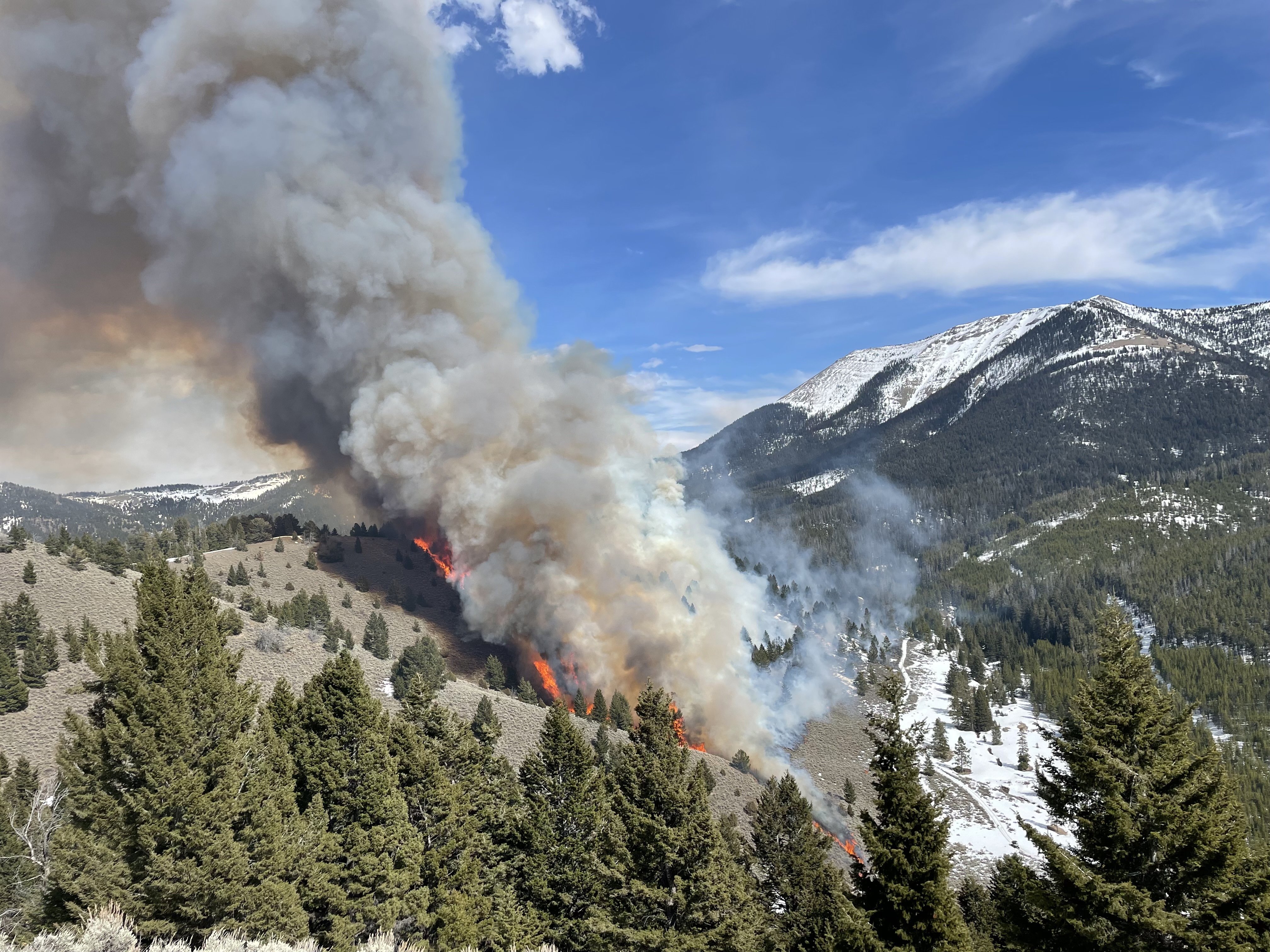
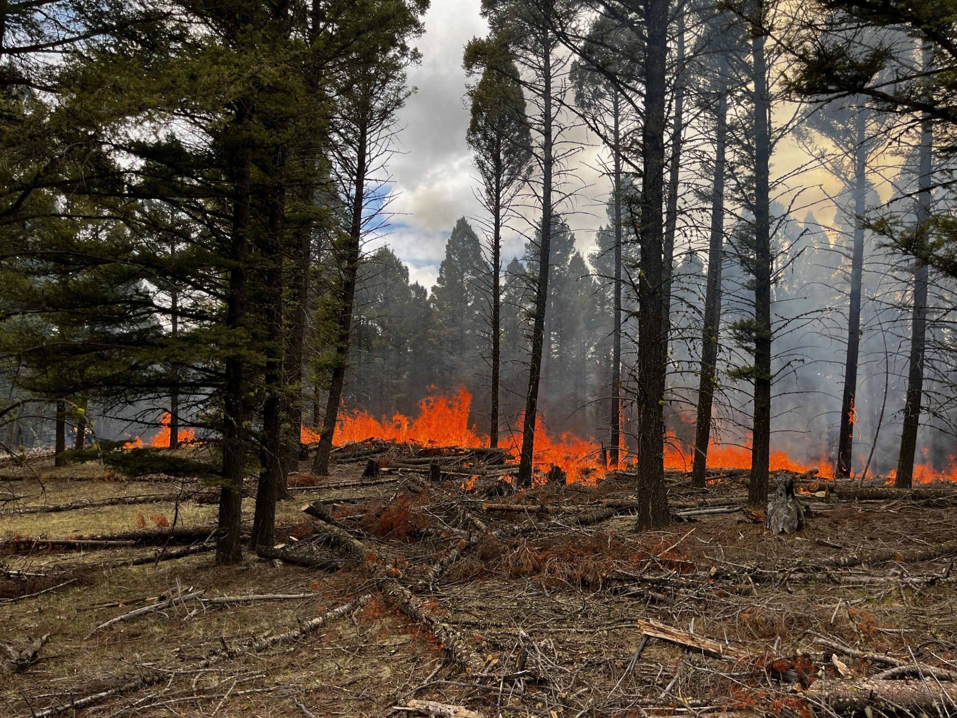
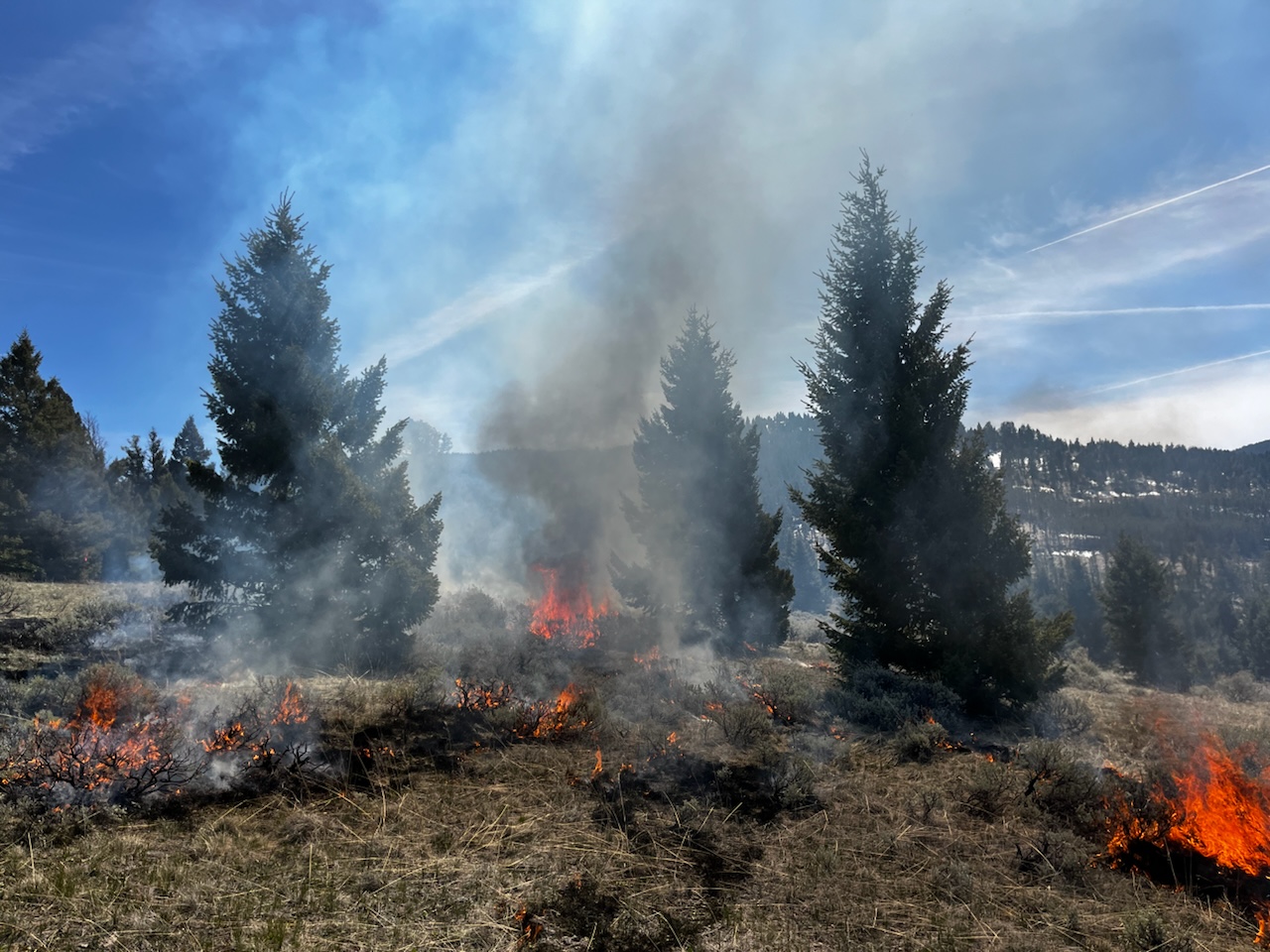
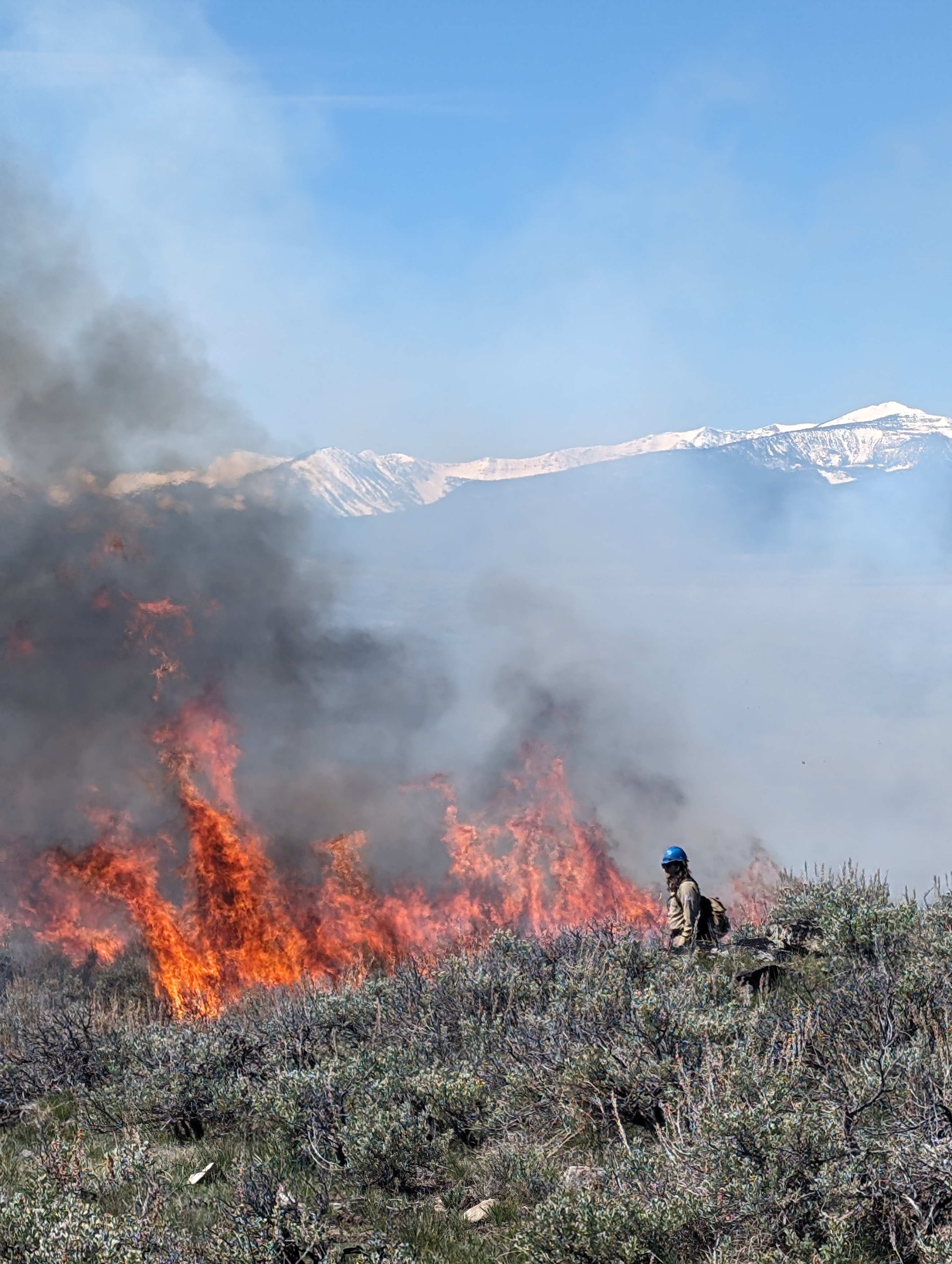
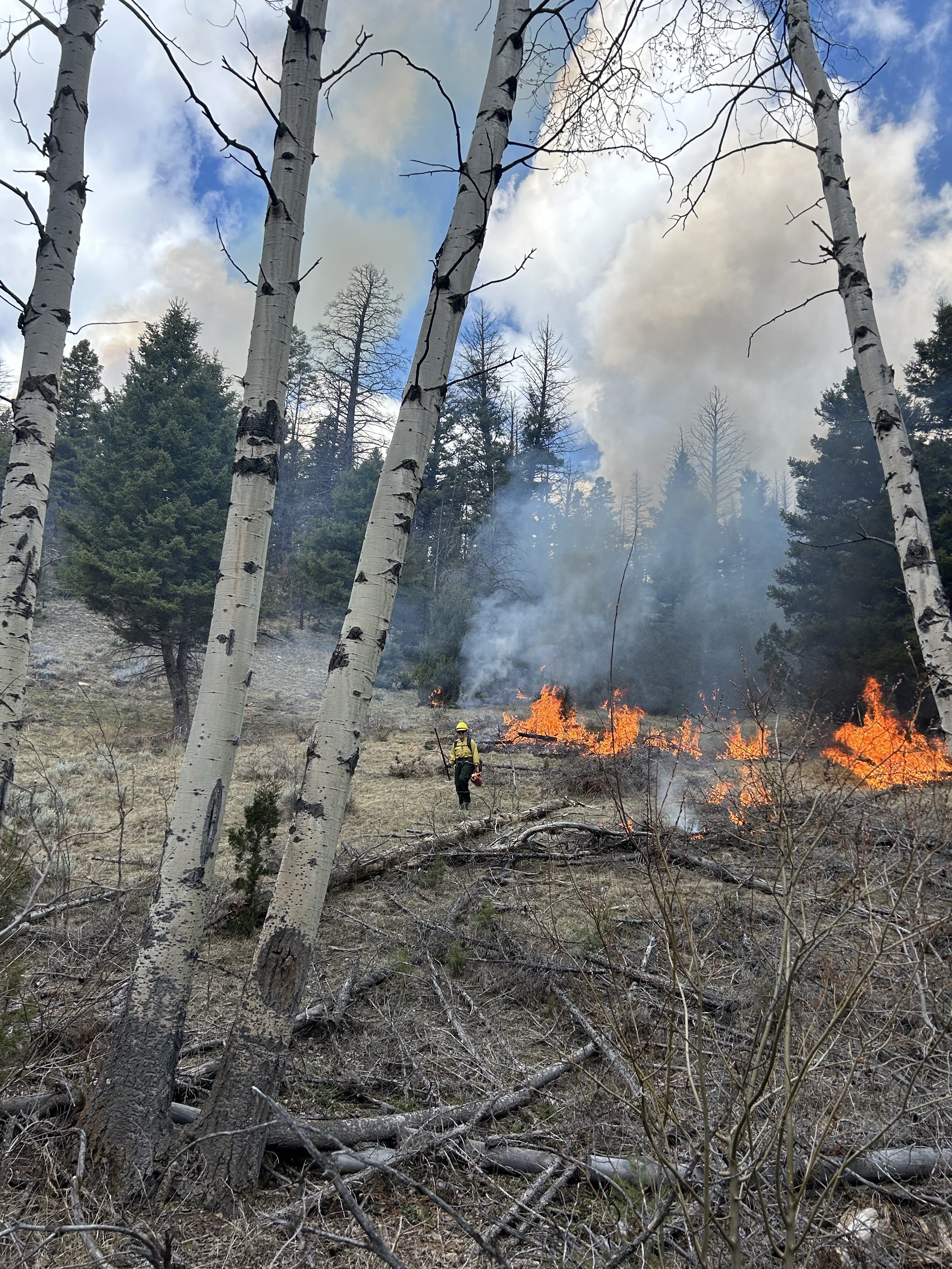
BDNF Spring 2024 Prescribed Fire Accomplishments 06 04 2024
Related Incident: Beaverhead-Deerlodge NF Prescribed Fire Operations
Publication Type: News
Fire and Fuels Management officials on the Beaverhead-Deerlodge National Forest are wrapping up the Spring 2024 prescribed fire and pile burning operations across the Forest, accomplishing important forest health and fuels reduction work.
Prescribed fire and pile burning operations are critical to the fuels management program, essential to restoring fire-adapted ecosystems. In the Northern Region, fire plays an important role on the landscape. As part of the agency’s nationwide Wildfire Crisis Strategy, the Forest Service will continue to work with Tribes, partners, and communities to expand this work in the coming years, improving forest health and reducing wildfire risk.
“The BDNF and our interagency partners are working toward a proactive (rather than reactive) approach to managing landscapes using mechanical and prescribed fire treatments. We have hit huge milestones, with over 4,300 acres treated on the Forest this spring,” said Greg Schenk, the Forest Prescribed Fire and Fuels Program Manager.
Dillon Ranger District
Accomplishments include 326 acres of prescribed fire to promote aspen stand health and vigor. Aspen, a relatively rare vegetation component on the BDNF compared to other vegetation communities, is one of the most biologically diverse ecosystems and an extremely important habitat type for a variety of wildlife species. Conifer expansion has greatly impacted aspen stands across the forest, with modeling of historic populations suggesting aspen have dwindled to less than 20 percent of its former range. Conifer removal, followed by disturbance such as burning triggers aspen suckering from the root mass below the ground and increases post disturbance ramet density. Without competition from conifers, the newly regenerated aspen should grow quickly, and rapid growth should be sustained. These spring treatments marked a continued success toward aspen stand restoration on the Dillon Ranger District (Virtual Lost and Black Mountain project areas).
Wisdom Ranger District
Accomplishments include both the Jackson and Steel Creek FS administrative sites, for a total of 210 acres. Treatments resulted in a mosaic burn pattern, with a diversity of age classes in the sagebrush. These openings will result in increased retention of snow and water into future spring seasons; and the reduction of fine fuels will increase more desirable forage for agency pack stock, while simultaneously addressing potential wildfire hazards. In the Steel Creek unit, areas of conifer expansion were treated, opening the area for more water consumption and sunlight to enhance aspen regeneration.
Butte Ranger District
Accomplishments include completion of 114 acres of pile burning in the Basin Creek Aspen project for hazardous fuels reduction in a municipal watershed, with a secondary benefit of promoting vigor within the aspen clone and 44 acres of pile burning in the Red Rocks project to remove residual piles from a previous forestry project treatment.
In partnership with RMEF, fire and fuels personnel completed 700 acres of prescribed fire to reduce the slash component created from conifer expansion treatments in sagebrush parks in the Red Rocks project area. An additional 9 acres of treatment is slated to be accomplished, in conjunction with the Forest-wide basic wildland fire training operation this week.
Madison Ranger District
Accomplishments include the completion of 481 acres in the Idaho Creek unit in the Greenhorn Mountains that resulted in the reduction of ground fuels to decrease the risk of intense ground fire in the event of wildfire, while creating a multi-stage sagebrush wildlife habitat and providing nutrients for other forage; and the completion of 2,117 acres of treatment in Antelope Basin project (Conklin and Spring Branch) to increase the aspen component and vigor across the landscape, improving habitat for wildlife. By providing a fire disturbance along aspen clone edges, the treatments promote sprouting and expansion of the aspen clone into sagebrush steppe and its historical range.
Fire personnel also accomplished 32 acres of pile burning in the Gravelly Mountain Range, burning residual piles from fire suppression operations on the Clover and Goose Fires.
Pintler Ranger District
Accomplishments include 95 acres of treatments in the Gold Coin project area for reduction of conifer expansion in the parks, promoting the palatability of the grass, forb, and shrub species on big game summer, transition, and winter range. The treatment also helped to restore structural composition of the vegetation, providing benefits to non-game species.
In partnership with the Rocky Mountain Elk Foundation, treating the Rally Way unit (144 acres) of the Lone Pine project reduced conifer expansion and hazardous fuels, promoted the growth of native rangeland grasses, and improved wildlife habitat.
Last year’s “slashing” treatment of smaller trees within the units greatly increased the success of the prescribed fire treatments this spring. The introduction of fire back onto the landscape reduces the natural fuel loads that can sustain and carry high-intensity wildland fire. Changes in fuel composition can also result in greater opportunity to suppress large fires on the landscape.
Additionally, fire personnel, working with our interagency partners utilized hand ignitions to burn the grassy fuels in the irrigation ditches on Grant Kohrs Ranch in Deer Lodge, accomplishing approximately 50 acres.
Actualización operacional para el Incendio Indios en español 06 04 2024
Related Incident: Indios Wildfire
Publication Type: Announcement
https://tinyurl.com/529p4xce
Indios Fire Operations Video 06 04 2024
Related Incident: Indios Wildfire
Publication Type: Announcement
https://tinyurl.com/bdd33e8b
Adams Fire Emergency Closure 06 04 2024
Related Incident: Adams Fire
Publication Type: Closures
To provide for public health and safety due to firefighting operations and fire danger associated with the uncontrolled Adams Fire, the Tonto National Forest implemented an emergency closure effective June 3, 2024. Forest Order No. 03-12-03-24-23
Daily Update 06 04 2024
Related Incident: Indios Wildfire
Publication Type: News
TEAM 4 – AARON HULBURD – INCIDENT COMMANDER
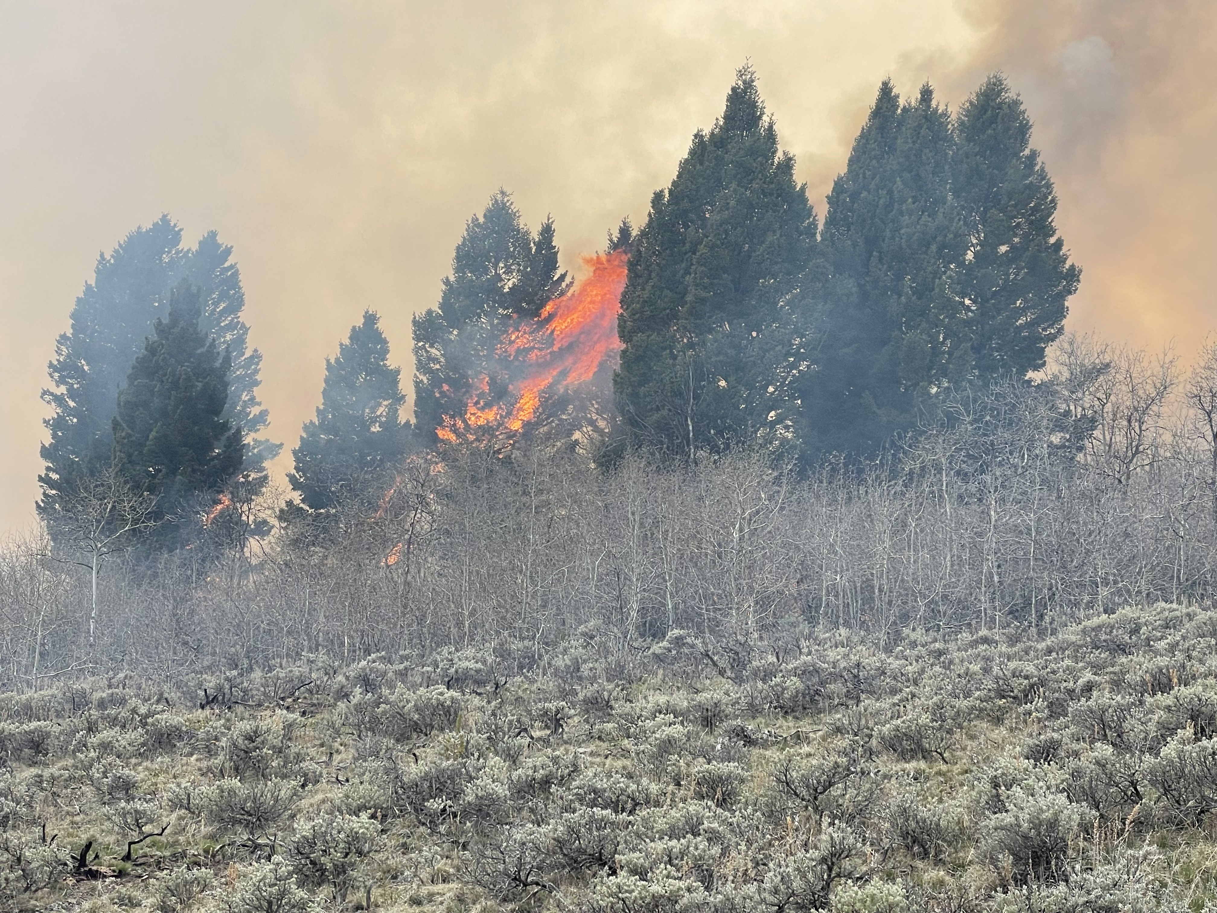
Indios Fire experiences no growth over last 24 hours
Daily Update – Tuesday, June 4, 2024
Acres: 11,500
Start Date: May 19, 2024
Location: 7 miles north of the village of Coyote, NM
Personnel: 594
Completion: 66%
Fuels: Timber
Highlights: The acreage of the Indios Fire remains unchanged from yesterday, and crews successfully reached 66% completion of operational objectives. Decreased winds and lower fire activity resulted in diminished smoke impacts to surrounding communities. Due to the successful placement and reinforcement of control lines along the southwestern perimeter of the fire, the Rio Arriba Sheriff's Office downgraded the Corrales Ranch area from “set” to “ready” status yesterday.
Operations: On the northwest edge of the fire perimeter, firefighters continued to travel back and forth along the control lines to identify any actions needed to prevent fire spread, suppress spot fires, or extinguish hot spots. Crews monitored the fire area to assess fire effects, observe fire behavior, and evaluate progress toward meeting incident objectives. Fire behavior specialists noted that the fire is currently smoldering and creeping with a low flame within the fire perimeter. As fire slowly consumes vegetation in the interior, overall fire activity decreases each day. Firefighters conducted chipping operations along the western portion of fire, then finished work on Forest Road 64. Around the southern edge of the fire near the private property, firefighters mopped up hot spots, secured the handline, and patrolled along Forest Road 77. Today, firefighters will continue chipping cut vegetation into small wood chips and scattering them to lessen the potential for ignition along roads. As primary firelines continue to hold the main fire, crews are strengthening contingency lines to provide secondary reinforcements in the event of further fire growth.
Weather: Today’s temperatures will be similar to yesterday. A low-pressure system from the west is expected to bring high clouds and a slight increase in wind speeds. High temperatures increase Wednesday and
Thursday with the hottest temperatures of the year so far. Chances for showers and thunderstorms will
increase Thursday through the weekend with the danger of strong gusty outflow winds near any storms.
Smoke: Smoke continues to impact surrounding communities. Smoke monitors have been installed in Coyote, Gallina, Cañones, the Monastery of Christ in the Desert, and the Abiquiu Dam. Smoke-sensitive individuals and people with respiratory problems or heart disease are encouraged to take precautions. A smoke outlook report for the Indios Fire is available online at the links below. View an interactive smoke map at https://fire.airnow.gov/. Learn more about smoke impacts at https://www.env.nm.gov/air-quality/fire-smoke-links/.
Closures: The Santa Fe National Forest has issued an emergency area closure for the Indios Fire. The full closure order (No. 03-12-05-23-22) and map are available on Inciweb. Camping and water will be available at the Coyote Ranger Station for Continental Divide Trail hikers impacted by this closure.
Safety: A temporary flight restriction (TFR) is in place over the area, which includes uncrewed aircraft systems or drones. More information on the dangers drones pose to wildland firefighting aircraft and personnel on the ground can be found at: https://uas.nifc.gov/.
inciweb.wildfire.gov/incident-information/nmsnf-indios-wildfire / nmfireinfo.com /
575-323-2290 / x.com/SantafeNF / facebook.com/santafeNF / 2024.indios@firenet.gov
Daily Update 06 04 2024
Related Incident: Indios Wildfire
Publication Type: News
TEAM 4 – AARON HULBURD – INCIDENT COMMANDER
Indios Fire experiences no growth over last 24 hours
Daily Update – Tuesday, June 4, 2024
Acres: 11,500
Start Date: May 19, 2024
Location: 7 miles north of the village of Coyote, NM
Personnel: 594
Completion: 66%
Fuels: Timber
Highlights: The acreage of the Indios Fire remains unchanged from yesterday, and crews successfully reached 66% completion of operational objectives. Decreased winds and lower fire activity resulted in diminished smoke impacts to surrounding communities. Due to the successful placement and reinforcement of control lines along the southwestern perimeter of the fire, the Rio Arriba Sheriff's Office downgraded the Corrales Ranch area from “set” to “ready” status yesterday.
Operations: On the northwest edge of the fire perimeter, firefighters continued to travel back and forth along the control lines to identify any actions needed to prevent fire spread, suppress spot fires, or extinguish hot spots. Crews monitored the fire area to assess fire effects, observe fire behavior, and evaluate progress toward meeting incident objectives. Fire behavior specialists noted that the fire is currently smoldering and creeping with a low flame within the fire perimeter. As fire slowly consumes vegetation in the interior, overall fire activity decreases each day. Firefighters conducted chipping operations along the western portion of fire, then finished work on Forest Road 64. Around the southern edge of the fire near the private property, firefighters mopped up hot spots, secured the handline, and patrolled along Forest Road 77. Today, firefighters will continue chipping cut vegetation into small wood chips and scattering them to lessen the potential for ignition along roads. As primary firelines continue to hold the main fire, crews are strengthening contingency lines to provide secondary reinforcements in the event of further fire growth.
Weather: Today’s temperatures will be similar to yesterday. A low-pressure system from the west is expected to bring high clouds and a slight increase in wind speeds. High temperatures increase Wednesday and
Thursday with the hottest temperatures of the year so far. Chances for showers and thunderstorms will
increase Thursday through the weekend with the danger of strong gusty outflow winds near any storms.
Smoke: Smoke continues to impact surrounding communities. Smoke monitors have been installed in Coyote, Gallina, Cañones, the Monastery of Christ in the Desert, and the Abiquiu Dam. Smoke-sensitive individuals and people with respiratory problems or heart disease are encouraged to take precautions. A smoke outlook report for the Indios Fire is available online at the links below. View an interactive smoke map at https://fire.airnow.gov/. Learn more about smoke impacts at https://www.env.nm.gov/air-quality/fire-smoke-links/.
Closures: The Santa Fe National Forest has issued an emergency area closure for the Indios Fire. The full closure order (No. 03-12-05-23-22) and map are available on Inciweb. Camping and water will be available at the Coyote Ranger Station for Continental Divide Trail hikers impacted by this closure.
Safety: A temporary flight restriction (TFR) is in place over the area, which includes uncrewed aircraft systems or drones. More information on the dangers drones pose to wildland firefighting aircraft and personnel on the ground can be found at: https://uas.nifc.gov/.
inciweb.wildfire.gov/incident-information/nmsnf-indios-wildfire / nmfireinfo.com /
575-323-2290 / x.com/SantafeNF / facebook.com/santafeNF / 2024.indios@firenet.gov