Could not determine your location.
Waterman
Unit Information
Incident Contacts
Borel Fire Kern County Evacuation Warnings 07 25 2024
Related Incident: 2024 SQF Lightning
Publication Type: Announcement
Borel Fire - Update 3 - Evacuation Warning
This is a message from the Kern County Fire Department
Haga clic aqui para Espanol: ahas1.com?es5486. For ASL interpretation follow the link: ahas1.com?5486.
This is an update to the Borel Fire in the Breckenridge area. The fire may become a threat to the community of Havilah.
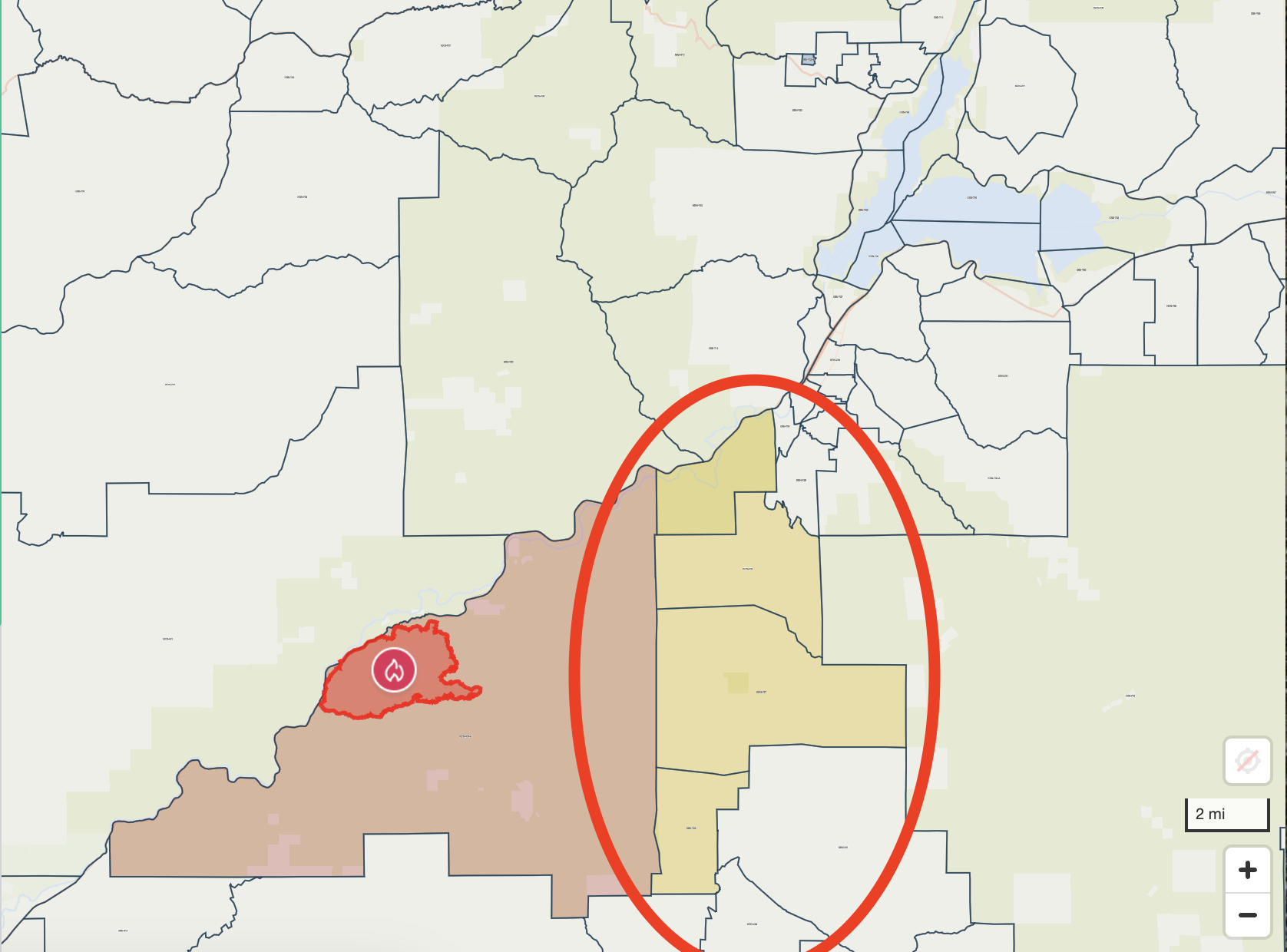
An Evacuation Warning has been issued for four zones. Follow the link to view a map of the area under the Evacuation Warning: go.genasys.com/pzhlf3.
KRN-403-B,
KRN-736
KRN-737
KRN-738
Be prepared to LEAVE. The situation can change very quickly, and visibility in the area may be reduced and roads can become blocked.
Evacuation Boundaries:
North of: Stagecoach Dr.
South of: State Route 178
East of: Breckenridge Rd., State Route 178
West of: Ball Mountain Down to Red Mountain
For the most updated information, please continue to monitor local media or visit Facebook.com/ReadyKern
If you have an emergency, call 9-1-1
Interactive Evacuation Map 07 25 2024
Related Incident: Badland Complex 2024
Publication Type: Announcement
Below is the link to the interactive map provided by Oregon Wildfire Response and Recovery. Users are able to utilized the search feature in the upper right-hand corner to type in their address and determine their evacuation status. The fire perimeter maps may not be up-to-date or completley accurate. For evacuation information please contact the Baker County Sheriff's Office.
For fire information please don't hesitate to call Badland Complex Fire Information if you have any questions or concerns. - 541-362-1507
Plumas County evacuation updates 07 25 2024
Related Incident: Gold Complex
Publication Type: Announcement
From the Plumas County Sheriff's Office:
As of 7/25/2024 at 1715 PM
Due to fire fighting efforts the following zones have been reduced from mandatory evacuation to evacuation warning- PLU95, PLU96, PLU98, PLU100, PLU111, PLU006, PLU007, PLU004
Could not determine your location.
Wolf Creek Fire
Unit Information
Incident Contacts
Could not determine your location.
Limepoint Fire
Unit Information
Incident Contacts
Borel Fire Kern County Evacuation Order 07 25 2024
Related Incident: 2024 SQF Lightning
Publication Type: Announcement
This is a message from the Kern County Fire Department
Haga clic aqui para Espanol: ahas1.com?es5485. For ASL interpretation follow the link: ahas1.com?5485
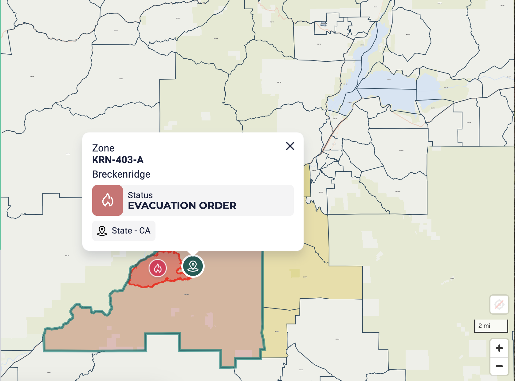
This is an update for the Borel Fire in the Breckenridge area. KRN-403-A has been upgraded to an Evacuation Order. You should Leave NOW. Visibility in the area will be reduced and roads may become blocked; if you do not leave now, you could be trapped, injured or killed.
If you have physical limitations and require evacuation assistance, please call the Aging & Adult Services hotline at 1-855-264-6565. We will not be able to guarantee assistance after 9:00 pm.
**Please plan to use Caliente Bodfish Rd SOUTH to the Tehachapi Area when evacuating the area. Evacuees are advised not to access Caliente Creek Rd**
An evacuation center has been set up at:
Tehachapi Education Center
126 S. Snyder Ave.
Tehachapi, CA 93561
Animal Services will assist with sheltering companion animals at the center.
Genays Protect zone KRN-403-A
Evacuation Boundaries
NORTH OF: Forest Route 28S07
SOUTH OF: State Route 178
EAST OF: Breckenridge Rd, State Route 178
WEST OF: Forest Route 28S19
Follow the link to view a map of the area under the Evacuation Order https://go.genasys.com/y3vaii
For the most updated information, please continue to monitor local media or visit Facebook.com/ReadyKern
If you have an emergency, call 9-1-1.
Hood River County Closures 07 25 2024
Related Incident: Whisky Creek Fire
Publication Type: Closures
As of 12:01am Tuesday, July 16th, Regulated Use Closure (RUC) will go into effect in Hood River and Wasco County. The RUC restrictions will close County Forest trails to motorized use in Post Canyon and Kingsley as well as the already enforced restrictions at Middle Mt., Pinemont and Fir Mt. (Eastside) due to fire danger at this time. E-motos and E-bikes are still permitted. Open campfires throughout the county forest are also prohibited. Campfires are NO LONGER permitted at the Kingsley Campground. Portable cooking stoves using liquefied or bottled fuels are allowed throughout the forest. All vehicles traveling on county forest roads will be required to have a shovel and a gallon of water or a 2 1/2 pound fire extinguisher or larger.
As of 7/22/2024, at 5:00pm the Kingsley Campground will be closed due to the Whisky Creek Fire until further notice.
Klamath National Forest Closure 07 25 2024
Related Incident: Shelly Fire
Publication Type: Announcement
From: Chris Christofferson, Forest Supervisor, Klamath National Forest
I am implementing a Forest Order closing the area and trails in the vicinity of the Shelly Fire on
the Salmon/Scott River Ranger District of the Klamath National Forest as described in Forest
Order No. 24-05-05-04, effective from July 25, 2024 – August 9, 2024. This Forest Order
supersedes Forest Order No. 24-05-05-03, signed on July 19, 2024.
This Forest Order is necessary to promote public safety within the area of the Shelly Fire.
Closing the areas, including the Forest roads, trails, and recreation sites within them, will keep
the public out of this area and reduce the risk of public injury or death. Additionally, burned
areas within the boundary of the Order present a substantial risk to the public until they are
assessed and mitigated. Hazards to the public in these burned areas are still being evaluated and
include: scorched and dead trees which could topple without warning, unpredictable debris flows
and landslides, and unstable soils causing increased road and trail erosion.
The Order will remain in effect until Friday August 9, 2024, or as conditions are reevaluated
and the Order is terminated or superseded.
This Forest Order includes an exemption for persons with a Forest Permit for Use of Roads,
Trails, or Areas Restricted by Regulation or Order (Form FS-7700-48). Authorization under this
exemption will only be provided if I or my delegates determine that the risk to personal health
and safety is reasonable considering the circumstances of the request. I hereby delegate the
authority to sign Form FS-7700-48 granting an exemption to this Forest Order to the District
Rangers of the Klamath National Forest.
Scoping efforts have included discussions with our cooperators and Forest Service law
enforcement.
I have concluded that this decision may be categorically excluded from documentation in an
Environmental Impact Statement (EIS) or Environmental Assessment (EA) under the National
Environmental Policy Act. This action falls within the category identified in 36 C.F.R.
§ 220.6(d)(1) – prohibitions to provide short-term resource protection or to protect public health
and safety – and does not require documentation in a decision memo, decision notice, or record
of decision. I have determined that there are no extraordinary circumstances associated with this
temporary closure. Implementation of the decision may begin immediately.
Could not determine your location.

 InciWeb
