
Hwy 113 Fire Daily Update 92123
Related Incident:
Publication Type: News
Information: Hours: 8:00 AM – 8:00 PM Phone: 318-239-9263 Email: 2023.TigerIsland@firenet.gov
Louisiana Statewide Burn Ban: The State Fire Marshal’s Office’s order prohibiting ALL private burning and the Louisiana Department of Agriculture and Forestry ban on all agricultural burning, remain in effect. These are reevaluated weekly. Open burning with exposed flames is prohibited with no exceptions. The use of prescribed fires is also banned. More information is available at http://sfm.dps.louisiana.gov/doc/press/pr_2023-36.pdf
Highlights: All four fires continue to have reburning in interior locations where needle cast continues to fall and hot spots remain due to heavier fuels. Multiple helicopters are providing water drops to cool areas of reburn, and ground crews continue to clear needle cast from containment lines and work inward from fire area perimeters to suppress hot spots and reburn. Hot spots continue to persist in hardwood drainages and are being monitored closely since there is a potential for more active fire behavior and spread along these drainages. Snag trees with weakened root systems are a major safety concern for crews as they work in the interior of the burn areas. The Southern Area Gold Team will transition with the Southern Area Blue Team and assume command on Saturday morning.
Tiger Island Fire: 31,290 acres, no change | 84% containment| 117 personnel assigned
Inciweb: https://inciweb.nwcg.gov/incident-information/lalas-tiger-island-fire
Facebook: https://www.facebook.com/TigerIslandFire
Hwy 113 Fire: 7,124 acres, no change | 95% containment | 37 personnel assigned
InciWeb: https://inciweb.nwcg.gov/incident-information/lalas-hwy-113-fire
Facebook: https://www.facebook.com/TigerIslandFire
Lions Camp Road Fire: 785 acres, no change | 91% containment | 7 personnel assigned
InciWeb: https://inciweb.nwcg.gov/incident-information/lalas-lions-camp-road-fire
Facebook: https://www.facebook.com/TigerIslandFire
Elizabeth Fire: 940 acres, no change | 100% containment | 5 personnel assigned
InciWeb: https://inciweb.nwcg.gov/incident-information/lalas-elizabeth-fire
Facebook: https://www.facebook.com/TigerIslandFire
Equipment resources assigned to the fires include Type 6 Engines; Dozers; Tractor Plow Units; and Water Tenders. Aerial resources include helicopters and fixed wing aircraft. Additional support is being provided by Parish authorities and departments; Sheriff’s Offices; and the Governor’s Office of Homeland Security and Emergency Preparedness.
Weather & Fire Behavior: High temperatures in the low to mid 90s and slightly higher relative humidity near 35% are forecast for this afternoon. Southeast winds of 5 to 10 mph with gusts into the teens are expected. Fuel moistures remains critically low for all fuel types with smaller fuels in the 6 to 9% range. Heavier fuels are very low with 10 to 15% fuel moisture due to the long-term EXCEPTIONAL /EXTREME drought conditions. The combination of weather and fuel moisture provides the potential for moderate to high fire behavior to continue.
Air Quality: Smoke may occur in areas of reburn. Air quality information is available at the EPA’s Fire and Smoke Map at: https://fire.airnow.gov/ .
Temporary Flight Restriction: A Temporary Flight Restriction (TFR) is in place over the Tiger Island Fire and Hwy 113 and Elizabeth Fire areas. If you fly, we can’t. Aircraft or drone intrusions into the restricted airspace endangers aircrews conducting fire operations and aerial resources are grounded for safety. This unnecessarily places aircrews and ground fire crews at risk in a dynamic and dangerous fire environment.
Lions Camp Rd Fire Daily Update 92123
Related Incident: Lions Camp Road Fire
Publication Type: News
Information: Hours: 8:00 AM – 8:00 PM Phone: 318-239-9263 Email: 2023.TigerIsland@firenet.gov
Louisiana Statewide Burn Ban: The State Fire Marshal’s Office’s order prohibiting ALL private burning and the Louisiana Department of Agriculture and Forestry ban on all agricultural burning, remain in effect. These are reevaluated weekly. Open burning with exposed flames is prohibited with no exceptions. The use of prescribed fires is also banned. More information is available at http://sfm.dps.louisiana.gov/doc/press/pr_2023-36.pdf
Highlights: All four fires continue to have reburning in interior locations where needle cast continues to fall and hot spots remain due to heavier fuels. Multiple helicopters are providing water drops to cool areas of reburn, and ground crews continue to clear needle cast from containment lines and work inward from fire area perimeters to suppress hot spots and reburn. Hot spots continue to persist in hardwood drainages and are being monitored closely since there is a potential for more active fire behavior and spread along these drainages. Snag trees with weakened root systems are a major safety concern for crews as they work in the interior of the burn areas. The Southern Area Gold Team will transition with the Southern Area Blue Team and assume command on Saturday morning.
Tiger Island Fire: 31,290 acres, no change | 84% containment| 117 personnel assigned
Inciweb: https://inciweb.nwcg.gov/incident-information/lalas-tiger-island-fire
Facebook: https://www.facebook.com/TigerIslandFire
Hwy 113 Fire: 7,124 acres, no change | 95% containment | 37 personnel assigned
InciWeb: https://inciweb.nwcg.gov/incident-information/lalas-hwy-113-fire
Facebook: https://www.facebook.com/TigerIslandFire
Lions Camp Road Fire: 785 acres, no change | 91% containment | 7 personnel assigned
InciWeb: https://inciweb.nwcg.gov/incident-information/lalas-lions-camp-road-fire
Facebook: https://www.facebook.com/TigerIslandFire
Elizabeth Fire: 940 acres, no change | 100% containment | 5 personnel assigned
InciWeb: https://inciweb.nwcg.gov/incident-information/lalas-elizabeth-fire
Facebook: https://www.facebook.com/TigerIslandFire
Equipment resources assigned to the fires include Type 6 Engines; Dozers; Tractor Plow Units; and Water Tenders. Aerial resources include helicopters and fixed wing aircraft. Additional support is being provided by Parish authorities and departments; Sheriff’s Offices; and the Governor’s Office of Homeland Security and Emergency Preparedness.
Weather & Fire Behavior: High temperatures in the low to mid 90s and slightly higher relative humidity near 35% are forecast for this afternoon. Southeast winds of 5 to 10 mph with gusts into the teens are expected. Fuel moistures remains critically low for all fuel types with smaller fuels in the 6 to 9% range. Heavier fuels are very low with 10 to 15% fuel moisture due to the long-term EXCEPTIONAL /EXTREME drought conditions. The combination of weather and fuel moisture provides the potential for moderate to high fire behavior to continue.
Air Quality: Smoke may occur in areas of reburn. Air quality information is available at the EPA’s Fire and Smoke Map at: https://fire.airnow.gov/ .
Temporary Flight Restriction: A Temporary Flight Restriction (TFR) is in place over the Tiger Island Fire and Hwy 113 and Elizabeth Fire areas. If you fly, we can’t. Aircraft or drone intrusions into the restricted airspace endangers aircrews conducting fire operations and aerial resources are grounded for safety. This unnecessarily places aircrews and ground fire crews at risk in a dynamic and dangerous fire environment.
Tiger Island Daily Update 92123
Related Incident: Tiger Island Fire
Publication Type: News
Information: Hours: 8:00 AM – 8:00 PM Phone: 318-239-9263 Email: 2023.TigerIsland@firenet.gov
Louisiana Statewide Burn Ban: The State Fire Marshal’s Office’s order prohibiting ALL private burning and the Louisiana Department of Agriculture and Forestry ban on all agricultural burning, remain in effect. These are reevaluated weekly. Open burning with exposed flames is prohibited with no exceptions. The use of prescribed fires is also banned. More information is available at http://sfm.dps.louisiana.gov/doc/press/pr_2023-36.pdf
Highlights: All four fires continue to have reburning in interior locations where needle cast continues to fall and hot spots remain due to heavier fuels. Multiple helicopters are providing water drops to cool areas of reburn, and ground crews continue to clear needle cast from containment lines and work inward from fire area perimeters to suppress hot spots and reburn. Hot spots continue to persist in hardwood drainages and are being monitored closely since there is a potential for more active fire behavior and spread along these drainages. Snag trees with weakened root systems are a major safety concern for crews as they work in the interior of the burn areas. The Southern Area Gold Team will transition with the Southern Area Blue Team and assume command on Saturday morning.
Tiger Island Fire: 31,290 acres, no change | 84% containment| 117 personnel assigned
Inciweb: https://inciweb.nwcg.gov/incident-information/lalas-tiger-island-fire
Facebook: https://www.facebook.com/TigerIslandFire
Hwy 113 Fire: 7,124 acres, no change | 95% containment | 37 personnel assigned
InciWeb: https://inciweb.nwcg.gov/incident-information/lalas-hwy-113-fire
Facebook: https://www.facebook.com/TigerIslandFire
Lions Camp Road Fire: 785 acres, no change | 91% containment | 7 personnel assigned
InciWeb: https://inciweb.nwcg.gov/incident-information/lalas-lions-camp-road-fire
Facebook: https://www.facebook.com/TigerIslandFire
Elizabeth Fire: 940 acres, no change | 100% containment | 5 personnel assigned
InciWeb: https://inciweb.nwcg.gov/incident-information/lalas-elizabeth-fire
Facebook: https://www.facebook.com/TigerIslandFire
Equipment resources assigned to the fires include Type 6 Engines; Dozers; Tractor Plow Units; and Water Tenders. Aerial resources include helicopters and fixed wing aircraft. Additional support is being provided by Parish authorities and departments; Sheriff’s Offices; and the Governor’s Office of Homeland Security and Emergency Preparedness.
Weather & Fire Behavior: High temperatures in the low to mid 90s and slightly higher relative humidity near 35% are forecast for this afternoon. Southeast winds of 5 to 10 mph with gusts into the teens are expected. Fuel moistures remains critically low for all fuel types with smaller fuels in the 6 to 9% range. Heavier fuels are very low with 10 to 15% fuel moisture due to the long-term EXCEPTIONAL /EXTREME drought conditions. The combination of weather and fuel moisture provides the potential for moderate to high fire behavior to continue.
Air Quality: Smoke may occur in areas of reburn. Air quality information is available at the EPA’s Fire and Smoke Map at: https://fire.airnow.gov/ .
Temporary Flight Restriction: A Temporary Flight Restriction (TFR) is in place over the Tiger Island Fire and Hwy 113 and Elizabeth Fire areas. If you fly, we can’t. Aircraft or drone intrusions into the restricted airspace endangers aircrews conducting fire operations and aerial resources are grounded for safety. This unnecessarily places aircrews and ground fire crews at risk in a dynamic and dangerous fire environment.
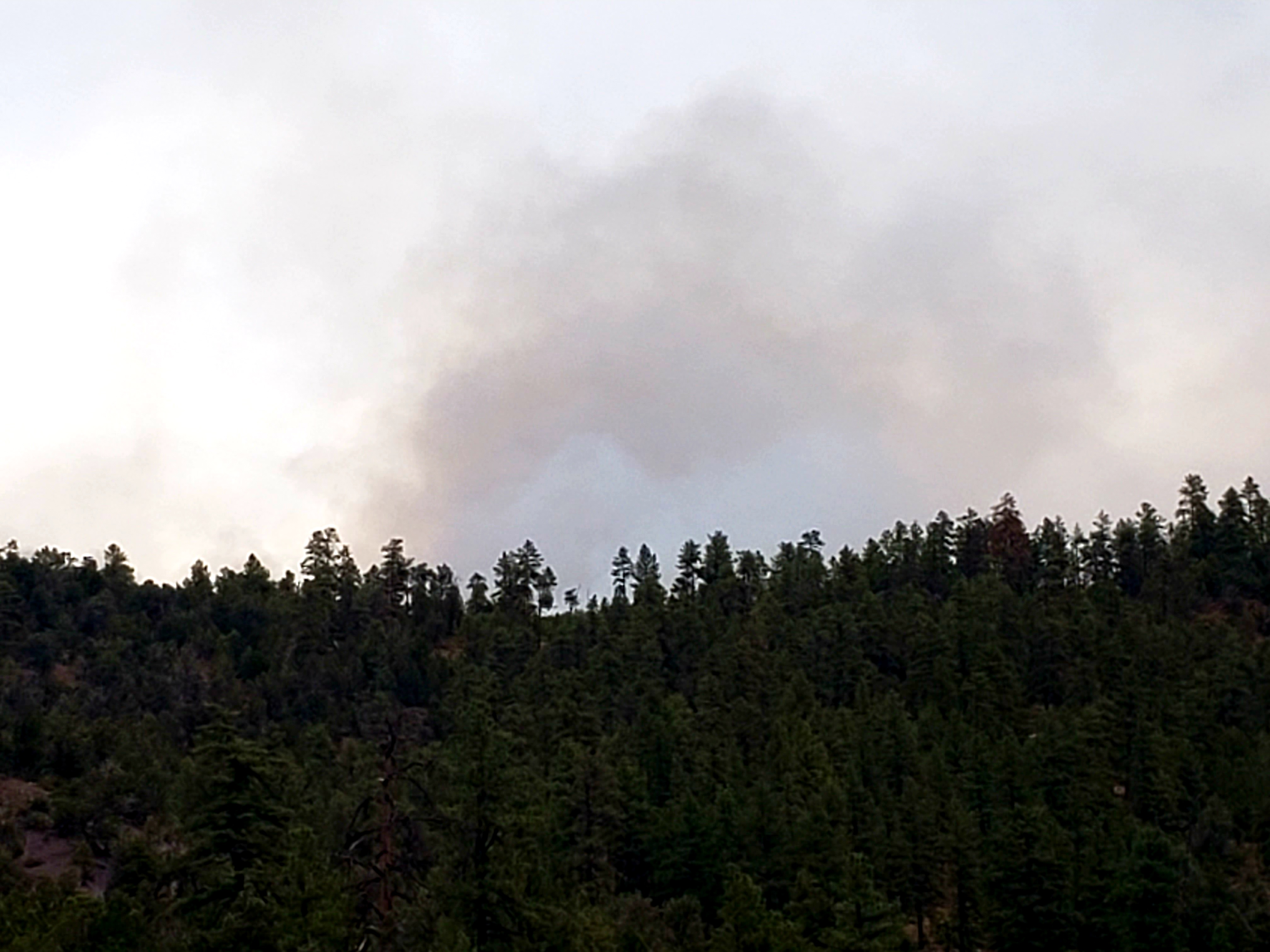
Thursday September 21 2023 Valentine fire update and map
Related Incident:
Publication Type: News
Size: 5,626 acres
Start Date: August 16, 2023
Cause: Lightning
Completion: 68%
Total personnel: 177
Location: 11 miles northeast of Young, Arizona and 27 miles
east of Payson, Arizona
Fuels:Ponderosa Pine, Hardwood litterand timber
Highlights: Due to expected winds today, Crews will be scouting the existing road systems and terrain in the southwest perimeter to plan the best route to proceed when conditions improve.
Operations: Yesterday, crews performed ignitions along the south fire line to bring the fire toward FSRD 411 while north crews patrolled the fire line. Today, crews are scouting the terrain looking for the best options to bring the fire south and patrolling the fire edge during wind events.
Fire Ecology: In recent years scientists have been finding out that smoke has a lot of ecological benefits. For example, the germination of bearded penstemon and yarrow seeds can more than quadruple when there is smoke residue in the soil or on the seeds. Smoke can inhibit mistletoe and fungi, and it attracts or repels many insect species. In the past, Native American Tribes lit fires at times and in places where the smoke would be dense for long periods to shade streams; cooling the water for the benefit of salmon migrating upstream.
Weather: Yesterday was dry with some cloud cover in the morning and winds out of the southwest along the ridge tops. Today will be sunny with cloud cover expected at night. Variable and gusty winds will come from the south.
Closures: An emergency closure order for the Valentine Fire went into effect as of 6 a.m. Sept. 5, 2023. The public is asked to avoid the fire area. The purpose of the closure order is to protect public health and safety during the Valentine Fire, and to protect assigned firefighting personnel engaging in wildland firefighting operations. Signs and gates will be in place to remind the public not to enter the fire area. Please visit the Alerts and Notices page for more information. https://www.fs.usda.gov/alerts/tonto/alerts-notices.
Safety: The health and safety of firefighters, and the public are always the highest priority. Members of the public are asked to avoid the fire area.
Smoke: The fire will produce considerable amounts of smoke due to excessive fuel accumulation. Smoke from the Valentine Fire may be visible in the surrounding areas for many days. Smoke-sensitive individuals and people with respiratory problems or heart disease are encouraged to take precautionary measures. An interactive smoke map, available at https://www.airnow.gov/wildfires/ allows you to zoom into your area to see the latest smoke conditions.
![]()
Information Links and Contacts:
Tonto National Forest https://www.fs.usda.gov/main/tonto/fire
InciWeb https://inciweb.nwcg.gov/incident-information/aztnf-valentine-fire Fire Email 2023.valentine@firenet.gov
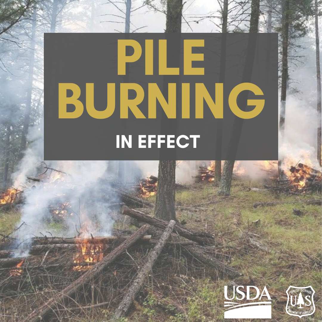
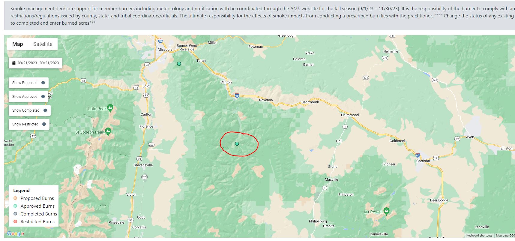
September 21 2023 Prescribed Fire Update
Related Incident: Lolo National Forest Prescribed Fire Operations
Publication Type: Announcement
Missoula Ranger District:
Pending conditions, pile burning operations will take place today on the Missoula Ranger District to reduce hazardous fuels from previous vegetation management operations.
Firefighters will conduct up to 5 acres of hand pile burning up Ranch Creek, 10 miles up the Rock Creek drainage. Residents near Rock Creek may see some residual smoke overnight. Firefighters will implement, patrol, and monitor the pile burning over the next few days.

Settings - change map background and toggle additional layers
Filter - control incident types displayed on map.
Zoom to your location
Reset map zoom and position
Could not determine your location.
Show Legend
 Wildfire
 Prescribed Fire
 Burned Area
Response
Burned Area
Response Other
Other
Morgan Fire
Unit Information
Incident Contacts
Columbine District Southern HD Unit Prescribed Fire East 4 Block 09202023
Related Incident: 2025 San Juan National Forest Prescribed Fire Program
Publication Type: News
Prescribed burning operations on the USDA Forest Service - San Juan National Forest Southern HD Unit East 4 block have concluded for today, September 20th, at 5:36pm. Crews completed 40% of the 500-acre goal. Weather and fuel conditions permitting, the San Juan National Forest Prescribed Fire Project will continue tomorrow on the East 4 block of Southern HD Unit. If weather conditions are not favorable for ignition, the prescribed burn will be re-scheduled for a later date.
Columbine District Southern HD Unit Prescribed Fire East 4 Block 09202023
Related Incident: 2025 San Juan National Forest Prescribed Fire Program
Publication Type: News
Ignitions for the prescribed burning operation begin today, September 20th, 2023, at 1:30pm on the East 4 block within the Southern HD Unit, USDA-San Juan National Forest. Today's operation is located west of Turkey Creek and east of Goose Creek on the southern end of the #SanJuanNF. Resources will complete the second burn unit in the Southern HD Unit for a goal of 500 acres, giving a total of 1000-acres burned in the Southern HD Unit of the Columbine Ranger District.
If you are in the area, please exercise extreme caution when around firefighters and fire apparatuses. Some smoke may be visible in the area.
60 firefighters will work to execute this prescribed fire, aimed at reducing hazardous ground fuels, reducing the risk of unplanned catastrophic wildfire, restoring ponderosa pine ecosystems, and improving wildlife habitat.
To learn more about air quality in your area, please visit: https://www.airnow.gov/?city=Arboles&state=CO&country=USA
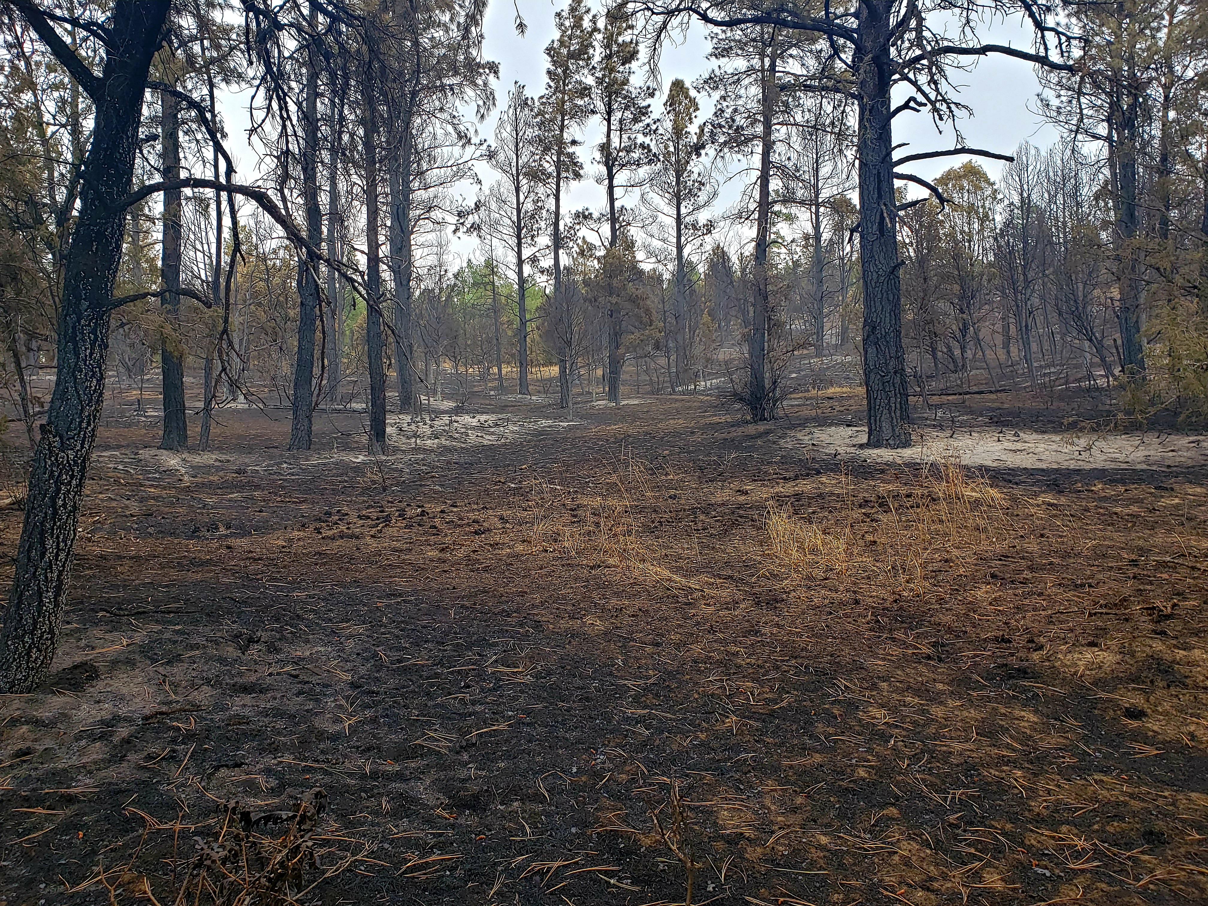
Happy Camp Complex Update for September 20 2023
Related Incident: 2023 Happy Camp Complex Klamath NF
Publication Type: News
Wednesday, September 20, 2023
WEATHER: Cooler and drier conditions are expected through today. Tomorrow, humidities will begin to increase with higher moisture levels into next week. Winds will be out of the northeast through Thursday as breezy winds peak today.
FIRE BEHAVIOR: Fire behavior is expected to be minimal. Gusty winds up to 25 mph are expected today on ridgetops; firefighters will be monitoring fire behavior. As the smoke clears, fire activity may increase with the warming slopes and afternoon winds.
FIRE MANAGEMENT: Note that today at 0700 California Interagency Team 11 will be managing the Elliot and UFish Fires. The management of all other fires that were formerly part of the Happy Camp Complex (Scott, Malone, Head, Lake, Hancock, Den, Kings, Townsend; all 100% contained) has returned to the Klamath National Forest.
UFISH FIRE: 7,603 acres at 58% containment. Containment line along the Hwy 96 corridor is complete and looks good. The northwest perimeter is in monitor & patrol status as well. The fire is gently backing down to Titus Creek on the southeast side and crews are monitoring this area. No firing operations are currently planned at Windy Gap above the Titus Creek drainage; a long weather window is necessary for this to occur.
ELLIOT FIRE: 13,649 acres at 51% containment. Existing containment line is in good shape. The burn area at the northern end resembles a desirable prescribed burn. The fire perimeter along the Hwy 96 corridor is black; firefighters are patrolling along Hwy 96 to watch for rollout.
Hazard tree removal is in progress along Doolittle Creek Road (17N11 Rd) as snags from the 202 Slater Fire are impacting access to the current UFish Fire area. Suppression repair is ongoing in both fire areas.
SMOKE EFFECTS: Today and tomorrow will see significant air quality improvements in communities around the Happy Camp Complex. Strong winds from the north for two consecutive days helped clear out the area but, starting Friday afternoon, we will see winds shift from the west that will likely bring smoke from the Happy Camp Complex and neighboring Six Rivers Lightning Complex back into the valleys and impact air quality over the weekend. For more information on the Six Rivers Lightning Complex, go to http://www.linktr.ee/srffirepio.
EVACUATIONS: View current Siskiyou County evacuation orders and warnings by visiting https://community.zonehaven.com. Please note that zone Orders and Warnings were changed yesterday. Siskiyou County residents are encouraged to sign up for rapid emergency notifications using the CodeRED emergency alert system at: https://bit.ly/SiskiyouCodeRedEmergencyAlert.
CLOSURES: A closure order has been implemented in the Klamath National Forest. Find more information at https://bit.ly/KlamathNFAlertsNotices.
As hunting season continues, please be aware of area closures within national forests. Contact local Forest Service offices for specific information.
DELAYS: One-way traffic control is on Highway 96 at various locations, from 5 miles east of Seiad to the Klamath River. Scott River Road is closed between Highway 96 and Mill Creek Road. https://roads.dot.ca.gov/.
Little Mesa Fire is 100 contained September 20 2023
Related Incident: Little Mesa Fire
Publication Type: News
Little Mesa Fire Update
Wednesday, September 20, 2023
Location: Approx. 15 miles west, southwest of Delta, CO, Dominguez Escalante National Conservation Area
Discovered: July 31, 2023, 11:00 AM
Cause: Lightning
Estimated Size: 4,009 acres
Vegetation Type: Pinyon, Juniper, sagebrush, grass
Containment: 100%
Total Personnel: 4
Special Note: This will be the last update for the Little Mesa Fire, unless fire activity increases significantly.
Current Situation: The Little Mesa Fire reached 100% containment on Tuesday, September 19, 2023. Firefighters determined the perimeter is contained and will stop further fire spread under reasonable conditions. Smoke may be intermittently present from the interior while vegetation smolders. The fire is being managed by a confine and contain strategy using existing roads and natural barriers. View this video to understand how the Little Mesa Fire is being managed https://www.youtube.com/watch?v=QfTz-5SCcmk.
For updated information follow on these outlets:
Inciweb: https://inciweb.wildfire.gov/incident-information/coupd-little-mesa-fire
Facebook: @LittleMesaFire
Twitter: @SWD_Fire