
Park Fire Evening Update 08 29 2024
Related Incident: Park Fire
Publication Type: News
Park Fire Evening Update for August 29 is posted on the Park Fire Status Update Page
CAL FIRE holding containment line 08 29 2024
Related Incident: Coffee Pot Fire
Publication Type: Announcement
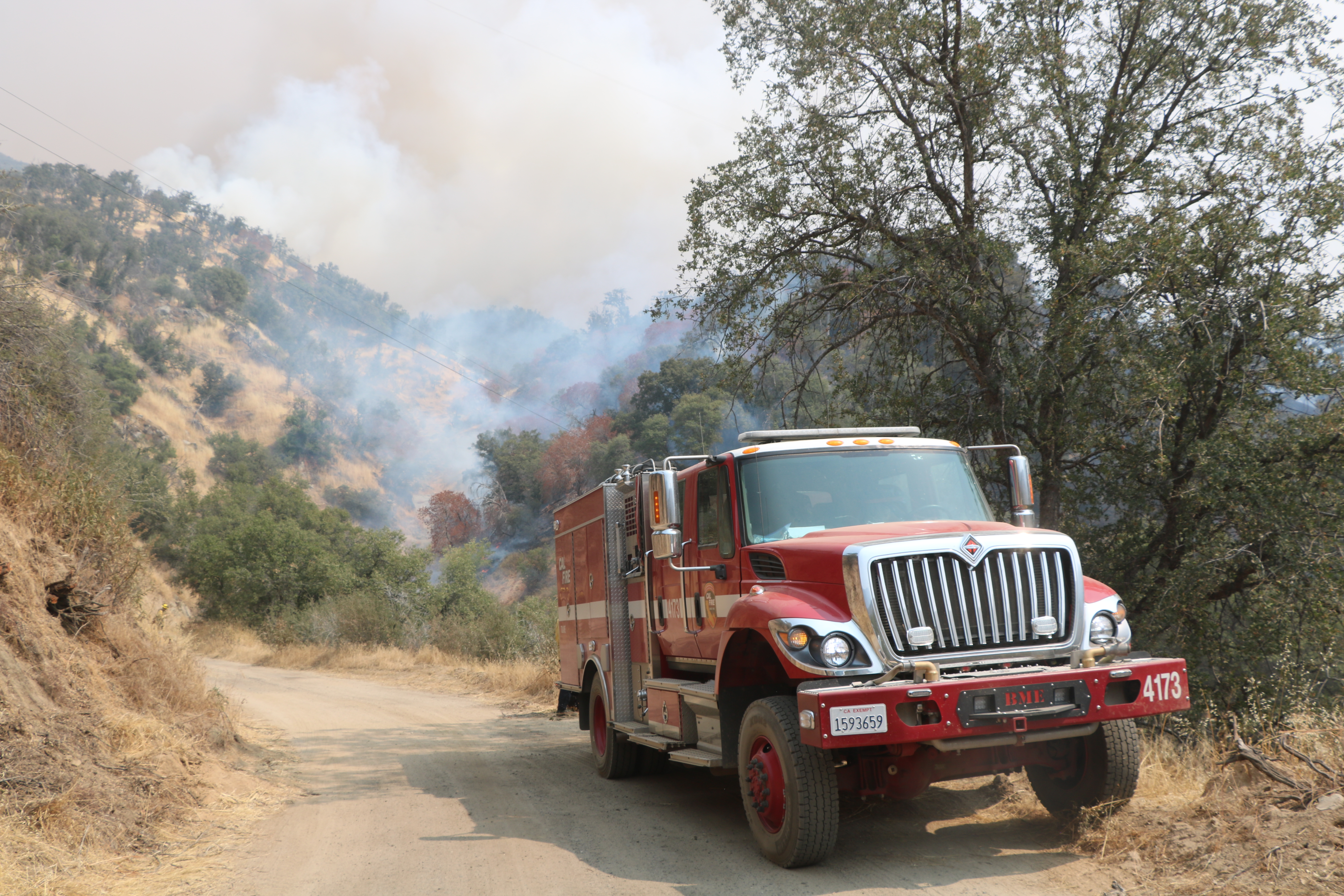
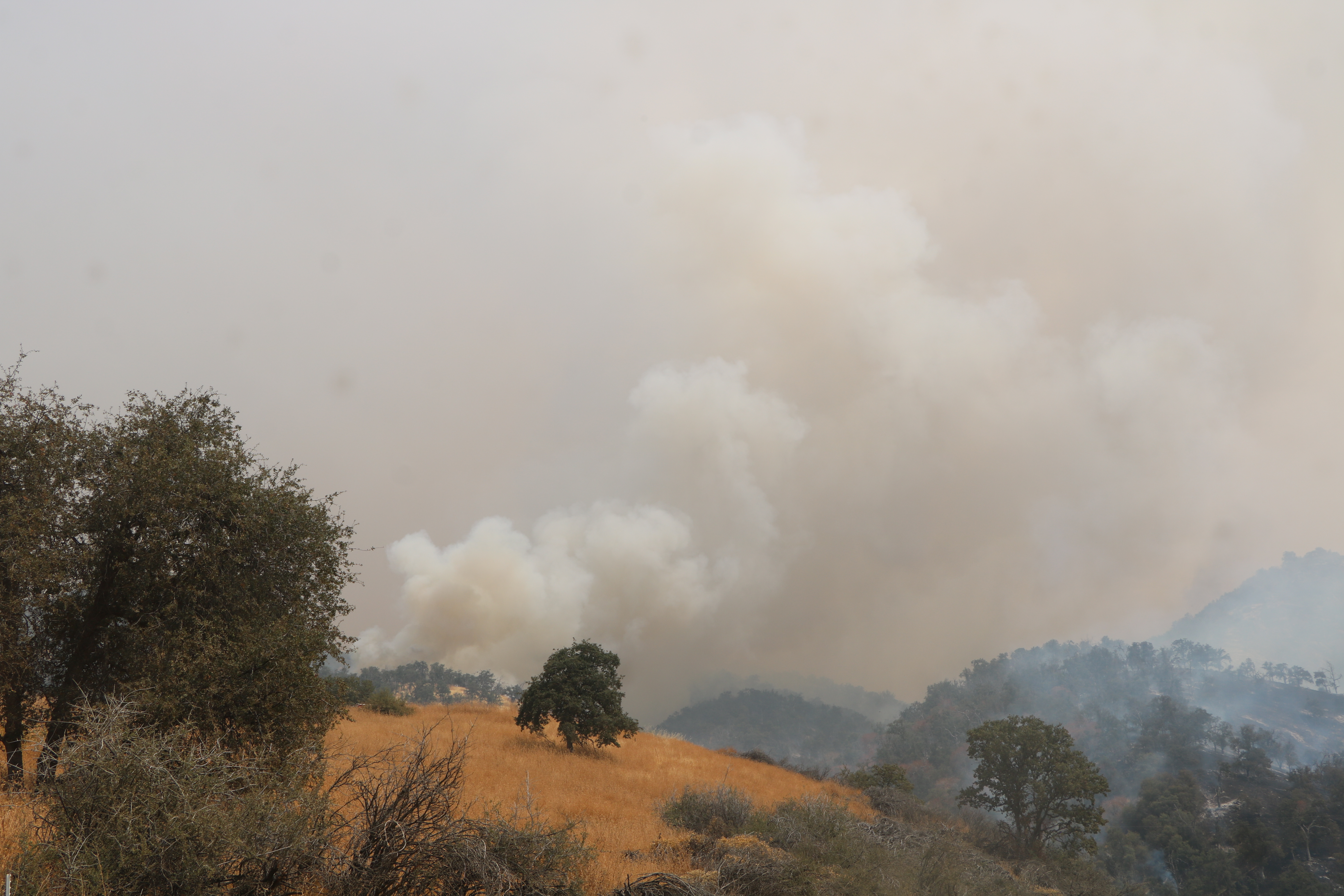
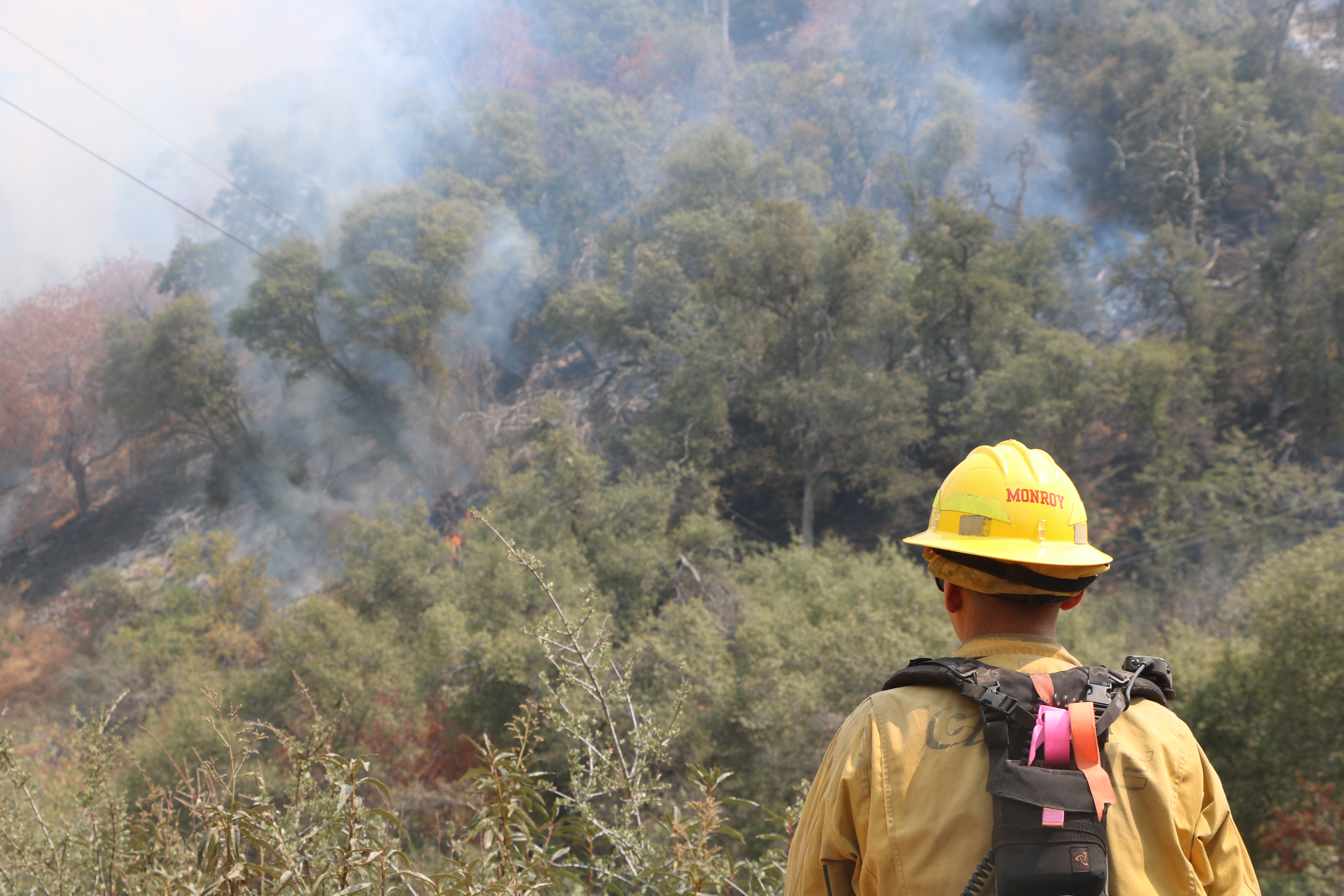
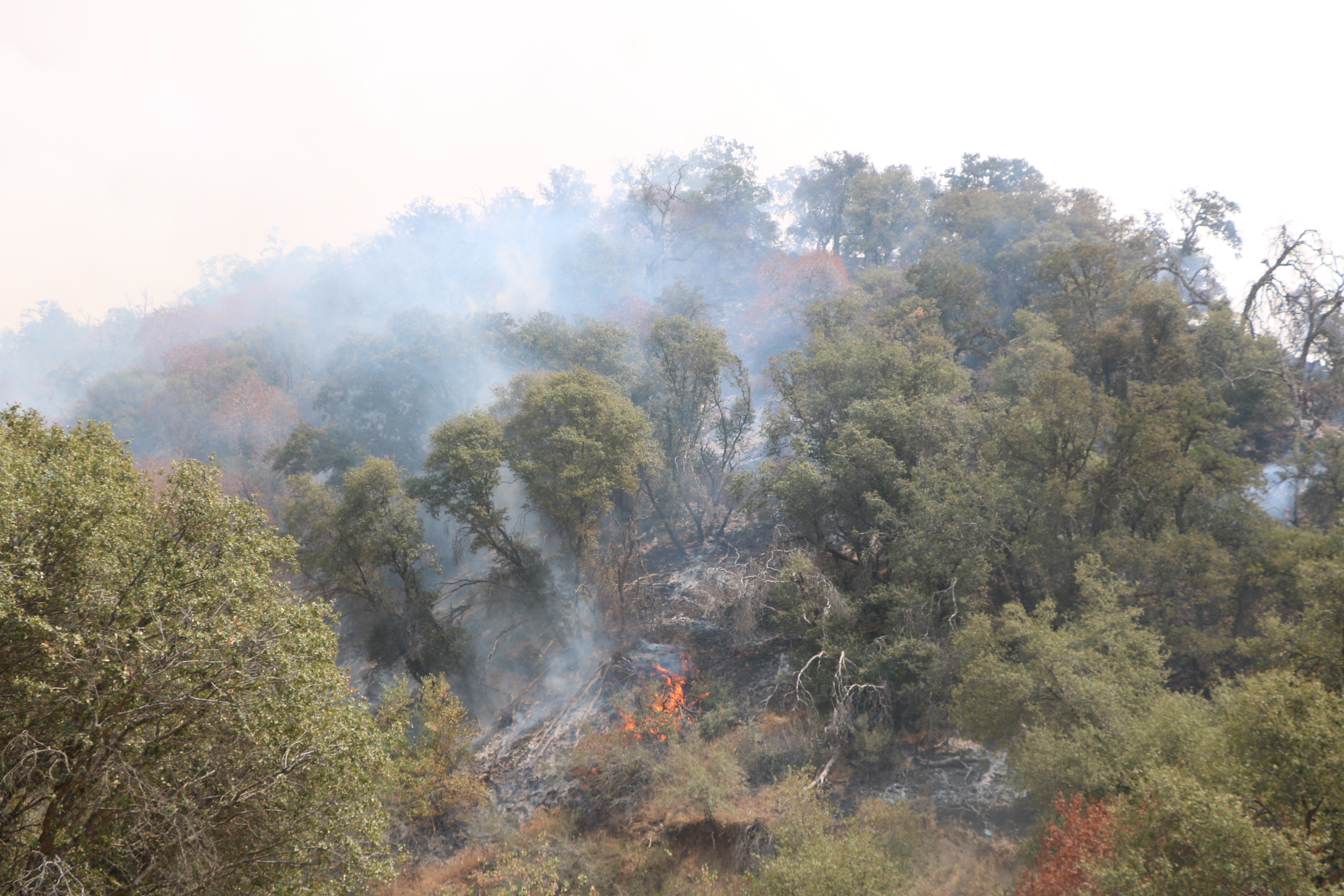
Fire personnel have been working hard today on the #CoffeePotFire as strategic firing operations take place. CAL FIRE Tulare Unit engines are tasked with holding containment lines along South Fork Drive in Three Rivers as operations progress. This planned burning is in an effort to slow the spread of the fire downslope by eliminating vegetative fuels.
Photo Credit: CAL FIRE Tulare Unit
What to Expect this 2024 Labor Day Weekendat Sequoia and Kings Canyon National Parks 08 29 2024
Related Incident: Coffee Pot Fire
Publication Type: News
For Immediate Release: August 29, 2024
Contact: Sintia Kawasaki-Yee, Chief of Communications
Phone: (559) 679-2866
Email: seki_public_affairs@nps.gov
Reference Number: 8550-2421
What to Expect this 2024 Labor Day Weekend at Sequoia and Kings Canyon National Parks
Mineral King Closure Due to Coffee Pot Fire Effective 8/30
SEQUOIA AND KINGS CANYON NATIONAL PARKS - Labor Day Weekend marks the end of the summer season and is historically a busy time at Sequoia and Kings Canyon National Parks. This year it is very important for visitors to plan ahead and understand how smoke and air quality may impact their visit. The Coffee Pot Fire continues to grow in Sequoia National Park wilderness, and although the main corridor through the parks to popular areas like the Giant Forest, Grant Grove, and Cedar Grove will remain open and accessible, planning ahead is highly recommended.
Coffee Pot Fire Impacts and Resources
Recreational access to the Mineral King area of Sequoia National Park will be closed to the public beginning Friday, August 30. This applies to Mineral King campgrounds, trailheads, and area trails. All other areas of the parks will remain open through the holiday weekend but are likely to be impacted by varying levels of smoke and poor air quality.
To monitor fire activity and updates visit inciweb.wildfire.gov/incident-information/caknp-coffee-pot-fire. For air quality updates and forecasts visit fire.airnow.gov.
Tips for Planning Ahead and Navigating Congestion
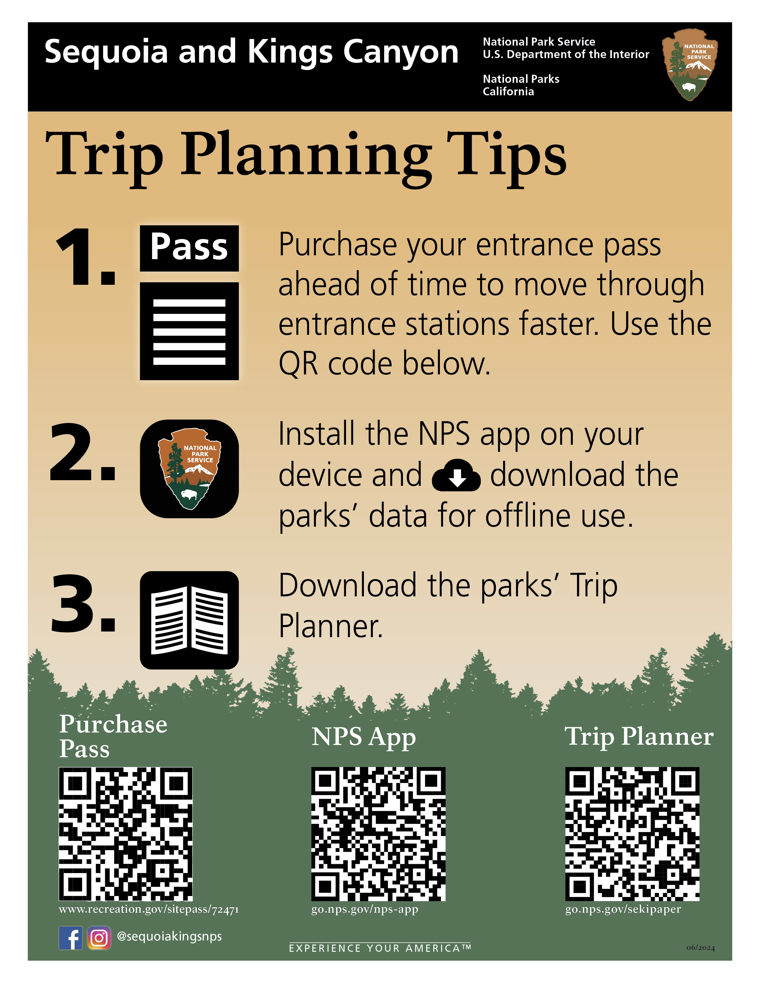
- Purchase an entrance pass in advance at recreation.gov and arrive before 9 a.m. or after 3 p.m. to reduce wait times at entrance stations.
- Consider entering the parks through the Big Stump entrance via highway 180 to avoid fire traffic and smoke impacts.
- If visiting the Giant Forest area, park your vehicle in a designated parking space and then use the free Sequoia Shuttle to explore the most popular sites.
- All campgrounds in the parks require reservations. To look for available campsites visit recreation.gov. Do not arrive planning to camp without a reservation.
- Be sure to Leave No Trace. All food must be kept in vehicles out of site or stored in designated food storage lockers. If a trash can is full, find another, or take trash with you.
- Visit the parks website www.nps.gov/SEKI for trip planning and current conditions.
- Download the free official National Park Service app that includes a map and information about all areas of the parks.
Overall, visitors should come prepared for a busy and likely smokey holiday weekend, but ready to experience the majestic nature of these parks.
-NPS-
About Sequoia and Kings Canyon National Parks
These two parks, which lie-side-by-side in the southern Sierra Nevada in Central California, serve as a prime example of nature’s size, beauty, and diversity. Nearly 2 million visitors from across the U.S. and the world visit these parks for the world’s largest trees (by volume), grand mountains, rugged foothills, deep canyons, vast caverns, the highest point in the lower 48 states, and more. Learn more at http://www.nps.gov/seki
Residents Can Return to Lower Stanley and Gateway Community as of 8 pm Thursday 08 29 2024
Related Incident:
Publication Type: Announcement
Lower Stanley and Gateway Community moved to Set Evacuation Status on 8 p.m. on Thursday, August 29. Residents can return home.
Casino Zone moved from SET TO READY at 8 p.m. on Thursday, August 29.
Remember that this does not mean there is no longer any threat. Simply that the threat has lessened enough for the Sheriff to feel confident to let them back into their homes. Please continue to be prepared, as well as follow the fire and Sheriff's page for current fire information.
West Mountain Fires Closures Current Evacuation Information Fire Restrictions TFR Important Links 08 31 2024
Related Incident: Boulder FireDollar Fire
Publication Type: Announcement
WEST MOUNTAIN FIRES
Closures, Current Evacuation Information
Fire Restrictions, TFR, Important Links
FOREST CLOSURES
Boise National Forest:
- Closure Order #0402-04-100 Dollar/Oro Area, Trail, and Road Closure, extending north to the boundary with Payette National Forest, south to Crouch and the Banks-Lowman Hwy, and east to the 579, 563 and 582 roads.
- Closure Order #0402-04-98 Boulder Fire Area, Trail, and Road Closure, encompassing Blue Lake and Snowbank Mountain Road (#446) along with all #404 and #421.
Payette National Forest:
- Closure Order #0412-606 Wolf Creek Burned Area Road and Trail Closure encompassing National Forest System Trail #560 and NFS Road #1762.
- Closure Order #0412-605 Dollar Fire Area and Trail Closure north of Warm Lake Road, west of South Fork Salmon River, east of NFS Trail #101, and south of NFS Trail #99 and #100.
Notice to hunters: Prior to entering the backcountry, Idaho Fish and Game advises hunters to check with their local Forest Service ranger district offices or county sheriffs’ offices for fire closures in their hunt areas. For more information visit: https://tinyurl.com/4td8hwzc.
FIRE RESTRICTIONS
Fire Restrictions: The Boise National Forest is Stage One Fire Restrictions.
EVACUATION INFORMATION
A “Ready” evacuation order has been issued by Valley County Sheriff’s Office for residents of Warm Lake and the North Shore Lodge at Warm Lake (see map https://tinyurl.com/42auxnk8). A “Ready” evacuation order has been issued for the Horsethief area, including the YMCA camp, and areas of Scott Valley (see map https://tinyurl.com/4vfj657x)
Review the READY, SET, GO evacuation procedure for Valley County: https://www.co.valley.id.us/ReadySetGo
To sign up for emergency alerts, such as evacuation notices, visit your county’s emergency alert system:
- Valley County: https://www.co.valley.id.us/CompleteEmergencyNotificationandAlerting
- Adams County: https://public.alertsense.com/SignUp/PublicUser.aspx?regionid=1077
ROAD CLOSURES
Warm Lake Highway Closure: The Valley County Sheriff’s Office has closed Warm Lake Highway due to threat to public safety from increased fire behavior and potential for fire spread along and/or across the roadway. For updates on county closures visit: https://www.co.valley.id.us/departments/SheriffsOffice.
TEMPORARY FLIGHT RESTRICTIONS
Temporary Flight Restrictions (TFR) are in place over the Boulder, Dollar, Snag, and Goat Fires. Yesterday morning, an aircraft entered the restricted zone without authorization, temporarily grounding fire aircraft and hampering firefighting efforts. Such incidents are reported to the Federal Aviation Administration (FAA) for further review. Wildfires are a no-fly zone for unauthorized aircraft, including drones. TFRs are critical for firefighter and aircraft safety. If you fly, we can’t. For more information, visit http://knowbeforeyoufly.org.
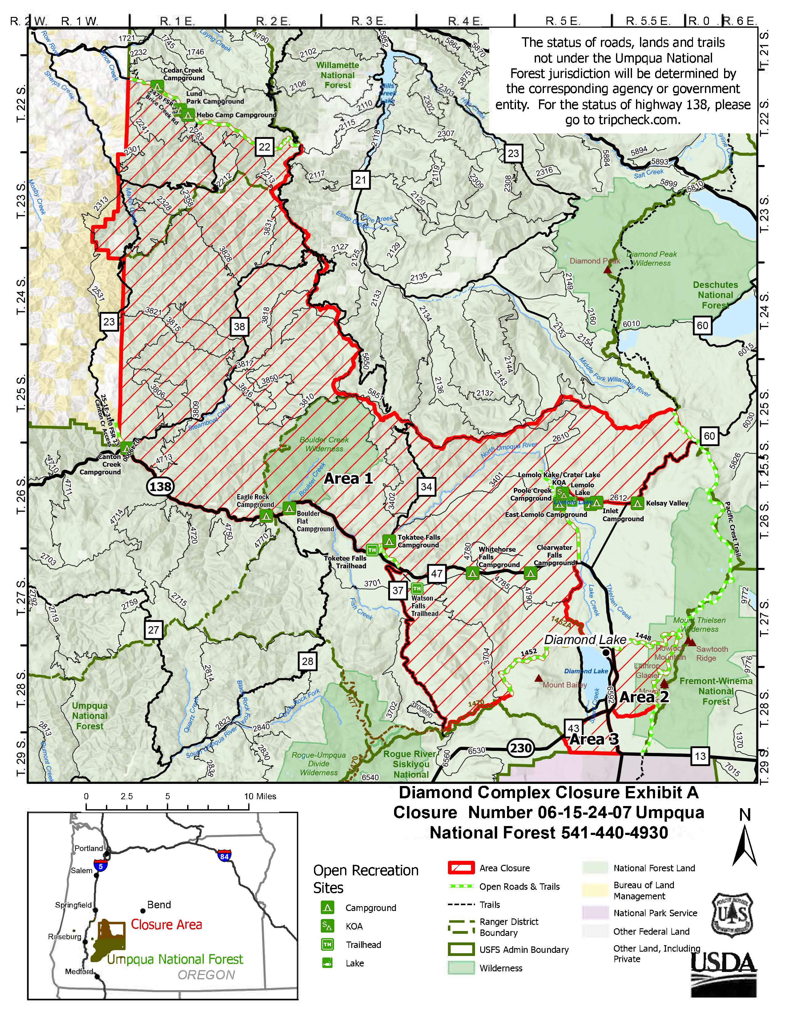
THREE WILLAMETTE NATIONAL FOREST CLOSURE ORDERS REMAIN IN EFFECT NEAR THE WILLAMETTE COMPLEX SOUTH FIRES 08 29 2024
Related Incident: Willamette Complex Fires - South
Publication Type: News
Three Willamette National Forest closures are in effect near the Willamette Complex South fires.
These orders can be found below and under the InciWeb "CLOSURES" tab.
Chalk Fire Closure - Order Number 6-18-10-24-22
Moss Mountain-Potter Closure - Order Number 06-18-10-24-26
Tire Mountain Fire Closure - Order Number 06-18-10-24-18
Aerial Resources Super Scoopers 08 29 2024
Related Incident: Coffee Pot Fire
Publication Type: Announcement
Super Scoopers have been a vital tool in battling the Coffee Pot Fire. These incredible aircraft are designed to collect massive amounts of water from nearby Lake Kaweah and then drop it directly on the wildfire to help slow its spread. In this video, you’ll see them in action, working tirelessly to protect the communities near Three Rivers, California. Witness the coordination, skill, and benefit of these planes as fight the flames from above!
News Release Willamette National Forest Visitors are encouraged to stay safe avoid wildfire areas and campfires 08 29 2024
Related Incident: Willamette Complex Fires - South
Publication Type: News
Willamette National Forest - Forest Service News Release
Contact: Breanne Schnell 541-285-8807 breanne.schnell@usda.gov https://www.fs.usda.gov/willamette/
Hunting season opens Aug. 31 on Willamette NF. Visitors encouraged to stay safe, avoid wildfire areas and campfires
Springfield, Ore. – Aug. 29, 2024 – Grab your bow and get ready for the big game as archery season for deer and elk starts Saturday, Aug. 31, on the Willamette National Forest.
Some popular hunting areas are near wildfires with closure areas that will affect the hunting season. There are fire-related closures in place that primarily impact the Santiam Unit (16), the McKenzie Unit (19), and the Indigo Unit (21). Some roads and sites also remain closed from past wildfires due to serious safety risks and ongoing rehabilitation work.
Visitors are encouraged to stay alert of conditions and seek out hunting opportunities in areas that are not impacted by current fires to give firefighters and first responders the room they need to move heavy equipment and work.
Open hunting areas include Coffin Mountain Lookout area, Lava Lake area, and Browder Ridge.
If you plan on hunting in the Mount Jefferson, Mount Washington or Three Sisters Wilderness areas, please visit the Central Cascades Wilderness Permit information page to familiarize yourself with special rules for some hunters.
For more information on hunting seasons and regulations, please check Oregon Department of Fish and Wildlife at https://myodfw.com/big-game-hunting/seasons.
Hunting season start dates include: Archery - Deer and Bull Elk Saturday, Aug. 31 California and Mountain Quail Sunday, Sept. 1 Ruffled and Blue Grouse Sunday, Sept. 1
Remember that open fires, such as grills and campfires, are currently not allowed on the Forest. Use only pressurized liquid or gas appliances that can be switched on and off.
Before you go hunting this season, be sure to check out our alerts webpage for current closure information. Keep in mind, closures can change quickly depending on fire activity: https://www.fs.usda.gov/alerts/willamette/alerts-notices.
Follow us on Facebook and X @WillametteNF for updates. To report a wildfire, please call 9-1-1.
Forest Service BAER Engineers Assess FireDamaged Historic Black Rock Bridge within the Park Fire Burn Area 08 29 2024
Related Incident: Park Post-Fire BAER
Publication Type: News
Forest Service BAER Engineers Assess Fire-Damaged Historic Black Rock Bridge within the Park Fire Burn Area
In 1934, the Civilian Conservation Corps and the Forest Service built an 800 mile long firebreak and access road called Ponderosa Way during the Great Depression—sadly much of which currently has fallen into disrepair. This firebreak is located through parts of Central California and runs all the way up into Oregon. Where the firebreak runs on the western slope of the Sierra Nevada Mountains, Ponderosa Way intersects the Northern California 2024 Park Fire.
Here on the Lassen National Forest, Burned Area Emergency Response (BAER) team engineers are currently assessing fire-damage to infrastructure caused by the Park Fire. Lead Forest Service civil engineer, Todd Orange, from the Lassen National Forest and Nicole Thompson, Forest Service civil engineer, from the Stanislaus National Forest (Pictured in PDF document at Related Information link located below this article), along with Forest Service civil engineers Pablo Gonzalez, Marcos Rios, and Antonio Cabrera from the Sierra National Forest are also helping in the Park Fire BAER team engineering assessment.
The Black Rock bridge was built in 1955 which provides a vital transportation link over Mill Creek. The bridge is a part of the 800-mile Ponderosa Way Road that was built by conservation crews. Black Rock Bridge and Lower Deer Creek Bridge were both burned in the Park Fire and will also be considered for the Federal Highway Administration Emergency Relief for Federally Owned Roads (ERFO) program (Emergency Relief for Federally Owned Roads (ERFO) | FHWA (dot.gov)). The Federal Highway Administration ERFO program assists federal agencies during natural disasters such as the Park Fire.
For additional information about the historic Ponderosa Way Road: A Firebreak Runs Through It | Living New Deal.
NOTE: See related photos to this article under the “Photos” Tab on this Park Post-Fire BAER InciWeb page: Calnf Park Postfire Baer Incident Photographs | InciWeb (wildfire.gov).
BAER SAFETY MESSAGE: Everyone near and downstream from the burned areas should remain alert and stay updated on weather conditions that may result in heavy rains and increased water runoff. Flash flooding may occur quickly during heavy rain events--be prepared to act. Current weather and emergency notifications can be found at the National Weather Service website: www.weather.gov/sto/.
###