
Bear Fire Incident Update 09 03 2024
Related Incident: Bear Fire, Tahoe National Forest
Publication Type: News
Size: 1,391
Start Date & Time: Sept. 2, 2024, 1400
Containment: 0%
Cause: Under investigation
Location: South of Sierra Brooks off Bear Valley Rd.
CURRENT SITUATION
Fire activity moderated overnight due to cooler temperatures and decreased winds. Yesterday and overnight, crews were able establish anchor points where fuels and terrain would allow and began to lay a combination of hand and dozer line. Today, firefighters will continue to engage in both direct and indirect line and hose lay to suppress and contain the fire as quickly as possible. Due to steep and rocky terrain and limited road access, crews are still working on gaining access to some areas of the fire. In addition to full suppression efforts, significant structure defense resources are working to triage and defend structures in and around Sierra Brooks. Primary and contingency lines will be constructed as necessary in order to protect the community.
Incident control objects are to keep the fire north of Lewis Mill, south of the community of Sierra Brooks, east of Antelope Valley and west of Bald Mountain Range.
Currently 286 structures and 536 residences are currently under mandatory evacuation orders. 760 residences are without power.
EVACUATIONS
The community of Sierra Books remains under a Mandatory Evacuation, and the following zones are under an Evacuation Warning: SIE-E022, SIE-E023, SIE-E027, SIE-E028, and SIE-E029. If additional evacuations become necessary, the Sheriff's Office will issue notifications through Everbridge and Zonehaven – Genesis. Find your zone at https://protect.genasys.com/search.
Actualizacin Sobre El Incendio Park Martes 3 de Septiembre de 2024 09 03 2024
Related Incident: Park Fire
Publication Type: News
Actualización Sobre El Incendio Park: Martes, 3 de Septiembre de 2024
Equipo Administrativo De Incidentes Complejos Del Área Suroeste Equipo 2
- John Truett - Comandante Del Incidente
Tamaño: 429,603 acres
Fecha de Inicio: 24 de Julio de 2024
Contencion: 98%
Personal Total: 606
Recursos: 1 helicóptero, 12 cuadrillas, 9 camiones de bomberos, 8 topadoras, 12 camiones de agua, 3 masticadoras, 16 excavadoras, 2 máquinas para talar árboles, 2 minicargadoras
SITUACIÓN ACTUAL: Continúan los trabajos de reparación de los daños causados por las actividades de extinción de incendios. Una de las razones por las que este trabajo es importante es que protege a las comunidades río abajo y sus instalaciones de tratamiento de agua. Estas instalaciones se contaminan fácilmente con barro y escombros de áreas quemadas. Ayer, los equipos repararon un drenaje al este de la autopista 32 cerca de Deer Creek Trailhead. Este drenaje fluye directamente hacia Deer Creek y se llenó de tierra mediante la construcción de una línea de topadoras. El equipo utilizó herramientas manuales para excavar el drenaje y luego lo cubrió con rocas para evitar la erosión futura y la contaminación de Deer Creek. Continuaron construyendo varias cuencas de captación revestidas de rocas para mantener la escorrentía cargada de lodo fuera del arroyo. Diariamente se producen videos y fotografías del equipo, los bomberos y las actividades de reparación de supresión y se pueden encontrar en la página de Facebook del Bosque Nacional Lassen: facebook.com/LassenNF.
CLIMA Y SEGURIDAD CONTRA INCENDIOS: El aumento de las temperaturas a partir de hoy se combina con la falta de precipitaciones y una humedad extremadamente baja, lo que hace que la zona sea muy susceptible a la ignición. Cualquier nuevo incendio sería difícil de contener. Tenga cuidado en cualquier actividad al aire libre y preste atención a las restricciones contra incendios emitidas por las agencias locales. El aumento de las temperaturas en los próximos días puede provocar que tocones o ganchos aislados en el interior del incendio produzcan un mínimo de humo. Esto no representa un peligro para las líneas de control y no debería generar alarma.
CIERRE DE BOSQUES: Los terrenos, caminos y senderos del Bosque Nacional Lassen cerca del incendio están cerrados temporalmente. Los individuos son responsables de saber dónde se encuentran en relación con el área de cierre. Mantenga a nuestros bomberos y a usted mismo seguros cumpliendo con la orden de cierre. Si está recreando en sus tierras públicas, prepárese y vea la Orden Forestal No. 06-24-07 y el mapa aquí: fs.usda.gov/alerts/lassen/alerts-notices.
RESTRICCIONES DE INCENDIO: ¡Infórmate antes de ir! Hay restricciones contra incendios vigentes dentro del Bosque Nacional Lassen. Para más detalles, consulte la Orden Forestal No. 06-24-04 aquí: fs.usda.gov/alerts/lassen/alerts-notices. Encuentre enlaces a las restricciones de incendios de otras agencias de administración de tierras en el árbol de enlaces de información sobre el incendio Park (URL y código QR a continuación).
![]() Información del incendio Park: 530-414-9298, 8 a.m. – 8 p.m. 2024.park@firenet.gov
Información del incendio Park: 530-414-9298, 8 a.m. – 8 p.m. 2024.park@firenet.gov
InciWeb-Incendio Park: inciweb.wildfire.gov/incident-information/calnf-park-fire
Bosque Nacional Lassen Facebook: facebook.com/LassenNF
Park Fire Daily Update 09 03 2024
Related Incident: Park Fire
Publication Type: News
Park Fire Update: Tuesday, September 3, 2024
Southwest Complex Incident Management Team 2
Incident Commander John Truett
Size: 429,603 acres
Start Date: July 24, 2024
Containment: 98 percent
Total Personnel: 606
Resources: 1 helicopter, 12 crews, 9 engines, 8 dozers, 12 water tenders, 3 masticators,
16 excavators, 2 feller bunchers, 2 skidsteers
CURRENT SITUATION: Work continues on repairing the damage caused by fire-suppression activities. One reason this work is important is that it protects downstream communities and their water treatment facilities. These facilities are easily fouled by mud and debris from burned areas. Yesterday crews repaired a drainage east of Highway 32 near Deer Creek Trailhead. This drainage flows directly into Deer Creek and had been filled with dirt by the construction of a dozer line. The crew used hand tools to dig out the large drainage then lined it with rocks to prevent future erosion and fouling of Deer Creek. They went on to construct a several rock-lined catchments to keep mud-laden runoff out of the creek. Videos and photos of the equipment, firefighters, and suppression-repair activities are being produced daily and can be found on the Lassen National Forest’s Facebook Page: facebook.com/LassenNF.
WEATHER & FIRE SAFETY: Increasing temperatures starting today combine with the lack of precipitation and extremely low humidity to make the area very susceptible to ignition. Any new fires would be difficult to contain. Exercise caution in any outdoor activities and pay attention to fire restrictions issued by local agencies. Rising temperatures over the next few days may cause isolated stumps or snags on the fire’s interior to produce minimal smoke. This does not represent a danger to the control lines and should not raise alarm.
FOREST CLOSURE: Lassen National Forest lands, roads, and trails near the fire are temporarily closed. Individuals are responsible for knowing where they are in relation to the closure area. Keep our firefighters and yourselves safe by abiding by the closure order. If you are recreating on your public lands, be prepared and view Forest Order No. 06-24-07 and map here: fs.usda.gov/alerts/lassen/alerts-notices.
FIRE RESTRICTIONS: Know before you go! Fire restrictions are in effect within the Lassen National Forest. For details, view Forest Order No. 06-24-04 here: fs.usda.gov/alerts/lassen/alerts-notices. Find links to other land management agencies’ fire restrictions in the Park Fire Information Linktree (URL and QR code below).
![]()
Park Fire Information (Southwest CIMT 2): 530-414-9298 | 2024.park@firenet.gov
Park Fire Information (CAL FIRE): 530-529-9233
Park Fire Linktree (fire information website links): linktr.ee/park_fire
Boise Fire Update September 3 2024 09 03 2024
Related Incident: 2024 Boise Fire
Publication Type: News
Operational Update: The active flank on the Eastern edge of the fire continues to be staffed with crews engaged in suppression efforts. In addition to direct line construction, there is also a strong suppression repair presence in the areas further East from the fires edge near the Forks of Salmon. With the use of resource and cultural assets along with crews and dozers, the plan is to reestablish a natural resemblance of the area. The Western flank is being maintained through mop up and monitoring efforts, with continued suppression repair. Snagging operations continue to improve safe passage for crews traveling in and out of the fire area. Firefighter safety remains to be the top priority considering the steep terrain. Aircraft continues to be available as needed for water dropping missions.
Weather and Fire Behavior: The weather prediction for Tuesday will return to warmer and drier conditions with highs in the mid to upper 80’s and minimum RH’s in the mid to low 20’s. Winds will remain relatively calm at 5-8 with gusts of 12. This weather pattern has the potential to increase fire activity, but no significant spread is anticipated.
Wapiti Fire Update Tuesday 09 03 2024
Related Incident:
Publication Type: News
Wapiti Fire Update
Tuesday, September 3, 2024 – 10:00 a.m.
Rocky Mountain Complex Incident Management Team 1
Dan Dallas, Incident Commander
Information Phone: 208-593-7132 (public) 208-901-8973 (media) Hours: 8 a.m. to 8 p.m.
Email: 2024.wapiti@firenet.gov
InciWeb:https://inciweb.wildfire.gov/incident-information/idbof-wapiti-fire
Facebook:https://www.facebook.com/wapitifireinfo2024/
Information Linktree:https://linktr.ee/WapitiFireInfo2024
Interactive Map:https://tinyurl.com/WapitiFireInfoMap
Special Notes: There will be a Wapiti Fire community meeting at the fire station in Lowman at 6:00 pm tonight. Officials will also be present to answer questions about the Nellie Fire. The meeting will be streamed live on Facebook (see above link for access).
State Highway 21 remains closed from east of Lowman to Stanley (MP84 to MP130) due to wildfire activity. Highway 75 remains open.
Current Situation: Unstable weather allowed the fire to became very active in the afternoon yesterday as thunderstorms, lightning and winds moved into the area. Resources from the fire assisted and will continue to assist the local Forests with initial attack to extinguish any new fire starts. The clear air allowed for greater utilization of air resources with retardant and water drops supporting the efforts on the ground for both the Wapiti Fire and local initial attack. It was proven yesterday that the long hours of work put in by the firefighters to establish and strengthen firelines around communities and other values at risk was effective in checking the fire’s threat. All the firelines held and the values at risk remain secure. Crews will remain on alert today as they continue to strengthen and hold established lines.
Division DD: Crews completed the indirect line from the Stanley Ranger Station to Redfish Lake. They will be working to extend the line from the Fish Hatchery south along the Decker Flats Road. This indirect line will check the fire’s progress in the event it moves out of Sawtooth Wilderness towards Highway 75 and values at risk. The fire in the Wilderness is slowly growing towards the south and east but is not threatening values at this time.
Division HH: Crews and heavy equipment have completed the indirect fireline around Goat Falls, Stanley and nearby communities, extending the fireline from Goat Falls to the Stanley Ranger Station. Personnel will continue to work on strengthening the line. This indirect line ties in with the indirect line being constructed in Division DD.
Division KK and Structure Group East: All lines held in this area. Crews will continue to secure and mop up along control lines in the Iron Creek area. Firefighters will remain in and around communities and other values at risk, watching for spot fires, maintaining defensible space and mopping up. Fire managers are feeling more comfortable with the security of the large spot east of Highway 21, as it remained secure through yesterday’s weather. It posed no threat to the community and crews will continue to assess and mop up within the spot.
Division PP: Crews continued to secure the fire’s edge and mop up in the finger that crossed Highway 21. They are also evaluating options for checking the fire’s progress to prevent its movement north of Thatcher Creek. Crews will again work at the Bradley Boy Scout Camp and other surrounding structures, prepping the area in the event the fire crosses Highway 21 further to the northwest.
Division MM: Crews experienced active fire behavior testing their lines yesterday. The firelines held and crews were able to check the fire’s progress. They will remain vigilant within the Bull Trout Lake area, securing the fire’s edge and watching for spot fires. Crews continue to prep along the Highway 21 corridor and have been checking the fire’s progress as it pushes west and northwest along the eastside of the highway.
Division WW and Structure Group West: The fire will continue to back in this area against prevailing winds and is checked up above the Warm Spring air strip. Fire managers are assessing opportunities to stop the fire’s progress in Casner Creek should it progress that far. The prep work, firelines and hoses lays around the Sourdough Lodge area, and the subdivisions of Two Ravens, Ten Ax, and Seven Peaks will continue today. The fire has crossed the Warm Springs drainage to the north and is slowly progressing towards the Eight Mile Fire scar. Crews continue patrolling within Hanging Valley and the Wapiti area, along the 524 road, and the Grandjean area looking for hot spots and removing hazards.
Division VV: The fire has entered Chapman Creek and fire managers will be assessing this area to see how they can check the fire’s progress to the southwest.
Weather, Fuels, and Fire Behavior:
The weather will remain unstable as a low-pressure system passes through the area. It will bring scattered showers and isolated thunderstorms and winds from the west northwest with gust between 15 to 25 mph. Temperatures will remain relatively moderate with relative humidity between 25-30%. The inversion will remain in place until late morning, then lifting and clearing to sunny skies. The unstable atmosphere today is conducive for challenging fire behavior.
Evacuations:
For evacuation information on the Wapiti Fire, please see the Custer County Sheriff’s Facebook page at https://www.facebook.com/p/Custer-County-Sheriff-Idaho-61558947312289/ and the Boise County Sheriff’s Facebook page at https://www.facebook.com/boisecountysheriff/.
Red Cross has established a shelter at the Church of Jesus Christ of Latter Day Saints at 24695 US-93, Challis, ID.
To sign up for Custer County CodeRED emergency notifications, text CUSTER to 99411 or enroll online at https://public.coderedweb.com/CNE/BF28E45537FF .
To sign up for Boise County Alert Sense emergency notification enroll online at https://public.alertsense.com/SignUp/publicUser.aspx?regionid=1163
Closures and Fire Restrictions:
State Highway 21 is closed from MP84 to MP130 for public and firefighter safety.
A Wapiti Fire Area Closure / Forest Order: 0414-04-151 for portions of the Boise, Sawtooth, and Salmon-Challis National Forests can be found at this site:
https://www.fs.usda.gov/alerts/sawtooth/alerts-notices.
Boise National Forest Stage 1 Fire Restrictions / Forest Order: 0402-00-63 can be found at this site: https://www.fs.usda.gov/alerts/boise/alerts-notices.
Sawtooth National Forest Stage 1 Fire Restrictions / Forest Order 0414-00-044 can be found at this site: https://www.fs.usda.gov/alerts/sawtooth/alerts-notices.
Fire restrictions on state and private lands may be found at this site: https://www.idl.idaho.gov/fire-management/fire-restrictions-finder/.
A Temporary Flight Restriction is in place over the Wapiti Fire. Wildfires are a no-fly zone for unauthorized aircraft, including drones. If you fly, we can’t. For more information, visit http://knowbeforeyoufly.org.
Wapiti Fire Statistics:
Size: over 108,017 acres
Containment: 2%
Total Personnel: 1510
Location: Grandjean, ID
Reported: July 24, 2024
Cause: lightning
For More Information:
Information Phone: 208-593-7132
Email: 2024.wapiti@firenet.gov
InciWeb: https://inciweb.wildfire.gov/incident-information/idbof-wapiti-fire
Facebook: https://www.facebook.com/wapitifireinfo2024/
Linktree: https://linktr.ee/WapitiFireInfo2024
Interactive Map: https://tinyurl.com/WapitiFireInfoMap
Whisky Creek Sandstone and Blister Creek Fire Update 09 03 2024
Related Incident: Whisky Creek FireSandstone Fire
Publication Type: News
Northwest Team 12
Whisky Creek, Sandstone and Blister Creek Fires
Sept. 3, 2024
Fire Information: (541) 208-1743, 8 AM - 8 PM
For links to incident information: https://linktr.ee/whisky_creek.2024
Whisky Creek Size: 2,092 acres | Start Date: July 20 | Cause: Human | Containment: 25%
Sandstone Size: 702 acres | Start Date: August 5 | Cause: Lightning | Containment 75%
Total Resources: 437 | Hand Crews: 6 | Engines: 4 | Dozers: 2 | Heavy Equipment: 8 | Helicopters: 4
The Whisky Creek, Sandstone, and Blister Creek Fires are located in steep and rugged terrain on the Mt. Hood National Forest where rolling debris and fire-weakened trees challenge firefighting efforts.
Whisky Creek:
Despite cool and moist weather yesterday, the fire continued to creep in surface fuels and deep duff layers in the east fork of Herman Creek. Gusty winds and fog prevented aircraft from reconnaissance flights and long-line external cargo missions for equipment backhaul. Water tenders, a handcrew, and a group of sawyers successfully secured the nearby Knebal Fire and returned to the Whisky Creek Fire.
Light fire suppression repair will continue where feasible while maintaining the integrity of the firelines. Resource advisors will assess remaining fire suppression tasks to minimize impacts to natural resources. Fire crews are pulling back berms to cover the exposed mineral soil on interior hand lines, cleaning out culverts, and revive wilderness character where suppression activities occurred. Backhaul of extra hose, pumps, and equipment is beginning via ground transportation and helicopter long-line. Fresh resources, including water tenders, graders, excavators, and a handcrew, are arriving to carry out specialized repair activities and to replace critical resources reaching the end of their 14-day assignment. Resources from both fires, including a number of fire engines, firefighters, a dozer, and fire managers, will remain available for initial attack of new fires.
Sandstone and Blister Creek:
An Unmanned Aircraft System (UAS) detected heat in both the Sandstone and Blister Creek Fires. Crews hiked into areas to grid and secure a hotspot near the fire’s edge on the Sandstone Fire. Mastication along Forest Service Road (FSR) 7010 is complete, but grading and chipping operations will continue along FSRs 7010 and 6320 east of the 114 spur. An excavator has also arrived to support suppression repair work on the northeast side of the fire.
Weather: Conditions will be cooler with higher humidity until a warming trend enters the area on Wednesday.
Closures: Mt. Hood National Forest, Columbia River Gorge National Scenic Area, and Hood River County closure information can be found at https://linktr.ee/whisky_creek.2024. Please respect area closure orders for your safety as well as the safety of our firefighters.
Safety: The public plays an important role in preventing the next wildfire; please use caution with all potential ignition sources. For prevention tips visit: https://keeporegongreen.org. The TFR remains in effect for both fires: https://bit.ly/3T59VWv. Fire restrictions are in place within the Mt. Hood National Forest. More information can be found at: https://www.fs.usda.gov/main/mthood/fire.
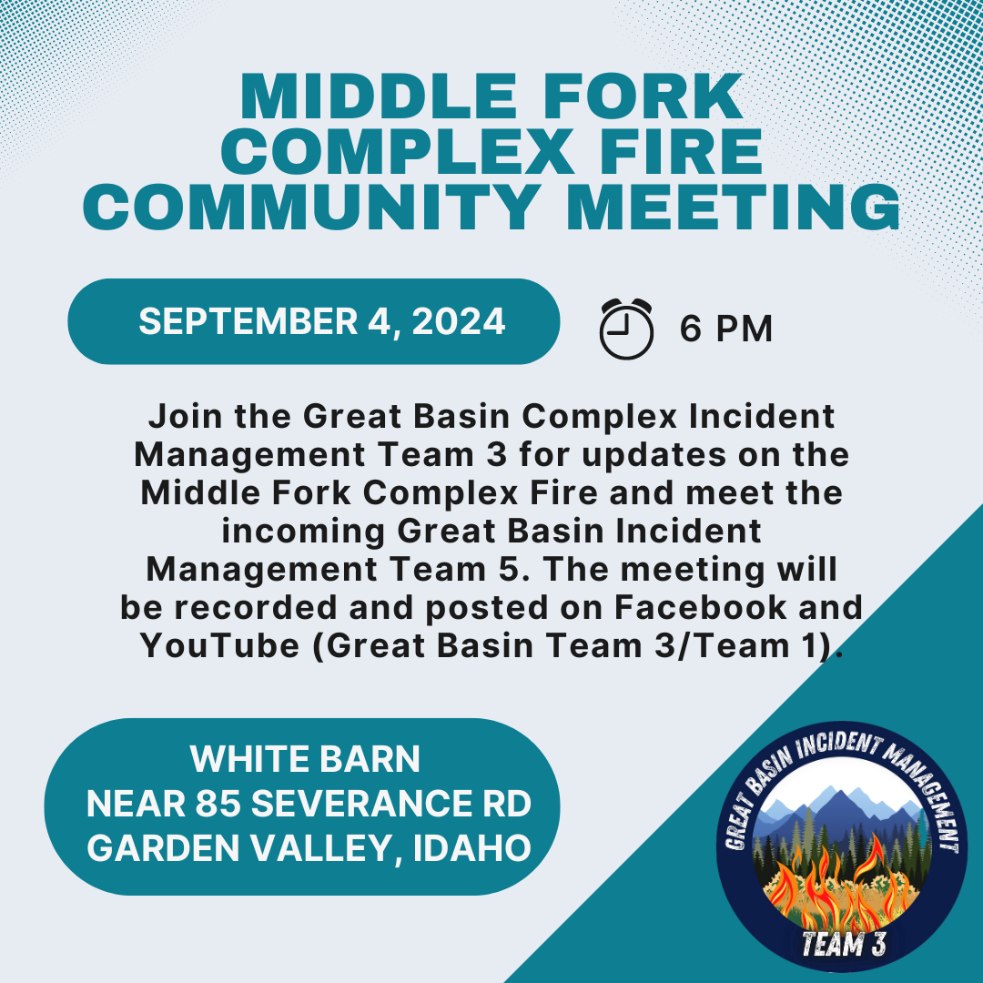
Community Meeting for 09 03 2024
Related Incident:
Publication Type: Announcement
Please join Great Basin Complex Incident Management Team 3 for updates on the Middle Fork Complex Fire tomorrow, and meet the incoming Great Basin Complex Incident Management Team 5. We will be holding the meeting at 6:00 PM at the White Barn: 85 Severence road Garden Valley, Idaho.
West Mountain Fires Daily Update 09 03 2024
Related Incident: Boulder FireDollar Fire
Publication Type: News
September 3, 2024
Fire Information Phone Line: 208-462-0345 (8 a.m. - 8 p.m.) Email: 2024.Boulder.id@firenet.gov
QUICK FACTS
Fire Location Size Containment Assigned Personnel Inciweb link
Boulder 9 miles SW of Cascade 2,868 acres 36% 401 https://tinyurl.com/ycdfv3tv
Snag 11 miles E of Cascade 31,809 acres 1% 425 https://tinyurl.com/4k9dk3mu
Dollar 18 miles NE of Cascade 4,010 acres 0% 61 https://tinyurl.com/bef6r3tz
Goat 11 miles SE of Cascade 3,265 acres 0% 124 https://tinyurl.com/2h4a3dvr
Cause: Lightning (All Fires) Total Incident Personnel: 1,011
Weather | Anticipated Fire Behavior:
Yesterday was another active day on all four of the West Mountain fires. Today, there is a possibility of scattered showers and thunderstorms, with 25 mile per hour winds shifting from southwest to northwest over the day. With increased cloud cover, temperatures will be cooler and relative humidity higher than yesterday. Skies clear overnight, with cooler temperatures and increased relative humidity recovery. Fire behavior is expected to moderate with weather.
- Army crews from the 14th Brigade Engineer Battalion based at Joint Base Lewis McChord are currently assisting with suppression efforts on the West Mountain Fires as well as assisting with adjacent wildfires in the area.
Boulder Fire: Evacuation orders are in effect. Learn more at Boulder Fire | Inciweb.
- The Boulder Fire progressed to the east and west in the Olson Creek drainage yesterday, as well as toward Blue Lake. Firefighters with four Army crews created indirect containment line to tie in with Forest Road 446 on National Forest System lands between the fire and residential areas, and structure assessment was initiated in the Willow Creek subdivision. Scoopers and Type 1 helicopters were used to slow the fire’s progression.
- Today, indirect line construction will continue using hand crews and heavy equipment from Forest Road 404 to 464. Aviation resources will be used again today, depending on weather conditions and aircraft availability.
- Fire managers coordinated with the Valley County Office of Emergency Management and the Valley County Sheriff’s Office to establish evacuation zones, including four zones in “go” status and two in “set” status.
Dollar Fire:
- Two Army crews supported firefighting efforts on the Dollar Fire yesterday.
- Firefighters completed a 5-acre burnout operation yesterday evening along the fire’s southwestern edge, where increased fire behavior threatened containment lines. They continue to mop up and patrol the area today.
Snag Fire:
- Yesterday, at the fire’s north end, crews continued to patrol and mop up hot spots along the Warm Lake Road, making the road safe for travel. The powerline was re-energized yesterday. Warm Lake Road will open today with one lane of traffic and a pilot car for residents of the Yellow Pine and Warm Lake areas.
- The Snag Fire grew slowly along its eastern flank yesterday, moving into previously burned areas where minimal fuels will help limit fire growth. A strike team of engine crews is beginning to assess structure needs for fuels mitigation and placement of sprinklers, hoses, and pumps in the Warm Lake area.
- Along the fire’s southern edge, crews mopped up and patrolled along Forest Road 409, keeping fire north of the road, and they were able to contain three spot fires south of the road yesterday. This activity continues today.
- Firefighters, along with four Army crews, continue to secure and mop up along the fire’s western flank.
Goat Fire:
- There was minimal growth along the southern edge of the Goat Fire yesterday.
- Crews continue preparing Forest Service Trail 099 as a holding feature and will continue to assess the need to fire from trail 099 either to the north or south of the fire if it approaches the trail at the top of the ridge.
Smoke: Find air quality and smoke information at: www.wildlandfiresmoke.net and www.airnow.gov/air-quality-and-health
Middle Fork Complex Fire Update for Tuesday 09 03 2024
Related Incident:
Publication Type: News
Fire Size: 56,806 Acres
Completion:14%
Resources: 919
Weather and Fire Behavior:
There is a 20 - 30% chance of showers in the morning, with unstable conditions throughout the afternoon. A front will pass through around 6:00 p.m., causing winds to switch to the northwest. Temperatures will be cooler with increasing humidity. Fire behavior is expected to remain moderated, with a chance of increased fire behavior due to winds arriving with the cold front.
Operations:
Crews continue to add black line along the western edge of the Bulldog Fire, and hope to have continuous containment on this side in the near future. Work continues on the indirect containment line that crews are building towards the Rattlesnake trail system. Firefighters will focus on road improvements and handline in the Silver Creek area today.
Mop up continues on the west side of the Nellie fire, while the Highway 17 corridor remains quiet, with patrols continuing throughout the day. Road improvements and the removal of dead trees, hazardous trees, also referred to as snags, are the focus on Forest Road 555.
Crews will focus on mop up operations on the southwest side of the Deadwood Reservoir. On the east side of the reservoir, firefighters are working to prevent the fire from moving further north. A direct line is being constructed from the reservoir to Wilson Creek. Firefighters will begin mop up operations today between the reservoir and the Bearskin fire scar. Military crews are removing brush and limbing trees along roads on the north side of the reservoir.
Today, firefighters will work to protect the White Hawk Mountain Lookout and Scott Mountain Lookout. They will start to make preparations to keep these lookouts safe.
Four helicopters remain on the fire with plans to start flight operations after 10:00 am this morning, if conditions allow.
Closures:
The Boise National Forest has issued Order Number 0402-06-60, effective August 23, 2024. Highway 21 is closed from the Sourdough Lodge in Lowman to Stanley (MP 84 to 130) due to wildfire activity. Only local traffic is permitted between the Sourdough Lodge and Warm Springs Airstrip. For additional information, visit https://511.idaho.gov/
Temporary Flight Restrictions (TFR):
A TFR is in effect over the fire area. It is illegal for the public to fly drones over or near wildfires due to the risk of accidents and interference with firefighting efforts.
Sharrott Creek Fire Daily Update 09 03 2024
Related Incident:
Publication Type: News
Northern Rockies Team 3, Incident Commander Mike Behrens
Location: Three miles west of Stevensville, Montana in Ravalli County
Start Date: 8/23/2024
Cause: Lightning
Size: 2,399 Acres
Completion/Containment: 3 percent
Resources assigned: 626 people
No infrared flight was available overnight due to smoke coverage, therefore acreage was not updated.
Current Status
Fire established in the head of Larson Creek on the northern boundary. Firefighters worked to hold and secure existing control lines during the passing cold front. Water dropped from the heavy helicopters helped crews catch a spot fire and cooled the fire edge. Additional resources are assigned today to continue holding and securing lines.
On the east side, crews dug hand line around a spot on the northeast corner yesterday, assisted by water from air resources. They will continue cleaning and mopping up the burnout on the dozer line along the Forest boundary.
On the south edge, the fire spotted onto the north slopes in upper McCalla Creek yesterday. Firefighters and helicopters worked most of the evening to curb fire progression. Crews on the night shift worked hard to hold the fire in its current footprint. Further south, more dozer line was completed and today firefighters will continue to construct and improve direct and indirect control lines using heavy equipment and hand crews. Yesterday crews connected existing roads together with dozer and hand lines to create a secondary control line south of the fire. Firing may occur as conditions allow today, as resources will work take advantage of cooler weather and build direct line.
Significant fire growth occurred on the west side of the fire with strong winds from the passing cold front.
Structure protection resources are staging in nearby neighborhoods during the day to respond to fire activity. Night shift resources will work on the southern, eastern and northern edges and patrol affected neighborhoods. They also have initial attack responsibilities. Aviation resources will check fire spread and support firefighters as smoke allows.
Weather and Fire Behavior
The fire experienced a trace of rain overnight. Temperatures will be in the mid-70s over the fire. Intermittent thunderstorms are expected with the chance of wetting rain and stronger outflow winds. Winds are expected to be generally west at 16 mph. Decreased fire behavior is expected.
SMOKE
For the current smoke reports, visit https://www.airnow.gov/
EVACUATIONS, RESTRICTIONS, CLOSURES
The Ravalli County Sheriff’s Office has updated evacuation orders and warnings for neighborhoods in the vicinity of the Sharrott Creek Fire. Download the Ravalli Co. Sheriff’s Office app for information. Evacuation questions can be directed to the Ravalli County Emergency Operations Center at 406-375-6650. The Bitterroot National Forest has issued an area closure from North Fork Sweeney Creek to Sweathouse Creek. See https://tinyurl.com/Sharrottclosure for the order and map. There are temporary flight restrictions (TFR) over the fire area west of Highway 93 from Bass Creek to Big Creek.