
Evacuation Orders for Little East Fork in Johnson Fire area 09 01 2024
Related Incident:
Publication Type: Announcement
Johnson Fire Forces Evacuation Orders on Little East Fork Road
Ravalli County Sheriff Steve Holton said that residents on Little East Fork Road were issued Evacuation Orders due to fire growth and activity of the Johnson Fire. The orders only apply to the residents of Little East Fork Road. There are no other evacuation warnings or orders in effect for the Johnson Fire at this time.
For more information on the Johnson Fire, please use the number or links below.
Contact Fire Information: 406-401-0286 or 2024.johnson@firenet.gov
Facebook: https://www.facebook.com/NevadaTeam1
Or https://www.facebook.com/DiscoverBitterrootNF
InciWeb: https://inciweb.wildfire.gov/incident.../mtbrf-johnson-fire
Diamond Complex and Middle Fork Fires Daily Update for August 31 2024 08 31 2024
Related Incident: Middle Fork Fire
Publication Type: News
Diamond Complex
- Size: 11,138 acres
- Containment: 78%
- Personnel: 1, 133
- Location: 18 miles SW of Chemult, OR
- Start Date: July 19, 2024
- Cause: Undetermined
Middle Fork Fire
- Size: 5,282 acres
- Containment: 46%
- Personnel: 75
- Location: Crater Lake National Park
- Start Date: July 17, 2024
- Cause: Undetermined
Current Situation
Today at 7 a.m. the Southern Area Gold Complex Incident Management Team assumed management of the Diamond Complex and the Middle Fork Fire under the leadership of Incident Commander Debbie Beard. The Gold Team is grateful to California Interagency Incident Management Team 4, cooperators, collaborators and the community for supporting the firefighters.
Heavy traffic is expected throughout the Labor Day holiday weekend. Please be careful when driving in the area.
Middle Fork Fire
Firefighters are suppressing interior heat and working on the north and west sides of the fire to secure and tie in firelines using minimum impact suppression tactics that decrease the fire’s long-term effects. Firefighters are also continuing suppression activities on the fire’s east and south sides where some heat remains. Where possible, crews will repair areas disturbed by wildfire suppression operations. Yesterday, crews removed hazard trees that posed a threat to firefighter and public safety along the 230 Road and the North Entrance Road in Crater Lake National Park. That work has been suspended until Tuesday in anticipation of holiday traffic.
The North Entrance of Crater National Park will be open today through 6 a.m. on Tuesday September 3. The park remains open.
Diamond Complex
- Pine Bench Fire (north of Hwy 138 near Dry Creek, 3,973 acres, 65% contained): Firefighters are securing fireline on the south and west edge and monitoring the north side of the fire. Aviation will support firefighters with water drops as needed. Crews will be patrolling and mopping up on the fire’s eastern edge.
- Potter Fire (north of Hwy 138, 2 miles southeast of Potter Mountain, 3,428 acres, 38% contained): Helicopters dropped water on hot spots on the fire’s south side yesterday. Firefighters continue to secure the eastern edge of the fire, especially near the water flume, although steep terrain, heavy timber and snags are making work difficult. Aviation will support firefighters with water drops as needed. On the north side of the fire, firefighters are making sure the fireline is cold and repairing areas disturbed by wildfire suppression operations. Crews are cleaning up contingency lines and roads.
- Lemolo Fire (north of Lemolo Lake, 1,246 acres, 100% contained): Firefighters found some rekindling fire due to dropping needles and are blowing them off the fireline to keep it secure.
- Multiple fires near the center of the complex: Infrared maps show a lot of heat that firefighters will assess and secure today. Crews will continue using water to eliminate heat and clean up needle cast.
Weather and Fire Behavior
The trend of very dry, hot weather continues today. Relative humidity will fall to 10% in valleys and 15% on ridgetops this afternoon. High temperatures expected in the upper 80s to low 90s for valleys and mid- to upper 80s for ridgelines. Some moisture and instability in the upper atmosphere arrive today with clouds building but rain is not expected. Winds will be southwesterly with gusts up to 18 mph along ridgetops.
Fire potential has increased after several solid drying days. Fire behavior may include some active flames and torching, but the fire will mostly smolder and creep. Dry lighting and gusty winds are expected Sunday. Monday brings a better chance of showers.
Smoke Outlook
Local smoke production has increased from the active fires yesterday. Smoke from Idaho fires also contributed to the degrading of air quality in Oregon. For more detailed information, please visit outlooks.airfire.org/outlook. Current air quality information is available at fire.airnow.gov.
Evacuations
As of August 23, 2024, the Douglas County Sheriff’s Office has cancelled evacuation orders for all areas.
Forest Closure
Please note that all Umpqua National Forest Ranger Stations are closed on Monday, Sept. 2, in observance of Labor Day.
On August 30, 2024, the Umpqua National Forest decreased Public Use Restrictions (PURs) to Level 2. The forest remains in High Fire Danger and Industrial Fire Precaution Levels are at Level 2. For more information, visit https://www.fs.usda.gov/detail/umpqua/news-events/?cid=FSEPRD1202470.
On August 27, 2024, the Umpqua National Forest issued an updated closure order, allowing increased access to specific roads, trails and campgrounds. These are listed as exemptions in Forest Order 06-15-24-07. For more information, visit https://www.fs.usda.gov/detail/umpqua/news-events/?cid=FSEPRD1202210.
The Rogue River-Siskiyou National Forest has issued a closure for the area north and west of Crater Lake National Park along Highway 230 south to the intersection with Highway 62. See the closure order and map at https://www.fs.usda.gov/alerts/rogue-siskiyou/alerts-notices.
Park Closure
The Crater Lake National Park remains open. However, Crater Lake National Park has several closures in effect. For details, visit https://www.nps.gov/crla/planyourvisit/conditions.htm.
The north entrance to Crater Lake National Park will be open Saturday, August 31 through 6 a.m. Tuesday, September 3, 2024. Fire operations may necessitate temporary closures or delays along the North Entrance Road.
Traffic at park entrances will be busier than usual throughout the holiday weekend. Long lines and waits of up to 2 hours are expected at both entrance stations. Arriving before 10 a.m. or after 3 p.m. may reduce wait times. If the park is not your destination, please consider avoiding Highway 62 and taking an alternative route.
Beginning at 6 a.m. Tuesday, September 3, and continuing until further notice, the North Entrance will be closed to all traffic to allow hazard reduction work related to the Middle Fork Fire to resume. During this time, access to the park will be limited to the South Entrance. We recommend checking the latest conditions and road status before your visit to ensure a smooth and enjoyable experience. Updates will be available on the park website at https://www.nps.gov/crla and on Oregon Tripcheck at https://www.tripcheck.com.
REMINDER: The Pacific Crest Trail between the Lightning Springs and Rim Trail Intersections, Bald Crater Loop, Bert Creek and Boundary Springs Trails are closed until further notice due to potentially hazardous conditions created by the Middle Fork Fire. Hikers and bikers may not use the North Entrance Road to enter or leave Crater Lake National Park.
Temporary flight restrictions (TFRs)
TFRs are in place over the Middle Fork Fire https://tfr.faa.gov/save_pages/detail_4_8387.html (6 a.m. to 9 a.m. local time to accommodate uncrewed aircraft systems work) and https://tfr.faa.gov/save_pages/detail_4_7055.html (9 a.m. to 8 p.m. local time) and over the Potter and Pine Bench Fires https://tfr.faa.gov/save_pages/detail_4_7055.html (9 a.m. to 8 p.m. local time).
August 31 2024 Red Fire Daily Update 08 31 2024
Related Incident: Red Fire
Publication Type: News
Size: 784 acres Location: 5 miles west of Crescent Lake Junction, OR County: Klamath
Start Date: July 17, 2024 Cause: Lightning Containment: 0% Total Personnel: 134
Activities – The section of shaded fuel break between Crescent Lake and Summit Lake continues to progress well and is anticipated to be complete by September 7. The bulk of the work remaining along the final portion of shaded fuel break is slash removal being accomplished by local contractors with equipment and log trucks. Structure protection equipment remains in place along Crescent Lake and is being tested periodically. A 1.5-mile hose lay remains in place along the Whitefish Creek Trail on the southern edge of the fire to check fire spread as it approaches the trail.
Weather, Fire Behavior, and Smoke – Warmer and drier conditions persist across the fire area Saturday under clear skies. Continued warming and drying is expected though Sunday followed by a slight cool down until Wednesday, September 4 before another warming and drying trend sets in late next week. Isolated thunderstorms may impact the fire area Sunday into Monday bringing the potential for outflow winds and new fire starts. Fire behavior has increased due to warmer temperatures and low relative humidity, single and group tree torching is being observed. Smoke production has increased daily and is expected to increase today through the weekend. Depending on weather conditions, fire season often lasts through September into early October.
Incident Strategy – A full suppression strategy is being implemented utilizing indirect tactics, shaded fuel breaks, structure protection equipment, trail, and hose lay. Firefighter and public safety remain the incident management team’s highest priority in managing this fire. Expect to see increased fire activity due to the warmer and dryer conditions.
Closures – To provide for the safety of firefighters, equipment operators, and the public, the Deschutes National Forest emergency closure around Crescent Lake and in the Diamond Peak Wilderness is still in effect, including these areas: Forest Service Road 60 is closed, and road guards have been posted for public safety. More closure information is available at: https://www.fsa.gov/alerts/deschutes/alerts-notices/?aid=89091
Evacuations – The WILDFIRE! Level 1 – BE READY to Evacuate notice issued by Klamath County Emergency Management for Crescent Lake, Odell Lake, and Crescent Junction areas remains in effect (INCENDIO FORESTAL! Nivel 1 - ESTÉ PREPARADO para evacuar de las siguientes zonas: Crescent Lake, Odell Lake, Crescent Junction). Visit www.klamathcounty.org/300/emergency-management for more information or to sign up for alerts.
Fire Restrictions – Stage 2 Public Use Fire Restrictions – which prohibit open fires, including in developed campgrounds – remain in effect for the Deschutes National Forest. The Industrial Fire Precaution Level is currently Level III “Partial Shutdown.” Visit fs.usda.gov/detail/deschutes/home/?cid=stelprdb5297376 for more information.
Drone Restrictions – Aerial firefighting is suspended when unauthorized drones are in the area. Unauthorized drone use over a fire area poses serious risks to fire personnel and the effectiveness of wildfire suppression operations. If you fly, we can’t.
Actualizacin del incendio Whisky Creek Sandstone y Blister Creek 08 31 2024
Related Incident: Whisky Creek FireSandstone Fire
Publication Type: News
Tamaño de Whisky Creek: 2,085 acres |Fecha de inicio: 20 de julio |Causa: De orígen humano |Contención 24%
Tamaño de Sandstone: 702 acres | Fecha de inicio: 5 de agosto | Causa: Rayo | Contención 75%
Total de recursos: 536 | Equipos de obreros: 7 | Camiones de bomberos: 7 | Topadoras: 1 | Maquinarias pesadas: 11 | Helicópteros: 4
Sigue el trabajo de extinción en el incendio Whisky Creek, a 6 millas al sureste de Cascade Locks, Oregón, y en los incendios de Sandstone y Blister Creek, a 9 millas al suroeste de Ripplebrook, Oregón. Estos arden en un terreno escarpado y accidentado en el Bosque Nacional Mt. Hood, donde los escombros rodantes y los árboles debilitados por el fuego dificultan el trabajo de extinción. La seguridad de los bomberos y la del público siguen siendo la principal prioridad.
Este fin de semana del Día del Trabajo, por favor ayude a prevenir incendios forestales y proteja a los bomberos al recrear de manera responsable, respetando los cierres de incendios y cumpliendo con todas las restricciones vigentes contra incendios.
Bomberos, camiones de bomberos y otros recursos en los incendios Whisky Creek y Sandstone están listos si es necesario para ayudar a las agencias locales de administración de tierras para el ataque inicial de fuegos nuevos en el área.
Whisky Creek: Sigue habiendo un poco de humo en el East Fork de Herman Creek debido a los combustibles que arden. Una evaluación de las tierras no observó ninguna actividad significativa de incendios a lo largo de las laderas norte y noreste. Esta menor intensidad del fuego permite que los asesores de recursos locales evalúen las condiciones del campo e identifiquen las reparaciones complejas que se necesitan una vez que terminen los trabajos de extinción. Se hizo una reparación pequeña en la carretera de servicio forestal (FSR) 2810, mientras que se planea terminar el trabajo de reparación que queda. Continúa el patrullaje a lo largo de la línea de contención al esta hasta Green Point Mountain, complementado por un vuelo de reconocimiento aéreo ayer. Continuarán las reparaciones a lo largo del sendero 409 Trail, mientras que siguen en marcha las reparaciones no mecánicas a lo largo del camino forestal 2080 cerca del límite del área de naturalez.
Sandstone y Blister Creek: Ya que no se observó ninguna actividad de incendio, no se tuvo que verter agua ayer en el incendio Blister Creek. El trabajo de nivelación y astillado continúa a lo largo del camino forestal 7010-630, y ya se terminó la trituración en el camino forestal 7015 y el astillado a lo largo del camino forestal 4620. Mañana llegará un sistema aéreo no tripulado (UAS, por sus siglas en inglés) con capacidad de mapeo infrarrojo para mapear el calor restante en áreas inaccesibles y de difícil acceso, para minimizar los riesgos a los bomberos debido a los acantilados muy empinados del incendio Blister Creek.
Clima y humo: El día de hoy resultará en las temperaturas más altas del incidente, con máximas casi a los 90 grados a lo largo de las crestas y bajos 90 en los valles. Aumentará la probabilidad de que el humo y la combustión se desplacen en las áreas de incendios debido a la menor humedad relativa, la débil recuperación durante la noche y los cambios de viento durante el día. Sin embargo, las condiciones de calidad del aire siguen siendo buenas para ambas zonas de incendios.
Cierres: Información sobre el cierre del Bosque Nacional Mt. Hood y el Área Escénica Nacional del Río Columbia se puede encontrar en escaneando el código QR o siguiendo el enlace en la esquina inferior derecha de la página. Los cierres se implementarn para la seguridad del público y de los equipos de bomberos.
Seguridad: El público juega un papel importante en la prevención del próximo incendio forestal. Tenga cuidado con cualquier fuente de ignición. Para obtener consejos de prevención, visite, https://keeporegongreen.org. Hay restricciones contra incendios dentro del Bosque Nacional Mt. Hood. Se puede ver más información en https://www.fs.usda.gov/main/mthood/fire.
Southwest Team 2 Informational Video 08 31 2024
Related Incident: Park Fire
Publication Type: Announcement
Click on the folowwing link to watch today's informational video...
Miners Complex Daily Update 08 31 2024
Related Incident: Miners Complex Fires
Publication Type: Announcement
11:00 AM, August 31, 2024
Estimated size: 1,098 acres
Start Date/Time: July 17, 2024
Area of Origin: 21 air miles east of Darrington WA
Cause: Lightning
Fuels/Topography: timber, rugged terrain
Structures Damaged: None, there are no homes threatened at this time.
Evacuations: None
The Miners Complex consists of eight wildfires caused by lightning strikes in the Mt. Baker-Snoqualmie National Forest. The fires included in the complex are Miners Fire, Vista Ridge Fire, Dolly Creek Fire, Sulphur Three Fire, Sulphur Four Fire, Sulphur Thirty-Four Fire, Plummer, and Middle Ridge Fire.
Update: Firefighter crews continue patrols of the Miners Complex along with accompanying rehab work. The helicopter flew a fire crew into Canyon Creek, where they were able to secure a portion of the Sulphur Three Fire that is closest to the Suiattle River Trail which continues the point protect strategy for the Canyon Creek suspension bridge.
Weather: Low level offshore flow into Sunday will result in critical RH values in the afternoon and evening hours this weekend. Low level flow turning onshore late Sunday. Around daytime temperature around 88°F with east winds 6 to 8 mph in the morning becoming light, then becoming northwest 6 to 7 mph late in the afternoon.
Smoke: For more information on smoke and air quality please visit: https://wasmoke.blogspot.com/
Closures: The following is a summary of the areas closed due to the fires in the Miners Complex: Pacific Crest National Scenic Trail #2000.2 from Mica Lake to Suiattle Pass, Suiattle River Trail #784, Miners Ridge Trail #785, Buck Creek Pass Trail #789, Miners Cabin Trail #795, Grassy Point Trail #788, Sulphur Mountain Trail #794, Sulphur Creek Trail #793, Sulphur Creek Campground, Sulphur Creek Trailhead, and the Downey Creek trailhead. Suiattle River Road, closure beginning at Downey Creek trailhead. The full Closure Orders visit: https://www.fs.usda.gov/mbs Forest Restrictions: The Mt. Baker-Snoqualmie has lifted the full campfire ban and forest-wide shooting restrictions, effective 8/28/2024. Additional details at: www.fs.usda.gov/mbs
###
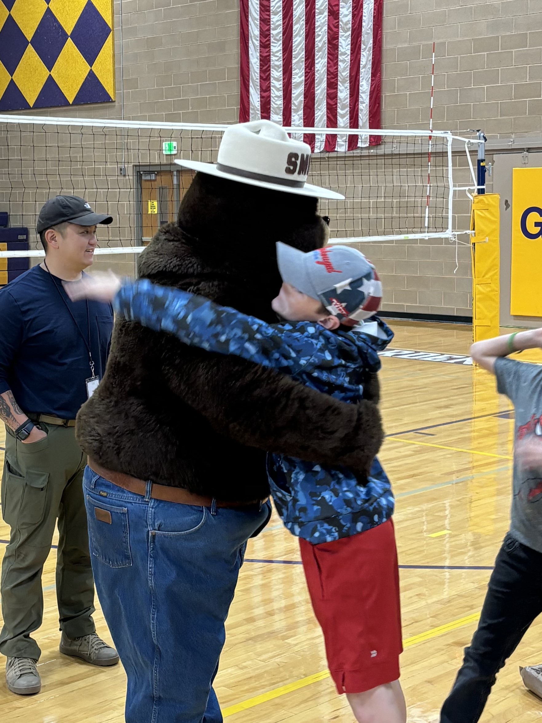
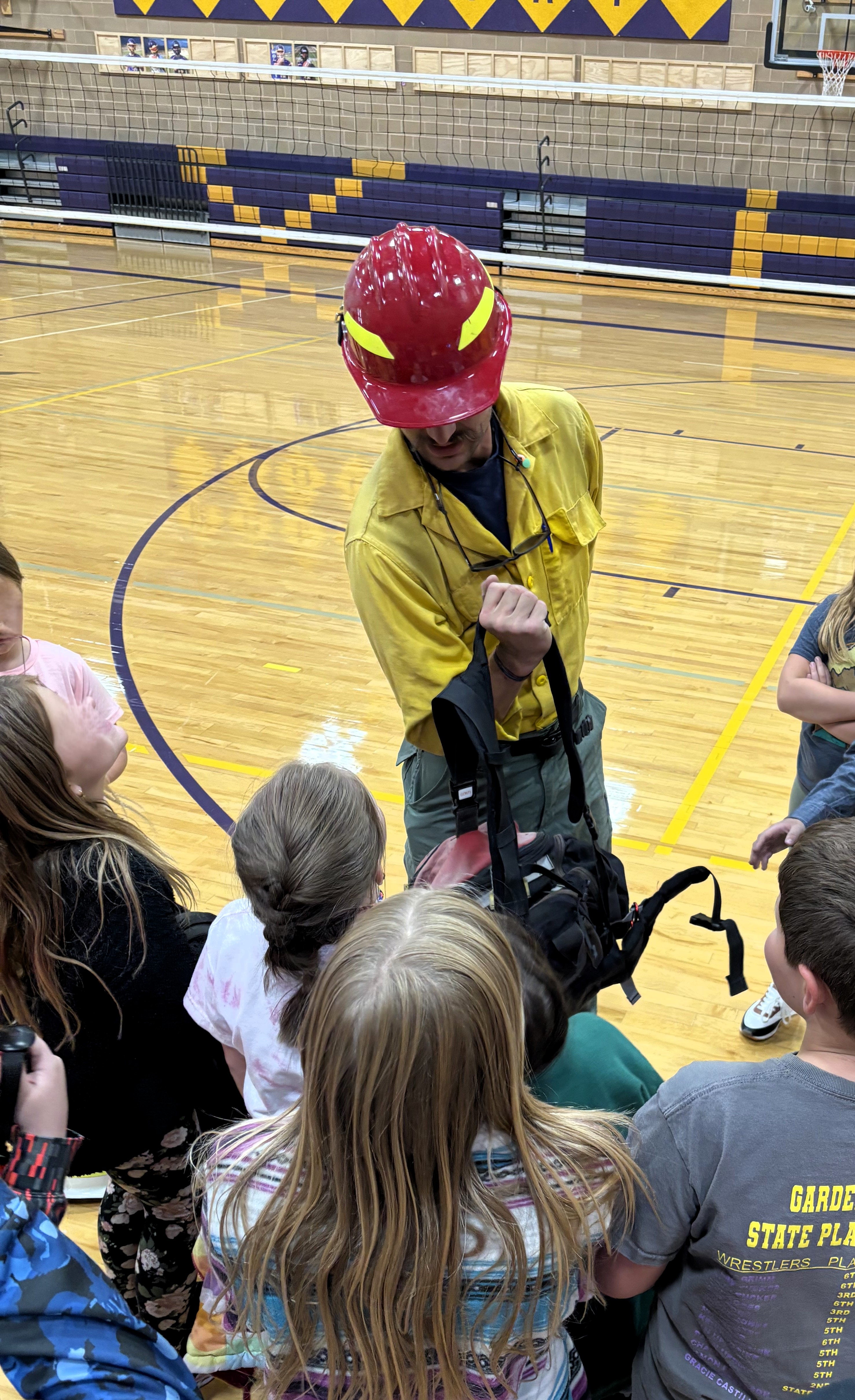
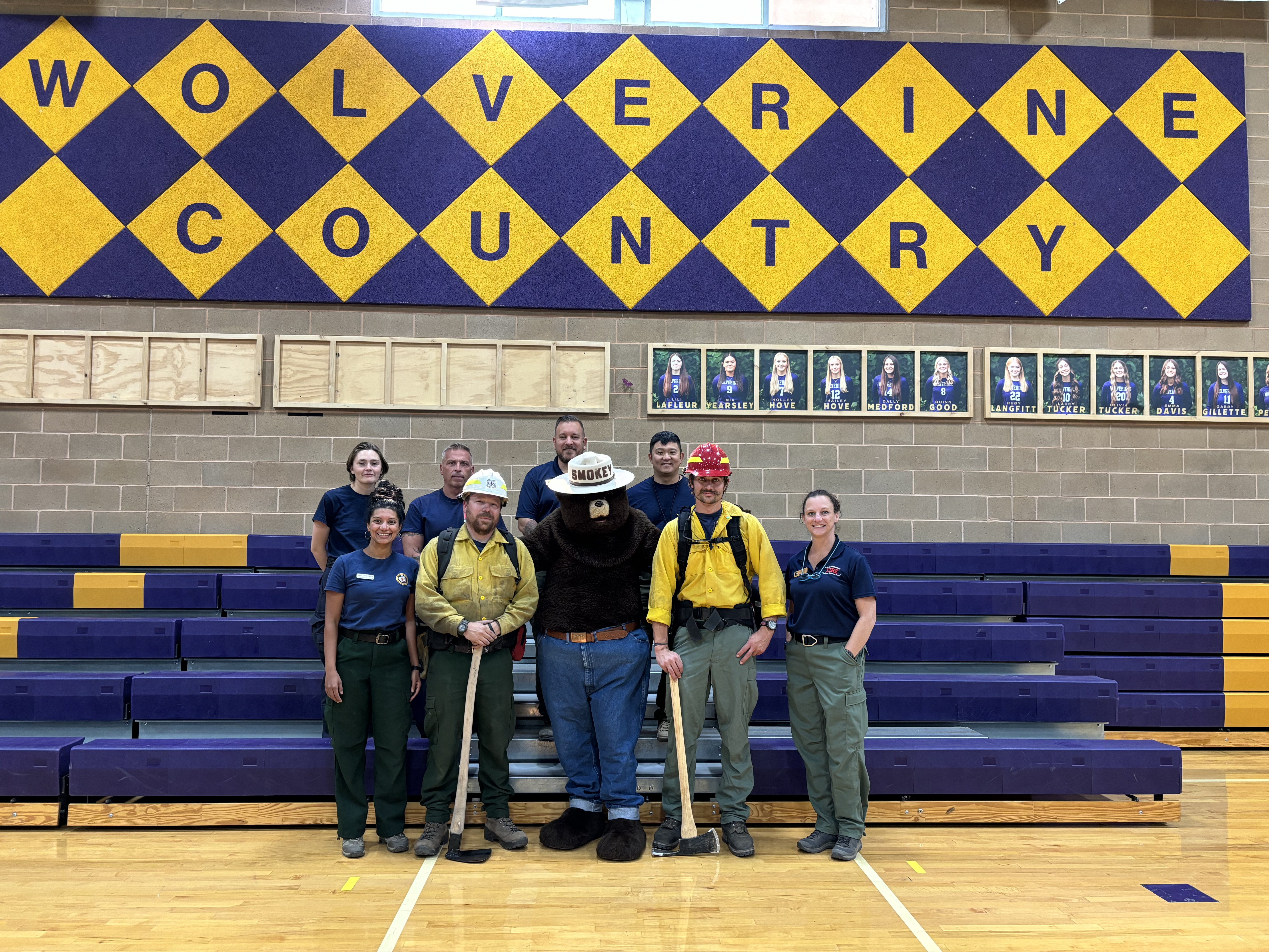
Educational Sparks Ignite at Garden Valley School 08 31 2024
Related Incident:
Publication Type: News
On Thursday, August 29, the Middle Fork Complex Fire’s Public Information Officers had an exciting opportunity to visit Garden Valley School in Garden Valley, Idaho, and chat with students from Kindergarten through Grade 12. The day was split into two energetic assemblies—one for the Kindergarten through Grade 5 group (elementary) and one for the Grade 6 through Grade 12 group (middle and high school).
For the younger students, the fire triangle—heat, oxygen, and fuel—was the star of the show. The officers demonstrated how these elements work together to create a fire and what happens when you take one element away. The real highlight, though, was when Smokey Bear made a surprise appearance, escorted by Fire Chief Paul Cleaveland. The kids were thrilled! As they left, a 5th-grade class passed on heartfelt letters thanking the firefighters. These letters are heading to camp and other places to spread the gratitude!
The middle and high school students had their turn to dive into the world of wildland firefighting. Sheena Waters shared her journey from firefighter to Branch Operations Director on the Middle Fork Complex, while Scott Brandt talked about his role as a Fisheries Biologist protecting everything from cultural and historic sites to rare plants and animals during wildfires. The students were engaged and eager to learn, wrapping up with a lively Q&A session that kept everyone on their toes.
A big shoutout to Garden Valley School for hosting such a fantastic day and to Stephanie Patota (Emmett District Visitor Information Assistant) and Andrew Hostad (Boise National Forest Fire Prevention) for their help in making the assemblies a blast!
Check out some pictures from the event:
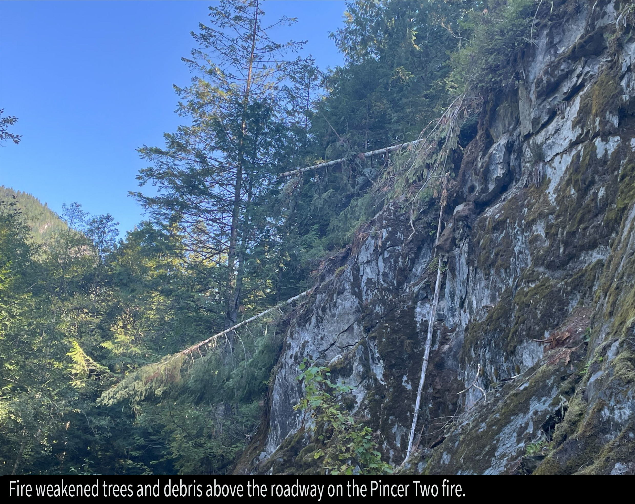
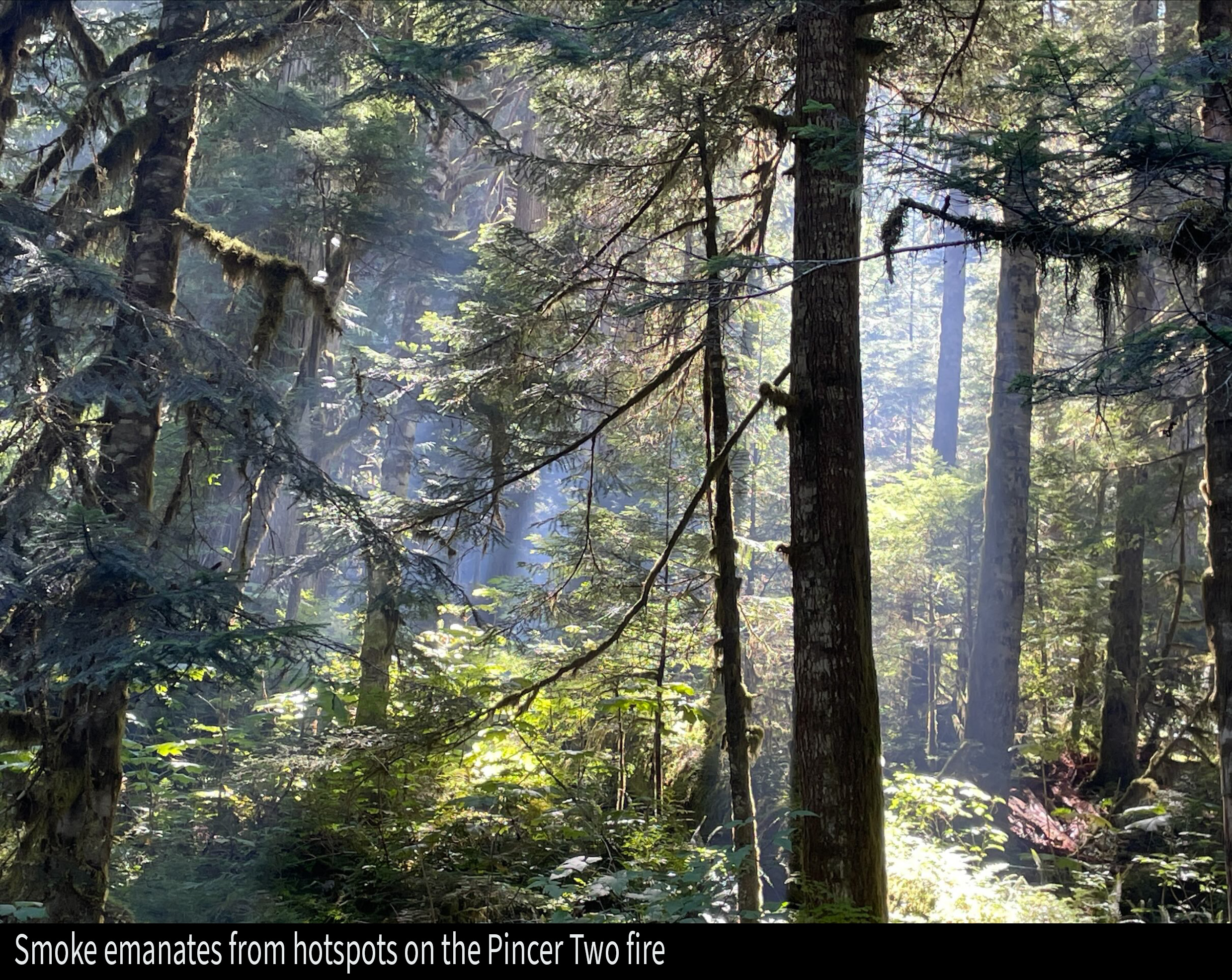
Pincer Two Fire Daily Update 08 31 2024
Related Incident: Pincer Two Fire
Publication Type: Announcement
11:00 AM, August 31, 2024
Estimated size: 211 acres
Start Date/Time: July 17, 2024
Area of Origin: Johannesburg Mountain. 1 Mile East of Mineral Park C.G.
Cause: Lightning
Fuels/Topography: Timber, rugged terrain
Structures Damaged: None, there are no homes threatened at this time.
Evacuations: None
Closures: Cascade River Road at and including Marble Creek Campground, Mineral Park Campground, and all tributary roads, trailheads, and trails are all closed. The public is not to enter the area for public and firefighter safety.
Full closure orders available at: https://www.fs.usda.gov/mbs
Update: Firefighter crews continue patrols of the Pincer Two along the Cascade River Road and Forest Road 1590, with accompanying rehab work. Recon flights will continue through the holiday weekend along with engine crew patrols as the warming weather trend continues.
Weather: Low level offshore flow into Sunday will result in critical RH values in the afternoon and evening hours this weekend. Low level flow turning onshore late Sunday. Around daytime temperature around 88°F with east winds 6 to 8 mph in the morning becoming light, then becoming northwest 6 to 7 mph late in the afternoon.
Smoke: For more information on smoke and air quality please visit: https://wasmoke.blogspot.com/
Air Space Restrictions: There are no air space restrictions at this time.
Forest Restrictions: The Mt. Baker-Snoqualmie has lifted the full campfire ban and forest-wide shooting restrictions, effective 8/28/2024. Additional details at: www.fs.usda.gov/mbs
###
Willamette Complex South Daily Update for Saturday 08 31 2024
Related Incident: Willamette Complex Fires - South
Publication Type: News
Willamette Complex South Update
Chalk, Coffeepot, McKinley, Moss Mountain, Tire Mountain, 208, and 217 Fires
Online: https://inciweb.wildfire.gov/incident-information/orwif-willamette-complex-fires-south
Facebook: https://www.facebook.com/WillametteComplexFires/
Email: 2024.willamettecomplex@firenet.gov
Fire Information Line: 541-208-1742
Saturday, August 31, 2024
Total Willamette Complex South Personnel: 622
Total Willamette Complex South Acres: 13,169
Resources (Includes Pyramid Fire Resources): 1 Type 1 Hotshot crew, 7 Type 2 crews, 3 Type 2 initial attack crews, 4 helicopters, 17 engines, 5 dozers, 150 heavy equipment (masticators, skid steers, feller bunchers, etc.)
Fire Cause: Lightning
Summary
With warmer, drier weather, some smoke was seen on Friday as smoldering heavy fuels flared up in interior areas of the fires. Helicopters made numerous water drops, assisting firefighters on the ground to check the spread of latent heat sources. The total incident acreage increased slightly as the fire crept through previously unburned interior pockets. Still, there was no additional outward spread on any of the fires in the complex. The focus remains on improving indirect firelines and contingency lines and preventing residual hot spots from spreading.
Chalk Fire (5,774 acres, 66% containment)
Patrolling continues on completed containment lines on the fire's north, east, and south sides. Crews are progressing with grading and brushing the Forest Service Road 1824 west of the fire and on other surrounding roads, improving their value as contingency lines.
Moss Mountain Fire (874 acres, 0% containment)
Firefighters worked on the east and north sides of the fire Friday, getting water on hot spots using a hose lay, supplemented by helicopter bucket drops. Today’s focus will be on reinforcing indirect lines, especially along the fire’s west edge where several hot spots remain, and uphill fire runs and torching remain possible.
208 Fire (255 acres, 0% containment)
Monitoring continues using aircraft. Ground crews keep working to improve contingency lines surrounding the fire. Helicopter water drops will be used when feasible on emerging hot spots.
217 Fire (38 acres, 100% contained), Tire Mountain Fire (23 acres, 100% contained), McKinley Creek Fire (24 acres, 100% contained), Coffeepot Fire (6,181 acres, 100% contained)
These fires remain in monitor/patrol status. Mop-up continues on the Coffeepot Fire, as scattered hot spots remain. Helicopters may drop water on hot spots as necessary to keep these fires reined in.
Weather and Fire Behavior
Humidities have remained low and temperatures high the past two nights, accelerating drying of heavy fuels after the recent rains. Relative humidities stayed in the teens most of Friday. Today will bring one more day of hot, dry weather before a weak storm system sends cooler, more humid conditions Sunday through Tuesday. Chances for precipitation from that system are low. Warmer, drier weather returns on Wednesday and Thursday.
Closures and Fire Restrictions
- For specific closure information, visit tinyurl.com/WillFireClosures2024
- For current fire restrictions, visit tinyurl.com/WillFireRestrictions2024
- Temporary Flight Restrictions (TFR): tfr.faa.gov for up-to-date areas. Wildfires are a no-fly zone for unauthorized aircraft, including drones. For more information, visit knowbeforeyoufly.org.
Johnson Fire Area Closure 09 05 2024
Related Incident:
Publication Type: Closures
U.S. Department of Agriculture, U.S. Forest Service
Bitterroot National Forest
Darby-Sula Ranger District
JOHNSON FIRE AREA CLOSURE
PROHIBITIONS
Pursuant to 16 U.S.C. § 551 and 36 C.F.R. § 261.50 (a) and (b), the following is prohibited on National Forest System (NFS) land area, including roads, trails & developed recreation sites on the Darby-Sula Ranger District, Bitterroot National Forest, described below and shown on the attached map incorporated into this Order as “Exhibit A”.
1. Going into or being upon the area described in the Order. 36 CFR § 261.52(e).
2. Public health or safety 36 CFR § 261.53(e).
3. Being on the road. 36 C.F.R. § 261.54(e).
4. Being on the trail. 36 C.F.R. § 261.55(a).
5. Entering or using a developed recreation site. 36 C.F.R. § 261.58(b).
EXEMPTIONS
Pursuant to 36 C.F.R. § 261.50(e), the following persons are exempt from this Order:
1. Any Federal, State, or Local Officer, or member of an organized rescue or firefighting resource in the performance of an official duty.
2. Persons with a Forest Service special use authorization or other authorization specifically exempting them from the effect of this Order.
AREA DESCRIPTION INCLUDING ROADS, TRAILS & DEVELOPED SITES
The closure area starts at the intersection of the East Fork Road and Forest Road 723 continuing Forest Road 723 to the intersection of the western side of Section 7 T2N R 17W. Continuing north along the west side of Section 6 T2N R 17W and Sections 31, 30, 19, 18 & 7 to the Continental Divide. Then following the Continental Divide trending east and then south to the intersection with Forest Trail 40 at Section 27 T3N R16W. Continuing south on the Continental Divide to an area where it changes direction at Section 32 T3N R16W and then continuing south into the Clifford drainage to Forest Trail 169 south to the East Fork of the Bitterroot River at the Junction of Forest Trail 433 at Section 19 T2N R16W. It continues following Forest Trail 433 to Forest Trail 198 at Section 19 T2N R16W. Following Forest Trail 198 south to the Continental Divide, then east on the Continental Divide to the intersection of Forest Trail 462 in Section 20 T1N R17W, then continuing along Forest Trail 462 to the junction with Forest Trail 171 at Section 18 T1N R17W. Then, it continues Forest Trail 171 west to Forest Trail 172 Trail at Section 13 of T1N R18W. Following Forest Trail 172 north to Forest Road 5761 at Section 14 T1N R18W. The closure then continues along Forest Road 5761, transitioning north to Forest Road 725 in Section 10 T1N R18W. On Forest Road 725 it continues north as the western boundary of the closure area back to the East Fork Road where it crosses the East Fork Road Section 24 T2N R18W following it west to the intersection of the East Fork Road and Forest Road 723.
Developed sites closed by this order are Martin Creek Campground and the East Fork Guard Station.
Access to Private Property including the Springer, Bonanza, Little East Fork and other areas are not affected by this closure.
PURPOSE
The purpose of this Order is to ensure public health and safety during fire suppression efforts of the Johnson Fire.
IMPLEMENTATION
This Order shall be in effect from September 5, 2024, at 6am until rescinded or until October 31, 2024, at 6am, whichever occurs first.
A map identifying the Described Roads and Trails is attached and made part of this Order as Exhibit A. For a digital version of this Order and Exhibit A, go to https://www.fs.usda.gov/alerts/bitterroot/alerts-notices.
Unless otherwise expressly defined in this Order, the terms used in this Order are defined by the regulations of the Secretary of Agriculture, 36 C.F.R. Chapter II, Parts 200-299. If there are terms in this Order that are not expressly defined in the Order or 36 C.F.R. Chapter II, Parts 200-299, their meaning shall be determined by their plain language definitions.
A violation of the above prohibitions is punishable as a Class B misdemeanor by a fine of not more than $5,000 for individuals and $10,000 for organizations, or by imprisonment for not more than six months, or both. 16 U.S.C. § 551; 18 U.S.C. §§ 3559, 3571, and 3581.
Contact the Darby-Sula Ranger District in Darby, MT, (406) 821-3913, or Bitterroot National Forest Supervisor’s Office in Hamilton, MT, (406) 363-7100, for more information about this Order.
This Order supersedes any previous Orders prohibiting the same or similar acts in/on the same Described Area/Roads/Trails.
Done at Hamilton, Montana this 5th day of September 2024.