
Temporary Closure Areas Decrease on Deschutes National Forest 09 14 2024
Related Incident: Bachelor Complex Fires
Publication Type: Closures
Deschutes National Forest has updated the temporary emergency fire closure areas on the Bend-Fort Rock Ranger District due to the Bachelor Complex. The Bachelor Complex includes Little Lava Fire, Backside Fire and multiple smaller fires.
All National Forest System Roads found within the area closure remain closed. Cascade Lakes Highway (NFSR 46), NFSR 41, and NFSR 42 are open for public use.
The full closure descriptions and map products for temporary emergency closures on the Deschutes National Forest are online at https://www.fs.usda.gov/alerts/deschutes/alerts-notices.
Johnson Fire Daily Update 09 13 2024
Related Incident:
Publication Type: News
Northern Rockies Team 5, Incident Commander Joe Sampson
Location:3 miles south of Springer Memorial Community, in the East Fork
Start Date: 7/25/2024
Cause: Lightning
Size: 6662 Acres
Completion: 25%
Total Personnel: 212
Current Status
Crews took shelter during the thunderstorms yesterday. Once storms subsided, crews were able to assess the impact of the rain on the fire and make operational plans for the coming days. A helicopter will be assisting crews to remove equipment off of the line today and over the weekend. Suppression repair on the fireline will likely begin this weekend. Crews will continue to patrol the west side of the fire, searching for residual heat.
Weather and Fire Behavior
Gusty winds are expected over the next few days with temperatures rising into the upper 60s over the weekend. The slight increase in temperatures and windy conditions will result in a higher likelihood of smokey conditions, with creeping and smoldering of larger fuels. By early next week, another low-pressure system will make its way through the area, bringing more wetting rain to the fire area.
EVACUATIONS, RESTRICTIONS, CLOSURES
- Area closures are in effect for both sides of the East Fork Road, the East Fork Guard Station, Martin Creek Campground, and a multitude of trailheads. More information on Bitterroot National Forest area closures can be found at: https://www.fs.usda.gov/alerts/bitterroot/alerts-notices
- The Anaconda-Pintler Wilderness within the Bitterroot National Forest is currently in Stage I Fire restrictions.
- The Temporary Flight Restriction (TFR) area was expanded on September 10th. More information can be found on the FAA website: https://tfr.faa.gov/save_pages/detail_4_2921.html
Johnson Fire Daily Update 09 14 2024
Related Incident:
Publication Type: News
Northern Rockies Team 5, Incident Commander Joe Sampson
Location:3 miles south of Springer Memorial Community, in the East Fork
Start Date: 7/25/2024
Cause: Lightning
Size: 6,679 Acres
Completion: 46%
Total Personnel:153
Current Status
Area closures surrounding the fire area are still in effect. These closures are necessary to protect the safety and welfare of the public and provide for safe firefighting operations and access. Fire managers are working in conjunction with Bitterroot National Forest officials to assess the need and potential boundary changes, shrinking the affected area within the closure.
Crews will be using an excavator to begin repair work on the equipment lines within the fire area. Firefighter focus will shift to repair work over the next week. Firefighters will work to remove remaining equipment off of the line. Crews will continue to patrol the west side of the fire, searching for pockets of residual heat. Temporary Flight Restrictions (TFRs) have been lifted over the fire area and are no longer in effect.
Weather and Fire Behavior
There will be a slight increase in fire conditions over the weekend. Temperatures will rise slightly and be in the 60s today and tomorrow. Relative humidities will also see somewhat of a drop to about 40 percent on mid-slopes. Winds up to 20 mph on ridgetops are possible. Late Monday another storm system is expected and will likely remain through Wednesday. This storm system could bring up to an inch of rain.
EVACUATIONS, RESTRICTIONS, CLOSURES
- Area closures are in effect for both sides of the East Fork Road, the East Fork Guard Station, Martin Creek Campground, and a multitude of trailheads. More information on Bitterroot National Forest area closures can be found at: https://www.fs.usda.gov/alerts/bitterroot/alerts-notices
- The Anaconda-Pintler Wilderness within the Bitterroot National Forest is currently in Stage I Fire restrictions.
Fossil Complex AM Update 09 14 2024
Related Incident: Fossil Complex
Publication Type: News
Drier Conditions Today On The Service Fire
SPRAY, Ore. – As fuels began to dry out yesterday afternoon, two spot fires became established outside of the fire lines. Ground and aerial resources responded and have reported that the spot fires are fully lined this morning. Crews also completed a survey of the perimeter of the unburned interior island that is about 700 acres in size and fire managers have developed a plan to secure the area without needing to burn the island. While this plan will require some extra effort, minimizing the acres burned to preserve landowner values is an incident objective.
Work along ORE 19 continues with chipping, hazard tree removal and mop-up. The public is reminded to use caution and slow down on the highway as crews and equipment are actively working. The west to northwest side of the fire is in mop up, with some areas having 100 feet of cool black. Around the north to northeast side of the fire the work will be laying hose and moving into the fire, cooling hot areas. To the east, crews will secure lines with tactical firing operations as conditions allow. The southern part will have crews continue their work building direct line and moving into the fire’s interior.
While today’s weather will be similar to yesterday, fuels are expected to dry and become available earlier in the day because moisture from the recent rains has evaporated.
The reported acreage of the fire changed yesterday because more accurate infrared mapping of the fire perimeter became available.
Videos: Recordings of the Daily Operations Updates and other stories are available at: https://www.youtube.com/@FossilComplex.
Evacuation: Level 3 evacuations remain inside the perimeter of the Service Fire. For the most recent evacuation levels please go to: https://www.facebook.com/WheelerCountySheriffsOffice/
The Two Cabin, Holmes, Kinzua and Canyon Fires are all in patrol status.
Bridge Fire Announcement 09 14 2024
Related Incident: Bridge Fire
Publication Type: Announcement
Field damage inspections for the Bridge Fire are ongoing and subject to change, as information is gathered and verified. The icons on the map indicate the current known status of the structure.
Addresses may be entered into the search bar to find a specific location.
Please be advised that a majority of the residential inspections in both Mt. Baldy Village and Wrightwood have been completed.
The majority of remaining inspections are outside of those areas.
For recovery support and information visit:
San Bernardino County Recovery Information
https://prepare.sbcounty.gov/bridge-fire/
Los Angeles County Recovery Information
https://recovery.lacounty.gov/bridgefire/
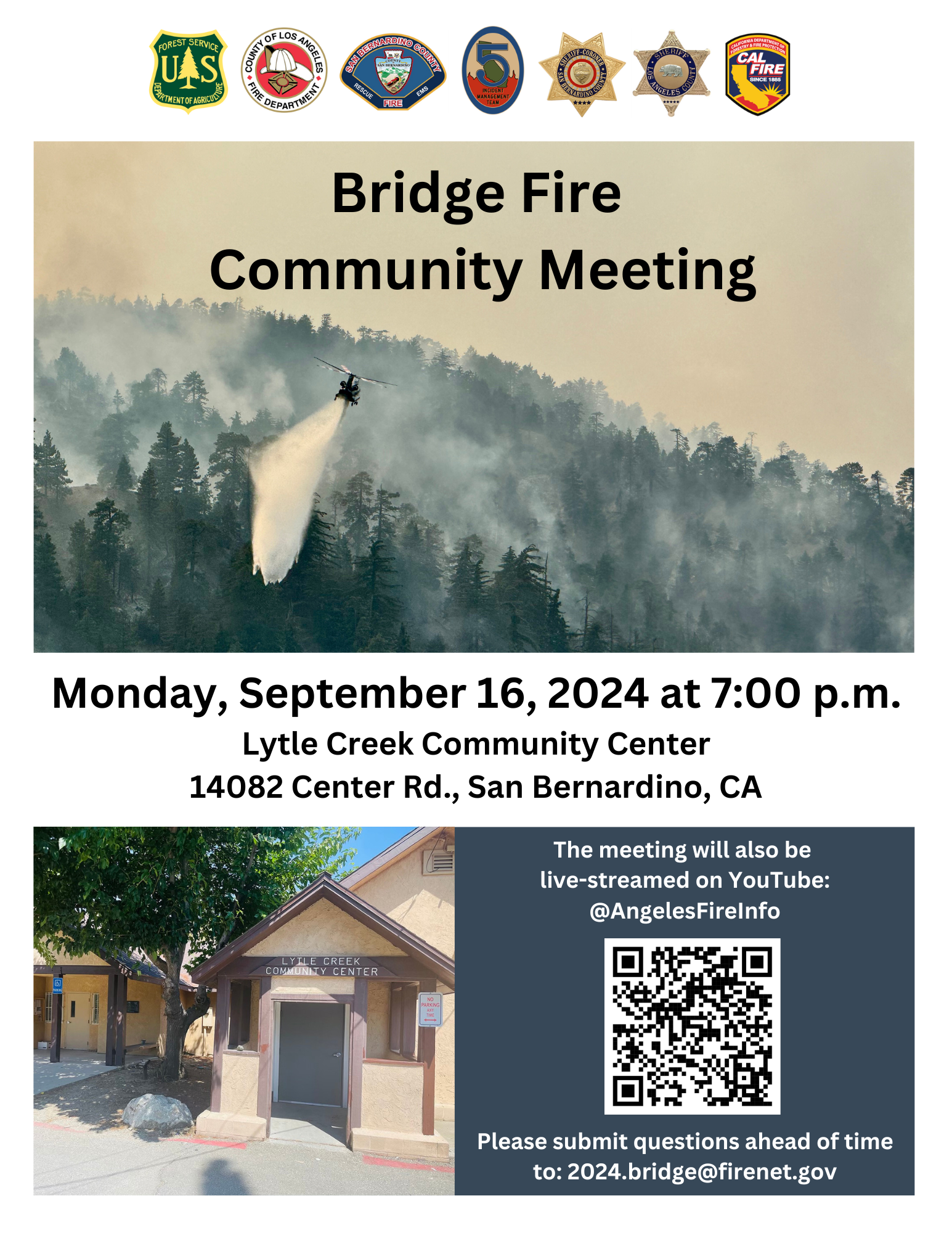
Bridge Fire Lytle Creek Community Meeting Sept 16th 09 14 2024
Related Incident: Bridge Fire
Publication Type: Announcement
The Unified Incident Command Team will be hosting a community meeting on Monday, September 16, 2024 at 7:00 p.m.
Location: Lytle Creek Community Center 14082 Center Rd., San Bernardino, CA
The meeting will also be live-streamed on YouTube: @AngelesFireInfo Please submit questions ahead of time to: 2024.bridge@firenet.gov
Huckleberry Ridge Fire Update 09 14 2024
Related Incident:
Publication Type: News
Huckleberry Ridge Fire
Daily Update
September 14, 2024
Reported: September 4th at 3:45 p.m. | Size: 300 | Cause: Under investigation
Total Personnel: 223| Engines/Tenders:11 | Hand Crews: 5
The Huckleberry Ridge Fire continues to burn in the timberlands South of Pe Ell. The fire is eight miles from the nearest structure and eleven miles from the nearest community. No Infrastructure are at risk at this time. The cooler and wetter weather conditions have greatly assisted the suppression efforts.
Update: Containment is shown at 75% today and expected to be fully contained on Sunday, September 15th. Removal of excess equipment is going well and helicopter sling loads are being prepared to be flown off the hillside when weather allows. Crews have been working around the perimeter extinguishing heat that poses a threat of escapement. Repair work is nearly complete but will be ongoing. The Western Washington Incident Management Team is working on close-out paperwork and coordinated the demobilization of base camp equipment to begin Monday.
Safety: The steep terrain, brushy slopes and loose footing continues to be the major focus to prevent injuries to the firefighters. Hunting Season continues so please be aware there are both firefighters and hunters in the woods right now. Use cation and stay vigilant. For anyone hunting, please stay out of the fire area for your safety and the safety of firefighters.
Evacuations/Closures: There are no anticipated evacuations or road closures in the future for this fire with the exception on the roads immediately adjacent to the burned area. We continue to ask that the community to stay out of the area of the fire until roads are reopened.
Weather: A weak weather disturbance will facilitate a chance for showers tonight, peaking in likelihood during the day Saturday - can’t rule out a weak T-storm Saturday afternoon as well. The overall flow turns more northerly on Sunday however slight chances continue. Daytimes and overnight RHs remain good to excellent. High Temp around 64, RH 80%.
Air Space Restrictions: A Temporary Flight Restriction (TFR) area is in place over the fire. This remains in place while Uncrewed Aerial Systems (UAS/” Drones”) continue to use infrared mapping in inaccessible areas of the fire. If you fly, We can’t.
Airport Fire Evacuation Update 09 14 2024
Related Incident:
Publication Type: Announcement
An interactive evacuation map for both counties may be found here: https://go.genasys.com/5wqfag . This map is the best place for evacuation updates from the county sheriff’s offices.
Riverside County Evacuation Update – September 14, 2024 3:00 p.m.
The following zone is being downgraded from an ORDER to a WARNING:
RVC – 1935
North- Trabuco Rd.
South- Soth of South Main Divide
East - Arroyo Rd
West Rodeo Rd/ Los Pinos Rd
Highway 74 remains closed on the Riverside County side
HumboldtToiyabe National Forest Reduces Emergency Closure for the Davis Fire 09 14 2024
Related Incident: Davis Fire
Publication Type: Closures
Sparks, Nev., Sept. 13, 2024 – Effective immediately, the USDA Forest Service has decreased the emergency area closure order on the Davis Fire. The north and west boundaries of the closure have been reduced to Thomas Creek Road and the eastside of the Mt. Rose Wilderness boundary on the Humboldt-Toiyabe National Forest’s Carson Ranger District.
“This closure was put in place for the safety of both the firefighters and the public,” said Carson District Ranger Matt Zumstein. “We know this is a very popular recreation area for people living in Reno, Nevada, and will reopen it as soon as it is safe to do so.”
The closure boundary runs along the Thomas Creek Road to the north, eastside of the Mt. Rose Wilderness and Forest boundaries to the west, Nevada State Route 877 (Franktown Road) to the south, and the Forest boundary to east (west of U.S. Interstate 580). All roads, trails, and developed recreation sites on National Forest System lands in this area are closed this includes a small portion of the Tahoe Rim Trail that comes in and out of Tahoe Meadows.
In cooperation with the Forest Service, the Washoe County Parks and Recreation has also closed their developed recreation sites and trails that are found in the closure area. The Carson Ranger District and Washoe County Parks and Recreation developed recreation sites affected by the closure include:
• Galena Creek Regional Park and Visitor Center
• Mt. Rose Welcome Plaza
• Mt. Rose Campground
• Browns Creek Trailhead
• Thomas Creek Trailhead
• Jones/White Creek Trailhead
• Whites Creek Trailhead
• Ophir Creek Trailhead
• Slide Mountain Trailhead
• Tahoe Meadows Trailhead
For other recreation opportunities in and around Reno, please visit:
• Washoe County Parks and Recreation: https://www.washoecounty.gov/parks/trails/index.php
• Humboldt-Toiyabe National Forest: https://www.fs.usda.gov/htnf
• Nevada Bureau of Land Management: https://www.blm.gov/nevada
• Nevada State Parks: https://parks.nv.gov/
This order is in effect from Friday, Sept. 13 to Wednesday, Sept. 25 or until rescinded. For more details, please refer to the Emergency Fire Closure document and map at: https://www.fs.usda.gov/alerts/htnf/alerts-notices/?aid=90526.
Davis Fire Information:
• X: https://x.com/HumboldtToiyabe
• Facebook: https://www.facebook.com/HumboldtToiyabeNF
• Inciweb: https://inciweb.wildfire.gov/incident-information/nvhtf-davis-fire
• Email: 2024.davis@firenet.gov
• Fire Information: 775-446-5520
For additional information on the Humboldt-Toiyabe National Forest, please visit https://fs.usda.gov/htnf or participate in the conversation at https://twitter.com/HumboldtToiyabe and https://facebook.com/HumboldtToiyabeNF/.
Lava Fire Daily Update September 14 2024 09 14 2024
Related Incident:
Publication Type: News
Saturday September 14, 2024
Overview: The Lava Fire is on the Boise and Payette National Forests and lands administered by the Bureau of Land Management and the Idaho Department of Lands. The fire is located north of Emmet and west of Lake Cascade and started by lightning on Monday, September 2nd and is burning in tall grass, brush, and timber.
The Lava Fire is currently 95,697 acres with 16 percent containment and 824 personnel assigned.
Any property remaining in an area that is either evacuated or impacted by Forest Service closures will need to remain in place until fire managers, Sheriff’s departments, and emergency management departments deem the area is safe for reentry.
Operations: Yesterday, structure protection was completed in God’s Acres Subdivision while continuing work in the church camp. Lines were completed on the west flank to the center of the northern flank near Indian Mountain Lookout Tower. The Four Corners Fire scar continues to mitigate fire behavior near Hazard Creek and Lookout Peak with crews establishing lines in places as needed. On the southwestern flank, fire crews mopped up east of Indian Valley Road, North Crane Road, and Spring Creek. The initial attack response, Red Fire, was controlled at the end of the day yesterday.
Night shift crews patrolled and monitored fire activity ready to respond to any concerns. Crews strengthened lines around structure work completed on day shift.
Today, fire suppression activities include handlines, dozer lines, and engine work on containment lines around the fire perimeter.
On the northern flank, personnel are scouting locations for containment lines from Grays Creek Road to the east in steep terrain and timber. Structure protection will work at the church camp and assess structures at the Tamarack Ski Resort.
On the eastern flank, Structure assessments and protection continues around Lake Cascade. Chipping operations have started around the structures on the southeast corner along the Forest Service Road 404. Firefighters are working on Forest Service Road 404, Willow Creek and Le John Road holding and securing line. Crews are working to improve structure protection at the Willow Creek community. Securing along the fire perimeter north of Boulder Creek continues.
On the southern flank, personnel will be mopping up FS 653 Road west to FS 618 Road. Line scouting continues eastward to the southeast corner. Scouting line construction along 601 Road to the north continues.
On the western flank, firefighters will continue to mop up isolated areas of heat on the western edge from Dodson Pass north to Little Weiser Road protecting the range allotments, grasslands, and private property outside the fire perimeter line. Crews will also begin road repair in areas that have been impacted by firefighter traffic.
Weather/Fire Behavior: Weak high pressure and southwest flow will continue a warming and drying trend today. Afternoon temperatures will be 5 to 10 degrees warmer and humidity around 10 to 15% lower than yesterday. Winds this afternoon will be out of the southwest and breezier than yesterday. Fire behavior will consist of smoldering heavy fuels and ground fuels. There will be an increase in fire behavior this afternoon in ground litter and under timber stands.
Evacuations and road closures:
Adams County Sheriff’s Office issued a LEVEL 3 “GO!” Evacuation notice to residents south of South Grays Creek and along Little Weiser Road in Indian Valley. A LEVEL 2 “SET” Evacuation has been issued for residents North of South Grays Creek Road to Highway 95, and a LEVEL 1 “READY” Evacuation has been issued for the Mesa area.
Gem County Sheriff’s Office Has downgraded to a LEVEL 2 “SET” Evacuation notice to residents on Third Fork Road (North of Nesbitt Lane), Second Fork Road (North of Nesbitt Lane), and the Sage Hen Reservoir area. A LEVEL 1 “READY” Evacuation has been issued for Nesbitt Lane residents.
Gem County Road and Bridge issued the following road closures: Third Fork Road at Nesbitt Lane, Second Fork Road at Nesbitt Lane, and Nesbitt Lane. The Sweet-Ola Highway is closed at the High Valley intersection in Ola. Please be advised that the Gem County Sheriff’s Office is staffing the road closure check points.
Valley County Sheriff’s Office zones 4 – 11 are in a LEVEL 2 “SET” Evacuation notice.
Forest Closures and Restrictions: The Boise and Payette National Forests implemented a joint Lava Fire Area, Road, and Trail Closure for public and firefighter safety. The closure includes Forest Service lands north of the 601 Road (approximately 7 miles southwest of Smiths Ferry) and north all the way to the northernmost extent of Lake Cascade. This expanded closure order supersedes previous closure orders and will be in place through December 31, 2024, unless rescinded.
A temporary flight restriction is in effect in and around the fire area. This includes the use of personal drones. If you fly, we cannot fly.