
Lowline Fire Update Tuesday August 1 2023 900 am
Related Incident: Lowline Fire
Publication Type: News
Rocky Mountain Complex Incident Management Team 1
Dan Dallas, Incident Commander
Information Phone: 970-648-4470 (public), 970-765-7123 (media)
Email: 2023.lowline@firenet.gov
Information Staffing Hours: 8 a.m. to 8 p.m.
Special Note: Community Fire Information Meeting tonight 6:00 PM at the Gunnison County Public Library, 1 Quartz St., Gunnison, CO. Livestreamed on Facebook at www.facebook.com/GMUGFireInfo .
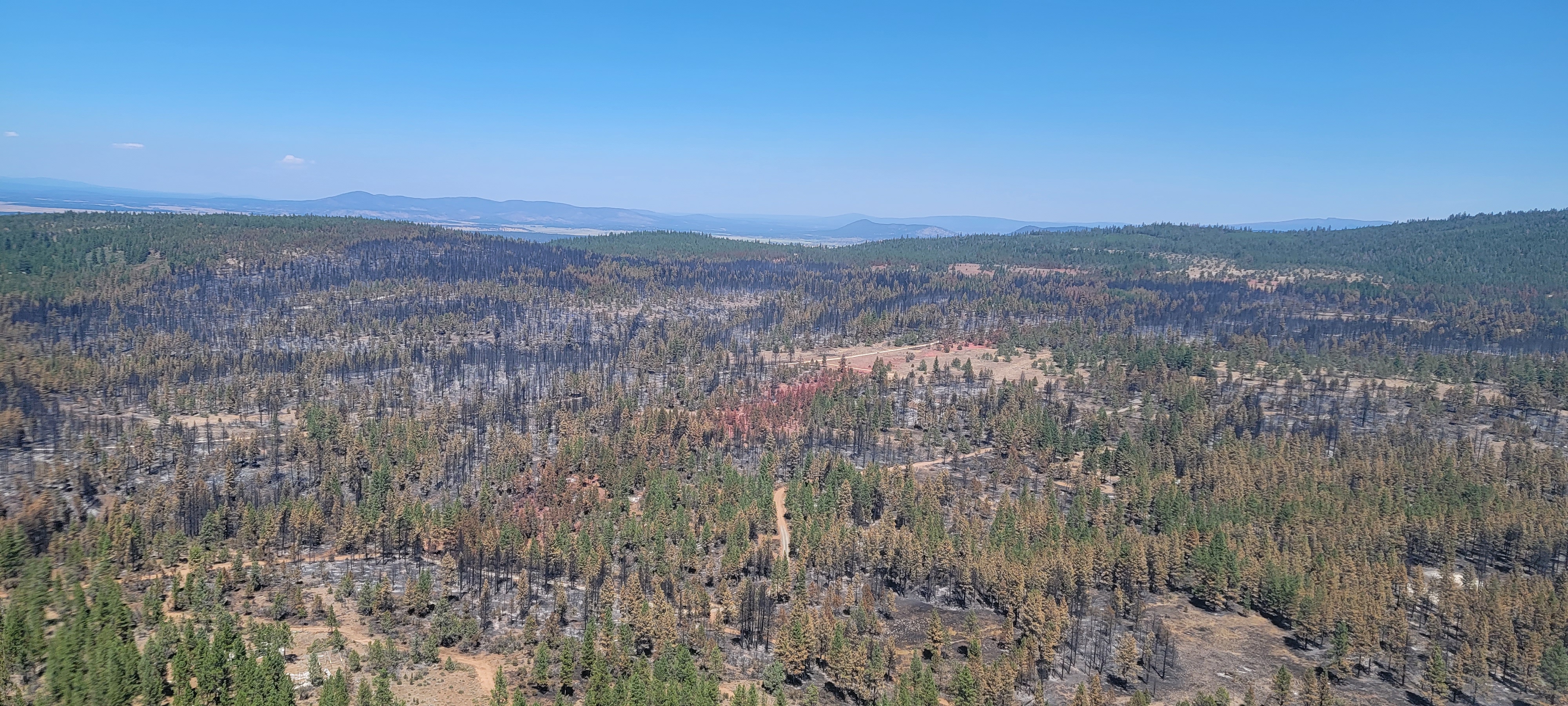
Current Situation: The fire is currently 1427 acres and 21% contained. Weather yesterday was more favorable for burnout operations than anticipated. Thunderstorms passed over the fire between 1:00 and 5:00 PM, but very little rain fell. Humidity was a little lower than expected, which allowed for productive fuels ignition while limiting spotting potential. Hand crews made progress with fireline preparation and construction, and the Structure Protection Group continued work near the southern portions of the fire. Today will be a repeat of yesterday’s activities, but with less favorable weather expected. Precipitation chance is around 95% today, with up to 1/4 inch of rain possible.
The favorable weather allowed hand and aerial ignition to continue yesterday in Division A. Hand crews continued to extend burned areas westward, while a helicopter filled in the larger unburned areas in the interior of the fire. It is unlikely that much burning will be possible today given the expected weather, but crews will still work on patrolling, mopping up, and improving containment lines.
In Division Z yesterday, crews worked on building fireline around a small timber stringer, hand firing small patches of unburned fuel, mopping up, and patrolling. With the exception of burning, the same activity will occur today.
The engine crew in Division Y continued lighting fuels below the ridgeline to keep pace with the slowly westward advancing fire below. They cleared part of a UTV trail up the ridgeline and built medivac helispots in the event a firefighter is injured in this remote section of the fire in future days. Today, a UAS (Unmanned Aerial System or drone) will fly the ridge location of the future fireline and record video to help firefighters plan their work in the area.
Crews in Division W continued firing out fuels between the fire edge and indirect containment line yesterday, moving further to the west. Today, they will continue burning if weather permits, but more likely will focus on patrolling and holding the line.
Weather & Fuel Conditions:
Today, there is a 95% chance of precipitation, with up to 1/4 inch of rain expected. There is a chance of rain again on Wednesday, but Thursday begins a warming and drying trend. The weather will become hot and dry by the weekend.
Higher moisture levels have slowed fire spread and reduced overall fire behavior. Rain expected today should significantly dampen fire behavior for a day or two.
Evacuations: www.gunnisoncounty.org Fire restrictions: currently none
Closures: USFS - www.fs.usda.gov/Internet/FSE_DOCUMENTS/fseprd1126172.pdf
BLM - www.blm.gov/programs/public-safety-and-fire/fire-and-aviation/regional-information/colorado/southwest-district
Lowline Fire Statistics:
Size: 1427 acres
Containment: 21%
Total Personnel: 412
Location: 14 mi. NNW of Gunnison, CO
Reported: 8:00 am July 26, 2023
Cause: lightning
For More Information:
Information Phone: 970-648-4470 (public), 970-765-7123 (media)
Email: 2023.lowline@firenet.gov
InciWeb: https://inciweb.wildfire.gov/incident-information/cogmf-lowline-fire
Facebook: www.facebook.com/GMUGFireInfo
Midnight Fire Update August 1 2023
Related Incident:
Publication Type: News
Location: Forest Service Road (FSR) #284 (Elk City Wagon Road) 1 mile east of China Point, 3 miles Northwest of Pilot Knob near Mountain House Site
Start Date: 7/10/23 Cause: Lightning Size: 179 acres Completion/Containment: 25%
Total Personnel: 119 Engines: 2 Dozers: 1 Forest Masticators: 2 Helicopters: 1
Water Tender: 5 Crews: 2
CURRENT SITUATION
Firefighters continue to hold, secure, and improve fire lines. They continue to search for, map and control sources of heat and mitigate safety concerns. The Midnight Fire did not see any additional growth yesterday; however, the burn is spotty and there are still interior fuel sources and heat. Good work and coordination continued along the contingency line as fire personnel work to implement plans for resource protection.
PLANNED ACTIONS
Firefighters will continue to hold, secure, and improve fire lines. They will continue to identify and control sources of heat and mitigate safety concerns. The work on the contingency line is important because one ember could provide a new ignition source.
WEATHER AND FIRE BEHAVIOR
The weather pattern is expected to continue through Wednesday with hot and dry conditions. Relative humidities remain in the low 20s, with moderate overnight recoveries. Winds are predicted to be light, and terrain driven. An afternoon thunderstorm could be possible.
The expected fire behavior remains similar to what we have seen in the past few days. It is described as moderate with smoldering, single tree torching, and group torching. As temperatures increase with the heat of the day so will fire behavior.
Air quality information: AirNow Interactive Map (epa.gov)
CLOSURES AND SPECIAL MESSAGES
There are currently no closures in place, but please use caution while enjoying your national forest. Firefighting traffic is expected to be heavy along FSR # 244 (Lighting Creek Road) and FSR# 284 (Elk City Wagon Road) between China Point and Lytle Cow Camp.
Grapevine Fire Daily Update August 1 2023
Related Incident:
Publication Type: News
Grapevine Fire
August 1, 2023 – Daily Update
Fire Resources Being Released to Deploy to Other Wildfires
Location: Mingus Mountain, Verde Ranger District (T14N, R2E, SEC 4), Approximately 10 miles east of Prescott Valley; 2 miles south of Mingus Spring Ranch
Start Date: July 21, 2023
Size: Approximately 1049 acres
Percent Contained: 7%
Cause: Lightning
Vegetation: Brush, Timber and Short Grass
Resources: 1 Type 1 Crews, 5 Type 2 Crews, 12 Engines, 1 Helicopters and additional support personnel
Number of Personnel Assigned: 304
Update: Great news, the fire area received up to a ¼ inch of rain and some parts of Mingus Mountain received 2 inches. Fire crews completed protection of Mingus Mountain Academy. Additional control lines are being constructed just north of the Whitehorse community along FR9002W using a combination of hand tools, heavy equipment. Heavy equipment and crews are still working on a protective line along FR132 and improving existing lines along the east side of the fire. An inferred flight has shown some heat sources in the interior and along the northern boundary; and very little heat near Tex Canyon. The monsoons are continuing to be a safety concern for fire personnel as the push forward building lines.
Fire Resources: Over the next few Days, the Incident Management Team will continue to release resources. This process is known as right-sizing the organization. Crews will be released from the fire as objectives are accomplished and made available to assist with other wildfires in the southwest.
Closures: Prescott National Forest Roads along the route beginning at the junction of FR104 and FR143 and extending ¼ mile on either side of FR413 to junction of FR132 then along FR132 to the junction of County Rd 75, Cherry Creek Road.
Fire Restrictions: The entire Prescott National Forest is under Stage 1 Fire Restrictions which prohibits building, maintaining, attending, or using a fire, campfire, or stove fire, including charcoal and briquettes, outside a structure that is provided by the Forest Service within designated areas for portions of the forest. Under these restrictions, discharging a firearm, air rifle or gas gun, except for persons engaged in legal hunting activities, is prohibited on the Prescott National Forest. Fireworks and the use of exploding targets are always prohibited year-round on national forests.
For current evacuation information contact the Yavapai County Sheriff’s Office at 928-771-3260 or follow them at https://www.facebook.com/YavapaiCountySheriff.
For fire information please call (928) 925-1111
Bowles Creek Fire Update for August 1 2023
Related Incident: Bowles Creek Fire
Publication Type: News
Diamond Fire Tonto Daily Update 08012023
Related Incident:
Publication Type: News
Location: Southwest of Sunflower Start Date: 07/22/2023 Cause: Under investigation
Size: 5,101 acres Containment: 34% Total Personnel: 387
Firefighters take advantage of favorable weather to protect Sonoran Desert ecosystem
OPERATIONAL UPDATE
The entire southeast side of the fire along State Route 87 is now contained. Yesterday, fire managers took advantage of higher humidity to insert firefighters into the Maverick Mountain area and use direct suppression action on the most active part of the Diamond Fire. Due to the inaccessible location, hotshots were shuttled into the area on helicopters to address remaining heat. Working with aircraft, the hotshots were able to mop up and secure the fire’s edge to reduce the chance of further movement south into the delicate Sonoran Desert ecosystem. The operation was successful, and the Maverick Mountain area will continue to be monitored by aircraft.
Today’s operational plan will include the continued monitoring, patrolling, and cooling of any remaining hot spots. Engines will continue patrolling the State Route 87 corridor and the community of Sunflower. Chipping and removal of brush and debris will continue with heavy equipment along the Old Beeline Hwy. Rehab of equipment and backhaul will begin.
Temperatures are expected to remain slightly lower today. A similar trend of building afternoon clouds and potential thunderstorms will increase the potential of gusty outflow winds. Any remaining heat may smoke or move when driven by wind. A warming and drying trend is expected to begin tomorrow and continue through the week.
CLOSURES AND EVACUATIONS
The National Forest has issued a closure order for the fire area to provide public health and safety due to firefighting operations. The Old Beeline Hwy is closed to non-residents.
Sunflower, Cross F Ranch, and Diamond Ranch are in SET. Please visit https://tinyurl.com/nhv6uyyt for further information. An interactive evacuation map link is available on both Inciweb and Facebook: https://tinyurl.com/54tbdhm2
RESTRICTIONS
There is a temporary flight restriction over the fire area, which includes the use of drones (UAS). Flying a drone over a fire area is dangerous to pilots and will cause air operations to shut down. Flying a drone within the restricted area is also illegal.
The National Forest is currently under Stage 1 Fire Restrictions. Please see https://www.fs.usda.gov/alerts/tonto/alerts-notices/?aid=81280 for more information.
Hayden Fire Update August 1 2023
Related Incident:
Publication Type: News
A community meeting is scheduled for today August 1, at 7 PM in Leadore’s community center.
Acres: 18,085
Completion: 47%
Personnel: 701
The Hayden Fire is being managed using a combination of actions, some directly adjacent to the fire perimeter and others further away; these actions include full suppression, confinement to pre-determined natural barriers, and the protection of values such as threatened and endangered species, sage-grouse habitat, rangeland and watershed health, and heritage resources as well as private property and infrastructure.
“Firefighter safety is always the number 1 objective, with that in mind we’ve decided to use a confinement strategy on certain areas of the fire,” said, Deputy Incident Commander Jeff Knudson. “This doesn’t mean our priorities have changed.”
This strategy presents the best option for firefighter safety and successful containment. With the work that was accomplished yesterday, the fire perimeter is 47% completed, utilizing a combination of containment with hand and dozerline and confinement tactics utilizing natural barriers.
Weather: Today winds will decrease significantly over the fire. It will still be hot and dry but no red flag warning. Monsoonal moisture will be pushing into the area Wednesday night with potential for wetting rain on Thursday.
Actions: The fire continues to consume dead and down fuels within the fire perimeter. Yesterday, air resources were very successful corralling spot fires inside the line and introducing fire to broaden the burned area along the fire lines. Burning operations will be used to further deepen the primary line from Tobias Creek northwest to Boulder Flat. Progress was made on the eastern flank as crews continued ignition operations on the west side of Mill Creek tying areas burned by the spot fires into the fires edge.
Important Information: The Lemhi County Sheriff’s Department in coordination with the Salmon-Challis National Forest and Great Basin Team 7 have pre-identified evacuation zones. Please visit the Lemhi County website at lemhicountyidaho.org for more information.
Stage 1 Fire Restrictions are in effect on the Salmon-Challis National Forest (SCNF), Idaho Department of Lands, and Bureau of Land Management jurisdiction. The SCNF also has an area closure order. For more information, please visit the Salmon-Challis National Forest’s Alerts and Notices webpage.
York Fire Update 7312023 900 PM
Related Incident: 2023 - York Fire
Publication Type: News
Start Date: Monday, July 28, 2023, at 12:09 pm
Percent Contained: 0%
Size: 77,000 Acres
Location: San Bernardino County, CA
Cause: Undetermined
Vegetation: Timber (Litter & Understory), Brush
Number of Personnel Assigned: 389
The York Fire remains under investigation, it started on a private land inholding within the Mojave National Preserve.
The Mojave Desert has a vibrant history. Before contact with the Europeans changed their world, the Chemehuevi lived on prickly pear, mesquite and roasted agave blooms and hunted deer and bighorn sheep. They resided in the Kingston, New York, and Providence Mountains west to Soda Dry Lake and south to the Whipple Mountains. Mojave tribal peoples were concentrated along the Colorado River and the Mojave trail became their main trading route.
Today firefighters continued working to gaining containment while observing less fire activity then in previous days. This means the fire’s intensity and spread were relatively low, which help in their containment efforts and reduced the risk to property and lives.
Tonight, firefighters will continue to focus on containment and suppression efforts. Limited visibility due to thick smoke is a challenge the firefighters are facing. With visibility up to a mile or less in some areas it has a significant implication and causes hazardous conditions, hindering firefighting operations as it affects aerial support, ground crews’ movement, and communications between firefighting units.
If weather conditions permit, an infrared mapping flight will take place in the early morning hours to obtain better map data for firefighting resources. This firefighting effort is an ongoing coordinated effort between resources from the National Park Service, Bureau of Land Management, San Bernardino Fire Protection District, and Clark County Fire. Additional, resources have been ordered to assist in these efforts.
As always, it's important to stay updated on official information and follow safety instructions given by local authorities. If you're in the vicinity of the fire, please take necessary precautions to ensure your safety and the safety of those around you.
Road and Area Closures: Hart Mine Road from Walking Box Ranch to Ivanpah are CLOSED in the area due to continued fire activity. These closures are due to hazardous wildfire conditions and fire suppression operations. Please stay clear of the area. All campgrounds are now OPEN in the Preserve. Please visit https://go.nps.gov/MojaveConditions for more details.
Smoke Effects: Smoke from the fire is reaching into Nevada and southern Utah. For current smoke impacts and for tips on managing your exposure of wildfire smoke, please visit Airnow.gov; also visit Nevada’s Department of Conservation and Natural Resources at Smoke Smart: Pro Tips to Protect your Family from Wildfire Smoke | DCNR (nv.gov)
Clark County, Nevada Impacts: The York Fire is working closely with Clark County Communications to provide timely and accurate information to the public. If you have any questions regarding what is occurring specifically with the residential areas of Nipton and Searchlight, please visit https://www.clarkcountynv.gov/newslist.php or follow on twitter at https://twitter.com/ ClarkCountyN
Flat Fire Evening Update 7312023
Related Incident: Flat Fire
Publication Type: News
July 31, 2023 Flat Fire Evening Update
Size: 25,572 Start Date: July 15, 2023
Point of origin: 2 miles southeast of Agness, OR
Containment: 14%
Cause: Human caused, Under Investigation
Total personnel: 1,547
Resources: 44 engines l 35 crews l 2 bulldozers l 32 water tenders l 4 masticators l
9 helicopters
Today’s Progress: The southeast perimeter of the fire is still showing very little heat, and any hot spots along the fire‘s edge have been targeted with helicopter bucket drops. Work continued to increase fireline depth using aerial ignitions from helicopters and Unstaffed Aerial Systems, futher securing the fireline ahead of anticipated seasonal vegetation drying, lower relative humidities and increased wind. Crews completed burn-out operations east of Game Lake along the control line. Northern containment line continues to be patrolled and secured. Good progress was made toward completing the alternate control line along Forest Service Roads 3313, 1503, and 3680.
With fire traffic on Bear Camp Road, all motorists on Bear Camp Road are asked to slow down, use headlights and proceed with caution.
Evacuations: As of this afternoon, all remaining evacuation levels have been reduced to Level 1 “Get Ready” evacuation status for all areas in the vicinity of the Flat Fire.
The Curry County Sheriff’s Office will continue to coordinate with the Fire Incident Management Team and will notify all residents affected by the fire of any reasons to change evacuation levels.
Curry County is using Everbridge to send evacuation notices. You can sign up for notifications here: https://www.co.curry.or.us/departments/emergency_management/index.php.
Weather: The forecast calls for slightly warmer temperatures and lower relative humidities Tuesday into Wednesday. Tuesday has the potential to be the warmest day on the Flat Fire so far.
Smoke: The Smoke Outlook is available at: https://outlooks.airfire.org/outlook/en/b74901f7
Closures: The Rogue-River Siskiyou National Forest has issued a closure order for the fire area including trails, roads and a portion of the Illinois River. Oak Flat Campground, Game Lake Campground, Wild Horse Campground and Snow Camp Lookout Recreation Rentals are all closed as part of the area closure. The Chetco River Road (FSR 1376) and Chetco/Pistol River Road (FSR 1407) are now closed. The updated closure allows for public access to the Big Rock swimming hole on the Illinois River. More information can be found here: https://tinyurl.com/bdzbae69.
Restrictions: Fire Restrictions are in place, to learn more visit: fs.usda.gov/rogue-siskiyou
Local fuel conditions are variable with fuels dry in some areas but still green vegetation in others. Warming and drying weather conditions continue resulting in higher fire danger.
Please follow all fire restrictions. Stay on roadways and do not drive, idle or park on dry grass. A hot vehicle undercarriage could easily start a wildfire.
Actualizacin del Incendio Lowline Lunes 31 de Julio 2023 900 pm
Related Incident: Lowline Fire
Publication Type: News
Equipo de Gestión de Incidentes del Complejo del área de las Montañas Rocosas 1
Dan Dallas, Comandante del Incidente
Teléfono de Información: 970-648-4470 (publico), 970-765-7123 (medios de comunicación)
Correo electrónico: 2023.lowline@firenet.gov
Horario: 8 a.m. – 8 p.m.
Nota Especial: Se invita a todos los miembros de la comunidad, ciudadanos preocupados, líderes gubernamentales y medios de comunicación a asistir a la reunión de información pública sobre el incendio Lowline en Gunnison mañana por la noche a las 6:00 p.m. en la Biblioteca Pública de Gunnison, ubicada en 1 Quartz Street. Los administradores de incendios y otros representantes de agencias estarán presentes para responder preguntas. Si no puede asistir en persona, la reunión se transmitirá en vivo en la página de Facebook de GMUG Fire (www.facebook.com/GMUGFireInfo). Se publicará una grabación de la reunión después de la sesión en vivo.
Situación Actual: El incendio Lowline continuó ardiendo activamente hoy, haciendo recorridos cortos y quemando árboles individuales en áreas de madera pesada, insectos y árboles muertos y caídos. El incendio mide actualmente 1427 acres y esta 21% contenido. Los bomberos aprovecharon la oportunidad para continuar las operaciones de quema más temprano en el día antes de un frente meteorológico que se pronostica que traerá lluvia, temperaturas más frías y humedades más altas.
En la División A, las operaciones de quema continuaron utilizando cuadrillas manuales y encendidos aéreos para cumplir con los objetivos de reducción de combustible. Los bomberos continuaron trabajando en líneas de fuego indirectas y directas. Los equipos de protección de estructuras exploraron y evaluaron las estructuras dentro de la División.
Los bomberos en la División Z pudieron realizar algunas operaciones de contrafuego y avanzaron hacia el oeste hasta el límite del Bosque Nacional.
En la División Y, la tripulación del camión de bomberos continuó asegurando la línea de fuego existente y logró realizar adicionales operaciones de quema.
Un equipo de la División W trabajó para mantener la línea de fuego patrullando y limpiando. Además, realizaron una pequeña operación de quema.
Condiciones del Clima y Combustibles: Mañana estará nublado con periodos de lluvia y posibles tormentas. Las temperaturas disminuirán entre bajos a mediados de los 70. Estas condiciones continuarán hasta el miércoles con el potencial de generar hasta un cuarto de pulgada de lluvia en el transcurso del día.
Evacuaciones, Cierres, y Restricciones de Incendios:
Se han realizado evacuaciones obligatorias en los drenajes de Squirrel Creek y Mill Creek. Para obtener información específica sobre evacuación, consulte Manejo de emergencias del condado de Gunnison en www.gunnisoncounty.org. Puede registrarse para recibir alertas de emergencia en sus teléfonos u otros dispositivos en: https://bit.ly/3QhZVZg.
Se ha implementado cierre de áreas, caminos y senderos en tierras del Sistema Forestal Nacional cerca del incendio. Para obtener detalles, consulte este enlace: https://www.fs.usda.gov/Internet/FSE_DOCUMENTS/fseprd1126172.pdf. BLM ha implementado un cierre temporal en la vecindad del incendio. Para obtener más información, consulte este enlace: www.blm.gov/programs/public-safety-and-fire/fire-and-aviation/regional-information/colorado/southwest-district. Las carreteras del condado en la vecindad del incendio están bloqueadas. En interés de la seguridad pública, los bomberos piden a los visitantes que estén atentos al tráfico de incendios y que eviten el área.
Actualmente no hay restricciones de incendios en el condado de Gunnison. Si se implementan restricciones, se publicarán en este sitio: https://westslopefireinfo.com/gunnison-county/.
Los incendios forestales son una zona de exclusión aérea para aeronaves no autorizadas, incluidos los drones. Si tu vuelas, nosotros no podemos. Para obtener más información, visite http://knowbeforeyoufly.org.
Estadísticas del Incendio Lowline:
Tamaño: 1427 acres
Contenido: 21%
Personal: 419
Locación: 14 mi. NNW de Gunnison, CO
Reportado: 8:00 am 26 de Julio, 2023
Causa: Relámpago
Para más Información:
Línea Telefónica: 970-648-4470 (public), 970-765-7123 (media)
Correo electrónico: 2023.lowline@firenet.gov
InciWeb: https://inciweb.wildfire.gov/incident-information/cogmf-lowline-fire
Facebook: www.facebook.com/GMUGFireInfo
Golden Fire Daily Evening Update July 31 2023
Related Incident: Golden Fire
Publication Type: News
Final Update as local Type 4 team takes command tomorrow at 8 a.m.
BONANZA, Ore. – Transition to the local Type 4 team will happen tomorrow morning at 8 a.m. The incident objectives for the local team will remain the same. Multiple engines and crews will continue to mop up where warranted. A thank you video from Oregon Department of Forestry’s Incident Management Team 2 (ODF IMT2) is posted on YouTube and can be view at: https://www.youtube.com/watch?v=lTdudxihNAE&feature=youtu.be
This will be the final fire update from the ODF IMT2. Beginning tomorrow, additional information can be found at the South-Central Oregon Fire Management Partnership site at: https://www.facebook.com/SCOFMPFIREINFO. The team would like to thank the cooperators and public for their support during the fire. Without local resources and support from the community our team would not have been as successful.
Today, crews worked on last minute touch-ups to prepare for demobilization. “With the fire containment reaching 83%, I am confident that we can continue the great work that has been put in,” states the incoming Incident Commander of the Type 4 team, Matt Anspach.
The weather for tomorrow will be hot and dry, but with little to light wind. Later in the week there is a chance for dry lightning. Storms are expected to generate strong outflow winds.
Evacuations downgraded as of Thursday, July 27 at 11:00 a.m.:
Level 2 (BE READY) - all areas inside the fire perimeter.
For the most current evacuation information, call the Klamath County hotline at 541-205-9730, and sign up for Klamath County alerts at http://alerts.klamathcounty.org. The American Red Cross is handing out cleaning kits to those affected by the fire. They are located at Living Springs Church, 31601 Mission Street, Bonanza, Oregon 97623.
Recovery Contact Information
Information for services and resources for those impacted by the community with unmet needs, residential cleanup guidance, disaster social services and donations are available here: https://tinyurl.com/bddatnxv.
We would like to remind the public that Klamath and Lake counties are in extreme fire danger. Human-caused fires are preventable, so please help your local resources by preventing anything that can spark a fire. Visit https://www.oregon.gov/odf/fire/pages/restrictions.aspx for fire restrictions in your area or areas you may be traveling to.