
Brice Creek Dinner Grizzly Chilcoot and Ridge Fires Virtual Community Meeting September 7 2023
Related Incident: Brice Creek FireDinner FireGrizzly Fire
Publication Type: Announcement
There will be a virtual community meeting with information on the Brice Creek, Dinner, Grizzly, Chilcoot, and Ridge Fires on Thursday, September 7th at 7:30 PM via Facebook Live hosted on both the Brice Creek, Dinner, and Grizzly Fire Facebook page and the Chilcoot and Ridge Fires page. NW Incident Management Team 12 personnel will be presenting updated information and answering questions on all fires. Questions should be submitted via our Facebook page or 2023.dinner@firenet.gov ahead of time to ensure incident management personnel will be able to answer them during the meeting timeframe.
Cowlitz Complex Update September 6 2023
Related Incident: Cowlitz Complex
Publication Type: News
Rocky Mountain Area Complex Incident Management Team Two
Jared Hohn, Incident Commander
Current Situation: Containment on the Cowlitz Complex has increased to 10%, with the size of the complex holding at 697 acres. A total of 456 personnel are currently assigned. Fire suppression objectives are to keep fire away from the communities of Randle and Packwood, private lands, and infrastructure, while committing resources only where they can operate safely and effectively and have the highest probability of success. These fires are being managed to minimize acres burned and minimize water quality degradation.
With increasing sun, lower humidity, and higher temperatures, fire behavior is increasing. Increased smoldering and smoke production was observed on the Grassy Mountain Fire yesterday. Clearer skies allowed use of aircraft for a variety of missions.
In Branch I/Division C/F, the biggest change yesterday was on the Grassy Mountain Fire, where a helicopter dropped water over areas of heat along the edges of Grassy Mountain Fire. A crew of rappelers was also delivered on top of Grassy Mountain to clear a helispot that will facilitate future transport of hotshot crews.
In Branch II/Division L, crews are identifying and extinguishing hot spots on the Adams Fork and Mission fires. The Sanctuary Rock Fire has been placed in patrol status. The Jackpot Creek Fire has a heavy layer of decomposed, unburned fuel that has masked areas of heat under recent wet conditions. With drier weather yesterday and today, areas of residual heat are expected to become more visible. Crews will continue working the Jackpot Creek Fire a few more days to ensure that established control lines are secure.
In Branch II/Division W, the McCoy Creek Fire has been declared out, and the Bear Creek and Quartz Junior fires were placed in patrol status. Hotshot crews have begun working in the vicinity of Spencer Quartz Fire, cutting back brush along closed roads and evaluating what their options are, and where they can safely engage. Snagtooth Fire remains unstaffed.
Fire Restrictions: Fire Restrictions are in effect. Campfires are prohibited across the Gifford Pinchot National Forest – only propane-fueled fire pits, stoves and lanterns are allowed. Additional information is available on the forest’s website at Gifford Pinchot National Forest - Fire Management (usda.gov). The decision to lift or maintain fire restrictions depends on a variety of factors including current and expected weather conditions, fuel moisture, the level of fire activity, and the availability of firefighting resources to respond to additional ignitions.
Weather & Smoke Information: A break in the cloud cover this afternoon is expected to bring a period of sunshine today, though another weak front is expected to pass through this afternoon, bringing clouds and light drizzle. Temperatures will be 5 to 10 degrees warmer than yesterday. Very little smoke has been visible from these fires over the past week; however, a shot of sunshine today may result in some visible smoke production from the Grassy Mountain Fire.
Closures: In anticipation of ongoing fire activity in the vicinity of the Snagtooth Fire the following roads and trails are closed to the public to reduce exposure and help ensure public safety: Forest Roads 9300 and 9341 (currently off limits), Boundary Trail #1 (from Elk Pass to intersection with Summit Prairie), Summit Prairie #2, Craggy Peak #3, Snagtooth #4, Quartz #5, Stabler Camp #17, Wright Meadows #80, Basin Camp #3A, Quartz #5B, Quartz #5C (French Creek), Snyder Pasture #80A. Forest Road 8410 is closed for firefighter and public safety in the vicinity of the Pothole Fire, and Forest Road 78 is temporarily closed between the 7802 junction and the 2278 junction due to hazardous debris rolling out onto the roadway.
Temporary Flight Restrictions: A temporary flight restriction (TFR) is in effect between Highway 12 and Mount Rainier National Park. Fire aviation response is halted or delayed if an unauthorized aircraft enters the TFR. Temporary flight restrictions also apply to unmanned aircraft systems or drones. If you fly we can't!. Lear more about how to use drones safely and responsibly at Home - Know Before You Fly.
East Fork Fire September 6
Related Incident: East Fork Fire
Publication Type: News
Location: 12 miles south of Trego, Montana Information Line: 406-285-8634
Start Date: 7/30/2023 Cause: Lightning Size: 5,162 acres Containment: 44%
Total Personnel: 414 Engines: 8 Helicopters: 2 Hand Crews: 7
CURRENT STATUS
Crews completed hand line along the fire’s southern edge. Heavy equipment assisted with moving pumps and hose off the fire line where they were no longer needed. An unmanned aerial system (UAS), also referred to as a “drone,” flew over the eastern edge of the fire and identified hot spots. Once identified, crews accessed these areas to mop-up the areas of residual heat.
PLANNED ACTION
Mop-up and patrol of residual heat will continue along the edges of the fire. Firefighters and heavy equipment are implementing repair plans and improving damaged roads and surfaces to pre-fire conditions. The UAS will move to the northern perimeter of the fire today to continue identifying hot spots near the fire’s edge. One type 3 helicopter will remain available to assist crews on the ground as needed.
WEATHER AND FIRE BEHAVIOR
A few stray showers early yesterday dissipated quickly with rainfall across the incident ranging from just a few hundredths of an inch to higher amounts both north and south of the fire area. In areas where rain doesn’t penetrate the tree canopy, the precipitation is not enough to completely extinguish the fire’s creeping and smoldering in heavy fuels and the thick layers of duff (vegetative matter that covers the forest floor). Highs were into the lower 60s and humidity levels in the 45 to 55%, with southwest winds around 10 mph. There is a small chance of rain today and a slightly higher chance of precipitation on Friday that may produce thunderstorms. Fire activity was minimal, with some creeping and smoldering. This fire behavior currently poses no threat to containment lines.
AREA AND ROAD CLOSURES
The Flathead National Forest rescinded its previously issued area closure order (#01-01-08-23-20) on September 2, 2023. The Kootenai National Forest-Fortine Ranger District and the Flathead National Forest-Tally Lake Ranger District have issued a new revised road closure order (#01-01-03-23-12), effective September 2, 2023.
The closure order is in place to provide heavy equipment and suppression repair personnel unhindered access to areas of the East Fork fire. Work in the area includes road repair, cleaning slash and other debris out of ditches and culverts, and strategically moving logs and other downed trees to prevent erosion in burned areas.
The roads in the area are narrow, and pullouts and turnarounds are too few for heavy traffic. Temporary closures are implemented during wildfire events to protect working firefighters and equipment operators. Once agency officials determine the area is safe, closure orders will be adjusted or rescinded.
Community Meeting Chilcoot Ridge Brice Creek Dinner and Grizzly Fires September 7 at 730 PM
Related Incident: 2023 Chilcoot Fire UNF2023 Ridge Fire UNF
Publication Type: Announcement
Join Northwest Incident Management Team 12 for a virtual community meeting on September 7 at 7:30 PM.
Fire personnel will discuss fire activity and suppression operations on the Umpqua National Forest's Chilcoot, Ridge, Brice Creek, Dinner, and Grizzly Fires. They will also be available for questions.
This event will be streamed through Facebook Live. The public can join virtually on the Chilcoot and Ridge Fires Information page.
Details can be found here at the event page.
Elizabeth Fire Daily Update 09062023
Related Incident: Elizabeth Fire
Publication Type: News
Louisiana Statewide Burn Ban: The state of Louisiana has declared a statewide burn ban to include any open flame outdoors. The message from the State Fire Marshal’s Office is “don’t burn anything” until further notice. Citations and arrests ARE happening across this state in partnership with local and state law enforcement agencies.
Personnel and Equipment:
Tiger Island: 1 Type-1 Crew; 1 Type-2 Crew; 21 Type-6 Engines; 7 Type-3 Tractor Plow Units; 4 Water Tenders and 3 Ambulances.
Hwy 113: 1 Type-1 Crew; 15 Type-6 Engines; 5 Type-2 Tractor Plow Units; 6 Type-3 Tractor Plow Units; 1 Water Tenders and 4 Ambulances.
Lions Camp Road: 2 Type-6 Engines; 3 Type-3 Tractor Plow Units and 1 Ambulance
Elizabeth: 6 Type-6 Engines; 6 Type-3 Tractor Plow Units and 1 Ambulances
Air Resources Assigned to all Fires: 15 Helicopters and 2 Air Attacks
Additional support is being provided to all fires by Parish authorities and departments, the Governor’s Office of Homeland Security and Emergency Preparedness, the Louisiana State Fire Marshal Team, Sheriff’s offices, and the Offices of Emergency Preparedness.
Tiger Island Fire: The Tiger Island Fire was first reported on Tuesday, August 22nd. The fire is located East of Merryville, south of Hwy 190, SW of DeRidder and North of Singer. The fire is burning in pine plantations of multiple ages. Heavy residual fuels because of Hurricane Laura in 2020 exist and contribute to extreme fire behavior.
Operations: The Tiger Island Fire is currently 65% contained. Yesterday, some rain fell across the western portion of the fire. Crews conducted mop up, patrol and used equipment to knock down berms that may be holding heat along dozer lines. Crews also cleared off firelines with accumulated needlecast. Today, crews will continue mopping up and seeking out hot spots along the firelines. Crews will continue knocking down debris berms that may be holding heat and monitoring for needlecast that has reburn potential.
Hwy 113 Fire: Located 14 miles northwest of Oakdale. This fire is burning in loblolly pines and hardwoods.
Operations: The Hwy 113 fire is currently 63% contained. Yesterday, due to wet conditions from Monday’s rainfall, access with heavy equipment was limited in some portions of the fire. Crews continued to connect and improve dozer lines and utilized hand lines to connect lines in areas difficult to access with equipment. Today, crews will evaluate road conditions for equipment access, especially in the Tenmile Creek drainage area. Crews will continue mopping up and patrolling the fire lines.
Lions Camp Road: Five miles northwest of Leesville. This fire is burning in southern rough, timber and brush.
Operations: The Lions Camp Road Fire is 81% contained. Yesterday, crews continued to mop up and patrol, looking for hot spots and cleaning up fire lines. Today, crews will continue mopping up, patrolling and looking for hot spots along the entire fire perimeter.
Elizabeth: Located in southwest Rapides Parish. The fire is south of Ten Mile Road and northeast of state Louisiana Hwy 462.
Operations: The Elizabeth Fire is 65% contained. Yesterday, crews continued mopping up and patrolling fire lines. Due to muddy road conditions equipment access was limited in certain portions of the fire area. Where crews were able to access, dozers established more direct line as close as possible to the fire perimeter. More direct lines will result in less unburned vegetation within the fire area and will provide crews better access for mopping up and patrolling. Today, crews will continue improving lines and connecting fire lines in the Tenmile Creek drainage.
Weather and Fire Behavior: Temperatures will be warmer and drier this afternoon compared to the past few days with temperatures in the upper 90’s and minimum humidity in the upper 30’s to mid 40’s. The heat index could reach 107 degrees today. Winds will be light and variable, with an occasional wind gust to 15 mph. There is only a slight chance of rain today. However, fuels in the area are still very dry and could burn until there is significantly more moisture. Heat scorched leaves and pine needles are falling and blanketing the ground, especially in Tiger Island Fire footprint, which could result in reburn.
Air Quality: Light smoke is only expected in the vicinity of large fuels that continue to smolder. Reburn could cause higher levels of smoke in localized areas. None of the communities in the area will be impacted by smoke from any of the fires. Expect to see only light smoke in the immediate vicinity of a fire or on interior roads. All monitor locations should see less smoke today due to low fire activity, light winds and high humidity. All communities should experience good air quality. For near time air quality information see EPA's Fire and Smoke Map: https://fire.airnow.gov/
Temporary Flight Restriction: A Temporary Flight Restriction (TFR) is in place over the Tiger Island Fire and Hwy 113 and Elizabeth Fire areas. This is necessary to protect aerial operations. If you fly, we can’t. If there are drone intrusions into the Temporary Flight Restrictions, we must ground all aircraft.
Evacuations: Updates on evacuations and shelters for the Tiger Island Fire can be found on the Beauregard Parish Sheriff’s Office Facebook Page at https://www.facebook.com/beauregardsheriff.
Lions Camp Road Fire Daily Update 9623
Related Incident: Lions Camp Road Fire
Publication Type: News
Louisiana Statewide Burn Ban: The state of Louisiana has declared a statewide burn ban to include any open flame outdoors. The message from the State Fire Marshal’s Office is “don’t burn anything” until further notice. Citations and arrests ARE happening across this state in partnership with local and state law enforcement agencies.
Personnel and Equipment:
Tiger Island: 1 Type-1 Crew; 1 Type-2 Crew; 21 Type-6 Engines; 7 Type-3 Tractor Plow Units; 4 Water Tenders and 3 Ambulances.
Hwy 113: 1 Type-1 Crew; 15 Type-6 Engines; 5 Type-2 Tractor Plow Units; 6 Type-3 Tractor Plow Units; 1 Water Tenders and 4 Ambulances.
Lions Camp Road: 2 Type-6 Engines; 3 Type-3 Tractor Plow Units and 1 Ambulance
Elizabeth: 6 Type-6 Engines; 6 Type-3 Tractor Plow Units and 1 Ambulances
Air Resources Assigned to all Fires: 15 Helicopters and 2 Air Attacks
Air Resources Assigned to all Fires: Additional support is being provided to all fires by the National Guard, Parish authorities and departments, the Governor’s Office of Homeland Security and Emergency Preparedness, the Louisiana State Fire Marshal Team, Sheriff’s offices, and the Offices of Emergency Preparedness.
Tiger Island Fire: The Tiger Island Fire was first reported on Tuesday, August 22nd. The fire is located East of Merryville, south of Hwy 190, SW of DeRidder and North of Singer. The fire is burning in pine plantations of multiple ages. Heavy residual fuels because of Hurricane Laura in 2020 exist and contribute to extreme fire behavior.
Operations: The Tiger Island Fire is currently 65% contained. Yesterday, some rain fell across the western portion of the fire. Crews conducted mop up, patrol and used equipment to knock down berms that may be holding heat along dozer lines. Crews also cleared off firelines with accumulated needlecast. Today, crews will continue mopping up and seeking out hot spots along the firelines. Crews will continue knocking down debris berms that may be holding heat and monitoring for needlecast that has reburn potential.
Hwy 113 Fire: Located 14 miles northwest of Oakdale. This fire is burning in loblolly pines and hardwoods.
Operations: The Hwy 113 fire is currently 63% contained. Yesterday, due to wet conditions from Monday’s rainfall, access with heavy equipment was limited in some portions of the fire. Crews continued to connect and improve dozer lines and utilized hand lines to connect lines in areas difficult to access with equipment. Today, crews will evaluate road conditions for equipment access, especially in the Tenmile Creek drainage area. Crews will continue mopping up and patrolling the fire lines.
Lions Camp Road: Five miles northwest of Leesville. This fire is burning in southern rough, timber and brush.
Operations: The Lions Camp Road Fire is 81% contained. Yesterday, crews continued to mop up and patrol, looking for hot spots and cleaning up fire lines. Today, crews will continue mopping up, patrolling and looking for hot spots along the entire fire perimeter.
Elizabeth: Located in southwest Rapides Parish. The fire is south of Ten Mile Road and northeast of state Louisiana Hwy 462.
Operations: The Elizabeth Fire is 65% contained. Yesterday, crews continued mopping up and patrolling fire lines. Due to muddy road conditions equipment access was limited in certain portions of the fire area. Where crews were able to access, dozers established more direct line as close as possible to the fire perimeter. More direct lines will result in less unburned vegetation within the fire area and will provide crews better access for mopping up and patrolling. Today, crews will continue improving lines and connecting fire lines in the Tenmile Creek drainage.
Weather and Fire Behavior: Temperatures will be warmer and drier this afternoon compared to the past few days with temperatures in the upper 90’s and minimum humidity in the upper 30’s to mid 40’s. The heat index could reach 107 degrees today. Winds will be light and variable, with an occasional wind gust to 15 mph. There is only a slight chance of rain today. However, fuels in the area are still very dry and could burn until there is significantly more moisture. Heat scorched leaves and pine needles are falling and blanketing the ground, especially in Tiger Island Fire footprint, which could result in reburn.
Air Quality: Light smoke is only expected in the vicinity of large fuels that continue to smolder. Reburn could cause higher levels of smoke in localized areas. None of the communities in the area will be impacted by smoke from any of the fires. Expect to see only light smoke in the immediate vicinity of a fire or on interior roads. All monitor locations should see less smoke today due to low fire activity, light winds and high humidity. All communities should experience good air quality. For near time air quality information see EPA's Fire and Smoke Map: https://fire.airnow.gov/
Temporary Flight Restriction: A Temporary Flight Restriction (TFR) is in place over the Tiger Island Fire and Hwy 113 and Elizabeth Fire areas. This is necessary to protect aerial operations. If you fly, we can’t. If there are drone intrusions into the Temporary Flight Restrictions, we must ground all aircraft.
Evacuations: Updates on evacuations and shelters for the Tiger Island Fire can be found on the Beauregard Parish Sheriff’s Office Facebook Page at https://www.facebook.com/beauregardsheriff
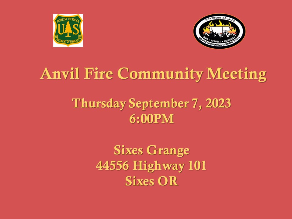
Anvil Fire Community Meeting 972023
Related Incident: Anvil Fire
Publication Type: Announcement
A community meeting will be held for the Anvil Fire on Thursday, September 7 at 6:00 p.m. at The Grange (44556 Highway 101) in Sixes. If internet connection allows, the meeting will be broadcast on Facebook Live. Otherwise, it will be recorded and posted to Facebook afterwards.
Flat Fire and Anvil Fire Morning Update 09062023
Related Incident: Flat FireAnvil Fire
Publication Type: News
A community meeting will be held for the Anvil Fire on Thursday, September 7 at 6:00 p.m. at The Grange (44556 Highway 101) in Sixes. If internet connection allows, the meeting will be broadcast on Facebook Live. Otherwise, it will be recorded and posted to Facebook afterwards.
Flat Fire Activity
Size: 34,242 acres Start Date: July 15, 2023 Point of origin: 2 miles southeast of Agness, OR
Containment: 70% Total personnel: 323
Resources: 5 crews, 3 helicopters, 12 engines, 6 water tenders, 11 pieces of heavy equipment
Yesterday, fire managers checked several areas where heat signatures showed up on the infrared flight on Monday night. These were investigated and no threat to containment was found. Crews are working closely with resource advisors to repair impacts to the landscape caused by suppression efforts. Native straw bales were delivered and will be spread with native seed, primarily along roadsides that intersect with dozer lines. Water bars are also being installed to prevent erosion. Other suppression repair activities may include pulling in berms from heavy equipment lines with excavators and hand crews and chipping branches and small trees. Some interior pockets of vegetation continue to burn and show some smoke. Crews are addressing any heat within a chain (66 feet) of the fire’s edge. Initial Attack resources are staged and ready to assist the Forest if needed, but they did not respond to any fires yesterday.
Anvil Fire Activity
Size: 301 acres Start Date: August 25, 2023 Point of origin: 8 miles east of Port Orford, OR
Containment: 0% Total personnel: 129
Resources: 4 crews, 3 helicopters, 5 engines, 4 water tenders, 2 pieces of heavy equipment
Warmer temperatures and lower humidity levels increased fire activity on the Anvil Fire today. Four helicopters dropped 80,780 gallons of water on the western edge to slow the fire’s spread. Fire managers identified an area on the northwest side where crews will build direct line close to the fire’s edge. This line will extend up a ridgeline on the northern side. Two Wildland Fire Modules will identify and implement line construction and monitor fire behavior. Firefighters are working to improve the Grassy Knob Road to use as a control feature by removing vegetation along the roadside. Crews are also working along the Elk River and Sixes River roads to remove hazardous fuels around structures and clear snags (dead standing trees) along the roads. Initial Attack resources remain ready but saw no new fires yesterday.
Weather: Warming temperatures and decreasing afternoon humidity are expected today. A weak cold front may bring slightly cooler temperatures and higher relative humidities on Thursday. Winds will remain light and terrain driven.
Smoke: Visit https://fire.airnow.gov/ for the national wildfire smoke map.
Closures: U.S. Highway 199 has been reopened to all traffic using a pilot car system north of Gasquet to the Oregon border in California. Local law enforcement is discouraging any non-essential traffic along this route. Expect 20-40 minute delays. The Rogue River-Siskiyou National Forest (RRSNF) has issued closure orders in the areas of the Flat and Anvil fires. For more information, visit https://bit.ly/RRSNFAlerts
Evacuations: Level 1 “Get Ready” evacuation status is in place for areas near the Flat Fire. Level 2 “Get Set“ evacuation status is in place along the Elk River from about milepost 4 to the USFS Butler Bar Campground near the Anvil Fire. Sign up for Curry Co. Everbridge Notifications (emergency alerts) at https://bit.ly/CurryCoEM to receive evacuation alerts.
Restrictions: The Rogue River-Siskiyou National Forest is decreasing the fire danger from Extreme down to High and the Industrial Fire Precaution Level from Level 3 to Level 2, effective September 5, 2023. Public Use Restrictions (PUR) remain at Stage 3 across the forest and on the Wild Section of the Rogue National Wild and Scenic River. Visit https://bit.ly/RRSNFAlerts for more information. There is a Temporary Flight Restriction (TFR) over the fire areas. Please do not fly unmanned aircraft (drones) in the fire vicinity. If you fly, we can't.
Hwy 113 Fire Daily Update 9623
Related Incident:
Publication Type: News
Louisiana Statewide Burn Ban: The state of Louisiana has declared a statewide burn ban to include any open flame outdoors. The message from the State Fire Marshal’s Office is “don’t burn anything” until further notice. Citations and arrests ARE happening across this state in partnership with local and state law enforcement agencies.
Personnel and Equipment:
Tiger Island: 1 Type-1 Crew; 1 Type-2 Crew; 21 Type-6 Engines; 7 Type-3 Tractor Plow Units; 4 Water Tenders and 3 Ambulances.
Hwy 113: 1 Type-1 Crew; 15 Type-6 Engines; 5 Type-2 Tractor Plow Units; 6 Type-3 Tractor Plow Units; 1 Water Tenders and 4 Ambulances.
Lions Camp Road: 2 Type-6 Engines; 3 Type-3 Tractor Plow Units and 1 Ambulance
Elizabeth: 6 Type-6 Engines; 6 Type-3 Tractor Plow Units and 1 Ambulances
Air Resources Assigned to all Fires: 15 Helicopters and 2 Air Attacks
Additional support is being provided to all fires by Parish authorities and departments, the Governor’s Office of Homeland Security and Emergency Preparedness, the Louisiana State Fire Marshal Team, Sheriff’s offices, and the Offices of Emergency Preparedness.
Tiger Island Fire: The Tiger Island Fire was first reported on Tuesday, August 22nd. The fire is located East of Merryville, south of Hwy 190, SW of DeRidder and North of Singer. The fire is burning in pine plantations of multiple ages. Heavy residual fuels because of Hurricane Laura in 2020 exist and contribute to extreme fire behavior.
Operations: The Tiger Island Fire is currently 65% contained. Yesterday, some rain fell across the western portion of the fire. Crews conducted mop up, patrol and used equipment to knock down berms that may be holding heat along dozer lines. Crews also cleared off firelines with accumulated needlecast. Today, crews will continue mopping up and seeking out hot spots along the firelines. Crews will continue knocking down debris berms that may be holding heat and monitoring for needlecast that has reburn potential.
Hwy 113 Fire: Located 14 miles northwest of Oakdale. This fire is burning in loblolly pines and hardwoods.
Operations: The Hwy 113 fire is currently 63% contained. Yesterday, due to wet conditions from Monday’s rainfall, access with heavy equipment was limited in some portions of the fire. Crews continued to connect and improve dozer lines and utilized hand lines to connect lines in areas difficult to access with equipment. Today, crews will evaluate road conditions for equipment access, especially in the Tenmile Creek drainage area. Crews will continue mopping up and patrolling the fire lines.
Lions Camp Road: Five miles northwest of Leesville. This fire is burning in southern rough, timber and brush.
Operations: The Lions Camp Road Fire is 81% contained. Yesterday, crews continued to mop up and patrol, looking for hot spots and cleaning up fire lines. Today, crews will continue mopping up, patrolling and looking for hot spots along the entire fire perimeter.
Elizabeth: Located in southwest Rapides Parish. The fire is south of Ten Mile Road and northeast of state Louisiana Hwy 462.
Operations: The Elizabeth Fire is 65% contained. Yesterday, crews continued mopping up and patrolling fire lines. Due to muddy road conditions equipment access was limited in certain portions of the fire area. Where crews were able to access, dozers established more direct line as close as possible to the fire perimeter. More direct lines will result in less unburned vegetation within the fire area and will provide crews better access for mopping up and patrolling. Today, crews will continue improving lines and connecting fire lines in the Tenmile Creek drainage.
Weather and Fire Behavior: Temperatures will be warmer and drier this afternoon compared to the past few days with temperatures in the upper 90’s and minimum humidity in the upper 30’s to mid 40’s. The heat index could reach 107 degrees today. Winds will be light and variable, with an occasional wind gust to 15 mph. There is only a slight chance of rain today. However, fuels in the area are still very dry and could burn until there is significantly more moisture. Heat scorched leaves and pine needles are falling and blanketing the ground, especially in Tiger Island Fire footprint, which could result in reburn.
Air Quality: Light smoke is only expected in the vicinity of large fuels that continue to smolder. Reburn could cause higher levels of smoke in localized areas. None of the communities in the area will be impacted by smoke from any of the fires. Expect to see only light smoke in the immediate vicinity of a fire or on interior roads. All monitor locations should see less smoke today due to low fire activity, light winds and high humidity. All communities should experience good air quality. For near time air quality information see EPA's Fire and Smoke Map: https://fire.airnow.gov/
Temporary Flight Restriction: A Temporary Flight Restriction (TFR) is in place over the Tiger Island Fire and Hwy 113 and Elizabeth Fire areas. This is necessary to protect aerial operations. If you fly, we can’t. If there are drone intrusions into the Temporary Flight Restrictions, we must ground all aircraft.
Evacuations: Updates on evacuations and shelters for the Tiger Island Fire can be found on the Beauregard Parish Sheriff’s Office Facebook Page at https://www.facebook.com/beauregardsheriff.
Tiger Island Fire Daily Update 9623
Related Incident: Tiger Island Fire
Publication Type: News
Louisiana Statewide Burn Ban: The state of Louisiana has declared a statewide burn ban to include any open flame outdoors. The message from the State Fire Marshal’s Office is “don’t burn anything” until further notice. Citations and arrests ARE happening across this state in partnership with local and state law enforcement agencies.
Personnel and Equipment:
Tiger Island: 1 Type-1 Crew; 1 Type-2 Crew; 21 Type-6 Engines; 7 Type-3 Tractor Plow Units; 4 Water Tenders and 3 Ambulances.
Hwy 113: 1 Type-1 Crew; 15 Type-6 Engines; 5 Type-2 Tractor Plow Units; 6 Type-3 Tractor Plow Units; 1 Water Tenders and 4 Ambulances.
Lions Camp Road: 2 Type-6 Engines; 3 Type-3 Tractor Plow Units and 1 Ambulance
Elizabeth: 6 Type-6 Engines; 6 Type-3 Tractor Plow Units and 1 Ambulances
Air Resources Assigned to all Fires: 15 Helicopters and 2 Air Attacks
Additional support is being provided to all fires by Parish authorities and departments, the Governor’s Office of Homeland Security and Emergency Preparedness, the Louisiana State Fire Marshal Team, Sheriff’s offices, and the Offices of Emergency Preparedness.
Tiger Island Fire: The Tiger Island Fire was first reported on Tuesday, August 22nd. The fire is located East of Merryville, south of Hwy 190, SW of DeRidder and North of Singer. The fire is burning in pine plantations of multiple ages. Heavy residual fuels because of Hurricane Laura in 2020 exist and contribute to extreme fire behavior.
Operations: The Tiger Island Fire is currently 65% contained. Yesterday, some rain fell across the western portion of the fire. Crews conducted mop up, patrol and used equipment to knock down berms that may be holding heat along dozer lines. Crews also cleared off firelines with accumulated needlecast. Today, crews will continue mopping up and seeking out hot spots along the firelines. Crews will continue knocking down debris berms that may be holding heat and monitoring for needlecast that has reburn potential.
Hwy 113 Fire: Located 14 miles northwest of Oakdale. This fire is burning in loblolly pines and hardwoods.
Operations: The Hwy 113 fire is currently 63% contained. Yesterday, due to wet conditions from Monday’s rainfall, access with heavy equipment was limited in some portions of the fire. Crews continued to connect and improve dozer lines and utilized hand lines to connect lines in areas difficult to access with equipment. Today, crews will evaluate road conditions for equipment access, especially in the Tenmile Creek drainage area. Crews will continue mopping up and patrolling the fire lines.
Lions Camp Road: Five miles northwest of Leesville. This fire is burning in southern rough, timber and brush.
Operations: The Lions Camp Road Fire is 81% contained. Yesterday, crews continued to mop up and patrol, looking for hot spots and cleaning up fire lines. Today, crews will continue mopping up, patrolling and looking for hot spots along the entire fire perimeter.
Elizabeth: Located in southwest Rapides Parish. The fire is south of Ten Mile Road and northeast of state Louisiana Hwy 462.
Operations: The Elizabeth Fire is 65% contained. Yesterday, crews continued mopping up and patrolling fire lines. Due to muddy road conditions equipment access was limited in certain portions of the fire area. Where crews were able to access, dozers established more direct line as close as possible to the fire perimeter. More direct lines will result in less unburned vegetation within the fire area and will provide crews better access for mopping up and patrolling. Today, crews will continue improving lines and connecting fire lines in the Tenmile Creek drainage.
Weather and Fire Behavior: Temperatures will be warmer and drier this afternoon compared to the past few days with temperatures in the upper 90’s and minimum humidity in the upper 30’s to mid 40’s. The heat index could reach 107 degrees today. Winds will be light and variable, with an occasional wind gust to 15 mph. There is only a slight chance of rain today. However, fuels in the area are still very dry and could burn until there is significantly more moisture. Heat scorched leaves and pine needles are falling and blanketing the ground, especially in Tiger Island Fire footprint, which could result in reburn.
Air Quality: Light smoke is only expected in the vicinity of large fuels that continue to smolder. Reburn could cause higher levels of smoke in localized areas. None of the communities in the area will be impacted by smoke from any of the fires. Expect to see only light smoke in the immediate vicinity of a fire or on interior roads. All monitor locations should see less smoke today due to low fire activity, light winds and high humidity. All communities should experience good air quality. For near time air quality information see EPA's Fire and Smoke Map: https://fire.airnow.gov/
Temporary Flight Restriction: A Temporary Flight Restriction (TFR) is in place over the Tiger Island Fire and Hwy 113 and Elizabeth Fire areas. This is necessary to protect aerial operations. If you fly, we can’t. If there are drone intrusions into the Temporary Flight Restrictions, we must ground all aircraft.
Evacuations: Updates on evacuations and shelters for the Tiger Island Fire can be found on the Beauregard Parish Sheriff’s Office Facebook Page at https://www.facebook.com/beauregardsheriff.