
Hwy 113 Fire Daily Update 9823
Related Incident:
Publication Type: News
Louisiana Statewide Burn Ban: As a reminder, the active State Fire Marshal’s Office’s burn ban order prohibiting ALL private burning, with no limitations, remains in effect. As does the corresponding burn ban from the Louisiana Department of Agriculture and Forestry prohibiting all agricultural burning, including but not limited to prescribed burning. However, Louisiana residents can resume outdoor cooking with safety measures in place. See http://sfm.dps.louisiana.gov/doc/press/pr_2023-36.pdf for more information. The use of open flames in fire pits, campfires, barrels, bonfires, burn piles, and like open burning is still prohibited. Citations and arrests ARE happening across this state in partnership with local and state law enforcement agencies.
Personnel and Equipment:
Tiger Island: 1 Type-2 Crew; 20 Type-6 Engines; 1 Dozer; 1 Type-2 Tractor Plow Unit; 7 Type-3 Tractor Plow Units; 3 Water Tenders; 3 Ambulances.
Hwy 113: 1 Type-1 Crew; 17 Type-6 Engines; 5 Type-2 Tractor Plow Units; 6 Type-3 Tractor Plow Units; 2 Water Tenders.
Lions Camp Road: 2 Type-6 Engines; 3 Type-3 Tractor Plow Units and 1 Ambulance.
Elizabeth: 7 Type-6 Engines; 6 Type-3 Tractor Plow Units; 1 Water Tender and 1 Ambulance.
Air Resources Assigned to all Fires: 5 Helicopters and 2 Air Attacks.
Additional support is being provided to all fires by Parish authorities and departments, the Governor’s Office of Homeland Security and Emergency Preparedness, Sheriff’s offices, and the Offices of Emergency Preparedness.
Tiger Island Fire: The Tiger Island Fire was first reported on Tuesday, August 22nd. The fire is located East of Merryville, south of Hwy 190, SW of DeRidder and North of Singer. The fire is burning in pine plantations of multiple ages. Heavy residual fuels because of Hurricane Laura in 2020 exist and contribute to extreme fire behavior.
Operations: The Tiger Island Fire is currently 71% contained. Yesterday, there was active reburning in the interior of the fire due to needlecast and unburned fuels, causing an increase in smoke within the fire area. Today, crews will continue to mitigate needlecast along firelines to minimize reburn potential. Crews will continue mopping up further into the interior of the fireline.
Hwy 113 Fire: Located 14 miles northwest of Oakdale. This fire is burning in loblolly pines and hardwoods.
Operations: The Hwy 113 fire is currently 63% contained. Yesterday, crews were able to complete the additional dozer line in the southeast section of the fire. They also discovered more heat sources as the area continued to dry out from Monday’s rain and began to see the first needlecast within the fire area. Today, crews will focus heavily on mopping up on the north and south sides of the fire near Tenmile Creek. They will also utilize dozers to mitigate hazard trees to ensure firefighter safety and mop up any other hotspots that are found.
Lions Camp Road: Five miles northwest of Leesville. This fire is burning in southern rough, timber and brush.
Operations: The Lions Camp Road Fire is currently 83% contained. Yesterday, crews mopped up dozer berms and reached 20-foot interior mop up of firelines. They also began mitigating needlecast around the fire area by reestablishing dozer lines so the containment lines remain clear. Today, crews will continue to mop up and seek out isolated heat sources.
Elizabeth: Located in southwest Rapides Parish. The fire is south of Ten Mile Road and northeast of state Louisiana Hwy 462.
Operations: The Elizabeth Fire is 72% contained. Yesterday, crews completed fireline on the southern end of the fire and began mopping up. They also improved current lines for increased access. Crews will continue to improve sections of fireline to mitigate the effects of reburn from needlecast. Lastly, they will work to break up dozer berms and expose and extinguish any trapped heat near the fire perimeter.
Weather and Fire Behavior: A heat advisory is in effect over the fire areas today, with heat indices predicted to reach 112 degrees. Relative humidity is forecasted to drop into the mid-30s. A weak front is expected to push through the area in the mid-afternoon, bringing a 30-40% chance of thunderstorms. Strong wind gusts could lead to active fire behavior, as live vegetation is still critically dry. Needlecast is beginning on the Hwy 113 and Lions Camp Road Fires, increasing fuel loads.
Air Quality: Very little smoke is present in communities; light smoke may be present in interior roads or near smoldering large fuels. There was some smoke visible yesterday from interior reburn on the Tiger Island Fire. New ignitions or reburn in areas where heavy needlecast is present could lead to additional smoke. All communities should experience good air quality. For near time air quality information see EPA's Fire and Smoke Map: https://fire.airnow.gov/
Temporary Flight Restriction: A Temporary Flight Restriction (TFR) is in place over the Tiger Island Fire and Hwy 113 and Elizabeth Fire areas. This is necessary to protect aerial operations. If you fly, we can’t. If there are drone intrusions into the Temporary Flight Restrictions, we must ground all aircraft.
Lions Camp Road Daily Update 9823
Related Incident: Lions Camp Road Fire
Publication Type: News
Louisiana Statewide Burn Ban: As a reminder, the active State Fire Marshal’s Office’s burn ban order prohibiting ALL private burning, with no limitations, remains in effect. As does the corresponding burn ban from the Louisiana Department of Agriculture and Forestry prohibiting all agricultural burning, including but not limited to prescribed burning. However, Louisiana residents can resume outdoor cooking with safety measures in place. See http://sfm.dps.louisiana.gov/doc/press/pr_2023-36.pdf for more information. The use of open flames in fire pits, campfires, barrels, bonfires, burn piles, and like open burning is still prohibited. Citations and arrests ARE happening across this state in partnership with local and state law enforcement agencies.
Personnel and Equipment:
Tiger Island: 1 Type-2 Crew; 20 Type-6 Engines; 1 Dozer; 1 Type-2 Tractor Plow Unit; 7 Type-3 Tractor Plow Units; 3 Water Tenders; 3 Ambulances.
Hwy 113: 1 Type-1 Crew; 17 Type-6 Engines; 5 Type-2 Tractor Plow Units; 6 Type-3 Tractor Plow Units; 2 Water Tenders.
Lions Camp Road: 2 Type-6 Engines; 3 Type-3 Tractor Plow Units and 1 Ambulance.
Elizabeth: 7 Type-6 Engines; 6 Type-3 Tractor Plow Units; 1 Water Tender and 1 Ambulance.
Air Resources Assigned to all Fires: 5 Helicopters and 2 Air Attacks.
Additional support is being provided to all fires by Parish authorities and departments, the Governor’s Office of Homeland Security and Emergency Preparedness, Sheriff’s offices, and the Offices of Emergency Preparedness.
Tiger Island Fire: The Tiger Island Fire was first reported on Tuesday, August 22nd. The fire is located East of Merryville, south of Hwy 190, SW of DeRidder and North of Singer. The fire is burning in pine plantations of multiple ages. Heavy residual fuels because of Hurricane Laura in 2020 exist and contribute to extreme fire behavior.
Operations: The Tiger Island Fire is currently 71% contained. Yesterday, there was active reburning in the interior of the fire due to needlecast and unburned fuels, causing an increase in smoke within the fire area. Today, crews will continue to mitigate needlecast along firelines to minimize reburn potential. Crews will continue mopping up further into the interior of the fireline.
Hwy 113 Fire: Located 14 miles northwest of Oakdale. This fire is burning in loblolly pines and hardwoods.
Operations: The Hwy 113 fire is currently 63% contained. Yesterday, crews were able to complete the additional dozer line in the southeast section of the fire. They also discovered more heat sources as the area continued to dry out from Monday’s rain and began to see the first needlecast within the fire area. Today, crews will focus heavily on mopping up on the north and south sides of the fire near Tenmile Creek. They will also utilize dozers to mitigate hazard trees to ensure firefighter safety and mop up any other hotspots that are found.
Lions Camp Road: Five miles northwest of Leesville. This fire is burning in southern rough, timber and brush.
Operations: The Lions Camp Road Fire is currently 83% contained. Yesterday, crews mopped up dozer berms and reached 20-foot interior mop up of firelines. They also began mitigating needlecast around the fire area by reestablishing dozer lines so the containment lines remain clear. Today, crews will continue to mop up and seek out isolated heat sources.
Elizabeth: Located in southwest Rapides Parish. The fire is south of Ten Mile Road and northeast of state Louisiana Hwy 462.
Operations: The Elizabeth Fire is 72% contained. Yesterday, crews completed fireline on the southern end of the fire and began mopping up. They also improved current lines for increased access. Crews will continue to improve sections of fireline to mitigate the effects of reburn from needlecast. Lastly, they will work to break up dozer berms and expose and extinguish any trapped heat near the fire perimeter.
Weather and Fire Behavior: A heat advisory is in effect over the fire areas today, with heat indices predicted to reach 112 degrees. Relative humidity is forecasted to drop into the mid-30s. A weak front is expected to push through the area in the mid-afternoon, bringing a 30-40% chance of thunderstorms. Strong wind gusts could lead to active fire behavior, as live vegetation is still critically dry. Needlecast is beginning on the Hwy 113 and Lions Camp Road Fires, increasing fuel loads.
Air Quality: Very little smoke is present in communities; light smoke may be present in interior roads or near smoldering large fuels. There was some smoke visible yesterday from interior reburn on the Tiger Island Fire. New ignitions or reburn in areas where heavy needlecast is present could lead to additional smoke. All communities should experience good air quality. For near time air quality information see EPA's Fire and Smoke Map: https://fire.airnow.gov/
Temporary Flight Restriction: A Temporary Flight Restriction (TFR) is in place over the Tiger Island Fire and Hwy 113 and Elizabeth Fire areas. This is necessary to protect aerial operations. If you fly, we can’t. If there are drone intrusions into the Temporary Flight Restrictions, we must ground all aircraft.
East Fork Fire September 8
Related Incident: East Fork Fire
Publication Type: News
Location: 12 miles south of Trego, Montana Information Line: 406-285-8634
Start Date: 7/30/2023 Cause: Lightning Size: 5,144 acres Containment: 49%
Total Personnel: 311 Engines: 5 Helicopters: 1 Hand Crews: 4
CURRENT STATUS/ PLANNED ACTIONS
Fire crews continue to look for hotspots throughout the fire area. The UAS (Unmanned Aerial System) is flying the perimeter of the fire, searching for and mapping areas holding residual heat. Once identified, crews access these areas to mop-up the smoldering fuels and remove the heat. A few smokes were located along the southern edge of the fire area yesterday. Firefighters and heavy equipment are implementing repair plans and improving damaged roads and surfaces to pre-fire conditions. Excess resources no longer needed are demobilizing and returning home.
There was a decrease in acreage due to more accurate mapping of the fire area.
WEATHER AND FIRE BEHAVIOR
A weak weather system moved through the area late last evening, producing a few sprinklers. The system may linger into the morning hours, with a slight chance of additional showers and thunderstorms. Wetting rain is not likely, and the amount of precipitation is not enough to impact the larger fuels due to the closed canopy and their location on the landscape. Warmer and drier conditions are predicted through the end of the week, but they are not expected to cause concern.
There is still some heat found in the deep ravines on the east and north aspects. The rest of the fire activity is limited to creeping and smoldering. This fire behavior currently poses no threat to containment lines, though a few additional smoldering fuels were observed due to the slightly warmer and drier conditions.
CLOSURES AND EVACUATIONS
The Flathead National Forest rescinded its previously issued area closure order (#01-01-08-23-20) on September 2, 2023. The Kootenai National Forest-Fortine Ranger District and the Flathead National Forest-Tally Lake Ranger District have issued a new revised road closure order (#01-01-03-23-12), effective September 2, 2023.
The closure order is in place to provide heavy equipment and suppression repair personnel unhindered access to areas of the East Fork fire. Work in the area includes road repair, cleaning slash and other debris out of ditches and culverts, and strategically moving logs and other downed trees to prevent erosion in burned areas. The rest of the fire is creeping and smoldering. This fire behavior currently poses no threat to containment lines.
The roads in the area are narrow, and pullouts and turnarounds are too few for heavy traffic. Temporary closures are implemented during wildfire events to protect working firefighters and equipment operators. Once agency officials determine the area is safe, closure orders will be adjusted or rescinded.
Tiger Island Fire Smoke Outlook September 8 2023
Related Incident: Tiger Island Fire
Publication Type: News
Tiger Island Fire Smoke Outlook September 8, 2023
Special Statement
Learn the air quality index numbers and colors: During periods of poor air quality, watch for air quality alerts, pay attention to numbers and colors of air quality monitors, and know when to limit your time outdoors. EPA Smoke Sense is an app that allows you to check current conditions on iPhone and Android. • fire.airnow.gov is a great website that provides even more local information.
Fire
The four fires in the area are Tiger Island (31,082 ac); Elizabeth (940 ac); Hwy. 113 (7,189 ac) and Lions Camp Rd. (785 ac). Fuels have dried after the recent rains and moderate fire activity is expected in the afternoon. (visit Inciweb Tiger Island Fire for more details) (visit Inciweb Hwy 113 Fire for more details) (visit Inciweb Elizabeth Fire for more details) (visit Inciweb Lions Camp Road Fire for more details)
Smoke
Light smoke in the vicinity of large fuels that continue to smolder. Heat scorched leaves and pine needles have fallen and covered much of the burned areas. Those areas have a rising potential for reburn that would cause increased levels of smoke for a short period in localized areas. Expect to see only light smoke in the immediate vicinity of a fire or on interior roads. None of the communities in the area should be impacted by smoke from the fires. Monitor locations may have more smoke today due to drying fuels and reburn potential. Even with the increased smoke, communities should experience GOOD air quality. DeRidder and Lake Charles may have brief periods of MODERATE air quality with smoke from other sources.
Lions Camp Road Fire Smoke Report 090823
Related Incident: Lions Camp Road Fire
Publication Type: News
Special Statement
Learn the air quality index numbers and colors: During periods of poor air quality, watch for air quality alerts, pay attention to numbers and colors of air quality monitors, and know when to limit your time outdoors. EPA Smoke Sense is an app that allows you to check current conditions on iPhone and Android. • fire.airnow.gov is a great website that provides even more local information.
Fire
The four fires in the area are Tiger Island (31,082 ac); Elizabeth (940 ac); Hwy. 113 (7,189 ac) and Lions Camp Rd. (785 ac). Fuels have dried after the recent rains and moderate fire activity is expected in the afternoon. (visit Inciweb Tiger Island Fire for more details) (visit Inciweb Hwy 113 Fire for more details) (visit Inciweb Elizabeth Fire for more details) (visit Inciweb Lions Camp Road Fire for more details)
Smoke
Light smoke in the vicinity of large fuels that continue to smolder. Heat scorched leaves and pine needles have fallen and covered much of the burned areas. Those areas have a rising potential for reburn that would cause increased levels of smoke for a short period in localized areas. Expect to see only light smoke in the immediate vicinity of a fire or on interior roads. None of the communities in the area should
be impacted by smoke from the fires. Monitor locations may have more smoke today due to drying fuels and reburn potential. Even with the increased smoke, communities should experience GOOD air quality. DeRidder and Lake Charles may have brief periods of MODERATE air quality with smoke from other sources.
Hwy 113 Smoke Report 090823
Related Incident:
Publication Type: News
Special Statement
Learn the air quality index numbers and colors: During periods of poor air quality, watch for air quality alerts, pay attention to numbers and colors of air quality monitors, and know when to limit your time outdoors. EPA Smoke Sense is an app that allows you to check current conditions on iPhone and Android. • fire.airnow.gov is a great website that provides even more local information.
Fire
The four fires in the area are Tiger Island (31,082 ac); Elizabeth (940 ac); Hwy. 113 (7,189 ac) and Lions Camp Rd. (785 ac). Fuels have dried after the recent rains and moderate fire activity is expected in the afternoon. (visit Inciweb Tiger Island Fire for more details) (visit Inciweb Hwy 113 Fire for more details) (visit Inciweb Elizabeth Fire for more details) (visit Inciweb Lions Camp Road Fire for more details)
Smoke
Light smoke in the vicinity of large fuels that continue to smolder. Heat scorched leaves and pine needles have fallen and covered much of the burned areas. Those areas have a rising potential for reburn that would cause increased levels of smoke for a short period in localized areas. Expect to see only light smoke in the immediate vicinity of a fire or on interior roads. None of the communities in the area should
be impacted by smoke from the fires. Monitor locations may have more smoke today due to drying fuels and reburn potential. Even with the increased smoke, communities should experience GOOD air quality. DeRidder and Lake Charles may have brief periods of MODERATE air quality with smoke from other sources.
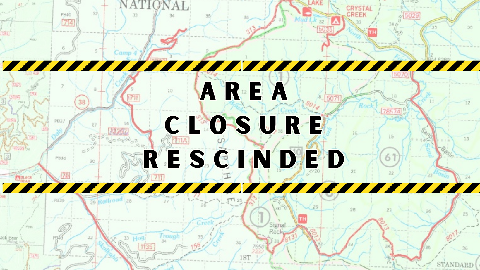
Area Closure Rescinded on the Bowles Creek Fire
Related Incident: Bowles Creek Fire
Publication Type: Closures
The Beaverhead-Deerlodge and Bitterroot National Forests have rescinded the area closure (order number 02-08-23-19) in association with the Bowles Creek Fire, effective at 6:00 a.m. this morning, September 8, 2023.
As a reminder, firefighters and agency personnel may be in the fire area, checking and monitoring conditions periodically. Expect other traffic and travel roads with caution.
Olympic National Park and Olympic National Forest Fire Update September 7
Related Incident: Eagle Point Fire
Publication Type: News
Olympic National Park and Olympic National Forest Fire Update- September 7
Port Angeles, Wash. – After cooler and more humid conditions, fire activity remained quiet today. However, firefighters are planning for a warming and drying trend over the next few days, which could increase fire activity.
Eagle Point Fire remains at 70 acres. Today, fire crews continued to double check and secure the fire perimeter near the switchbacks on Obstruction Point Road.
The Hurricane Fire is 85% contained and remains at 4 acres. Crews continued to double check and secure the fire perimeter. The Hurricane Ridge Road will remain open to the public.
The Delabarre, Low Divide, Martins Lake, and Diamond Mountain fires showed no change from yesterday and remain at the same acreage:
Fire Name
Initial Report
Estimated Size as of 9/5
Location
Hurricane
8/28/23
4 acres
2,000 ft below Hurricane Ridge parking area
Eagle Point
8/28/23
70 acres
~5 miles out Obstruction Point Road
Diamond Mountain
9/1/23
25 acres
3.3 miles NE of
Anderson Pass
Low Divide
9/1/23
4.5 acres
N. Fork Quinault drainage
Delabarre
9/1/23
1 acre
3 miles SE of Mount Christie
Martins Lake
9/2/23
.1 acres
2 miles NE of Mount Christie
Fire is an integral part of the forested ecosystems on the Olympic Peninsula; plants and animals here have evolved with fire for thousands of years. Many factors such as weather, topography, and vegetation influence fire behavior and the effects that fires have on natural resources.
Olympic National Forest Fires
The Tunnel Creek Fire, located east of the Buckhorn Wilderness in the Olympic National Forest, is now 80% contained, and is estimated at just under 1 acre in size. Moderated weather conditions continue to help firefighters as they work to create handline around the perimeter of the fire. Visitors are asked to avoid the area for public and firefighter safety. For additional information contact the Olympic National Forest Supervisor’s Office at (360) 956-2402.
Background Information
All six active fires in Olympic National Park ignited when a series of lightning strikes occurred on the Olympic Peninsula.
On August 18, Olympic National Park and Olympic National Forest implemented a fire ban including charcoal fires. The move to Stage 2 fire restrictions is due to continued hot and dry conditions that are forecasted to continue at least through the end of October as dry conditions in the region persist. One less spark means one less wildfire.
Closures
Obstruction Point Road and the trailhead will be closed until further notice. Olympic National Park Wilderness Information Center (WIC) will be notifying backcountry permit holders who may be impacted by this closure. Any permit holders who plan to backpack via the Obstruction Point Trailhead should contact the WIC at 360-565-3100 or https://www.nps.gov/olym/planyourvisit/wic.htm.
Weather and Fire Behavior
A weak upper level trough will move through the state this afternoon. A mix of clouds and sun will be seen in most places this afternoon. There is a slight chance of a couple showers. The weather clears out Friday into Saturday as surface high pressure and upper-level ridging build into the region. High temperatures will peak Saturday with upper 70s to low 80s. The next weather system arrives Sunday evening and Monday with a cold front sweeping through the state.
Information for the Eagle Point Fire can be found at: Eagle Point Fire Information | InciWeb (wildfire.gov)
Information for the Hurricane Fire can be found at: Hurricane Fire Information | InciWeb (wildfire.gov)
Olympic National Park information: www.nps.gov/olym
Olympic National Forest information: www.fs.usda.gov/olympic
State and county area burn bans: www.waburnbans.net
Daily Fire Update September 7th
Related Incident: Bear Creek Fire
Publication Type: News
September 7, 2023 Type 3 Team, Incident Commander: Nick Collard ICT3
Daily Update – 9:00 AM
Highlights: Fire activity and smoke production for both fires increased yesterday due to drier and relatively windier conditions. Active fire perimeter growth yesterday contributed to approximately 200 acres of growth on each incident. Significantly increased wildfire smoke from active fire growth is expected to persist in the area as near-critical fire weather conditions are forecast for today’s operational period (9/7).
Bear Creek Fire: 638 acres, increase of 192 acreages | 83% of objectives achieved | 28 personnel assigned
The Bear Creek Fire saw an increase of activity with a total increase of 192 acres. Personnel remain engaged in structure protection operations. Additional fire hose, pumps, and portable water tanks are arriving today for preemptive installation.
Weather: Expect a round of near critical fire weather conditions today. High temperatures will range from the upper-60s to upper-70s, with afternoon humidity dipping below 15%. Winds will generally blow from the southwest, with afternoon gusts potentially reaching 25 mph at ridgetops. These dry and breezy conditions are expected to persist Friday and Saturday.
San Juan National Forest Temporary Closures: Roads and trails within the Bear Creek Fire area are: Little Sand Trail (NFST #591) and Shaw Creek Trail (NFST#584).
Fire Information
Office Hours: 8:00 AM – 8:00 PM Phone: 970-426-5370
Bear Creek Fire
Email: 2023.BearCreek@firenet.gov
Inciweb
https://inciweb.nwcg.gov/incident-information/cosjf-bear-creek-fire
Facebook
https://www.facebook.com/profile.php?id=100095241777192
Daily Fire Update September 7th
Related Incident: Quartz Ridge Fire
Publication Type: News
September 7, 2023
Type 3 Team
Incident Commander: Nick Collard ICT3
Highlights: Fire activity and smoke production for both fires increased yesterday due to drier and relatively windier conditions. Active fire perimeter growth yesterday contributed to approximately 200 acres of growth on each incident. Significantly increased wildfire smoke from active fire growth is expected to persist in the area as near-critical fire weather conditions are forecast for today’s operational period (9/7).
Quartz Ridge Fire: 2,098 acres, increase of 203 acreages | 77% of objectives achieved | 68 personnel assigned
The Quartz Ridge Fire saw an increase of activity with a total increase of 202 acres. Firefighting personnel are present in Quartz Meadow/Quartz Creek constructing a shaded fuel break. Additional personnel continue to recon the new fire perimeter and its proximity to existing infrastructure.
Weather: Expect a round of near critical fire weather conditions today. High temperatures will range from the upper-60s to upper-70s, with afternoon humidity dipping below 15%. Winds will generally blow from the southwest, with afternoon gusts potentially reaching 25 mph at ridgetops. These dry and breezy conditions are expected to persist Friday and Saturday.
San Juan National Forest Temporary Closures: Closure orders are in effect and additional information can be found here: Quartz Ridge Closure and Bear Creek Closure. Roads and trails within the Quartz Fire area are Quartz Meadows Rd (NFSR#684), Quartz Ridge Trail (NFST#570), Quartz Creek Trail (NFST#571). The trails within the Bear Creek Fire area are Little Sand Trail (NFST #591) and Shaw Creek Trail (NFST#584).
Fire Information
Office Hours: 8:00 AM – 8:00 PM Phone: 970-426-5370
Quartz Ridge Fire
Email: 2023.QuartzRidge@firenet.gov
InciWeb:
https://inciweb.nwcg.gov/incident-information/cosjf-quartz-ridge-fire
Facebook
https://www.facebook.com/profile.php?id=100095556640621