
Final Daily Update September 8 2023
Related Incident:
Publication Type: News
Buckskin 2 Fire - September 8, 2023
Idaho Panhandle National Forests, Sandpoint Ranger District
Fire Information: 208-557-8813
https://inciweb.nwcg.gov/incident-information/idipf-buckskin-2-fire
Type 4 Incident Commander, Kelly Tucker
Location: Located approximately 8 miles due south of Clark Fork, ID on the upper end of Twin Creek and Buckskin Saddle, south of Highway 200
Start Date: 8/4/2023 Cause: Undetermined Size: 242 acres Containment: 100%
The Forest Closure Order for roads associated with the Buckskin Fire; the intersection of Forest Service Roads 203 and 332, the intersection of FSR 1021 and 332, and 1533 and 306 in Clark Fork. UTV trail 77. An extension of the FSR 203 closure, extending to the edge of private land, has officially been RESCINDED as of September 7, 2023. Visitors are reminded to drive and recreate with caution and be aware as hazards can still be present in the area.
Work that was outlined in the suppression repair plan is completed. Crews and Forest Service staff will still be in the area patrolling and backhauling any equipment left in the area.
This will be the Final Update for the Buckskin 2 Fire. The published email and phone number will still be monitored. If you are having any issues connecting to these sites, or simply have questions about the status of the fire, please call the fire information line at 208-557-8813. The line is staffed from 7 AM to 7 PM, and all calls will be returned.
Until a season-ending event occurs, smoke may be visible from pockets of unburned fuels within the perimeter of the fire. The smoke that has settled into the area is from existing large fires in Washington and British Columbia. See https://fire.airnow.gov/ for more detailed smoke information.
EVACUATION STATUS
The Bonner County Sheriff’s Office has rescinded the READY notification for the Twin Creek Rd and Rearden Rd residents in Clark Fork as of August 19, 2023, at 4 PM. Citizens should continue to stay alert and prepared, as fire conditions are always subject to quick and unexpected changes. Sign up for Bonner County Sheriff’s Office emergency messaging through NIXLE at www.nixle.com to receive local status updates.
The Temporary Flight Restriction that was in place for the safety of our aerial resources and firefighters on the ground has been officially rescinded as of August 20, 2023. Drone operators are reminded to never fly around active fire operations, as it could create critical interference with firefighting efforts. If you fly, we can't!
Camp Creek Fire Daily Update for Friday September 8
Related Incident: Camp Creek Fire
Publication Type: News
Camp Creek Fire Daily Stats: 1,940 acres, 17% contained, and 593 total personnel.
Weather and Fire Behavior:
The forest floor in the Bull Run Watershed is covered in a thick layer of duff. Duff is an organic material made up of decaying wood, leaves, and other plant materials that have accumulated over the years to form a mass several feet in depth. Recent rains moistened the surface of the duff and moderated fire behavior. As the warm and sunny weather pattern continues, this material will become more receptive to fire and the amount of smoke rising from the area will increase. Westerly winds will push this smoke from the fire area toward the east.
Operations:
As drying occurs, tactical firing operations will be implemented to secure fire edges. This is a process where highly trained firefighters use fire to remove fuels along the fire's edge. These controlled, low-intensity fires consume ground fuels, creating a buffer to contain the fire within the control line. This adds to containment on that portion of the fire's perimeter.
Crews successfully constructed a handline north of Forest Road 14, allowing firefighters to directly engage the fire. The next planned action in this area is mop up, which refers to a stage of firefighting to extinguish any remaining heat sources along a containment line.
The fire's southeastern edge – with steep terrain and hazard trees – continues to challenge firefighters. Since there are no well-defined edges from which to build a control line, crews are working along old logging roads as a safe and effective measure.
Firefighters continue to strengthen and improve containment lines along existing roads by removing brush and smaller trees that act as ladder fuels and provide a means for fire to reach the forest canopy. Trees that are felled are being collected and will be stored in log decks outside of the fire area. Commercial logging in the watershed is prohibited by law. The Forest Service is working with Portland Water Bureau to find ways to use these materials that benefit the community, tribal partners, fish and wildlife, and increase access to the Forest.
Fire information officers will be stationed at the Hoodland Thriftway in Welches, OR, from 1 – 7 p.m. today to provide updates and answer questions, followed by the Safeway in Sandy, OR, from 1 – 7 p.m. tomorrow.
Additional Information:
Current smoke outlook: https://outlooks.wildlandfiresmoke.net/outlook/2c7a8f9b.
Closures and Evacuations:
Barlow Wayside Park and the Sandy Ridge Recreation Site are temporarily closed due to fire activity. Clackamas County residents can sign up at https://www.clackamas.us/dm/publicalerts to receive emergency alerts via email, phone, or text.
Temporary Flight Restriction (TFR):
A TFR is issued over the fire area. It is illegal for members of the public to fly drones over or near wildfires because of the potential for accidents and disruption of suppression operations. Regardless of the fire, aircraft is not permitted to fly over the Bull Run Watershed Management Unit.
Videos:
- Click the link below to view today's morning video update by Operations Section Chief Matt Call.
You Tube Video: Morning Video Update with Operations Section Chief Matt Call for September 8 (7:36)
- Click the link below to view the video concerning the removal of cut trees from the fire area with the Mt. Hood Forest Supervisor, Meta Loftsgaarden.
You Tube Video: Repurposing Wood (3:25)
Daily Fire Update September 8th
Related Incident: Quartz Ridge Fire
Publication Type: News
QUARTZ RIDGE FIRE
September 8, 2023
Type 3 Team, Incident Commander: Nate Hallam
Daily Update – 9:00 AM
Highlights: Fire activity and smoke production for both fires increased yesterday due to drier and windier conditions, along with temperature rise. Fire growth and increased wildfire smoke is expected to persist in the area similar to yesterday, as near-critical fire weather conditions continue. The relative humidity recovery overnight was extremely poor, starting today’s operational period very dry. The Incident Commander will transition from Nick Collard to Nate Hallam, however the same objectives and operational tempo will remain in place.
Quartz Ridge Fire: 2,384 acres, increase of 286 acreages | 77% of objectives achieved | 64 personnel assigned
The Quartz Ridge Fire saw an increase of activity with a total increase of 286 acres. Yesterday, the southern/southeastern portion of the fire was the hottest, producing much of the smoke seen by the public. Firefighting personnel completed recon of Elwood Pass Road and looked at structure protection, cleanup, and prep at McCormack Cabin.
Weather: Today, the area will reach near critical fire weather conditions again. High temperatures will range from the mid-60s to upper-70s, with afternoon humidity dipping around 15%. Winds speeds will be lighter than they have been the last couple of days, but southwest gusts approaching 20 mph are possible at the ridgetops. Moving to through the weekend, some moisture is expected across the area, although only light showers and slight chance of thunderstorms, particularly on Sunday.
San Juan National Forest Temporary Closures: Closure orders are in effect and additional information can be found here: Quartz Ridge Closure and Bear Creek Closure. Roads and trails within the Quartz Fire area are Quartz Meadows Rd (NFSR#684), Quartz Ridge Trail (NFST#570), Quartz Creek Trail (NFST#571).
Tyee Ridge Complex Daily Update 090823
Related Incident: Tyee Ridge Complex
Publication Type: Announcement
Acreage: 7,577
Containment: 44%
Containment Approaches 50% on the Tyee Ridge Complex Fire
UMPQUA, Ore. – Effective suppression increased containment on the Tyee Ridge Complex fire to 44%. Last night firefighters secured the fireline and patrolled areas around homes near the NE corner of the Cougar Creek Fire. Crews detected one spot fire, and quickly lined and mopped it up. Crews patrolled and mopped up from the firing operations around homes on the SW corner near Hubbard Creek Road as well. Other areas of the Tyee Ridge Complex remain in mop up and patrol status. The infrared drone flew last night detecting hotspots during the operations.
Last night’s weather brought cooler temperatures with a high humidity recovery and smoke that lingered in the valley. Fire behavior may increase earlier this morning with warmer temperatures, low humidities, and light winds. Residents may see more smoke this afternoon.
Today, fire crews are working on hazard tree mitigation and continuing with mop up. Additional firing operations may take place to secure the fire’s perimeter. Helicopters will be supporting fire crews with water buckets as firefighters secure the control lines. Oregon Department of Forestry Team 1 will be transferring Command to ODF Team 3 at 6pm this evening.
Level 2 (Be Set) and Level 1 (Be Prepared) evacuation notices are still in effect. To view the current evacuation information map, go to www.dcso.com/evacuations. To shelter livestock, contact Douglas County Animal Control at 541-440-4471. Companion pets can be sheltered at Saving Grace Pet Adoption Center in Roseburg.
Oregon Department of Forestry Team 1
Joe Hessel, Incident Commander
Community Meeting Set for September 13
Related Incident: 2023 Horse Creek FireBedrock FireLookout Fire
Publication Type: Announcement
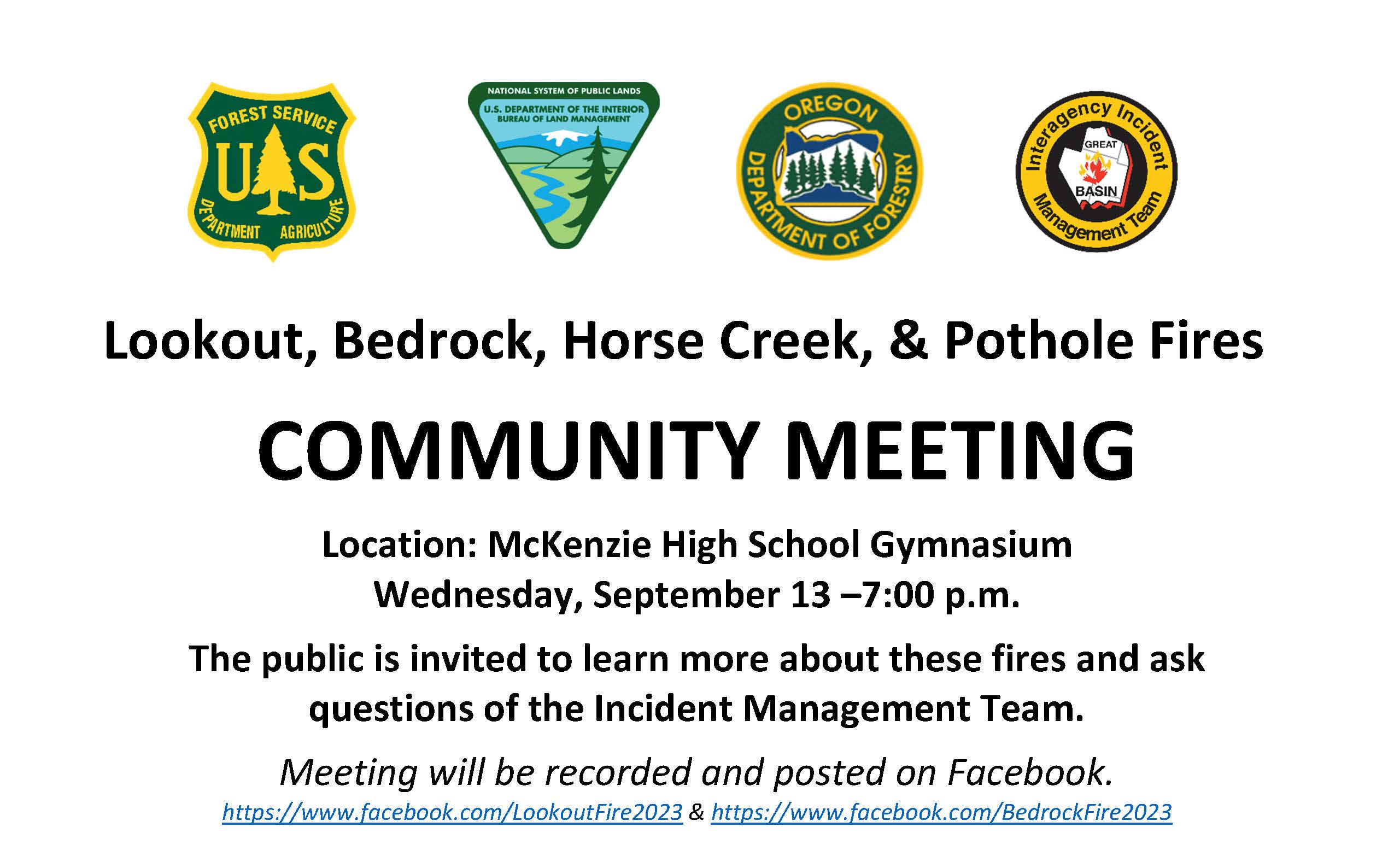
Lookout, Bedrock, Horse Creek, & Pothole Fires
COMMUNITY MEETING
Location: McKenzie High School Gymnasium
Wednesday, September 13 –7:00 p.m.
The public is invited to learn more about these fires and ask questions of the Incident Management Team.
Meeting will be recorded and posted on Facebook.
https://www.facebook.com/LookoutFire2023 & https://www.facebook.com/BedrockFire2023
Daily Fire Update September 8th
Related Incident: Bear Creek Fire
Publication Type: News
BEAR CREEK FIRE
September 8, 2023 Type 3 Team, Incident Commander: Nate Hallam
Daily Update – 9:00 AM
Highlights: Fire activity and smoke production for both fires increased yesterday due to drier and windier conditions, along with temperature rise. Fire growth and increased wildfire smoke is expected to persist in the area similar to yesterday, as near-critical fire weather conditions continue. The relative humidity recovery overnight was extremely poor, starting today’s operational period very dry. The Incident Commander will transition
Bear Creek Fire: 779 acres, increase of 141 acreages | 83% of objectives achieved | 22 personnel assigned
The Bear Creek Fire saw an increase of activity with a total increase of 141 acres. Yesterday, personnel received fire hose, pumps, and portable water tanks and will continue today reestablishing equipment in the Weminuche Valley for structure protection operations.
Weather: Today, the area will reach near critical fire weather conditions again. High temperatures will range from the mid-60s to upper-70s, with afternoon humidity dipping around 15%. Winds speeds will be lighter than they have been the last couple of days, but southwest gusts approaching 20 mph are possible at the ridgetops. Moving to through the weekend, some moisture is expected across the area, although only light showers and slight chance of thunderstorms, particularly on Sunday.
San Juan National Forest Temporary Closures: Closure orders are in effect and additional information can be found here: Quartz Ridge Closure and Bear Creek Closure. The trails within the Bear Creek Fire area are Little Sand Trail (NFST #591) and Shaw Creek Trail (NFST#584).
Fire Information
Office Hours: 8:00 AM – 8:00 PM Phone: 970-426-5370
Bear Creek Fire
Email: 2023.BearCreek@firenet.gov
Elizabeth Fire Daily Update 09082023
Related Incident: Elizabeth Fire
Publication Type: News
Fire Update
Friday September 8, 2023
Hours: 8 am-8 pm Phone: 318-239-9263
Email: 2023.TigerIsland@firenet.gov
InciWeb:
Tiger Island Fire: https://inciweb.nwcg.gov/incident-information/lalas-tiger-island-fire
Hwy 113 Fire: https://inciweb.nwcg.gov/incident-information/lalas-hwy-113-fire
Lions Camp Road Fire: https://inciweb.nwcg.gov/incident-information/lalas-lions-camp-road-fire
Elizabeth Fire: https://inciweb.nwcg.gov/incident-information/lalas-elizabeth-fire
Facebook:
Tiger Island Fire: https://www.facebook.com/TigerIslandFire
Hwy 113 & Lions Camp Road Fire: https://www.facebook.com/113andLionsCamp
Elizabeth Fire: https://www.facebook.com/ElizabethFireLa
Louisiana Statewide Burn Ban: As a reminder, the active State Fire Marshal’s Office’s burn ban order prohibiting ALL private burning, with no limitations, remains in effect. As does the corresponding burn ban from the Louisiana Department of Agriculture and Forestry prohibiting all agricultural burning, including but not limited to prescribed burning. However, Louisiana residents can resume outdoor cooking with safety measures in place. See http://sfm.dps.louisiana.gov/doc/press/pr_2023-36.pdf for more information. The use of open flames in fire pits, campfires, barrels, bonfires, burn piles, and like open burning is still prohibited. Citations and arrests ARE happening across this state in partnership with local and state law enforcement agencies.
Fire Name Acreage Personnel
Tiger Island 31,082 283
Hwy113 7,189 108
Lions Camp Road 785 19
Elizabeth 940 38
Personnel and Equipment:
Tiger Island: 1 Type-2 Crew; 20 Type-6 Engines; 1 Dozer; 1 Type-2 Tractor Plow Unit; 7 Type-3 Tractor Plow Units; 3 Water Tenders; 3 Ambulances.
Hwy 113: 1 Type-1 Crew; 17 Type-6 Engines; 5 Type-2 Tractor Plow Units; 6 Type-3 Tractor Plow Units; 2 Water Tenders.
Lions Camp Road: 2 Type-6 Engines; 3 Type-3 Tractor Plow Units and 1 Ambulance.
Elizabeth: 7 Type-6 Engines; 6 Type-3 Tractor Plow Units; 1 Water Tender and 1 Ambulance.
Air Resources Assigned to all Fires: 5 Helicopters and 2 Air Attacks.
Additional support is being provided to all fires by Parish authorities and departments, the Governor’s Office of Homeland Security and Emergency Preparedness, Sheriff’s offices, and the Offices of Emergency Preparedness.
Tiger Island Fire: The Tiger Island Fire was first reported on Tuesday, August 22nd. The fire is located East of Merryville, south of Hwy 190, SW of DeRidder and North of Singer. The fire is burning in pine plantations of multiple ages. Heavy residual fuels because of Hurricane Laura in 2020 exist and contribute to extreme fire behavior.
Operations: The Tiger Island Fire is currently 71% contained. Yesterday, there was active reburning in the interior of the fire due to needlecast and unburned fuels, causing an increase in smoke within the fire area. Today, crews will continue to mitigate needlecast along firelines to minimize reburn potential. Crews will continue mopping up further into the interior of the fireline.
Hwy 113 Fire: Located 14 miles northwest of Oakdale. This fire is burning in loblolly pines and hardwoods.
Operations: The Hwy 113 fire is currently 63% contained. Yesterday, crews were able to complete the additional dozer line in the southeast section of the fire. They also discovered more heat sources as the area continued to dry out from Monday’s rain and began to see the first needlecast within the fire area. Today, crews will focus heavily on mopping up on the north and south sides of the fire near Tenmile Creek. They will also utilize dozers to mitigate hazard trees to ensure firefighter safety and mop up any other hotspots that are found.
Lions Camp Road: Five miles northwest of Leesville. This fire is burning in southern rough, timber and brush.
Operations: The Lions Camp Road Fire is currently 83% contained. Yesterday, crews mopped up dozer berms and reached 20-foot interior mop up of firelines. They also began mitigating needlecast around the fire area by reestablishing dozer lines so the containment lines remain clear. Today, crews will continue to mop up and seek out isolated heat sources.
Elizabeth: Located in southwest Rapides Parish. The fire is south of Ten Mile Road and northeast of state Louisiana Hwy 462.
Operations: The Elizabeth Fire is 72% contained. Yesterday, crews completed fireline on the southern end of the fire and began mopping up. They also improved current lines for increased access. Crews will continue to improve sections of fireline to mitigate the effects of reburn from needlecast. Lastly, they will work to break up dozer berms and expose and extinguish any trapped heat near the fire perimeter.
Weather and Fire Behavior: A heat advisory is in effect over the fire areas today, with heat indices predicted to reach 112 degrees. Relative humidity is forecasted to drop into the mid-30s. A weak front is expected to push through the area in the mid-afternoon, bringing a 30-40% chance of thunderstorms. Strong wind gusts could lead to active fire behavior, as live vegetation is still critically dry. Needlecast is beginning on the Hwy 113 and Lions Camp Road Fires, increasing fuel loads.
Air Quality: Very little smoke is present in communities; light smoke may be present in interior roads or near smoldering large fuels. There was some smoke visible yesterday from interior reburn on the Tiger Island Fire. New ignitions or reburn in areas where heavy needlecast is present could lead to additional smoke. All communities should experience good air quality. For near time air quality information see EPA's Fire and Smoke Map: https://fire.airnow.gov/
Temporary Flight Restriction: A Temporary Flight Restriction (TFR) is in place over the Tiger Island Fire and Hwy 113 and Elizabeth Fire areas. This is necessary to protect aerial operations. If you fly, we can’t. If there are drone intrusions into the Temporary Flight Restrictions, we must ground all aircraft.
Actualizacin del Incendio del Complejo Cowlitz 8 de septiembre de 2023
Related Incident: Cowlitz Complex
Publication Type: News
Equipo Dos de Gestión de Incidentes del Complejo del Área de las Montañas Rocosas
Jared Hohn, Comandante del incidente
Reunión comunitaria:Habrá una reunión de la comunidad a las 6:00 de esta tarde en el Randle Fire and EMS, ubicado en 9978 US-12 en Randle. El CIMT proporcionará una actualización sobre el Complejo Cowlitz, seguido de preguntas y respuestas.
Situación actual: El Complejo Cowlitz está contenido en un 12%, y con la mejora de la cartografía, los acres se han ajustado a 657 acres. Un total de 439 personas están asignadas actualmente. Con el calentamiento, las condiciones climáticas de secado, el comportamiento del fuego se espera un aumento en el próximo par de días.
Las cuadrillas siguen comprobando el calor residual en cada incendio, utilizando diversos recursos de detección de calor, incluidas imágenes térmicas y de otro tipo mediante aeronaves tripuladas y no tripuladas, así como mediante recursos terrestres. Estamos aplicando la herramienta adecuada para cada trabajo en función del acceso, la pendiente y otras consideraciones. Un sistema aéreo no tripulado sobrevolará hoy los incendios menos accesibles de la Rama I para ayudar a vigilar y comprobar si aumenta el comportamiento del fuego o cambian las condiciones. El uso de drones privados está prohibido dentro de la zona del incendio en virtud de las restricciones temporales de vuelo (TFR) al norte y al sur de la US-12. Las cuadrillas pueden utilizar UAS dentro del TFR debido al contacto y la coordinación con otros recursos aéreos.
En la Subdivisión I/División C/F, los bomberos volvieron a visitar los incendios de Allen Mountain, Cougar Gap y Berry, sin encontrar humo ni otros indicios de calor. Un operador de bulldozer y las cuadrillas de bomberos están reparando antiguos caminos madereros al oeste del incendio de Grassy Mountain para mejorar el acceso y cortar la maleza para su posible uso como futuros elementos de control. Las cuadrillas siguen trabajando en los incendios de Pothole, Willame y Yew, limpiando los puntos calientes. Un motor sigue asignado a vigilar el incendio de Carlton Ridge.
En la Subdivisión II/División L, los equipos están limpiando los puntos calientes de los incendios de Adams Fork, Jackpot y Mission, donde el calor se ha ocultado en capas profundas de turba y musgo. Mientras las cuadrillas siguen encontrando humos, continúan trabajando en esos incendios.
En la Subdivisión II/División W, las cuadrillas están trabajando en las proximidades de los incendios de Spencer Quartz y Snagtooth, talando y desbrozando a lo largo de antiguos caminos madereros, seguidos de una masticadora para ampliar aún más el acceso para los camiones de bomberos y las cuadrillas, y una topadora para mejorar las superficies de los caminos. El terreno extremo y la alta densidad de árboles caídos suponen un riesgo inaceptable para los bomberos en caso de ataque directo a lo largo de los perímetros de esos incendios.
Restricciones contra incendios: Las restricciones contra incendios están en vigor. Las hogueras están prohibidas en todo el Bosque Nacional de Gifford Pinchot; sólo se permiten hogueras, estufas y linternas alimentadas con propano. Para más información, visite el sitio web del bosque en Gifford Pinchot National Forest - Fire Management (usda.gov). La decisión de levantar o mantener las restricciones contra incendios depende de factores como las condiciones meteorológicas actuales y previstas, la humedad del combustible, el nivel de actividad del incendio y la disponibilidad de recursos de extinción para responder a nuevas igniciones.
Información meteorológica y sobre el humo: Se espera que la nubosidad desaparezca a media mañana, con sol y cielos despejados. Las temperaturas serán entre 5 y 10 grados más cálidas que ayer, con vientos ascendentes. La humedad relativa mínima será más baja, entre el 40 y el 45%. Muy poco humo ha sido visible a partir de estos incendios durante la semana pasada, sin embargo, el calentamiento y la tendencia de secado, el aumento de comportamiento del fuego y el aumento de la producción de humo se puede esperar en los próximos días o semanas.
Cierres: En previsión de la actividad del fuego en curso en las proximidades del Snagtooth Fire las siguientes carreteras y senderos están cerrados al público para reducir la exposición y ayudar a garantizar la seguridad pública: Carreteras forestales 9300 y 9341, Boundary Trail #1 (desde Elk Pass hasta la intersección con Summit Prairie), Summit Prairie #2, Craggy Peak #3, Snagtooth #4, Quartz #5, Stabler Camp #17, Wright Meadows #80, Basin Camp #3A, Quartz #5B, Quartz #5C (French Creek), Snyder Pasture #80A. La carretera forestal 8410 está cerrada para la seguridad de los bomberos y del público en las proximidades del incendio de Pothole, y la carretera forestal 78 está cerrada temporalmente entre el cruce 7802 y el cruce 2278 debido a los escombros peligrosos que ruedan por la calzada.
Restricciones temporales de vuelo: Hay dos TFR en vigor, uno situado al norte de la US-12 hasta el Parque Nacional del Monte Rainier, y un nuevo TFR al sur de la US-12 para incluir los incendios de Snagtooth y Spencer Quartz. Si una aeronave no autorizada entra en el TFR, la respuesta de la aviación al incendio se interrumpe o se retrasa. Las restricciones temporales de vuelo también se aplican a los sistemas de aeronaves no tripuladas o drones. ¡Si usted vuela, nosotros no podemos! Más información sobre el uso seguro y responsable de drones en Home - Know Before You Fly.
Cowlitz Complex Update September 8 2023
Related Incident: Cowlitz Complex
Publication Type: News
Rocky Mountain Area Complex Incident Management Team Two
Jared Hohn, Incident Commander
Community Meeting: There will be a community meeting at 6:00 this evening at the Randle Fire and EMS, located at 9978 US-12 in Randle. The CIMT will provide an update on the Cowlitz Complex, followed by question and answer.
Current Situation: The Cowlitz Complex is 12% contained, and with improved mapping, acres have been adjusted down to 657 acres. A total of 439 personnel are currently assigned. With warming, drying weather conditions, increased fire behavior is expected over the next couple of days.
Crews on the fires continue to check for residual heat on each fire, using a variety of heat detection resources, including thermal and other imaging by manned and unmanned aircraft, as well as by ground resources. We are applying the right tool for the job depending on access, slope, and other considerations. An unmanned aerial system will be flying over less accessible fires in Branch I today to assist with monitoring and checking for any increased fire behavior or changed conditions. Private drone use is prohibited within the fire area under temporary flight restrictions (TFR) north and south of US-12. Crews are able to utilize UAS within the TFR due to contact and coordination with other air resources.
In Branch I/Division C/F, firefighters revisited the Allen Mountain, Cougar Gap, and Berry fires, finding no smokes or other evidence of heat. A dozer operator and fire crews are repairing old logging roads west of Grassy Mountain Fire to improve access and cutting back brush for potential use as future control features. Crews continue working the Pothole, Willame, and Yew fires, mopping up hot spots. An engine remains assigned to keep eyes on the Carlton Ridge Fire.
In Branch II/Division L, crews are mopping up hot spots on the Adams Fork, Jackpot, and Mission fires, where heat has been hidden within deep duff and peat moss layers. While crews continue to find smokes, they continue working those fires.
In Branch II/Division W, crews are working in the vicinity of Spencer Quartz and Snagtooth fires, cutting back and brush along old logging roads, followed by a masticator to further widen access for fire trucks and crews, and a dozer to improve road surfaces. Extreme terrain and a high density of falling tree hazards create unacceptable risk to firefighters for direct attack along those fires’ perimeters.
Fire Restrictions: Fire Restrictions are in effect. Campfires are prohibited across the Gifford Pinchot National Forest – only propane-fueled fire pits, stoves and lanterns are allowed. Additional information is available on the forest’s website at Gifford Pinchot National Forest - Fire Management (usda.gov). The decision to lift or maintain fire restrictions depends on factors such as current and expected weather conditions, fuel moisture, the level of fire activity, and the availability of firefighting resources to respond to additional ignitions.
Weather & Smoke Information: Cloud cover is expected to break up by mid-morning, bringing sun and clear skies. Temperatures will be 5 to 10 degrees warmer than yesterday, with increased upslope and upvalley winds. Minimum relative humidity will be lower, in the 40 to 45% range. Very little smoke has been visible from these fires over the past week; however, warming and drying trend, increased fire behavior and increased smoke production can be expected over the coming days or weeks.
Closures: In anticipation of ongoing fire activity in the vicinity of the Snagtooth Fire the following roads and trails are closed to the public to reduce exposure and help ensure public safety: Forest Roads 9300 and 9341, Boundary Trail #1 (from Elk Pass to intersection with Summit Prairie), Summit Prairie #2, Craggy Peak #3, Snagtooth #4, Quartz #5, Stabler Camp #17, Wright Meadows #80, Basin Camp #3A, Quartz #5B, Quartz #5C (French Creek), Snyder Pasture #80A. Forest Road 8410 is closed for firefighter and public safety in the vicinity of the Pothole Fire, and Forest Road 78 is temporarily closed between the 7802 junction and the 2278 junction due to hazardous debris rolling out onto the roadway.
Temporary Flight Restrictions: Two TRF's are in effect, one located north of US-12 to Mount Rainier National Park, and a new TFR south of US-12 to include Snagtooth and Spencer Quartz fires. Fire aviation response is halted or delayed if an unauthorized aircraft enters the TFR. Temporary flight restrictions also apply to unmanned aircraft systems or drones. If you fly, we can't! Learn more about how to use drones safely and responsibly at Home-Know Before You Fly.
Oregon Fire Update 982023
Related Incident: Oregon Fire
Publication Type: News
Oregon Fire Update 9-8-2023
Fire Size: 10,817 acres
Initial Start: 8/18/2023 at 1600 pm
Location: Approximately 4 miles northeast of Elk, WA.
Cause: Human- Still under investigation
Containment: 93%
Resources Committed: 8 Engines, 5 Crews, 1 Bulldozer, 6 Water Tenders, 2 Skidgens
Personnel: 152
Road Closures: None
Elk, WA, - Current Situation: Northeast WA Incident Management Team 3 is in command of the Oregon and Gray fires. The Oregon Fire continues to remain within the current footprint with no further growth, the strategy remains full suppression and work is progressing as expected. Northeast WA Incident Management Team 3 will continue their efforts through the 11th before turning the fire back to local resources next week.
Today’s activities: With the dry weather taking hold over the fire area after the recent moisture, there is the possibility for isolated sources of heat to pop up. Crews will continue to patrol the area, both on road and by foot, to find and mop-up any of those isolated heat sources. Those residing in and around the fire area will also start to see salvage logging and post fire clean up, by landowners, within in the fire perimeter. These activities will likely cause clouds of dust and ash that resemble smoke. With crews in the area for the foreseeable future, they will be able to verify if any reports are false alarms or cause for response.
Evacuations: All evacuations throughout the entire fire area have been rescinded.
Weather: There is a slight chance for lightning activity today as a front moves into the Oregon Fire area. After that front passes, continued dry air will reside over the area with relative humidity at or below 25% through the weekend.
For fire information contact the Public Information Officer at 509-508-3323 or email 2023.oregon@firenet.gov
Inciweb: https://inciweb.wildfire.gov/incident-information/wanes-oregon-fire
Facebook: https://www.facebook.com/newfireinfo