
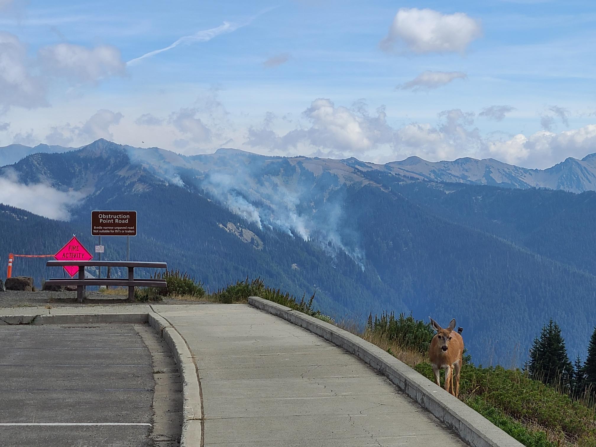
The Eagle Point Fire is located approximately 5 miles out the Obstruction point Road and is currently 122 acres.
The Eagle Point Fire is one of seven active fires in Olympic National Park that were ignited when a series of lightning strikes occurred on the Olympic Peninsula in the afternoon on August 28.
Fire is an integral part of the forested ecosystems on the Olympic Peninsula; plants and animals here have evolved with fire for thousands of years. Many factors such as weather, topography, and vegetation influence fire behavior and the effects that fires have on natural resources.
Due to wildfire activity the following closures are in effect until further notice:
- Elwha River Trail from Elkhorn to Low Divide
- Hayden Pass Trail
- Dosewallips River Trail from Dose Meadows to Hayden Pass
- Dodger Point Way Trail
- North Fork Quinault Trail from Elip Creek trail junction to Low Divide
- Skyline Trail from Elip Creek Trail junction to Low Divide
- Martin Park Trail
- Obstruction Point Road and Trailhead
Olympic National Park Wilderness Information Center (WIC) will be notifying backcountry permit holders who may be impacted by this closure. Any permit holders who plan to backpack in the above impacted areas should contact the WIC at 360-565-2992 or by emailing OLYM_WIC@nps.gov.
| Current as of | Sun, 09/17/2023 - 00:43 |
|---|---|
| Incident Type | Wildfire |
| Cause | Lightning |
| Date of Origin | |
| Location | Olympic National Park |
| Incident Commander | Olympic Interagency Fire Management - Olympic National Park and Olympic National Forest |
| Coordinates |
47° 56' 10'' Latitude
-123° 25' 26
'' Longitude
|
| Total Personnel: | 40 |
|---|---|
| Size | 122 Acres |
| Fuels Involved | Heavy dead and down fuels |
| Significant Events | Warm temperatures and low relative humidity levels greatly increased fire activity on the Delabarre Fire. After low fire activity for the last several days, it grew significantly in size. Acreage estimates are between 400 and 500 acres, but a more accurate size will be known tomorrow after infrared mapping flights take place. |
| Weather Concerns | High pressure aloft will move away from the region today, but the fire sites will still feel its effects with another day of warm and dry conditions. Relative humidity values will remain slightly above critical thresholds, although combined with the poor overnight recoveries lately, the potential for active fire behavior remains high. Onshore flow will increase tonight along with clouds associated with an incoming front. This will not make much of an impact on overnight relative humidity recoveries, but its effects will be felt throughout the day Sunday as well as the potential for showers Sunday night into Monday. |
|---|