
Actualizacin del incendio Stayman 21 de agosto de 2024 08 21 2024
Related Incident:
Publication Type: News
Actualización del incendio Stayman
21 de agosto de 2024
Tamaño: 3,458 acres
Fecha de inicio: 20 de agosto de 2024
Ubicación: 1.5 millas al SE de Chelan
Contencón: 0%
Personal: 184
Causa: A ser determinada
Recursos asignados: 6 equipos de obreros, 17 camiones de bomberos, maquinaria pesada adicional y apoyo aéreo
Incendios Pioneer, Flat, Easy, y Stayman – Habrá una sesión informativa virtual comunitaria el miércoles 21 de agosto a las 5:30 p.m.
Vea la sesión informativa virtual comunitaria en vivo en la página de Facebook de información de los incendios Pioneer e Easy Fires en facebook.com/profile.php?id=61560760893080. Envíe sus preguntas con antelación a 2024.pioneer@firenet.gov o a través de Facebook Messenger.
SITUACIÓN ACTUAL: Ayer, el día 20 de agosto y poco después de las 2:00 p.m., los bomberos respondieron a un incendio de maleza de 25 acres que se desplazaba cuesta arriba por el área de vida silvestre de Chelan Butte. El fuego se quema dentro de césped alto, maleza, salvia y madera. Los bomberos lucharon hasta la noche para proteger las casas y minimizar el desplazo del fuego. También utilizaron topadoras para construir un cortafuegos a lo largo de los extremos sur y oeste del incendio. Ayer por la tarde, las aeronaves vertieron retardante y agua para reducir la propagación del fuego y apoyar a los bomberos en tierra. Se pide a los navegantes de botes que den suficiente espacio a los aviones que trabajan en el lago Chelan.
ACTIVIDADES DE HOY: El Equipo 3 de gestión de incidentes 3 del complejo Noroeste, que ha gestionado los incendios Pioneer, Easy y Flat, también tomó el mando del incendio Stayman a las 7:00 a.m. esta mañana. Trabajará para mantener el incendio lo más pequeño posible mientras garantiza la seguridad de los bomberos y protege a las comunidades alrededor. Los bomberos continuarán manteniendo las laderas oeste y sur del incendio dentro de las líneas establecidas por las topadoras y retardantes. También reforzarán el cortafuegos a lo largo del extremo norte del incendio por abajo de Chelan Butte para proteger las propiedades privadas que se encuentran allí.
CLIMA: Las temperaturas estarán a mediados de los 70 hoy. El día de hoy se esperan condiciones secas hasta la tarde. Hay una ligera probabilidad de lluvias hoy, con una posibilidad creciente de lluvias hasta el viernes. Los vientos serán ligeros y el terreno impulsará durante la mañana, y aumentará por la tarde soplando más del suroeste.
EVACUACIONES: Existen órdenes de evacuación vigentes debido el incendio Stayman. Para ver más información, comuníquese con el Departamento de gestión de emergencias del condado de Chelan (facebook.com/CCSOEM) o consulte el Mapa de incidentes de emergencia del condado de Chelan: Chelan Co Emergency Incidents App (arcgis.com).
InciWeb: https://inciweb.wildfire.gov/incident-information/wases-pioneer
Facebook: https://www.facebook.com/profile.php?id=61560760893080
Línea de información de los incendios: 541-861-5808, 8 a.m. to 8 p.m.
Correo electrónico: 2024.pioneer@firenet.gov
August 21 2024 Daily Update 08 21 2024
Related Incident: Red Fire
Publication Type: News
Size: 737 acres Location: 5 miles west of Crescent Lake Junction, OR County: Klamath
Start Date: July 17, 2024 Cause: Lightning Containment: 0% Total Personnel: 118
Crescent, OR – The Red Fire is burning within the Diamond Peak Wilderness of the Deschutes National Forest, on the southwest slope of Redtop Mountain. The fire continues being managed under a full suppression strategy. Public and firefighter safety is the highest priority in managing this fire.
Yesterday’s Activities – The fire activity picked up in dead and down fuels during the late afternoon and there was increased smoke visible. Shaded fuel break construction continued yesterday along the northwest side of Crescent Lake. The trees and vegetation are being trucked out of the fire area for storage and disposal.
Today’s Activities – Crews are making good progress constructing the shaded fuel break between Crescent Lake and Summit Lake. Managers are working with the “208 MF” fire team on the Willamette Complex for long term coordination.
Weather and Smoke – No precipitation was received over the fire yesterday. A low-pressure system will continue to develop off the Pacific Northwest coast by Thursday and is expected to bring wet chilly weather across the fire area with light rain Friday through Sunday. https://fire.airnow.gov/.
Closures – The Deschutes National Forest emergency closure around Crescent Lake and in Diamond Peak Wilderness is still in effect. The public should note that Forest Service Road 60 is closed, and road guards have been posted for public safety. More closure information is available at: https://www.fsa.gov/alerts/deschutes/alerts-notices/?aid=89091
Evacuations – The WILDFIRE! Level 1 – BE READY to Evacuate notice issued by Klamath County Emergency Management for Crescent Lake, Odell Lake, and Crescent Junction areas remains in effect (INCENDIO FORESTAL! Nivel 1 - ESTÉ PREPARADO para evacuar de las siguientes zonas: Crescent Lake, Odell Lake, Crescent Junction). Visit www.klamathcounty.org/300/emergency-management for more information or to sign up for alerts.
Fire Restrictions – Stage 2 Public Use Fire Restrictions – which prohibit open fires, including in developed campgrounds – remain in effect for the Deschutes National Forest. The Industrial Fire Precaution Level is currently Level IV “General Shutdown.” Visit fs.usda.gov/detail/deschutes/home/?cid=stelprdb5297376 for more information.
Drone Restrictions – Aerial firefighting is suspended when unauthorized drones (UAS) are in the area. Unauthorized drone use over a fire area poses serious risks to fire personnel and the effectiveness of wildfire suppression operations. If you fly, we can’t.
Coffee Pot Fire Update 08 21 2024
Related Incident: Coffee Pot Fire
Publication Type: News
CURRENT SITUATION: As expected, the Coffee Pot Fire continues to gradually spread on the landscape, advancing about two-tenths of a mile per day. Yesterday, the southeast flank of the fire burned slowly along the forest floor in Surprise Grove leaving the tree tops undamaged. Fire crews and heavy equipment continued constructing indirect control lines along the west and south flanks. Firefighters also continued prepping the various sequoia groves in the area of Case Mountain to help minimize the fire’s impact on those values. Water-dropping “scooper” planes worked to support suppression efforts along the western flank to slow the fire’s spread in that direction.
Today’s operations on the western flank will focus on building the indirect control line north from South Fork Drive to Salt Creek Road. Additionally, firefighters will look to connect this control line through Cinnamon Gap to Mineral King Road. On the southeast flank, crews will continue prepping and constructing handlines near Cedar Creek near Lady Bug Trail.
WEATHER: Today’s weather should be similar to yesterday with cooler conditions expected later this week as a cold front passes through. Humidity and overnight recovery will be higher heading into the weekend. Cloud cover will increase by Friday, but dry weather is expected over the fire area.
SMOKE IMPACTS: Air quality will remain poor to unhealthy near Three Rivers, CA. Everyone should take precautions to reduce outdoor activities, especially those sensitive to smoke. For more information on current wildfire smoke impacts in your community, please visit AirNow.gov or fire.airnow.gov.
HIGHWAY AND ROAD IMPACTS: Highway 198, Mineral King Road, and the Generals Highway in Sequoia and Kings Canyon National Parks are open.
BLM AND PARK CLOSURES: The portion of South Fork Drive in Sequoia National Park and trails accessed from the road, including the Lady Bug and Garfield Grove Trails, are closed until further notice. You can view all Park closure information online at: https://www.nps.gov/seki/learn/management/superintendent-s-compendium.htm. The Bureau of Land Management has also issued a closure of the Case Mountain Extensive Recreation Management Area: https://www.blm.gov/press-release/bureau-land-management-temporarily-closes-case-mountain-recreation-area.
EVACUATION WARNING: An Evacuation WARNING has been issued for TLC Zones TLC-E128-B and TLC-E094-B, area north of South Fork Drive, East of Skyline Drive (Salt Creek Fire Control Road), South of Mineral King Road, and West of the National Park Boundary. An evacuation WARNING means you should prepare to evacuate the area should the fire approach your home or if ordered to do so. Please stay clear and out of the areas affected by the fire. If there is an emergency please dial 911. https://tularecounty.ca.gov/emergencies/.
Miners Complex Daily Update 08 21 2024
Related Incident: Miners Complex Fires
Publication Type: Announcement
11:00 AM, August 21, 2024
Estimated size: 1,098 acres
Start Date/Time: July 17, 2024
Area of Origin: 21 air miles east of Darrington WA
Cause: Lightning
Fuels/Topography: timber, rugged terrain
Structures Damaged: None, there are no homes threatened at this time.
Evacuations: None
The Miners Complex consists of ten wildfires caused by lightning strikes in the Mt. Baker-Snoqualmie National Forest. The fires included in the complex are: Miners Fire, Vista Ridge Fire, Dolly Creek Fire, Sulphur Three Fire, Sulphur Four Fire, Sulphur Thirty-Four Fire, Upper Sulphur Thirty-Two Fire, Lower Sulphur Thirty-Two Fire, Plummer, and Middle Ridge Fire.
Update: The cool weather over the last few days have provided relief for the fires, though they are still active. Heavy, low cloud covers have resulted in high relative humidities and minimal fire behavior. In the next two days minimal growth is anticipated due to high humidities and chance of showers.
Weather: Cool and unsettled weather into the weekend. Upper level low north of Vancouver Island will move south ending up off the Oregon coast late tonight and Thursday. The southerly movement of the low will make it hard for the associated front to move eastward today and tonight. The system will be close enough to the area for a chance of showers. Chance of showers continuing Thursday with a slight chance of an afternoon thunderstorm as the air mass becomes slightly unstable. Mostly cloudy today, with max temperatures around around 64. Light winds will continue through the evening.
Smoke: For more information on smoke and air quality please visit: https://wasmoke.blogspot.com/
Closures: The following is a summary of the areas closed due to the fires in the Miners Complex: Pacific Crest National Scenic Trail #2000.2 from Mica Lake to Suiattle Pass, Suiattle River Trail #784, Miners Ridge Trail #785, Buck Creek Pass Trail #789, Miners Cabin Trail #795, Grassy Point Trail #788, Sulphur Mountain Trail #794, Sulphur Creek Trail #793, Sulphur Creek Campground, Sulphur Creek Trailhead, and the Downey Creek trailhead. Suiattle River Road, closure beginning at Downey Creek trailhead. The full Closure Orders visit: https://www.fs.usda.gov/mbs Forest Restrictions: The Mt. Baker-Snoqualmie has a full campfire ban and forest-wide shooting restrictions in place to help prevent human-caused starts during this period of unprecedented resource scarcity. Additional details at: www.fs.usda.gov/mbs
###
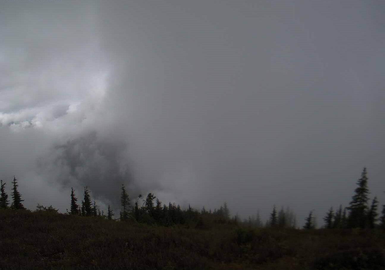
Stayman Fire Update 08 21 2024
Related Incident:
Publication Type: News
Stayman Fire Update
August 21, 2024
Quick Facts
Size: 3,458 acres
Start Date: August 20, 2024
Location: 1.5 miles SE of Chelan
Containment: 0%
Personnel: 184
Cause: Under investigation
Resources Assigned: 6 crews, 17 engines, additional heavy equipment and air support
Pioneer, Flat, Easy, and Stayman Fires - Virtual Community Briefing Wednesday, August 21 at 5:30 p.m.
View the live virtual community briefing on the Pioneer and Easy Fires Information Facebook Page at facebook.com/profile.php?id=61560760893080. Please submit questions in advance to 2024.pioneer@firenet.gov or via Facebook Messenger.
CURRENT SITUATION: Shortly after 2:00 p.m. yesterday, August 20, firefighters responded to a 25-acre brush fire moving uphill through the Chelan Butte Wildlife Area. The fire is burning in tall grass, brush, sage and timber. Firefighters worked into the night to protect homes and limit fire spread. Bulldozers were also used to construct a fireline along the southern and western edges of the fire. Throughout the afternoon yesterday, aircraft dropped retardant and water to reduce fire spread and aid firefighters on the ground. Boaters are asked to give scooper planes operating out of Lake Chelan plenty of space.
TODAY’S ACTIVITIES: Northwest Complex Incident Mangement Team 3, which has been managing the Pioneer, Easy, and Flat fires, also assumed command of the Stayman Fire at 7:00 a.m. this morning. The team will be working to keep the fire as small as possible while ensuring firefighter safety and protecting the surrounding communities. Firefighters will continue holding the west and south flanks of the fire within the established dozer and retardant lines. They will also reinforce fireline along the northern edge of the fire below Chelan Butte to protect private properties below.
WEATHER: Temperatures will be in the mid-70s today. Dry conditions are expected through this afternoon. There is a slight chance of showers today, with increasing chance of showers into Friday. Winds will be light and terrain driven through the morning hours, increasing in the afternoon with a more southwesterly component.
EVACUATIONS: Evacuation orders are in place for the Stayman Fire. For more information, please contact Chelan County Emergency Management (facebook.com/CCSOEM) or view the Chelan County Emergency Incidents Map: Chelan Co Emergency Incidents App (arcgis.com).
InciWeb: https://inciweb.wildfire.gov/incident-information/wases-pioneer
Facebook: https://www.facebook.com/profile.php?id=61560760893080
Fire Information Line: 541-861-5808, 8 a.m. to 8 p.m.
Email: 2024.pioneer@firenet.gov
Pincer Two Fire Daily Update 08 21 2024
Related Incident: Pincer Two Fire
Publication Type: Announcement
11:00 AM, August 21, 2024
Estimated size: 189 acres
Start Date/Time: July 17, 2024
Area of Origin: Johannesburg Mountain. 1 Mile East of Mineral Park C.G.
Cause: Lightning
Fuels/Topography: Timber, rugged terrain
Structures Damaged: None, there are no homes threatened at this time.
Evacuations: None
Closures: Cascade River Road at and including Marble Creek Campground, Mineral Park Campground, and all tributary roads, trailheads, and trails are all closed. The public is not to enter the area for public and firefighter safety.
Full closure orders available at: https://www.fs.usda.gov/mbs
Update: Cool temperatures, heavy cloud cover and scattered rainfall resulted in minimal growth on the fire for the past few days. Firefighters continue to patrol along the Cascade River Road and FS Road 1590 for any falling debris. Minimal growth is anticipated over the next few days due to high humidities and chance of showers.
Weather: Cool and unsettled weather into the weekend. Upper level low north of Vancouver Island will move south ending up off the Oregon coast late tonight and Thursday. The southerly movement of the low will make it hard for the associated front to move eastward today and tonight. The system will be close enough to the area for a chance of showers. Chance of showers continuing Thursday with a slight chance of an afternoon thunderstorm as the air mass becomes slightly unstable. Mostly cloudy today, with max temperatures around around 64. Light winds will continue through the evening.
Smoke: For more information on smoke and air quality please visit: https://wasmoke.blogspot.com/
Air Space Restrictions: There are no air space restrictions at this time.
Forest Restrictions: The Mt. Baker-Snoqualmie has a full campfire ban and forest-wide shooting restrictions in place to help prevent human-caused starts during this period of unprecedented resource scarcity. Additional details at: www.fs.usda.gov/mbs
###
Actualizacin diaria del incendio Easy 21 de agosto de 2024 08 21 2024
Related Incident: Easy Fire
Publication Type: News
Actualización diaria del incendio Easy
21 de agosto de 2024
Datos clave
Tamaño: 2,130 acres
Fecha de inicio: 17 de julio de 2024
Ubicación: 17 millas al oeste de Mazama, WA
Contención: 36%
Personal asignado: 115
Causa: Rayo
Recursos asignados: 2 equipos de obreros, 5 camiones de bomberos, 5 tanques de agua
Esta será la última actualización diaria de fuego para el incendio Easy a menos que cambien las condiciones.
Habrá una sesión informativa virtual comunitaria el miércoles 21 de agosto a las 5:30 p.m. en la página de Facebook de información de los incendios Pioneer y Easy en facebook.com/profile.php?id=61560760893080 Envíe sus preguntas con antelación a 2024.pioneer@firenet.gov o a través de Facebook Messenger.
SITUACIÓN ACTUAL: El clima húmedo reciente y las temperaturas más frías han ayudado a minimizar la intensidad del incendio Easy. Los bomberos en tierra, ayudados por helicópteros que vierten agua, han logrado mantener el fuego dentro de su huella actual en los últimos días. El terreno escarpado e inaccesible y los peligros aéreos, lo que incluye árboles caídos y la posibilidad de escombros rodantes, limitan la capacidad de los bomberos para entrar a ciertas partes del incendio. Los recursos han fortalecido áreas del incendio a lo largo de la carretera 20 y dentro del desague de Swamp Creek donde se ve que es seguro hacerlo. En lugares donde el fuego no ha llegado a la carretera, se ha preparado el bosque a lo largo de la carretera para el fuego al removerse grandes concentraciones de vegetación lo que minimizará la intensidad del fuego en caso de que este se desplace en esa dirección. También se están usando las características naturales en el norte y el sur para limitar la propagación del fuego en el incendio Easy.
El incendio Easy continuará en el paisaje hasta que haya un cambio grande en el patrón climático, tal como varios días consecutivos de lluvia húmeda que por lo general significa el final de la temporada de incendios. Los visitantes de la zona continuarán viendo humo en el interior del incendio mientras que los combustibles pesados siguen quemándose y ardiendo. Los bomberos patrullarán el incendio para asegurarse de que el calor permanezca dentro de la huella actual del fuego.
ACTIVIDADES DE HOY: Hoy los bomberos continuarán usando sistemas de aeronaves no tripuladas (UAS) para buscar cualquier foco de calor residual que quede. Con la ayuda de agua vertidad estratégicamente, los bomberos extinguirán cualquier calor que pueda contribuir a la propagación del fuego. Los equipos de bomberos también continuarán coordinándose con el Departamento de Transporte de Washington para remover los escombros que resultaron de los deslizamientos de tierra la semana pasada y limpiar las zanjas a lo largo de la carretera 20.
CLIMA: Hoy las temperaturas estarán entre los 60 y los 70 grados y hay un 50% de probabilidad de lluvia.
CIERRES: La carretera 20 está cerrada en ambas direcciones entre Granite Creek (MP 148) y Rainy Pass (MP 157): Manténgase actualizado sobre el cierre consultando la Washington Department of Transportation Facebook page para ver actualizaciones y las condiciones actuales de las carreteras en wsdot.com/Travel/Real-time/Map/. Están prohibidas las fogatas.
El Bosque Nacional Okanogan-Wenatchee tiene cierres vigentes para los senderos dentro del área del incendio. Para saber más vaya a https://www.fs.usda.gov/alerts/okawen/alerts-notices. Este cierre incluye una parte del sendero Pacific Crest Trail y encontrará más información en https://closures.pcta.org. Están prohibidas las fogatas. Hay una restricción temporal de vuelo (TFR, en inglés) sobre el área del incendio: https://tfr.faa.gov/save_pages/detail_4_6779.html. La actividad de drones no autorizados está prohibida por la TFR.
EVACUACIONES: No existen órdenes de evacuación para el incendio Easy. Cualquiera que utilice la zona para recrearse debe estar atento a su entorno y permanecer fuera de las áreas cerradas.
InciWeb: https://inciweb.wildfire.gov/incident-information/waowf-easy-fire
Facebook: https://www.facebook.com/profile.php?id=61560760893080
Línea de información sobre el incendio: 541-861-5808, 8 AM to 8 PM
Correo electrónico: 2024.easy@firenet.gov
Actualizacin diaria del incendio Pioneer 21 de agosto de 2024 08 21 2024
Related Incident:
Publication Type: News
Actualización diaria del incendio Pioneer
21 de agosto de 2024
Tamaño: 38,730 acres
Fecha de inicio: 8 de junio de 2024
Ubicación: 31 millas al NO de Chelan, WA
Contención: 23%
Personal: 558
Causa: A ser determinada
Recursos asignados: 5 equipos de obreros, 6 helicópteros, 15 camiones de bomberos, 23 tanques de agua, 9 maquinarias pesadas
Habrá una sesión informativa virtual comunitaria el miércoles 21 de agosto a las 5:30 p.m.
Vea la sesión informativa virtual comunitaria en vivo en la página de Facebook de información de los incendios Pioneer e Easy en facebook.com/profile.php?id=61560760893080. Envíe sus preguntas con antelación a 2024.pioneer@firenet.gov o a través de Facebook Messenger.
SITUACIÓN ACTUAL: Las cuadrillas continuaron avanzando en su trabajo alrededor del incendio Pioneer, que permanece dentro de su huella. Los vuelos infrarrojos han detectado solo un calor aislado disperso en el extremo sur del incendio y a lo largo del extremo este por abajo de Sawtooth Ridge, donde ha habido una actividad mínima del fuego y no se ha desplazado. En el área de Stehekin, un helicóptero dejó a los bomberos en la cresta por arriba del desague de Boulder Creek para fortalecer aún más la línea de control de retardante. Las cuadrillas también continuaron fortaleciendo la línea de mano cerca de Little Boulder Creek, donde han neutralizado hasta una profundidad de 100 pies. Al sur del incendio cerca de Oss Peak, los recursos continuaron triturando, acarreando escombros de Cooper Ridge y reparando la carretera debido a los daños causados por el tráfico del fuego. Los recursos del incendio Pioneer, que incluyen los camiones de bomberos, cuadrillas, topadoras y personal de operaciones, ayudaron con el ataque inicial del incendio Stayman, un nuevo incendio cerca de Chelan Butte. El Equipo de gestión de incidentes del Noroeste 3 tomó el mando del incendio Stayman a las 7:00 a.m. de esta mañana.
ACTIVIDADES DE HOY: En Stehekin, las cuadrillas trabajarán para terminar de colocar mangueras alrededor de las estructuras en el valle y continuarán astillando y transportando los escombros de vegetación. También continuarán fortaleciendo la línea de mano de Little Boulder. Las cuadrillas continuarán con la trituración y el transporte de escombros cerca de Manson. Las operaciones aéreas están listas para apoyar a las tripulaciones de tierra si es necesario. Las cuadrillas asignadas al incendio Pioneer continuarán disponibles para cualquier ataque inicial de nuevos fuegos en coordinación con el personal de la agencia local.
CLIMA: Habrá nubes todo el día, con temperaturas a mediados de los 70 grados. Hay un 20% de posibilidad de lluvias aisladas. Por la mañana los vientos ligeros serán generalmente lago abajo, y cambiarán a uno impulsado por el terreno más tarde.
EVACUACIONES: Los niveles de evacuación en el incendio Pioneer a partir de las 12 p.m. del domingo 18 de agosto son los siguientes:
- Nivel 2 (Estar preparado): El Stehekin Valley, desde High Bridge sur hasta Adams Point
- Nivel 1 (Manténgase alerta): Desde (and including) Adams Point sur hasta Camas Creek
El área de Stehekin permanece cerrada a los visitantes. Para ver más información, visite: https://www.co.chelan.wa.us/emergency-management/pages/active-emergencies.
Closures: Cierres actuales para el Parque Nacional North Cascades: https://www.nps.gov/noca/index.htm. El Bosque Nacional Okanogan-Wenatchee ha emitido una orden de cierre sobre gran parte del área afectada por el incendio: https://www.fs.usda.gov/alerts/okawen/alerts-notices. Las fogatas están prohibidas. El sendero Pacific Crest Trail está cerrado en diferentes áreas de Washington debido a varios incendios. Para más información, visite closures.pcta.org/. Hay una restricción temporal de vuelo (TFR, en inglés) sobre el área del incendio: https://tfr.faa.gov/save_pages/detail_4_6779.html. La actividad de drones no autorizados está prohibida por la TFR.
InciWeb: https://inciweb.wildfire.gov/incident-information/wases-pioneer
Facebook: https://www.facebook.com/profile.php?id=61560760893080
Línea de información sobre el incendio: 541-861-5808, de 8 AM a 8 PM
Correo electrónico: 2024.pioneer@firenet.gov
2620 Road Fire Update 08 21 2024
Related Incident: 2620 Road Fire
Publication Type: News
2620 Road Fire
Incident Commander: Kent Stanford/Blair Joiner
Fire Information Phone Number: 360-323-1903
Email: 2024.2620Road@firenet.gov
Facebook: www.facebook.com/2620RoadFire2024
InciWeb: https://inciweb.wildfire.gov/incident-information/waolc-2620-road-fire
Update as of: August 21, 2024
Estimated size: 398 acres
Containment: 8%
Start Date/Time: 8/14/2024 at 5:00 PM
Area of Origin: West of Brinnon, North of Duckabush Rd. on Mt. Jupiter
Cause: Undetermined
Structures Damaged: None
Update: The cooler temperatures and occasional light showers have presented firefighters with an opportunity to make line advancements while fire activity is lower. In some areas of the fire, we have been able to begin mop-up efforts. In other areas of the fire, crews will continue to create and strengthen existing lines. Mop-up is a term used to describe an important step when fire fighters remove burning, smoking, and smoldering material near the firebreak. Crews use water, hand tools, and equipment to cool hot areas. This helps to reduce the chance of fire moving into un-burned fuels which can also reduce smoke in the area. These efforts should lead to an increase in the containment over the next few days.
There are 373 personnel assigned to the 2620 Road Fire. Equipment resources include wildland engines, water tenders, dozers, and various types of excavators and logging equipment. To help support firefighters, a mobile kitchen and shower facility are now on site. The outpour of support from the local community has been felt by all and we are extremely grateful.
With the increase in personnel and fire vehicles, roadways in and around the fire can become easily congested and cause serious delays. Please use caution when driving through these areas. Fire Management also reminds the public to please stay out of the fire area while fire crews work. The roadways immediately adjacent to the fire remain closed.
Air Restrictions: As crews continue to work on the 2620 Road fire a Temporary Flight Restriction (TFR) remains in place over the fire which is in effect 24/7. Penalties for flying in a restricted air space can carry significant fines in excess of $30,000. Please remember that if you fly, we can’t.
Weather: The weather pattern continues to bring scattered showers with minimal accumulation across the area. Strong outflow winds from passing storms can cause erratic changes in wind direction and have an impact on fire behavior. Morning weather continues to be hazy early, clearing mid-day, and gusty evening winds.
Road Closures: Duckabush Road and Mt. Jupiter Road (2620 Road) remain closed except for residents on these roads.
Forest Closures: Olympic National Forest has updated closures are located at www.fs.usda.gov and Olympic National Forest – Alert and Closures web page
Evacuation Levels/Shelters: The 2500 block and above of Duckabush Road remains at a Level 2. The 1000 block up to the 2500 block of Duckabush Road remains at a Level 1. There are no shelters open at this time.
Middle Fork Fire Emergency Trail and Backcountry Closure 36 CFR 15b 08 20 2024
Related Incident: Middle Fork Fire
Publication Type: Closures
Memorandum
Date: August 20, 2024
To: All Park Visitors, Employees and Residents
From: Superintendent, Crater Lake National Park
Subject: Middle Fork Fire, Emergency Trail and Backcountry Closure, 36 CFR 1.5(b)
Due to potentially hazardous conditions created by the Middle Fork Fire, the following trails will be closed to entry and use until further notice:
• Pacific Crest Trail from its intersection with the Lightning Springs Trail to the intersection with the Rim Trail.
• The Bald Crater Loop Trail
• The Bert Creek Trail
• The Boundary Springs Trail
Additionally, an area closure is in place north of Lightning Springs Trail and west of the West Rim Drive and North Entrance Roads. Backcountry travel is prohibited in this area and no backcountry permits will be issued until further notice. Crater Lake Visitor and Resource Protection and Fire Management staff will be assessing ongoing conditions as the fire progresses.
The trail and area closures are being implemented to reduce threats to public safety associated with active wildland fire hazards.
All other trails in the park are currently open and any previous closure orders are rescinded.
This closure is implemented pursuant to the authority described in Title 36, Code of Federal Regulations 1.5(a)(1), 1.5(b) and 1.5(f). Please contact Public Information Officer Marsha McCabe at 541-594-3091 with any questions or for additional information.