
Highlighted Media
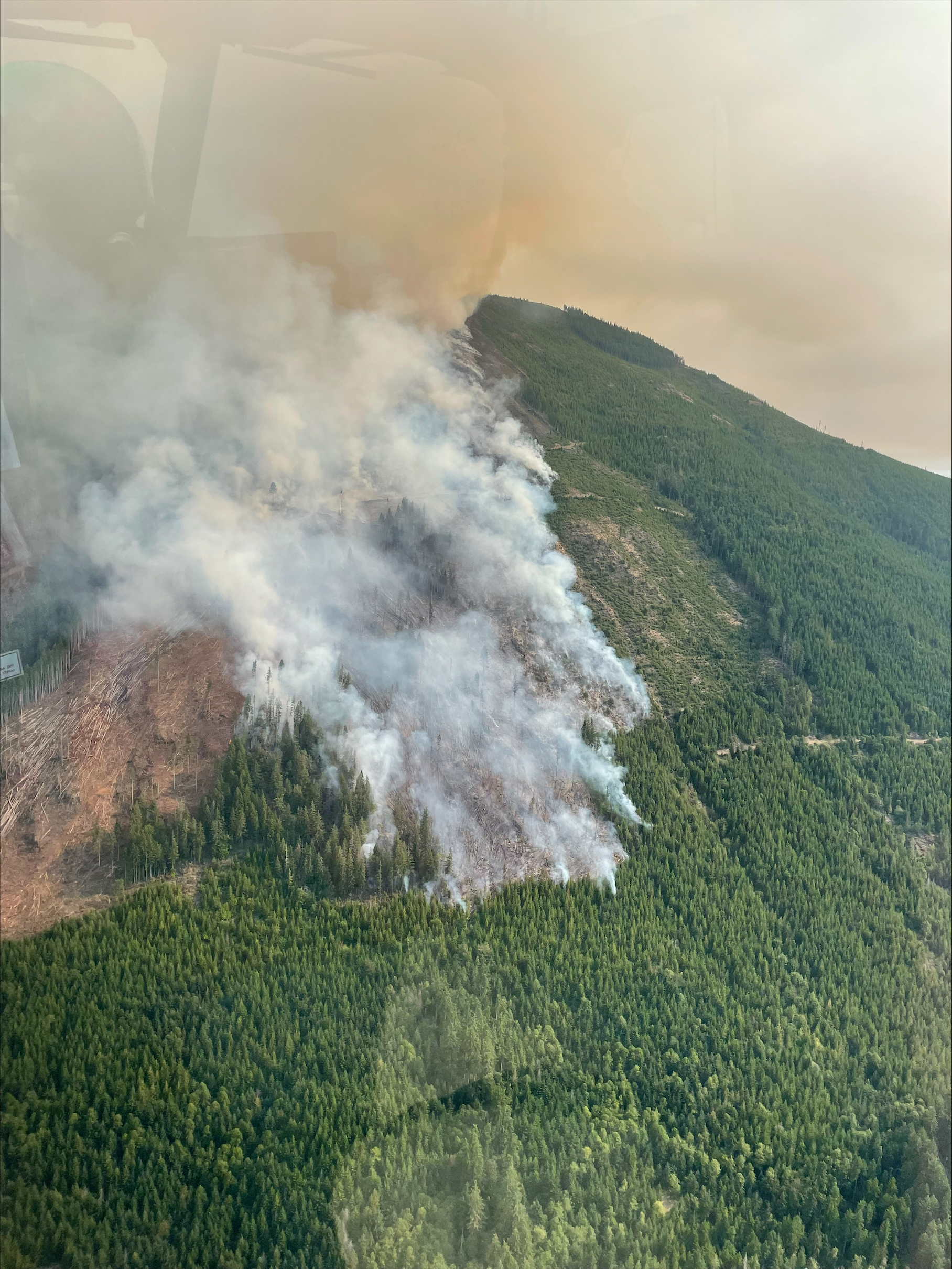
The 2620 Road Fire can be seen burning in login slash on a steep slope on Mt. Jupiter on August 16t, 2024.
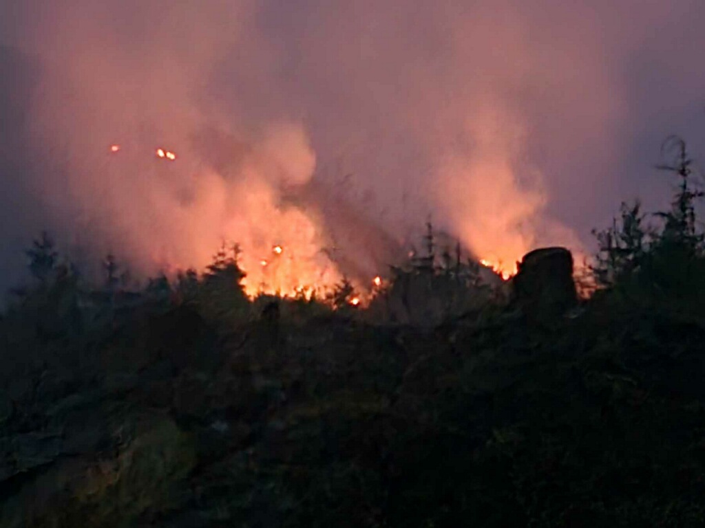
2620 Road Fire debris burning during night shift 08/17/2024
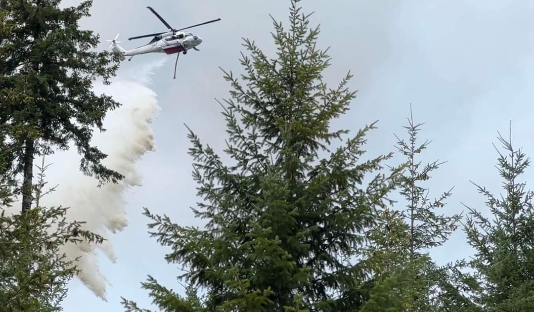
2620 Road Fire receiving a water drop from a helicopter 08/17/2024
The 2620 Road Fire began Wednesday, August 14, 2024, at 5:00 pm. Western Washington Type 3 Incident Management Team, with Incident Commander Kent Stanford, and Georgia Forestry Type 3 Incident Management Team, with Incident Commander Blair Joiner worked together to manage the fire in full suppression efforts. The fire was turned over on Tuesday, August 27, 2024, at 4:00 PM to a local Washington State Department of Natural Resources Type 4 Incident Management Team, with Daniel Lacy as the Incident Commander. The fire is in the final stages of being mopped up.
The 2620 Road Fire began Wednesday, August 14, 2024, at 5:00 pm. Western Washington Type 3 Incident Management Team, with Incident Commander Kent Stanford, and Georgia Forestry Type 3 Incident Management Team, with Incident Commander Blair Joiner worked together to manage the fire in full suppression efforts. The fire was turned over on Tuesday, August 27, 2024, at 4:00 PM to a local Washington State Department of Natural Resources Type 4 Incident Management Team, with Daniel Lacy as the Incident Commander. The fire is in the final stages of being mopped up.
| Current as of | Tue, 09/03/2024 - 11:20 |
|---|---|
| Incident Time Zone | America/Los_Angeles |
| Incident Type | Wildfire |
| Cause | Undetermined |
| Date of Origin | |
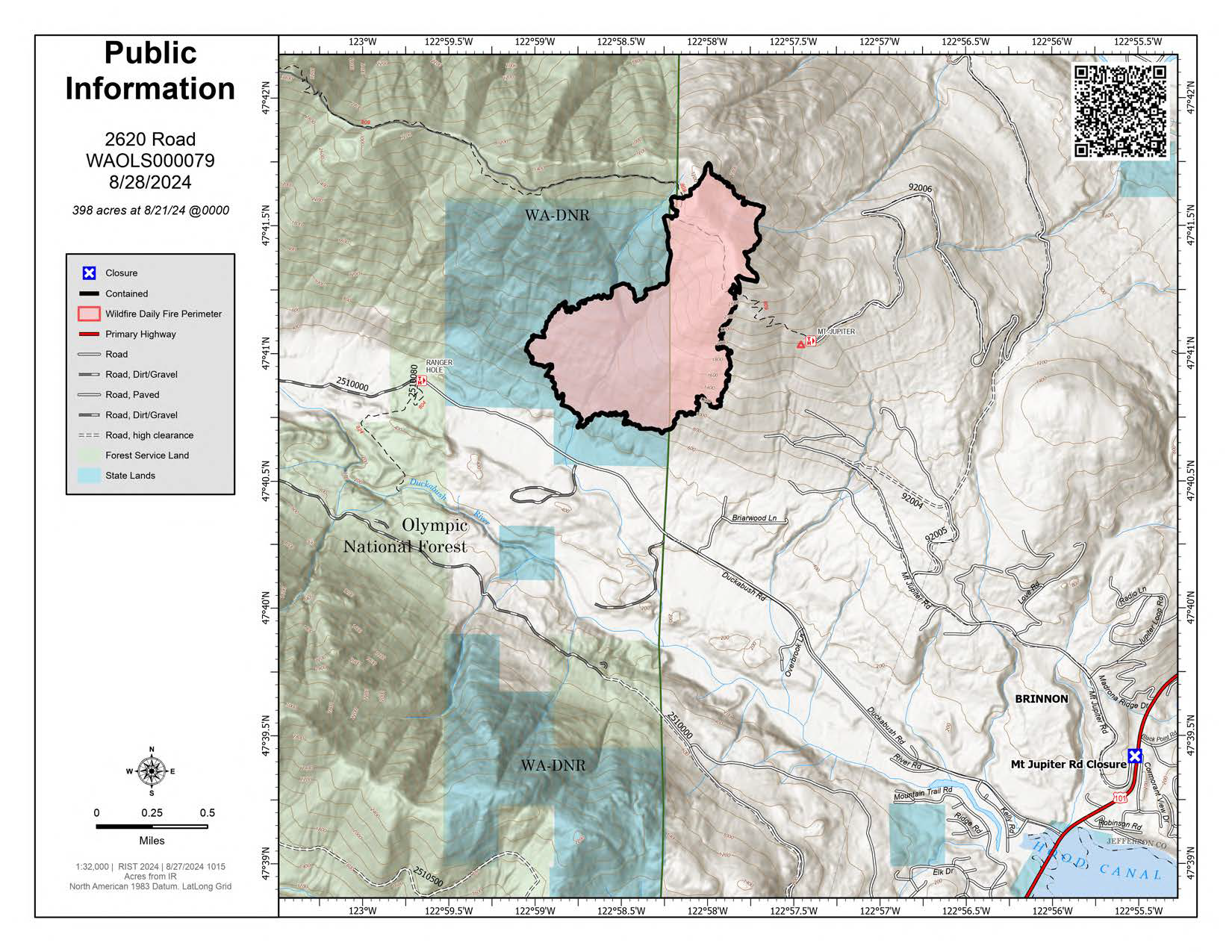
| Location | The fire is located 5 miles West of Brinnon Washington. |
| Incident Commander | Daniel Lacy, Incident Commander Local Washington State Department of Natural Resources Type 4 Incident Management Team |
| Incident Description | The fire started in a recently logged area with steep terrain and heavy fuels and was managed by two Type 3 Incident Management Teams. Due to the steep terrain, a small local Type 4 team will continue working on the 2620 Road Fire, moping up and ensuring the fire is out. |
| Coordinates |
47° 41' 05'' Latitude
-122° 57' 40
'' Longitude
|
| Total Personnel: | 161 |
|---|---|
| Size | 398 Acres |
| Percent of Perimeter Contained | 100% |
| Estimated Containment Date | September 2, 2024 |
| Fuels Involved | Timber (Litter and Understory) Light Logging Slash 10/100/1000 Hr. Fuels
|
| Significant Events | Minimal Smoldering |
| Planned Actions |
Provide for the safety of first responders and the public through the use of a risk management process. Implement operations that have the greatest probability of success while minimizing acres burned. Provide timely updates to Assisting and Cooperating Agencies; and the public, as appropriate. Operate in a cost-effective manner when doing so does not significantly impact operational efficiency, nor negatively impact safety. Mop-up standards to agency protocol. |
|---|---|
| Projected Incident Activity |
12 HOURS: No expected growth potential given ongoing mop-up activities. 24 HOURS: No expected growth potential given ongoing mop-up activities. 48 HOURS: No expected growth potential given ongoing mop-up activities. 72 HOURS: No expected growth potential given ongoing mop-up activities. ANTICIPATED AFTER 72 HOURS: No expected growth is predicted if consistent precipitation continues. However, if no precipitation occurs, continued smoldering is likely. |
| Weather Concerns | Outlook shows decreasing rain chances for the next operational periods and low chances of thunderstorm developments. Drying of fuels may allow smoldering to continue. |
|---|