
MOOSE FIRE EMERGENCY AREA ROAD AND TRAIL CLOSURE REDUCED OCTOBER 6 2022
Related Incident:
Publication Type: Closures
Salmon-Challis National Forest
Wildfire Fact Sheet
Media Contact: Amy Baumer(Public Affairs Officer); 208-756-7853
Email: SM.FS.SCFFIREINFO@usda.gov
Web: https://www.fs.usda.gov/scnf/
Twitter: @salmonchallisnfFacebook: @salmonchallisnf
MOOSE FIRE EMERGENCY AREA, ROAD, AND TRAIL CLOSURE REDUCED
OCTOBER 6, 2022
The Central Idaho Dispatch Zone is at MODERATE Fire Danger
On InciWeb @ https://inciweb.nwcg.gov/incident/8249/
Effective October 7, 2022 at 12:01 am, the Salmon‐Challis National Forest has reduced the Moose Fire Emergency Area, Road, and Trail Closure, Order Number: 04‐13‐22‐513. The new description of the closure is as follows: DESCRIBED AREA, ROADS, AND TRAILS:All NFS lands on the North Fork and Salmon-Cobalt Ranger Districts of the Salmon-Challis National Forest in the area bounded at the junction of the Salmon-Challis National Forest boundary and starting at Forest Service boundary and NFSR #Trail 075, West on Trail # 075 to the intersection of NFSR #026 then on FS #026 north to intersection with NFSR #020 Ridge Road. Then following NFSR #020 (Ridge Road) north to the intersection of NFSR #020 and NFSR #272, and the powerline. Then west following the powerline to the intersection with NFSR #007, then west on NFSR #007 to the intersection with NFSR #300. Then following NFSR #300 North to the intersection with NFSR #023 Moose Creek Road. Then North on NFSR #023 Moose Creek Road to its intersection with NFSR #65078 road. North on NFSR #65078 to intersection with Trail #049. Then East on Trail #049 to NFSR #60712. Continue East on NFSR #60712 to intersection of NFSR #020 Ridge Road and NFSR #129 Diamond Creek Road. Then following NFSR #129 Diamond Creek Road east to its intersection with the National Forest Boundary. Follow the National Forest Boundary south to the point of origin at the junction of National Forest Boundary and FS Trail #075. PURPOSE: The purpose of this Order is to protect public health and safety from the effects of the Moose Fire. This Order will be in effect from October 7th and shall remain in effect until rescinded. Visit our website at: www.fs.usda.gov/scnf/, ‘Like Us’ on Facebook @salmonchallisnf, and ‘Follow Us’ on Twitter @salmonchallisnf.
Moose Fire Update for Thursday October 6
Related Incident:
Publication Type: News
Thursday, October 6, 2022
Mouse Fire Information 208-742-6690 (8am-8pm) | 2022.moose@firenet.gov
Quick Facts
Fire Location
17 miles N of Salmon, Idaho
Size
130,120 acres
Containment
80%
Start Date
7/17/22
Cause
Unextinguished unattended campfire
Incident Commander
Mike Johnston, Great Basin Type 2 Incident Management Team #7
Personnel
303
Online Links
InciWeb:
· https://inciweb.nwcg.gov/incident/8249/
Facebook:
· https://www.facebook.com/IDFG.salmon
Idaho Department of Lands
· https://www.idl.idaho.gov/fire-management/
Salmon-Challis National Forest
· https://www.fs.usda.gov/scnf
Bureau of Land Management Salmon Field Office
· https://www.facebook.com/BLMIdahoFire
Summary: The Moose Fire started on Sunday, July 17th, 2022 at approximately 4:00 pm. The fire is located in the Salmon River mountains, 17 miles north of Salmon, Idaho. A mix of federal and private land is impacted. The terrain is difficult, and the fire is burning in grass, shrubs and timber. The fire was caused by an unextinguished unattended campfire.
Weather | Anticipated Fire Behavior: Warmer and drier weather is expected through the week. High overnight moisture recovery is helping reduce fire activity. This weather pattern is expected to hold through early next week. An inversion is keeping lows near 50 degrees at 5,000-6,000 feet. The above average temperatures are expected to increase smoke in the coming days. Lookouts are placed in strategic locations to keep watch on the fire, including in the watershed. Containment is currently at 80%.
Actions: Crews continue to work on repair projects in coordination with National Forest resource advisors. This work helps return damaged areas to a more stable condition. Resources are being shifted to focus on the uncontained portion of the fire. Hose was removed near cabins in the Moose Creek area. Crews continue to work on the Chips Creek to Spring Creek area. Road repairs using graders and water tenders are working on the Old Leesburg Road south towards Gorley Creek.
Important Information: Great Basin Incident Management Team 7, led by Incident Commander Mike Johnston, took operational control of the Moose Fire at 8:00 PM last night. “Team 7 is looking forward to serving the Lemhi County, the Salmon-Challis National Forest and public land users,” said Johnston. “We recognize hunting season is starting soon and we are looking at the closure area daily.” The Salmon-Challis National Forest has a road and area closure in place to protect public safety and responders still working on this incident. Thank you to the public for adhering to this closure and their continued support of all the boots on the ground!
Moose Fire Update for Wednesday October 5
Related Incident:
Publication Type: News
Moose Fire Daily Update for October 5, 2022
Today is the last operational shift of Great Basin Incident Management Team 5. Great Basin Incident Management Team 7 is assuming command of the fire at 8:00 PM tonight.
Weather this week is transitioning to warmer and dryer, with light winds. There will be good overnight moisture recovery, creating minimal fire behavior. Weather remains favorable with limited surface spread potential. Lookouts placed in strategic locations have reported minimal fire behavior. They continue to keep watch on the fire line, including in the watershed.
Crews continue to work on repair projects with Forest resource advisors, returning damaged areas to a more stable condition. Significant progress has been made on a number of these projects, including:
- Completion of repair along the 300 Road
- Completion of repair work in the Jureano Mountain/Trapper Ridge area
- Completion of fuels removal and repair in the powerline corridor
- Repair work south of Salmon from Old Leesburg Road south towards Gorley Creek
There are no longer zones in any evacuation status. For more information, visit the Lemhi County website at https://www.lemhicountyidaho.org/site-home/news/moose-fire-evacuation-zones-map-1003.
CLOSURES AND RESTRICTIONS: A Salmon-Challis National Forest closure order was updated on September 19. It reduces the closure area lands north of Williams Creek and Deep Creek Roads, east of Panther Creek Road, and south of North Fork Ranger District/Salmon-Cobalt Ranger District. The closure includes national forest service lands pertaining to certain roads, trails, and a defined geographic area around the fire. See Moose Fire Emergency Area, Road, and Trail Closure, Order #04-13-22-512 for a complete description. This closure applies to hunting access, firewood cutting and gathering, fishing, hiking, camping, and other recreational activities.
- Public Lands north of the town of Salmon, south of Wallace Creek, and west of the Fairgrounds/Diamond Creek Road administered by the BLM Salmon Field Office will remain Temporarily Closed to the public.
- For more information about area hunting units, please visit the Idaho Fish and Game fire map at https://fishandgame.idaho.gov/ifwis/maps/realtime/fire/ or the Idaho Fish and Game Salmon Region Facebook page at https://www.facebook.com/IDFG.salmon.
Moose Fire update for Tuesday October 4
Related Incident:
Publication Type: News
Moose Fire Daily Update for October 4, 2022
As announced by the Lemhi County Sheriff’s Office yesterday, there are no longer zones in any evacuation status. For more information, visit the Lemhi County website at https://www.lemhicountyidaho.org/site-home/news/moose-fire-evacuation-zones-map-1003.
A community meeting will take place at 6 p.m. today at the Salmon-Challis National Forest Supervisor's Office, located at 1206 S. Challis Street in Salmon. If you are unable to attend and would like to submit a question beforehand, please email it to 2022.moose@firenet.gov by noon.
Fire activity remains minimal due to recent precipitation, moderate relative humidity (RH), and moisture levels in fuels on the ground. This week weather will transition to be warmer and dryer, with light winds. Clearer skies are predicted with cooler overnight temperatures. Since the fire began in July, daylight is now three hours shorter. Currently, each coming day will have two minutes less daylight. Weather remains favorable with limited surface spread potential. Lookouts placed in strategic locations will continue to keep watch on the fire line.
Crews continue to work on repair projects with Forest resource advisors, returning damaged areas to a more stable condition. Significant progress has been made on a number of these projects, including:
- Completion of repair along the 300 Road
- Repair work in the Jureano Mountain/Trapper Ridge area
- Repair work south of Salmon from Old Leesburg Road south towards Gorley Creek
- Removal of pumps and hoses from Diamond Creek and Jesse Creek
- Crews are nearing completion of fuels removal and repair in the powerline corridor
CLOSURES AND RESTRICTIONS: A Salmon-Challis National Forest closure order was updated on September 19. It reduces the closure area lands north of Williams Creek and Deep Creek Roads, east of Panther Creek Road, and south of North Fork Ranger District/Salmon-Cobalt Ranger District. The closure includes national forest service lands pertaining to certain roads, trails, and a defined geographic area around the fire. See Moose Fire Emergency Area, Road, and Trail Closure, Order #04-13-22-512 for a complete description. This closure applies to hunting access, firewood cutting and gathering, fishing, hiking, camping, and other recreational activities.
- Public Lands north of the town of Salmon, south of Wallace Creek, and west of the Fairgrounds/Diamond Creek Road administered by the BLM Salmon Field Office will remain Temporarily Closed to the public.
- For more information about area hunting units, please visit the Idaho Fish and Game fire map at https://fishandgame.idaho.gov/ifwis/maps/realtime/fire/ or the Idaho Fish and Game Salmon Region Facebook page at https://www.facebook.com/IDFG.salmon.
Moose Fire Evacuation Status 100322
Related Incident:
Publication Type: Announcement
Lemhi County Update
https://www.lemhicountyidaho.org/site-home/news/moose-fire-evacuation-zones-map-1003
As of today there are no zones in any evacuation status - 10/03/2022
Moose Fire Update for Monday October 3
Related Incident:
Publication Type: News
Moose Fire Daily Update for October 3, 2022
A community meeting is scheduled for Tuesday, October 4, at 6 p.m. at the Salmon-Challis National Forest Supervisor's Office, located at 1206 S. Challis Street in Salmon. If you are unable to attend and would like to submit a question beforehand, please email it to 2022.moose@firenet.gov by noon on Tuesday.
Fire activity remains minimal due to recent precipitation, cooler temperatures, moderate relative humidity (RH), and moisture levels in fuels on the ground. Today, skies will begin to clear and temperatures will begin to rise with lower RH, but should have little effect on fire activity.
Lookouts placed in strategic locations will continue to keep an eye on the fire line, and crews will continue to work with Forest resource advisors to return damaged areas to a more stable condition. Crews have made significant progress on repair projects, including:
- Completion of repair along the 300 Road
- Repair of dozer line in the Jureano Mountain/Trapper Ridge area utilizing excavators to move slash to cover disturbed areas
- Repair work south of Salmon on the handline and dozer line from Old Leesburg Road south towards Gorley Creek
- Removal of pumps and hoses from Diamond Creek and Jesse Creek
- Crews are also nearing completion of fuels removal and repair in the powerline corridor
AS OF TODAY THERE ARE NO ZONES IN ANY EVACUATION STATUS
For more information, visit the Lemhi County website at https://www.lemhicountyidaho.org/site-home/news/moose-fire-evacuation-zones-map-1003
CLOSURES AND RESTRICTIONS: A Salmon-Challis National Forest closure order was updated on September 19. It reduces the closure area lands north of Williams Creek and Deep Creek Roads, east of Panther Creek Road, and south of North Fork Ranger District/Salmon-Cobalt Ranger District. The closure includes national forest service lands pertaining to certain roads, trails, and a defined geographic area around the fire. See Moose Fire Emergency Area, Road, and Trail Closure, Order #04-13-22-512 for a complete description. This closure applies to hunting access, firewood cutting and gathering, fishing, hiking, camping, and other recreational activities.
- Public Lands north of the town of Salmon, south of Wallace Creek, and west of the Fairgrounds/Diamond Creek Road administered by the BLM Salmon Field Office will remain Temporarily Closed to the public.
- For more information about area hunting units, please visit the Idaho Fish and Game fire map at https://fishandgame.idaho.gov/ifwis/maps/realtime/fire/ or the Idaho Fish and Game Salmon Region Facebook page at https://www.facebook.com/IDFG.salmon.
Moose Fire Update for Sunday October 2
Related Incident:
Publication Type: News
Moose Fire Daily Update for October 2, 2022
A community meeting is scheduled for Tuesday, October 4, at 6:00 p.m. at the Salmon-Challis National Forest Supervisor's Office. The address is 1206 S. Challis Street in Salmon. If you cannot attend and would like to submit a question beforehand, please email it to 2022.moose@firenet.gov by noon on Tuesday.
A light rain throughout the fire footprint yesterday combined with increased relative humidity (RH) to raise moisture levels in the fuels on the ground. This resulted in very minimal fire spread. The drizzle slowed repair work somewhat, but crews were still able to make good progress on significant projects. This included completion of repair along the 300 Road and nearing completion of the fuels removal and repair in the powerline corridor. Lookouts near the active edges of the fire observed very minimal fire activity.
As this cold weather system moves out of our area, we can expect to see decreasing cloud cover and slightly warming temperatures into the beginning of the week. With that, winds are forecasted to remain light and RHs to remain high. This should help to keep fire spread to a minimum through the early part of the week. Firefighters will continue to keep an eye on the active portions of the fire and will be ready to respond if fire behavior dictates. Elsewhere, crews will continue with suppression repair and fuel removal projects. This will include starting repair work south of Salmon on the handline and dozer line from Old Leesburg Road south towards Gorley Creek.
EVACUATIONS: Evacuation zones 1, 12, 13, and 15, as well as Beartrack Mine and Leesburg remain in “READY” status. The Sheriff’s Office and the Incident Management Team are regularly evaluating the potential for changes in status.
CLOSURES AND RESTRICTIONS: A Salmon-Challis National Forest closure order was updated on September 19. It reduces the closure area lands north of Williams Creek and Deep Creek Roads, east of Panther Creek Road, and south of North Fork Ranger District/Salmon-Cobalt Ranger District. The closure includes national forest service lands pertaining to certain roads, trails, and a defined geographic area around the fire. See Moose Fire Emergency Area, Road, and Trail Closure, Order #04-13-22-512, for a complete description. This closure applies to hunting access, firewood cutting and gathering, fishing, hiking, camping, and other recreational activities.
- Public Lands north of the town of Salmon, south of Wallace Creek, and west of the Fairgrounds/Diamond Creek Road administered by the BLM Salmon Field Office will remain Temporarily Closed to members of the public.
- For more information about area hunting units, please visit the Idaho Fish and Game fire map: https://fishandgame.idaho.gov/ifwis/maps/realtime/fire/ or the Idaho Fish and Game Salmon Region Facebook page https://www.facebook.com/IDFG.salmon.
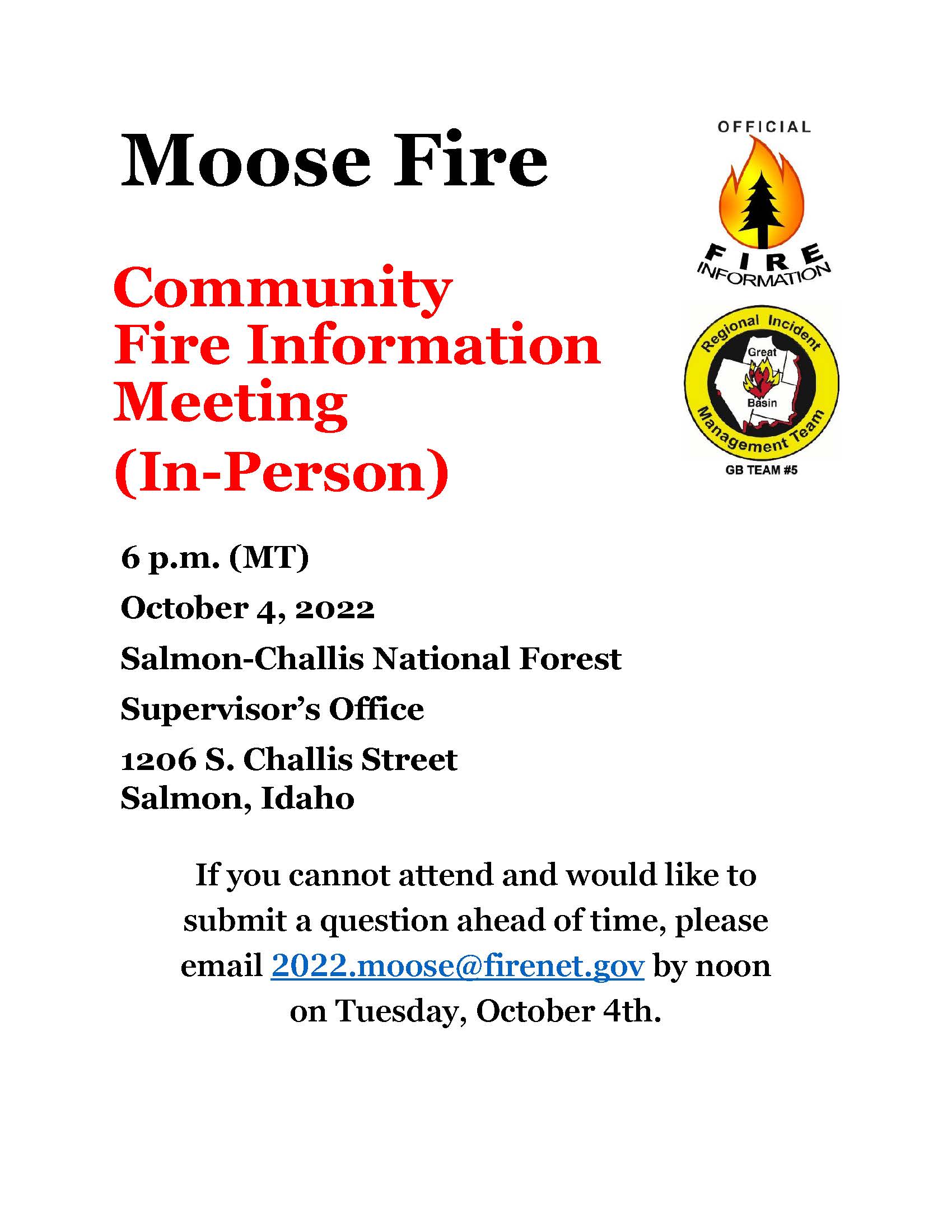
Moose Fire Public Meeting for October 4
Related Incident:
Publication Type: Announcement
Moose Fire Community Fire Information Meeting (In-Person)
6 p.m. (MT)
October 4, 2022
Salmon-Challis National Forest
1206 S. Challis Street
Salmon, Idaho
If you cannot attend and would like to submit a question ahead of time, please email 2022.moose@firenet.gov by noon on Tuesday.

Moose Fire Update for Saturday October 1
Related Incident:
Publication Type: News
Moose Fire Daily Update for October 1, 2022
The next community meeting will take place on Tuesday, October 4, at 6:00 p.m. The location will be the Salmon-Challis National Forest Supervisor's Office at 1206 S. Challis Street in Salmon. If you will not be able to attend and would like to submit a question beforehand, please email it to 2022.moose@firenet.gov no later than noon on Tuesday.
The Suppression Repair Group completed handline repair yesterday near the Wagonhammer RV Park south of North Fork, as well as the line put in near the junction of Napias and Deep Creeks to the south of the fire area. Firefighters near the active edges of the fire reported only creeping and smoldering fire behavior yesterday with no single tree torching observed. Idaho Power was able to fly the powerline and found a single tree down along the line, which they are working to repair.
For the weekend, continued cooler weather and heavier cloud cover will contribute to higher relative humidity (RH). The increased RH will raise the moisture levels in fuels and help to further decrease the surface spread of the fire. Crews will remain ready to respond if needed and will continue to work on backhaul and repair where suppression operations have concluded. The Fuels Removal Group working the powerline corridor will continue dozer line repair and slash spreading.
Currently, the main areas of heat in the fire are east of Beartrack Mine and the upper portion of Fenster Creek drainage, as well as the upper reaches of Jesse Creek in the municipal watershed. During the community meeting on Thursday, September 29, the Burned Area Emergency Response (BAER) team leader shared that initial assessments showed only 2% of high intensity burned area in the Jesse Creek drainage. The rest of the burn area to date in the upper Jesse Creek drainage burned with low or moderate severity and is likely to prove beneficial to the forest in that area in the next few years.
EVACUATIONS: Evacuation zones 1, 12, 13, and 15, as well as Beartrack Mine and Leesburg remain in “READY” status. The Sheriff’s Office and the Incident Management Team are regularly evaluating the potential for changes in status.
CLOSURES AND RESTRICTIONS: A Salmon-Challis National Forest closure order was updated on September 19. It reduces the closure area lands north of Williams Creek and Deep Creek Roads, east of Panther Creek Road, and south of North Fork Ranger District/Salmon-Cobalt Ranger District. The closure includes national forest service lands pertaining to certain roads, trails, and a defined geographic area around the fire. See Moose Fire Emergency Area, Road, and Trail Closure, Order #04-13-22-512, for a complete description. This closure applies to hunting access, firewood cutting and gathering, fishing, hiking, camping, and other recreational activities.
- All lands managed by Bureau of Land Management (BLM) in the closure area east of the Fairgrounds/Diamond Creek Road, including the temporary closure of Morgan Bar Campground administered by the BLM Salmon Field Office, terminated on September 28, 2022.
- Public Lands north of the town of Salmon, south of Wallace Creek, and west of the Fairgrounds/Diamond Creek Road administered by the BLM Salmon Field Office will remain Temporarily Closed to members of the public.
- For more information about area hunting units, please visit the Idaho Fish and Game fire map: https://fishandgame.idaho.gov/ifwis/maps/realtime/fire/ or the Idaho Fish and Game Salmon Region Facebook page https://www.facebook.com/IDFG.salmon.
Moose Fire Update for Friday September 30
Related Incident:
Publication Type: News
Moose Fire Daily Update for September 30, 2022
Yesterday crews inspected the lines in the Stormy Creek Road area and determined that they were secure, resulting in an increase in the percentage of containment. Shifting and gusty winds from the incoming weather system caused little to no change in fire behavior. At the community meeting last night, the Burned Area Emergency Response (BAER) team leader announced the burn severity findings, which showed that within the fire perimeter only 10% of the land burned at a high intensity, while about 72% burned at a moderate or low intensity, and the remainder was unburned.
Crews today will continue to observe and take responsive actions as changing weather and fire behavior may dictate. Where suppression operations are complete, firefighters and suppression repair crews will be backhauling equipment and repairing handline and dozer lines to prevent future erosion. This work is ongoing in the southern portions of the fire, and will be starting near Wagonhammer in the northeast portion of the fire footprint today. Roads crews are assisting with grading and maintaining the 300 Road, Williams Creek Road, and others, to mitigate their use by heavy equipment and engines. Idaho Power will be flying along the powerline today to survey for any hazards to the powerline. Log removal in the powerline corridor is complete and repair work is ongoing for the dozer line that was cut in that area.
The weather heading into the weekend is forecasted to stay relatively cool, with increased cloud cover, higher relative humidity, and light winds. This should help to further limit surface spread in areas of active fire.
EVACUATIONS: Evacuation zones 1, 12, 13, and 15, as well as Beartrack Mine and Leesburg remain in “READY” status. Evacuation status has been rescinded for Zones 2, 3, 4, 7, 8, 9a, 9b, 10, and 14. The Incident Management Team will continue to work closely with the Sheriff’s Office to consider changes to the evacuation status.
CLOSURES AND RESTRICTIONS: A Salmon-Challis National Forest closure order was updated on September 19. It reduces the closure area lands north of Williams Creek and Deep Creek Roads, east of Panther Creek Road, and south of North Fork Ranger District/Salmon-Cobalt Ranger District. The closure includes national forest service lands pertaining to certain roads, trails, and a defined geographic area around the fire. See Moose Fire Emergency Area, Road, and Trail Closure, Order #04-13-22-512, for a complete description. This closure applies to hunting access, firewood cutting and gathering, fishing, hiking, camping, and other recreational activities.
- All BLM-managed lands in the closure area east of the Fairgrounds/Diamond Creek Road, including The temporary closure of Morgan Bar Campground administered by the Salmon Field Office, Bureau of Land Management (BLM), terminated on September 28, 2022.
- Public Lands north of the town of Salmon, south of Wallace Creek, and west of the Fairgrounds/Diamond Creek Road administered by the Salmon Field Office, Bureau of Land Management (BLM) will remain Temporarily Closed to entry by members of the public.
- Currently, Stage 1 Fire restrictions are in effect on the Salmon-Challis National Forest, BLM, and State of Idaho lands in Custer and Lemhi Counties, excluding wilderness areas. These restrictions will end immediately after midnight (00:01) on Thursday, September 29, 2022.
- For more information about area hunting units, please visit the Idaho Fish and Game fire map: https://fishandgame.idaho.gov/ifwis/maps/realtime/fire/ or the Idaho Fish and Game Salmon Region Facebook page https://www.facebook.com/IDFG.salmon.