
Golden Fire Daily Evening Update July 25 2023
Related Incident: Golden Fire
Publication Type: News
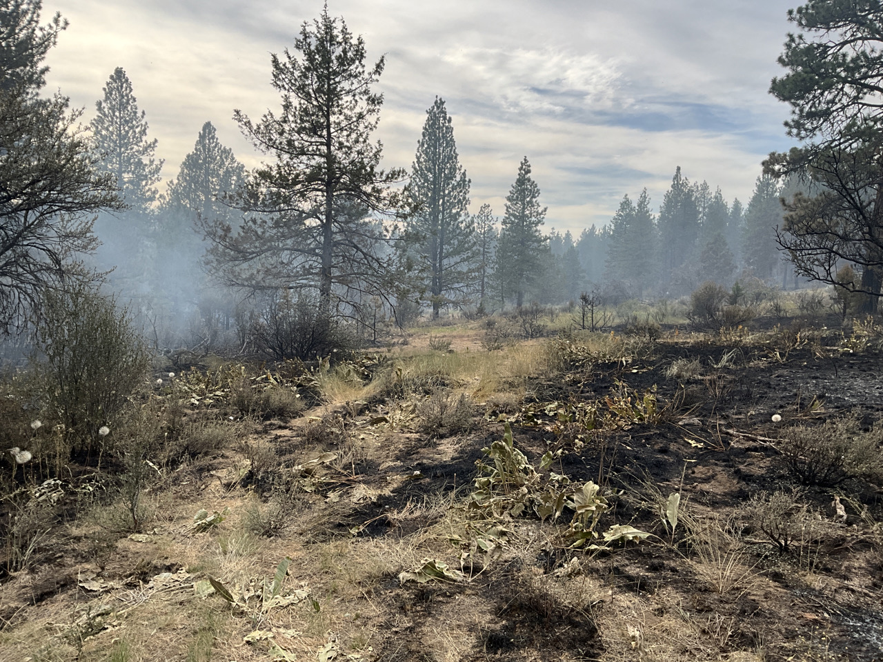
BONANZA, Ore. – Crews have been reinforcing the line and are removing remaining hot spots along the fire’s edge. Tomorrow, crews will progress deeper into the burned area to cool down hot spots, so that heat that could threaten the security of the fire line is extinguished. Crews continue to work around structures to mop up 50 feet and in some places up to 100 feet.
Incident managers are optimistic about the efforts and progress that have been made. However, they encourage people to stay vigilant and updated on conditions.
Lumen LLC will begin working along Highway 140 to replace approximately 25,000 feet of fiber optic cable between Bly Mountain Cutoff Road to Polar Bear Lane. The work will start at 9:00 A.M., Wednesday, July 26, and they estimate completion by 3:00 P.M., July 26. Crews replacing the fiber will have flag protection while conducting the work. Replacing the fiber optic cable is critical work that will restore connectivity to many essential services in Lake County.
Weather conditions are expected to continue with a similar pattern as today, with the potential to be a little hotter and drier. Gusty winds are expected to be 20-25 mph. Lower nighttime temperatures will assist with diminishing fire activity. The extended forecast predicted no real change in weather.
The Unified Command, of Oregon State Fire Marshal and Oregon Department of Forestry held a successful community meeting tonight at the Bonanza school and provided information on fire status and evacuations and answered follow-up questions.
Evacuations downgraded as of July 25th:
- Level 3 (GO NOW)-evacuation area is now reduced to a quarter-mile perimeter around the fire and the interior of the fire. Evacuation is maintained along Hummingbird Drive and Sandpiper Drive.
- Level 2 (BE READY)-area follows west of Bechdoldt Flat Rd, south of Racoon Lane and Jaguar Lane. It also extends east of the Golden Fire, approximately 3-4 miles to the powerline corridor.
- Level 1 (GET SET)-area now includes the west side of Hwy 140 to Golden Eagle Drive and north to Parrot Drive.
For the most current evacuation information, call the Klamath County hotline at 541-205-9730, and sign up for Klamath County alerts at http://alerts.klamathcounty.org. American Red Cross and Klamath County Community Emergency Response Team (CERT) have established an evacuation shelter at Bonanza School, 31601 Mission Street, Bonanza, OR 97623.
The cause of the fire is still under investigation and will be determined by fire investigators from Oregon Department of Forestry, detectives from the Klamath County Sheriff’s, and the Oregon State Police.
###
Hayden Fire Update July 26 2023
Related Incident:
Publication Type: News
There will be a community meeting in Salmon on Thursday, July 27th at 6 PM at the Idaho Fish and Game Office
Size: 11,032 acres
Containment: 0%
Personnel: 537
Summary: The Hayden Fire started on Wednesday, July 19th, 2023, at approximately 11:30 am. The fire is located in the Lemhi Range, 18 miles west of Leadore, Idaho. The fire is burning in steep and difficult terrain with spruce/subalpine fir containing a heavy dead/down timber component. Fire cause is undetermined.
Weather: THERE IS A RED FLAG WARNING FOR GUSTY WINDS AND LOW RELATIVE HUMIDITY. Incident Remote Automatic Weather Stations (IRAWS) have been deployed to the fire to augment on-site forecasts. The combination of low afternoon humidity and strong southwest winds will create critical fire weather conditions on Wednesday and Thursday. West winds gusting up to 45 mph along the ridges are anticipated on both days.
Actions: Additional fire personnel and equipment have been arriving and are being integrated into the fire operations. The Temporary Flight Restriction (TFR ) around the fire area has increased for the safety of the aviation resources on the scene. In the northern area of the fire, crews are continuing work on both hand and dozer lines by upper Kadletz Creek and Ford Creek. In the southern area, firefighters are identifying and improving control lines. With yesterday’s fire progression, crews are scouting opportunities for additional containment lines.
Important Information: The Lemhi County Sheriff’s Department in coordination with the Salmon-Challis National Forest and Great Basin Team 7 has pre-identified evacuation zones. They will be implemented using the “Ready, Set, Go” terminology, for more information on the evacuation zones please visit the Lemhi County website at lemhicountyidaho.org. Information on “ready, set, go” is available on the Hayden Fire Inciweb page.
The Salmon-Challis National Forest has a revised closure order in place to help protect firefighter and public safety. Maps and additional information are available on the Alerts and Notices section of the SCNF website. Risk to responders and public safety remains the highest priority for the incident management team.
The U.S. Forest Service, Idaho Department of Lands, and Bureau of Land Management in east-central Idaho will begin Stage 1 fire restrictions, effective at just after midnight (12:01 am) on Friday, July 28, 2023.
Big Iron Fire Daily Update July 26 2023
Related Incident: Big Iron Fire
Publication Type: News
Big Iron Fire Daily Update
July 26, 2023
8:00 am
Size: 150 acres
Containment: 50%
Date Started: July 24, 2023
Cause: Unknown
State resources from Texas A&M Forest (TAMFS) and Texas Intrastate Fire Mutual Aid System (TIFMAS) returned to the Big Iron Fire early this morning to continue to improve constructed control line, patrol, and mop-up. A 10-person handcrew module is joining resources today on the fireline to assist with mop up, a process of extinguishing all burning material near containment lines, particularly in the areas where vehicles cannot reach.
Ground and aviation resources were able to construct fireline around the majority of the perimeter yesterday, resulting in no significant growth. Continuing drought conditions, including low relative humidity, and gusty winds combine to keep potential fire growth high.
25 de Julio 2023 Reporte vespertino del Incendio Flat
Related Incident: Flat Fire
Publication Type: News
25 de Julio, 2023
Tamaño: 22,697
Inicio: 15-Julio-2023
Contención: 3%
Origen: 2 millas Sureste de Agness, OR
Causa: Error Humano, bajo investigación
Personal: 1,528
Recursos: 46 camiones de bomberos l 36 escuadrillas de bomberos l 9 buldóceres l 24 cisternas l 8 máquinas masticadoras l 8 helicópteros
Situación actual: Por la tarde de hoy, los bomberos iniciaron operaciones de quema a lo largo de la Carretera Forestal (FS) 3680 comenzando en el empalme con el camino forestal 330 y avanzando hacia el Norte dirigiéndose hacia la carretera forestal 3318. Las escuadrillas de bomberos también continúan progresando en la eliminación de material de combustión a lo largo de la carretera forestal Burnt Ridge Road (FR 2308) y el camino forestal 150. De esta manera se encuentran preparados para futuras operaciones de incendio en la porción Noreste del Incendio.
Los helicópteros están irrigando el eje Sureste del fuego y así lograr moderar el comportamiento del incendio; esto tiene como objetivo el detener un poco la velocidad de propagación en el incendio al acercarse a las líneas de control establecidas en frente del mismo.
Actividades para la noche de hoy: Si las condiciones se presentan favorables en la noche, los bomberos proseguirán con las igniciones en la porción Suroeste del incendio. Asimismo, tendrán como prioridad la ardua tarea de limpieza a lo largo del perímetro Noreste del incendio y en áreas que fueron quemadas recientemente.
Evacuaciones: Se mantiene en efecto un Nivel 2 de Evacuación “Listos” desde Agness hasta Quosatana Creek y para las áreas de Oak Flat, Old House Creek Road y Spud Road.
La ciudad de Curry está enviando noticias de evacuación utilizando el sistema Everbridge.
Usted puede registrarse en: https://www.co.curry.or.us/departments/emergency_management/index.php
Condiciones climáticas: El día de hoy, se inició un patrón ligeramente caluroso y seco en el clima.
Impacto del humo: Pronósticos en la presencia del humo, puede encontrarse en la página web: https://www.airnow.gov/ y oregonsmoke.org
Cierres de áreas: El Bosque Nacional de Rogue River-Siskiyou, ha emitido una orden de cierre en el área del incendio la cual incluye senderos, carreteras y parte del rio Illinois. Esta orden de cierre abarca Oak Flat Campground, Game Lake Campground, Wildhorse Campground y el Lookout Recreacional de Snow Camp. Para mayor información: bit.ly/RRSNFClosures
Orden de restricción: Se han establecido Restricciones en el área. Para más información: fs.usda.gov/rogue-siskiyou
Se hace un llamado al público en general de manejar con sumo cuidado cuando se encuentre cerca del área del incendio y del campamento de los bomberos. Esto es debido al incremento significativo del tráfico del personal luchando por extinguir el incendio. Este llamado se hace más crítico cuando se encuentre manejando en la carretera Bear Camp Road (Carretera del Servicio Forestal #23). En este momento se está experimentando un tráfico pesado compuesto por el público y el tráfico relacionado con el incendio.
Flat Fire Evening Update 7252023
Related Incident: Flat Fire
Publication Type: News
July 25, 2023
Size: 22,697
Start Date: July 15, 2023
Containment: 3%
Point of origin: 2 miles southeast of Agness, OR
Cause: Human caused, Under Investigation
Total personnel: 1,528
Resources: 46 engines l 36 crews l 9 bulldozers l 24 water tenders l 8 masticators l 8 helicopters
Current Situation: This afternoon, firefighters began burnout operations along Forest Road (FR) 3680 starting at its junction with FR 330 and working north towards FR 3318. Crews also continue to make great progress reducing fuels along Burnt Ridge Road (FR 2308) and FR 150 in preparation for future firing operations in the northeast portion of the fire. Helicopters are dropping water on the fire’s southern edge to moderate fire behavior; the goal is to slow fire spread as it approaches the established control line ahead of it.
Tonight’s activities: Firefighters will continue ignitions in the southwest portion of the fire if conditions are favorable this evening. Crews will also prioritize mopping up along the fire’s northern perimeter and in recently burned areas.
Evacuations: A Level 2 “Get Set” evacuation notice remains in effect from Agness to Quosatana Creek and for the areas of Oak Flat, Old House Creek Road and Spud Road. Curry County is using Everbridge to send evacuation notices. You can sign up for notifications here: https://www.co.curry.or.us/departments/emergency_management/index.php.
Weather: A slight warming and drying weather pattern began over the fire area today.
Smoke: The Smoke Outlooks are available at https://www.airnow.gov/ or oregonsmoke.org.
Closures: The Rogue River Siskiyou National Forest has issued a closure order for the fire area including trails, roads and a portion of the Illinois River. Oak Flat Campground, Game Lake Campground, Wild Horse Campground and Snow Camp Lookout Recreation Rentals are all part of the area closure. More information can be found here: bit.ly/RRSNFClosures.
Restrictions: Fire Restrictions are in place, to learn more visit: fs.usda.gov/rogue-siskiyou.
Please slow down and be careful when driving near the fire area and incident camps due to increased fire traffic. The public is asked to be especially cautious when driving on Bear Camp Road (Forest Service Road 23). There is heavy public and fire-related traffic on this road.
Fire Information:(541)216-4579
Media inquiries: (541)237-6369
Email: 2023.flat.or@firenet.gov
July 25 Evening Update
Related Incident: NEWELL ROAD
Publication Type: News
3 p.m. Update, July 25, 2023
Estimated size: 59,858 acres
Containment: 20%
Start Date: July 21, 2023
Area of Origin: Klickitat County near Newell Road
Cause: Under Investigation
Structures Damaged: Currently being assessed
Fire Update: Yesterday’s strong winds persisted through the night. Night shift resources worked in the northwest corner of the fire to check-up and slow its spread out of the Walaluuks Canyon towards the Dot Road area. The wind also tested control lines along the eastern and southern portions of the fire and these areas held up well, with only minor mop-up challenges.
Today’s activity: Crews got an early start to take advantage of favorable morning weather conditions. Suppression efforts continue to be focused on the northwest corner of the fire, which is still seeing active fire behavior. Fire crews continue to work the northern edge of the fire near Dot Road. This afternoon the fire did spot across the road, triggering action points that increased the evacuation levels in the area. To the southwest, cold trailing efforts continue as fire personnel focus on mop-up and patrol work. Aircraft resources continue to be available to support on-the-ground operations as needed.
This morning a firefighter was injured when his tender experienced a rollover. The firefighter was treated on scene and transported by air to a hospital for further evaluation and treatment.
Evacuations and Road Closures: The fire spotting over Dot Road has increased evacuations levels – Bickleton residents are advised to evacuate north and east. For the latest evacuations, please see: http://www.facebook.com/klickitatDEM911
Road closures include: Roosevelt Grade Road, Middle Road, Old Highway 8 north to and including Dot Road. Also closed is Rock Creek Road, Bikelton Highway between Old Mountain Road and the county line, Highway 14 is closed except for local traffic, and Hoctor Road is closed east of Oak Flat.
Temporary Flight Restriction (TFR): TFR is in place over the Newell Road Fire. Please review the Notice to airmen in its entirety.
Sheltering: The American Red Cross has a shelter established at the Goldendale Middle School 520 E. Collins Street, Goldendale, WA. Due to the spotting across Dot Road, a second shelter has opened at Grandview Middle School: 1401 W 2nd St, Grandview, WA.
Newell Road Fire
Incident Commander: Kevin Stock
Fire Information Phone: 208-713-2740
Media Fire Information Phone: 208-891-7491
Email: 2023.NewellRoad@firenet.gov
Facebook: facebook.com/NewellRoadFire
Inciweb: inciweb.wildlfire.gov/newellroad
Total people assigned: 561
Engines: 49
Dozers: 9
Handcrews: 11
Water Tenders:8
Overhead:127
Type 1 Helicopter:2
Type 2 Helicopter:2
Air Tankers: As needed
Settings - change map background and toggle additional layers
Filter - control incident types displayed on map.
Zoom to your location
Reset map zoom and position
Could not determine your location.
Show Legend
 Wildfire
 Prescribed Fire
 Burned Area
Response
Burned Area
Response Other
Other
Pipeline Fire
Unit Information
Incident Contacts
Bowles Creek Fire Update Map July 25 2023
Related Incident: Bowles Creek Fire
Publication Type: News
Bowles Creek Fire Roads and Trail Closure MapJuly 25 2023
Related Incident: Bowles Creek Fire
Publication Type: Closures
Settings - change map background and toggle additional layers
Filter - control incident types displayed on map.
Zoom to your location
Reset map zoom and position
Could not determine your location.
Show Legend
- Wildfire
- Prescribed Fire
- Burned Area
Response
- Other