
Informe vespertino del Incendio Flat24 de julio 2023
Related Incident: Flat Fire
Publication Type: News
24 de julio, 2023
Informe vespertino del Incendio Flat
Start Date: July 15, 2023
Extension: 22,130 acres
Origen: 2 millas Sureste de Agness, OR
Causa: Error humano, bajo investigación
Personal: 1,528
Recursos: 46 camiones de bomberos l 36 escuadrillas de bomberos l 9 buldóceres l 24 cisternas l 8 máquinas masticadoras l 8 helicópteros
Situación actual: El día de hoy, las temperaturas mas bajas y los niveles de humedad más altos, ayudaron a los bomberos en los esfuerzos de suprimir el incendio. Los trabajadores continúan con las tácticas de operaciones de incendio a lo largo de los flancos Oeste y Suroeste reforzando las líneas de control. El crecimiento estrecho del fuego hacia el área Suroeste el cual recientemente se hace visible en el mapa, se debe a las igniciones exitosas que han ocurrido en los últimos días. En la tarde de hoy, se desplegaron los Sistemas Aéreos sin personal (UAS) para encender la vegetación en el área más interna y así profundizarse mas a lo largo de las líneas de control. Además, las escuadrillas de bomberos continúan patrullando áreas quemadas recientemente y al mismo tiempo extinguiendo fuentes de calor sobre el eje del fuego. El día de hoy, arribó un Equipo médico especializado que permanecerá in situ en el campamento de bomberos. Este equipo médico proveerá cuidado inmediato a los bomberos afectados por el contacto al roble venenoso (poison oak).
Actividades nocturnas: En la noche, si las condiciones permanecen favorables, se continuarán las operaciones de incendio sobre el flanco Suroeste del mismo. Los bomberos del turno nocturno se darán a la tarea ardua de patrullar todas las áreas quemadas y continuarán limpiando las fuentes de calor persistentes en la zona.
Evacuaciones: Se mantiene en efecto un Nivel 2 de Evacuación “Listos” desde Agness hasta Quosatana Creek y para las áreas de Oak Flat, Old House Creek Road y Spud Road.
La ciudad de Curry está enviando noticias de evacuación utilizando el sistema Everbridge.
Usted puede registrarse en:
https://www.co.curry.or.us/departments/emergency_management/index.php
Condiciones climáticas: Para el día de mañana, se pronostica un patrón climático con un ligero calentamiento y sequedad en el clima.
Impacto del humo: Pronósticos en la presencia del humo, puede encontrarse en la página web: oregonsmoke.org y también en airnow.gov
Cierres de áreas: El Bosque Nacional de Rogue River-Siskiyou, ha emitido una orden de cierre en el área del incendio la cual incluye senderos, carreteras y parte del rio Illinois. Esta orden de cierre abarca Oak Flat Campground, Game Lake Campground, Wildhorse Campground y el Lookout Recreacional de Snow Camp. Para mayor información: bit.ly/RRSNFClosures
Orden de restricción: Se han establecido Restricciones en el área. Para más información: fs.usda.gov/rogue-siskiyou
Se hace un llamado al público en general de manejar con sumo cuidado cuando se encuentre cerca del área del incendio y del campamento de los bomberos. Esto es debido al incremento significativo del trafico del personal luchando por extinguir el incendio. Este llamado se hace mas critico cuando se encuentre manejando en la carretera Bear Camp Road (Carretera del Servicio Forestal #23). En esta área, se ha observado un tráfico pesado del público y del tráfico relacionado con el incendio.
Flat Fire Evening Update 7242023
Related Incident: Flat Fire
Publication Type: News
July 24, 2023
Flat Fire Evening Update
Start Date: July 15, 2023
Size: 22,130
Point of origin: 2 miles southeast of Agness, OR
Cause: Human caused, Under Investigation
Total personnel: 1,528
Resources: 46 engines l 36 crews l 9 bulldozers l 24 water tenders l 8 masticators l 8 helicopters
Current Situation: Cooler temperatures and higher humidity levels aided in suppression efforts today. Firefighters continued tactical firing operations along the western and southwestern flanks to strengthen control lines. The narrow fire growth towards the southwest that’s recently become visible on the map is due to successful ignitions that have occurred over the past few days. Unstaffed Aerial Systems (UAS) were deployed this afternoon to ignite vegetation in areas further interior to establish more depth along control lines. Crews also continued to patrol recently burned areas and extinguish sources of heat along the fire’s edge. A special medical team has arrived today that will be on site at fire camp, who will be able to provide rapid care to firefighters experiencing symptoms of poison oak.
Tonight’s activities: Firing operations may continue this evening along the southwestern flank of the fire if conditions remain favorable. Night shift crews will patrol all previously burned areas and continue to mop up lingering heat sources.
Evacuations: A Level 2 “Get Set” evacuation notice remains in effect from Agness to Quosatana Creek and for the areas of Oak Flat, Old House Creek Road and Spud Road. Curry County is using Everbridge to send evacuation notices. You can sign up for notifications here: https://www.co.curry.or.us/departments/emergency_management/index.php.
Weather: A slight warming and drying weather pattern will begin over the fire area tomorrow.
Smoke: The Smoke Outlooks are available at oregonsmoke.org and airnow.gov.
Closures: The Rogue River Siskiyou National Forest has issued a closure order for the fire area including trails, roads and a portion of the Illinois River. Oak Flat Campground, Game Lake Campground, Wild Horse Campground and Snow Camp Lookout Recreation Rentals are all closed as part of the area closure. More information can be found here: bit.ly/RRSNFClosures.
Restrictions: Fire Restrictions are in place, to learn more visit: fs.usda.gov/rogue-siskiyou.
Please slow down and be careful when driving near the fire area and incident camps due to increased fire traffic. The public is asked to be especially cautious when driving on Bear Camp Road (Forest Service Road 23). There has been heavy public and fire-related traffic on this road.
July 24 2023 FOREST ORDER 01040323001 Forest Service Road FSR 453 Road CLOSURE
Related Incident: Beauty Creek Fire
Publication Type: Closures
Order Number: # 01-04-03-23-001
U.S. Department of Agriculture, U.S. Forest Service Idaho Panhandle National Forest
Coeur d’Alene River Ranger District
FOREST ORDER #01-04-03-23-001 Forest Service Road (FSR) #453- Road CLOSURE
PROHIBITIONS
Pursuant to 16 U.S.C. § 551 and 36 C.F.R. § 261.50 (b), the following are prohibited on the National Forest System (NFS) road in the Coeur d’Alene River Ranger District, Idaho Panhandle National Forest, described below and shown on the attached map incorporated into this Order as Exhibit A (the “Described Road”).
1. Being on the Road. 36 CFR 261.54 (e)
EXEMPTIONS
Pursuant to 36 C.F.R. § 261.50(e), the following persons are exempt from this Order:
1. Persons with Forest Service Permit No. FS-7700-48 (Permit for Use of Roads, Trails, or Areas Restricted by Regulation or Order), specifically exempting them from this Order or a written determination by a Forest Service authorized officer that a permit is not required under 36 C.F.R. § 251.50(e)(1) or (2).
2. Any Federal, State, or Local Officer, or member of an organized rescue or firefighting resource in the performance of an official duty.
DESCRIBED ROADS
FSR 453 from the junction of FSR 453 and FSR 438 to the west to the junction of FSR 453 and FSR 439.
PURPOSE
The purpose of this Order is for public and firefighter safety due to heavy fire traffic on the area impacted on the Coeur d’Alene River RD, and prohibits all methods of travel (foot, mechanized, motorized and stock) on FSR 453 from the junction of FSR 453 and FSR 438 to the west to the junction of FSR 453 and FSR 439 (see Exhibit A-Map).
IMPLEMENTATION
1. This Order shall be in effect from July 24, 2023 at 1200 hours through August 15, 2023 at 0600 hours, unless rescinded.
2. A map identifying the Described FSR 453 is attached and made part of this Order as Exhibit A. For a digital version of this Order and Exhibit A, go to https://www.fs.usda.gov/alerts/ipnf/alerts-notices.
3. Unless otherwise expressly defined in this Order, the terms used in this Order are defined by the regulations of the Secretary of Agriculture, 36 C.F.R. Chapter II, Parts 200-299. If there are terms in this Order that are not expressly defined in the Order or 36 C.F.R. Chapter II, Parts 200-299, their meaning shall be determined by their plain language definitions.
4. A violation of the above prohibitions is punishable as a Class B misdemeanor by a fine of not more than $5,000 for individuals and $10,000 for organizations, or by imprisonment for not more than six months, or both. 16 U.S.C. § 551; 18 U.S.C. §§ 3559, 3571, and 3581.
5. Contact the Coeur d’Alene River Ranger District in Coeur d’Alene at, (208) 664- 2318, and Idaho Panhandle National Forest Supervisor’s Office in Coeur d’Alene, (208) 765-7223, for more information about this Order. 6. This Order supersedes any previous Orders prohibiting the same or similar acts the same Described FSR 453.
Signed and issued on July 24, 2023.
Heather Degeest-Acting Forest Supervisor Idaho Panhandle National Forests
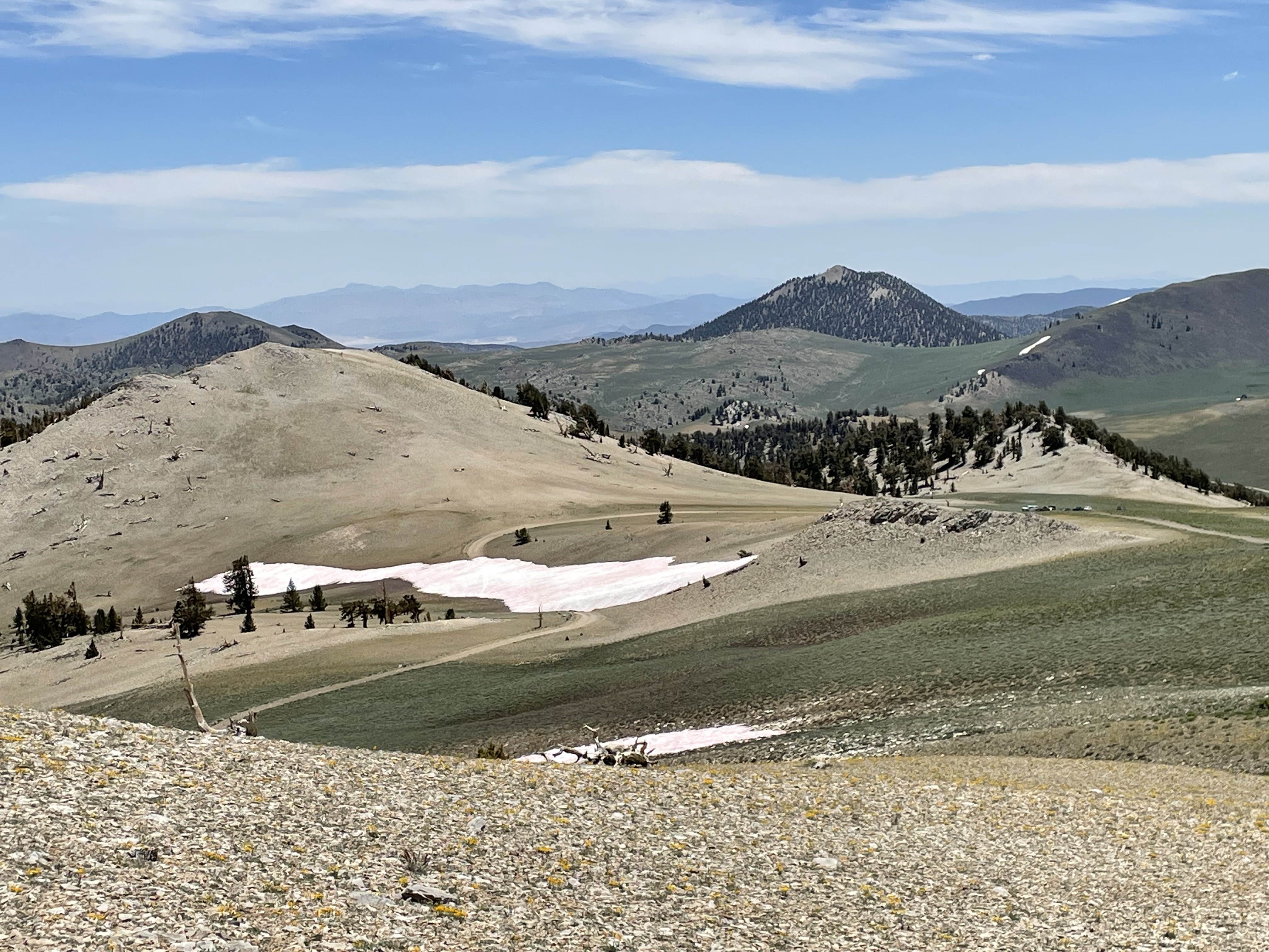
Road openings and closures update on Inyo National ForestJuly 13
Related Incident: INYO NATIONAL FOREST--FLOOD RESPONSE
Publication Type: Announcement
Road openings and closures update on Inyo National Forest-July 13
It’s no secret this past winter’s effects on the roads within Inyo National Forest (Forest or NF) have been long-lasting. The Forest has continued reassessing roads after record-breaking snowmelt runoff and thunderstorms caused heavy damage to numerous Off-Highway Vehicle (OHV) routes and has developed a prioritization protocol for repair based on access for fire personnel, developed recreation sites and high-use areas.
With it still being a very dynamic situation expected to last into the summer and beyond, the forest has some updates to share regarding the reopening of some roads with additional closures of others, broken down by each Ranger District:
Mammoth Ranger District
- Lake Mary Road and roads within the Lakes Basin: opening Friday, July 14 at 8:00 a.m.
- Hazard tree abatement will continue and there will be temporary traffic stops.
- The only campground open will be Twin Lakes.
- Coldwater Creek is overflowing. Drive slowly, and do not park in flooded shoulders.
- Parking is extremely limited. Please check the ESTA website for trolley information.
- Reds Meadow Road will remain closed up to the Mammoth Mountain Inn/Main Lodge. Admin access is only allowed past this point as staff continue clearing the road, assessing for damage and conducting trainings before ESTA can begin providing shuttle service.
- More information will be forthcoming jointly from the Inyo National Forest and Devils Postpile National Monument regarding the reopening of Reds Meadow Road to the public.
Mammoth Ranger District staff would like to thank the Town of Mammoth Lakes and Mammoth Mountain Ski Area for their continual assistance in clearing these roads!
White Mountain Ranger District
- Buttermilk Loop Road is now open.
- Silver Canyon Road is now open.
- Coyote Flat, Sugarloaf Road, Sand Canyon, Wyman Canyon, and White Mountain Road (past Patriarch Grove) remain closed. Of these roads, Coyote Flat and Sand Canyon are the top priority.
The Coyote Flats area has been and continues to be one of the worst-affected roads on the forest from snowmelt runoff and thunderstorm damage this year. After a recent attempt to work on the road forest service engineering staff had to retreat because the road surface was unstable and unsafe for them to operate their equipment. Staff then headed four miles further up the road and found a new, larger gully washout. It was then determined that the road closure would need to be kept in place while further planning for repairs is conducted, as the type of work needed will not be supported by the current heavy equipment on-hand.
Forest Service staff are working on agreements with individuals in the community who have the proper and right-sized heavy equipment and also with volunteer groups such as Valley Outdoors to organize additional public work-day events, as have happened in the recent past.
“With the now dwindling budget available to utilize in ordering equipment, the forest is grateful for a community that is so enthusiastic about getting involved in their public lands,” said Mike Wiese, Incident Commander for the team managing the storm damage. “The Forest continues working with locals to facilitate a faster reopening, while also ensuring safety to those involved.”
- Big Springs Road and Sawmill Cutoff Road are currently being repaired for fire access.
- Big Springs Road has been repaired as of July 7 and is being prepared for opening shortly.
- Walker Lake Road (Forest Road 1S23), Bohler Canyon Road (Forest Road 1N106), Horse Meadow Road (Forest Road 1N16), Forest Roads 1S131, 1S131A, 1S131B remain closed due to storm damage.
- Walker Lake and Horse Meadow Roads are the priority for repairs.
Three new roads have been partially closed this week due to excessive storm damage as well:
- Sagehen Meadow Road (Forest Road 1N02 junction of 1N02G and 1N02H)
- Wild Horse Meadow Road (Forest Road 1S56 junction of 1S17 and 1S56B)
- Pilot Springs Road (Forest Road 1S04 junction of 1S167 and 1S04J)
All roads listed in the Closure Order are open to foot traffic or bicycles. Motorized vehicles are not.
If you would like to get involved with efforts to help repair these roads, please contact our partner organization at Valley Outdoors: Volunteer@valleyoutdoors.org.
For current road conditions for the Inyo NF: www.fs.usda.gov/goto/inyo/alerts-notices/roadconditions.
Other agencies manage roads that are partially Forest Service-owned or lead into our roads. Please “know before you go” by visiting their websites:
Inyo County:
https://www.inyocounty.us/services/public-works/news/inyo-county-road-openclosed-status
Mono County: https://monocounty.ca.gov/roads
Los Angeles Department of Water and Power: ladwpeasternsierra.com
BLM - Bishop Field Office: www.blm.gov/office/bishop-field-office
CalTrans: quickmap.dot.ca.gov
Nevada Department of Transportation: https://www.nvroads.com/
White Mountain Road remains closed at Patriarch Road Junction
Related Incident: INYO NATIONAL FOREST--FLOOD RESPONSE
Publication Type: Announcement
White Mountain Road remains closed at Patriarch Road Junction
White Mountain Road at the Patriarch junction remains closed. A large snow drift remains near the beginning of the Patriarch Road, blocking the road and access to the drive to the grove.
Within approximately ¾ of a mile past the closure on the White Mountain Road section, a large snow drift was recently plowed, creating a 30 to 50-foot section with one lane road access to the White Mountain trailhead, while encountering a couple of wet sections along the road.
SEE PHOTOS BELOW UNDER RELATED INFORMATION OR ABOVE AT PHOTOS TAB
Colt Fire Public Meeting 7pm Wednesday July 26 Condon Community Center
Related Incident:
Publication Type: Announcement
A public meeting will be held on Wednesday, July 26 at 7 pm at Condon Community Center.
Incident Management Team members and local officials will provide an update on the Colt Fire.
More details will be provided soon. Please join us. Thank you.
Colt Fire Public Meeting 7 pm Tuesday July 25 Seeley Lake Elementary School
Related Incident:
Publication Type: Announcement
A public meeting will be held on Tuesday, July 25 at 7 pm at Seeley Lake Elementary School.
Incident Management Team members and local officials will provide an update on the Colt Fire.
The meeting will be live streamed through the Colt Fire Facebook page.
Please join us. Thank you.
072423 Golden Fire Evacuation map and level downgrade
Related Incident: Golden Fire
Publication Type: Announcement
Evacuation map and level downgrade: A portion of the level 3 (GO NOW) area is being reduced to a level 2. Level 2 (BE READY) area includes both sides of Hwy 140 and Bly Mountain Cutoff south of Ground Hog Lane to Keno Springs. Downgraded area follows west of Bechdoldt Flat Rd, south of Racoon Lane and Jaguar Lane.
Learn more about Klamath Couty evacuations here: https://alerts.klamathcounty.org/
July 24 2023 Beauty Creek Fire Update
Related Incident: Beauty Creek Fire
Publication Type: News
Beauty Creek Fire
Idaho Panhandle National Forests, Coeur d’Alene River Ranger District
Fire Information 208-557-8813
https://inciweb.wildfire.gov/incident-information/idipf-beauty-creek-fire
July 24, 2023
Location: Approximately 3 miles up Beauty Creek Rd, off the northeast tip of Coeur d’Alene Lake
Start Date: 7/21/2023 Cause: Under Investigation Size: 13 acres Containment: 0%
Total Personnel: 53 Engines: 3 Hand Crews: 1
The Beauty Creek Fire was reported by the public on the evening of 7/21/23. It is approximately 13 acres and burning in heavy timber. By the end of the 2nd shift yesterday, interagency firefighters had completed handline around 100% of the fire. The fireline has been completely plumbed, meaning that hose has been laid the length of the perimeter, allowing firefighters quick access to water. This achievement will assist in eliminating hotspots and holding the fireline.
Active backing and flanking fire behavior may skirt the lines, so additional holding is needed before any containment can be achieved. Last night, one spot fire was detected that crews are suppressing today. If needed, aviation assets will be requested to support suppression efforts on the ground.
The cause of the fire is currently under investigation by Federal Law Enforcement.
WEATHER AND FIRE BEHAVIOR
A red flag warning is in effect until 11 pm due to a cold front bringing gusty winds and low relative humidity this afternoon and evening. Today's high temperature will be 89 degrees, with a minimum humidity of 13 percent. Winds will start out of the southwest 5 to 15 mph increasing to 15 to 25 with gusts to 30 mph, increasing to 45 mph in the afternoon.
CLOSURES AND SPECIAL MESSAGES
Although official closures are not yet in place, road guards are working on Forest Service Road 453. Temporary emergency closures may be needed as there is active fire along the roadway. Please avoid this area to protect the safety and welfare of the public and provide for safe firefighting efforts and access.
Continued aviation support may be needed, so boaters of all kinds are cautioned to avoid the Beauty Bay area. Failure to clear out when fire aircraft are working can cause delays that waste valuable time and put boots on the ground at additional risk.
Racetrack Fire Update July 24 2023
Related Incident: 2023 Racetrack Fire
Publication Type: News
Racetrack Fire Update - July 24, 2023
Location: North of Highway 169, south of Crater Mountain
Start Date: July 23, 2023
Size: 405 acres
Cause: Lightning
Resources: 1 Type-1 Crew, 2 Type-2 Crews, 3 Engines, additional support personnel.
Fire behavior: Moderate fire behavior.
Types of vegetation in the area (aka fuels): Grass, Brush
SUMMARY: Yesterday afternoon as outflow winds increased firefighters worked to slow the progression of the Racetrack fire as it moved towards the community of Cherry. Fire activity has been moderate today as it moves to the east. Monsoonal weather is expected to continue today as firefighters identify options ahead of the main fire, looking at roads and other natural features to limit fires spread with the use of containment lines.
Smoke may be visible from multiple locations including Dewey, Mayer, and Prescott Valley.
Evacuations – Please follow Yavapai County Sheriff’s Office Facebook page for current evacuation information at: https://www.facebook.com/YavapaiCountySheriff
FIRE RESTRICTIONS: The entire Prescott National Forest is under Stage 1 Fire Restrictions which prohibits building, maintaining, attending, or using a fire, campfire, or stove fire, including charcoal and briquettes, outside a structure that is provided by the Forest Service within designated areas for portions of the forest. Under these restrictions, discharging a firearm, air rifle or gas gun, except for persons engaged in legal hunting activities, is prohibited on the Prescott National Forest. Fireworks and the use of exploding targets are always prohibited year-round on national forests.
For fire information please call (928) 925-1111; or stay up to date on Prescott National Forest news by checking the Prescott NF website and following us on Facebook and Twitter.
For fire information please call (928) 925-1111; or stay up to date on Prescott National Forest news by checking the Prescott NF website and following us on Facebook and Twitter.