
Colt Fire Daily Update Monday July 24
Related Incident:
Publication Type: News
Colt Fire Fact Sheet
Montana Department of Natural Resources and Conservation Fire Protection
Lolo National Forest and Flathead National Forest Land Management
NORTHERN ROCKIES TEAM 1 INCIDENT COMMANDER: BRENT OLSON
Fire Information: 406-247-0922 2023.Colt@firenet.gov
https://inciweb.wildfire.gov/incident-information/mtmts-colt-fire
Monday, July 24, 2023 at 10:00 am
Location: 15 miles northwest of Seeley Lake, Montana
Start Date: 7/17/2023 Cause: Lightning Size: 2,927 acres Containment: 0%
Total Personnel: 412 Engines: 9 Helicopters: 5 Hand Crews: 13
ATTENTION
For the safety of the pilots and public boaters on Seeley Lake and Lindbergh Lake need to stay clear of fire aircraft when they are scooping water from the lakes for firefighting efforts.
The National Weather Service has issued a Red Flag Warning today from 2pm until 12 midnight. A combination of low humidity and gusty winds will lead to critical fire weather conditions.
CURRENT STATUS
An overnight infrared flight mapped the Colt Fire at approximately 2,927 acres in size and it remains 0% contained. The fire size has increased by 1,352 acres over the past two days. Fire activity on Sunday was moderate with light winds and stable air over the area. Additional fire crews and equipment have been assigned to fire operations.
Crews continued to prepare an indirect fire line on the northeast side of the fire along Forest Road 646 by hand cutting and removing brush and other ground vegetation. Personnel working on the south, west and north sides of the fire looked at road systems for access and for opportunities to develop direct or indirect fire lines. The Structure Protection group conducted assessments and preparations for structure protection in the areas along Highway 83 and around the lakes south and east of the fire. Air Operations was busy using helicopters and the CL415 water scooper fixed wing aircraft to drop water on areas on the fire. The fire continued to actively burn and remained active during the night.
PLANNED ACTIONS
Fire personnel completed the fuels removal and access improvement work along Forest Road 646, the primary control line feature for the East side of the fire. Personnel will now be working on the North and South sides of the fire to open existing roads and begin fire line construction in areas that have a high probability of success of containing the fire. Access to the north side of the fire is proving to be a bit more challenging. The Structure Protection Group will continue their structure assessments and preparations. Helicopters and fixed wing water scooping aircraft will be used to drop water on the fire if the flying conditions remain safe. Firefighter and public safety are the number one priority as suppression work continues. With a Red Flag Warning forecasted for the area, fire managers and crews will review their escape routes and safety zones and work with a heightened awareness of changing weather and fire activity.
WEATHER AND FIRE BEHAVIOR
The National Weather Service has issued a Red Flag Warning in the fire area from 2:00pm to midnight today for low humidity and strong winds. Winds are forecasted to be 20 mph with gusts up to 30 mph. Humidity levels will drop below 30% in the fire area. Winds will be blowing directly across the fire area.
EVACUATIONS AND CLOSURES
The Missoula County Sheriff’s Office Evacuation Warning and Order summary:
-Residents on Beaver Creek Road (near the summit) are under an Evacuation Warning.
-Mile marker 31 (Beaver Creek Road at the intersection of Hwy 83) south towards Seeley Lake to mile marker 27, and including residences in Rovero Flats, are under an Evacuation Order.
-Residences beginning at mile marker 27, south end of Rovero Flats, to mile marker 25.5 (the intersection of the West Fork of the Clearwater Road and Hwy 83) are under an Evacuation Warning.
-Residences on the north and south ends of Lake Inez are under an Evacuation Warning. The east side of Lake Inez, along Hwy 83, is not under any Warning or Order.
For evolving Evacuations and Warnings please visit the Missoula County Sheriff’s Office Facebook page at https://www.facebook.com/MissoulaCountySheriffsOffice .
Please be aware that due to the possibility of rapidly changing conditions, an Evacuation Order may be issued with no prior notice or warning. Home and property owners in the surrounding area should remain vigilant and prepared. Have an evacuation plan for family, pets, and livestock; sign up for emergency alerts at Smart911.com; and be familiar with the Missoula County evacuation process and what an order and warning means https://www.missoulacounty.us/government/public-safety/office-of-emergency-management/evacuation-information.
The Lolo and Flathead National Forests have closed several forest roads, areas, and campgrounds near the fire area for public safety. The list of current closures includes:
-Forest Road 906 (closed at Highway 83)
-Rainy Lake Campground access road 4357 (closed at Highway 83)
-Rainy Lake Campground
-Alva Lake Campground access road (closed by gate at Highway 83)
-Alva Lake Campground
-Lakeside Campground access road (closed by gate at Highway 83)
-Lakeside Campground
-Forest Road 646 (closed at the junction of FSR 552; FSR 4354; Forest Road 552 (beyond the turn off to west side Lake Inez access
-Forest Road 5507 and 463 closed beyond the West Side snowmobile trailhead (these roads access the Montana Fish, Wildlife, and Parks Marshall Wildlife Management Area and Lake Marshall)
-Temporarily closing the Forest System Road loops of the Clearwater (FSR 4370 and 4353) and Richmond (FSR 667 and 720)
TEMPORARY FLIGHT RESTRICTIONS
A Temporary Flight Restriction is in place for air space over the Colt Fire (FDC 3/0291) to provide a safe environment for firefighting aircraft operating in the area. Remember that temporary flight restrictions also apply to unmanned aircraft systems (UAS) or drones. If you fly, we can’t!
Grapevine Fire Daily Update July 23 2023
Related Incident:
Publication Type: News
Grapevine Fire Update - July 23, 2023
Location: Mingus Mountain, Verde Ranger District (T14N, R2E, SEC 4), Approximately 10 miles east of Prescott Valley; 2 miles south of Mingus Spring Ranch
Start Date: July 21, 2023
Size: 140 Acres
Cause: Lightning
Resources: 2 Type-1 Crews, 2 Engines, additional support personnel.
Fire behavior: Low/Moderate fire behavior.
Types of vegetation in the area (aka fuels): Grass, brush, and timber understory.
Update: Afternoon thunderstorms moved over the Grapevine Fire yesterday where outflows winds increased the fire size to 140 acres. Each fire receives a strategic, risk-based management strategy. Due to terrain and access; firefighters continue to scout the area for containment features and identify hazards as they begin to safely suppress the fire. There are no values at risk or threatened infrastructure at this time.
Ryan Barela’s Arizona Central West Zone Type 3 Incident Management will assume command of the Grapevine Fire on Monday, July 24, 2023.
Smoke: Smoke may be visible from multiple locations including Prescott Valley, Dewey, Prescott and along Highway 169.
Fire Restrictions: The entire Prescott National Forest is under Stage 1 Fire Restrictions which prohibits building, maintaining, attending, or using a fire, campfire, or stove fire, including charcoal and briquettes, outside a structure that is provided by the Forest Service within designated areas for portions of the forest. Under these restrictions, discharging a firearm, air rifle or gas gun, except for persons engaged in legal hunting activities, is prohibited on the Prescott National Forest. Fireworks and the use of exploding targets are always prohibited year-round on national forests.
Recreationists on Mingus Mountain should avoid camping and hiking near the fire and utilize caution while driving the roads as firefighters will be traveling to and from the fire.
For fire information please call (928) 925-1111; or stay up to date on Prescott National Forest news by checking the Prescott NF website and following us on Facebook and Twitter.
Hayden Fire Update July 24 2023
Related Incident:
Publication Type: News
Fire Location: 18 miles W of Leadore, Idaho
Size: 7076 acres
Containment: 0%
Personnel: 386
Start Date: 7/19/23
Cause: undetermined
Incident Commander: Mike Johnston, Great Basin Type 2 Incident Management Team #7
Summary: The Hayden Fire started on Wednesday, July 19th, 2023, at approximately 11:30 am. The fire is located in the Lemhi Range, 18 miles west of Leadore, Idaho. The terrain is difficult, and the fire is burning in spruce/subalpine fir with a heavy dead/down timber component. Fire cause is undetermined.
Weather | Anticipated Fire Behavior: Haze will become more common over western Montana and north central Idaho as local and regional wildfires become more active. Low humidities and hot temperatures ranging from the mid 90s to low 100s will continue in the valleys through the day. An approaching dry cold front will increase southwest winds with the frontal passage tonight. These winds have a high potential to increase fire behavior on the north and east flanks of the fire. Expect increased fire behavior in Hayden and Mogg drainages. Fire will continue to burn along Cold Creek and Carol Creek.
Actions: Yesterday, gusting outflow winds moving out in front of storm cells in the fire area challenged containment lines. Significant fire activity and fire growth occurred to the north and east. By 1pm it was necessary for fire resources to back out for their safety. Today, fire personnel will be continuing to strengthen the firelines to the north, and implementing alternative plans to the east.
Important Information: An Air Resource Advisor has joined the Incident Management Team in Leadore. She will be producing an air quality report for the local community as well as provide information to the fire team about how smoke will affect fire activity and operations. Additionally, air quality information can be found online at Airnow.gov. They provide data to the public to communicate whether air quality is healthy or unhealthy for you.
The Salmon Challis National Forest has a revised closure order in place to help protect firefighter and public safety. Maps and additional information are available on the Alerts and Notices section of the SCNF website. Risk to responders and public safety remain the highest priority for the incident management team.
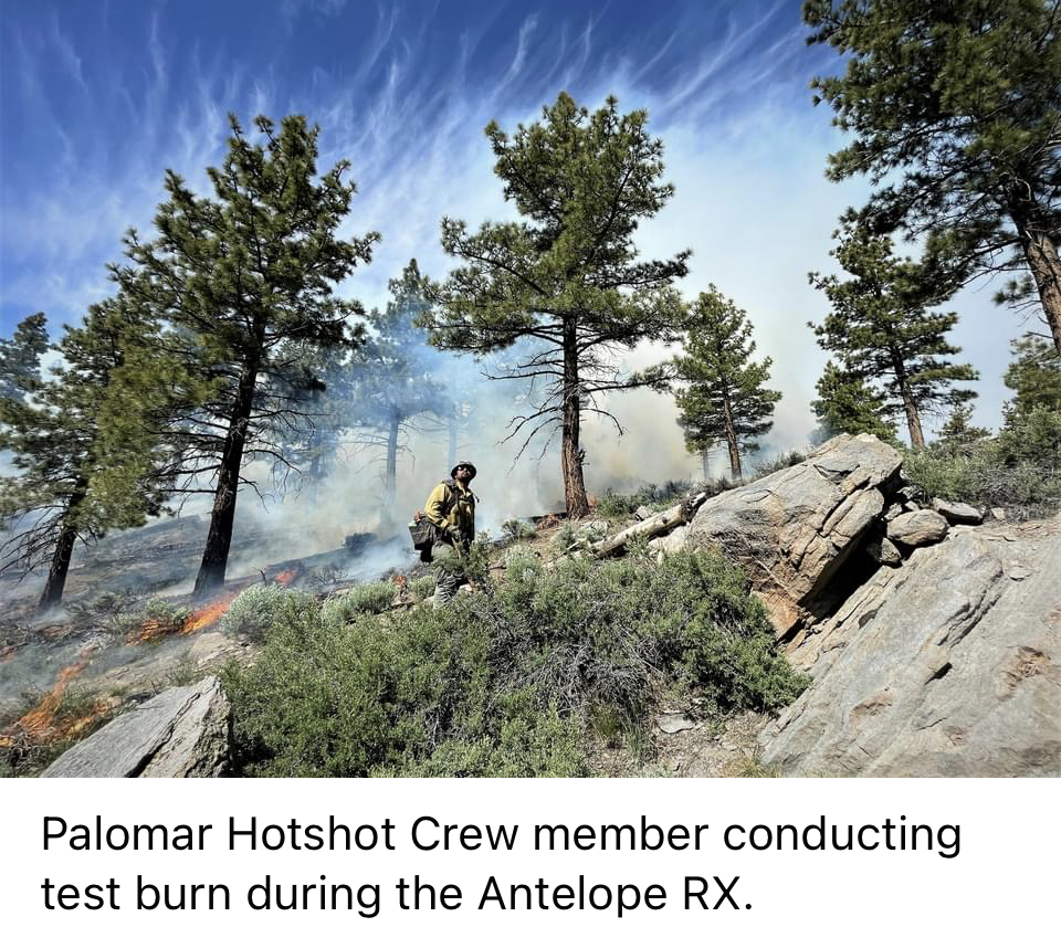
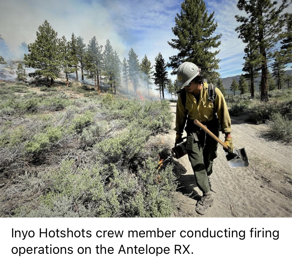
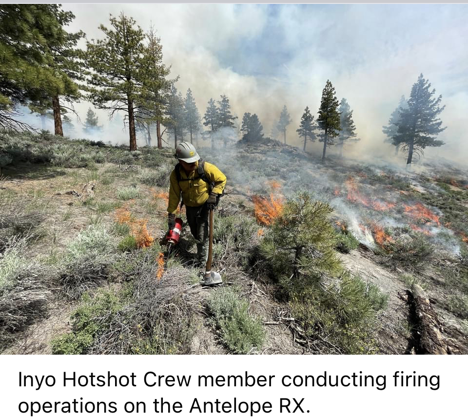
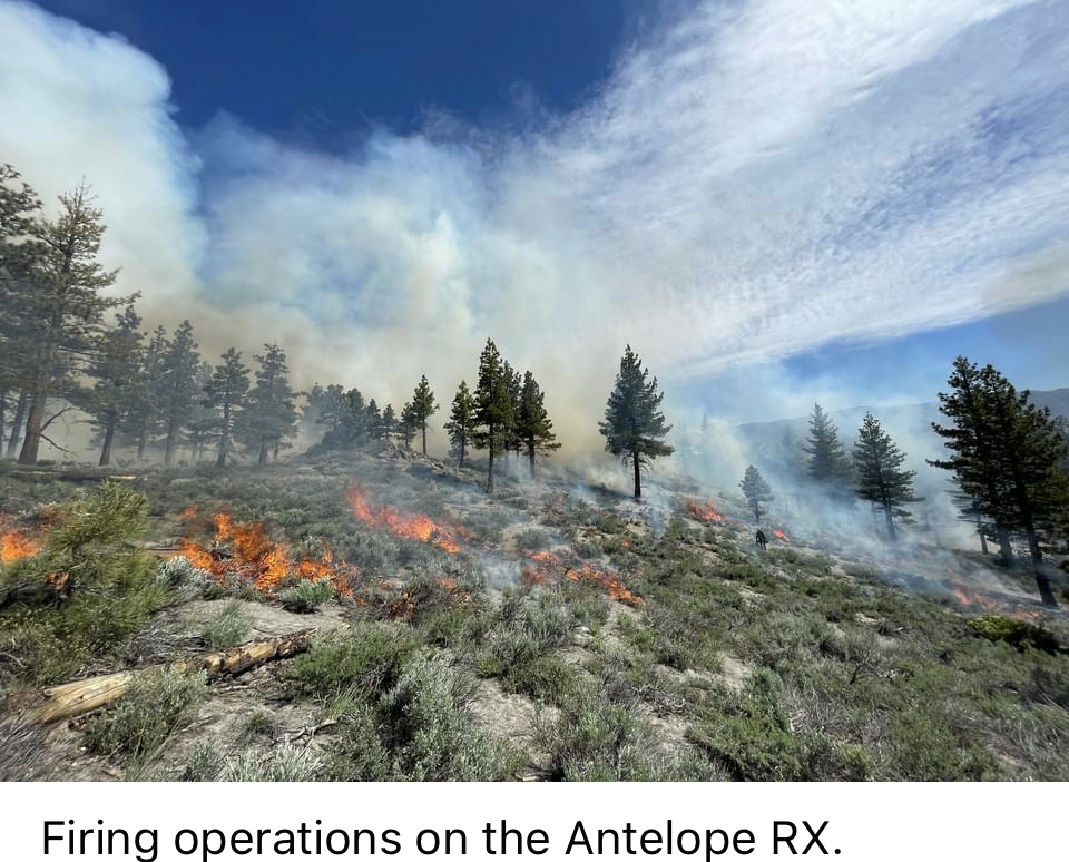
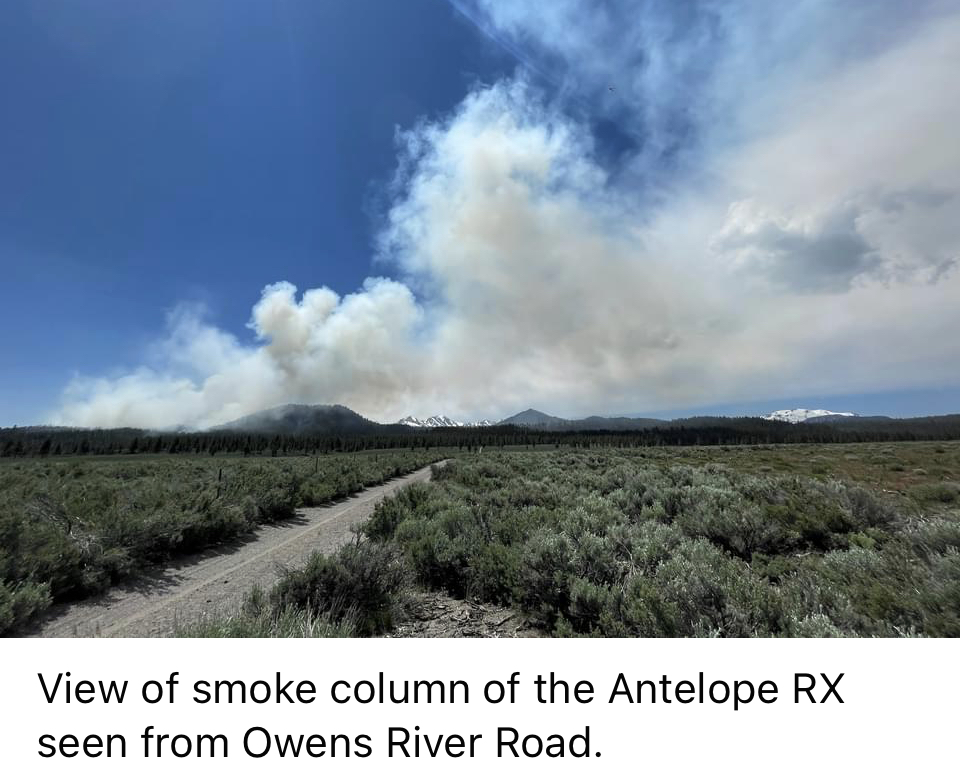
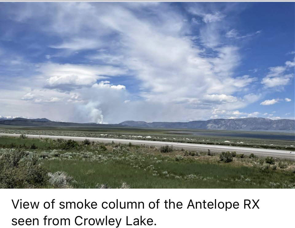
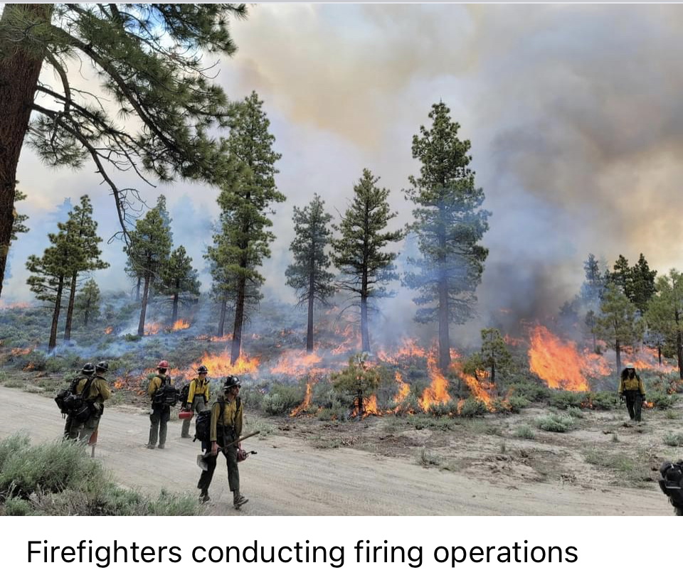
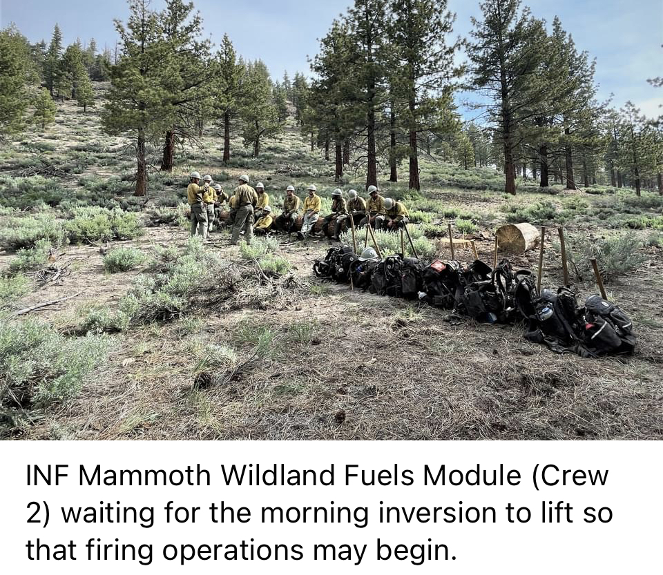
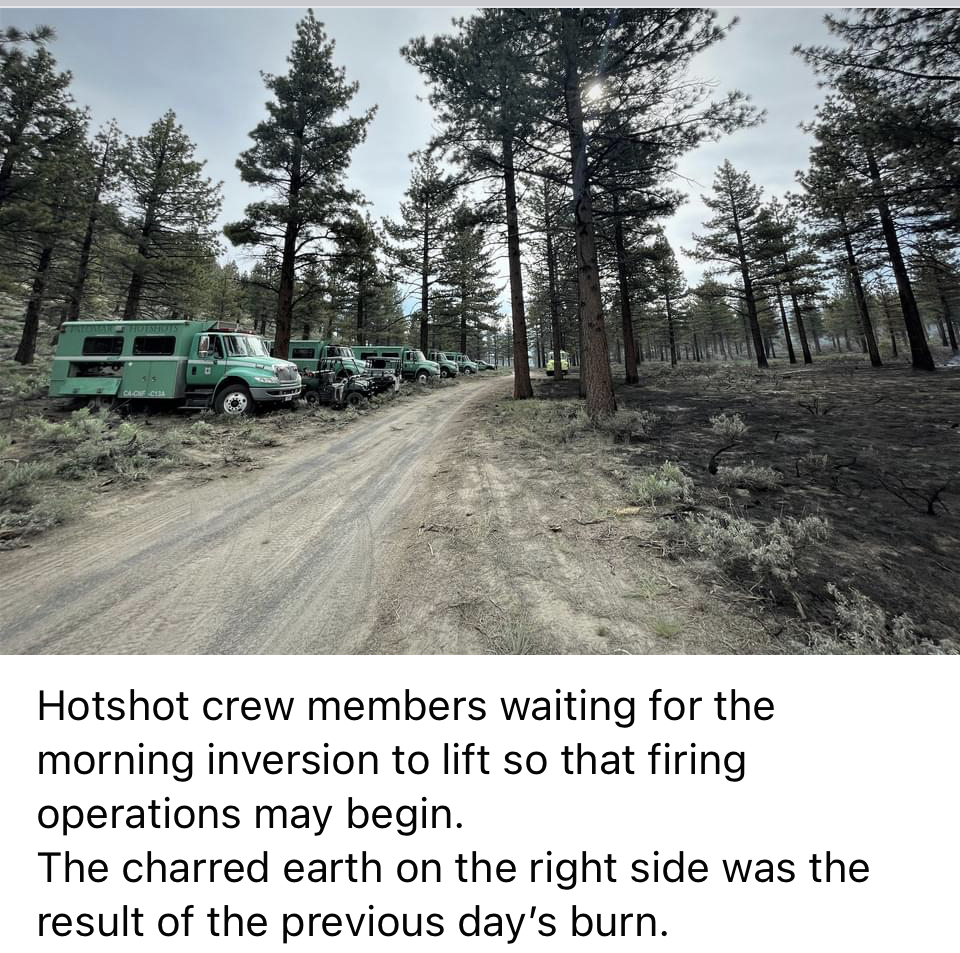
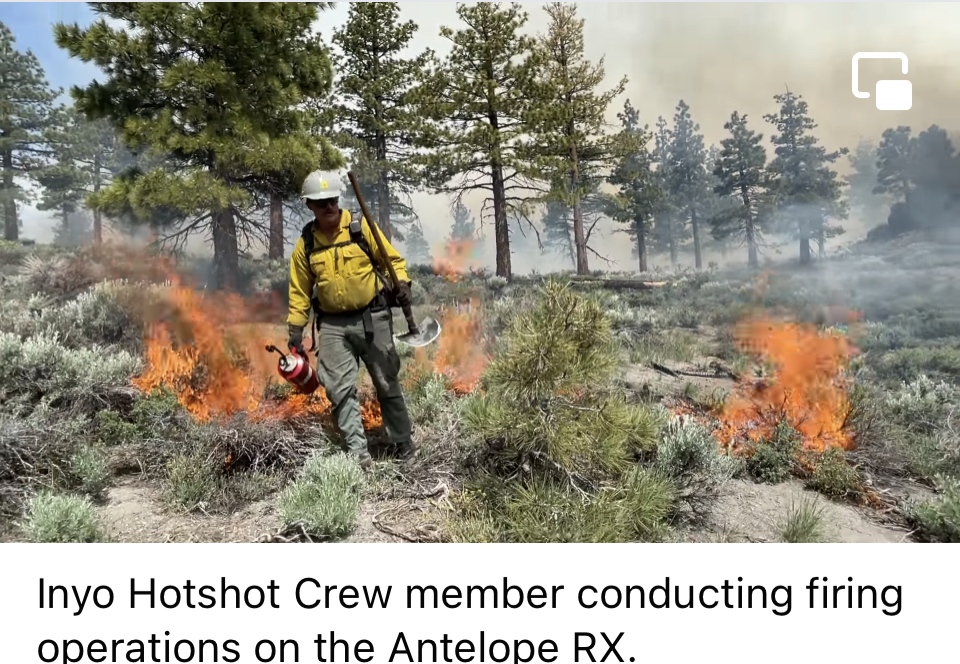
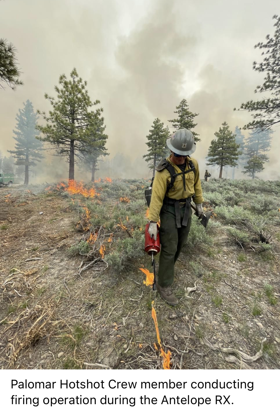
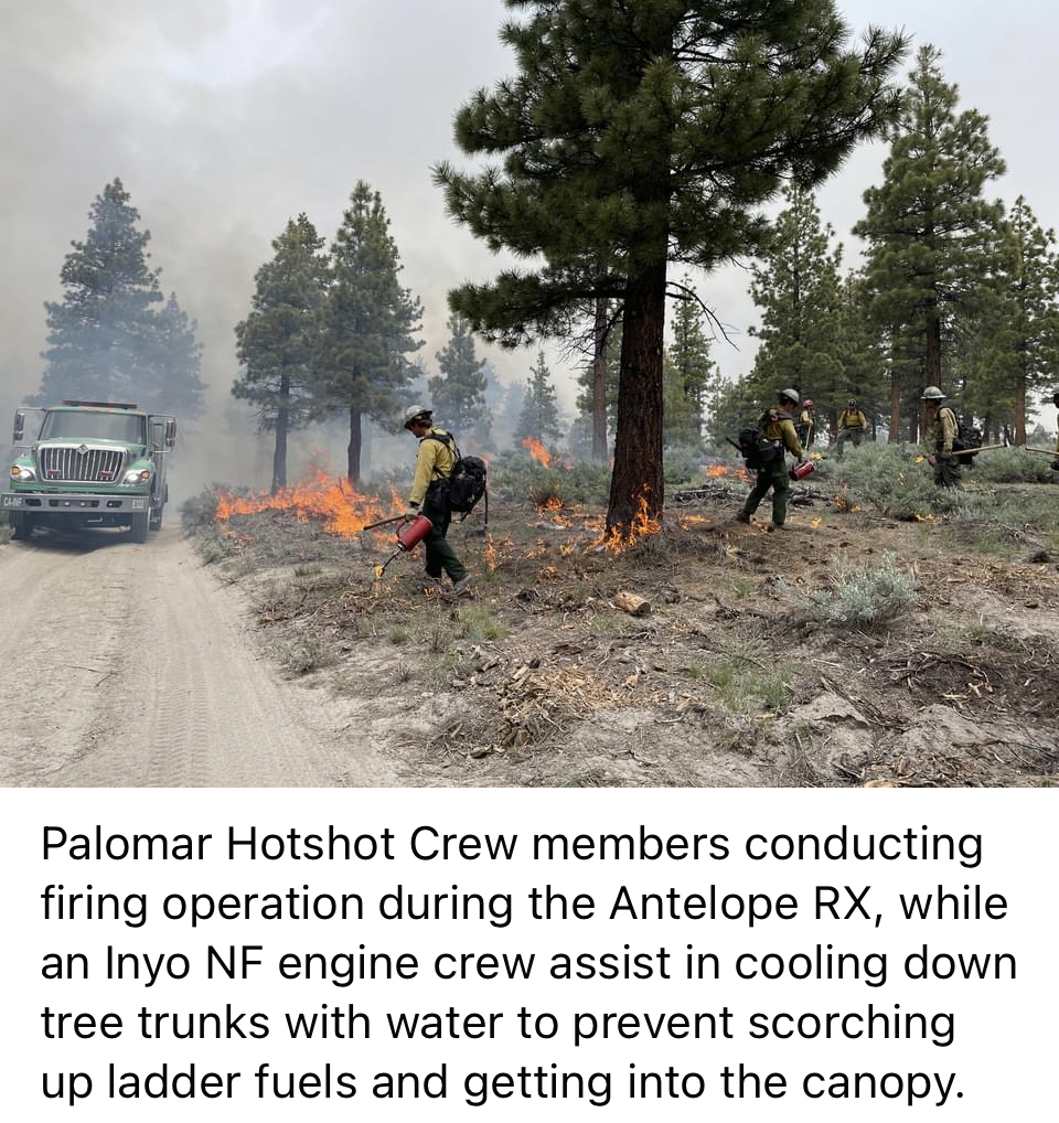
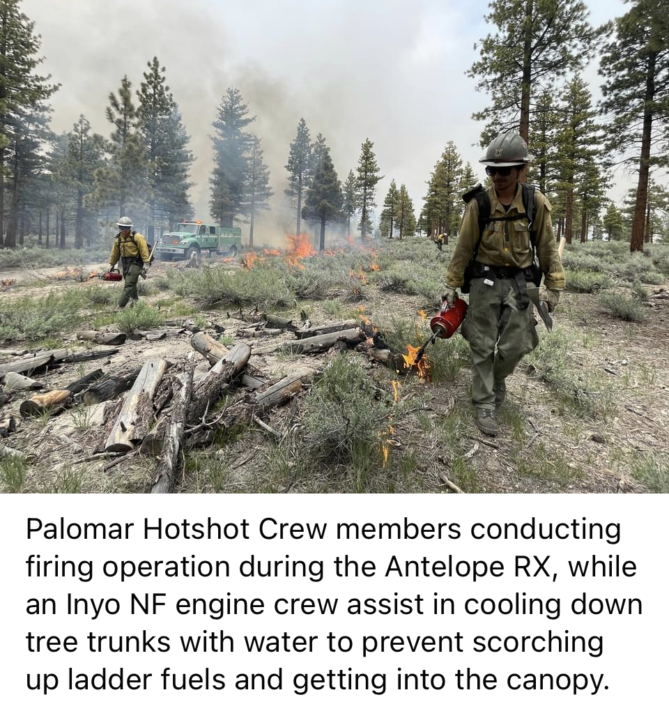
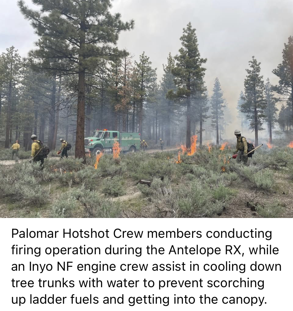
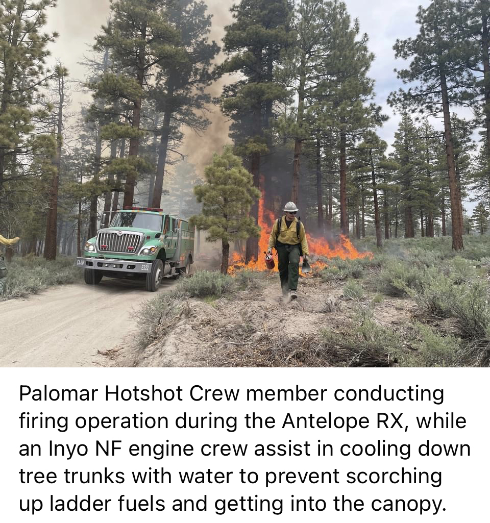
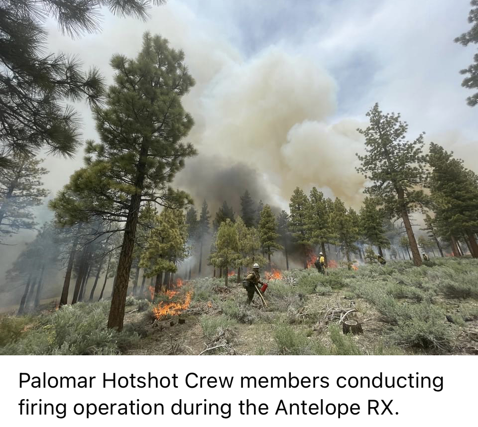
INYO NATIONAL FOREST COMPLETES 1713 ACRES OF PRESCRIBED BURNING
Related Incident: INYO NATIONAL FOREST 2023 PRESCRIBED FIRE PROJECTS
Publication Type: News
INYO NATIONAL FOREST COMPLETES 1,713 ACRES OF PRESCRIBED BURNING
National Forest firefighters along with supporting resources have finished their prescribed fire projects for this most recent burn window for a total of 1,713 acres as of Sunday, June 25, 2023.
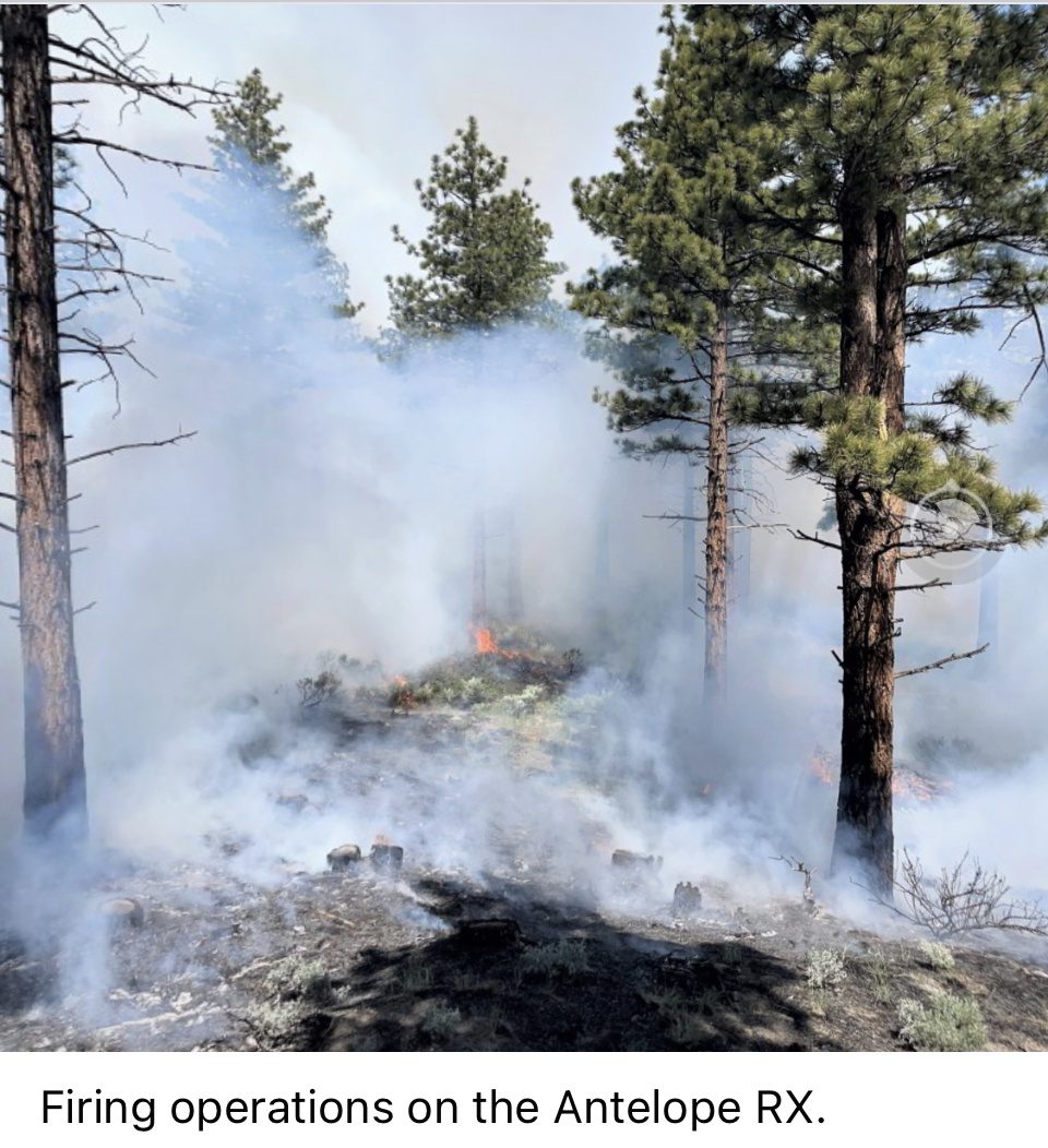
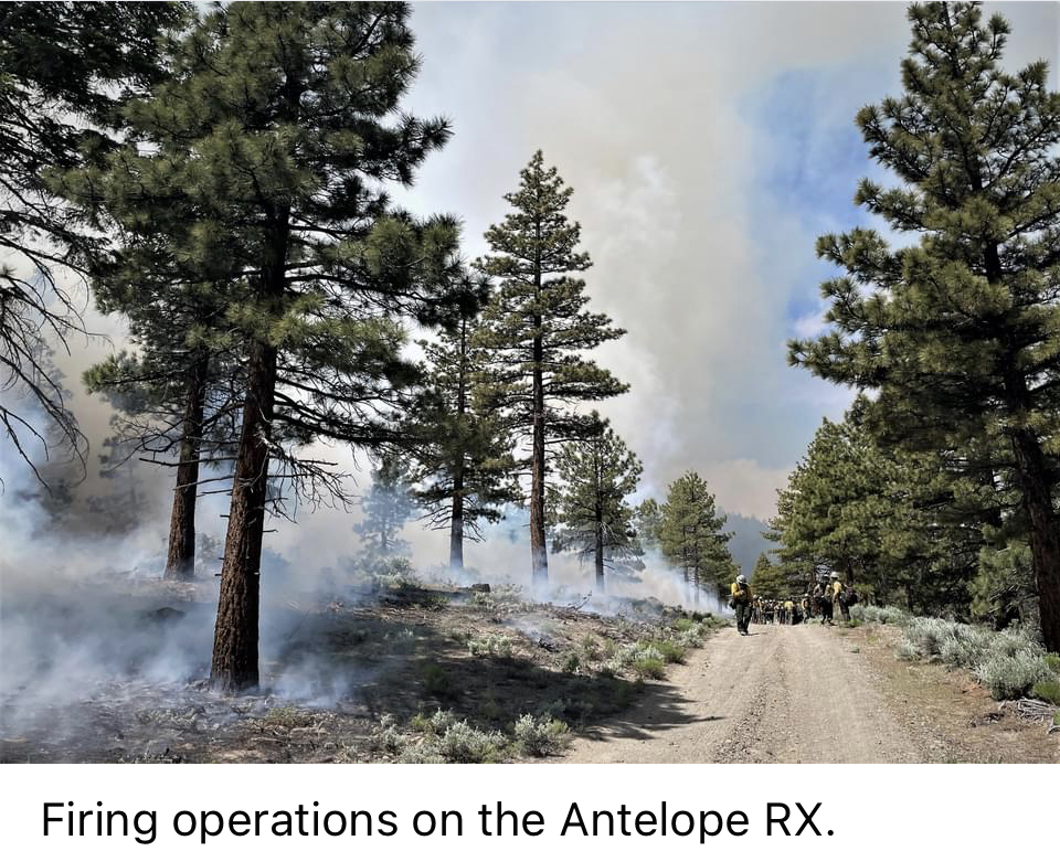
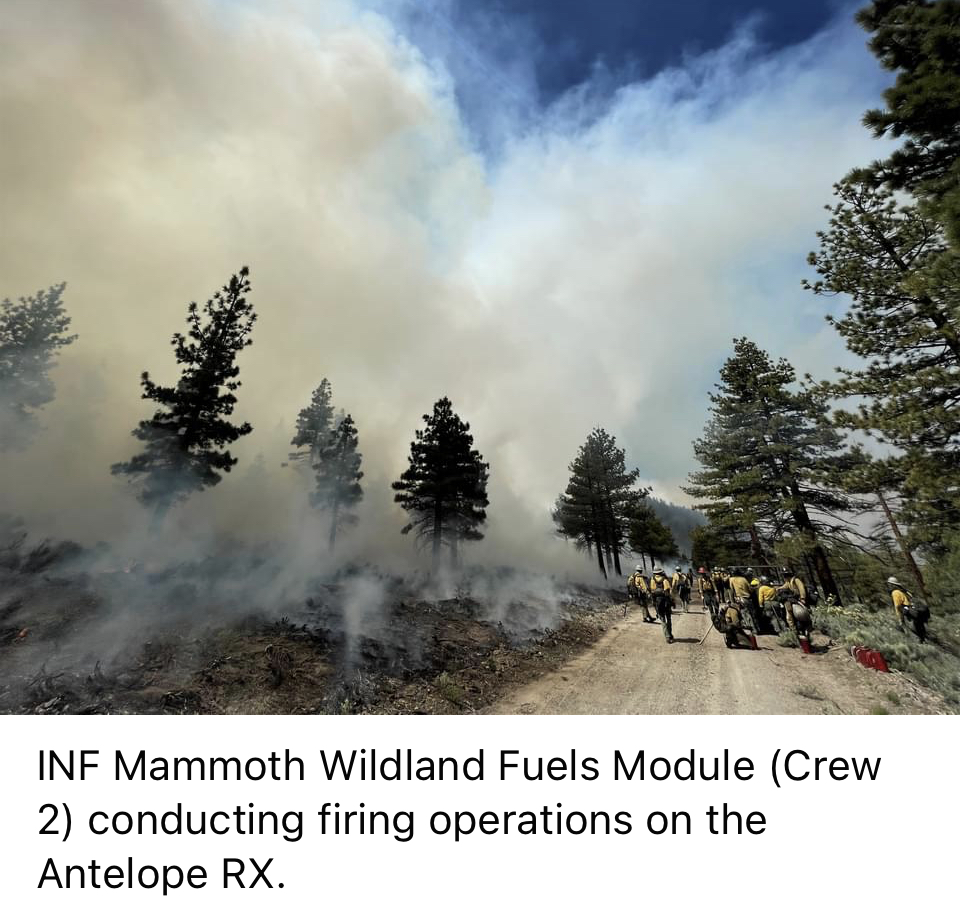
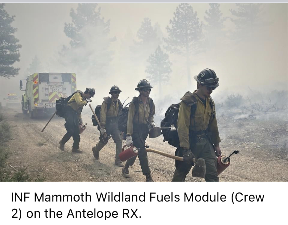
Fire personnel overseeing the “Casa Diablo/Crowley Prescribed Fire” next to the community of Sunny Slopes, and the “Antelope Prescribed Fire” northeast of Mammoth Lakes are very satisfied with the resulting fire effects. These areas will now provide a defensive buffer adjacent to nearby communities and infrastructure that will allow firefighters to work in the event of a wildfire. The prescribed fires will also improve forest health and resilience to stressors and disturbance such as wildfire, insects, disease and drought.
“We are happy to see fire return to more natural interval on the landscape,” said Chance Traub, Fire Management Specialist for Fuels and Prescribed Fire on Inyo National Forest. “Both of these projects have evolved from previous prescribed burns. They can now be areas we build off of, providing an anchor point for future prescribed fire projects.”
Ignition days were chosen in consideration for the direction and dispersion of smoke, helping reduce smoke impact to communities, roadways and popular recreation areas over the course of the burns.
Inyo National Forest Chief of Fire and Aviation Management Larry Pingel and Forest Supervisor Lesley Yen would like to thank the assisting resources who made these prescribed burns possible:
Humboldt-Toiyabe, Angeles, Manti-La Sal, San Bernardino and Cleveland National Forests, Bureau of Land Management’s Central California District and Kern Valley Hotshots, Savannah River Fire Unit out of Georgia, RJT Contracting hand crew, and Mammoth Lakes Fire Department as one of our contingency resource.
Additionally, the support from the Pacific Southwest Region’s UAS (Unmanned Aircraft Systems) program increased efficiency and safely for firefighters on the burns.
NOTE: SEE PHOTOS POSTED BELOW UNDER RELATED INFORMATION OR ABOVE AT THE PHOTOS TAB
Informacion vespertine del Incendio Flat 23 de julio 2023
Related Incident: Flat Fire
Publication Type: News
23 de julio, 2023
Informacion vespertine del Incendio Flat
Fecha de Inicio: 15-julio-23
Extensión: 20,232
Origen: 2 millas Sureste de Agness, OR
Causa: Error humano, bajo investigacion
Personal: 1,497
Recursos: 40 camión de bomberos l 36 escuadrillas l 8 buldóceres l 26 cisternas l 8 masticadores l 8 helicópteros
Situación actual: Los bomberos han estado construyendo líneas, realizando quemas y limpiando espacios de emanación de calor para lograr completar la quema en ciertas áreas. Alrededor del perímetro del incendio, el personal de bomberos se encuentra explorando el área y planeando de una manera estratégica la construcción de líneas primarias, alternativas y de contención del fuego. El día de mañana, se podrá observar la presencia del humo en las comunidades cercanas al incendio.
Actividades nocturnas: Los bomberos del turno nocturno estarán patrullando el perímetro del incendio y trabajando en mantener el fuego entre las líneas de control. El turno rotatorio estará trabajando en conjunto con la escuadrilla de bomberos del turno nocturno los cuales continuaran con las operaciones de quema en la sección Noreste del fuego para asegurar aún más las líneas de control.
Evacuaciones: La ciudad de Curry está enviando noticias de evacuación utilizando el sistema Everbridge.
Si aun no lo ha hecho, por favor inscríbase en el programa, visitando el website:
https://www.co.curry.or.us/departments/emergency_management/index.php
Las areas de Oak Flat, Old House Creek Road y Spud Road que estaban a un Nivel 3 de Evacuación, fue reducido a un Nivel 2 “Este listo”. También se mantiene en pie un Nivel 2 de Evacuación desde Agness hasta Quosatana Creek.
Condiciones climáticas: Para el día de mañana, se pronostican temperaturas más frescas, lo cual será de gran ayuda para los bomberos trabajando arduamente en la extinción del incendio.
Impacto del humo: Pronósticos en la presencia del humo, puede encontrarse en la página web: oregonsmoke.org y también en airnow.gov
Cierres de áreas: El Bosque Nacional de Rogue River-Siskiyou, ha emitido una orden de cierre en el área del incendio la cual incluye senderos, carreteras y parte del rio Illinois. Para mayor information: bit.ly/RRSNFClosures
Orden de restricción: Se han establecido Restricciones en el área. Para más información: fs.usda.gov/rogue-siskiyou
Se hace un llamado al público en general para que manejen con cautela mientras se encuentren en el área debido al incremento de trafico de cuadrillas de bomberos y sus equipos.
Flat Fire Evening Update 7232023
Related Incident: Flat Fire
Publication Type: News
July 23, 2023
Flat Fire Evening Update
Start Date: July 15, 2023
Size: 20,232
Point of origin: 2 miles southeast of Agness, OR
Cause: Human caused, Under Investigation
Total personnel: 1,497
Resources: 40 engines l 36 crews l 8 bulldozers l 26 water tenders l 8 masticators l 8 helicopters
Current Situation: Firefighters have been building line, burning out, and mopping up (extinguishing hot spots) in completed burnout areas. Fire personnel are also scouting and strategically planning for primary, alternate, and contingency control lines around the perimeter of the fire. Tomorrow, smoke may be visible in nearby communities.
Tonight’s activities: Night shift crews will be patrolling the fire perimeter and working to ep the fire within the control lines. Swing shift in combination with night shift crews will continue burnout operations in the northeast section of the fire to further secure control lines.
Evacuations: Curry County is sending evacuation notices utilizing Everbridge. Sign up below https://www.co.curry.or.us/departments/emergency_management/index.php The areas of Oak Flat, Old House Creek Road and Spud Road that were previously in a Level 3 Evacuation were downgraded to a Level 2 “Get Set”. A Level 2 evacuation notice also remains in effect from Agness to Quosatana Creek.
Weather: Tomorrow’s forecast is for cooler weather which will help with firefighters working to suppress the fire.
Smoke: The Smoke Outlooks are available at oregonsmoke.org and airnow.gov
Closures: The Rogue River Siskiyou National Forest has issued a closure order for the fire area including trails, roads, and a portion of the Illinois River. bit.ly/RRSNFClosures
Restrictions: Fire Restrictions are in place fs.usda.gov/rogue-siskiyou
Please slow down and be careful when driving near fire traffic in the area.
Adams Robles Complex Fact Sheet for Saturday July 22 2023
Related Incident:
Publication Type: News
Today’s Date: 07/22/2023
Start Date: 07/19/2023 Location: 3 mi. west of Dragoon, Cochise County
Cause: Lightning
Acres: 5,232 Containment: Robles: 75% - Adams Peak: 0
Evacuations: SET: between I-10, Dragoon Road and Touchstone Road
Structures Damaged: 0 Destroyed: 0
Summary: Crews are making significant progress on the Adams Robles Complex. Overnight precipitation assisted crews in stopping the Robles Fire’s forward progress. Crews have that fire 75% contained at 3,000 acres. Today, crews worked along Robles Road improving line to be certain it will hold in the wind. Outflow winds associated with thunderstorms have been problematic over the last few days. Engines are present within the communities, patrolling and monitoring in between structures to make sure no heat remains. Over on the Adams Peak side, crews continued work to add approximately another mile of containment line on the southern flank in order to tie it in with line on the east side. The Adams Peak Fire is 2,232 acres with no containment. Both fires are burning in a continuous fuel bed of mixed grass and light brush. Fuels are fully cured and contributing to spread. An infrared (IR) flight has been requested for tomorrow to check for remaining heat within the fires’ perimeters and provide a more accurate size up of the two fires. While overnight rain helped with suppression efforts, it was not enough to help fully suppress either of the incidents. Last night’s storm also created four new starts in the area, including the Horse Camp Fire four miles east of San Simon. That fire is under the jurisdiction of the Bureau of Land Management. Crews off the Adams Robles Complex were sent to assist on the new starts as part of initial attack efforts. There is a 50% chance of thunderstorms forecast for Sunday. The Department of Forestry and Fire Management (DFFM) complexed both fires into the Adams Robles Complex Fire. The fires have not merged, they are just being managed as one incident. Smoke off both fires may impact the highway and drivers in the area should use caution.
Resources and Personnel Assigned: 185
Type 2 Hand Crews (HC): 5, Type 2-IA HC: 1, Engines: 12, Water Tenders: 2
Weather: Very hot and dry conditions persist. Erratic winds and lightning associated with thunderstorms.
Incident Information:
Twitter: @azstateforestry: https://twitter.com/azstateforestry
Facebook: https://www.facebook.com/arizonaforestry
Adams Robles Complex Fact Sheet for Sunday July 23 2023
Related Incident:
Publication Type: News
Today’s Date: 07/23/2023
Start Date: 07/19/2023 Location: 3 mi. west of Dragoon, Cochise County
Cause: Lightning
Acres: 5,232 Containment: Robles: 100% - Adams Peak: 60%
Evacuations: SET: between I-10, Dragoon Road and Touchstone Road
Structures Damaged: 0 Destroyed: 0
Summary: The Robles Fire, south of Interstate 10 is now 100% contained at 3,000 acres. On the Adams Peak Fire, north of I-10, crews were able to stop the fire’s forward progress today and are reporting 60% containment. The Adams Peak Fire remains within its footprint and is 2,232 acres. Hand crews are cold trailing containment line checking for any remaining heat while engine crews are patrolling and monitoring the perimeter to ensure there is no interior smoke or lingering hotspots. Recent precipitation over the fires assisted crews with suppression efforts and significantly reduced fire activity. A majority of the resources, including the Department of Forestry and Fire Management’s (DFFM) hand crews have been released from the Adams Robles Complex and were reassigned to the Gallineta Fire northeast of San Miguel. That fire was reported at 300 acres as of Sunday afternoon and is burning at the base of the Baboquivari Mountains in Pima County. DFFM complexed both the Adams Peak and Robles Fire into one incident in order to more efficiently manage both.
Resources and Personnel Assigned: 128
Type 2 Hand Crews (HC): 5, Engines: 4, Water Tenders: 1
Weather: Hot, dry, and windy conditions. Outflow winds and lightning associated with thunderstorms.
Incident Information:
Twitter: @azstateforestry: https://twitter.com/azstateforestry
Facebook: https://www.facebook.com/arizonaforestry
Settings - change map background and toggle additional layers
Filter - control incident types displayed on map.
Zoom to your location
Reset map zoom and position
Could not determine your location.
Show Legend
 Wildfire
 Prescribed Fire
 Burned Area
Response
Burned Area
Response Other
Other
Golden Fire
Unit Information
Incident Contacts
July 23 2023 Beauty Creek Fire Update
Related Incident: Beauty Creek Fire
Publication Type: News
Beauty Creek Fire
Idaho Panhandle National Forests, Coeur d’Alene River Ranger District
Fire Information: 208-557-8813
https://inciweb.wildfire.gov/incident-information/idipf-beauty-creek-fire
July 23, 2023
Location: Approximately 3 miles up Beauty Creek Rd, off the northeast tip of Coeur d’Alene Lake
Start Date: 7/21/2023
Cause: Under Investigation
Size: 13 acres Containment: 0%
Total Personnel: 30+ Engines: 5 Helicopters: 2 Hand Crews: 1
The Beauty Creek Fire was reported by the public on the evening of 7/21/23. It is approximately 13 acres and burning in heavy timber. Initial Attack efforts include a Type 1 and Type 3 Helicopter, five staffed engines, a water tender, a falling module, and a hand crew. The Panhandle Hotshots, local district Forest Service firefighters, and Idaho Department of Lands firefighters have worked together to construct handline around approximately 75% of the fire. The hotshot crew is being replaced by a Miller handcrew. Active backing and flanking fire behavior is skirting the lines, so additional work is needed before any containment can be achieved.
The cause of the fire is currently under investigation by Federal Law Enforcement.
CLOSURES AND SPECIAL MESSAGES
Although official closures are not yet in place, road guards are working on Forest Service Road 453. Temporary emergency closures may be needed as there is active fire along the roadway. Please avoid this area to protect the safety and welfare of the public and provide for safe firefighting efforts and access. Continued aviation support will likely be needed, so boaters of all kinds are cautioned to avoid the Beauty Bay area. Failure to clear out when fire aircraft are working can cause delays that waste valuable time and put boots on the ground at additional risk.