
Big Knife Fire Update August 19 2023
Related Incident: Big Knife
Publication Type: News
A community meeting with updates on the Big Knife Fire will be held at the Arlee Community Center at 34086 Pow Wow Rd., Arlee, MT on Monday, August 21st, 2023 at 7 P.M.
With temperatures and wind speeds moderated by heavy cloud cover, fire activity was milder than predicted. On the north edge of the fire, along S. Canal Road, crews are continuing to mitigate hazards by removing snags inside the fire perimeter at least a tree length from the line. Crews patrolling the area observed the fire backing down into the bottom of the Gold Creek drainage. On the south end of the fire in the Agency Creek drainage, crews are continuing to patrol and monitor fire activity. On the east side of the fire near Jocko Lookout, crews will continue monitoring the pumps and sprinkler systems and monitoring the fire growth in the primitive area.
The Big Knife Fire is currently 1.25 miles north of the Rattlesnake Wilderness Boundary (Lolo National Forest) with no significant growth towards the Lolo National Forest in the last week. Smoke from the fire may impact the Snowbowl area, however the Lolo National Forest does not have any forest closures in place on the Missoula Ranger District.
CLOSURES AND SPECIAL MESSAGES: Several areas near the base of the mountains west of the Big Knife Fire remain in PRE-EVACUATION WARNING by order of the Lake County Sheriff. See the map for those locations in yellow (Jocko, Canal, Francis). The Tribal Primitive Area, Belmore Slough and Burnt Cabin Roads are closed.
A PRE-EVACUATION WARNING means you may be in your home. Individuals in this status should not bring back evacuated livestock until the area is downgraded to READY status.
A temporary flight restriction (TFR) is in effect around the fire area. Do not fly unmanned aircraft (drones) near the fire areas.
Weather: Temperatures will remain cooler with highs in the 70s and 80s on Saturday, with only a slight chance of rainfall. Remnants of Hurricane Hilary are expected to arrive late Saturday night, with the heaviest rains on Monday and Tuesday. Up to 1.5 inches are possible, while 0.50 to 0.75 is more likely.
FIRE RESTRICTIONS: Stage 2 fire restrictions are in place across the Flathead Indian Reservation. No campfires are allowed, no smoking outside of vehicles, no operating combustible engines from 1 p.m. to 1 a.m., no operating vehicles off designated roads and trails. Stage 1 fire restrictions are in place in Granite County. The following are prohibited until rescinded: Building, maintaining, attending, or using a fire or campfire except within a developed recreation site or improved site. Smoking, except within an enclosed vehicle or building, a developed recreation site or while stopped in an area at least three feet in diameter that is barren or cleared of all flammable materials. Visit https://www.mtfireinfo.org/ for more fire restriction information across Montana.
Anderson Complex Daily Update for Saturday Aug 19 2023
Related Incident: Anderson Complex
Publication Type: News
ANDERSON COMPLEX DAILY FIRE UPDATE | Saturday, Aug. 19, 2023
![]()
Anderson Complex Fire Information
Phone: (907) 921-2553 (8 a.m. to 8 p.m.)
Email: 2023.andersoncomplex@firenet.gov
Evacuations downgraded; command of Anderson Complex to change hands
The Teklanika River and all residents along the Teklanika River have been moved from evacuation status GO to evacuation status SET. Individuals in this area should be set to leave at a moment’s notice.
All other residents, including those in the City of Anderson, North Forties, Kobe Ag, Rose Hip Creek and Clear Sky Homestead, have been released from evacuation status. Residents should remain alert and informed. If you encounter firefighters working in these areas, please give them space.
Individuals re-entering burned areas should be aware of possible hazards, including fire-damaged trees, ash pits, smoldering stumps or logs, and the potential for flash flooding. Areas impacted by the Birch Creek Fire (#285) have experienced flooding in recent days. Roads in the Rose Hip Creek area may be impassable due to water.
Visit the Denali Borough website for additional information.
FIRE UPDATE: This is the final update for Great Basin Team 3. The team will transfer command of the Anderson Complex to a Type 3 organization on Sunday, Aug. 20, at 8 a.m. Incident command will move from Anderson to Nenana to better support firefighters working on the Teklanika River Fire (#257) and Shores Landing Fire (#325). Both fires still have the potential to threaten structures and allotments.
Over the past three weeks, crews have ended the threat to 80 percent of the structures that were initially endangered by fires in the Anderson Complex. Cooler, wetter weather has also significantly reduced fire activity. Firefighters continue to remove pumps, hoses and other equipment from areas where they are no longer needed. The equipment is being brought to the incident helibase at the Nenana Airport before being returned to the interagency fire cache in Fairbanks.
Firefighters are still extinguishing hotspots and felling fire-damaged trees in some areas as part of a post-fire process known as mop-up. Suppression repair work is complete in the North Forties and Kobe Ag subdivisions. Roads in the area have been graded.
A contingent of firefighters assigned to the Anderson Complex remain ready to respond to any new fires in the area.
The Anderson Complex includes the Teklanika River Fire (#257), Birch Creek Fire (#285), Shores Landing Fire (#325), Rock Creek Fire (#287), Bear Creek Fire (#287), Kobe Road Fire (#297), Nenana River Fire (#288), and Nenana River 2 Fire (#289). The fires have a combined acreage of 58,933 acres.
WEATHER: Scattered showers are expected again today. Winds will still be from the southwest with gusts up to 18 mph. The high temperature should be in the low 60s. Widespread rain showers are in the forecast beginning Sunday.
August 19 2023 Daily Update
Related Incident:
Publication Type: News
Yesterday the area experience higher relative humidities and cloud cover that assisted firefighters in their efforts to contain the East Fire. The weather did bring with it some winds that created spot fires and growth in acreage. The main growth of the fire occurred downslope towards the Middle Fork River and south towards the East Fork Clear Creek. Air resources worked throughout the day to drop retardant on the upper slopes and scooper planes dropped water in the areas near the streams.
The 11 hand crews currently on scene are spread out along the western edge of the fire from the repeater site to Forest Road 405. Work includes digging containment line, improving road access, and falling snags or trees that could fall across the line.
Today the Great Basin Type 2 Incident Management Team will access the fire area, and work alongside the current fire managers on the ground to gain knowledge. The Incident Command Post will be located south of Cabarton road, so expect fire traffic travel across Highway 55 and in that area.
Values threated include the East Mountain repeater site, timber sales, trail systems, and private timber lands.
Weather: Isolated showers and thunderstorms are expected after noon with areas of smoke. High temperatures are expected to be around 82 with calm winds. Chance of precipitation is 20%
Closure Area: expected to be issued later today.
Air Quality: http://idsmoke.blogspot.com/
Thompson Ridge Fire Update Aug 19 2023
Related Incident: Thompson Ridge Fire
Publication Type: News
Thompson Ridge Fire Update
Saturday, August, 19, 2023
FIRE SITUATION
With a few days of strong work through difficult conditions, the firefighters on the Thompson Ridge Fire have achieved 60% containment.
Moderate and sporadic rain continues to fall. During the day, before the storms impacted the area, crews were able to seek out remaining heat sources around much of the perimeter. The Unmanned Aircraft System (UAS) assisted firefighters in this process by identifying the heat sources so crews could mop up any hot spots that threatened the line. The UAS was then released after recon flights were completed to detect these heat signatures.
With the current weather, increased fuel moisture, and high humidity, there is little threat to the fire perimeter. Firefighters will continue to work the remaining uncontained portions of the fire’s edge and monitor and patrol the fire area. Potential for growth is low, but fire managers want to ensure as much containment as possible during this period of moderate fire behavior.
As storms continue to impact the area, firefighters are pulled from the fireline as needed to avoid any injury and minimize danger. The predicted rain will continue to impact suppression efforts, as it creates unsafe conditions to work in. Firefighter safety remains the number one priority.
EVACUATIONS: None at this time.
CLOSURES: Please refer to closure order. Please note that SR-153, Kent’s Lake Road (137), Upper and Lower Kent’s Lake, Little Res. Campground, Anderson Meadow, and LeBaron remain open at this time. Use caution in and around these areas, as you will see an influx of both ground and aviation equipment working to suppress the fire.
STATUS
Start Date: August 4, 2023
Incident Type: Wildfire
Size: 7,253 acres
Cause: Lightning
Containment: 60%
Location: 10 miles southeast of Beaver, Utah
Terrain: Steep, rugged terrain in remote areas transitioning to rolling pinyon juniper hills
Structures Threatened: None
RESOURCES
Engines: 12
Water Tenders: 1
Crews: 7
Helicopters: 5
Dozers: 1
Total Personnel: 398
August 19 2023 Colt Fire Daily Update
Related Incident:
Publication Type: News
NORTHERN ROCKIES TEAM 5 INCIDENT COMMANDER: JOE SAMPSON
CURRENT STATUS
Firefighters are taking advantage of limited fire activity to patrol and mop up hot spots. Chipping operations continue on the southern and eastern edges. The TFR will still be in effect 24 hours a day due to continued night operations with the unmanned aerial system conducting infrared flights looking for areas of heat along the fire’s perimeter. The ceiling is 9,500 feet.
PLANNED ACTION
Command of the fire will transfer from Northern Rockies Complex Incident Management Team 5 to Wyoming Team 4 Type 3 team at 8:00 pm today. Crews will continue to mop-up residual heat along the fire’s perimeter. The majority of the fire’s heat remains on the fire’s southwestern edge. Chipping operations will continue on the southern and eastern perimeters. Unmanned Aerial Surveillance flights will continue to assist firefighters searching for heat along the fire’s perimeter.
WEATHER AND FIRE BEHAVIOR
Temperatures will be moderate over the weekend with precipitation possible on Sunday. Tropical moisture from Hurricane Hilary is expected to make its way into the area in the beginning of next week. Heavy downed fuels will continue to smolder but fire activity is anticipated to be low.
CLOSURES AND EVACUATIONS
The Lolo National Forests has lifted the closure of the following: Rainy Lake Campground and access road, Alva Lake Campground and access road, as well as Lakeside Campground and access road. All other Forest closures remain in place.
Lolo and Flathead National Forest Closure reduction in size
Related Incident:
Publication Type: Announcement
The Lolo National Forest has lifted the closure of the following; Rainy Lake Campground, Alva Lake Campground. All other Forest closures remain in place.
Settings - change map background and toggle additional layers
Filter - control incident types displayed on map.
Zoom to your location
Reset map zoom and position
Could not determine your location.
Show Legend
 Wildfire
 Prescribed Fire
 Burned Area
Response
Burned Area
Response Other
Other
Gray Fire
Unit Information
Incident Contacts
Happy Camp Complex Incident Update August 18 2023 830 pm
Related Incident: 2023 Happy Camp Complex Klamath NF
Publication Type: News
CURRENT SITUATION
This week a series of thunderstorms moved across the Klamath National Forest bringing abundant lightning and igniting roughly 20 fires over the western side of the Forest. The most active of the resulting fires was the Head Fire, burning at the confluence of the Klamath and Scott Rivers. Yesterday the Klamath National Forest brought California Interagency Incident Management Team 5 (CIIMT5) (Mueller) in to manage the fire. With the multiple fires across the Forest, it was decided to manage the majority together as a complex. CIIMT5 was asked to assume command of the Happy Camp Complex, which consists of the following fires: Head, Den, Scott, Gold, Townsend, Elliot, Canyon, Aubrey, Malone, Ufish, Block, and Lake.
The complex is being managed under an aggressive full suppression strategy to protect life, property, and resources. Efforts will be made to minimize impacts to private property, critical infrastructure, commercial timber assets, and surrounding communities. CIIMT5 absorbed fire resources that were working the fires. Additional ground and air resources have been ordered to support the complex, including Type 1 & 2 hand crews, engines, dozers, and aircraft. Currently assigned to the incident are five Type 1 hand crews, five Type 2 hand crews, fifty-seven Type 3 engines, five dozers, four water tenders one heavy helicopter, and one air attack. There are also three rotor wing air assets, not assigned to us, though available if we need to call on them. Unfortunately, most aircraft have been unable to fly due to smoke. In some areas the smoke lifted, and aircraft were able to support the Den, Scott, and Gold fires.
Yesterday evening the complex sent ground resources to assist with the Den Fire. Fire engines performed structure protection and put in a hose lay around a majority of the fire perimeter while hand crews anchored in and cut line around the heel and flanks of the fire. We want to thank our partners from CAL FIRE and the Klamath River Hose Company for their help on the Den Fire. These local volunteer fire companies are critical partners in keeping communities safe.
Today the priority was constructing containment lines around the Head, Den, Scott, Gold, Townsend, Ufish, and Malone, as life and safety is our highest concern. Today’s forecasted weather was similar to yesterday’s, with a smoke inversion lying over the fire area and communities in the morning and evening. The Den fire has a 20 acre spot fire, but was quickly picked up and firefighters will continue to secure containment line.
This afternoon the Siskiyou County Sheriff’s Office announced they identified a man found deceased in the Head Fire. Our deepest condolences go out to the family and friends. For more information visit the Siskiyou County Sheriff’s Office Facebook page.
Today a Damage Assessment Team is working to evaluate the damage sustained to structures within the fires area. Their assessment is ongoing. As of this evening, there are nine damaged or destroyed structures.
For information about evacuations, go to the Siskiyou County OES evacuation map at https://protect.genasys.com/search
How did the York Fire affect cultural resources at MOJA
Related Incident: 2023 - York Fire Burned Area Emergency Response (BAER)
Publication Type: News
Some impacts of wildfire on cultural resources are obvious, like the loss of historic structures that burn completely. Potential, unseen impacts can include long-term risks like flooding and destabilization.
As firefighters gained containment of the York Fire, Mojave National Preserve archaeologists Dave Nichols and Danilo Giordano went into the field for a post-fire assessment. They visited the cultural sites within the fire perimeter to evaluate fire-related damage. They documented their observations and concerns for the Burned Area Emergency Response (BAER) team.
In previous wildfires, like the Dome Fire, partially damaged resources were addressed by BAER teams and rehabilitated using Burned Area Rehabilitation (BAR) funding. Structures that are partially charred are destabilized, which puts the rest of the structure at risk of collapse. Staff evaluate these situations to propose certain structures as candidates for stabilization in the BAER plan. The York Fire’s burn pattern was unique in that structures and artifacts were either destroyed or unaffected, so no cultural resources from the preserve were included in the BAER treatment plan.
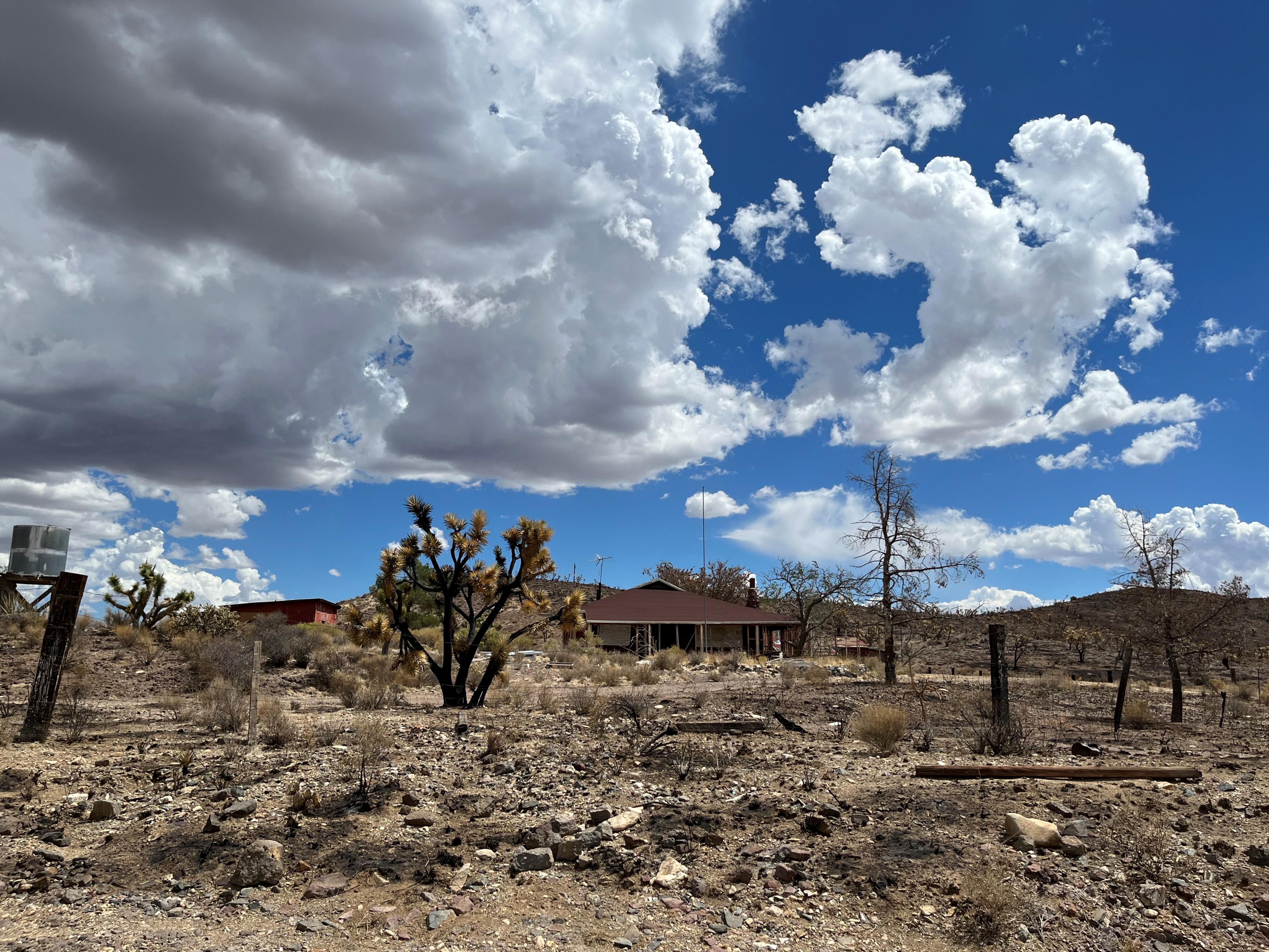
Evidence of historic practices like ranching and mining is often lost in a fire. Structures like barns, corrals, and mine shafts are usually built of flammable materials like wood, which catches fire easily and burns quickly. Some of the most prominent losses from the York Fire were a homestead, a rare wooden cattle scale, and historic grazing pastures. Some unique railroad structures were also lost, like wooden culverts that supported historic railroad lines.
The York Fire also spared some of the preserve’s irreplaceable cultural resources. OX Ranch and the red house at Barnwell, which is the original headquarters of the Rock Springs Land and Cattle Company, miraculously survived. The fire moved swiftly through open-air prehistoric sites where artifacts like ceramic pottery sherds and stone projectile points are scattered, resulting in little damage. The fire reached some prehistoric rock art sites, where the lack of surrounding vegetation caused it to move quickly across these areas, leaving the art intact. The Slaughterhouse Spring and Vanderbuilt Cemeteries, both of which have unique wooden components, were luckily untouched by the fire.
Staff like Dave and Danilo spend years documenting data on historic structures, gathering historic accounts, adding structures to the National Register of Historic Places, and preserving historic structures. The preserve loses more of this work with each wildfire. As climate change causes desert wildfires to become increasingly frequent and severe, land managers consider new approaches to prepare public lands. Preserve staff clear vegetation around flammable historic structures to reduce the fuels that carry fire. Structures can also be wrapped in fire-resistant foil when a fire approaches, which may reduce the impact of heat and flames.
Please enjoy historic structures from a safe distance, especially after a fire. Fire can destabilize structures like mines and cabins, making them vulnerable to collapse and posing a safety hazard to visitors. Cultural artifacts can’t be replaced once they’re lost.
Slide 1 Fire Update Aug 18 700 pm
Related Incident: 2023 Slide 1
Publication Type: News
WILLOWS, Calif., Aug. 18, 2023 —The Slide 1 Fire burning in the Yolla Bolly Middle Eel Wilderness is at 20% containment. A recent reconnaissance flight has provided a more accurate picture of the fire’s size, which is at 473 acres. Fire behavior today was mellow, and firefighters are making progress on the line.
Firefighters are using a confine and contain strategy to keep the fire within the wilderness, building containment lines off of existing trails and natural barriers. This strategy helps to minimize risk and firefighter exposure in this challenging terrain.
Earlier today a closure was issued for roads, trails and recreation sites in the Yolla Bolly Middle Eel Wilderness within the Grindstone District to protect public safety and emergency operations. With the opening of B zone archery season tomorrow, forest officials urge hunters to use caution and expect fire-related traffic on the M22 Road.
The Rock Fire in the Sanhedrin Wilderness remains at an estimated 2.5 acres, and crews on scene are working to contain the fire.
Chance of showers and thunderstorms tonight is slight. Temperatures are trending down through the weekend, and there is potential for a cooler and wetter pattern early next week as Hurricane Hilary moves into the region.
Information about the forest closure, Slide 1 Fire and other lightning-related fires is available on Inciweb: https://inciweb.wildfire.gov/incident-information/camnf-2023-slide-1.
Unless significant activity occurs, an update will be produced once daily starting tomorrow, Aug. 19.