
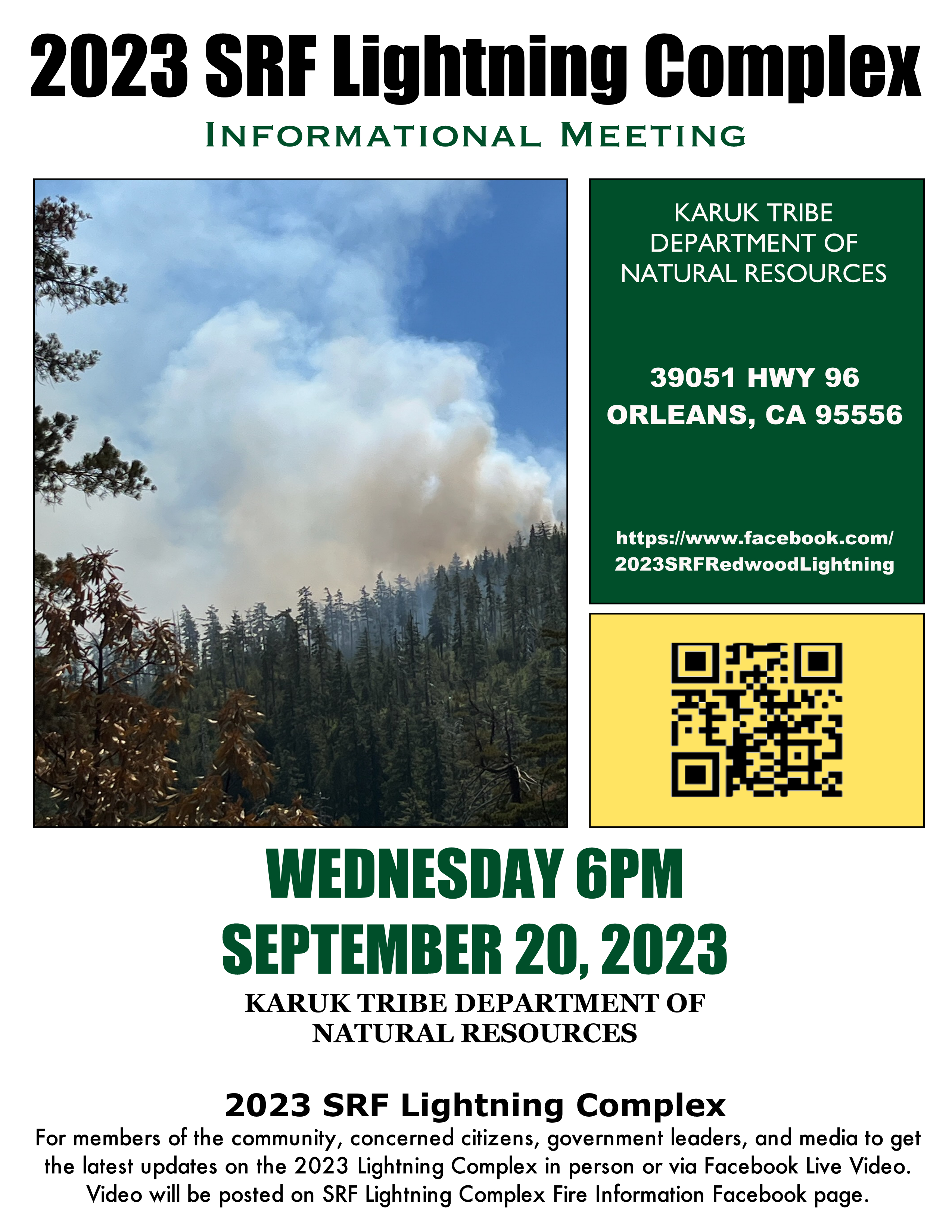
2023 SRF Lightning Complex Informational Meeting Sept 20 2023
Related Incident: 2023 SRF Lightning Complex and Redwood Lightning Complex
Publication Type: Announcement
2023 SRF Lightning Complex Informational Meeting
Wednesday, September 20, 2023 at 6PM
Karuk Tribe Department of Natural Resources, 39051 HWY 96, Orleans, CA 95556
For members of the community, concerned citizens, government leaders, and media to get the latest updates on the 2023 SRF Lightning Complex.
In person or via Facebook Live Video. Video will be posted on the SRF Lightning Complex Fire Information Facebook page.
https: www.facebook.com/2023SRFRedwoodLightning
2023 SRF Lightning Complex Update September 19 2023
Related Incident: 2023 SRF Lightning Complex and Redwood Lightning Complex
Publication Type: News
Fire Update
2023 SRF Lightning Complex
Tuesday, September 19, 2023 – 9:00 a.m.
Eastern Area Gold Team
Brian Jenkins, Incident Commander
Information Phone: 530-536-0767
Email: 2023.lightningcomplex@firenet.gov
Information Staffing Hours: 8 am to 8 pm
COMMUNITY MEETING: Wednesday, September 20th, 2023, at 6:00 p.m. Karuk Tribe DNR (39051 CA-96, Orleans, CA 95556)
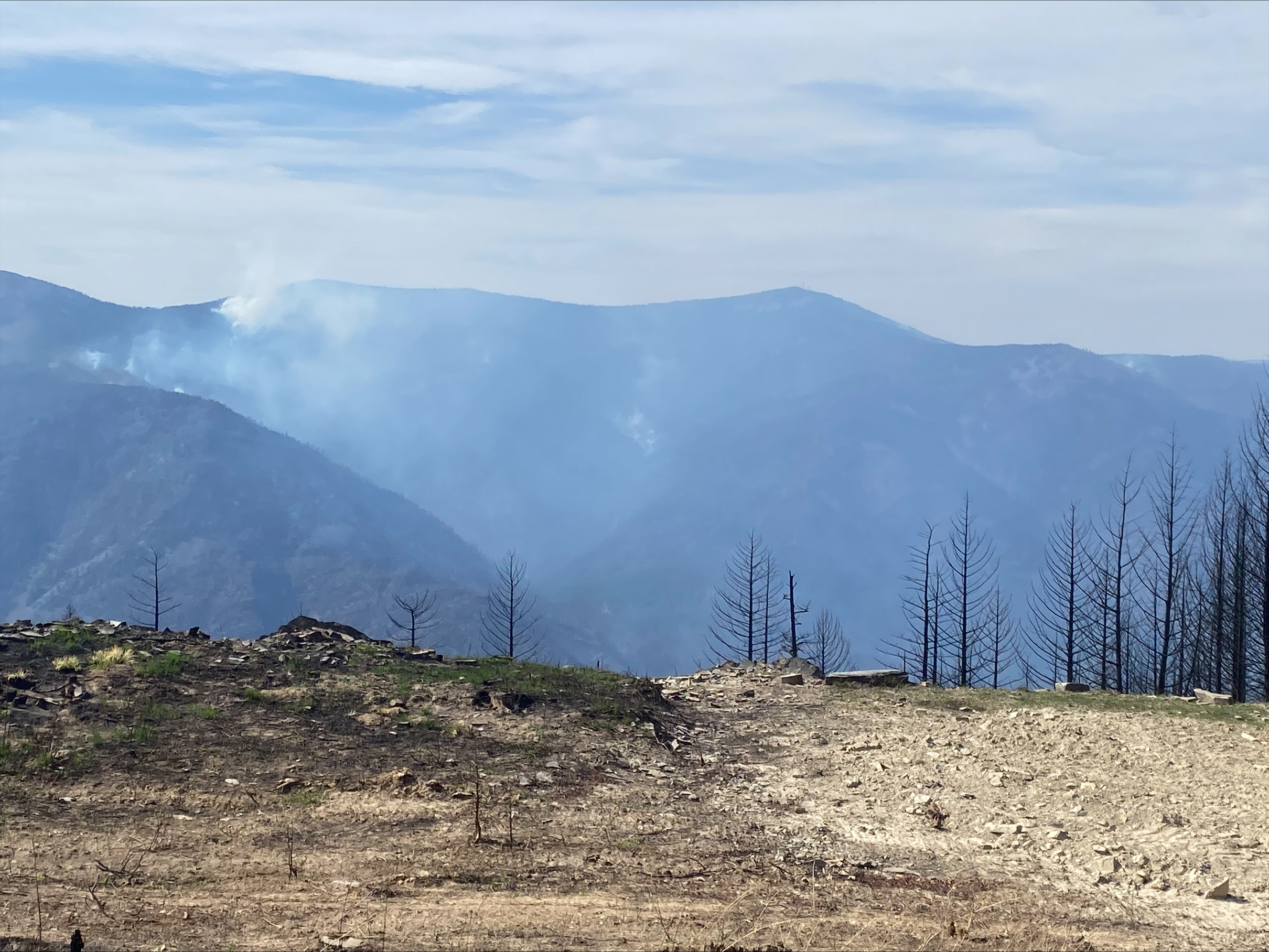
This update covers 7 of the 14 fires being managed as part of the SRF Lightning Complex. The Copper Fire (2184 acres) has been absorbed by the Blue Creek #2 Fire. The remaining 6 fires (Big Foot, Blue Creek, Creek, Flat, Iron, and Merrill) totaling 34 acres, are contained and in patrol status. They are checked daily, and their size and containment are unlikely to change.
Current Situation: The 14 fires in this incident total 27,573 acres and overall containment is 7%. The 7 uncontained fires described below total 25,355 acres. In total, 972 personnel are assigned to the incident.
Decades of research shows that fire is critical for healthy forests and maintains important forest functions like water quality, clean air, and wildlife habitat. In addition, Indigenous traditional ecological knowledge supports the practice of cultural burning that was historically conducted by local Tribal Nations. The fire, weather, and fuel conditions on the 2023 SRF Lightning Complex have been favorable for using strategic firing operations to accomplish fire suppression, reduce the risk of future extreme wildfires, and uphold our responsibilities to Tribal Nations.
Man-made containment of a fire is often constructed using a combination of handline, tree fallers, dozers, masticators, and strategic firing operations. As fire managers decide where and when to use these tactics, they also consult with tribal and forest Resource Advisors (READs). These technical specialists provide guidance to the crews on potential impacts to natural and culture resources in the area. Some of the READs assisting on this Complex have direct ancestral ties to the land and serve an invaluable role as fire managers strategically use fire to mimic cultural burning to aide in protecting these sacred lands and communities. Several crew members guiding the strategic firing operations are Tribal members part of the Hoopa, Yurok, and Karuk tribes.
Pearch Fire (7666 acres, 8% contained) – Crews continued to monitor fire activity on the north and east side of the fire. On the northeastern side of the fire, fire behavior continued to be moderate with fire slowly backing downhill into the Butler and Somes Creek drainages. On the west side, along Whitmore Creek, a hotshot crew continued to monitor any northern fire progression and will continue doing so over the coming days. No additional ignition is planned today. The Structure Protection Group continued reinforcement and assessed structures at the confluence of the Klamath and Salmon Rivers. Crews will remain on the fire during both day and night shifts.
Bluff #1 (3814 acres, 27% contained) and Mosquito (4943 acres, 11% contained) Fires – Yesterday on the south end of Bluff #1, crews continued to patrol and contain the fire north of Onion Road, resulting in minimal fire growth. South along Bluff Creek Road, masticator and chipping operations began and made significant progress yesterday. This work is tied to a larger strategic objective to build a stronger fuel break line to protect and preserve the tribal lands to the west. On the northeast end of Bluff #1, crews continued to tactically ignite along Bluff Creek Road, further securing the top of the horseshoe and continuing approximately another 2 miles north. If conditions are favorable today, crews will continue igniting along Bluff Creek Road to the intersection with Nikowitz Road.
On the south end of the Mosquito Fire, fire behavior was similar to previous days and crews continued to maintain the south and east containment lines. In support of historical fire regimes and cultural burning, but also recognizing our commitment to protect the community of Orleans, firing modules continued to strategically fire north of the Mosquito Fire, parallel to Cedar Camp Road, approaching the intersection of the 13N13 Road. As the fire adjacent to the road was secured, UAS equipment was used to add small amounts of low intensity fire to interior ridgeline pockets. This work was done at a slow methodical pace allowing fire managers to adapt as needed. As conditions allow, similar actions will continue tomorrow along the Go Road and 13N13 Road. A contingency of engines remains on both fires throughout the nighttime hours.
Blue Creek #2 (6897 acres, 0% contained) and Marlow (1942 acres, 0% contained) Fires – These fires are bounded by indirect control lines to the east and south and prior fire footprints where fuels are lighter. Fire growth was moderate yesterday. Today, with the forecasts predicting warmer and drier weather, activity in the interior pockets may become more active as the fire continues to consume dead material from a 2008 fire. No values are currently threatened. A Wildland Fire Module continues to monitor and assess conditions on the ground and air resources will monitor from above. Fire managers from the 2023 SRF Lightning Complex are coordinating daily with fire managers on the Happy Camp Complex due to the proximity of the Elliot Fire.
Monument (2 acres, 0% contained) and Let er-Buck (92 acres, 0% contained) Fires – Due to limited values at risk, the remote, steep terrain and associated safety concerns for our firefighters, these fires are being addressed with a confinement strategy. Terrain, natural fire barriers such as rock outcroppings, and old fire footprints where fuels are limited will be used to confine fire growth until season ending precipitation extinguishes the fires. These fires are checked regularly by aerial patrols to ensure they remain within acceptable bounds.
Weather: Temperatures will warm today by several degrees thus decreasing the relative humidity in the valley and ridges. The increased onshore flow will support breezier westerly conditions. Up-canyon winds 10-15 mph will develop this afternoon. Highs will be in the upper 80s in the valleys and lower 80s on ridges. Smoke will persist in the valleys through the day.
Closures
Six Rivers National Forest: Area and campground closures are in effect on portions of Six Rivers National Forest. They can be found at: https://www.fs.usda.gov/detail/srnf/notices/?cid=FSEPRD1096395.
Additional Fire Information
Facebook: https://www.facebook.com/2023SRFRedwoodLightning
More Fire Information Links: www.linktr.ee/srffirepio
For Air Quality Information: www.airnow.gov
NOTE: For information about the Elliot or Hancock Fires which are part of the
Happy Camp Complex, please visit https://linktr.ee/happycampcomplex2023 .
Lookout Bedrock Horse Creek Pothole Petes Lake Fires Daily Update 91923
Related Incident: Lookout FireBedrock Fire2023 Horse Creek FirePetes Lake Fire
Publication Type: News
Join us on Wednesday, September 20th @ 7 pm for a Facebook Live virtual meeting. There will be a live question-and-answer session following the presentations. For those who cannot attend, it will be recorded and available for viewing. We will continue to answer any incoming questions.
Current Status
Lookout Fire: Size: 25,515 acres l Start Date: August 5 l Cause: Lightning l Containment: 50%
Bedrock Fire: Size: 31,590 acres l Start Date: July 22 l Cause: under investigation l Containment: 98%
Petes Lake Fire: Size: 3,086 acres l Start Date: August 25 l Cause: Lightening l Containment: 0%
Horse Creek Fire: Size: 763 acres l Start Date: August 24 l Cause: Lightning l Containment: 100%
Pothole Fire: Size: 109 acres l Start Date: August 25 l Cause: Lightning l Containment: 100%
Total Personnel: 943 Total Assigned Resources: 34 engines l 14 crews l 11 dozers l 28 water tenders l 12 masticators l 8 helicopters
Suppression: Fire suppression involves a deliberate, risk informed approach specific to each fire, from direct firefighting to shaded fuel breaks and aerial support. The Petes Lake Fire is burning in a wilderness area where terrain and access make direct attack difficult to put firefighters on the ground. Therefore, an indirect suppression approach is being used. Fire managers have initiated strategies that focus on proactive and preventative measures to safeguard potential values at risk should the Petes Lake Fire experience unlikely fire growth. These measures, designed to enhance future resiliency, include a 9.7-mile shaded fuel break and a structure protection plan for 110 commercial and residential buildings to the east of the Cascade Lakes Highway. Both the shaded fuel break and the structure protection plan are complete.
Suppression Repair: With the ongoing process of suppression repair around the fires, resource advisors, who are experts in natural resources, guide the rehabilitation of suppression actions. Resource advisors assess potential impacts of firefighting activities on natural and cultural resources and recommend ways to minimize these impacts during suppression efforts. Their repair plan outlined 29 miles of dozer line for rehabilitation around the Bedrock Fire, of which, crews are almost 50 percent complete. Hand crews restore sensitive areas, while dozers are utilized for road repair. To further bolster safety, a process known as ‘snagging’ is underway, involving the removal of dead and fire weakened trees or ‘snags’ along forest road FR18 thru Fall Creek drainage. This proactive measure aims to create safer working conditions for crews and facilitates access for the Burned Area Emergency Rehabilitation (BAER) Teams tasked with assessing the aftermath of the wildfire.
Burned Area Emergency Rehabilitation (BAER): BAER Teams are deployed post-fire to assess and address immediate risks and rehabilitation needs within the burned area. Currently, the BAER Team started work on the Bedrock Fire on September 11. Evaluating factors like soil stability, water quality, and the potential for post-fire hazards, such as flooding. They are now working on a comprehensive assessment report, expected by September 21, to guide emergency rehabilitation efforts that would reduce these post-fire risks. Subsequently, their focus will shift to the Lookout Fire.
Weather: Cooler conditions will prevail today due to a weak, dry cold front. While increased cloud cover at night contribute to higher relative humidity levels. This cooling trend is expected to persist through the week accompanied by potential rain within the next 72 hours. The combination of these cooler and wetter conditions, is expected to moderate fire behavior.
Linn County Evacuations: Visit the website for current evacuations: https://www.linnsheriff.org/wildfire_live_updates.
Lane County Evacuations: Visit the website for current evacuations: https://www.lanecountyor.gov/cms/one.aspx?pageId=19729054
Deschutes County Evacuations: Visit the website for current evacuations: www.deschutes.org/emergency.
Forest Closures: Emergency closure orders remain in place for these national forests. These closures can be found at: Willamette National Forest: https://www.fs.usda.gov/alerts/willamette/alerts-notices/?aid=61574 and Deschutes National Forest: https://www.fs.usda.gov/alerts/deschutes/alerts-notices/?aid=82845.
Information on Oregon hunting regulations and these forest closures, contact Oregon Department of Fish and Wildlife at (503) 947-6000 or visit https://myodfw.com
Restrictions: Fire Restrictions are in place on the Willamette and Deschutes National Forest. For more information, visit the Willamette National Forest or the Deschutes National Forest website. Temporary Flight Restrictions remain in place over the Bedrock and Lookout Fire areas.
Smoke Outlook: https://outlooks.wildlandfiresmoke.net/outlook/4c92bc1a The Fire and Smoke Map (fire.airnow.gov) is another source for air quality information.
Fire Information:
Email: 2023.lookout@firenet.gov
Lookout, Horse Creek, and Pothole Fire Facebook: https://www.facebook.com/LookoutFire2023
Bedrock Fire Facebook:: https://www.facebook.com/BedrockFire2023/
Petes Lake Fire Facebook:: https://www.facebook.com/PetesLakeFireInfo
Lookout, Horse Creek, and Pothole Fire Inciweb: https://inciweb.nwcg.gov/incident-information/orwif-lookout-fire
Bedrock Fire Inciweb: https://inciweb.wildfire.gov/incident-information/orwif-bedrock-fire
Petes Lake Fire Inciweb: https://inciweb.nwcg.gov/incident-information/orwif-petes-lake-fire
Fire Information Phone Line: 541-215-6735 (staffed 8 a.m. - 8 p.m.)
Smith River Complex North Daily Update September 19 2023
Related Incident: Smith River Complex
Publication Type: News
Size: 92,180 total/ 12,460 in Oregon
Start Date: August 15, 2023
Location: Grants Pass, OR
Containment: 73%
Total personnel: 1,583 for Complex
Cause: Lightning
Resources:41 crews 6 helicopters 66 engines 8 bulldozers 26 water tenders 14 masticators 1 Skid Steer
Yesterday: The Josephine County Sheriff reduced the evacuation status from Level 2-GET SET to Level 1-BE READY for the area in Josephine County west of US-199 including the community of O’Brien and south to the Oregon-California border. The Northwest Incident Management Team 8 shadowed the Alaska Incident Management Team during a transition day to share knowledge and coordinate fire management and operations.
Today’s Activities: Northwest Team 8 assumed command of the Smith River Complex North at 7:00 AM this morning. Crews will continue to patrol and secure the north and northwest edge of the fire perimeter. Masticators, feller bunchers, and chippers are working the secondary containment line to the west along Forest Road 1106. Suppression repair continues around Monkey Ridge and Sanger Peak. And crews are removing hose, tanks, sprinklers, and other equipment on the eastern edge of the fire area.
Evacuations: The Josephine County Sheriff has reduced the evacuation status from Level 2-GET SET to Level 1-BE READY. This includes the area west of US-199 in Josephine County, including the community of O’Brien and to the Oregon-California border. Monitor the Rogue Valley Emergency Management site and sign up for evacuation alerts and updates at https://rvem.org/. An interactive Fire First Response Map with evacuation areas can also be found there.
Smoke: An air quality advisory was issued by Oregon Department of Environmental Quality for western Crook, Curry, Deschutes, and southern Josephine counties through Wednesday night due to smoke from the Anvil, Smith River Complex, Bedrock, and Lookout fires. Smoke levels can change rapidly depending on weather; check current conditions at: https://bit.ly/SWORsmoke
Closures: A closure is in place on the Rogue River-Siskiyou National Forest for Forest Road 1106 (South Elk Mountain Road), Forest Road 1205 (Lower Wheeler Road), and Forest Road 1983 (Mt. Emily Road) until October 31, 2023 or until rescinded. The closure allows for safe operations related to the Smith River Complex North. Closures on BLM land are in place, as well. Visit bit.ly/RRSNFAlerts or https://www.blm.gov/orwafire for additional information.
Road Closures and Delays: Caltrans in Del Norte County issued a schedule of road closures and lane restrictions on US-199. Weekdays will have a combination of road closure and lane restrictions. Over the weekend, the road will remain open, but with lane restrictions and pilot cars. Expect delays. For specific information on road access, please see the Caltrans QuickMap site https://quickmap.dot.ca.gov/ and Oregon Department of Transportation’s https://www.tripcheck.com/. Local law enforcement cautions against any non-essential traffic along this route. Navigation apps and mapping programs have been routing travelers into active fire areas. Do not use forest roads as alternate routes.
Restrictions: Please respect the temporary flight restriction (TFR) established for the Smith River Complex. Keep drones away from firefighting operations and the TFR. If you fly, we can’t. Don’t be the reason a firefighting air mission has to divert! For more information on the TFR, visit https://tfr.faa.gov/.
Anvil and Flat Fires Update September 19
Related Incident: Anvil FireFlat Fire
Publication Type: News
Anvil Fire
Size: 9,023 acres | Start Date: August 25, 2023 | Location: 8 miles east of Port Orford, OR | Containment: 0% | Total personnel: 779 | Resources: 19 crews, 4 helicopters,32 engines
The strategic preparations firefighters have made to protect structures and keep the Anvil Fire within containment lines resulted in minimal fire growth Monday. To counter critical fire weather conditions, crews maintained a heavy presence of engines, mechanized equipment, helicopters, and hand crews. Patrols from the air and ground scoured the area for signs of fire embers drifting over the Elk River Road but detected none. Additional work has been completed near the Fish Hatchery to burn vegetation from the pre-constructed containment line down the ridge to reduce the intensity of the main fire as it approaches the ridge. Firefighters are evaluating the effectiveness of these actions constantly as the wind direction and weather conditions change. Mechanical issues prevented infrared mapping last night so exact acreage has not been updated.
Yesterday, firefighters were successful in slowing fire spread in spite of windy and dry conditions. More challenging weather is in the forecast for today and tonight. In response, managers bolstered night shift operations in the Elk River corridor and have ordered more firefighters.
**Fire managers and local agency representatives are hosting a community meeting tonight at 7 PM at the Sixes Grange. Community members are invited to bring questions in person or live on Facebook at https://www.facebook.com/flatfireoregon2023.
Evacuations: Curry County Sheriff’s Office has identified four evacuation zones around the Anvil Fire. An interactive evacuation map is available at https://bit.ly/45UIh2E. Zones 1 and 4 are in Level 3 “Go“ evacuation status. Zones 2 and 3 are in Level 2 “Get Set“ status. Sign up for Curry Co. emergency alerts at https://bit.ly/CurryCoEM.
Flat Fire
Size: 34,242 acres | Start Date: July 15, 2023 | Location: 2 miles southeast of Agness, OR | Containment: 75% | Total personnel: 78 | Resources: 1 crews, 3 helicopters, 1 engines
The Flat Fire has remained mostly static, but fire engines continue to patrol and monitor the fire and respond rapidly as needed to any increased fire behavior. On Monday, crews worked to extinguish fire from a stump hole within the existing containment line. Repair of suppression line is ongoing. The fire camp located at Old Mill will be closed up this morning as it is no longer needed to support the resources still assigned to the Flat Fire.
General Information
Weather: A Red Flag Warning, an indication of weather conditions that could contribute to large fire growth, is in effect in the fire area from Monday at midnight through Tuesday at noon. Ridgetop winds are expected to top 25 mph. Relative humidity will also be low during this time. North/northeast winds are forecast for tonight. Fire managers are coordinating with local agencies to prepare for these weather events and their impact to the fires. Conditions may change quickly. Continue to monitor information sites for fire status updates.
Smoke: Visit https://bit.ly/SWORsmoke for current smoke and air quality updates.
Area and Road Closures: For the safety of firefighters and the public, the Rogue River-Siskiyou National Forest has issued closure orders for the Anvil and Flat Fire areas. The Bureau of Land Management Coos Bay District has also issued an area closure which includes Edson and Sixes Campgrounds. Visit https://inciweb.wildfire.gov/incident-closures/orrsf-anvil-fire and https://inciweb.wildfire.gov/incident-closures/xx1002-flat-fire for closure maps and information.
Smoke and the marine cloud layer are mingling and settling in the lower elevations overnight causing limited visibility along highways. Please drive slowly and with headlights on through any fire area. Heavy equipment and firefighter transportation vehicles are also using the area highways and roads. Caltrans issued a schedule of road closures and lane restrictions on US-199 northeast from Crescent City. Local law enforcement cautions against any non-essential traffic along this route. For specific information on road access, please see the Caltrans QuickMap site at: https://quickmap.dot.ca.gov/ and Oregon Department of Transportation site at: https://www.tripcheck.com/. Do not use forest roads for alternate routes.
Prescribed Burn Update September 18 September 19 2023
Related Incident: Southwest Idaho Wildfire Crisis Strategy Prescribed Fire
Publication Type: News
Each prescribed burn project in the Southwest Idaho Wildfire Crisis Strategy Prescribed Burn area is divided into smaller units for fire operations, allowing firefighters to manage and control the burning area.
Active units/projects for Monday, September 18th, and Tuesday, September 19th are identified below.
Weiser Ranger District:
Robinson (22 miles Northwest of Weiser) – On Monday, Firefighters successfully completed 50 acres. No burning planned for Tuesday.
New Meadows Ranger District:
Brush (10 miles Northwest of New Meadows) - Scouting and identification of potential burn locations continue, no burning is planned for Tuesday.
Cold (Lost Valley Reservoir area) – Using helicopters, aerial emission took place on Monday, with 600 acres treated by fire. Tuesday’s plans are to use helicopter emissions again to burn an additional 600 acres.
Goose Creek – with burning operations complete, crews continue to patrol and monitor the area.
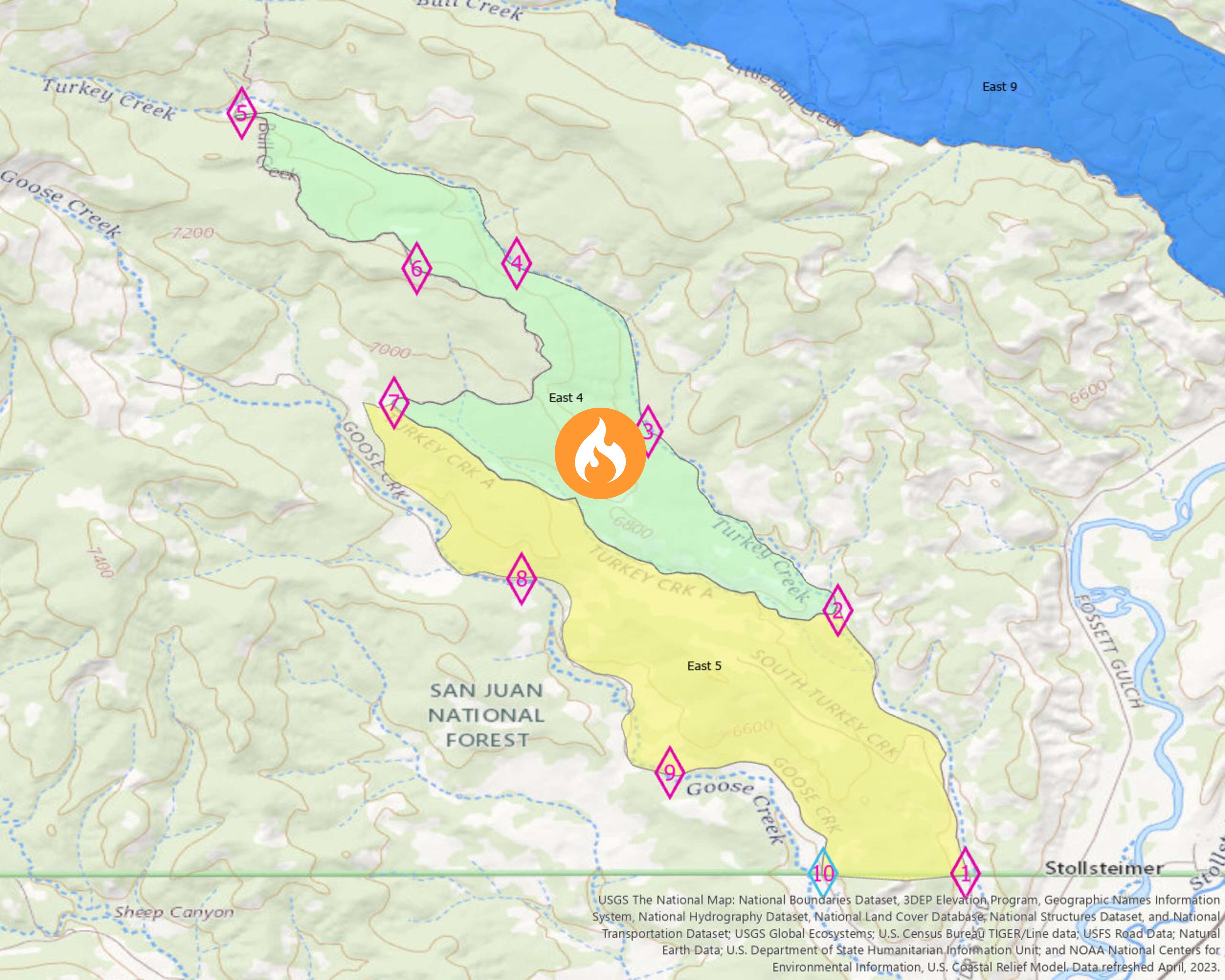
Columbine District Southern HD Unit Prescribed Fire East 4 Block 09192023
Related Incident: 2025 San Juan National Forest Prescribed Fire Program
Publication Type: News
**POSTPONED**
The USDA-San Juan National Forest has postponed the scheduled prescription burn set to start today, September 19, 2023, at 10am on the East 4 Block of the Southern HD Unit in the Columbine District. #SJNF will look at future opportunities to initiate the East 4 prescribed burning operation when weather conditions are more favorable, which could happen as early as tomorrow. Crews will continue mop-up procedures on the previously burned East 5 block of the Southern HD Unit, Columbine District. If you are in the area, please exercise caution as firefighters and firefighting apparatuses will be actively patrolling and working in the area.
September 19 2023 Update
Related Incident:
Publication Type: News
Smoke and increased fire activity has been visible over the last couple of days on the River Road East Fire in the Kennedy Creek drainage below Pat’s Knob due to warmer temperatures and lower relative humidities. All observed fire activity poses no threat to existing containment lines and will continue to be patrolled by the local district. Expect to see occasional smoke as some interior vegetation burns.
Fire behavior is expected to be minimized with cooler temperatures over the coming days. A low-pressure system is still on track to bring a pattern change Wednesday and Thursday, where widespread wetting rains are possible.
Suppression repair is ongoing on the east side of the fire and around Pat’s Knob. Crews are working with an excavator to repair dozer lines.

Camp Creek Fire Daily Update for Sunday September 19
Related Incident: Camp Creek Fire
Publication Type: News
September 19, 2023
Camp Creek Fire Update
Size: 2,055 acres
Containment: 54%
Total personnel: 355
Current Situation: Fire crews have been working to prepare and strengthen containment lines around the fire and that work is coming to completion. Yesterday firefighters completed mop-up to remove any remaining heat adjacent to the fireline. There has been little to no growth of the Camp Creek fire in the last week and no significant fire activity or growth is expected. Within the interior of the fire, some areas will continue to smolder and burn in place with minimal fire activity until there is significant precipitation.
Today’s Activities: Today firefighters will continue chipping and hauling away vegetation debris created from fireline preparation. Suppression repair activities will also continue throughout the fire area and will include construction of water bars to minimize erosion on the mechanically constructed portion of the fireline north of the fire. Crews will also continue patroling the fireline, checking for and extinguishing any hot spots.
Weather: Today will be cold and damp and these weather conditions will continue at least through the middle of the week. Widespread rain showers are possible as a cold front passes through the region tonight and tomorrow.
Smoke: Current smoke outlook: https://outlooks.wildlandfiresmoke.net/outlook/2c7a8f9b
Closures: Barlow Wayside Park and the Sandy Ridge Recreation Site are temporarily closed due to fire activity. Clackamas County residents can sign up at https://www.clackamas.us/dm/publicalerts to receive emergency alerts via email, phone, or text.
Restrictions: A Temporary Flight Restriction (TFR) is issued over the fire area. It is illegal for the public to fly drones over or near wildfires because of the potential for accidents and disruption of suppression operations. Regardless of the fire, aircraft is not permitted to fly over the Bull Run watershed.
Operational Briefing Video: View the September 18 operations video on Facebook or Inciweb.