
HAPPY CAMP COMPLEX POSTFIRE BAER ASSESSMENT REPORT RELEASED
Related Incident: 2023 Happy Camp Complex BAER Assessment
Publication Type: Announcement
HAPPY CAMP COMPLEX POST-FIRE BAER ASSESSMENT REPORT RELEASED
The Forest Service--Klamath National Forest (USFS) completed its BAER post-fire assessment of the 2023 Happy Camp Complex burned areas and affected watersheds to determine their response, soil conditions, potential threats, and recommended BAER emergency stabilization measures and actions on National Forest System (NFS) lands. BAER emergency treatments and activities are designed to decreased possible impacts to critical values from the burned areas during rainstorm events such as: life and safety, property, critical natural resources, and cultural resources.
NOTE: Attached below as “Related Information” is a PDF document called “Happy Camp Complex Post-Fire BAER Assessment 2500-8 Report_PUBLIC”.
BAER SAFETY MESSAGE: Everyone near and downstream from the burned areas should remain alert and stay updated on weather conditions that may result in rain and increased water runoff. Flash flooding may occur quickly during heavy rain events. Be prepared to act. Current weather and emergency notifications can be found at the National Weather Service website: www.weather.gov/mfr/.
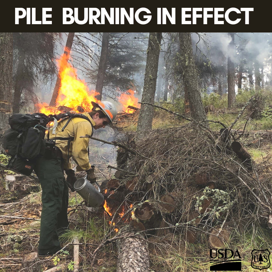
Planned understory burn at Howard Mill pile burning at Snow Basin this week Oct 16 2023
Related Incident: Mendocino NF Fall 2023/Spring 2024 RX Fire Projects
Publication Type: News
For the week of Oct. 16, Upper Lake District staff are planning to conduct ignitions for the Howard Mill Understory burn starting Tuesday, Oct. 17. Fire personnel plan to burn approximately 24 acres, and the burn unit is located east of M1 Road and south of the Penny Pines Campground. On the Grindstone Ranger District, pile burning is planned at Snow Basin for approximately 10 acres starting Monday, Oct. 16.
Informacin actual para los incendios Anvil y Flat 16 de octubre 2023
Related Incident: Anvil FireFlat Fire
Publication Type: News
Incendio Anvil
Área: 22,170 acres Fecha de inicio: 25 de agosto, 2023 Localizado: 8 millas Este de Port Orford, OR
Contenido: 80% Personal:293 Recursos: 9 escuadrillas de bomberos, 1 helicópteros, 6 camiones de bomberos
El día de ayer, los bomberos aprovecharon las condiciones favorables del tiempo para continuar con el trabajo arduo de reparación de supresión. Se logro un progreso excelente en la reparación de las líneas de buldóceres a lo largo del lado Oeste del incendio. Se completo con el apilado del material de combustión a lo largo de la carretera forestal 0307 y los bomberos completaron tres millas de astillado en el lado Sur. Las operaciones en el área de China Mountain consistieron en la limpieza de las alcantarillas y en la instalación de las características de drenajes. El día de hoy, se pronostican vientos fuertes los cuales representan un peligro para la seguridad de los bomberos debido a los árboles que han sido debilitados por el incendio. Lluvias pesadas hasta de 2 pulgadas, representaron un peligro para manejar en estas áreas, así como también los caminos no pavimentados podrían estar en malas condiciones por el transito vehicular durante el incendio. Si las condiciones climáticas presentan seguridad para llevar a cabo las operaciones, las escuadrillas de bomberos estarán trabajando a lo largo de las carreteras principales.
Evacuations: Level I evacuation zones around the Anvil Fire remain. There are no evacuation statuses on the Flat Fire. View the interactive evacuation map at https://bit.ly/AnvilEvacs. Sign up for Curry Co. emergency alerts at https://bit.ly/CurryCoEM.
Incendio Flat
Área: 34,242 acres Inicio:15 de julio, 2023 Localizado: 2 millas Sureste de Agness, OR
Contención: 93% Personal: 56 Recursos: 1 escuadrilla de bomberos, 4 camiones de bomberos
El día de ayer, los bomberos y la maquinaria pesada tuvieron otro día exitoso en las operaciones de reparación de supresión las cuales incluyen la limpieza de alcantarillas y astillado. Se completo una misión importante con la utilización de los helicópteros entregando pacas de paja para tratar de proteger el producto recién sembrado en las áreas al Este de Agness.
Las áreas para Emergencia de Incendio y las Ordenes de Cierre de Carreteras aún se encuentran en efecto:
Permanecen en pie la Orden de Cierre en el Bosque para ambos incendios. Se dio un cambio en la Orden de Emergencia de cierre de Área y carreteras para el incendio Flat, reduciendo el tamaño del área afectada por dicha orden y adyacente al área del incendio. La orden se dio en efecto el 3 de octubre, 2023 y rescinde el 31 de diciembre, 2023, a menos que sea anulada antes de esa fecha. Puede encontrar mapas e información más detallada en: https://bit.ly/RRSNFAlerts o https://inciweb.wildfire.gov/incident-closures/orrsf-anvil-fire
Restricciones: El Bosque Nacional de Rogue River Siskiyou, levanto todas las Restricciones en las tierras del bosque para uso del público y movió a un nivel de peligro de incendio “Bajo”. El Nivel de Precaución de Incendios se encuentra a un Nivel 1.
Condiciones climáticas: Para el día de hoy, se pronostican vientos altos con ráfagas de 40 a 50 mph y lluvias fuertes con una precipitación acumulada de hasta 2” durante un periodo de 24 horas. Una tendencia cálida y seca se presentará desde el martes y extendiéndose hasta el jueves.
Condiciones del humo: Debido a la presencia de la lluvia que ha eliminado el humo sobre el área, ya no se estará informando el pronóstico de las condiciones del humo en la zona afectada. La información acerca de la calidad del aire está disponible en: www.OregonSmoke.org.
línea de información: (541) 216-4579
Email: 2023.anvil@firenet.gov
Facebook: facebook.com/flatfireoregon2023
X/Twitter:twitter.com/RRSNF
Inciweb Anvil Fire: bit.ly/AnvilFireOR
Inciweb Flat Fire: bit.ly/FlatFireOR
Quarry Fire Daily Update Oct 16
Related Incident: 2023-STF-Quarry Fire
Publication Type: Announcement
Quarry Fire Update
Monday, October 16th, 2023
Stanislaus National Forest
Incident Management Team (Type-3)
PIO Contact:
Phyllis Ashmead - phyllis.ashmead@gmail.com
Fire Statistics:
Location: The Quarry Fire is located on the Stanislaus National Forest, Mi-Wok Ranger District, off Forest Road 3N01, east of Bourland Creek and near the Emigrant Wilderness west of Cherry Creek.
Acres Burned to Date: 6,929
Cause: Lightning
Containment: 45%
Total Personnel: 57
Current Activities: Yesterday, crews monitored and completed burning in the area between Hells Mountain and Cherry Ridge as they allowed fire to naturally move through unburned fuels, utilizing natural rock features as barriers. In the northeast, crews ignited fuels near Weed Meadow gaining fire depth off of Rock Creek. Crews also scouted areas to the north of the burn for potential future treatments.
Background: The Quarry fire was one of 42 fires ignited by lightning strikes across the forest on September 9, 2023. District fire managers immediately worked to ensure these naturally ignited fires stayed within pre-determined boundaries. Fire personnel with the Stanislaus National Forest are currently managing the Quarry Fire to achieve multiple resource objectives.
Closures: Soft closures are in effect to provide for the safety of the public utilizing public lands as well as fire personnel working in the area. The soft closures encourage the public to stay clear of the area, to find alternate routes to their locations and to provide fire personnel the widest berth possible as they go about their mission.
With the public’s cooperation, we will continue to monitor the number and duration of soft closures, recognizing that fire personnel and public safety is the focus.
As of October 14th, 2023, the following soft closures are in effect:
3N17 where it meets 3N29
3N16
Smoke: An Air Resource Advisor has been assigned to the Quarry Fire and will be producing a daily Smoke Outlook.
The amount of smoke in the air is carefully planned for. The team is in close alignment with and get approvals from the Tuolumne County Pollution Control District (link) each day to burn the maximum amount of acreage that will not negatively impact air quality to an unsafe level. Additionally, firefighters monitoring smoke are staged around the vicinity of the fire to adjust tactics to minimize smoke impacts.
If possible, minimize outdoor activity if you are sensitive to smoke. Smoke does tend to settle in low-lying areas in the evenings to the mornings, so camping and recreating in this vicinity is not advised. To check air quality, visit fire.airnow.gov.
More Information:
INCIWEB - Quarry Fire Info - https://inciweb.wildfire.gov/incident-information/castf-2023stfquarry-fire
Stanislaus National Forest – Official Website - https://www.fs.usda.gov/stanislaus
Air Quality Info - http://fire.airnow.gov
Oct 16 Update Sagehen Hills Underburn
Related Incident: Sagehen Hills Underburn
Publication Type: Announcement
Ignitions were completed on 49 acres, Oct. 14. Crews are continuing to secure and patrol previously burned units. Ignitions were held on Sunday, Oct. 15 due to forecasted winds. Fire and fuels managers will continue ignitions through the week as conditions allow.
Dolores District Boggy Draw area Prescribed Burn Scheduled for Oct 17
Related Incident: 2025 San Juan National Forest Prescribed Fire Program
Publication Type: News
Prescribed Burn Scheduled for October 17 NE of Dolores
DOLORES, Colo., October 16th, 2023—The San Juan National Forest’s Dolores Ranger District is planning to conduct a prescribed burn this week on Forest land near Boggy Draw, about 5 miles northeast of Dolores. The prescribed burn is expected to last 1-2 days, and, weather-permitting, will begin Tuesday, October 17th.
Smoke will be visible in Dolores, Cortez, Mancos, Highway 145, 184 and the Highway 491 corridor. Smoke may also settle into low lying valleys and the Dolores River Canyon overnight. All roads and trails in the area will remain open, but people should use caution if traveling in the vicinity, as Fire crews and engines will be operating along the perimeter.
The project area involves 1,094 acres located west of Hwy 145 near the intersection of Forest Roads 528 and 405. Prescribed fire is being implemented to reduce hazardous ground fuels, lessen the risk of unplanned large-scale wildfire, help restore ponderosa pine ecosystems, and improve wildlife habitat. Prescribed fire can also help protect mature trees by reducing the ladder fuels that can carry fire into the canopy.
Prescribed fire smoke may affect your health. More information can be found at: https://www.colorado.gov/pacific/cdphe/wood-smoke-and-health
For information on the San Juan National Forest, call (970) 247-4874, visit the Forest website, or follow us on social media (Twitter and Facebook)
Anvil and Flat Fires Update October 16 2023
Related Incident: Anvil FireFlat Fire
Publication Type: News
Anvil Fire
Size: 22,170 acres Start Date: August 25, 2023 Location: 8 miles east of Port Orford, OR
Containment: 80% Total personnel: 293 Resources: 9 crews, 1 helicopter, 6 engines
Yesterday, firefighters took advantage of favorable weather conditions to continue fire suppression repair work. Excellent progress was made on dozer line repair along the west side of the fire. Piling of woody fuel was completed along Forest Service Road 0307 and crews accomplished three miles of chipping on the south side of the fire. Operations in the China Mountain area consisted of clearing out culverts and installing drainage features. Forecasted strong winds today may pose a threat to firefighter safety due to potential blow down of fire weakened trees. Heavy rains of up to two inches in areas present driving hazards and dirt roads could potentially be damaged by vehicle travel. Fire crews will be working along main artery roads if conditions allow for operations to be carried out safely.
Evacuations: Level I evacuation zones around the Anvil Fire remain. There are no evacuation statuses on the Flat Fire. View the interactive evacuation map at https://bit.ly/AnvilEvacs. Sign up for Curry Co. emergency alerts at https://bit.ly/CurryCoEM.
Flat Fire
Size: 34,242 acres Start Date: July 15, 2023 Location: 2 miles southeast of Agness, OR
Containment: 93% Total personnel: 56 Resources: 1 crew, 4 engines
Fire crews and heavy equipment had another successful day yesterday engaging in fire suppression repair operations including cleaning out culverts and chipping. A helicopter mission was completed delivering straw bales to be utilized as mulch to protect newly seeded areas east of Agness.
Emergency Fire Area and Road Closures Still in Effect: Forest closures remain in place in both fire areas. There is an update to the Emergency Area and Road Closure for the Flat Fire, reducing the closure area and reopening roads adjacent to the fire area. The new order is effective October 3, 2023 through December 31, 2023 unless rescinded sooner. For current closure information and maps, please visit: https://bit.ly/RRSNFAlerts or https://inciweb.wildfire.gov/incident-closures/orrsf-anvil-fire.
Restrictions: The Rogue River-Siskiyou National Forest lifted all Public Use Restrictions on Forest Service lands and moved to "low" fire danger. The Industrial Fire Precaution Level was reduced to Level 1.
Weather: High winds gusting to 40-50 mph and heavy rain is expected today with precipitation accumulation of up to two inches within a 24-hour period. A warming and drying trend will develop Tuesday through Thursday.
Smoke: Due to rain and lack of smoke, a daily smoke outlook no longer will be provided. Air quality information is available at www.OregonSmoke.org.
Contact Fire Information: (541) 216-4579
Email: 2023.anvil@firenet.gov
Facebook: facebook.com/flatfireoregon2023
X/Twitter:twitter.com/RRSNF
Inciweb Anvil Fire: bit.ly/AnvilFireOR
Inciweb Flat Fire: bit.ly/FlatFireOR
October 16 2023 Pile Burn Update
Related Incident: Lolo National Forest Prescribed Fire Operations
Publication Type: Announcement
Pile burning will take place on the Seeley Ranger District to help reduce hazardous fuels, a key component of the Wildfire Crisis Strategy.
Seeley Ranger District:
Firefighters will conduct up to 6 acres of hand pile burning 15 miles north Fork of the Seeley Lake. Smoke may be visible from Highway 83 and Rovero Flats. Hand ignitions will take less than one day to complete and firefighters will monitor and patrol the burn over the next few days.

McCrystal Rock Prescribed Fire Ignitions Completed
Related Incident:
Publication Type: News
Oct. 15, 2023—Today, fire crews finalized all hand and aerial ignitions on the 4,000-acre broadcast prescribed fire in the McCrystal Rock Unit within Valle Vidal. The remaining 2,333 acres will be addressed in the future.
All resources and firefighters that performed the burn will stay assigned to hold and closely monitor the fire area through tomorrow, 10/16. In the days to follow, local fire officials will continue to monitor the fire daily to ensure it stays within the existing footprint. In addition, a smaller organization of fire personnel will remain in the area to continue checking the fire by walking the unit boundary, mopping up edges and monitoring any remaining interior burning. No further growth is expected.
The unit remains open, but visitors should take caution when entering a recently burned area. Smoke may be present with occasional interior areas of fuel continuing to burn. Motorists are asked to slow down and drive with caution when firefighters and apparatuses are working on or near the roadways.
The McCrystal Rock Unit is part of the larger 21,000-acre Valle Vidal Northeast Prescribed Fire Project. The goal is to improve wildlife habitat by, in part, promoting grassland and meadow regeneration and reducing the potential for high-severity wildfires in forested areas.
Fire-adapted forests in the Southwest must undergo fire disturbance on a regular basis to maintain resiliency. Reintroducing and maintaining regular fire intervals in the Valle Vidal, the so-called “Yellowstone of the Southwest,” is a key component of the USDA Forest Service’s Wildfire Crisis Strategy. The emphasis of the strategy is to increase fuels and forest health treatments to protect natural resources in designated landscapes, including the 1.5-million-acre Enchanted Circle Landscape in Northern New Mexico.
The public can learn more information about this prescribed fire on InciWeb, New Mexico Fire Information and Carson National Forest social media channels (Facebook, X).
Quarry Fire Daily Update Oct 15
Related Incident: 2023-STF-Quarry Fire
Publication Type: Announcement
Quarry Fire Update
Sunday, October 15th, 2023
Stanislaus National Forest
Incident Management Team (Type-3)
PIO Contact:
Phyllis Ashmead - phyllis.ashmead@gmail.com
Fire Statistics:
Location: The Quarry Fire is located on the Stanislaus National Forest, Mi-Wok Ranger District, off Forest Road 3N01, east of Bourland Creek and near the Emigrant Wilderness west of Cherry Creek.
Acres Burned to Date: 6,752
Cause: Lightning
Containment: 41%
Total Personnel: 57
Current Activities: Yesterday crews took advantage of the warming and drying weather trend for another successful day of burning. Building on progress from the day before, fire personnel made headway in the northeast burning in Rock Creek as they brought fire towards Coffin Hollow increasing fire depth in this area. Crews allowed low intensity fire to clean and connect areas between Hells Mountain east towards Cherry Ridge. The focus is on igniting the abundant dead and down surface fuels and timber litter on the ground, making way for renewed, healthy plant growth.
Background: The Quarry fire was one of 42 fires ignited by lightning strikes across the forest on September 9, 2023. District fire managers immediately worked to ensure these naturally ignited fires stayed within pre-determined boundaries. Fire personnel with the Stanislaus National Forest are currently managing the Quarry Fire to achieve multiple resource objectives.
Closures: Soft closures are in effect to provide for the safety of the public utilizing public lands as well as fire personnel working in the area. The soft closures encourage the public to stay clear of the area, to find alternate routes to their locations and to provide fire personnel the widest berth possible as they go about their mission.
With the public’s cooperation, we will continue to monitor the number and duration of soft closures, recognizing that fire personnel and public safety is the focus.
As of October 14th, 2023, the following soft closures are in effect:
3N17 where it meets 3N29
3N16
Smoke: The amount of smoke in the air is carefully planned for. Burn Bosses are in close alignment with and get approvals from the Tuolumne County Pollution Control District (link) each day to burn the maximum amount of acreage that will not negatively impact air quality to an unsafe level. Additionally, firefighters monitoring smoke are staged around the vicinity of the fire to adjust tactics to minimize smoke impacts.
If possible, minimize outdoor activity if you are sensitive to smoke. Smoke does tend to settle in low-lying areas in the evenings to the mornings, so camping and recreating in this vicinity is not advised. To check air quality, visit fire.airnow.gov.
More Information:
INCIWEB - Quarry Fire Info - https://inciweb.wildfire.gov/incident-information/castf-2023stfquarry-fire
Stanislaus National Forest – Official Website - https://www.fs.usda.gov/stanislaus
Air Quality Info - http://fire.airnow.gov