
Emergency Alert from Wheeler County Sheriffs Office 07 20 2024
Related Incident: Lone Rock Fire
Publication Type: Announcement
***Emergency Alert***
Wildfire Alert from Wheeler County Sheriff's Office.
***Level 3 - GO NOW - Evacuate immediately from 5 miles South of Highway 207, East of Service Creek and West of Bologna Rd/Balm Creek and the area extending 5 miles West of Highway 19 South of Rowe Creek and Northwest of Highway 207
Settings - change map background and toggle additional layers
Filter - control incident types displayed on map.
Zoom to your location
Reset map zoom and position
Could not determine your location.
Show Legend
 Wildfire
 Prescribed Fire
 Burned Area
Response
Burned Area
Response Other
Other
Boneyard Fire
Unit Information
Incident Contacts
Hill Fire Community Meeting July 18th 2024 07 18 2024
Related Incident: Hill Fire
Publication Type: Announcement
Thursday, July 18th, 2024
7:00-8:00pm
Veteran's Hall, 20 Kimtu Road, Willow Creek, CA
Hosted by: North Coast Interagency Type 3 Team and CAL FIRE Incident Management Team 2
Virtually streamed live on Six Rivers National Forest Facebook page: https://fb.watch/trTTp27rul/
Diamond Complex Daily Update for July 20th 2024 07 20 2024
Related Incident:
Publication Type: News
Widespread lightning over the Pacific Northwest on July 16 ignited many wildland fires. Firefighters are detecting, assessing and attacking these fires as they develop. Fires on the Diamond Lake District of the Umpqua National Forest are grouped into the Diamond Complex.
Complex Incident Management Team Northwest 7, led by Incident Commander Nate LeFevre, assumed command of the Diamond Complex at 6:00am on Saturday, July 20th, 2024. Currently there are nine fires totaling an estimated 1755 acres in the Diamond Complex, under a strategy of full suppression. This means firefighters are directly attacking the fires’ edge where access and firefighter safety allow, and implementing indirect strategies using constructed control lines, and utilizing natural barriers where access issues and safety concerns prevent direct attack.
The fires currently comprising the Diamond Complex are Pine Bench, 773 acres, north of Hwy 138 near Dry Creek; Trail, 701 acres, east of Hwy 138 on the west slope of Mt. Thielsen; Lemolo, north of Lemolo Lake on Bunker Hill, 173 acres; Pig Iron, Pig Iron Mountain north of Hwy 138, 2 acres; Watson, north of Hwy 138 on Watson Ridge, 37 acres; Brodie, 40 acres, about 5 miles south of Hwy 138 and south of Devils Canyon; Trep, 21 acres, about 4 miles south of Hwy 138; Garwood, 2 acres, about 3 miles southwest of Mt. Bailey; Slide, northeast of the Pine Bench, 0.1 acres and Clearwater, 0.1 acres. There are also several emerging new fires that have been observed.
Yesterday, Northwest Team 7 had a successful shadow day with the local Type 3 team that was in place previously. Crews assessed the Trail, Pine Bench, Pig Iron and Lemolo fires and while doing so, detected more fires to the south. Firefighting operations continued with active suppression on the Trail Fire with the anchor points holding well. The Pig Iron had active suppression activities with ground and aerial resources to protect current infrastructure.
Today, active suppression continues with the Lemolo, Trail, Pig Iron and Pine Bench fires as priorities. As the fires progress, the team will re-prioritize suppression actions. Active fire behavior is expected with incoming predicted weather. Firefighters will continue to remain vigilant for the possibility of more lightning. Nationally and in the Pacific Northwest, fire activity is putting an extreme demand on firefighting resources. This means that firefighters must carefully prioritize and efficiently utilize available resources to protect values at risk. The highest priority will remain public and firefighter safety and protecting infrastructure and homes.
Weather: The National Weather Service has issued a Fire Weather Watch in effect from Saturday afternoon through Sunday morning. Isolated to scattered thunderstorms are expected with temperatures in the 80’s, low relative humidity, and gusty winds due to the incoming thunderstorms. Expect active fire behavior and smoke in the area.
Closures and Evacuations: The USFS and the Douglas County Sheriff have implemented public safety measure in response to these fires. For a map of the Trail Fire Closure Order, visit: https://bit.ly/3SeYvih. The Douglas County Sherriff has issued a Level 3: GO NOW for the Trail Fire and a Level 2: BE SET for the Pine Bench. Fire danger is set at High and public use restrictions are set at Level 2. Please see detailed information here: www.dcso.com/EVACUATIONS and www.fs.usda.gov/umpqua.
Actualizacin diaria del incendio Pioneer y el incendio Easy del 20 de julio 2024 07 20 2024
Related Incident: Easy Fire
Publication Type: News
Se detectó un incendio nuevo después de la tormenta eléctrica que se desplazó por el valle de Methow el 17 de julio. El Equipo 12 del NO ha tomado el mando del incendio Kitling Peak y lo gestionará junto con los incendios Pioneer e Easy. Anoche, se enviaron bomberos helitack por helicóptero al incendio de Kitling Peak, para intentar acceder en tierra y así extinguír el fuego mientras que está muy pequeño (aproximadamente 1 acre). La prioridad sigue siendo el incendio Pioneer a medida que recursos adicionales llegan a estar disponibles. El Equipo 3 del NO llegó y pasará el día trabajando junto al Equipo 12 del NO. Transicionarán para tomar mando de la gestión de los incendios cuando el Equipo 12 del NO complete su tarea de 14 días y regrese a casa.
Tamaño del incendio Pioneer: 26,407 acres | Causa: de orígen human | Contención: 14% | Personal total: 783
Los bomberos avanzaron en fortalecer y mejorar las líneas de contención alrededor de las estructuras en Stehekin y siguen explorando toda opción posible para proteger Stehekin en cooperación con los residentes locales. Ayer, los bomberos utilizaron una operación táctica de quema cerca de Hunts Bluff para retirar los combustibles disponibles con una quema de menor intensidad, con el fuego necesario solo en el suelo para completar con cuidado el trabajo. Las cuadrillas también removieron material combustible en áreas previamente quemadas alrededor de Moore Point. Ayer un helicóptero grande perdió una cubeta de agua sobre el fuego ya que tuvo un fallo mecánico en el gancho. Los helicópteros están usando cubetas de agua en el extremo norte cerca de Hunts Bluff, y los bomberos están preparados para iniciar operaciones de quema limitadas adicionales si es necesario para mejorar partes del borde del incendio.
Tamaño del incendio Easy: 150 acres | Causa: Rayos | Contención: 0% | Personal total: 20
El viernes el incendio Easy se desplazó poco. Los bomberos identificaron dos conductos de avalanchas a cada lado del incendio que se pueden preparar para usarse como líneas de control de fuego. Se requerirán recursos adicionales para terminar este trabajo, ya que actualmente no están disponibles por causa de otros incendios forestales a través del estado. Los encargados de bomberos tratarán de liberar a estas cuadrillas en los próximos días y completar estas líneas de control.
Seguridad y cierres: El Servicio de Parques Nacionales-North Cascades ha ampliado su lista de cierres: https://www.nps.gov/noca/planyourvisit/fire-closures.htm. El Bosque Nacional Okanogan-Wenatchee ha emitido una orden de cierre sobre gran parte del área afectada por el incendio. Podrá encontrar detalles y mapas disponibles en: https://bit.ly/PioneerClosure. La restricción temporal de vuelo (TFR, en inglés) sobre el área del incendio fue ampliada ayer: https://tfr.faa.gov/save_pages/detail_4_6779.html. La actividad de drones está prohibida por la TFR, ya que los helicópteros no pueden volar si hay drones no autorizados.
Evacuaciones: Permanecen vigentes los niveles de evacuación de nivel 1, 2 y 3 alrededor del incendio Pioneer. No existen evacuaciones vigentes para el incendio Easy. Visite https://t.ly/QoH9w para obtener más información.
Clima y humo: El Servicio Meteorológico Nacional emitió una advertencia de calor excesivo hasta las 8 p.m. del lunes https://bit.ly/46byTZw. Podría empeorar la actividad del fuego y volverse errática a medida que se desplazan temperaturas más altas junto con inestabilidad al área el fin de semana. El pronóstico de la calidad del aire se puede ver en: https://bit.ly/PioneerFireSmoke. Obtenga más información sobre el humo en http://wasmoke.blogspot.com/. El jefe de bomberos emitió clasificaciones de peligro de incendio y restricciones: https://t.ly/WLBds.
Malheur County Evacuation Update 102 pm 07 20 2024
Related Incident: Durkee Fire
Publication Type: Announcement
The Durkee Fire has advanced to the south making it all the way to the east side of Brogan last night. The fire crossed Lockett Road this morning making it all the way to 10th Ave East near Willowcreek. Residents from 10th Ave East south to Vale, from Vale around Foothill Dr. to Heinz Blvd, to Jacobsen Gulch Rd to I84 are advised to evacuate. This is the highest level of preparedness, or the "GO" level. Please be advised if you live within the Cities of Ontario or Vale, or within irrigated cropland areas this does not apply to you. If you reside near or on the rangeland/cropland interface it does apply to you.
Level 2 evacuation or “Get Set” is advised for areas north of Willowcreek Road at Basin Creek and east of Basin Creek north into Baker County and east to Birch Creek.
Fire crews are battling winds and environmental factors that make it incredibly difficult to keep up with. Winds are expected from the Northeast throughout the day.
If you need shelter accommodations, call Malheur County Dispatch at (541) 473-5125. Dispatch is very busy. Do not call for anything other than shelter accommodations or emergencies.
For further information on the Durkee Fire you can visit the Cow Valley and Durkee Fires Facebook Page.
July 20 2024 Morning Update Fork Fire 07 21 2024
Related Incident:
Publication Type: News
Morning Update
Date: 7-20-2024 Time: 8:00 am
Size: 330 acres Start Date & Time: 7-19-24 3:23 pm
Containment: 0% Cause: Under Investigation
Total Personnel: 350 Location: Heaton Flats
Structures Threatened: 0
Current Situation:
The Fork Fire started at 3:23 p.m. near East Fork Rd. The fire is 330 acres with 0% containment and is burning in steep terrain in chaparral. The wildfire is burning in a northeasterly direction towards the Sheep Mountain Wilderness. Over 350 personnel are committed to this incident including the Angeles National Forest, LA County Fire Department, Ventura County Fire Department, Cal Fire, California Highway Patrol, and LA County Sheriff's Department. Recreationist have been evacuated from the East Fork of the San Gabriel Canyon. The San Gabriel Canyon is closed to all forest visitors. For current wildfire information follow Angeles National Forest:
- Website: fs.usda.gov/angeles
- Facebook: https://www.facebook.com/angelesnationalforest
- X (formally known as Twitter): https://x.com/Angeles_NF
- InciWeb: https://inciweb.wildfire.gov/incident-information/caanf-fork-fire
Evacuations:
Recreationists have been evacuated from the East Fork of the San Gabriel River. Residents have not been evacuated at this time.
Closures:
- Highway 39
- East Fork Road
- Glendora Ridge Road
- Glendora Mountain Road
Fire Restriction:
The current fire danger level on Angeles National Forest is HIGH. "Know Before You Go"--to always check fire restrictions before each and every visit, as restrictions can change at any time with little to no notice: https://www.fs.usda.gov/detail/angeles/home/?cid=FSBDEV3_027721
Red Fire Daily Update 07202024 07 20 2024
Related Incident: Red Fire
Publication Type: News
RED FIRE UPDATE
July 20, 2024
Fire Information Line - 541-316-7711
centraloregonfire.org x.com/CentralORFire
Inciweb: https://inciweb.wildfire.gov/incident-news/ordef-red-fire
Size: 138 acres | Location: 5 miles west of Crescent Lake Junction, Oregon
County: Klamath | Start Date: July 17, 2024 | Containment: 0% | Cause: Lightning
Total Personnel: 90
Crescent, Oregon — The Red Fire is located within the Diamond Peak Wilderness on the Deschutes National Forest, on the southwest slope of Redtop Mountain. The fire is being managed under a full suppression strategy. The Southern Area Gray Incident Management Team, led by Incident Commander Fulton Jeansonne, assumed command of the fire on Friday, July 19, at 6:00 a.m. local time. Public and firefighter safety is the highest priority in managing this fire.
The Diamond Peak Wilderness encompasses 52,500 rugged acres straddling the crest of the Cascade Mountains. It was designated in 1964 by the Wilderness Act, to be stewarded in its natural, undeveloped condition. Motorized equipment, motor vehicles, and aircraft are prohibited in Wilderness by federal law, with narrow criteria for exceptions. The USDA Forest Service has authorized the use of chain saws, portable pumps, fire retardant, and aircraft landings by firefighters on the Red Fire since initial attack.
Yesterday’s Activities – Firefighters continued to build on prior suppression efforts, beginning on the southwest side of the fire near the Whitefish Creek Trail (# 3842), utilizing Minimum Impact Strategy and Tactics. Fireline supervisors continued to scout for future primary and secondary firelines. Resource advisors were engaged to assist in protecting natural and cultural resources. Fire activity increased throughout the day as temperatures and wind increased.
Today’s Activities – Firefighters will continue to build on prior suppression efforts and opportunities close to the current fire footprint in the Diamond Peak Wilderness. Firefighters will also continue performing structure assessments in the communities on the east side of the fire around Odell Lake, Crescent Lake Junction, and Crescent Lake. In addition, work will start on a shaded fuel break on National Forest land west of those communities and outside of Wilderness.
Weather – Sunny with areas of smoke through the day. Temperatures with a high near 90 degress, Relative Humidity 20-25%, east morning winds 5-8 mph, changing to north in the afternoon with winds 5-8 mph
Evacuations – There are no evacuation orders in place at this time for the Red Fire.
Fire Restrictions – Public use fire restrictions are currently in effect for the Deschutes National Forest. Visit CentralOregonFire.org or the Deschutes National Forest’s website (fs.usda.gov/detail/deschutes/home/?cid=stelprdb5297376) for more information.
Air quality information can be found at https://fire.airnow.gov/.If you fly, we can’t. Unauthorized drone flights (UAS) pose serious risks to firefighter and public safety and the effectiveness of wildfire suppression operations. Aerial firefighting is suspended when unauthorized UAS are in the area, allowing wildfires to grow larger.
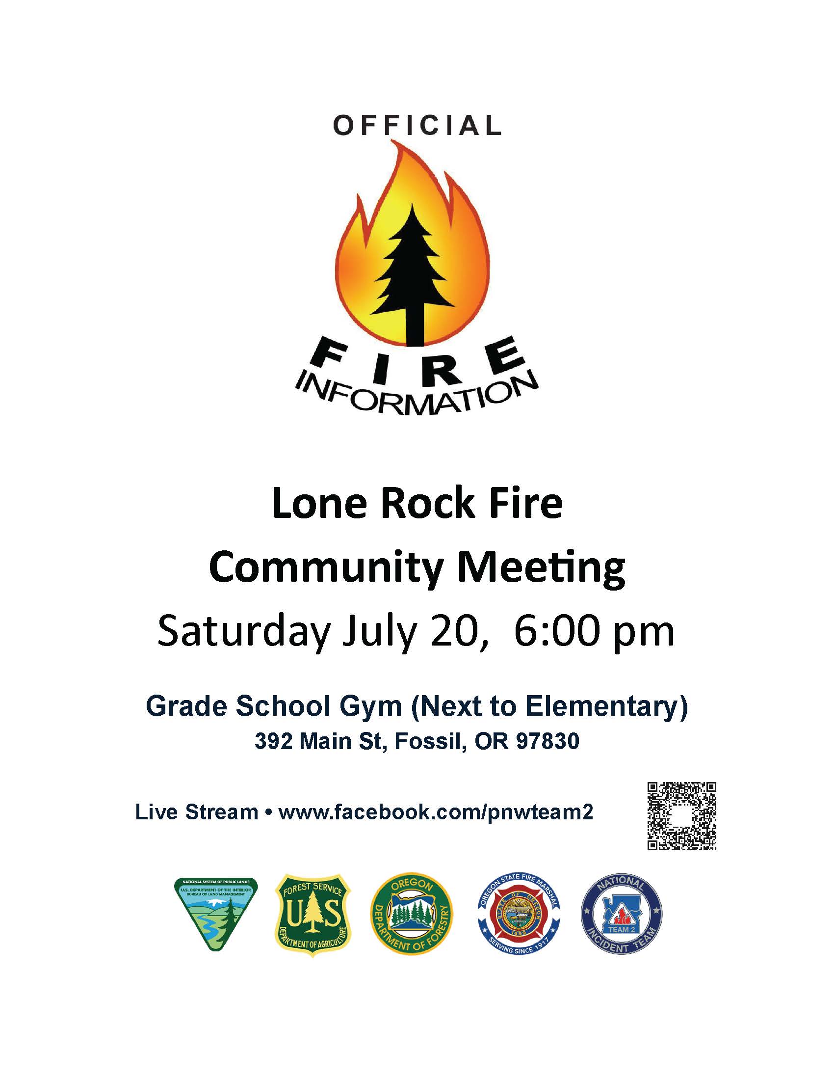
Facebook Page Temporarily Not Functional due to Facebook Review 07 20 2024
Related Incident: Lone Rock Fire
Publication Type: Announcement
Facebook administrators have flagged the newness and engagement level of the Lone Rock Fire Facebook Page. The Community Meeting at 6:00 pm will be live streamed at NW2's Facebook Page. You can click here to open: https://www.facebook.com/pnwteam2
This has put a sudden, unannounced and temporary hold on our ability to use this new page. The Operations video update by NW2 and OSFM was stricken from the page today and flagged as Spam.
The link for today's Operations video update is here: https://www.youtube.com/watch?v=E_vYo1pdtjc&t=8s
We are asking for patience while we resolve this issue. This has happened to other Fire Facebook pages in recent past.
***The National Weather Service has issued a RED FLAG WARNING from 11:00 AM Saturday through 11:00 PM Sunday for Hot, Dry and Unstable conditions***
Stay safe and informed, and thank you for your continued support.
Fire Information 8am - 8pm 541-208-4369
#LoneRockFire #lonerockfire2024
Ore Fire Update 07 20 2024
Related Incident: Ore Fire
Publication Type: News
Ore Fire Update
Saturday, July 20, 2024 – 9:30 a.m.
Size: 500 acres | Reported Date: July 16, 2024 | Personnel: 115
(Springfield, Ore.) – Fire suppression efforts continue on the Ore Fire, which is burning in steep, rugged terrain 7 miles northeast of Blue River, Oregon. The current acreage of 500 is an estimate due to the unavailability of an updated infrared flight. The cause of the fire remains under investigation. Northwest Complex Incident Management Team 10 (NWT10) took command of the fire at 7:00 p.m. yesterday. Members of the incoming team spent the day shadowing the local forest unit gathering information, assessing and surveying the fire area to ensure a smooth transition. Resources continue to arrive, with more expected in the coming days.
Yesterday, fire activity increased in the afternoon, prompting the withdrawal of resources along the fire line due to safety concerns. The rugged terrain poses significant challenges and hazards to firefighters, inhibiting their efforts to attack the fire directly. Firefighter and public safety are the highest priority on the Ore Fire.
Given the hazardous terrain, fire managers are implementing indirect containment strategies, such as utilizing existing roads to create containment lines instead of deploying firefighters directly on the fire's edge. This approach prioritizes the safety of the firefighting personnel while still effectively managing the fire. The control objectives for this fire include several miles of forest fuel reduction along roads and trails using crews and mechanized equipment.
Today, crews and machinery will work to prepare FS Road 15 and 1509 by thinning vegetation, removing fuel and improving these features as containment/contingency lines. Air operation resources are available and will be utilized to assist personnel and monitor fire progression.
Weather: Hot and dry conditions will continue through the weekend. This afternoon, unstable air conditions and a chance of thunderstorms in the area are possible, which may lead to increased fire activity. Cooler temperatures in the 80s are expected early next week.
Safety: Fire personnel will be working with heavy equipment along FS Road 15 and 1509. Fire managers ask the public to drive defensively while crews diligently work to complete suppression efforts along the road. With fire danger remaining high, fire restrictions are in place within the Willamette National Forest. Current fire restriction information can be found at: https://www.fs.usda.gov/main/willamette/fire.
Smoke: Smoke from numerous wildfires burning throughout the state will affect air quality in many areas over the coming days. For information on air quality in your area go to: www.airnow.gov
Forest Closures: Established closures on the Willamette National Forest are in place around fire-impacted areas. These closures include the following sites: Buck Mountain Trail, Tidbits South and West Trail, Gold Hill Trail, Mona Campground, Lookout Campground, and Saddle Dam Boat Launch. For a complete list of recreation and roads in the Ore Fire closure order, visit https://www.fs.usda.gov/alerts/willamette/alerts-notices.