
National Park Service Closures Related to Pioneer Fire 07 25 2024
Related Incident:
Publication Type: Closures
As of 7.25.24, the following are closed to all access due to fire activity. Exceptions: Any Federal, State, or Local employee in the performance of an official duty.
- Roads
- Stehekin Valley Road - closed to visitor access, including foot travel (open to Stehekin residents)
- Trails
- Lakeshore from Stehekin to the NPS boundary
- Purple Creek
- Boulder Butte
- Chelan Summit
- Boulder Creek
- Company Creek Trail - from Stehekin Valley to the NPS boundary
- Devore Creek Trail - from Stehekin Valley to the NPS boundary
- Stehekin River Trail
- Rainbow Loop Trail
- Rainbow Creek from junction with Rainbow Lake Trail (Bench Creek Camp) to junction with Rainbow Loop Trail (Rainbow Bridge Camp)
- Campgrounds and Campsites
- Frontcountry Campgrounds
- Lakeview
- Purple Point
- Harlequin
- Backcountry Campsites
- Juanita Lake Camp
- Juanita Lake Stock
- Rennie Camp
- Reynolds Camp
- Reynolds Stock
- Hooter Camp
- Rainbow Ford
- Rainbow Bridge
- Boat-in Campsites
- Flick Creek
- Manly Wham
- Weaver Point
- Frontcountry Campgrounds
- Cross-country Zones
- Triplet Lakes
- Purple
- Cross-country Zone access from closed trails is prohibited
For Pacific Crest Trail information visit the PCT closures page.
Tanques Wildfire News Release July 26 2024 07 26 2024
Related Incident: Tanques Wildfire
Publication Type: News
Location: Northwest corner of the Santa Fe National Forest in the Cuba Ranger District,
approximately 27 miles north of Cuba, NM.
Start Date: July 18, 2024
Size: 2,745 acres with a planned perimeter of 7,000 acres
Percent completed: 35 %
Cause: Lightning
Vegetation: The wildfire is burning in ponderosa pine, pinyon-juniper, and oak.
Resources: 36 personnel including aerial resources
Overview: Santa Fe National Forest will manage the fire as a Type 3 incident with a confine and contain strategy. This means crews will manage the fire within a predetermined area (confine) and use points to stop the fire’s spread (contain). To accomplish this strategy, crews will conduct firing operations using aerial and hand ignitions within a 7000-acre planned perimeter as early as July 25 and use roads, hand lines, and natural barriers as containment lines.
The fire is burning in the Moya National Environmental Policy Act (NEPA) project area and a landscape that has been thinned and treated with prescribed fire in the past. The primary objectives for the Tanques Wildfire are to provide for firefighter and public safety and improve wildlife habitat.
Highlights: Fire held within the fire perimeter overnight. Today, aerial ignitions, conducted by a helicopter, continue within the project area. Crews are managing fire activity and preparing for thunderstorms later this evening.
Weather: After a relatively calm night Thursday night, an uptick in afternoon thunderstorm activity in the fire area is forecast Friday through the weekend.
Closure Order: A temporary area and road closure is in effect to protect the public's health and safety during firefighting operations for the Tanques Wildfire. The closure order is available on the Santa Fe National Forest’s website - Closure Order 03-10-02-24-11 .
Safety: The health and safety of firefighter and the public are always the highest priority. Please avoid the area while crews manage the Tanques Wildfire. Drones and firefighting aircraft are a dangerous mix and could lead to accidents or slow down wildfire operations. If you fly, we can’t.
Smoke: Smoke may be visible from communities along Highway 112 including El Vado and Llaves, NM and from the Jicarilla Apache Nation Indian Reservation. View an interactive smoke map on AirNow Fire and Smoke Map. To learn more about smoke impacts visit Wildfire and Prescribed Fire Smoke Resources (nm.gov).
Fire Information:
Contact Claudia Brookshire, Public Affairs Officer, Santa Fe National Forest
Phone: 505-607-0879 (available from 8:00 am to 7:00 pm)
Email: claudia.brookshire@usda.gov
Links: Santa Fe National Forest website, New Mexico Fire Info, Inciweb, and Santa Fe National Forest social media (Facebook and X).
Tanques Wildfire updates will be provided weekly.
###
USDA is an equal opportunity provider, employer and lender.
BLM issues emergency fire closure in Williams Lake area due to Thunder Fire 07 26 2024
Related Incident:
Publication Type: Closures
The Bureau of Land Management (BLM) Salmon Field Office is temporarily closing BLM-managed public lands in Lemhi County, due to the risk of the nearby Thunder Fire. This closure is essential to ensure public and firefighter safety and to allow fire fighting crews to respond effectively. This closure will remain in effect until the risk of wildland fire subsides.
The temporary closure includes all BLM-managed public lands south of Williams Creek Road, and west and north of Williams Lake Road. Additionally, BLM-managed public lands north and west of Lakeview Drive, including the Williams Lake Campground, will also be temporarily closed. This order does not include private land. Please see the map for a visual look of the closure area.
The Thunder Fire is believed to have been sparked by lightening on Wednesday, July 24, approximately 12 miles south and southwest of Salmon. At the time of this announcement, the fire has burned roughly 2,200 acres of fir trees and grass with 0% containment. The blaze is showing extreme fire behavior with torching and crowning, burning and jumping along treetops, and throwing out spot fires. A Red Flag Warning is in effect today, which is expected to bring gusty winds and dry conditions.
Public and wildland firefighter safety are BLM’s highest priority. Please be aware that firefighting crews and emergency vehicles will be in the area. Do not drive into smoke. The BLM encourages the public to obey all evacuation orders issued by the Sheriff’s Office. For the latest information on the Thunder Fire, visit InciWeb: https://inciweb.wildfire.gov/incident-information/idscf-thunder-fire.
THUNDER FIRE CLOSURE 07 26 2024
Related Incident:
Publication Type: Closures
CENTRAL IDAHO FIRE RESTRICTIONS AREA IS IN STAGE I FIRE RESTRICTIONS
On InciWeb @ https://inciweb.nwcg.gov/incident-information/idscf-thunder-fire
The Salmon‐Challis National Forest has implemented the Thunder Fire Closure, Order Number: 04‐13‐24‐014.
Description of #04-13-24-014:
Described Area/Roads/Trails: The Described Areas includes all NFS lands, roads, and trails within the following boundaries: Starting at the junction of National Forest System Road (NFSR) #60021 Williams Creek Road and the Salmon-Challis National Forest boundary (Forest Boundary), then following the Forest Boundary south to its junction with NFSR #60028 Lake Creek Road, then following NFSR #60028 Lake Creek Road to the west and north to its junction with NFSR #60021 Williams Creek Road, then following NFSR #60021 Williams Creek Road to the east to the point of origin at the junction of NFSR #60021 Williams Creek Road and the Forest Boundary.
Additional Described Roads and Trails: This closure shall include the following National Forest System Roads and Trails outside of the designated area described above:
- That portion of NFSR #60028 Lake Creek Road that is east of the Forest Boundary.
- That portion of NFST #6040 Thunder Mountain Historic Trail that is east of NFSR #60045 Iron Creek Road.
- NFST #6080 Lake Mountain Trail.
- NFST #6128 Henry Creek Trail.
***NFSR #60021 Williams Creek Road will remain open***
The purpose of this order is to protect public safety during Thunder Fire.
This Order shall be in effect from July 26, 2024, at 12:00 am through September 30, 2024, at 12:00 am, unless rescinded.
Visit our website at: www.fs.usda.gov/scnf/, ‘Like Us’ on Facebook @salmonchallisnf, and ‘Follow Us’ on X @salmonchallisnf.
####
USDA is an equal opportunity provider, employer, and lender.
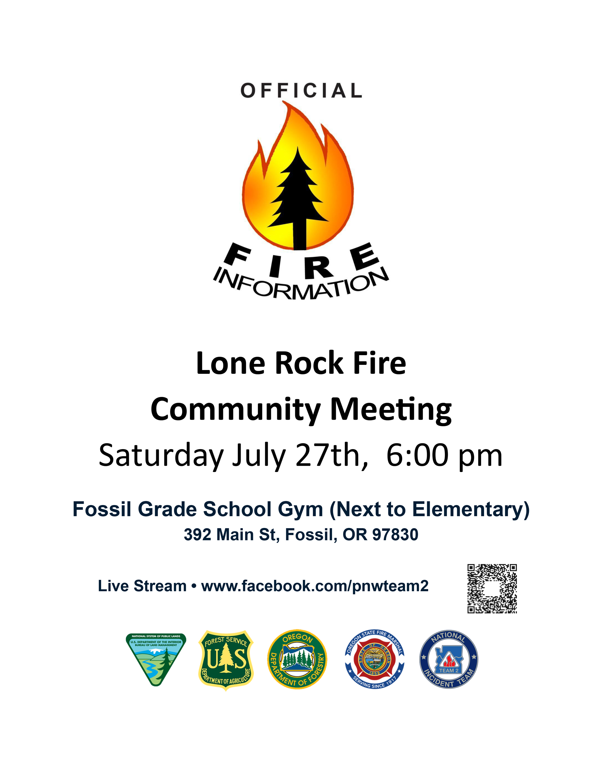
Lone Rock Fire Community Meeting 07 28 2024
Related Incident: Lone Rock Fire
Publication Type: Announcement
Lone Rock Fire Community Meeting Link - Recorded and Posted to Facebook
📅 Saturday, July 27th
🕕 6:00 PM
📍 Fossil Grade School Gym (Next to Elementary)
🏫 392 Main St, Fossil, OR 97830
#LoneRockFire #CommunityMeeting
Oregon State Fire Marshal
Wheeler County Sheriff's Office
Gilliam County Sheriff's Office
Morrow County Sheriff's Office
U.S. Forest Service - Umatilla National Forest
Oregon Department of Forestry
Bureau of Land Management
BLM Oregon & Washington
Oregon Department of Forestry Central Oregon District
Grant County Emergency Management
Settings - change map background and toggle additional layers
Filter - control incident types displayed on map.
Zoom to your location
Reset map zoom and position
Could not determine your location.
Show Legend
 Wildfire
 Prescribed Fire
 Burned Area
Response
Burned Area
Response Other
Other
Middle Fork Fire
Unit Information
Incident Contacts
IDSCF SALMONCHALLIS FIRE SUMMARY July 26 2024 07 26 2024
Related Incident:
Publication Type: News
The Central Idaho Dispatch Zone is at EXTREME Fire Danger
CENTRAL IDAHO FIRE RESTRICTIONS AREA IS IN STAGE I FIRE RESTRICTIONS
There have been five (5) new fires reported on the Salmon-Challis National Forest since the last update on Monday, July 22, 2024. To date, there have been 15 wildfires reported on the Salmon-Challis National Forest. Nine (9) of the fires have been declared out.
Deer (July 25): The lightning fire is located approximately 33 miles northwest of Challis, southeast of Pinyon Peak on the Middle Fork Ranger District in the Frank Church River of No Return Wilderness. Loon Creek Guard Station is east of the fire. The fire, burning in grass and conifers is estimated at approximately 75 acres. The fire is burning on both side of Rabbit Creek. The fire is burning in the 2006 Trail Creek Fire.
Sheep (July 25): The lightning fire is located approximately 11 miles northeast of North Fork, northwest of Sheep Mountain on the North Fork Ranger District. The 0.10 acre fire is burning in subalpine fir. Two (2) firefighters are on scene working to suppress the fire.
Joseph Pass (July 24): The lightning fire is located approximately 20 miles north of North Fork on the North Fork Ranger District. The 0.10 acre fire is 100% contained and controlled.
Thunder (July 24): The lightning fire is located approximately two (2) miles northwest of Williams Lake and approximately 12 miles southwest of Salmon. The fire is estimated to be 2,465 acres in size and is burning in timber, sagebrush, and grass. Yesterday, the fire progressed towards Henry Creek and burned down the Henry Creek drainage to the Williams Lake Road. Firefighters, with the assistance of Lemhi County Fire Protection district and Lemhi County Sheriff’s Office, burned out along to the road from Henry Creek to the south. Today, a Type II hand crew is working along the Willams Lake Road mopping up the fire’s edge and a Type I Crew is going direct on the west side of the fire. Aircraft will be used as weather conditions allow. A Complex Incident Management Team has been ordered and will in brief with Forest Officials this evening.
The Lemhi County Sheriff has identified evacuation zones for the Thunder Fire. ZONES 1, 2 AND 3 ARE NOW IN "SET" STATUS. Information can be found on the Lemhi County website at https://www.lemhicountyidaho.org/.
The Salmon-Challis National Forest has a closure in place: https://www.fs.usda.gov/Internet/FSE_DOCUMENTS/fseprd1196683.pdf. The Bureau of Land Management Salmon Field Office has a closure in place: https://www.blm.gov/sites/default/files/docs/2024-07/BLM_ID_IDF_Thunder_Fire_Temporary_closure.pdf.
Visitors will need to stay East of the Boat launch if recreating on the lake. West of the boat launch will be the Primary Dipping site for the helicopters. This will still allow for the public to enjoy the lake. If you are recreating at Williams Lake near this ongoing wildfire suppression operation, please keep your distance ‐ don’t congregate in the area where the firefighters are at work and allow the firefighters to do their job safely and efficiently. Forest officials as asking the public to limit vehicle traffic on the Williams Lake Road for the safety of the firefighters. The Thunder Fire can be found on InciWeb at https://inciweb.wildfire.gov/incident-information/idscf-thunder-fire.
Ajax (July 24): The lightning fire is located approximately 13 miles northeast of Salmon, approximately one (1) mile northwest of Ajax Peak on the east side of the Carmen Creek drainage on the North Fork Ranger District. The Ajax Fire is holding at 2.5 acres with only 1/2 acre of growth since initial fire detection. Six (6) firefighters are on scene working to suppress the fire. A helicopter is assisting with bucket drops when weather allows.
Mayfield (July 19): The lightning fire is located approximately 27 miles northwest of Challis northwest of Mayfield Peak on the Middle Fork Ranger District in the Frank Church River of No Return Wilderness. The 0.10 acre fire is burning in a single tree in a steep, rugged, scabby, and rocky terrain at approximately 9,000 feet. A helicopter flew the fire this morning and no smoke was observed.
Loon (July 7): The lightning fire is located approximately 38 miles northwest of Challis in the West Fork of Little Loon Creek on the Middle Fork Ranger District in the Frank Church River of No Return Wilderness. The five (5) acre fire burning in grass, brush, and timber is out.
Weather: ...RED FLAG WARNING IN EFFECT FROM NOON TO 10 PM MDT FRIDAY FOR GUSTY WINDS AND LOW RELATIVE HUMIDITY...Dangerous fire weather conditions are likely this afternoon as humidity falls into the mid-teens and gusty winds are likely. Humidity levels are a little higher on Saturday and winds are lighter.
The forest is asking visitors to be aware of the EXTREME fire danger for the Salmon-Challis National Forest. The U.S. Forest Service, Idaho Department of Lands, and Bureau of Land Management in east-central Idaho are in Stage 1 fire restrictions. The Central Idaho Fire Restrictions Area encompasses those portions of Custer County that are north and east of the Sawtooth National Recreation Area (excluding the Frank Church River of No Return Wilderness) and that portion of Lemhi County that is not federal land designated as wilderness. One Less Spark Means One Less Wildfire. Since June 1, Forest employees have found and extinguished at least 13 abandoned campfires.
Nationally, there are 104 uncontained large fires being managed under a full suppression strategy and 7 large fires managed under a strategy other than full suppression.
Visit our website at: www.fs.usda.gov/scnf/, ‘Like Us’ on Facebook @salmonchallisnf, and ‘Follow Us’ on X @salmonchallisnf.
####
‘USDA is an equal opportunity provider and employer’
USFS Pioneer Fire Closure Order 0617022415 effective 07232024 07 26 2024
Related Incident:
Publication Type: Closures
An updated US Forest Service closure order is in effect for much of the Chelan Ranger District north of Lake Chelan, due to the Pioneer Fire. Please see the attached official closure order and map for specific information on open and closed trails, roads, and developed campgrounds. The communities of Chelan and Manson are open and continue to welcome visitors.
Notices and alerts for the Okanogan-Wenatchee National Forest are located at: Okanogan-Wenatchee National Forest - Alerts & Closures (usda.gov)
WSDOT Travel Advisory SR 20 North Cascades Highway reopens July 26 between Granite Creek and Easy Pass trailhead after multiday closure due to wildfire 07 26 2024
Related Incident: Easy Fire
Publication Type: Closures
Washington State Department of Transportation
North Central Region- 2380 Euclid Ave. – Wenatchee, WA, 98801-5616 – 509-667-3000
TRAVEL ADVISORY
July 26, 2024
Contacts: Lauren Loebsack, communications, 509-667-2815
Aisha Dayal, communications, 206-482-1130
SR 20 North Cascades Highway reopens July 26 between Granite Creek and Easy Pass trailhead after multiday closure due to wildfire
WINTHROP – State Route 20/North Cascades Highway has reopened at 1 p.m. on Friday, July 26 between Granite Creek and Easy Pass trailhead (mileposts 148-157), following a multiday closure due to fire activity from the Easy Fire.
Fire crews have been removing trees and brush adjacent to the highway and will continue fire mitigation work in the area. Operations are scheduled from 7 a.m. to 8:30 p.m. daily. Work will require extended closures, with flagger-controlled traffic and pilot car with delays of 30 minutes to allow fire crews to safely remove trees and brush from the roadway. Travelers are still advised not to pull off the highway between mileposts 148 and 157 and to remain alert for fire response and maintenance crews throughout the mountain passes. There are no detours on Forest Service roads. Never pass flaggers or pilot cars.
Wildfire activity can mean quickly changing conditions. Road closure information is posted in the WSDOT real-time travel center and @wsdot_north and @wsdot_east on X/Twitter and updates will be provided as available. Wildfire information can be found by visiting the Washington State Department of Natural Resources wildfire incident information webpage.
Hyperlinks within the release:
Easy Fire: inciweb.wildfire.gov/incident-information/waowf-easy-fire
Real time travel center: https://wsdot.com/Travel/Real-time/Map/
@wsdot_north: x.com/wsdot_north
@wsdot_east: x.com/WSDOT_East
Wildfire incident information webpage: /www.dnr.wa.gov/Wildfires
###
Miners Complex Daily Update 20240726 07 26 2024
Related Incident: Miners Complex Fires
Publication Type: Announcement
11:00 AM, July 26, 2024
Estimated size: 500 acres
Start Date/Time: July 17, 2024
Area of Origin: 21 air miles east of Darrington WA
Cause: Lightning
Fuels/Topography: timber, rugged terrain
Structures Damaged: None, there are no homes threatened at this time.
Evacuations: None
The Miners Complex consists of nine wildfires caused by lightning strikes in the Mt. Baker-Snoqualmie National Forest. The fires included in the complex are: Miners Fire, Vista Ridge Fire, Dolly Creek Fire, Sulphur Three Fire, Sulphur Four Fire, Sulphur Thirty-Four Fire, Upper Sulphur Thirty-Two Fire, Lower Sulphur Thirty-Two Fire, and Plummer Fire.
Update: Fire growth on all fires were hampered by yesterday’s cold and wet weather. As the day progresses smoke will again be visible but minimal fire behavior is expected. Operations staff has been working on identifying objectives pending fulfillment of fire resources. With multiple fires in the area and nationwide resources being funneled to highest priority fires where life and personal property are at risk, staffing continues to be an issue. As resources become available identified suppression effort priorities will be implemented.
Smoke: For more information on smoke and air quality please visit: https://wasmoke.blogspot.com/
Closures: The following is a summary of the areas closed due to the fires in the Miner's Complex. The full Closure Orders visit: https://www.fs.usda.gov/mbs
Pacific Crest National Scenic Trail #2000.2 from Mica Lake to Suiattle Pass, Suiattle River Trail #784, Miners Ridge Trail #785, Buck Creek Pass Trail #789, Miners Cabin Trail #795, Grassy Point Trail #788, Sulphur Mountain Trail #794, Sulphur Creek Trail #793, Sulphur Creek Campground, and Sulphur Creek Trailhead. Closure has been extended on the ground down valley to include the Downey Creek trailhead.
Campfire Restrictions: The Mt. Baker-Snoqualmie will be elevating to a full campfire ban, even in developed campgrounds, starting Wednesday July 24, 2024 to help prevent human-caused starts in this critically dry period. Additional details at: www.fs.usda.gov/mbs
###