


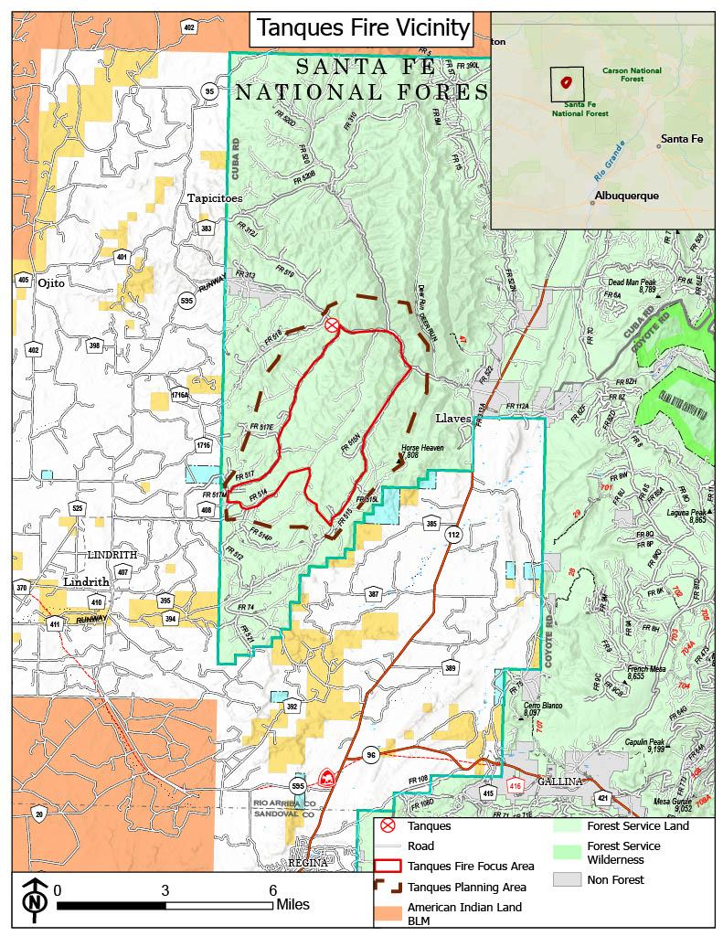
The Tanques Fire is a lightning-caused wildfire located in the Cuba Ranger District, about 27 miles north of Cuba, NM within the Santa Fe National Forest.
Incident Objectives:
- Provide for firefighter and public safety
- Meet Moya project (Forest Service (usda.gov)) National Environmental Policy Act (NEPA) objectives to improve wildlife habitat.
- Protecting values at risk
Santa Fe National Forest will manage the fire as a Type 3 incident with a confine and contain strategy. This means crews will manage the fire within a predetermined area (confine) and use points to stop the fire’s spread (contain). To accomplish this strategy, crews will conduct firing operations using aerial and hand ignitions within a 7000-acre planned perimeter as early as July 25 and use roads, hand lines, and natural barriers as containment lines
| Current as of | Mon, 10/07/2024 - 21:33 |
|---|---|
| Incident Time Zone | America/Denver |
| Incident Type | Wildfire |
| Cause | Lightning |
| Date of Origin | |
| Location | Santa Fe National Forest - Cuba Ranger District |
| Incident Commander | Santa Fe National Forest Incident Commander (IC 4) Charles Alcon Incident Commander Trainee (IC 4) Isiah Eichwald |
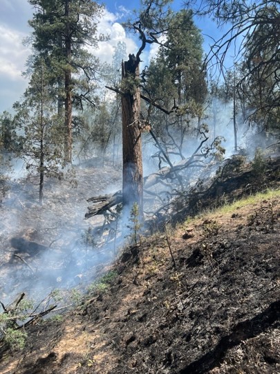
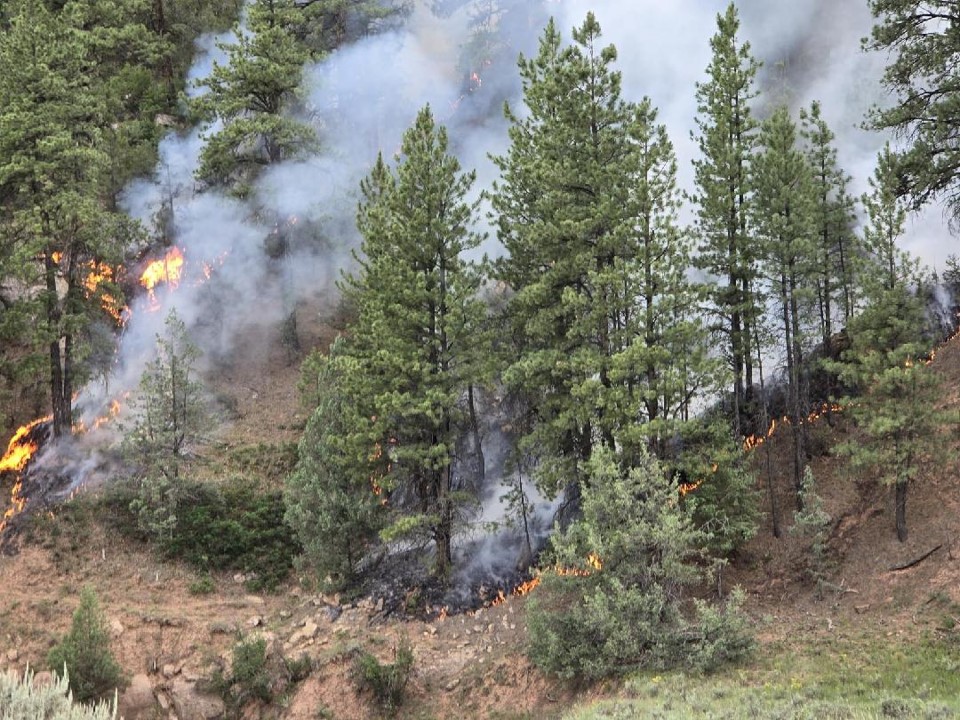
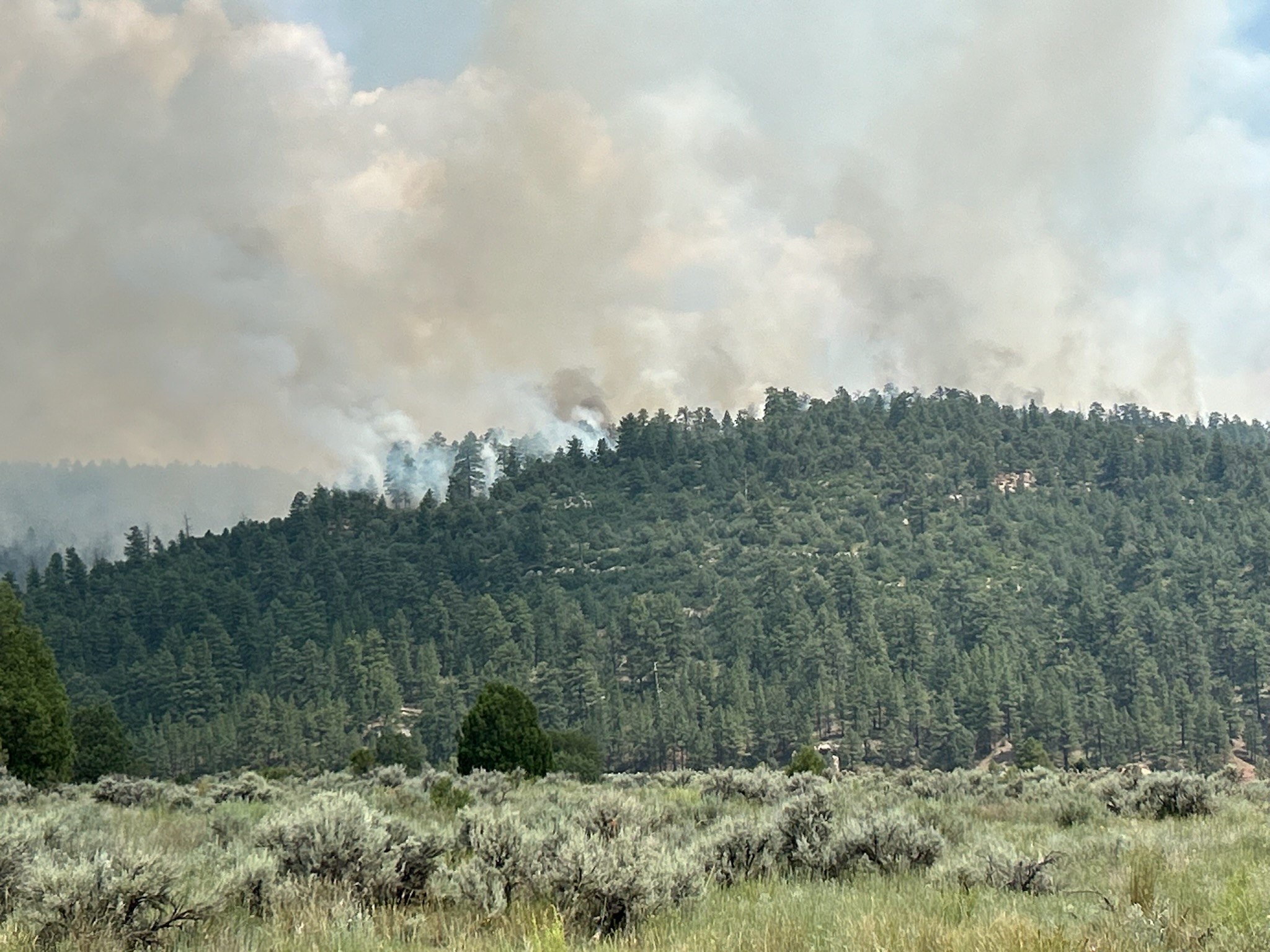
| Incident Description | Wildfire burning in ponderosa pine, pinyon-juniper, and oak. |
| Coordinates |
36° 24' 25.8'' Latitude
-106° 56' 31.3
'' Longitude
|
| Total Personnel: | 15 |
|---|---|
| Size | 7,000 Acres |
| Percent of Perimeter Contained | 100% |
| Fuels Involved | Ponderosa pine, pinyon-juniper, and oak. |
| Significant Events | July 25
July 26
Weekly updates August 1
|
| Weather Concerns | August 1 Drier air will limit the chances for storms today and Tuesday with just a 10 percent chance today and only a 20 percent chance tomorrow. Winds will tend to be light turning from the west northwest in the afternoon hours. Temperatures will trend warmer than normal, reaching the mid to upper 80s while humidity falls to near 20 percent each afternoon. |
|---|