
Midday operations update 230 pm 1012020
Related Incident:
Publication Type: Announcement
This morning, the Mullen Fire has been less active, due to higher nighttime humidity recovery. Fire behavior is expected to increase as the day becomes warmer and drier, but the duration of that peak fire activity is expected to be shorter today.
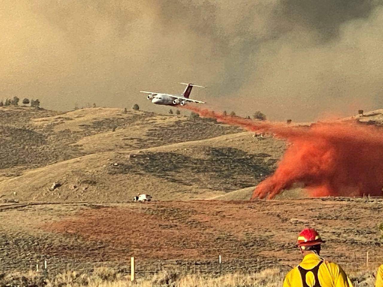
Firefighters are preparing to conduct burnout operations to reduce the chance of fire spread in several places around the fire area. On the south flank of the fire, in Colorado, firefighters plan to apply retardant along CO 127 and WYO 230/CO 127 before continuing burnouts on the north side of those roads. This is a key location where fire managers want to prevent further fire advance southeast through Wyoming and into Larimer County, Colorado.
Structure protection efforts continue to protect communities already affected by the fire, and prepare others for potential fire impacts.
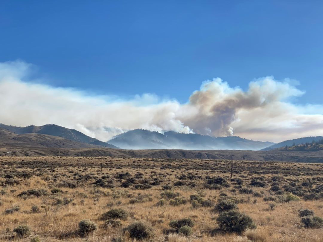
The active behavior of both the Mullen Fire and Cameron Peak Fire is creating increasing smoke impacts to southern Wyoming and northern Colorado. Today’s Smoke Outlook is posted to the Photos section of Inciweb.
Our Story Map shows the most recent perimeters of both the Mullen Fire and Cameron Peak Fire, and includes features to look up your address and measure the distance to the fire – or between the fires. See it here at: https://arcg.is/1mnyXL
Mullen Fire Daily Update for 1012020
Related Incident:
Publication Type: News
Virtual Community Q&A TODAY at 5 p.m.
The meeting will be livestreamed on the Mullen Fire Information page (https://www.facebook.com/MullenFire)
Summary
Despite aggressive actions by fire crews, the fire quickly moved across the Colorado state line into Jackson County late yesterday afternoon. Energized by dry fuels and winds, it ran several miles in just under an hour and a half. Crews were moved from other parts of the fire to assist with suppression efforts in response to the rapidly changing conditions.
During the evening, firefighters initiated burnout operations along WY230 between the Badger Creek Fire scar and the Colorado border. This is a key location where the fire could further advance southeast through Wyoming and into Larimer County, Colorado. Under favorable conditions, burning will continue today south to the junction of CO125.
Further to the north, crews burned west of Albany to hold the fire’s edge at the 542 road. They will continue burning toward the Keystone Fire burn scar to remove fuel and establish a stronger perimeter. Ongoing structure protection includes laying hoses, setting up sprinklers and portable pumps, and removing brush near structures to secure at-risk communities. Yesterday’s extreme fire activity prompted additional evacuations and road closures in both Wyoming and Colorado. The public should be aware of all restrictions and adjust travel and recreation plans as needed. This fire has a history of moving at extreme rates of speed.
The Mullen Fire is occurring during an exceptional fire year when resources have been scarce. Though the total number of personnel has grown over the past two days, fire managers hope to increase the amount of both personnel and equipment in the coming days.
Fire Conditions and Weather
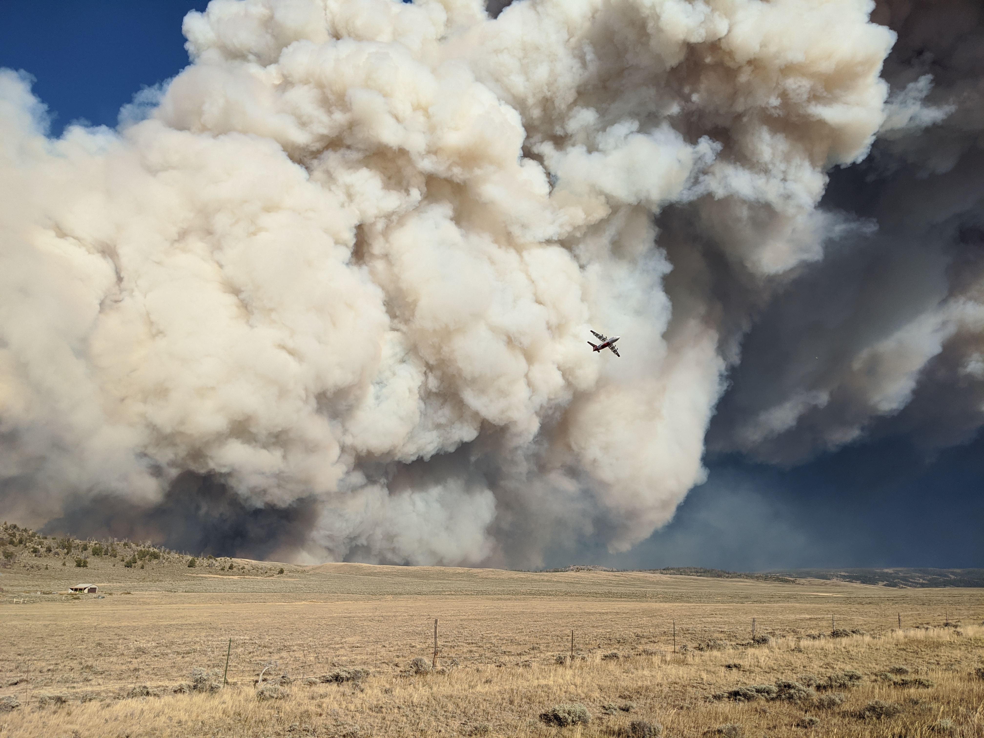
The Mullen Fire is exhibiting extreme fire behavior, moving through features that typically slow fire progression such as roads and timber sales. In addition, prolific spotting has been sending embers well in advance of the fire’s front. The active behavior of the Mullen Fire is increasing smoke impacts to southern Wyoming and northern Colorado. An Air Resource Advisor is here to predict and measure smoke impacts and share that information with the public, the incident management team, and air quality regulators.
Mandatory Evacuations:
Multiple evacuations and pre-evacuations are in place. See the Albany County Sheriff Office (WY) and Jackson County Sheriff’s Office (CO) Facebook pages for the most current list.
https://www.facebook.com/Albany-County-Sheriffs-Office-618424944997540
https://www.facebook.com/JacksonCountySheriffOffice
Road closures
Road status can change quickly change in response to fire conditions. For the most current information on Wyoming and Colorado road closures, please see https://www.wyoroad.info/pls/Browse/WRR.STATIC5?SelectedDistrict=1 and https://cotrip.org/travelAlerts.htm#?roadId= No estimate is available about reopening these roads.
Forest area closure
A Forest area closure is in effect surrounding the Mullen Fire for public safety. See the new Forest Closure Order at https://tinyurl.com/yyanh6ey and the new Forest Closure Area Map at https://tinyurl.com/y3wh7bv3
Stage 2 Fire Restrictions in Effect for the Fire Area
- Medicine Bow-Routt National Forests and Thunder Basin National Grassland: https://www.fs.usda.gov/Internet/FSE_DOCUMENTS/fseprd786902.pdf
- Albany County: https://www.co.albany.wy.us/247/Fire-Restrictions
Temporary Flight Restriction
A Temporary Flight Restriction is in effect for the fire area: https://tinyurl.com/y3foyxwt
Firefighters dont need donations but you can still help
Related Incident:
Publication Type: Announcement
We've been overwhelmed by the kindness and generosity of the many communities affected by the Mullen Fire. We want to reassure you all that our firefighters have everything they need, so we do not need any donations. But your donations can be put to good us in many other ways, and here are a few suggestions. Please share this among your friends and neighbors - and thank you!
Morning operations update 720 am 1012020
Related Incident:
Publication Type: Announcement
This morning, the size of the Mullen Fire is 117,240 acres, based on an infrared measurement just after midnight.
Last night, when winds were favorable to do so, firefighters conducted burnout operations to limit the fire’s spread by removing fuels along roads, fire lines and natural features. West of Albany, a burnout south of the 500, 513 and 542 Roads began a control line to improve the defense of Albany, Keystone and areas east of Rob Roy Reservoir. Southeast of the fire, firefighters worked to interrupt the fire’s progression to the southeast, by burning out fuels on the west side of Wyoming Hwy 230/Colorado Hwy 127, on the Wyoming-Colorado border just southwest of Mountain Home and Wyocolo.
Throughout the night, firefighters worked to prepare structures for possible impacts from fire, and defend homes in and near the fire footprint. More firefighters continue to arrive to reinforce more than 900 personnel who are already assigned to the fire.
If a new perimeter measurement is available today, our interactive Story Map (https://arcg.is/1mnyXL) will display it. This online map includes features to look up your address and measure the distance to the fire – or between the fires.
Evening operations update 930 pm 9302020
Related Incident:
Publication Type: News
This evening, the size of the Mullen Fire is now 106,747 acres, based on an infrared measurement taken today. 934 personnel are working on both sides of the Wyoming-Colorado state line, and more are arriving daily. They are diligently protecting defend structures in and near the fire footprint, and working ahead of the fire to prepare structures for possible fire impact.
Today, the fire moved faster than our mapmakers could keep up. But when the infrared measurement data has been processed, our interactive Story Map (https://arcg.is/1mnyXL) will show the latest perimeter of both the Mullen Fire and Cameron Peak Fire. This online map includes features to look up your address and measure the distance to the fire – or between the fires.
NEW Colorado evacuations and Wyoming road closures
Related Incident:
Publication Type: Closures
Mandatory Evacuation order from Larimer County, Colorado at 5:40 pm:
Due to the Mullen Fire in Wyoming, Fire officials have upgraded to Mandatory Evacuations for the Roach and Hohnholz areas in northwest Larimer County due to immediate and imminent danger. Residents and visitors should evacuate the area immediately and as quickly as possible. Do not delay leaving to gather belongings or make efforts to protect your home or business. Evacuating immediately not only supports your safety, but also allows emergency crews better access to the area. For updates, text the word MULLEN to 888777 from your cell phone. We will communicate information to that key word as needed. Please do not call 9-1-1 unless you are in danger.
Evacuation order from Jackson County, Colorado Sheriff’s Office at 3:30 pm:
“Emergency!!!! Today’s pre evacuation has been updated to evacuation. All residents north of 3 way please evacuate ASAP.
Highway 125 to Riverside, Wyoming is how closed until further notice. Highway 127 is still closed and Highway 14E is still closed.”
Road closure announcement from Wyoming Department of Transportation at 3:30 pm:
WYO 230 from Riverside to the Colorado state line (CO 125) is now CLOSED due to Mullen Fire activity.
Also closed due to fire activity are:
- WYO 230 between the Colorado state line (CO 127) and Woods landing (mm 27)
- WYO 11 between Albany and where it connects to WYO 130
- WYO 10 between the CO state line (CO 103) and where it connects to WYO 230 (near Jelm)
Midday operations update 230 pm 9302020
Related Incident:
Publication Type: Announcement
Mullen Fire Daily Update for 9302020
Related Incident:
Publication Type: News
Virtual Community Q&A TODAY at 5 p.m.
The meeting will be livestreamed on the Mullen Fire Information page (https://www.facebook.com/MullenFire)
The interactive Story Map shows the most recent perimeter, and includes features to look up your address and measure the distance to the fire. See it here at: https://arcg.is/1mnyXL
Summary
Fire activity increased early in the day yesterday and is expected to be active today. On the west side, crews are working to slow fire progression along the North Platte River. A fleet of 20 aerial resources has been critical in cooling the fire’s edge and assisting with structure protection.
In addition to focusing on structure protection in multiple communities, firefighters are working to limit growth of the fire in key areas such as Albany, Sheep Mountain, Highway 230 near Woods Landing, Foxborough, Fox Park, Rob Roy, and the southwestern corner of the fire near Six Mile Campground. Fire managers are strategically shifting resources between divisions as needed to respond to changing conditions. The fire continues to be wind and fuels-driven and is expected to move to the south to the Colorado border.
Additional engines and other support staff are arriving, and getting reassigned to the Mullen Fire after being released from other incidents. Over 100 new personnel have been added to the operational resources.
Albany County Sheriff’s Office announced at last evening’s Facebook Live Q&A that assessments were made in lower Keystone, Lake Creek and Foxborough. They have made contact with 38 property owners who experienced loss of property. In all, 29 dwellings and 31 outbuildings were lost. If there is further damage to private property as the fire progresses, additional assessments and notifications will be made.
Fire Conditions and Weather
Similar to Tuesday, smoke is expected to fill the local area this morning until the inversion breaks. Visibility will then increase with breezy west/northwest winds gusting up to 20 mph. There should be warm temperatures and low humidity throughout much of the area today, resulting in persistent fire behavior.
Mandatory Evacuations
Multiple evacuations and pre-evacuations are in place. See the Albany County Sheriff Office’s Facebook page or Albany County website for the latest list.https://www.facebook.com/Albany-County-Sheriffs-Office-618424944997540
https://www.co.albany.wy.us/
Road Closures
Wyoming 11 is closed from the junction with County Road 47 into Albany. Wyoming 230 is closed from the Colorado border to Sodergreen Lake. County Road 47 (Fox Creek Road) is closed between WYO 11 and WYO 230. WYO 10 is closed from WYO 230 to the Colorado state line. There is no estimate on when these roads might reopen.
Forest Closure
A Forest area closure is in effect surrounding the Mullen Fire. For details, see the new Forest Closure Order https://tinyurl.com/Order270 and the new Forest Closure Area Map https://tinyurl.com/OrderMap270
Stage 2 Fire Restrictions in Effect for the Fire AreaMedicine Bow-Routt National Forests and Thunder Basin National Grassland: https://www.fs.usda.gov/Internet/FSE_DOCUMENTS/fseprd786902.pdf Albany County: https://www.co.albany.wy.us/247/Fire-Restrictions
Temporary Flight Restriction is in effect for the fire area: https://tinyurl.com/y3foyxwt
Morning operations update 850 am 9302020
Related Incident:
Publication Type: Announcement
This morning, the size of the Mullen Fire is 96,757 acres, based on an infrared measurement after midnight. As of last night, 887 personnel are now working to defend homes in and near the fire footprint, and more help continues to arrive. Firefighters worked through the night to aggressively defend structures.
As soon the new perimeter data is available, our interactive Story Map (https://arcg.is/1mnyXL) will display it. This tool includes features to look up an address or measure the distance between your home and the fire.
Evening operations update 821 pm 9292020
Related Incident:
Publication Type: Announcement
This evening, the size of the Mullen Fire is now 83,254 acres, based on an infrared measurement taken today. A total of 887 personnel are now working to defend homes in and near the fire footprint, and more help continues to arrive.
Printable maps are not ready this evening, but our interactive Story Map (https://arcg.is/1mnyXL) shows the latest perimeter, and includes features to look up an address or measure the distance between your home and the fire.