
Shoe Fly Fire Morning Update 09 13 2024
Related Incident: Shoe Fly Fire
Publication Type: News
Crews focus on mop up, return of warm weather
MITCHELL, Ore. – Crews on the Shoe Fly Fire continue to work into the interior of the fire from the perimeter, creating an area of cold black adjacent to the fireline. The fire has reached 65% containment with significant portions of the fire in patrol status and all areas with a minimum of 100 feet mopped up from the perimeter into the interior of the fire.
Today, crews will focus on areas with larger fuels that may still be holding heat and fire. With the return of warm weather, grass and lighter fuels are drying and more receptive to burning. These areas can put up small amounts of smoke, making it easier for firefighters to locate any remaining hotspots.
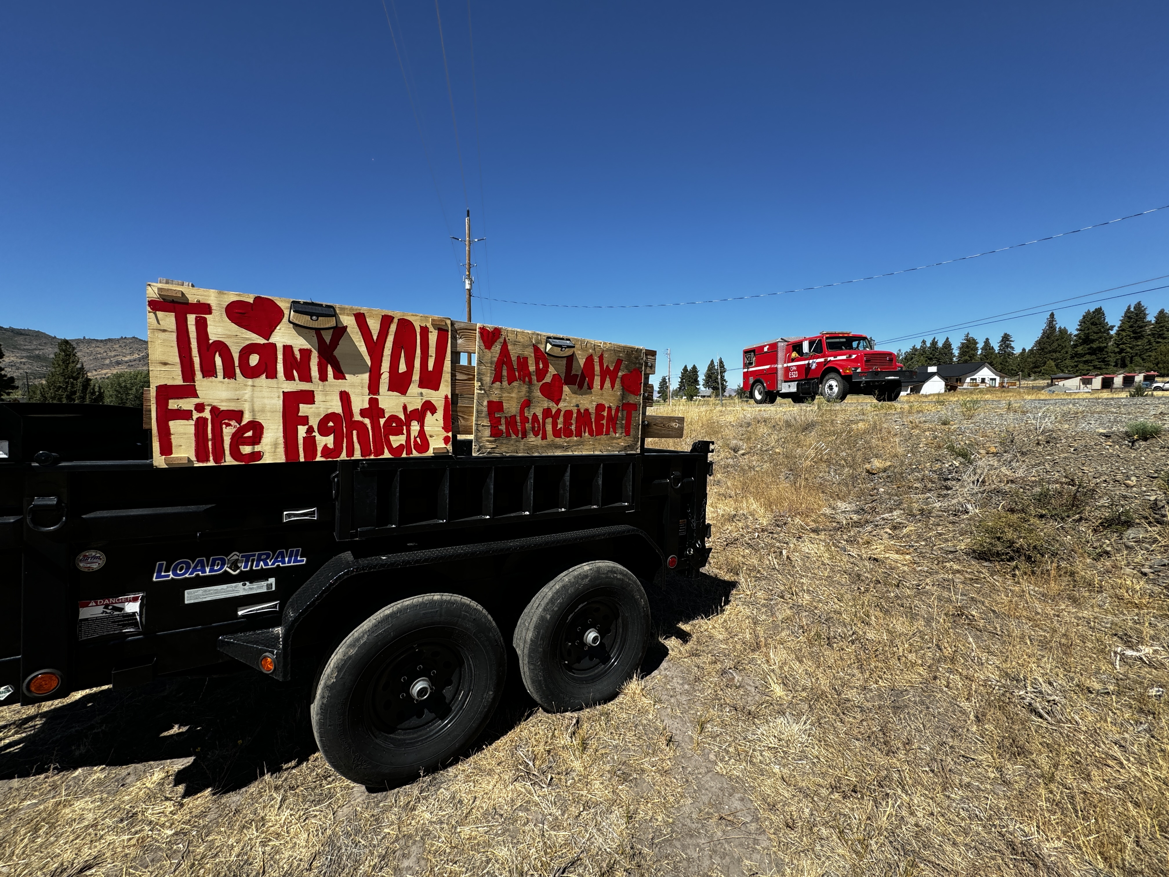
Bear Fire Final Update 09 13 2024
Related Incident: Bear Fire, Tahoe National Forest
Publication Type: News
Location: South of Sierra Brooks off Bear Valley Rd., Tahoe National Forest
Personnel: 233
Start Date: 9/2/2024 @ 2:00 PM
Cause: Undetermined
Size: 3,323 acres
Percent contained: 83%
***This will be the final written update for the Bear Fire, unless significant activity occurs***
Thanks to the work of fire crews, the Bear Fire has continued to stay within its footprint. Patrol and repair will continue through the weekend as crews prepare for an incoming cold front. Repair activities include mitigating long-term environmental impacts and facilitating the restoration of the affected landscape. Repair operations include chipping and road repair in areas damaged by suppression efforts.
A Burned Area Emergency Recovery (BAER) Team will begin work on the impacted area starting Saturday. The team is comprised of experts – including hydrologists, soil scientists, road engineers and archeologists – who will be monitoring soil burn severity and developing rehabilitation plans for the Bear Fire area.
This will be the final written incident update unless significant incident activity warrants otherwise. Incident information, including containment progression, will continue to be updated on the official incident information platform Inciweb: inciweb.wildfire.gov/incident-information/catnf-bear-fire-tahoe-national-forest.
WEATHER:
Temperatures will warm back to around season averages on Friday with mid-70s to near 80 degrees for lower valleys. Light afternoon breezes will prevail on Friday afternoon with West-Northwest winds around 8-12 mph. Typical southwest breezes will return on Saturday before another cold front provides gusty southwest winds of 25-35 mph on Sunday afternoon followed by a5 0-60 percent chance of showers late Sunday night into Monday.
EVACUATIONS:
Sierra County: Evacuation order and warnings remain in effect. For an interactive map of evacuations, visit: https://protect.genasys.com/search.
FOREST CLOSURE:
An updated forest closure has been issued. For more information visit the Tahoe National Forest website at: https://www.fs.usda.gov/alerts/tahoe/alerts-notices.
Map has not changed since 09/11/2024
Friday September 13 2024 RailroadDaly Fire Update and Map 09 13 2024
Related Incident:
Publication Type: News
Current Status
Minimal fire activity is present, following yesterday’s storm and today’s continued rainfall on the Railroad and Daly Fires. Ground conditions remain wet, limiting active fire spread. Today, crews will continue tree removal for hazard mitigation along Skalkaho Highway (Highway 38) and maintain structure protection equipment near Gem Mountain, Stony Creek, Rock Creek Road, and north of Hwy 38.
Weather and Fire Behavior
Rain will come to an end gradually with a few lingering showers. Cloud cover is expected to decrease throughout the day, becoming partly cloudy. Another storm front is expected to arrive Monday into Tuesday, bringing additional rain and thunderstorms. Westerly winds of 8-12 mph could gust up to 25 mph at times, especially along ridgetops and west-facing slopes. Temperatures are forecasted to range from the mid-50s to mid-60s with fog expected in the valleys during the early morning hours and relative humidity around 60 percent. Fire behavior remains limited to creeping and smoldering, though more smoke may be visible in the coming days.
EVACUATIONS, RESTRICTIONS, CLOSURES
The Skalkaho Highway (Highway 38) is closed from Black Bear Campground to Skalkaho Pass on the Beaverhead-Deerlodge National Forest side. Gird Point Lookout is also closed. The Anaconda-Pintler Wilderness in the Bitterroot National Forest is currently in Stage I Fire restrictions.
Bridge Fire Morning Update 09 13 2024
Related Incident: Bridge Fire
Publication Type: News
Unified Command: CIIMT5, Los Angeles County Fire, Los Angeles County Sheriff, San Bernardino County Fire, San Bernardino County Sheriff, CAL FIRE – San Bernardino/Inyo/Mono Unit
Start Date: September 8, 2024, at 2:12 p.m.
Incident Website:
inciweb.wildfire.gov/incident-information/caanf-bridge-fire
Fire Information: (626) 470-1404 ***new number***
Media Line: (626) 470-1395
Hours: 7:00 a.m. to 9:00 p.m.
Email: 2024.Bridge@firenet.gov
Fire Size: 51,884 acres
Percent Contained: 3%
Personnel: 2,104
Injuries: 0
Cause: Under investigation
Location: Sheep Mountain Wilderness, San Gabriel Mountains National Monument
CURRENT SITUATION: Due to excellent work by firefighters and moderating weather, containment has now been confirmed at 3% in the southwestern flank on the Bridge Fire with minimal growth in acreage.
The north flank of the fire is the number one priority in halting acreage growth, as well as continuing structure protection in Piñon Hills, Wrightwood, and Mount Baldy Village. On the northeast flank, the top priority is to keep the fire out of Lytle Creek. With a total of 15 helicopters assigned to this incident including four from the National Guard, aviation crews plan to focus on dropping water and fire retardant heavily in the northwest flank where the fire is currently the most active.
With the extremely steep terrain and lower humidities remaining in the higher elevations, firefighters will prioritize direct attack tactics to stop the rollout of burning vegetation causing spot fires below. Aircraft will be concentrating on dropping water and fire retardant on the northwest flank. Due to the rugged and steep terrain on the western flank of the fire, aircraft will continue monitoring for any heat signatures where ground crews cannot be inserted.
With the help of the marine layer increasing humidity in the lower elevations and favorable onshore winds, firefighters are making great progress in strengthening both primary and secondary containment lines in the southeast, south, and southwest flanks of the fire, while also gaining depth in their mop up operations.
Evacuation Orders:
- Mt. Baldy Road, North Mountain Avenue and Shinn Roads from San Antonio heights to Wrightwood and east to Cucamonga Peak
- Hwy 138 south to Lone Pine Canyon and Highway 2 east to Lone Pine Canyon Road.
- Piñon Hills from Wrightwood north to Highway 18 and Beekley Road west to LA County.
- Lone Pine Canyon from the community of Wrightwood to Highway 138/Lone Pine Canyon Road south to the forest.
- Entire community of Wrightwood.
- East Fork communities of Camp Williams Resort (café, mobile home park, campground) and River Community (near the resort).
Evacuation Warnings:
- The area of Phelan from Hwy 138 east to Baldy Mesa Road and Phelan Road south to Sayle Road.
- San Antonio Heights and Upland from the foothills south to 23rd Street.
- Piñon Hills from Wrightwood north to Highway 138 and Lebec Road west to Los Angeles County.
“Know Your Zone” by visiting the Genasys Protect website or download the app. protect.genasys.com
Evacuation Centers:
- San Bernardino County Fairgrounds: 14800 Seventh Street, Victorville, CA 92392
- Jessie Turner Health and Fitness Community Center: 15556 Summit Ave, Fontana, CA 92336. Call (909) 854-5100
- Pomona Fairplex: 601 W McKinley Avenue Pomona, CA 91768 (Enter Gate 3, corner of McKinley and White)
- Animals:
- Devore Animal Shelter: 19777 Shelter Way, San Bernardino, CA 92407. Call (909) 386-9820, or after hours: (800) 472-5609
- Palmdale Animal Care Center (Small Animals): 38550 Sierra Hwy, Palmdale, CA 93550
- Lancaster Animal Care Center (Small Animals): 5210 W Ave I, Lancaster, CA 93536
- Antelope Valley Fairgrounds (Large Animals): 2551 W Avenue H, Lancaster, CA 93536. Call 562-706-8581 prior to arrival.
For more information on shelters, visit:
- www.redcross.org/get-help/disaster-relief-and-recovery-services/find-an-open-shelter.html
- https://lacounty.gov/emergency/
- If not already registered for emergency alerts, please register for them here:
CLOSURES:
- SR-138 from Lone Pine Canyon Road to Beekley Road
- SR-2 closed from Big Pines to SR-138
- Big Pines Highway
- Big Rock Creek Road
- San Gabriel Canyon and East Fork of the San Gabriel River
- Highway 39
- East Fork Road
- Glendora Ridge Road
- Glendora Mountain Road
- Mt. Baldy Road at Shinn Road intersection
WEATHER:
Coastal marine influence and favorable onshore winds will aid firefighters in direct attack as fire backs downhill for most of the west half of the fire’s perimeter. However, at the higher elevations humidity will still be low and the desert areas will not have much humidity recovery. Overall, air masses are becoming more stable which will moderate fire behavior. For information on smoke impacts and an interactive map, visit fire.airnow.gov.
PUBLIC MEETING ON SATURDAY, SEPT. 14
The Incident Management Team is in the process of setting up a public meeting on Saturday, Sept. 14, starting at 6:00 p.m. The meeting will be live streamed. The goal is to have an in-person location for the meeting, if possible, hopefully in/near the Phelan area.
Huckleberry Ridge Fire Update 09 12 2024
Related Incident:
Publication Type: News
Huckleberry Ridge Fire
Daily Update
September 12, 2024
Reported: September 4th at 3:45 p.m. | Size: 301 | Cause: Under investigation
Total Personnel: 349| Engines/Tenders:24 | Hand Crews: 12
The Huckleberry Ridge Fire continues to burn in the timberlands South of Pe Ell. The fire is eight miles from the nearest structure and eleven miles from the nearest community. No Infrastructure are at risk at this time. The cooler and wetter weather conditions have greatly assisted the suppression efforts. Crew have made significant progress in the containment of the fire over the past 24 hours. There is still area of heat in and near the fire’s edge and these areas are being sought after and extinguished in order to fully secure the fire’s perimeter. Steep slopes and loose footing continue to hamper the suppression efforts, but firefighters are maintaining the physical effort needed to fully suppress the fire.
Update: Containment is shown at 52% today and will slowly be increasing as the days go on while mop-up is done along containment lines. Secure and mop up existing control lines is the focus. We are still constructing fire line in approximately 48% of the fire’s perimeter and initiating rehab efforts in areas that are fully extinguished.
Safety: The steep terrain, brushy slopes and loose footing is a major focus to prevent injuries to the firefighters. There have been very injuries and only minor suffering has resulted from the ones that have occurred. Hunting Season continues so please be aware there are both firefighters and hunters in the woods right now. Use cation and stay vigilant. For anyone hunting, please stay out of the fire area and be aware there is substantial firefighting activity in the area with a lot of vehicle traffic.
Evacuations/Closures: There are no anticipated evacuations or road closures in the future for this fire with the exception on the roads immediately adjacent to the burned area. We continue to ask that the community stay out of the area of the fire until fire bosses have reopened the roads to the burned area.
Weather: While the bulk of the rain has ended, showers do linger through Thursday morning. A lift from the Coast Range will increase those probabilities through 1200 Thursday night. Dry conditions with onshore flow from Thursday into Friday will occur over the fire area. An inversion forms around 0100 Friday at 1800 ft above sea level and lifts around 1000 and this may increase some fire activity.
Air Space Restrictions: We continue to have a Temporary Flight Restrictions (TFR) is in place over the fire. If you fly, We can’t.
West Mountain Fires Daily Update September 13 2024 09 13 2024
Related Incident: Dollar Fire
Publication Type: News
Snag,11 miles E of Cascade, 33,244 acres, 15% contained, https://tinyurl.com/4k9dk3mu
Dollar, 18 NE of Cascade, 4,359 acres, 8% contained, https://tinyurl.com/bef6r3tz
Goat, 11 miles SE of Cascade, 25,648 acres, 0% contained https://tinyurl.com/2h4a3dvr
Cause: Lightning (All Fires)
Personnel: 489
EVACUATIONS: Please check Valley County Sheriff’s Office Facebook or call dispatch at 208-382-5160.
Weather and Fire Behavior:
Yesterday, 1/2 to 9/10 of an inch of precipitation fell over the fire area, continuing to subdue fire behavior. A warmer trend begins today, with temperatures from the mid 40s in higher elevations to the mid 60s in lower elevations. Winds should be light with gusts to 10 mph. The warming and drying trend continues over the weekend, with rain returning Monday to Tuesday. Up to 1.5 inches is possible. As for fire behavior, only smoldering is expected today, with very little likelihood for fire growth.
Dollar Fire:
- The Dollar Fire remains unstaffed and in monitor status. Conditions allowing, a recon flight will be flown today to assess the status of the northern edge of the fire. No significant growth is expected.
Snag Fire:
- Firefighters are monitoring the spot on the northeast corner of the fire.
- Crews are mopping up and securing the Warm Lake Rd. and managing some continued rock rollout on the road. Firefighters are also beginning to “backhaul” (remove unneeded equipment) in this area.
- Yesterday, near the southern tip of the Snag Fire, off the 409 Rd, crews were able to burn some hazardous fuels reduction piles. Fire personnel and Army crews from the 14th Brigade Engineer Battalion based at Joint Base Lewis McChord worked together to accomplish these pile burning tasks.
- On the southwest side of the Snag, fire managers are scouting for more areas to improve roads and build indirect line around the Horsethief area.
- On the east side, firefighters continue with preparing structures in the Fish Hatchery and Warm Lake areas.
- Masticators are removing fuels along Bear Creek, Lodgepole Creek, and Rice Creek, and crews are scouting for options for more indirect fireline to the east of the Snag Fire.
Goat Fire:
- Crews are continuing to scout for both indirect and direct line options to limit both northwestern and southernly spread of the Goat fire. Firefighters are assessing whether it is possible to construct direct fireline along the northwest edge of the fire, south of the 409 Road.
- Firefighters are widening the 409 road to make this a larger fuel break.
- A structure protection group remains in the Horsethief Reservoir preparing structures and plumbing the area.
Operational Video for the Chimney Fire 09 13 2024
Related Incident: Chimney Fire
Publication Type: News
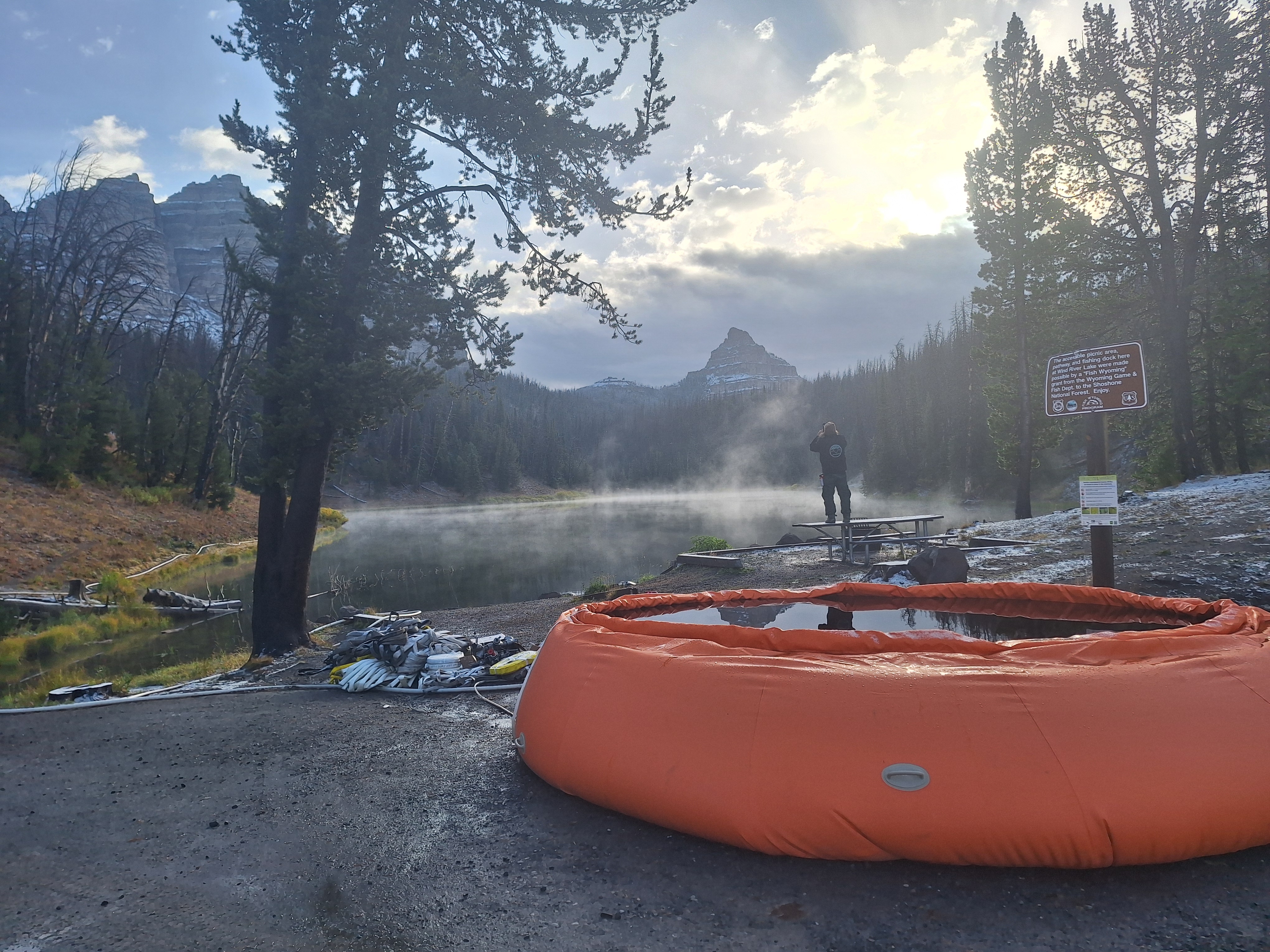
Fish Creek Fire Update Friday 09 13 2024
Related Incident:
Publication Type: News
Northern Rockies Team 2, Incident Commander Scott Schuster
Location: 7 miles SW of Togwotee Pass
Start Date: Friday, August 16, 2024
Cause: Lightning
Size: 24,904
Percent complete: 69%
Resources: 437 Total Personnel: 9 Hand Crews; 16 Engines; 17 Heavy Equipment; 2 Helicopters
KEY MESSAGES:
Precipitation and a few thunderstorms moved across the region yesterday, bringing light rain and snow across the fire zone. Precipitation will diminish, but minimal fire activity is expected again today. Heavy fuels will continue to creep and smolder with occasional single tree torching. Spotting is unlikely with high ground fuel moisture. Smoke will continue to impact the Highway 26/287 corridor and the immediate area around the fire. Roadway visibility may be impacted by the smoke from the fire; please slow down and use caution when driving Highway 26/287.
Fremont County has decreased the “GO – Level 3” Evacuation Order to the “SET – Level 2” Notice for the Brooks Lake, Pinnacle, and Breccia areas. These areas are still within Forest Closures, so access to Brooks Lake, Pinnacle, and Breccia areas will be reevaluated next week. Residents are advised to monitor the situation, as there is still the possibility evacuations may once again be ordered if conditions worsen.
CURRENT STATUS:
Fire monitoring continues for any potential threats to Highway 26 and other critical values. Fuels reduction work is progressing along Deception Road from Highway 26 to Brooks Lake Lodge campground. The moderated weather and minimal fire behavior has allowed resources to begin work on a shaded fuel-break along a 2-mile stretch of the Upper Flagstaff Road. This work includes clearing the understory vegetation and smaller trees for 50’ to 100’ on each side of the road. Firewise fuels mitigation actions are taking place around the Togwotee Lodge to ensure improved defensible space for values at risk from the Fish Creek Fire or future wildfires.
WEATHER AND FIRE BEHAVIOR:
Chances of precipitation will diminish during the day. Overcast, cool and moist conditions are expected for the next few days. A slight drying and warming trend is expected beginning Sunday. The moderating weather conditions will reduce active fire behavior, however heavy fuels will continue to creep and smolder with occasional single tree torching. High ground fuel moisture will greatly reduce the chances of spotting.
AIR QUALITY AND SMOKE:
Although air quality has improved, unhealthy air quality is possible in locations, especially in low-lying drainages and along the Highway 26/287 corridor. For up-to-date air quality alerts, current and predicted smoke conditions and ways to mitigate poor air quality, check out the AirNow website at https://www.airnow.gov/.
CLOSURES AND EVACUATIONS:
The joint Closure Order issued by both the Bridger-Teton and Shoshone National Forests for the fire area, remains in effect. Please do not enter the closure area or use any Forest Roads that are closed. For specific details regarding this closure, please reference the Fish Creek Area, Roads, and Trails Closure Order (map) and the Forest website at https://www.fs.usda.gov/alerts/btnf/alerts-notices.
Under the jurisdiction of Fremont County, the areas of Brooks Lake, Pinnacle Drive and Breccia Drive have decreased to Level 2 “Set” Notice (indicated by yellow blocks on the PIO Incident Map). A Level 2 “Set” Notice means residents should be ready to evacuate at a moment’s notice. If the Level 2 Set notice changes back to a Level 3 “Go” notice, residents must evacuate until advised otherwise by Fremont County. See the alert notice on the Fremont County Fire Protection District Facebook page.
The Teton County Division of Emergency Management utilizes a Ready, Set, Go system for evacuation messaging, visit their website for additional details at www.tetoncountywy.gov/1846/Ready-Set-GO. (Indicated by green blocks on the PIO Incident Map.) They advise all residents to be in a “Ready” status by preparing for evacuations and becoming fire adapted. All residents are encouraged to sign up for Teton County, Wyoming's free alert and warning service, Teton_WY Alerts at: Teton_WY Alerts - Sign Up (everbridge.net).
US HWY 26/287 is open for free-flowing traffic. Motorists may still experience smoke and sometimes limited visibility. A 45-mph speed restriction remains in effect for the fire area. Motorists are encouraged to stay alert for fire personnel and fire vehicles and use caution when travelling through the area. The Wyoming Department of Transportation (WYDOT) continues to work closely with Fremont County Emergency Management, Fremont County Sheriff’s Office and fire officials for the safety of motorists and firefighters. Drivers are encouraged to visit https://www.wyoroad.info/ prior to traveling on US HWY 26/287 for road status and information, or download the Wyoming 511 app at https://www.wyoroad.info/511/WY511Mobile.html to monitor for any changes due to fire activity.
Central Idaho Smoke Outlook 09 13 2024
Related Incident:
Publication Type: News
AIR QUALITY ADVISORIES in effect. See Idaho DEQ for current status.
Fire
Fire spread potential has diminished thanks to the rain. With warming and drying conditions, expect a little more smoldering each day through Sunday. Any air quality impacts will be limited to the communities closest to large fires: Stanley, Garden Valley, and Lowman.
Smoke
Widespread GOOD conditions Friday across the region. The weekend will see a warming trend with dry, sunny weather, which will cause increased smoldering locally and regionally. Air quality may slowly become worse, with hazy skies likely on Sunday, especially in the mountains. View interactive smoke outlook.
Wapiti Fire Update 09 13 2024
Related Incident:
Publication Type: News
Fire Statistics
- Size: 125,429 acres
- Containment: 13%
- Total Personnel: 1,138
- Location: Grandjean, ID
- Reported: July 24, 2024
- Cause: Lightning
More Information
- Information Phone: 208-593-7132
- Email: 2024.wapiti@firenet.gov
- InciWeb: https://inciweb.wildfire.gov/incident-information/idbof-wapiti-fire
- Facebook: https://www.facebook.com/wapitifireinfo2024
- Linktree: https://linktr.ee/WapitiFireInfo2024
- Interactive Map: https://tinyurl.com/WapitiFireInfoMap
Special Notes: State Highway 21 remains closed east of Lowman to Stanley from MP84 (Sourdough Lodge) to MP126 (Stanley Lake turnoff) due to wildfire activity and potential hazards caused by rainfall within the burn area. The Idaho Transportation Department is assessing the condition of the highway twice daily and engaging in cleanup and repair as needed, including replacement of guardrails. Highway 75 remains open.
Current Situation: Crews continue to provide protection to values at risk across the incident with a special focus on Lowman for potential fire activity. Resources are engaging directly with the fire in geographical locations where they have a reasonable probability of success. On Thursday, crews focused on reinforcing containment lines and extinguishing hot spots along the fire’s perimeter. Continued cold and damp weather are helping hold existing fire lines. Air operations are expected to resume Friday afternoon once weather conditions improve. Some resources are being reassigned to the Frog Fire.
Incident Managers and Agency Administrators from the Forest Service and Idaho Department of Lands continue to meet daily to evaluate firefighting efforts and incident goals and objectives.
Division KK (Structure Group East) and HH: Some additional containment was achieved above Iron Creek. After today, the structure protection group will shift their focus to suppression repair. Suppression repair is the phase of fire suppression where resources try to repair disturbance caused by efforts during initial and extended attack on the fire. This group will begin to assess areas needing repair on both private and public lands throughout the fire area.
Division DD: The fire continues to hold within the creek drainages and at the rock scree above the tree line in the Sawtooth Wilderness. Reconnaissance flights for hotspots and fire progression will resume when cloud cover lifts and favorable flying conditions return.
Divisions MM and PP: Fire lines are holding around Cape Horn. Crews are actively monitoring fire activity to ensure the fire does not cross Highway 21 to the north and east.
Division WW and Structure Group West: Resources continue to patrol and keep watch around the Warm Spring Guard Station and 8-Mile Ridge for fire progression that could compromise contingency lines. Crews continue to prepare structures and other infrastructure in and around Lowman.
Division VV: Low temperatures and precipitation have contributed to limited fire activity. Fire lines are holding at Chapman Creek.
Weather, Fuels, and Fire Behavior: The wind event Wednesday had limited effect on fire growth. Cold temperatures overnight combined with recent moisture will result in fog and low clouds Friday morning with clearing expected before noon. Expect daytime temperatures in the high 40s to low 60s. Winds will be 20-25mph coming out of the west south-west on the ridgetops. As conditions continue to dry out expect to see an increase in fire behavior ahead of the next round of moisture expected early next week.
Evacuations:
For evacuation information on the Wapiti Fire, please see the Custer County Sheriff’s Facebook page at https://www.facebook.com/p/Custer-County-Sheriff-Idaho-61558947312289 and the Boise County Sheriff’s Facebook page at https://www.facebook.com/boisecountysheriff/.
To sign up for Custer County CodeRED emergency notifications, text CUSTER to 99411 or enroll online at https://public.coderedweb.com/CNE/BF28E45537FF
To sign up for Boise County Alert Sense emergency notification enroll online at: https://public.alertsense.com/SignUp/publicUser.aspx?regionid=1163
Closures and Fire Restrictions:
The Middle Fork Complex Fire Closure Order has been amended to provide consistency with the Wapiti Fire Closure. This amended order, Forest Order #0402-06-64, closes the 582 and 563 roads, as well as the 579 road from its junction with 563 eastward to the junction with Highway 21. More information can be found at: https://www.fs.usda.gov/alerts/boise/alerts-notices
State Highway 21 remains closed from MP84 to MP126 for public and firefighter safety. A Wapiti Fire Area Closure / Forest Order: 0414-04-151 for portions of the Boise, Sawtooth, and Salmon-Challis National Forests can be found at this site: https://www.fs.usda.gov/alerts/sawtooth/alerts-notices
Boise National Forest Stage 1 Fire Restrictions / Forest Order: 0402-00-63 can be found at this site: https://www.fs.usda.gov/alerts/boise/alerts-notices.
Sawtooth National Forest Stage 1 Fire Restrictions / Forest Order 0414-00-044 can be found at this site: https://www.fs.usda.gov/alerts/sawtooth/alerts-notices
Fire restrictions on federal, state, and private lands may be found at this site: https://www.idl.idaho.gov/fire-management/fire-restrictions-finder
Temporary Flight Restriction is in place over the Wapiti Fire. Wildfires are a no-fly zone for unauthorized aircraft, including drones. If you fly, we can’t. For more information, visit http://knowbeforeyoufly.org.