U.S. flag

An official website of the United States government

Here's how you know

Incident Media Maps

Zoom to your location
Reset map zoom and position

Could not determine your location.

Lost Horse Creek Fire

Unit Information

3700 Airport Way 
Fairbanks, 
Alaska 
99709 
3700 Airport Way 
Fairbanks, 
Alaska 
99709 

Incident Contacts

  • Public information
    Phone:
    907-356-5511
    Hours:
    8am - 4pm

Maps Gallery

Image options: [ Full Size ] - [ PDF ]

Image options: [ Full Size ] - [ PDF ]

Image options: [ Full Size ] - [ PDF ]

Image options: [ Full Size ] - [ PDF ]

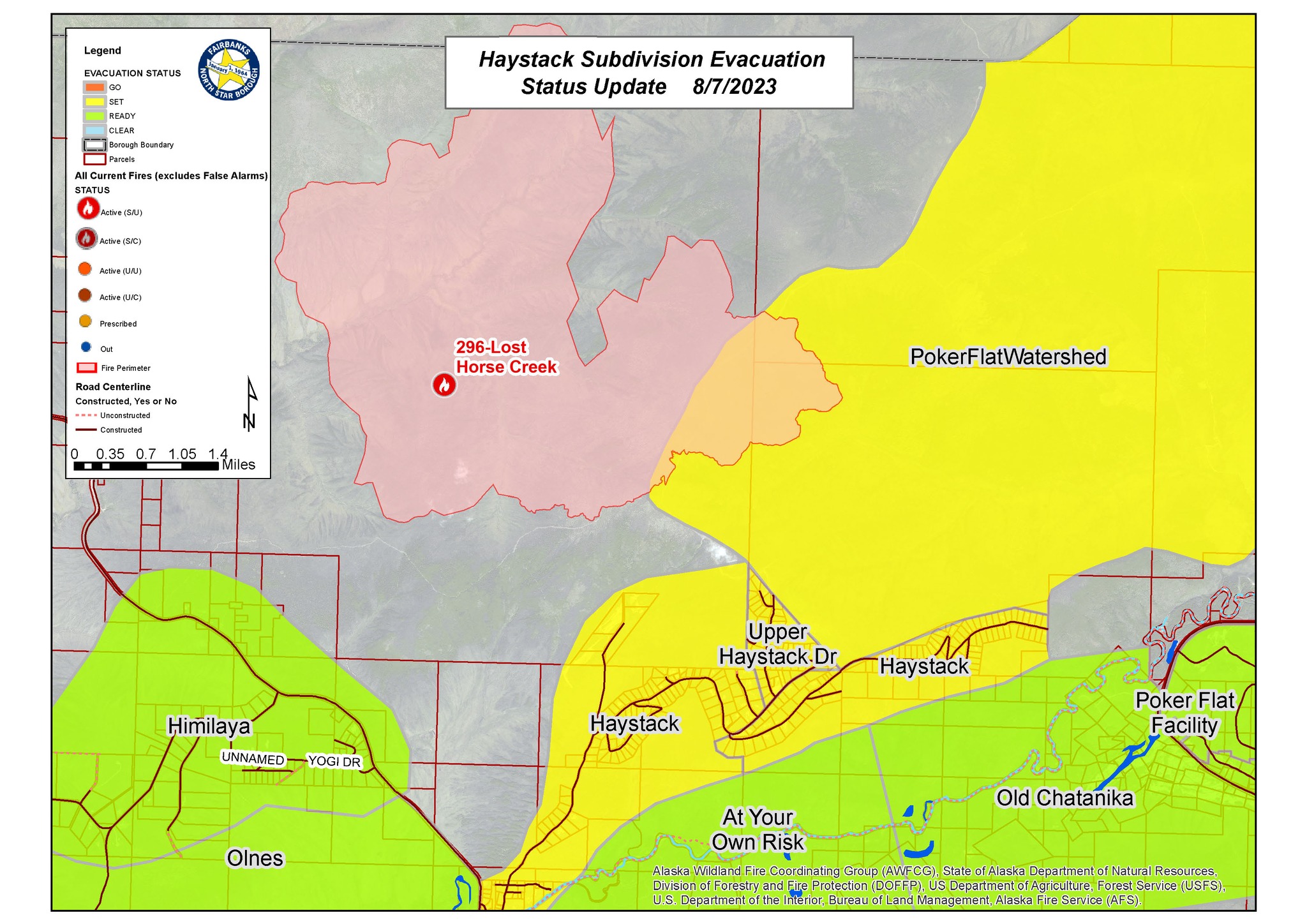
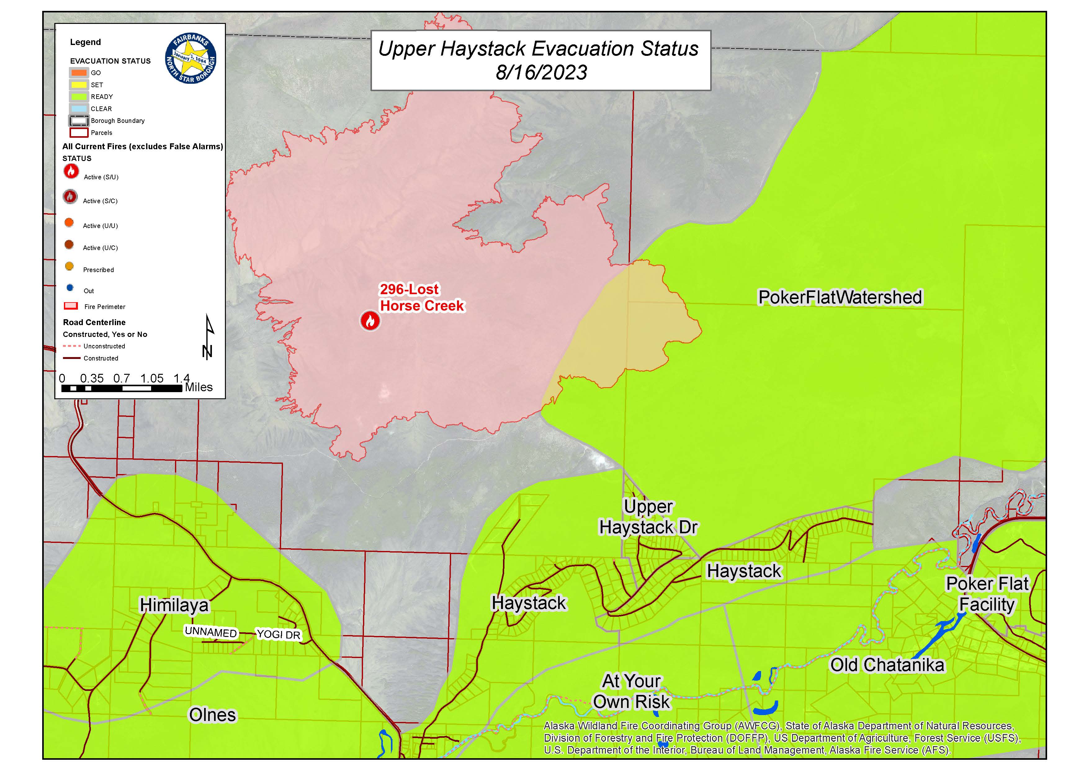
Fairbanks North Star Borough Emergency Alert CHANGE: From Level 2 (SET) to Level 1 (READY) for the following Evacuation Zones: Haystack, Poker Flat Watershed, and Upper Haystack Drive. This includes ALL AREAS withing they Haystack Subdivision.

Image options: [ Full Size ] - [ PDF ]

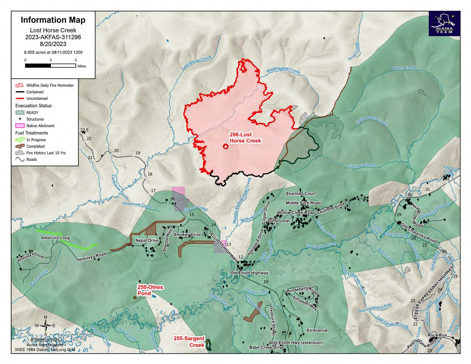
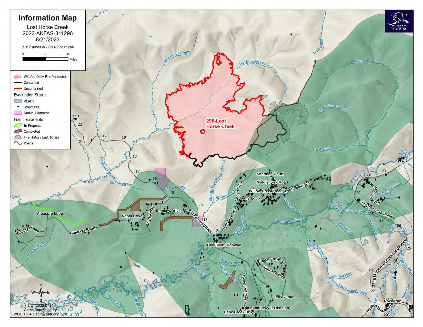
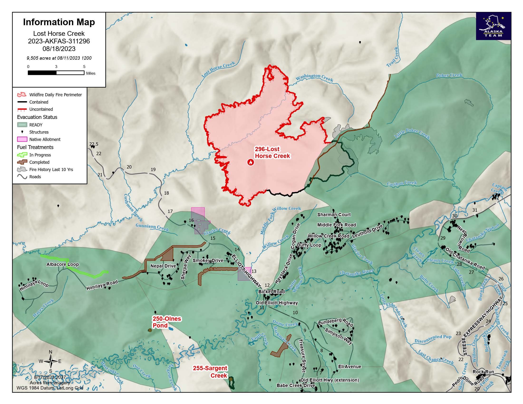
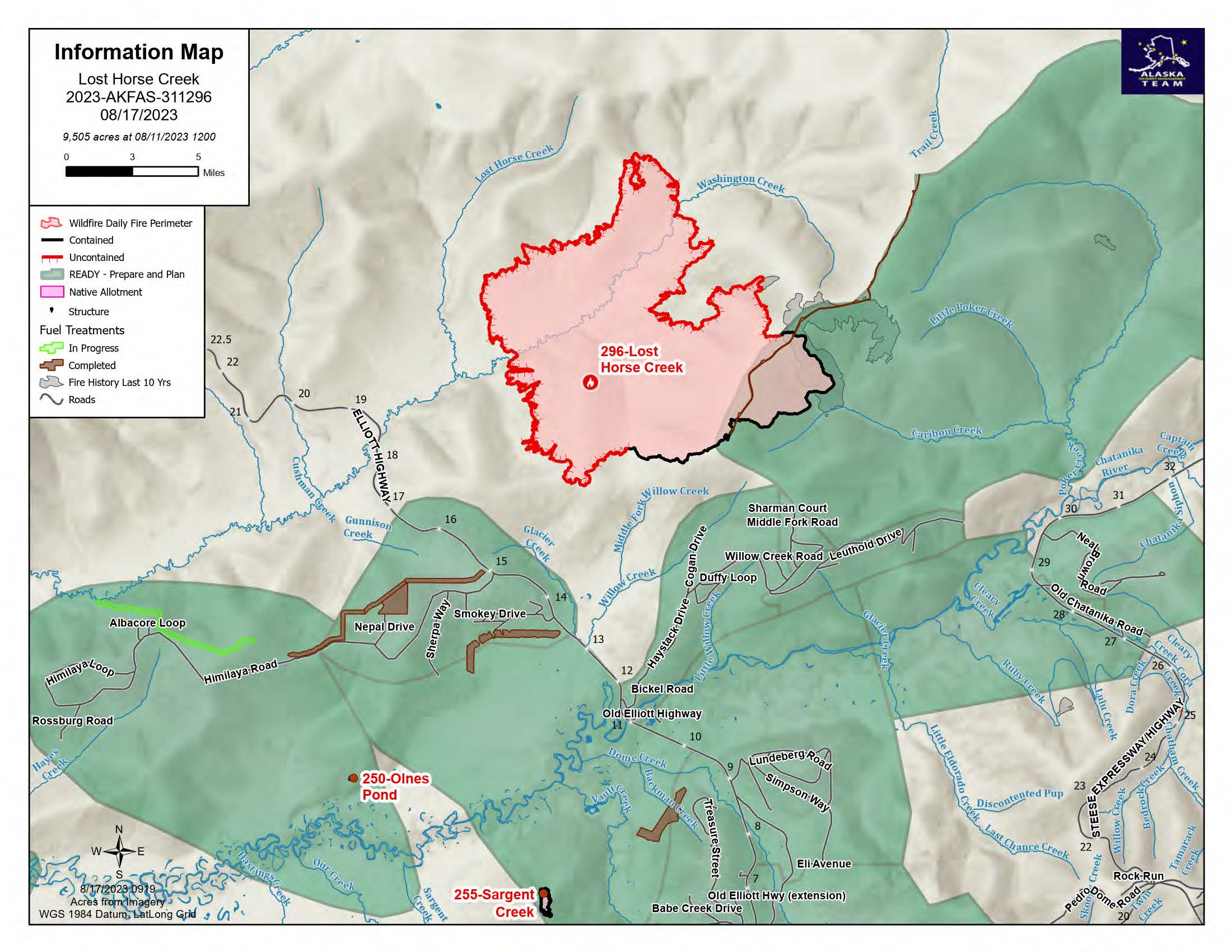
August 17, 2023 map for the Lost Horse Creek Fire shows that the area has all been moved to READY status. 

Image options: [ Full Size ] - [ PDF ]

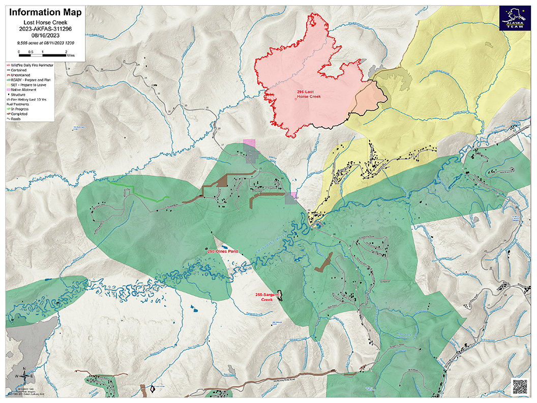
The Lost Horse Creek Fire remains at 9,505 acres, is 16% contained, and has 369 personnel assigned as of Wednesday, August 16, 2023.

Image options: [ Full Size ] - [ PDF ]

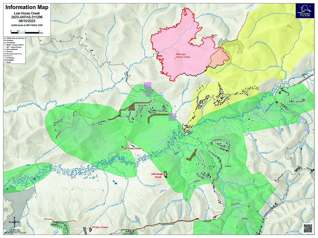
The Lost Horse Creek Fire map for Tuesday, August 15, 2023. The fire remains at 9,505 acres, 12% containment, and has 366 personnel.

Image options: [ Full Size ] - [ PDF ]

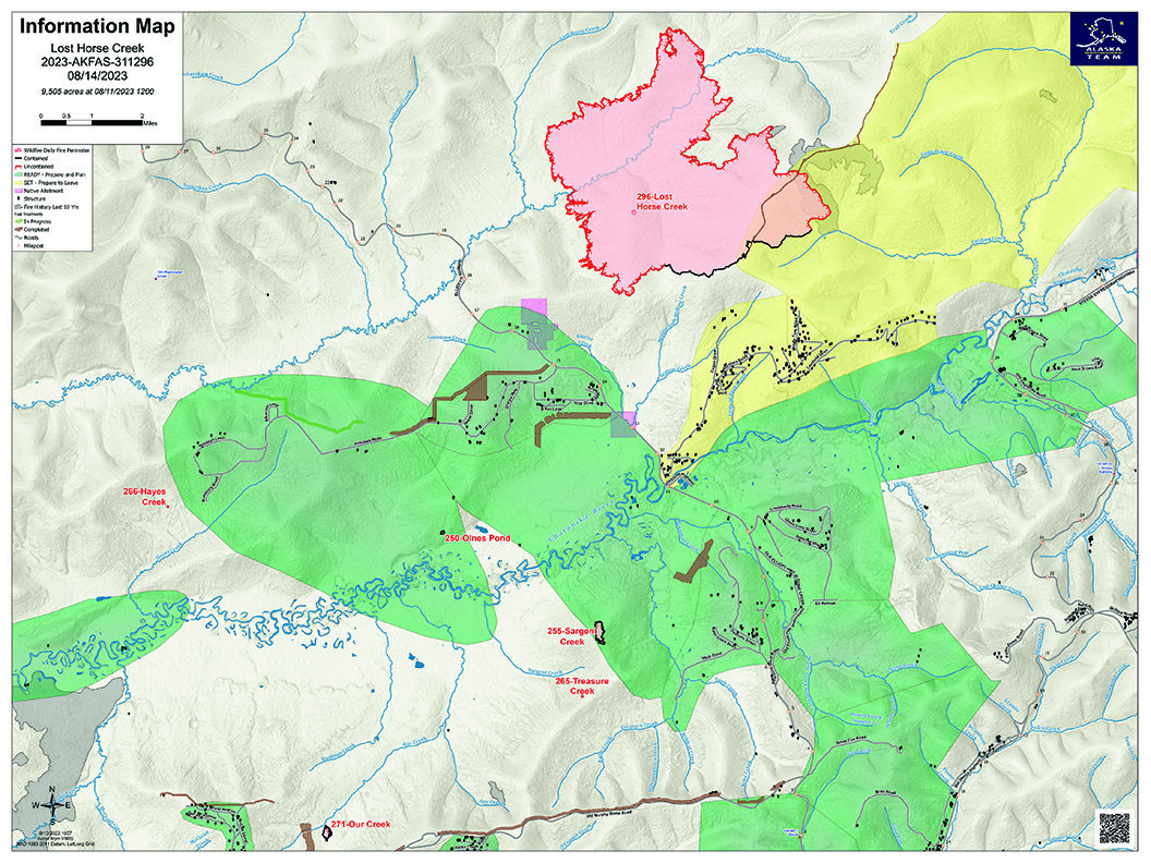
The Lost Horse Creek Fire, August 14, 2023. The fire is now 9,505 acres in size, 12% contained, and 360 personnel.

Image options: [ Full Size ] - [ PDF ]

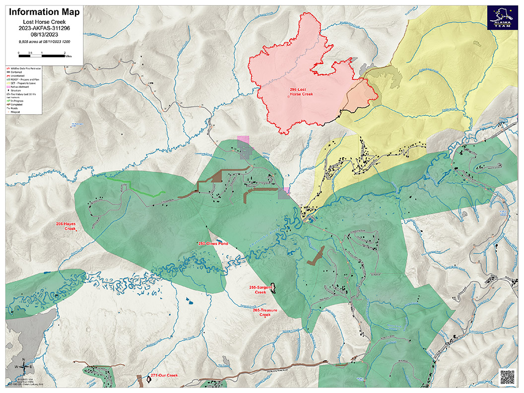
The Lost Horse Creek Fire, August 13, 2023. The fire area is 9,505 acres, 12% contained, with 350 personnel.

Image options: [ Full Size ] - [ PDF ]

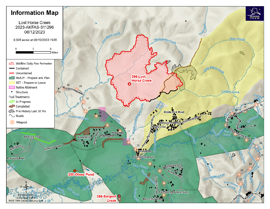
The Lost Horse Creek Fire, Saturday August 12, 2003. The fire is 9,505 acres, there are 316 personnel on the fire, and it is 12% contained.

Image options: [ Full Size ] - [ PDF ]

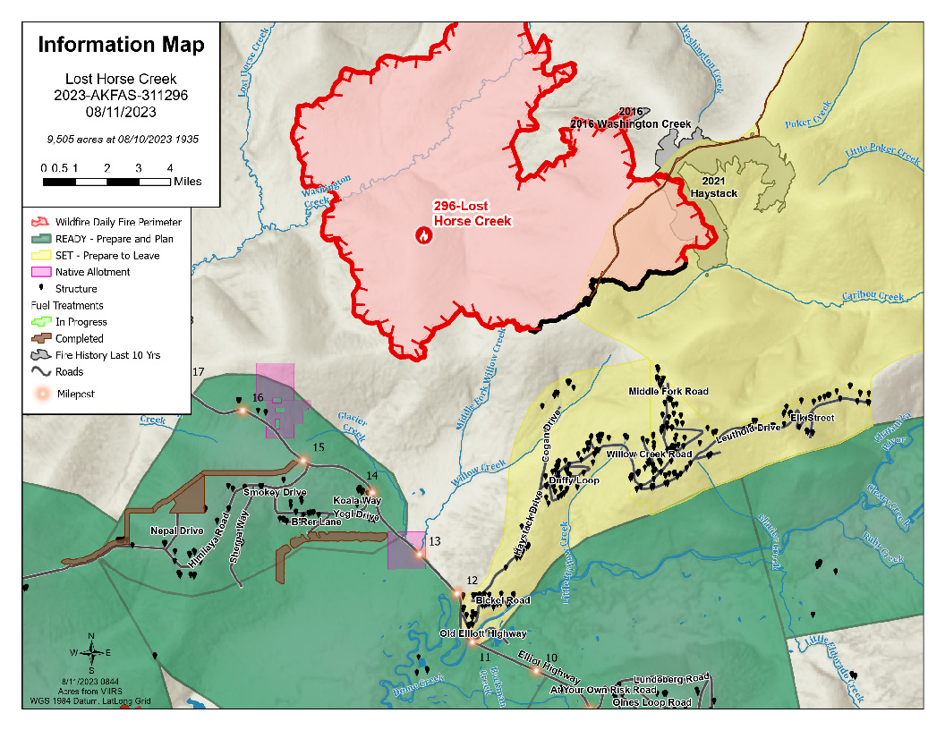
The location and extent of the Lost Horse Creek Fire with evacuation status, August 11, 2023. Eight miles of the fire perimeter are targeted for containment; of that, three miles are contained. The fire size is 9,505 acres with 293 personnel.

Image options: [ Full Size ] -

FNSB EMERGENCY OPERATIONS ANNOUNCEMENT: CHANGE IN EVACUATION LEVEL for UPPER HAYSTACK SUBDIVISION from LEVEL 3 (GO!) TO LEVEL 2 (SET)

This notice is for residents and individuals affected by the Lost Horse Creek Fire #296 in the Upper Haystack Subdivision, including Sharmon Court and Middle Fork Road.

The evacuation level has been changed from Level 3 (Go) to Level 2 (Set), effective TONIGHT AT 8:00 PM AK. This means that residents who evacuated the area may return to their homes this evening.

All other roads in Haystack Subdivision remain at Level 2 (SET).