
Incident Media Maps
Settings - change map background and toggle additional layers
Filter - control incident types displayed on map.
Zoom to your location
Reset map zoom and position
Could not determine your location.
Show Legend
 Wildfire
 Prescribed Fire
 Burned Area
Response
Burned Area
Response Other
Other
Maps Gallery
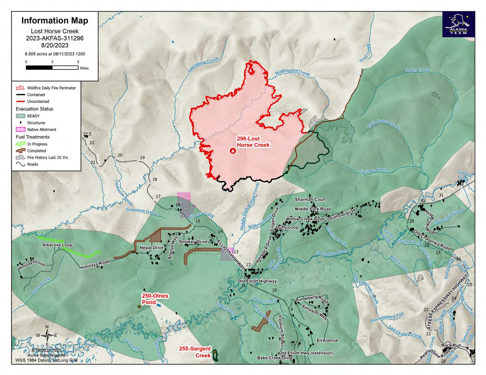
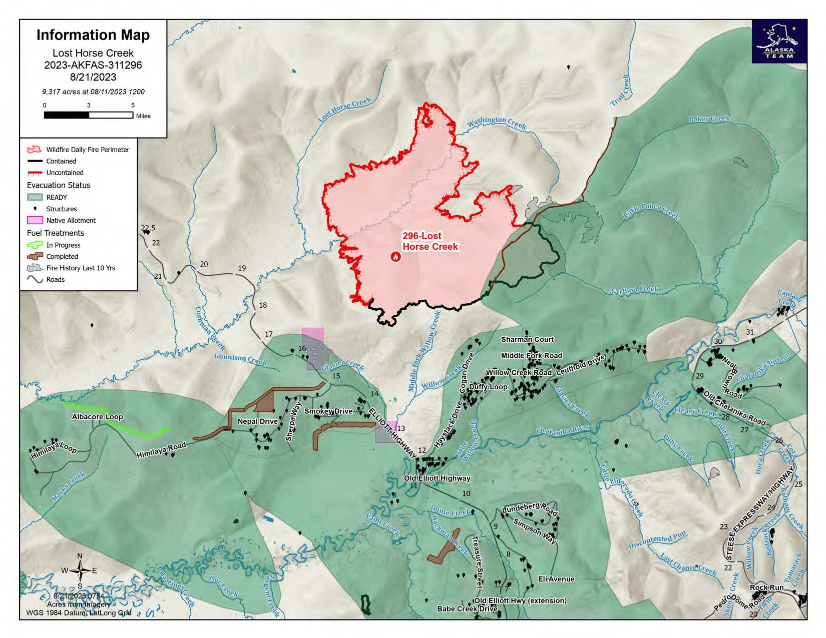

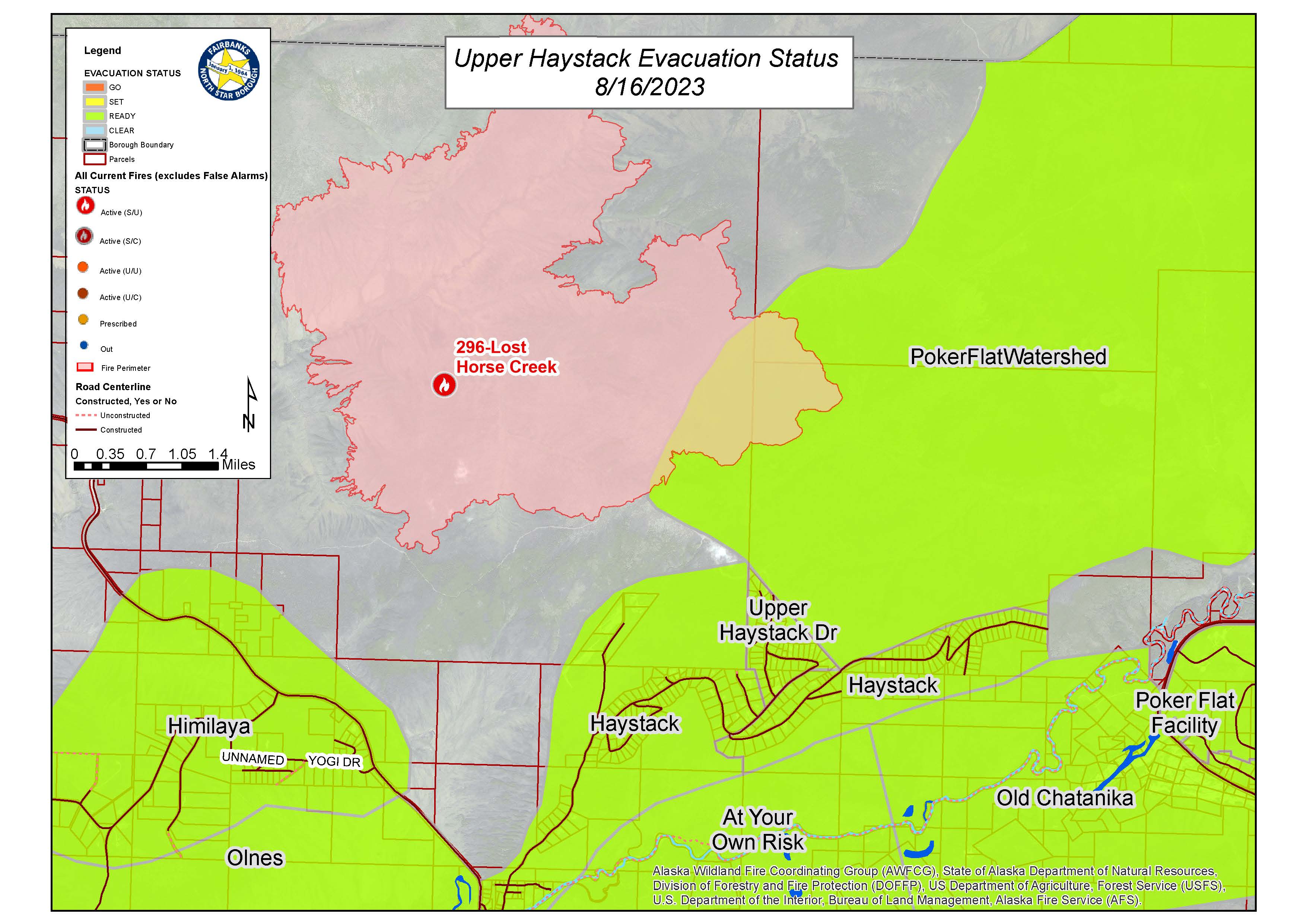
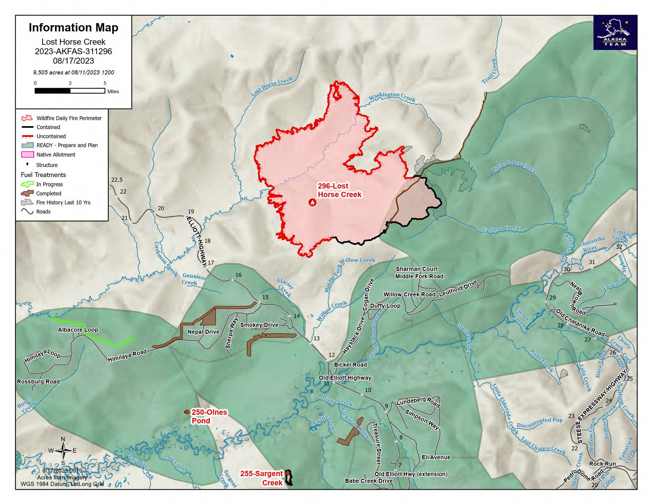
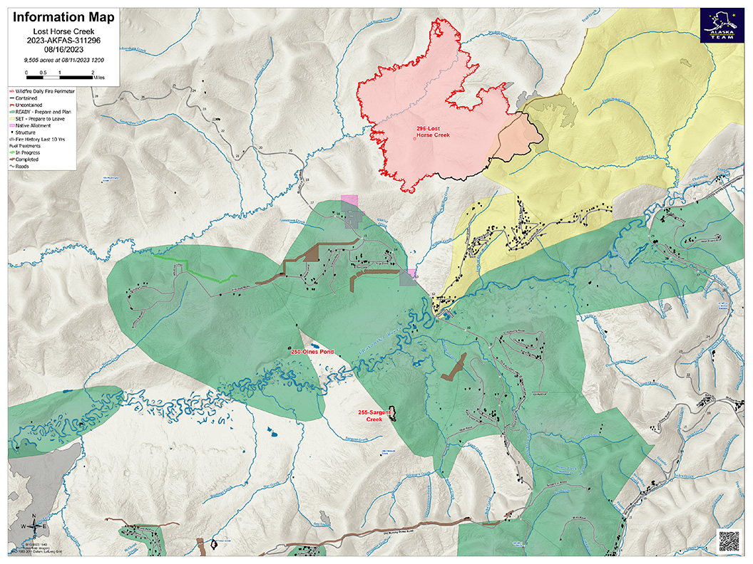
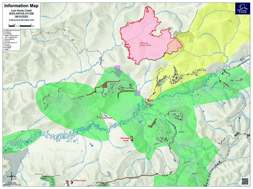
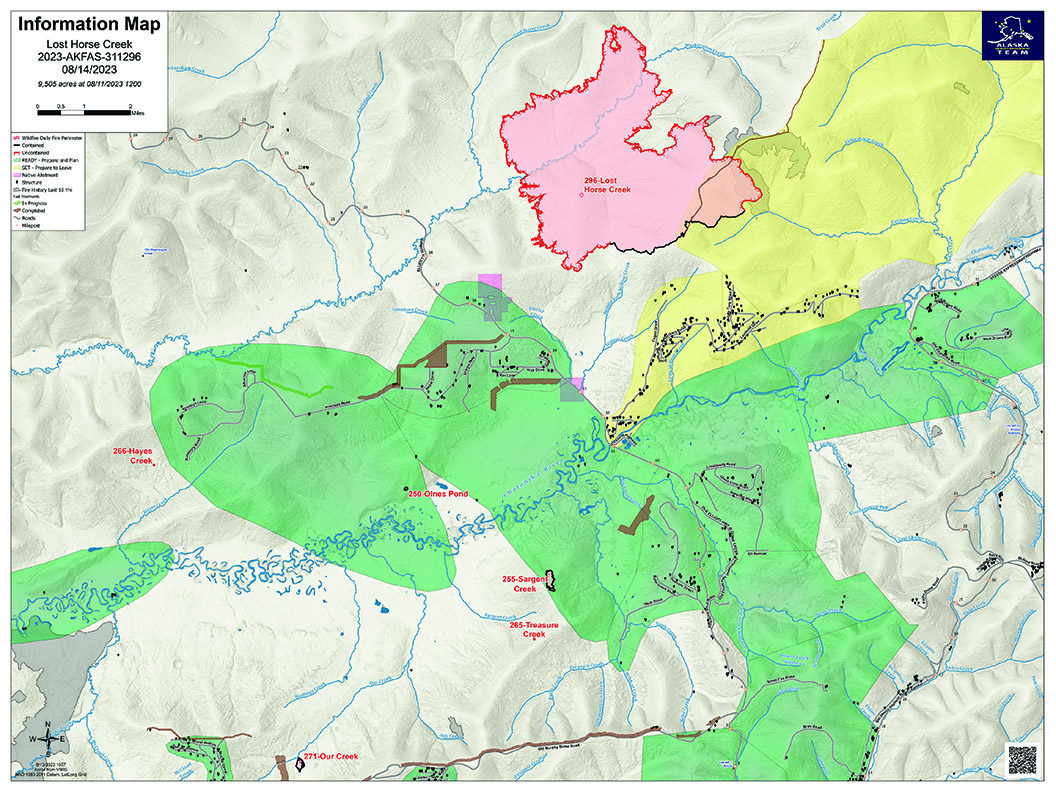
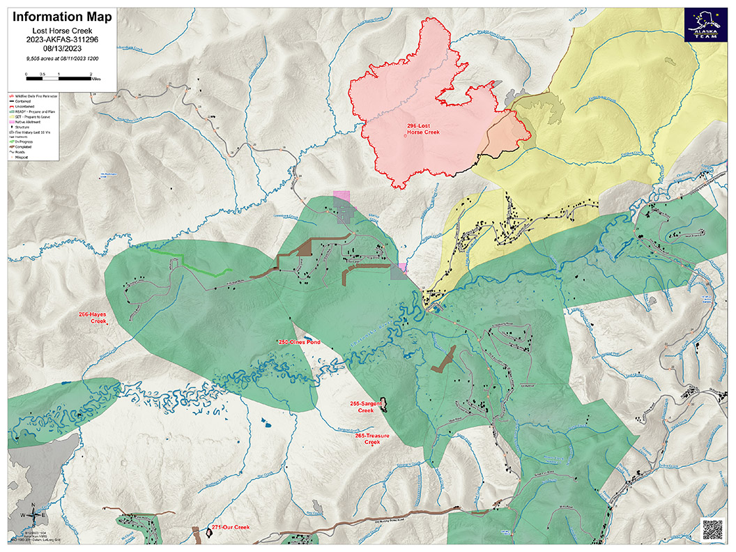
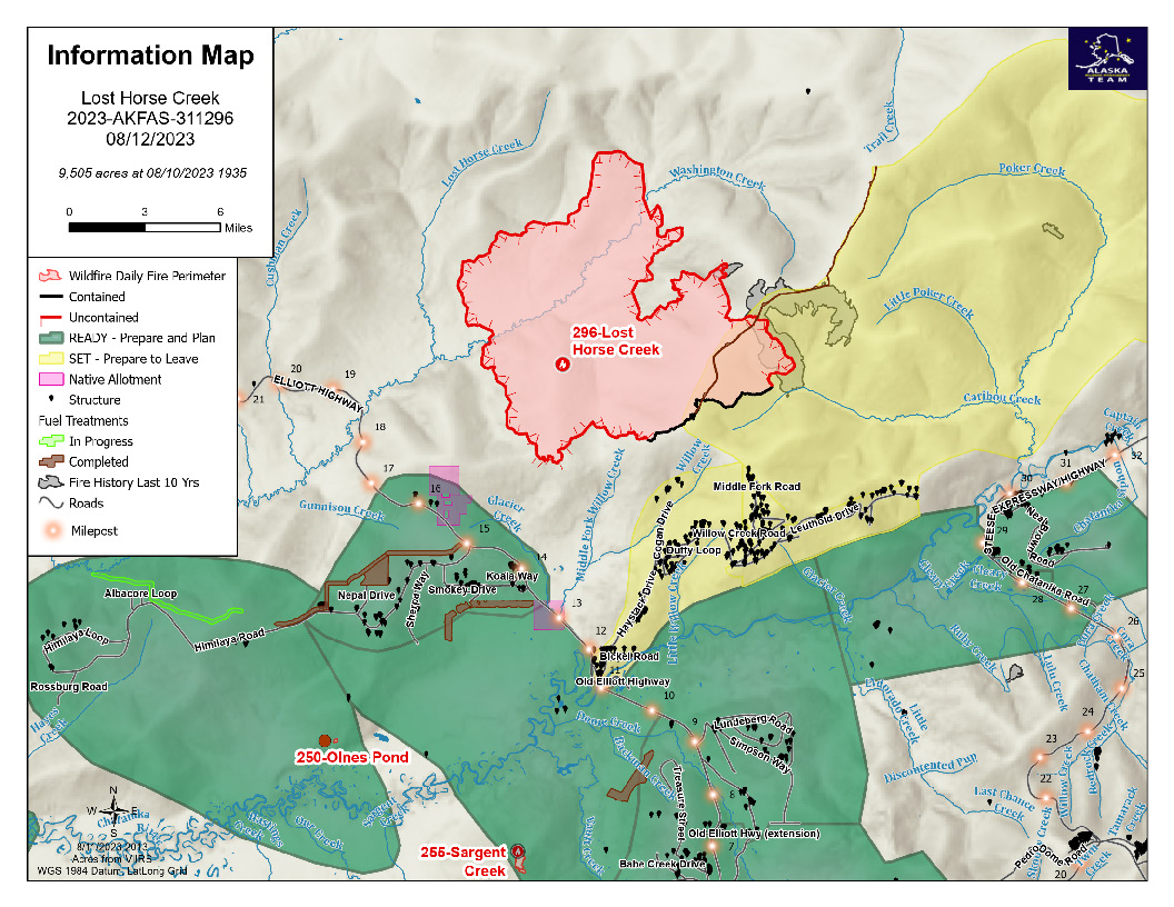
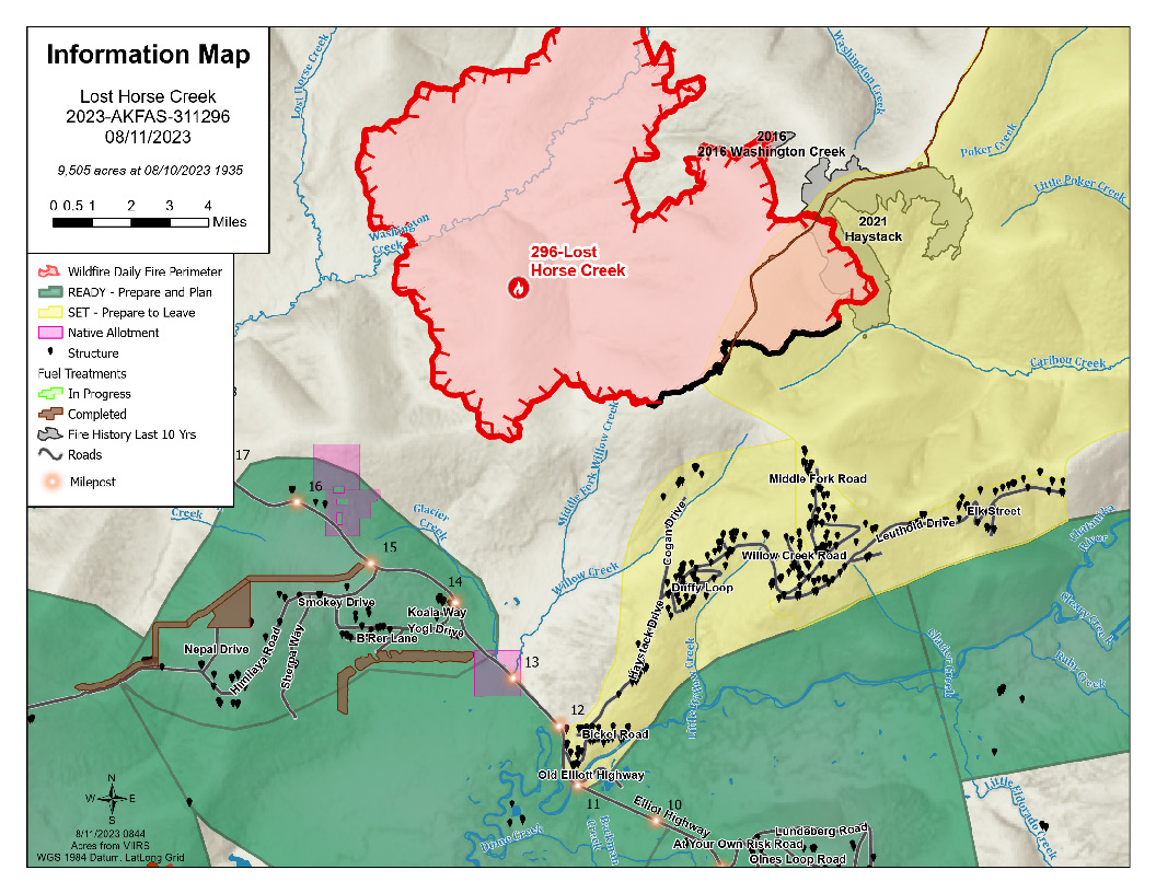
Image options: [ Full Size ] -
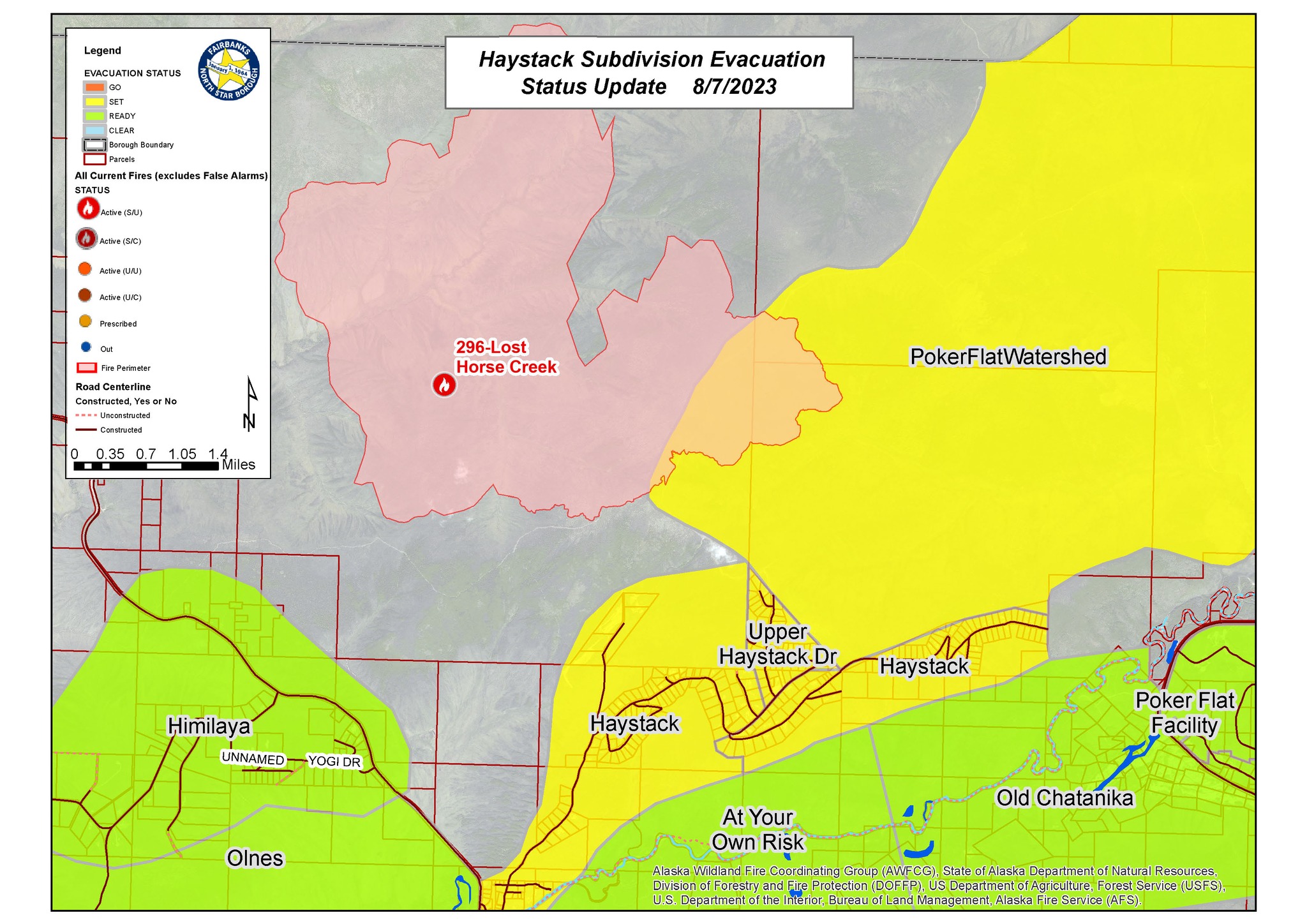
FNSB EMERGENCY OPERATIONS ANNOUNCEMENT: CHANGE IN EVACUATION LEVEL for UPPER HAYSTACK SUBDIVISION from LEVEL 3 (GO!) TO LEVEL 2 (SET)
This notice is for residents and individuals affected by the Lost Horse Creek Fire #296 in the Upper Haystack Subdivision, including Sharmon Court and Middle Fork Road.
The evacuation level has been changed from Level 3 (Go) to Level 2 (Set), effective TONIGHT AT 8:00 PM AK. This means that residents who evacuated the area may return to their homes this evening.
All other roads in Haystack Subdivision remain at Level 2 (SET).