
Spice Lake Fire Fact Sheet for June 23 2023
Related Incident:
Publication Type: Announcement
Spice Lake Fire Fact Sheet
Date: June 23, 2023 3:00PM
Fire Information: 218-248-7240, on inciweb at Mnsuf Spice Lake Fire Information | InciWeb (nwcg.gov) or the Superior National Forest website: www.fs.usda.gov/superior
Incident Name: Spice Lake Fire Size: 22 acres Containment: 100%
Location: Near Spice Lake within the Boundary Waters Canoe Area Wilderness (BWCAW), Superior National Forest, Lake County, Township 65 North, Range 6 West, Section 27
Summary: Late in the afternoon on June 13th, a wildfire was detected between Spice Lake and Ogishkemuncie Lake in the Boundary Waters Canoe Area Wilderness (BWCAW) on the Gunflint Ranger District of the Superior National Forest. Spice Lake is located east of Knife and Kekekabic Lakes and southwest of Seagull Lake, approximately 10 miles west of the Gunflint Trail. Suppression actions were taken by both aircraft and firefighters on the ground from June 14-20, 2023.
Current Status: Fire activity has been minimal, and the containment lines have all remained quiet. The fire has been 100% contained since the morning of June 21. The 9-person fire crew that has been located on site has completed their mop up work and is paddling out from the fire today.
Planned Actions: A 2-person fire crew from the district will travel by canoe to the fire on Monday, June 26 and be on site to monitor the fire condition next week.
Area Closures: The Superior National Forest has implemented Forest Order (09-09-23-04) for a closure area of lakes, portages, and trails near the fire for public safety. Public safety crews are redirecting visitors and posting portages closed. Details can be found at Superior National Forest - Alerts & Notices (usda.gov).
Fire Restrictions: The Superior National Forest has implemented a Forest Order (09-09-23-02) for campfire restrictions due to continued dry conditions and very high wildfire danger. This Order will remain in effect until further notice. See the Superior National Forest website https://www.fs.usda.gov/superior for more information on fire restrictions.
20230623RicoFireUpdate
Related Incident:
Publication Type: News
Rico Fire Update – June 23, 2023
Location: ¼ mile NW of Pinos Altos, NM I Size: 423 acres I Containment: 20% I Personnel: 170
Start Date: June 20, 2023 I Cause: Under investigation I Fuels: Slash, timber and brush
SILVER CITY, NM, June 23, 2023 – Firefighters have achieved 20% containment on the Rico Fire which is now 423 acres and remains within the jurisdiction of the BLM Las Cruces District and NM State lands. Fire behavior has moderated significantly, creeping and backing through small pockets of unburned fuel within the perimeter. As work continues on the containment lines, some areas require extra attention in anticipation of a Red Flag Warning that is expected to materialize later today. “Today’s weather conditions may test the fireline…we recognize the extensive hard work that has been completed over the past several days and we anticipate that the lines will hold,” said Incident Commander Soliz, adding “we will continue to engage the firefighting effort with our primary objective being firefighter and public safety,” he added.
Bear Creek Road is not closed, however is experiencing heavy fire traffic. Travelers on Bear Creek Road are asked to reduce speeds and proceed with caution. The area will be heavily patrolled by Grant County Deputies over the next three days, while firefighting operations are ongoing. Please adhere to this request to help ensure everyone’s safety. Thank you!
Aviation Restrictions: A Temporary Flight Restriction (TFR) remains in place over the Rico Fire. All non-fire aircraft are restricted. This includes civilian drones. Unauthorized aircraft in the area will ground firefighting aircraft, hindering firefighting efforts.
Residual Smoke: expected to settle into the valley, possibly impacting Silver City and surrounding areas. Residents are advised to close their windows. Smoke sensitive individuals who want to learn more should follow recommendations at NMFireInfo Smoke Management
Road Closure Status: NM State Highway 15 between Silver City and Pinos Altos is OPEN.
For more information: visit NMFireInfo or the Inciweb direct link to the Rico Fire
Rico Fire Information: 575-323-1533 8 am to 8 pm or email Loretta_Benavidez@firenet.gov
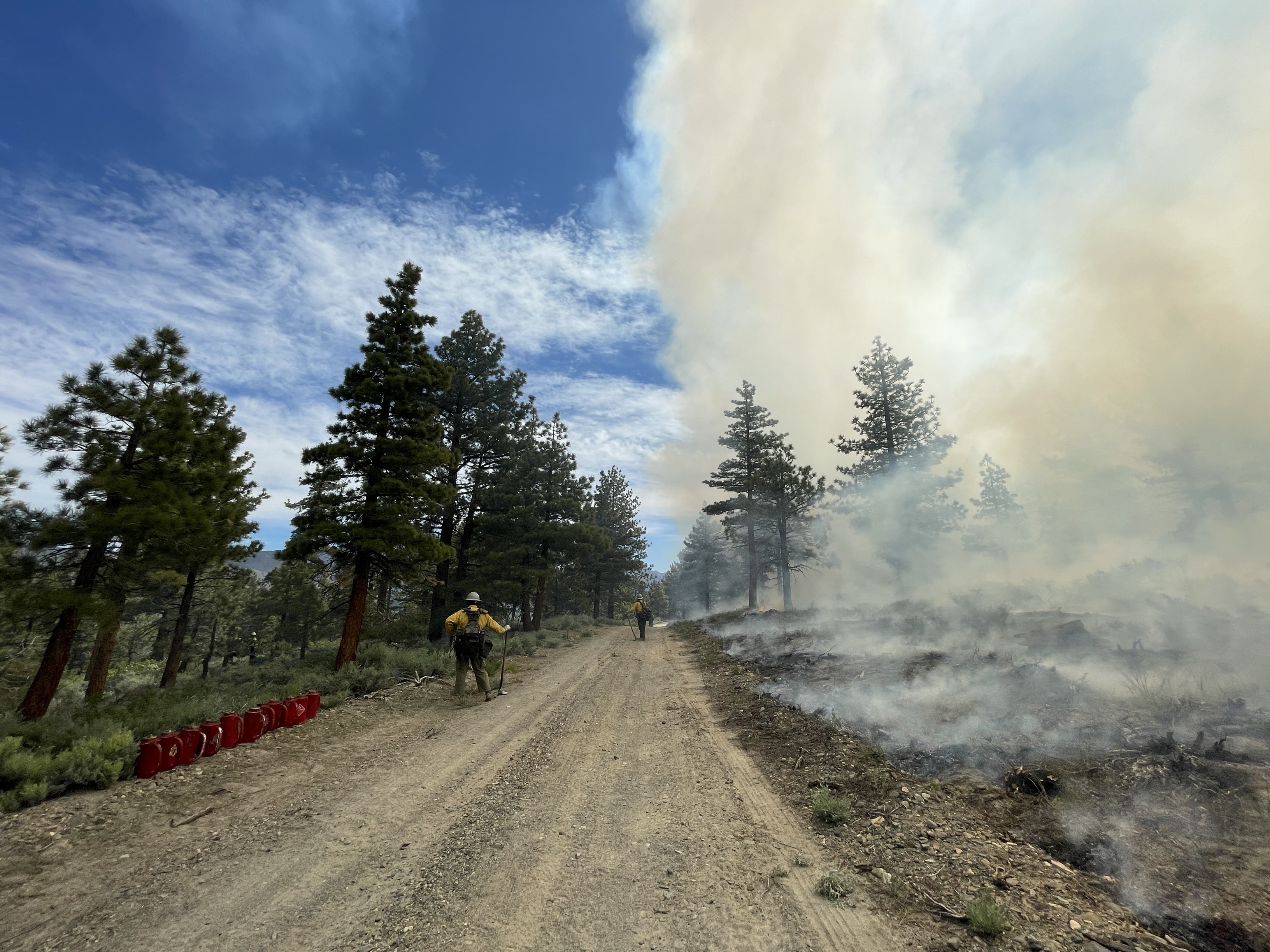
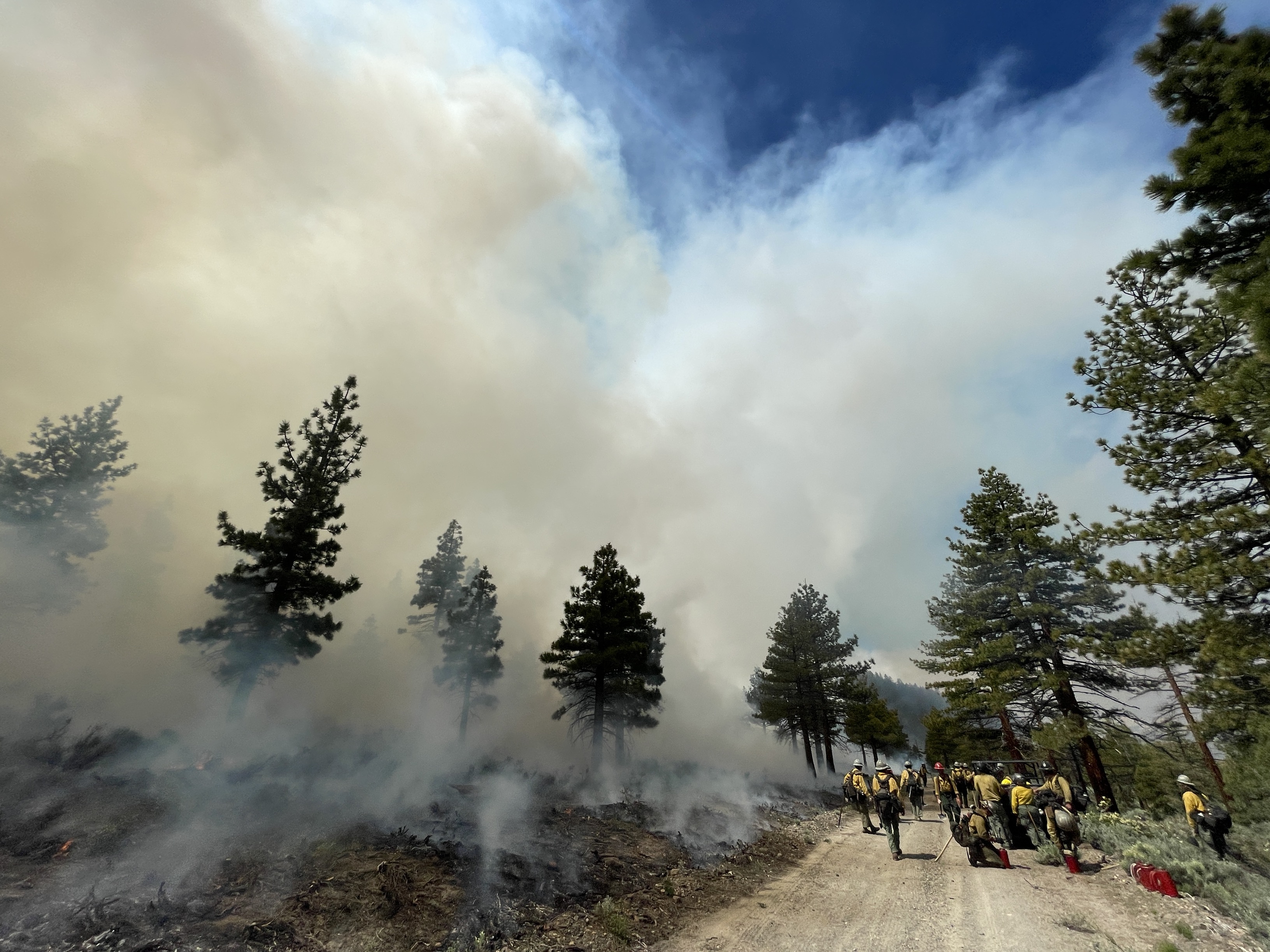
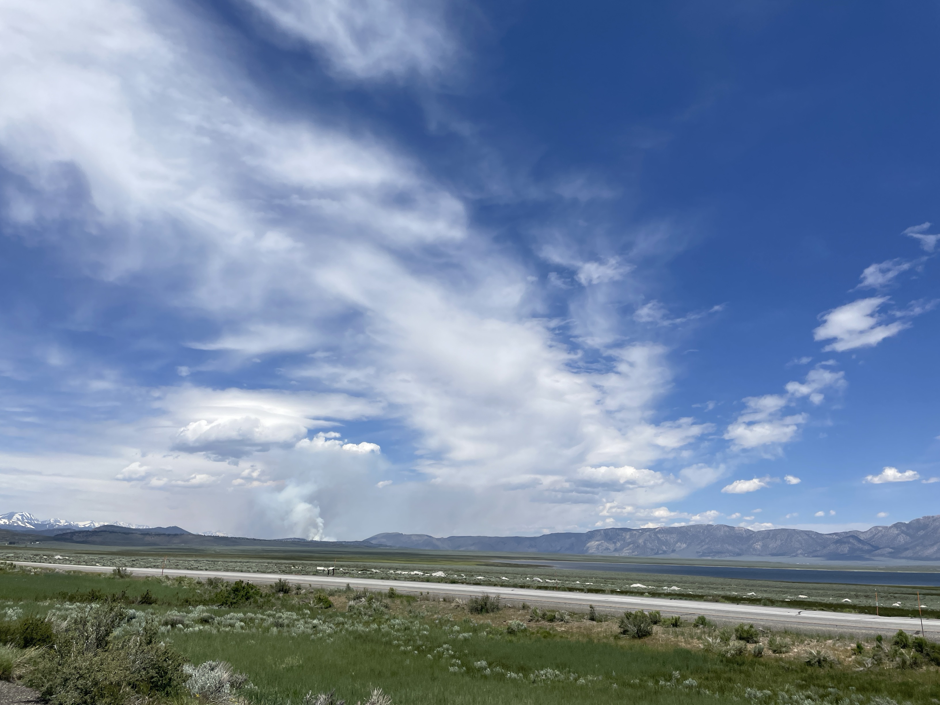
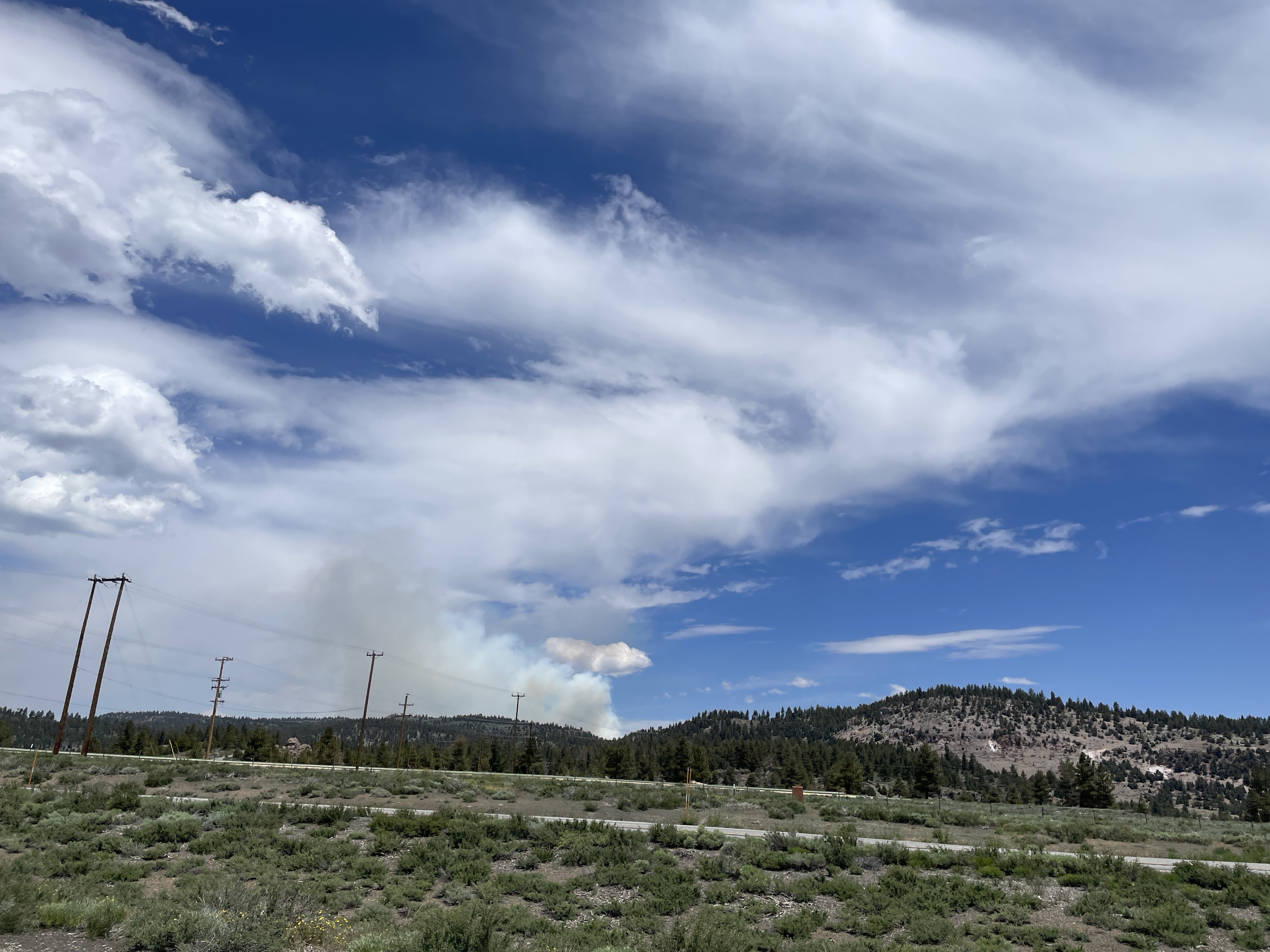
Burning Begins in Inyo NF Antelope Prescribed Burn Project Area
Related Incident: INYO NATIONAL FOREST 2023 PRESCRIBED FIRE PROJECTS
Publication Type: Announcement
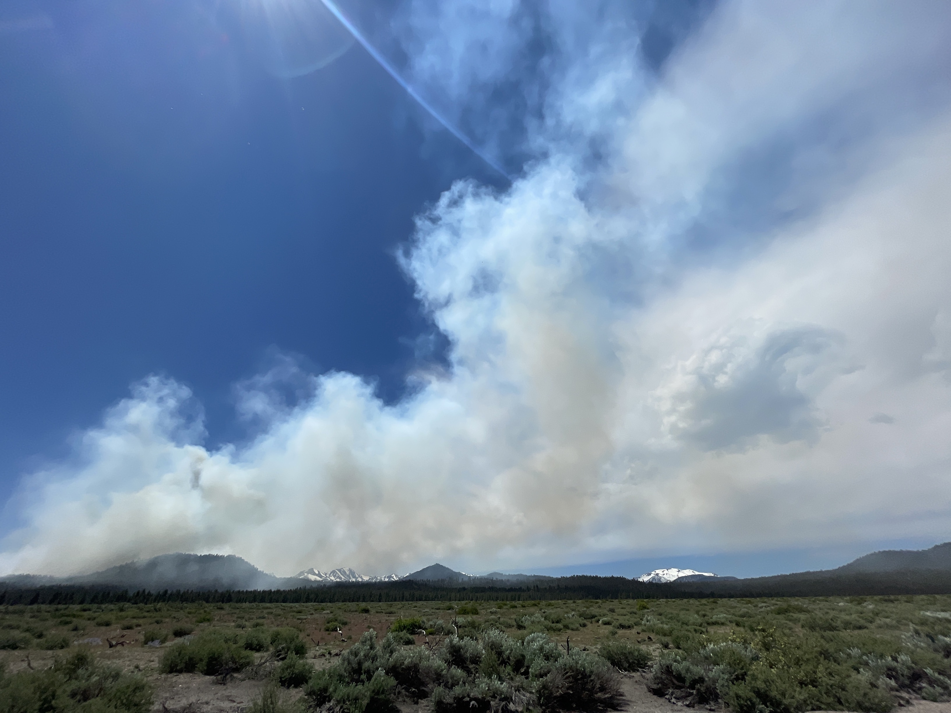
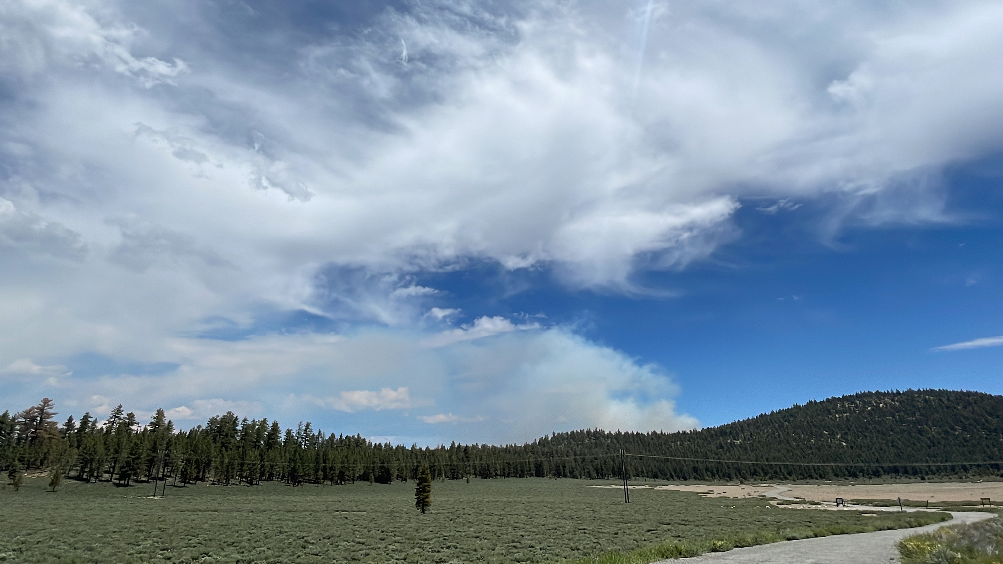
On June 22, burning began in the Inyo National Forest (NF) Antelope Prescribed Burn project area. Fire crews were able to complete 115 acres and plan to burn about the same amount of acres on June 23.
Smoke is very visible from Crowley Lake up to almost Lee Vining. Signs are everywhere and the Inyo NF staffed the Crestview rest stop on June 22 for questions from visitors related to the prescribed burn project.
The Antelope Prescribed Burn is the Inyo NF's 2nd prescribed burn project for 2023. This project has a target of 600 acres to burn over several days.
The other project is the Casa Diablo Prescribed Burn which began on June 7, and has a target of 3,000 acres to burn.
Prescribed burning is the application of fire to the land (under precise prescribed conditions) to reduce wildfire hazards, clear downed trees and brush, control plant diseases, improve rangeland and wildlife habitats, and restore natural ecosystems.
To view 10 photos related to the Antelope Prescribed Burn project, see links below under Related Information or above under the Photos Tab.
Prescribed Fires Near Mogote Called Off
Related Incident:
Publication Type: News
Prescribed Fires Near Mogote Called Off
Expected break in winds not developing
LA JARA, CO, June 22, 2023 – Despite favorable vegetation and fuels conditions, the Conejos Peak Ranger District has decided to postpone the planned prescribed fires in the Mogote area. Fire managers have determined that an anticipated break in the windy weather pattern is not going to develop in time to meet project objectives. Forecast windspeeds will remain above the parameters set forth in the prescribed fire plan.
“Our fire managers are constantly evaluating weather and fuels conditions,” said Conejos Peak District Ranger Andrea Jones. “Past experience with similar burn windows has resulted in successful prescribed fires in this area. This time, we knew that we would only implement the burn if the forecasted winds did not materialize.” Jones expressed her gratitude to the burn boss for investing so much time and effort into preparation for this burn and being cognizant of all the elements needed to conduct a successful prescribed fire.
Fire managers will continue to seek opportunities to conduct the Bighorn/Stateline and Conejos Canyon prescribed fires but are doubtful that a “burn window” will develop until after the monsoon subsides later in the summer.
The Bighorn/Stateline project is being implemented in cooperation with the Carson National Forest in New Mexico and falls within the Rio Chama Collaborative Forest Landscape Restoration Project boundaries.
For information on the Rio Grande National Forest, call (719) 850-2374, visit the forest website, or follow us on our Facebook page or Twitter.
####
USDA is an equal opportunity provider, employer and lender.
STF Rx Burn Update Morning June 23 2023
Related Incident: 2023 - Strawberry Prescribed Burn, Summit Ranger District, Stanislaus National Forest2023 - Dry Meadow Prescribed Burn, Summit Ranger District, Stanislaus National Forest
Publication Type: Announcement
Work continued yesterday on the Stanislaus National Forest Rx Burn Projects. On the Dry Meadow Rx Burn Project, unit DM48 was completed. There was a small spot fire to the west of this unit on private land that was secured by the firefighters. This is the last unit to be burned on this project during this burn period. The project will go in to patrol status.
On the Strawberry Rx Burn Unit, firefighters completed units CS05 and S05 on Thursday. Today, crews will look to burn unit S04. If that unit progresses well, crews may continue with S09.
Tomorrow’s relative humidity levels are forecast to be 40% - 50%. Sunny conditions are presently over the fire area and scattered low clouds will develop this afternoon. Winds will be light today. Sunday will start a gradual warming and drying trend.
The communities of Pinecrest and Strawberry will have about three hours of medium smoke this morning.
Crabtree Road remains closed from 108 to the intersection of 4N26 and 4N11 until it is safe for the public to access the road.
There are a total of 610 firefighters working on these Rx Project areas. To date, a total of 3,490 acres of prescribed burning has occurred in this area of the forest.
Three Lakes Fire being managed to promote healthier landscapes
Related Incident: Three Lakes Fire
Publication Type: News
Fredonia, Ariz., June 22, 2023 - The lightning-caused Three Lakes Fire south of Jacob Lake, will be managed within a designated area to reduce hazardous fuels and promote healthier landscapes.
The fire was discovered last week and is located approximately 6 miles south of Jacob Lake between Forest Road 217 and AZ-67, just east of Three Lakes on the North Kaibab Ranger District of the Kaibab National Forest. It is currently approximately 100 acres and burning with a low-to-moderate rate of spread through the mixed ponderosa pine and aspen forest and grassy meadows. Higher humidity levels and green grasses have held fire activity to a slow spread, consuming pine needle duff and dead-and-down woody debris and stumps on the forest floor.
The fire is expected to grow given the warmer, drier weather in the forecast, terrain, and available fuels. Fire managers will manage the Three Lakes Fire within a designated area as long as it continues burning in this manner and conditions allow crews to safely do so. The intended outcome of this fire includes encouraging the growth of native plants, increasing species diversity in the understory, and the restoration of wildlife habitat.
Fire crews from the USDA Forest Service, National Park Service, and Bureau of Land Management are patrolling, collecting data on fire behavior and on-the-ground conditions, and preparing roads and other natural control features to confine the fire within a designated area. Portions of this area were already prepared for the Three Lakes prescribed fire project that was planned for this spring.
Many other specialists are involved in managing this incident. Wildlife biologists, botanists, and archaeologists are helping to ensure that natural and cultural resources are protected, a meteorologist is providing current and forecast weather information, and air resource advisors to monitor and model smoke production and dispersal.
Smoke may be visible from various forest roads in and around the vicinity of Jacob Lake, including State Routes 67 and 89A, and Forest Roads 212, 217, 260, and 462. Smoke impacts may be anticipated for the Jacob Lake area, State Routes 67 and 89A, and House Rock Valley.
Fire personnel and vehicles will be visible to the public in the vicinity the fire, including the Jacob Lake area and State Route 67. Motorists and visitors are asked to avoid active hot areas and are reminded to use caution and drive with heightened awareness when passing through any fire vicinity. There are currently no closures in place but are anticipated as the fire grows.
The Kaibab National Forest is one of many fire-adapted ecosystems. It is dependent on fire to play a natural role in maintaining vibrant forest health. Decades of fire suppression have caused an abundance of fuels to build up, which can leave the forest vulnerable and susceptible to more dangerous high-severity wildfires. Managing naturally caused wildfires across the landscape is a very effective tool in restoring the forest to a healthier condition. These efforts align with the Forest Service's 10-year Wildfire Crisis Strategy, which aims to increase the use of fire on the landscape as well as other treatments to improve forest resiliency for generations to come.
Additional information can be found on the on InciWeb, Kaibab NF website, Twitter, Facebook, Flickr, or by calling the Fire Information Hotline at 928-635-8311 or local ranger stations.
New lightningcaused fire on North Kaibab Ranger District
Related Incident: Three Lakes Fire
Publication Type: News
Fredonia, Arizona, June 20, 2023 - The Three Lakes Fire started by lightning on June 16 is located approximately 6 miles south of Jacob Lake between Forest Road 217 and AZ-67. It is currently 42 acres burning in ponderosa pine forest with a low to moderate rate-of-spread.
The overall strategy will be to allow fire to burn as it would naturally as long as it can be safely managed while meeting objectives. This fire is occurring within a planned future prescribed fire unit. The fire will be monitored as it spreads with the goal of reducing hazardous fuel accumulations while restoring and maintaining forest health. It will also be beneficial for increasing protection of wildlife habitat and sensitive watersheds. Resource specialists will take great care to protect cultural and natural resources in and around the proposed burn area.
Size is expected to increase on this fire as growth is largely influenced by weather, available fuels, and terrain.
Smoke may be visible from various forest roads in and around the vicinity of Jacob Lake, including State Routes 67 and 89A, and Forest Roads 217, 260, and 462. Smoke impacts may be anticipated for Jacob Lake, State Routes 67 and 89A, and House Rock Valley.
Fire personnel and vehicles will be visible to the public at these locations. Motorists and visitors are asked to avoid active hot areas and are reminded to use caution and drive with heightened awareness when passing through any fire vicinity. There are no closures in place currently but are anticipated as the fire grows.
The Kaibab National Forest is one of many fire-adapted ecosystems. It is dependent on fire to play a natural role in maintaining vibrant forest health. Decades of fire suppression has caused an abundance of fuels to build up, which can leave the forest vulnerable and susceptible to more dangerous high-severity wildfires. Managing naturally caused wildfires across the landscape is a very effective tool in restoring the forest to a healthier condition.
Additional information can be found on the Kaibab NF website, Twitter, Facebook, Flickr, or by calling the Fire Information Hotline at 928-635-8311 or local ranger stations.
20230623PassFireUpdate
Related Incident:
Publication Type: News
Pass Fire Update - June 23, 2023
Acres: 53,091
Start Date: May 18, 2023
Location: 40 miles west of Winston, NM
Cause: Lightning
Containment: 13%
Fuels: Timber, pinon/juniper and grass
Personnel: 79
Yesterday’s reconnaissance flight showed minimal fire activity and no change in acreage on the Pass Fire. Firefighters worked along Indian Creek securing the containment line to prevent any future fire activity from pushing west of the creek. Fire crews remain on the south end of the fire perimeter, to ensure any smoldering fire does not cross the Middle Fork. Interior smokes still exist within the perimeter of the fire.
Stronger winds and a Red Flag warning today may increase fire activity. Firefighters are monitoring the fire area and are ready to conduct suppression tactics if necessary to protect values at risk.
The overall strategy on the Pass Fire is to allow the low to moderate intensity of the fire to play its natural role on the landscape as firefighters take appropriate actions to keep the fire within the designated planned boundaries while protecting private land, infrastructure, and natural resources. The Gila National Forest is a fire-adapted ecosystem. It is dependent on fire to play a natural role in restoring the landscape to more natural conditions while preventing the occurrence of extreme fires in the future.
Safety: Fire season is here. Please use caution and stay informed on changing fire and weather conditions. There are currently no closures in place.
Weather: Sunny, with highs around 82-87 degrees. Red Flag warning today through Tuesday. Southwest winds 11-21 and increasing to 20-25 mph in the afternoon with up to 40 mph gusts.
Aviation Restrictions: A Temporary Flight Restriction (TFR) is still in place over the Pass Fire. All non-fire aircraft are restricted. This includes civilian drones. Unauthorized aircraft in the area will ground firefighting aircraft, hindering firefighting efforts. If you fly, we can’t.
For More Information:
- Inciweb: https://inciweb.wildfire.gov/incident-information/nmgnf-pass-fire Inciweb is the official site for fire information. This site is secure and updated daily.
- New Mexico Fire Information: https://nmfireinfo.com/
- Air Quality: https://www.airnow.gov
June 23 2023 Update
Related Incident: Comanche Fire
Publication Type: News
Northern New Mexico Type 3 Incident Management Team
Luke McLarty, Incident Commander
Fire Information: 505-418-1038
2023.comanche@firenet.gov
Upcoming Actions: Yesterday’s operations were successful as fire crews continued to create depth in the containment lines on the east perimeter of the Comanche Fire focus area. With information from a meteorologist and other specialists, fire managers are halting firing operations today due to Red Flag conditions and forecasted west winds. Crews will focus on holding the fire within the designated perimeter along the east line. The tactics implemented over the past week will help make this possible. Smoke may be visible from afar as the fire becomes more active in the interior.
The fire has been burning at low to moderate intensity, cleaning up the understory and leaving the tree canopies intact. The anticipated outcome will be a healthier forest ecosystem.
Management of the naturally ignited Comanche Fire, including additional firing operations, could last through next week. However, a specific timeframe will depend on weather and fuel conditions.
Smoke: Smoke may be visible from Canjilon, Abiquiu, El Rito and as far as Santa Fe and Taos. It may impact the communities of Abiquiu, El Rito, Medenales, Hernandez and the Española Valley. Temporary smoke monitors have been placed at the El Rito Ranger Station, Ghost Ranch in Abiquiu and in Hernandez, which was installed yesterday. Air quality data is available from the Fire and Smoke Map at fire.airnow.gov, where air quality data can be tracked.
Closure: Temporary partial road closures are in effect on Forest Roads 137 and 20 during firing operations for safety of the public and fire crews.
Fast Facts
Size: 1032 acres
Cause: Lightning
Fuels: Ponderosa pine and mixed conifer
Values at risk: Cultural/historical sites.
Percent Completed: 1%
Resources: 3 hand crews, 2 wildland fire modules, 7 engines, 1 dozer, 2 water tender, 2 REMS teams, total personnel 186
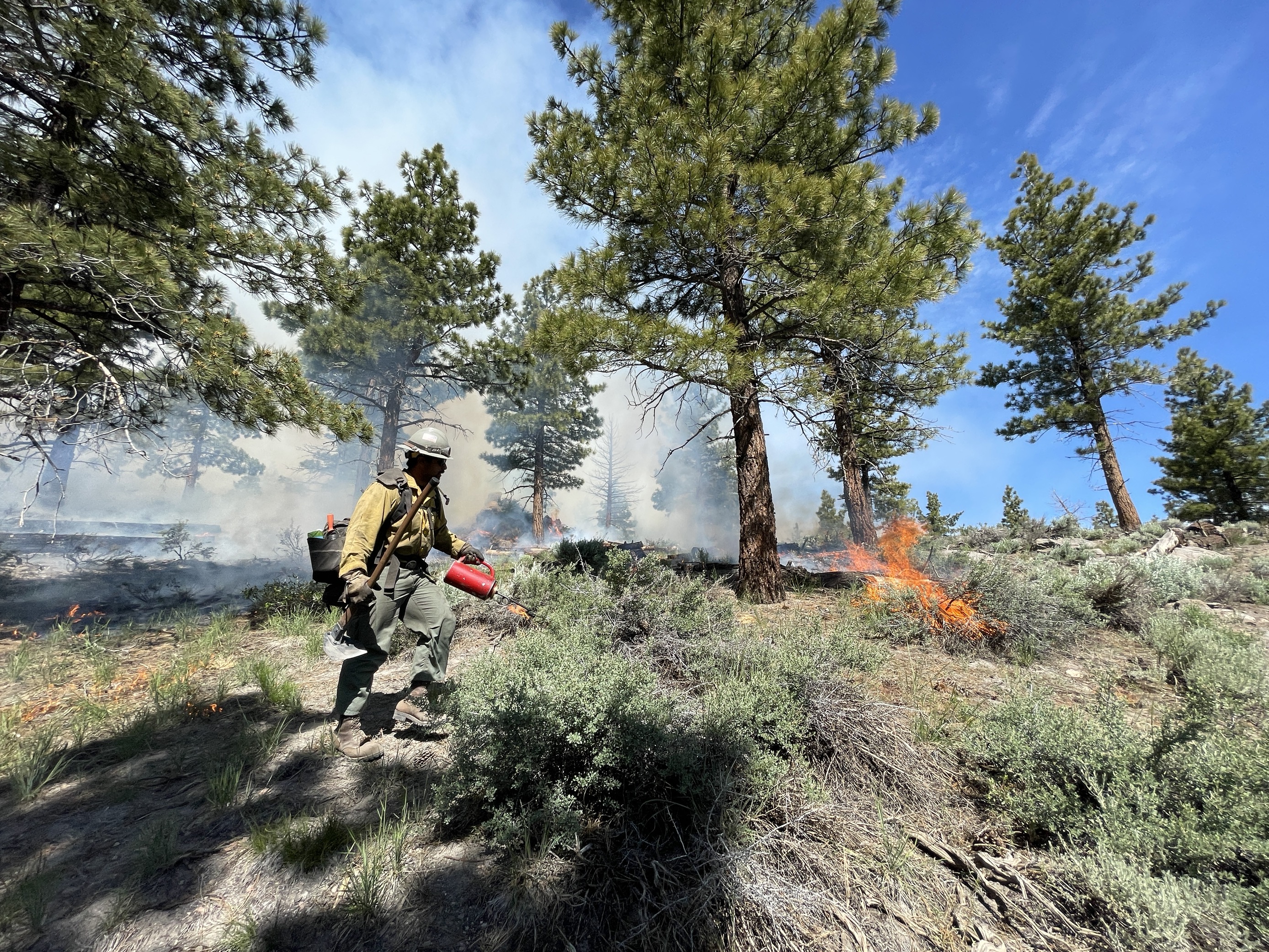
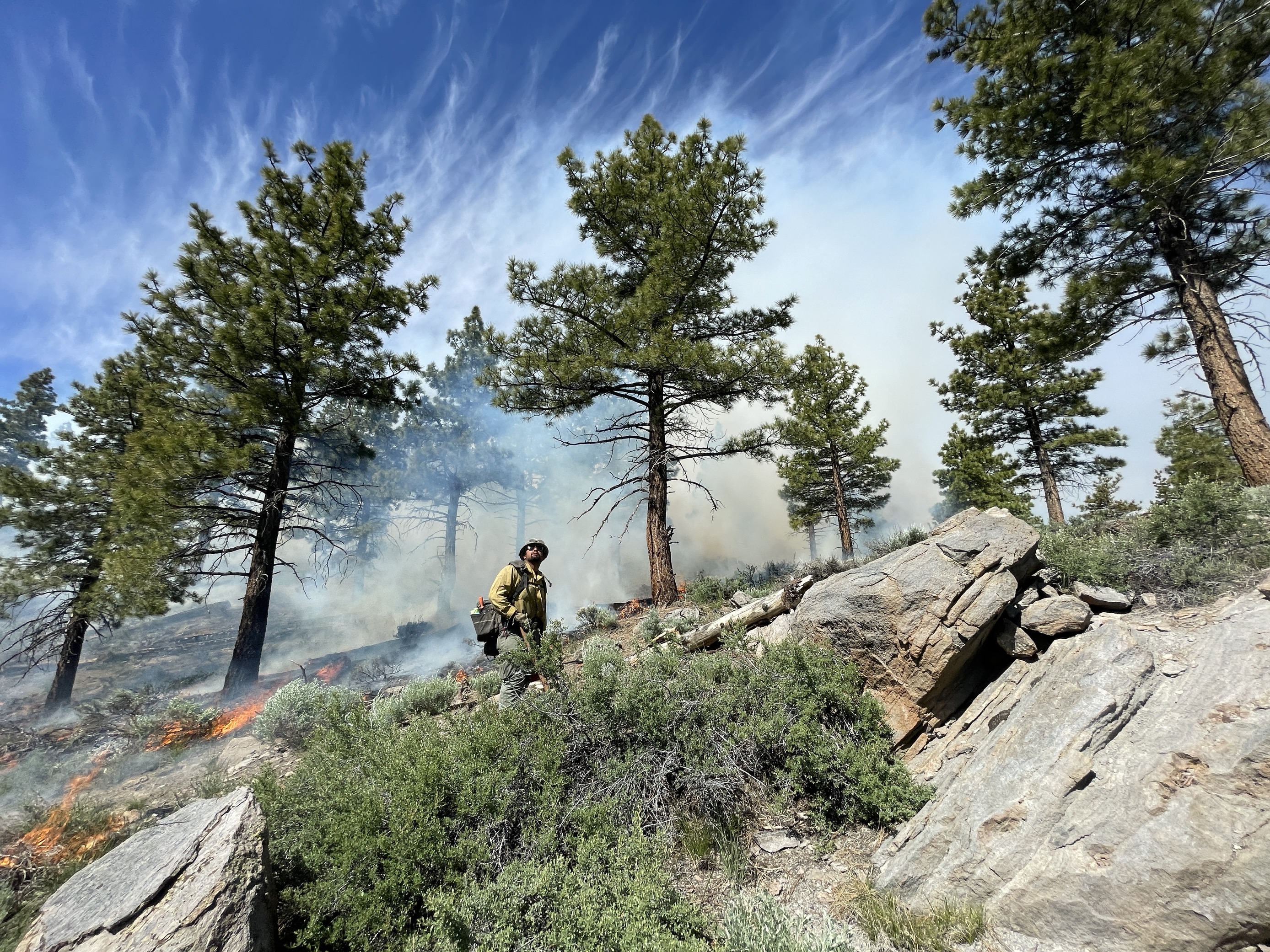
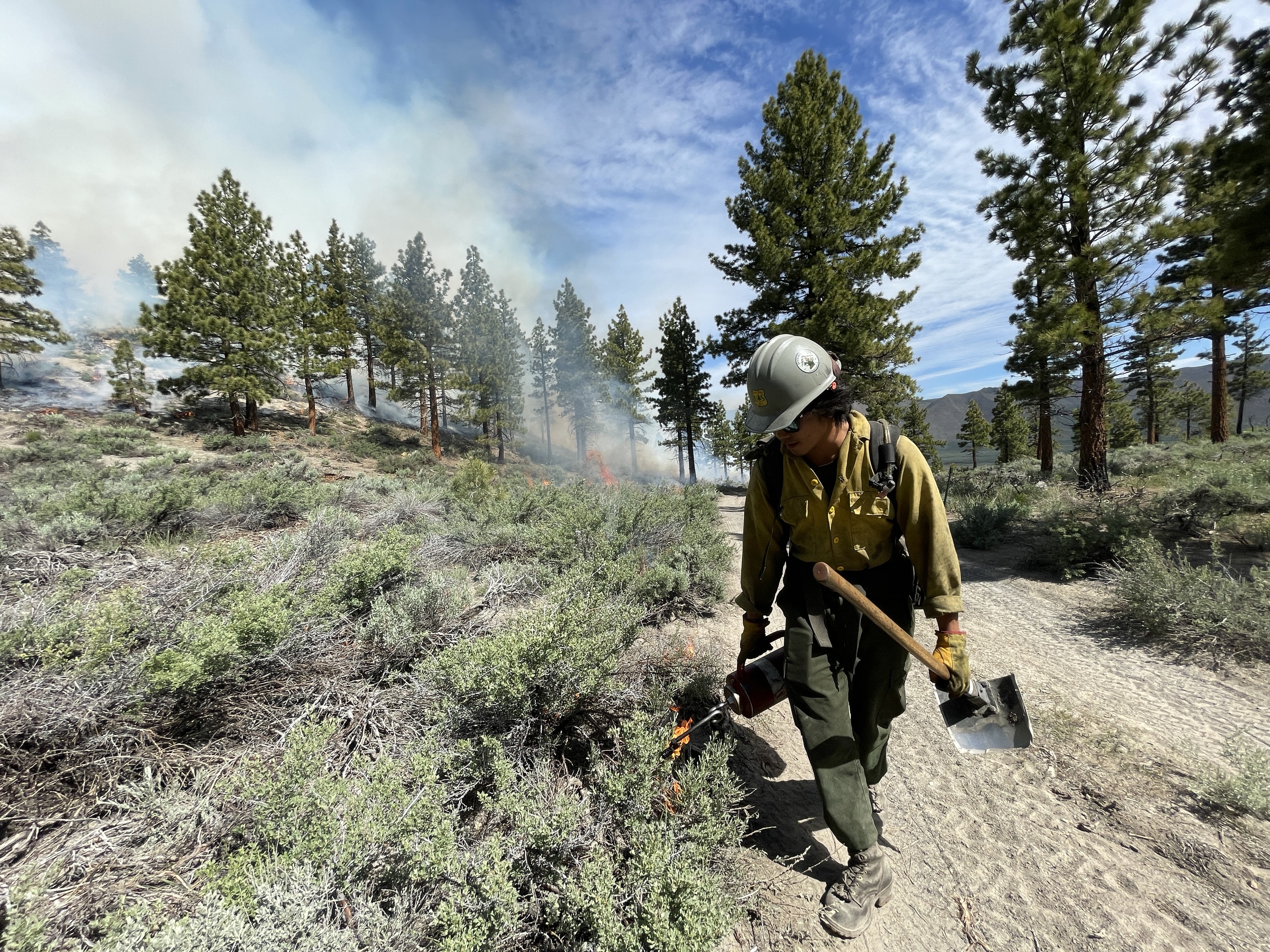
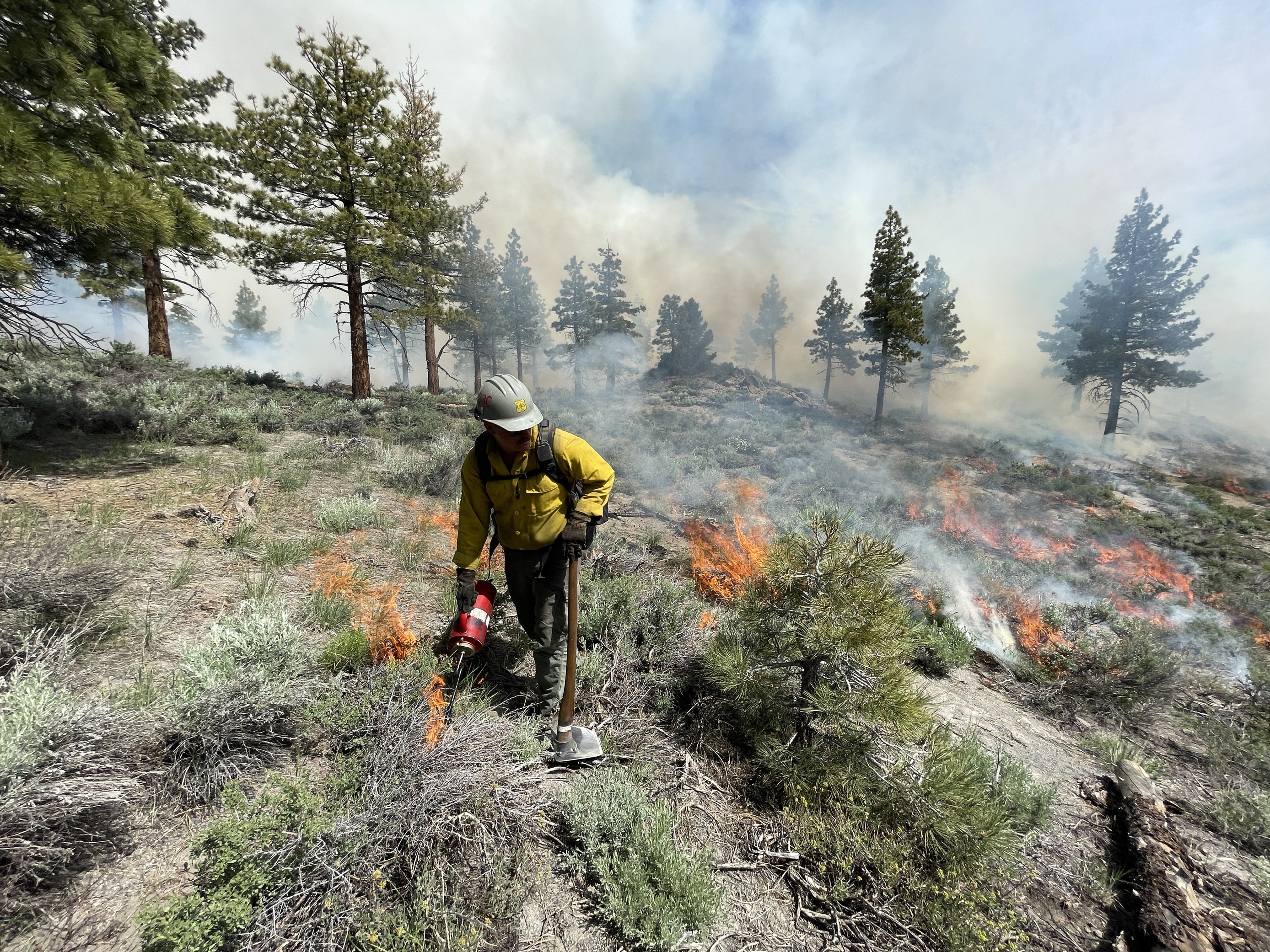
Thomas Mountain Broadcast Burn San Jacinto Ranger District 62323
Related Incident: 2023 - San Bernardino National Forest Wildfire Crisis Response
Publication Type: News
June 23, 2023 – The recent unfavorable winds have caused some delays on the prescribed burn on Thomas Mountain. However, with the availability of favorable weather conditions, the San Jacinto District has made the decision to proceed with the prescribed burn today and tomorrow. The primary objective remains consistent, focusing on working the interior of the fire and consuming the accumulated downed and dead fuels. Residents and visitors will see flames and smoke visible throughout the day and evening.
If you are traveling on California Highway 74 you may experience brief closures due to aerial operations. These closures are to protect both the firefighters involved in the operations and the public using the highway.
During these operations certain areas will be temporarily closed to the public: Forest Road 6S13, Tool Box Springs Yellow Post Sites, Thomas Mountain Yellow Post Sites, and the Ramona Trail. These closures are implemented for the safety of both the public and firefighters involved in the operations.
Prescribed fire plays an important role in forest health and in reducing extreme wildfires and their negative impact. These fires also help reduce heavy fuel loads while simultaneously opening the conifer forest structure and maintaining the health of meadow habitats. Fire is also used to enhance native plant communities and cultural landscapes and improve wildlife habitats. Another goal is to provide defensible space for communities and developed areas within and surrounding the BDF. With all fire comes smoke, and the U.S. Forest Service works to mitigate smoke impacts from prescribed fires on the communities in the area.
#PrescribedBurn #PrescribedFire #ForestHealth #ThomasMountainPrescribedBurn