
River Road East Fire Update September 29
Related Incident:
Publication Type: Announcement
Good news- the River Road East Fire is 100% contained and all suppression repair work is complete. Please continue to exercise caution when travelling in or around the recently burned areas as hazards may be present. Fire-weakened trees or pockets of internal residual heat are still possible.

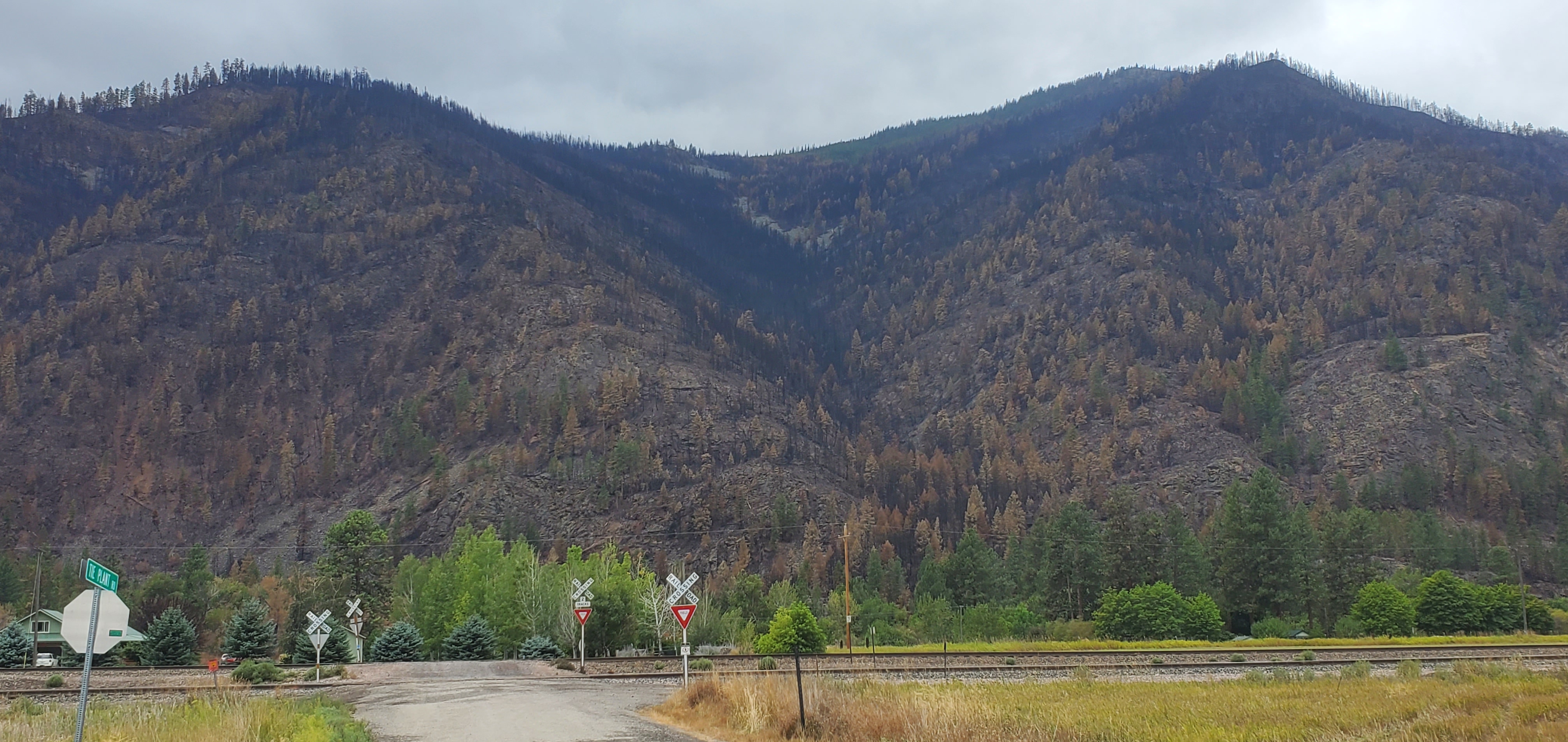
Fire restrictions lifted on Klamath National Forest September 28 2023
Related Incident: 2023 Happy Camp Complex Klamath NF
Publication Type: News
Fire restrictions lifted on Klamath National Forest
Yreka, Calif., September 28, 2023— Recent weather conditions have lessened the fire danger on the Klamath National Forest, and fire restrictions will be lifted effective September 28, 2023 across the forest.
Forest officials stress that the Northern California fire season is not over, and care and common sense must still be used when in the forest. The larger fuels, such as logs, remain fairly dry and have not been as affected by the recent rains. The potential for wildfires still exists and visitors to the forest should remember to never leave campfires unattended.
California Campfire Permit is still required for open campfires, stoves, and barbecues outside developed campgrounds. The permit lists requirements for clearing the ground around campfires, how to completely extinguish fires, and which tools must be always kept at the campfire site. The permit may be obtained free of charge from any USDA Forest Service office or online at https://www.readyforwildfire.org/permits/campfire-permit/.
# # #
Area and Road Closure Orders Still in Effect for Anvil Flat and Smith River Complex Fire Areas
Related Incident: Anvil FireFlat Fire
Publication Type: Closures
Forest Service News Release
Fire Information: 541.646.9177
https://www.facebook.com/R6RRSNF/
Area and Road Closure Orders Still in Effect for Anvil, Flat and Smith River Complex Fire Areas
MEDFORD, OR, Sept. 28, 2023 — Closure Orders remain in place for areas of the Rogue River – Siskiyou National Forest for the Anvil, Flat and Smith River Complex Fires. Recent precipitation across the forest allowed for the lifting of Public Use Restrictions, which allows campfires on areas of the forest that are not currently under a closure order. Lifting Public Use Restrictions for campfires does not rescind closure orders. Forest staff are working closely with fire managers daily to re-evaluate closures and look for opportunities to reopen them as soon as safely possible for both firefighters and the public.
The following acts are prohibited upon closed areas within the forest. These orders will be effective through October 31, 2023, unless rescinded sooner.
PROHIBITIONS:
1. Being upon a closed road.
2. Going into or being upon land within the Closure Area.
3. Being on a trail within the Closure Area.
Closure Order for Anvil Fire: https://bit.ly/AnvilClosure
Closure Order for Flat Fire: https://bit.ly/FlatClosure
Closure Order for Smith River Complex North: https://bit.ly/SRCNorthClosure
For the safety of firefighters and the public, please respect closure orders. The current fire danger rating is “moderate” for all five Ranger Districts. The Industrial Fire Precaution Level is currently at Level 1. For up-to-date information regarding fire season, ongoing fires, and fire restrictions, follow the RRSNF on Twitter/X and Facebook or visit: https://www.fs.usda.gov/rogue-siskiyou
###
Daily Fire Update September 28
Related Incident: Hope Fire
Publication Type: News
Fact Sheet for the Hope Fire - September 28, 2023
The Hope Fire was lightning-caused and detected on September 21st. The fire is being managed under a full suppression strategy by local resources from the Dolores Ranger District of the San Juan National Forest. It is currently burning at Hoppe Point located northwest of the McPhee Dam and Reservoir, east of Bradfield Campground.
The location of the fire is within the boundaries of a prescribed fire burn unit. Fire personnel have been working to prepare lines around the estimated 3,000-acre section. Firefighters are reinforcing and using previously defined and prepared control lines to allow this naturally caused wildfire to reduce forest fuels and improve forest health within those boundaries. This will decrease risk of future catastrophic wildfire, protect infrastructure and private lands, and improve forage for wildlife.
Current
Firefighters will continue firing operations today, building on yesterday’s success. The public will likely see increased smoke.
The fire behavior is expected to increase due to burnout operations.
Firefighters continue to reinforce containment lines around the planning area to support fire suppression efforts.
Outlook
Winds are expected to increase over the weekend.
Firefighters will look for opportunities to reinforce control lines through the weekend.
Where weve been Where we are going Payette NF Fuels Treatment Plan
Related Incident: Southwest Idaho Wildfire Crisis Strategy Prescribed Fire
Publication Type: News
Payette National Forest Planned Fuels Treatment Overview
Payette National Forest Planned Fuels Treatment Overview
Where we’ve been: 09/20/23 through 09/27/23
East Zone (Krassel Ranger District (RD) and the Frank Church Wilderness)
- Scouting units for prep needs, helping other zones as needed
West Zone (Council and Weiser RDs)
- Completed 150-200 acres in the Robinson project area
- Completed 800-900 acres in the Weasel project area
Central Zone (New Meadows and McCall RDs)
- Completed 1440 acres in the Brush project area
- Patrolling in the Goose project area
- Patrolling in the Cold project area
Where we’re going: 09/28/23 through 09/04/23
(all statements below are subject to furlough)
East Zone (Krassel RD and the Frank Church Wilderness)
- Waiting for a window to burn.
West Zone (Council and Weiser RDs)
- 200 acres Hand ignitions in the Robinson project area/ numerous pile opportunities if the weather shifts
Central Zone (New Meadows and McCall RDs)
- 60 acres in the Goose project area, near Gordon Titus Parking (planned 9/28)
- 1200 acres in the Brush project area, North of New Meadows
SITPA
- Looking to start burning in Ponderosa State Park when conditions allow.
NOTE: All units are subject to change due to weather and environmental conditions
For the most current information about prescribed burning projects please visit the Payette Facebook page or visit the Payette National Forest planned fuels treatments map at https://tinyurl.com/Payette-Prescribed-Fire-Map
For more information on the Forest Service Wildfire Crisis Strategy and the Southwest Idaho Landscape project, visit this link: Southwest Idaho Landscape Project
Actualizacin del Incendio del Complejo Cowlitz 28 de septiembre de 2023
Related Incident: Cowlitz Complex
Publication Type: News
28 de septiembre de 2023
Cowlitz Complex Continues Winding Down
(RANDLE, Wash.) – El Complejo Cowlitz está contenido en un 39% con un total de 731 acres quemados.
Actualmente hay 122 recursos asignados al Complejo Cowlitz. Con los recientes cambios de tiempo, los incendios tienen poca o ninguna actividad. Las cuadrillas siguen vigilando todos los incendios mientras continúan los trabajos de reparación de la extinción. El equipo de gestión de incidentes de tipo 3 se está preparando para entregar el fuego a un pequeño equipo de tipo 4 que continuará el gran trabajo de reparación de la zona del incendio y la
vigilancia de cualquier actividad de humo o fuego.
Meteorología: Después de una breve pausa en la lluvia, las lluvias adicionales se moverán en el Complejo Cowlitz durante las horas diurnas del jueves como un refuerzo de nivel superior vaguada de baja presión se adentra en la región. La probabilidad de precipitaciones mensurables es del 90 por ciento durante el día del jueves, disminuyendo por la tarde. Los valores de humedad relativa se mantendrán por encima del 70%. Las temperaturas diurnas volverán a rondar los 50º en la mayoría de las localidades. Los vientos más suaves se afianzarán, del oeste 2-5 mph para gran parte de la zona con algunas ráfagas cercanas a 14 mph sobre las crestas expuestas. Las
precipitaciones adicionales durante el día del jueves al jueves por la noche serán 0.20-0.50 pulgadas
Mensaje de seguridad: Mientras que los incendios están disminuyendo, es fácil llegar a ser complaciente. Hoy, por favor, haga una pausa para ser consciente de los peligros que puede presentar si se encuentra con equipos de extinción de incendios durante su rutina diaria.
Antecedentes: Hubo 30 incendios en el complejo. Los incendios comenzaron el 25 de agosto después de un rayo en todo el Bosque Nacional de Gifford Pinchot. La mayoría se han contenido y se encuentran en estado de patrulla o vigilancia mientras continúan las reparaciones de supresión.
Cierres: Debido a las actividades de los incendios en curso, las siguientes carreteras y senderos están cerrados al público para ayudar a garantizar la seguridad pública y de los bomberos: Forest Roads 25, 9300 y 9341, Boundary Trail #1 (desde Elk Pass hasta la intersección con Summit Prairie), Summit Prairie #2, Craggy Peak #3, Snagtooth #4, Quartz #5, Stabler Camp 17, Wright Meadows #80, Basin Camp #3A, Quartz #5B (French Creek), Snyder Pasture #80A.
###
Cowlitz Complex Daily Update September 28 2023
Related Incident: Cowlitz Complex
Publication Type: News
September 28, 2023
Cowlitz Complex Continues Winding Down
(RANDLE, Wash.) – The Cowlitz Complex is 39% contained with a total of 731 acres burned.
There are currently 122 resources assigned to the Cowlitz Complex. With the recent weather changes, the fires have little to no activity. Crews are still monitoring all of the fires while they continue the suppression repair work. The Type 3 Incident Management Team is preparing to turn the fire over to a small Type 4 team that will continue the great work repairing the fire area and monitoring any smoke or fire activity.
Weather: After a brief lull in the rain, additional showers will move into the Cowlitz Complex during the daytime hours Thursday as a reinforcing upper-level trough of low pressure digs into the region. The chance of measurable rainfall is 90 percent during the day Thursday, lowering in the evening. Relative humidity values will remain above 70 percent. Temperatures during the day will again be in the 50s for most locations. Lighter winds will take hold, out of the west 2-5 mph for much of the area with some gusts nearing 14 mph over the exposed ridges. Additional rainfall during the day Thursday through Thursday night will be 0.20-0.50 inches
Safety Message: While the fires are winding down, it’s easy to become complacent. We get comfortable in our daily drive, or our daily job duties and forget that hazards are still out there and firefighters are still working in the area Today, please pause to be aware of hazards that you may present if you encounter firefighting equipment during your daily routine.
Background: There were 30 fires in the complex. The fires started August 25th after a lightning event across the Gifford Pinchot National Forest. Most have been contained and are in patrol or monitor status as suppression repair continues.
Closures: Due to ongoing fire activities, the following roads and trails are closed to the public to help ensure public and firefighter safety: Forest Roads 25, 9300 and 9341, Boundary Trail #1 (from Elk Pass to intersection with Summit Prairie), Summit Prairie #2, Craggy Peak #3, Snagtooth #4, Quartz #5, Stabler Camp 17, Wright Meadows #80, Basin Camp #3A, Quartz #5B (French Creek), Snyder Pasture #80A.
###
Quartz Ridge and Bear Creek Fires Update 92823
Related Incident: Quartz Ridge FireBear Creek Fire
Publication Type: News
QUARTZ RIDGE & BEAR CREEK FIRES
Update: September 28, 2023
Type 3 Team, Incident Commander: Scotty Nilson
Updates will be produced every other day unless significant activity occurs
Highlights:
Near-critical fire weather has been forecast for Thursday and Friday. Fuels have become drier and more receptive to burning, and winds are increasing. Firefighters will be closely watching for any fire activity that threatens the perimeters of the fires.
Prescribed Fire: There has been increased smoke production this week caused by prescribed burning in locations on the San Juan National Forest. For the most up to date and detailed information, visit https://inciweb.nwcg.gov/incident-maps-gallery/cosjf-san-juan-national-forest-prescribed-fire-program
Quartz Ridge Fire: 2,850 acres | 22 personnel assigned
Fire activity has increased, with more signs of heat and isolated smoke within the fire perimeter. Fire managers expect the increased activity to continue on Thursday and Friday, due to dry, windy conditions. The fire is located in rugged Wilderness with heavy dead and downed timber where it is unsafe and impractical for firefighters to take aggressive actions. Firefighters continue to actively observe fire behavior from strategic locations near the fire.
Bear Creek Fire: 1,093 acres | 13 personnel assigned
During a helicopter flight on Wednesday, flames were observed in a heavily-treed area near the northern edge of the fire. Isolated burning continues in other parts of the fire, and people in the Weminuche Valley may notice more smoke through Thursday and Friday. The fire is burning above the valley in steep, difficult terrain. If the fire were to push down closer to the valley, Fire managers may take more aggressive actions.
Weather:
The drying trend continues, and winds will be stronger over the fire areas on Thursday, into Friday. Relative humidity will be 16-18 on Thursday. Wind gusts could reach 25 mph on Quart Ridge, 20 mph on Bear Creek. Temps will reach the mid to upper 60’s. Friday: slightly stronger winds, but with humidity levels increasing to about 20%
San Juan NF Temporary Closures: The closure order for the Quartz Ridge Fire has been amended. Quartz Meadows Rd (NFSR#684) and the Quartz Ridge Trail (NFST#570) have re-opened. Quartz Creek Trail (NFST#571) remains closed. In the Bear Creek Fire area, Little Sand Trail (NFST #591) and Shaw Creek Trail (NFST#584) are closed. For more info: Quartz Ridge Closure and Bear Creek Closure.
Informacin actual para los incendios Anvil y Flat 28 de septiembre 2023
Related Incident: Anvil FireFlat Fire
Publication Type: News
Incendio Anvil
Área: 21,911 acres Fecha de Inicio: 25 de agosto, 2023 Localizado: 8 millas Este de Port Orford, OR
Contención: 27% Personal: 1,131 Recursos:32 escuadrillas de bomberos, 10 helicópteros, 46 camiones de bomberos
El día de ayer, los bomberos continuaron patrullando las líneas de contención. Algunas porciones del área del incendio permanecen demasiado húmedas lo que limita a los buldóceres en la construcción de nuevas líneas de incendio. Sobre el área Este del incendio Anvil, las escuadrillas de bomberos continúan esculcando la oportunidad para lograr construir líneas de contención en un lugar seguro y apropiado para trabajar. El día de hoy, un grupo de expertos en incendios (Hotshot) se encuentran evaluando la posibilidad para crear líneas de contención en la esquina Noroeste del incendio. Para este fin de semana, se espera un comportamiento mínimo en el incendio con lluvias adicionales para el viernes. Sin embargo, podrá observarse un incremento en la actividad del fuego en las próximas semanas continuando hasta que se presenten lluvias de manera consistente y logren cubrir la totalidad del área afectada. El fuego continuara quemándose lentamente en la vegetación alta y árboles caídos hasta que baje el nivel de humedad y el grado de temperaturas se caliente lo suficiente para permitir que las llamas empiecen a quemarse más activamente.
Evacuaciones: La Oficina del Alguacil para el Condado de curry, ha identificado cuatro zonas de evacuación alrededor del incendio Anvil. En horas de la tarde del lunes, el Alguacil logro reducir los Niveles de Evacuación. Zonas 1, 2 y 4 se encuentran en un Nivel 2 “LISTOS”. Los residentes podrán regresar a sus viviendas, pero deberán estar preparados para ser evacuados en caso de darse un incremento en el incendio. La Zona 3 ahora se encuentra en un Nivel 1 “PREPARESE”. La comunidad deberá estar atenta para los cambios en las condiciones hasta que se considere que el incendio ha sido contenido en su totalidad y las evacuaciones puedan ser levantadas completamente. Para revisar un mapa interactivo de evacuación, visite:
https://bit.ly/45UIh2E. Puede registrarse en el sistema de Alertas de emergencias para el condado: https://bit.ly/CurryCoEM
Ordenes de Cierres para ciertas áreas y carreteras: Para la seguridad de los bomberos y para el público en general, el Bosque Nacional de Rogue River-Siskiyou (RRSNF)y la Agencia para el Manejo de Tierras en el distrito de Coos Bay, han dictado una orden de cierre para el Incendio Anvil. Puede encontrar mapas e información más detallada en: https://inciweb.wildfire.gov/incident-closures/orrsf-anvil-fire
Restricciones: El 27 de septiembre, 2023 a las 12:01 a.m., el Bosque Nacional de Rogue River Siskiyou, levanto todas las Restricciones en las tierras del bosque para uso del público, moviendo el Nivel de Peligro de Incendio a “Moderado” y reduciendo el Nivel de Precaución de Incendios a Nivel 1. Restricciones para el Publico en la sección silvestre de Rogue River, se encuentran en una Fase 1 – el cual se refiere a uso de fogatas en un sartén para fuego y a una altura más baja del nivel del agua.
Incendio Flat
Área: 34,242 acres Inicio:15 de agosto, 2023 Localizado: 2 millas Sureste de Agness, OR
Contención: 75% Personal: 11 Recursos: 3 camiones de bomberos
Las escuadrillas de bomberos prosiguen con la implementación del plan de reparación de supresión para el Incendio Flat. Otros grupos adicionales, incluyendo excavadores, trabajaran en la limpieza de las líneas de incendio, tratando de retornar el área a su estado original antes del incidente. Permanece en efecto la Orden de Cierre para el Bosque nacional de Rogue River-Siskiyou. Información más detallada: https://bit.ly/RRSNFAlerts
Información General
Condiciones climáticas: El día de hoy, en horas de la tarde, se estarán presentando vientos ligeros desplazándose desde el Noreste hacia el Noroeste. Existe un 50% de posibilidad de lluvias a través del área del incendio para el viernes. Durante el fin de semana, se experimentarán un clima más seco y con vientos provenientes desde el lado Norte.
Condiciones del humo: Se podrá incrementar la presencia del humo para los próximos días debido a la materia de combustión secándose y por el incremento en la actividad del incendio. Para información al día en la presencia del humo y la calidad del aire, visite: https://bit.ly/SWORsmoke. Caltrans ha publicado un horario del cierre de carreteras y restricciones en las líneas de tráfico, para el Hwy. US 199. Las autoridades locales recomiendan no utilizar esta ruta si no es realmente necesario. Para encontrar información específica en el acceso de carreteras, por favor lea el sitio de Caltrans QuickMap en: https://quickmap.dot.ca.gov/ y también el sitio de Oregon Department of Transportation site en: https://www.tripcheck.com/. No utilize las carreteras forestales como una ruta alternativa.
Líneas Informativas: (541) 216-4579 o (541) 237-6369
Email: 2023.anvil@firenet.gov
Facebook: facebook.com/flatfireoregon2023
X/Twitter: twitter.com/RRSNF
Inciweb Anvil Fire: bit.ly/AnvilFireOR
Inciweb Flat Fire: bit.ly/FlatFireOR
2023 SRF Lightning Complex Update September 28 2023
Related Incident: 2023 SRF Lightning Complex and Redwood Lightning Complex
Publication Type: News
Fire Update
2023 SRF Lightning Complex
Thursday, September 28, 2023 – 9:00 a.m.
Eastern Area Gold Team
Brian Jenkins, Incident Commander
Information Phone: 530-536-0767
Email: 2023.lightningcomplex@firenet.gov
Information Staffing Hours: 8 am to 8 pm
This update covers 5 of the 14 fires being managed as part of the SRF Lightning Complex. The Copper Fire (2184 acres) was absorbed by the Blue Creek #2 Fire. On September 22, 2023, the Bluff #1 Fire (4270 acres) and Blue Creek #2 Fire (9751 acres) were absorbed by the Mosquito Fire. The combination of Blue Creek #2 Fire, Bluff #1 Fire, and Mosquito Fire is now referred to as the Mosquito Fire. The remaining 6 fires (Big Foot, Blue Creek, Creek, Flat, Iron, and Merrill) totaling 34 acres, are contained and in patrol status. They are checked daily, and their size and containment are unlikely to change.
Current Situation: The 14 fires on this incident total 47,564 acres and overall containment is 15%. In total, 661 personnel are assigned to the incident. Today is the last full work shift for the Eastern Area Gold Incident Management Team and a transition or shadow day with the incoming California Interagency Incident Management Team 16. Transfer of command between the two teams will occur on Friday, September 29, 2023 at 7:00 A.M. It is a common occurrence to transfer command of ongoing fires and both teams are dedicated to making the transition safe and successful.
Yesterday, crews continued to assess the conditions of the Pearch and Mosquito Fires following the recent change in weather. Firefighter and public safety are priorities because the rain has increased the potential hazards of fire weakened trees falling on all parts of the fires due to wet soil conditions. Crews continued to monitor the remote Marlow Fire and north side of the Mosquito Fire during the day. Mastication work progressed south along the Bluff Creek Road and Slate Creek Road. This work will create a fuel break if needed in the future. On the Pearch Fire the backhaul of pumps and hose from locations where they are no longer needed continued. In addition, firefighters monitored the Highway 96 corridor and Salmon River Road for falling rocks and debris and fire activity. CalTrans and Siskiyou County crews remain available to clear the roadways if needed.
Crews and equipment will continue the mastication work along the Bluff Creek and Slate Creek Roads to improve and create an effective fuel break on the south side of the Mosquito Fire. On the west and east sides of the fire extra equipment and supplies will start to be backhauled. On the Pearch Fire pumps and hose that are no longer needed will continue to be backhauled. The Highway 96 and Salmon River Road will continue to be monitored for falling rocks and debris that need to be removed. Crews will assess and mitigate any fire weakened trees with root systems affected by wet soils before reengaging on the fire control lines. The fire activity has diminished somewhat but several areas of heat and large diameter trees are still burning and creating smoke. Smoke may remain visible on all parts of the fires as warmer and dryer conditions return over the next several days.
Pearch Fire (12,125 acres, 31% contained) – Firefighters will monitor and assess the Highway 96 corridor and Salmon River Road throughout the day for falling rocks and debris. CalTrans and Siskiyou County crews are available to clear the rocks and debris as needed. Please continue to drive with caution and consider alternate routes. Crews will continue the process of packing up and backhauling pumps, hose, and other equipment. The effects of recent rainfall have somewhat subdued fire activity but has not extinguished the fire.
Mosquito Fire (33,319 acres, 10% contained) – Crews and equipment have returned to the Bluff Creek Road and Slate Creek Road and restarted mastication work to create a fuel break along the roads. There are still several days of mastication work that will be done to prepare these roads. Fire managers will monitor fire activity on the north side where the fire is still in a remote location. Along the east and west sides of the fire crews continued to hold and secure the control lines and work to mop up hot spots near the line.
Marlow Fire (1,988 acres, 0% contained) – There continues to be minimal activity on the Marlow Fire. This fire is in a remote area and is bounded by indirect control lines to the east and south and prior fire footprints where fuels are lighter. No values are threatened by the Marlow Fire.
Monument (2 acres, 100% contained) and Let er-Buck (96 acres, 100% contained) Fires – A confinement strategy was used to address these two fires due to limited values at risk and the remote, steep terrain with associated safety concerns for the firefighters. Terrain, natural fire barriers such as rock outcroppings, and old fire footprints where fuels are limited will be used to confine fire growth until season ending precipitation extinguishes the fires. These fires are checked regularly to ensure they remain within an acceptable area and both are now considered 100% contained.
Weather: Mostly sunny skies will be in place over the fire area today. Temperatures will be 10 degrees warmer than yesterday with highs of 68 to 74 in the valleys and 47 to 53 on the ridges. The winds will be from the northwest at 8 to 12 mph. The humidity levels will remain in the 40 to 55 percent range.
Evacuation Information
Siskiyou County Office of Emergency Services: https://www.co.siskiyou.ca.us/emergencyservices
Closures
Six Rivers National Forest: Area and campground closures are in effect on portions of Six Rivers National Forest. They can be found at: https://www.fs.usda.gov/detail/srnf/notices/?cid=FSEPRD1096395.
Additional Fire Information
Facebook: https://www.facebook.com/2023SRFRedwoodLightning
More Fire Information Links: www.linktr.ee/srffirepio
For Air Quality Information: www.airnow.gov
NOTE: For information about the Elliot or Hancock Fires which are part of the
Happy Camp Complex, please visit https://linktr.ee/happycampcomplex2023 .