
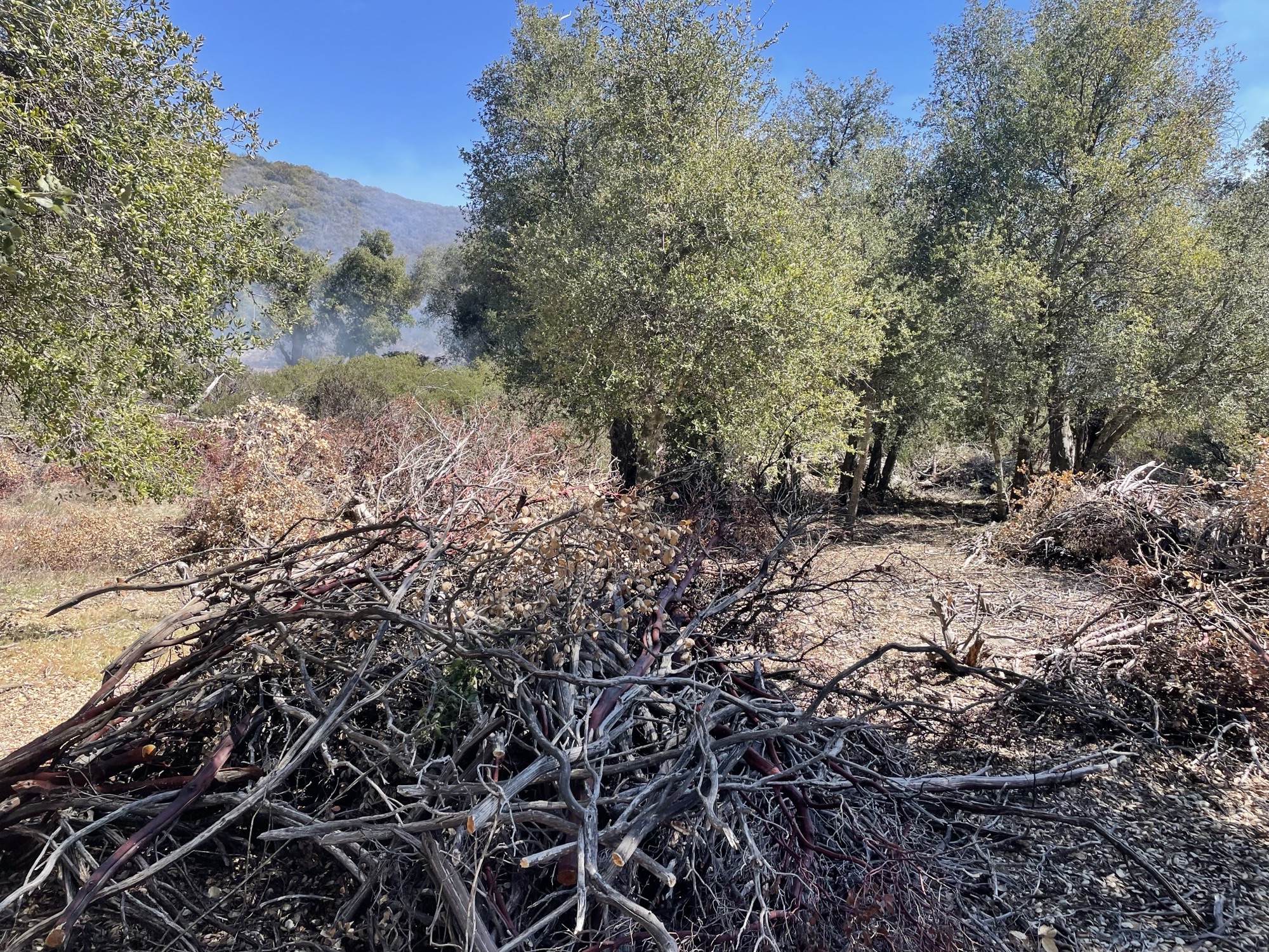
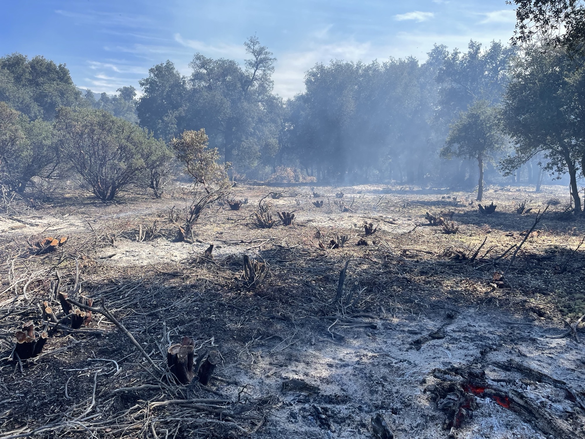
Descanso Ranger District Fuel Treatment 03 15 2024
Related Incident: 2025 - Cleveland National Forest, Forest Health Treatments
Publication Type: News
Today, fuel crews on the DRD are burning piles in the Mount Laguna area off Los Hurcos Rd. Residents and visitors may see smoke from Sunrise Hwy, the I-8 and surrounding communities. We ask the pubic not to call 911 if smoke is seen in the area.
This project funded in part by the President's Inflation Reduction Act which is a part of confronting the wildfire crisis.
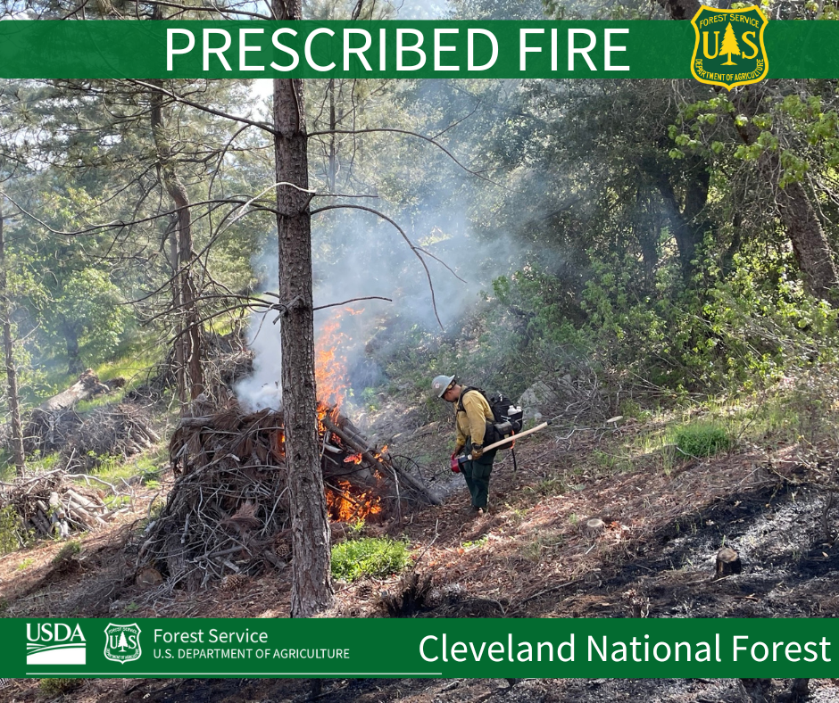
Prescribed Fire is part of Confronting the Wildfire Crisis: https://fs.usda.gov/managing-land/wildfire-crisis. Prescribed fire plays an important role in forest health and in reducing extreme wildfires and their negative impact. These fires also help reduce heavy fuel loads while simultaneously opening the conifer forest structure and maintaining the health of meadow habitats. Fire is also used to enhance native plant communities and cultural landscapes and improve wildlife habitats. Another goal is to provide defensible space for communities and developed areas within and surrounding the CNF. With all fire comes smoke, and the U.S. Forest Service works to mitigate smoke impacts from prescribed fires on the communities in the area.
Yellow Jacket Pile Burning Canyons of the Ancients National Monument March 14 15, 2024 03 14 2024
Related Incident:
Publication Type: Announcement
Weather forecast looks good today and Friday for firefighters to burn 35-acres of hand piles at Yellow Jacket/McElmo project area, located on BLM lands within Canyons of the Ancients National Monument. The site runs north and south of Montezuma County Road G in Montezuma County, Colorado. Piles are from a previous invasive species removal of tamarisk and Russian olive project. Expect visible smoke throughout today, and lighter amounts for several days as vegetation in the interior continue to smolder.
The project area has a detailed burn plan that outlines the parameters for prescribed burning and contains specific criteria regarding weather conditions and air quality that must be met to ensure control of the burn, as well as minimizing the potential smoke impact to local communities.
For more information on smoke, visit https://www.colorado.gov/pacific/cdphe/wood-smoke-and-health
For information on prescribed burns, visit the Southwest District BLM Prescribed Fire InciWeb page https://inciweb.nwcg.gov/incident/7852/ or follow us on Twitter https://twitter.com/SWD_Fire and Facebook http://www.facebook.com/BLMMontroseFireUnit
Yuba River Ranger District Madrone Admin Piles 03 13 2024
Related Incident:
Publication Type: Announcement
The Yuba River Ranger District will be burning 1 acre of admin handpiles today, March 13, 2024. These piles are located at Madrone Cove Campground on Bullards Bar Reservoir. Smoke will be visible from Bullards Bar, North San Juan, Camptonville and surrounding areas. Smoke impacts should be minimal.
Yuba River Ranger District Madrone Cove Piles 03 12 2024
Related Incident:
Publication Type: Announcement
The Yuba River Ranger District will be burning 5 acres of admin handpiles today. These piles are located at Madrone Cove Campground on Bullards Bar Reservoir. Smoke will be visible from Bullards Bar, North San Juan, Camptonville and surrounding areas. Smoke impacts should be minimal.
Prescribed fires planned for the Columbine Ranger District 03 12 2024
Related Incident: 2025 San Juan National Forest Prescribed Fire Program
Publication Type: News
BAYFIELD, Colo., March 12, 2024—The San Juan National Forest’s Columbine Ranger District is planning to conduct several prescribed burns between late March and early May. Ignitions will take place over several consecutive days and operations may take several weeks to complete. These burn units are part of the larger Vallecito-Piedra and Fosset Gulch/Northern HD’s Integrated Vegetation Management projects aimed at reducing hazardous ground fuels and long-term risk of catastrophic wildfire, as well as restoring ponderosa pine ecosystems, and improving wildlife habitat.
Project areas identified for burn implementation are:
- Beaver Meadows: 1100 acres – approximately 10 miles northeast of Bayfield
- Sauls Creek: 1600 acres – approximately 2 miles east of Bayfield
The forests in Southwest Colorado are part of a fire-adapted ecosystem, which has historically experienced frequent, low-intensity fires on a large scale. Prescribed fire replicates that fire regime under controlled conditions. Prescribed fires will only be ignited when all weather, fuels, and smoke requirements are met. Burning operations will be conducted by district personnel and other fire resources from the Forest Service and partner agencies, using both ground and aerial ignition.
Daytime smoke is expected to travel to the north/northeast. Nighttime smoke is expected to travel downslope into Beaver Creek, Bear Creek, and the Pine River. Smoke will be heavier in the mornings that follow burning operations, although should clear by mid-day. Smoke will be visible from Durango, Ignacio, Bayfield, Pagosa Springs, as well as the U.S. Highway 160 corridor near those towns. Smoke monitoring will be conducted and ignitions will be scheduled to minimize smoke impacts to communities. Prescribed fire smoke may affect your health. More information can be found online.
Maps of the prescribed burn units and additional San Juan National Forest prescribed fire program news can be found on InciWeb. For more information, please contact District Assistant Fire Management Officer Noah Daniels, by email at noah.daniels@usda.gov.
For information on current conditions and recreation opportunities on the San Juan National Forest, call (970) 247-4874, visit the forest website, or follow us on social media (Twitter and Facebook).
RX Update Descanso Ranger District Fuel Treatments 03 11 2024
Related Incident: 2025 - Cleveland National Forest, Forest Health Treatments
Publication Type: News
Last week fuel crews on the DRD conducted three prescribed burns, accomplishing 10 acres in Deer Park Oak Woodlands, 15 acres off Bear Valley Road north of Pine Valley, and 20 acres in Mount Laguna. These projects are funded in part by the Presidents Inflation Reduction Act which is a part of confronting the wildfire crisis.
Daily Update for the Smokehouse Creek, Windy Deuce and Grape Vine Creek Fires March 8, 2024 03 08 2024
Related Incident:
Publication Type: News
Today’s cooler weather will further reduce fire behavior on any residual pockets of heat. Dozers, engines and aerial resources are available to assist as required. As resources are no longer needed, they will be reassigned or released home. The incident will be transitioning from the Southern Area Blue Team back to the Texas A&M Forest Service local unit, who will manage the Smokehouse Creek, Windy Deuce and Grape Vine Creek Fires until 100 percent containment.
WEATHER and FIRE BEHAVIOR:
Today’s weather includes considerably colder temperatures, with scattered showers and isolated thunderstorms continuing through much of the day. The additional moisture and cooler temperatures make additional fire spread unlikely.
MAJOR CLOSURES:
Alibates Flint Quarries National Monument, McBride, Mullinaw, Blue West, Plum Creek and Fritch Fortress Areas are closed. No other road closures at this time. Please see local sheriffs’ websites for the most current roads update.
BURN BANS:
Burn Bans in effect for Lake Meredith National Recreation Area, Hemphill, Roberts, Potter, Moore and Gray Counties. Please use the following link to see additional Texas counties with burn bans: tfsweb.tamu.edu/TexasBurnBans
Fire Information Line: (979) 255-0591
Email: information@tfs.tamu.edu
Inciweb:
Smokehouse Creek: https://inciweb.nwcg.gov/incident-information/txtxs-smokehouse-creek-fire
Windy Deuce: https://inciweb.nwcg.gov/incident-information/txtxs-windy-deuce-fire
Grape Vine Creek: https://inciweb.nwcg.gov/incident-information/txtxs-grape-vine-creek-fire
Facebook: https://www.facebook.com/AllHazardsTFS
Daily Update for Smokehouse Creek, Windy Deuce and Grape Vine Creek Fires March 7, 2024 03 07 2024
Related Incident:
Publication Type: News
Today’s increased containment percentages reflect the progress made on all three fires yesterday. With changing weather this afternoon and evening, there is potential for active fire behavior throughout the area. Dozers, engines and aerial resources are available to assist as required. As resources are no longer needed, they will be reassigned or released home.
Smokehouse Creek Fire: Firefighters continue mopping-up pockets of residual heat within the fire perimeter and along the southern edge of the fire.
Windy Deuce Fire: Today firefighters will continue mopping-up and patrolling the fire, with emphasis on residual pockets of heat in the McBride Canyon area. Some rehabilitation of the fire area has begun.
Grape Vine Creek Fire: Engines will continue to mop-up hot spots.
WEATHER and FIRE BEHAVIOR:
Today will be warmer and drier with temperatures reaching 70 to 75 degrees Fahrenheit. Wind speeds of 10 to 15 mph and gusts of 20 mph are predicted from the southwest in the morning, and from the northwest in the early afternoon. Minimum relative humidities will be 15 to 20 percent today. Any flare-ups or new fires have the potential to move at up to 1.25 mph and burn 450 to 700 acres in an hour during the peak burning period today. A cold front is expected to bring more moisture into the area and much cooler temperatures after midnight tonight.
MAJOR CLOSURES:
Alibates Flint Quarries National Monument, McBride, Mullinaw, Blue West, Plum Creek and Fritch Fortress Areas are closed. No other road closures at this time. Please see local sheriffs’ websites for the most current roads update.
BURN BANS:
Burn Bans in effect for Lake Meredith National Recreation Area, Hemphill, Roberts, Potter, Moore and Gray Counties. Please use the following link to see additional Texas counties with burn bans: tfsweb.tamu.edu/TexasBurnBans
Fire Information Line: (979) 255-0591
Email: information@tfs.tamu.edu
Inciweb:
Smokehouse Creek: https://inciweb.nwcg.gov/incident-information/txtxs-smokehouse-creek-fire
Windy Deuce: https://inciweb.nwcg.gov/incident-information/txtxs-windy-deuce-fire
Grape Vine Creek: https://inciweb.nwcg.gov/incident-information/txtxs-grape-vine-creek-fire
Facebook: https://www.facebook.com/AllHazardsTFS
Descanso Ranger District Fuel Treatments 03 06 2024
Related Incident: 2025 - Cleveland National Forest, Forest Health Treatments
Publication Type: News
Today, fuel crews on the DRD are burning piles south of Pine Valley off Bear Valley Road near Long Valley Rd. Two locations in Mount Laguna, one off Los Huros Rd, and the second at Deer Park/Pine Creek roads. Residents and visitors may see smoke from Sunrise Hwy, the 79, the I-8, and surrounding communities. We ask the public not to call 911 if smoke is seen in these areas.
Prescribed Fire Updates 03 06 2024
Related Incident: Mendocino NF Fall 2023/Spring 2024 RX Fire Projects
Publication Type: News
Today fire personnel on the Grindstone Ranger District are planning ignitions on approximately 4 acres of piles in the Red Bluff Recreation Area.