
Basin Fire Daily Update for July 8 2024 07 08 2024
Related Incident: Basin Fire
Publication Type: News
Basin Fire Update Monday, July 8, 2024 Public Fire Information: 559-468-6809, 8 A.M. to 6 P.M. Media Information: 559-492.9967 Email: 2024.basin@firenet.gov
Settings - change map background and toggle additional layers
Filter - control incident types displayed on map.
Zoom to your location
Reset map zoom and position
Could not determine your location.
Show Legend
 Wildfire
 Prescribed Fire
 Burned Area
Response
Burned Area
Response Other
Other
Silver King Fire
Unit Information
Incident Contacts
Oak Ridge Fire Update 07 08 2024
Related Incident: Oak Ridge Fire
Publication Type: News
The strategic firing operation that occurred in Div. K over the past couple days has backed down to Middle Creek. The containment line held all day on Sunday with no spotting of fire across the line. This area and much of the ground within the fire perimeter is a mosaic of burned and unburned fuels. In upcoming days, as burning conditions allow, these pockets of unburned fuel may burn and smolder.
The work occurring on the fire is transitioning. The biggest efforts in upcoming days will focus on the backhaul of equipment and suppression repair. Backhaul involves taking equipment such as hoselays and pumps that were used in structure protection and bringing it back to camp using a vehicle or helicopter. In camp this equipment will be cleaned and returned to the supply cache for the next fire. Suppression repair work will be done to containment lines, helicopter landing spots and other places where firefighting work impacted the landscape. It is the responsibility of the incident management team to ensure that areas affected by suppression actions are returned to pre-existing conditions or better to the extent possible. This work is being done in close coordination with resource advisors from the Pike-San Isabel National Forest. Completing this work successfully will lessen the impact of this fire to Beulah and the Middle Creek Watershed.
As containment on the fire increases, resources will continue to demobilize and go home or on to another assignment. The transition to a smaller incident management team will occur Tuesday evening. Today is the last day that the public information boards in Westcliffe, Wetmore, San Isabel and Bishop Castle will be available. The board at the Beulah General Store will remain and public information will still be available via Inciweb and Facebook.
Weather & Smoke Information: Yesterday evening’s storms brought a few hundredths of an inch of water over the fire. Today, temperatures will reach 76 and relative humidity levels will reach a minimum of 27%. The U.S. Interagency Wildland Fire Air Quality Response Program daily smoke outlook report specific to the fire area may be found at https://outlooks.airfire.org/outlook/d9fa3c77.
Closures: The San Carlos Ranger District of the Pike and San Isabel National Forests issued an area, trail and road closure effective June 26, 2024. Go to www.fs.usda.gov/alerts/psicc/alerts-notices for the entire order. Evacuations: For up-to-date evacuation information in Pueblo County, visit: www.puebloemergency.info.
Temporary Flight Restrictions: There is a 24-hour a day Temporary Flight Restriction (TFR) over the fire area. The TFR includes restrictions against private drones. Air incursions will impede firefighting efforts and ground our aircraft. All air incursions will be immediately reported to law enforcement.
Sheering Fire Update 07 08 2024
Related Incident: 2024- Sheering Fire
Publication Type: News
CURRENT SITUATION: Yesterday, firefighters performed hand ignitions between the fire line off of Forest Road 3N01 to the slowly progressing fire’s northeast edge, facilitating the consumption of unburned fuel and further securing the line. This added approximately 34 acres of fire growth. An Unmanned Aerial System (UAS or drone) continues to be used to detect areas of high-intensity and scattered heat within the perimeter and identify heavy fuels that could carry fire beyond its current footprint. On the western edge, containment was gained after firefighters completed a hose lay and mop-up, extinguishing hotspots, falling hazardous trees, and removing burning material along Forest Road 2N85. Firefighters continue to hold and monitor the eastern containment line along Forest Road 3N01. The most challenging portion of the fire in the southern perimeter above Lost Creek continues to be scouted and assessed for opportunities to place primary fire line. Due to topography, heavy fuels, and excessive dead trees from the 2013 Rim Fire, this location is difficult for firefighters to access, and a strategy that prevents risking firefighter safety is the top priority. Dozers have constructed and continue to improve a contingency line on the ridge above Lost Creek.
WEATHER & FIRE BEHAVIOR: In areas where the fire is active, especially in the northeast perimeter of the fire, fire behavior continues to be low to moderate, with a slow rate of spread. Red Flag warnings remain in place for locations north of the fire area; very hot and dry conditions are expected over the fire area. Above-average temperatures will continue throughout the week, with poor humidity recovery across the fire area. Winds will be out of the northeast up to 6 mph.
SMOKE CONDITIONS: Although this fire has not produced notable smoke for several days, this region may experience occasional smokey and unhealthy conditions from a combination of burning fires in central California. For more information on air quality, go to: https://fire.airnow.gov/
FIRE RESTRICTIONS: There are currently no fire restrictions on the Stanislaus National Forest; however, please check before you go, as fire restrictions periodically change throughout the year and vary from area to area. We remind all forest visitors that responsible fire use is crucial, and unpermitted fires can lead to devastating wildfires, endangering lives, property, and landscapes. Everyone is required to obtain a campfire permit to have fires in dispersed campsites. To obtain a fire permit, go to any Forest Service office or online at https://readyforwildfire.org/permits/
LOCATION: Stanislaus National Forest
DATE STARTED: June 24, 2024
ACRES: 528
PERCENT CONTAINED: 12%
INJURIES/ACCIDENTS: 2 (minor)
TOTAL PERSONNEL: 174
Fire Resources include: 5 Hand Crews, 1 Helicopter, 7 Engines, 1 Dozer, 1 Water Tender
Public Affairs Officer Benjamin Cossel at 209-288-6261 or at Benjamin.Cossel@usda.gov.
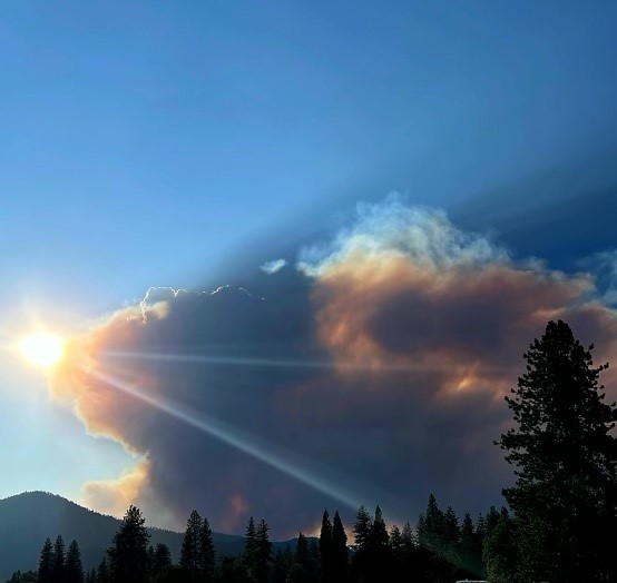
Oak Ridge Fire Smoke Outlook 07 08 2024
Related Incident: Oak Ridge Fire
Publication Type: Announcement
Fire
The Oak Ridge fire is currently at 1310 acres with 69 percent containment. It still remains three miles northwest of Beulah.
Smoke
On Monday we will see very light smoke west of Beulah late in the afternoon into the evening. Terrain winds in the area will keep the smoke near the fire. Possible showers again in the Beulah area with changing winds late into the afternoon. Canon City, Florence Westcliffe, Wetmore, Pueblo, and Colorado City areas will have GOOD air quality today. Information on the air quality and smoke impacts in the area are on the link.
Shelly Fire Evening Update 07 07 2024
Related Incident: Shelly Fire
Publication Type: News
Evening - Update
July 7, 2024
The #ShellyFire has now spread to 1,193 acres with 0% containment. There are currently 925 personnel working to suppress this fire.
Due to a red flag warning, the Shelly Fire is exhibiting significant fire activity.
Evacuation warnings have been upgraded to orders, and additional warnings have been issued. For more details, please visit the Siskiyou County Sheriff's Office and the Siskiyou County Office of Emergency Management.
Settings - change map background and toggle additional layers
Filter - control incident types displayed on map.
Zoom to your location
Reset map zoom and position
Could not determine your location.
Show Legend
- Wildfire
- Prescribed Fire
- Burned Area
Response
- Other
Vista Fire
Unit Information
Incident Contacts
Forest Order 240505Shelly Fire Closure 07 07 2024
Related Incident: Shelly Fire
Publication Type: Closures
KLAMATH NATIONAL FOREST
Forest Order No. 24-05-05
Shelly Fire Closure
To provide for public safety, the following acts are prohibited within the Salmon Scott Ranger District of the Klamath National Forest. This order is effective from July 04, 2024. Select the forest order link to see full closure, Exhibit A, and map.
- Going into or being upon any National Forest System lands within the Shelly Fire Closure Area, as described in Exhibit A and shown on the attached map.
- Being on any National Forest System trails within the Shelly Fire Closure Area, as described in Exhibit A and shown on the map.
- Being on any National Forest System roads within the Shelly Fire Closure Area, as described in Exhibit A and shown on the map.
- Entering or using any Developed Recreation Sites within the Shelly Fire Closure Area, as described in Exhibit A and shown on the map.
Pursuant to 36 C.F.R. § 261.50(e), the following persons are exempt from this Order:
- Persons with Forest Service Permit No. FS-7700-48 (Permit for Use of Roads, Trails, or Areas Restricted by Regulation or Order), specifically exempting them from this Order.
- Any Federal, State, or local officer, or member of an organized rescue or firefighting force in the performance of an official duty.
- Owners or lessees of land in the area, to the extent necessary to access their property.
These prohibitions are in addition to the general prohibitions in 36 C.F.R. Part 261, Subpart A.
A violation of these prohibitions is punishable by a fine of not more than $5,000 for an individual or
$10,000 for an organization, or imprisonment for not more than 6 months, or both. 16 U.S.C. § 551 and 18 U.S.C. §§ 3559, 3571, and 3581.
Executed in Yreka, California, this 4th day of July 2024.
CHRIS CHRISTOFFERSON
Acting Forest Supervisor Klamath National Forest
Public Information Boards 07 07 2024
Related Incident: Oak Ridge Fire
Publication Type: Announcement
As containment continues to increase and with community risks being considerably reduced, fire managers are working to "right size" the needs of personnel on the #oakridgefire_co to ensure fiscal responsibility. Therefore, effective, Tuesday, July 9, Fire Information Boards in the communities of Westcliffe, Wetmore, San Isabel, and Bishop Castle will be taken down. Information will remain at Beulah Fire Protection and Ambulance District for the near future.
While you might not be able to talk to Public Information Officers (PIO)s at Fire Information Boards, please continue to follow this Facebook page for updates and our Youtube channel https://www.youtube.com/.../UCqMo_lPC1Y5GAOvFm71WDBg/videos.
*NOTE, you do NOT need a social media account to access the Youtube channel.
Idaho Team 1 IMT 3 takes command of McDonald Fire crews continue securing fireline 07 07 2024
Related Incident: McDonald Fire
Publication Type: News
Idaho Team 1 IMT 3 takes command of McDonald Fire, crews continue securing fireline
Size: 172,236
Personnel: 100
Start Date: June 8, 2024
Cause: Lightning
FAIRBANKS, Alaska – Today at 7:00 am, Idaho Team 1 IMT 3 assumed command from the BLM Alaska Fire Service Type 3 organization. Yesterday, operations personnel conducted a reconnaissance flight over the 5 Mile Creek Area. Despite colder temperatures and precipitation, the black spruce stands and tundra continue to smolder and burn. Firefighting efforts will focus on these areas where movement potential exists. The fire footprint has not changed.
Crews are creating defensible space around cabins in the 5 Mile Creek Area and continuing mop-up operations to secure the fire’s edge. Fire behavior remains minimal, but firefighters will stay vigilant for any potential spotting outside the fireline. A wildland fire module is staffing lookouts. Operations are dependent on weather and safety conditions, with firefighter and public safety as the top priority.
Weather: Potential for wetting rains continue. Smoldering is expected under the canopy and in areas that receive less precipitation. Temperatures are forecasted in the low to mid 50s.
Burn Permits: The Division of Forestry and Fire Protection has lifted the Burn Permit Suspensions for Fairbanks, Salcha, Delta, Tok, and Railbelt areas. Small and Large Scale Permits are required. Burning is allowed today. The fire danger in these areas is MODERATE. Please check https://dnr.alaska.gov/burn/fireareas or call the burn permit hotline for the Fairbanks Area Forestry at (907) 451-2631 for the most current updates.
Air Quality: The cool, wet weather significantly moderated fire behavior and smoke production. There is still some lingering smoke in the Tanana River Valley. With the decrease in smoke, the air quality is expected to remain GOOD. Fairbanks Memorial Hospital (1650 Cowles St.) has clean-air rooms available for people impacted by smoke open from 9 a.m. to 9 p.m. Find information on how to protect yourself from wildfire smoke at the Smoke Management page on https://akfireinfo.com/smoke-management/.
Evacuation Notices: A Level 2: SET evacuation notice is in effect for the approximately 20 cabins near the fire’s southeastern edge west of the Tanana River. The communities east of the Tanana River are in READY status, including the Johnson Road neighborhoods, Canaday, Harding Lake, Salcha, the lower Salcha River, Hollies Acres, and south to Birch Lake. Find more information and an interactive map of these areas on the Fairbanks North Star Borough Emergency Services website.
Temporary Flight Restriction: The temporary flight restriction (TFR) has been adjusted based on public input to give float plane access to Harding Lake. Be aware helicopter operations to support the fire still continue in the area. Visit tfr.faa.gov for more information.