
Huckleberry Ridge Fire Update 09 06 2024
Related Incident:
Publication Type: News
Huckleberry Ridge Fire
Daily Update
September 6, 2024
Reported: September 4th at 3:45 p.m. | Size: 186 acres | Cause: Under investigation
Total Personnel: 230| Engines/Tenders:15 | Hand Crews: 7
Update: The Huckleberry Ridge Fire continues to burn in recent harvest units, mature timber, and one-year old reprod timber in steep terrain, 20 miles southwest of Pe Ell, Washington near the corner where Lewis, Pacific, and Wahkiakum Counties meet.
The weather today was moderated with a lack of heavy winds. This caused slower growth than anticipated on the fire. There were more retardant drops, along with scoopers and helicopters working over the fire. The fire did expand to the northeast jumping across the East Fork Chehalis River.
You will continue to see firefighters and heavy equipment working in the area. Please drive with caution avoiding areas with heightened fire equipment activity. Public and firefighter safety continue to be our highest priorities on the Huckleberry Ridge Fire.
Objectives for Today: Crews continued to monitor the fire progression, establish control features, and work on hotspots. There will also be a night shift working and patrolling the fire area.
Evacuations: There are currently no evacuations. Fire managers remind everyone to stay out of the area of the fire. Be alert and stay aware of the danger that exists in your area.
Closures: No road or trail closures.
Weather: Hot and dry weather will continue through the end of today, with slight cooling tomorrow. Expect poor overnight humidity recoveries with higher humidities on Saturday. Winds may be more northerly today.
Air Space Restrictions: A Temporary Flight Restriction (TFR) is in place over the fire. If you fly, we can’t.
BLM prescribed fires planned on Carpenter Ridge and West Dolores Rim 08 28 2024
Related Incident:
Publication Type: News
Announcement
Southwest District Office, Colorado
FOR IMMEDIATE RELEASE: August 28, 2024
BLM prescribed fires planned on Carpenter Ridge and West Dolores Rim
MONTROSE, Colo. – The Bureau of Land Management (BLM) Tres Rios and Uncompahgre field offices plan to conduct prescribed fire treatments this fall. Prescribed fire is an important tool for reducing fuels and improving ecosystem health. The Carpenter Ridge project area is two miles outside Paradox Valley, CO, between Q13 and R3 roads (Rimrocker Route). Firefighters intend to burn 200 acres of oak brush and pine tree litter within ponderosa pine stands. The West Dolores Rim project area is seven miles east of Dove Creek. Firefighters will use hand ignitions and Unmanned Aircraft System (UAS) to ignite 1,402 acres of pine needle cast and mountain brush leaf litter within ponderosa pine stands.
“The Carpenter Ridge prescribed fire treatment will benefit big game species as well as reduce hazardous fuels, building a more resilient ponderosa pine stand for the future,” said James Savage, BLM Supervisory Fuels Specialist. “The West Rim project continues to be one of the BLM's greatest successes in reintroducing fire onto the landscape. BLM began implementing prescribed fire in the West Rim project area in 2008, and after 16 years and thousands of acres treated, the BLM continues to see fantastic benefits for the timber stand, wildlife, and public land users, including reduced risk to homes, infrastructure, and resources.”
Prescribed fire mimics natural processes under appropriate weather and vegetative conditions, which improves forage for wildlife, increases plant diversity by creating breaks in the understory where native grasses and forbs can thrive, and effectively reduces hazardous vegetation while enhancing woodland health.
The projects are part of the BLM’s ongoing commitment to protect human and safety while maintaining or enhancing forest and woodland health and functionality. The BLM obtained smoke permits from the Colorado State Air Pollution Control Division, which identify atmospheric conditions under which the burns can be implemented. Prescribed fire smoke may affect your health. For more information, visit https://www.colorado.gov/pacific/cdphe/wood-smoke-and-health.
More information on Southwest District prescribed fuel treatments Southwest District BLM Prescribed Fire Information | InciWeb (wildfire.gov) and follow our Facebook page https://www.facebook.com/BLMMontroseFireUnit or Twitter https://twitter.com/SWD_Fire
Smoke Report for West Mountain Fire 09 06 2024
Related Incident: Dollar Fire Boulder Fire
Publication Type: Announcement
With the stable air mass remaining in place on Friday, USG or degraded air quality is expected throughout the entirety of the Long Valley. Air quality is expected to worsen through the day and improves overnight for much of the Outlook area. Grangeville is expected to be an outlier, with air quality ranging from MODERATE to USG on Friday. See here for more detailed information on Salmon and Challis: Central Idaho Smoke Outlook. Check here for latest AQ monitoring: AirNow Fire and Smoke Map
Heavy Equipment Boss Kara Oikarinen and her team speak about clearing Hazard Trees as the Park Fire 09 06 2024
Related Incident: Park Fire
Publication Type: Announcement
Click the link to view Heavy Equipment Boss Kara Oikarinen and her team speak about clearing Hazard Trees as the Park Fire.
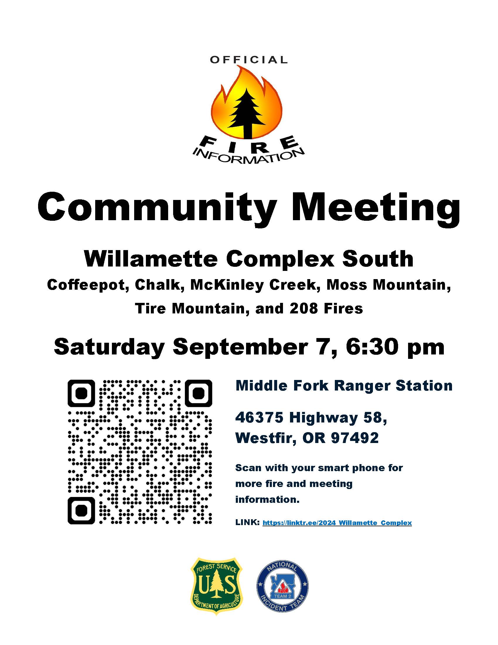
Community Meeting Saturday Sept 7th 630pm Middle Fork Ranger Station 09 06 2024
Related Incident: Willamette Complex Fires - South
Publication Type: Announcement
Community Meeting Tomorrow 6:30pm - Wildfire Update
Join us for a community meeting tomorrow, Saturday, September 7th, 2024, at 6:30 PM PST at the Middle Fork Ranger Station. Subject Matter Experts from the NW2 Incident Command Team will provide briefings on current operations, weather, and fire behavior. Local USFS personnel will also be on hand to answer questions about the July 17th lightning strikes and discuss both past and current priorities.
There will be opportunity for questions after the close of the live meeting.
The meeting will be held in person with a virtual option available on this Facebook page. If you can’t make it, don’t worry—the recording will be posted afterward.
Middle Fork Ranger Station
46375 OR-58
Westfir, OR 97492
Stay safe and informed, and thank you for your continued support.
Fire Information Line: 541-208-1742, staffed 8 a.m. to 8 p.m.
Email: 2024.willamettecomplex@firenet.gov
McDermott Fire Update 09 06 2024
Related Incident: McDermott
Publication Type: News
Incident Commander: Jamie Tyson
Location: 16 miles northwest of Philipsburg, MT
Start Date: 8/26/2024
Cause: Undetermined
Size: 145 acres
Resources on Site: 1 crew; 2 engines; 1 helicopter; miscellaneous heavy equipment
Total Personnel: 31
The McDermott Fire, located in the Upper Willow Creek area, is burning in an inaccessible area containing a large concentration of standing dead trees (“snags”) that pose challenges to ensuring firefighter safety and in responding to potential medical emergencies.
Fire managers from the Forest, working in collaboration with local county officials and cooperating agency representatives, have identified and prioritized critical values at risk in the fire area. The closest values are located three miles to the east of the fire’s location.
Helicopters dropped water on the fire during the initial attack phase, but high winds and the inaccessibility of the fire location resulted in fire growth. Additionally, drift smoke from other large fires to the west and south resulted in the inability to fly additional helicopters for air operations in subsequent days.
CURRENT STATUS/PLANNED ACTIONS:
Helicopters will continue to support ground crews with water bucket drops on the east flank to cool hot spots and prevent fire progression. The crew will continue to construct handline on the fire, east of the Black Pine Trail.
WEATHER AND FIRE BEHAVIOR:
Gusty outflow winds associated with passing thunderstorms materialized over the fire area days ago, with little to no measurable precipitation. Temperatures are expected to continue in the mid to upper 80s for at least the next week.
Fire behavior initially was active, with spotting and group torching and a moderate rate of spread. The fire showed little to no movement and was burning internal pockets of timber in the McDermott Ridge area. Small plumes of smoke from group torching of trees on the northern flank near McDermott Gulch were visible today.
CLOSURES AND RESTRICTIONS:
The Forest is in Stage 1 Fire Restrictions. Campfires are allowed only in a permanent metal fire grate/ring provided by the Forest Service in a designated, developed recreation site. Smoking is restricted to vehicles, in buildings, or in an area clear of flammable materials. Devices with an on/off switch that use LPG fuels are allowed in an area clear of flammable materials within 3 feet of the device.
Forest fire managers are working on trail closures. They encourage the public to please avoid the fire area as to not interfere with fire fighting operations.
Settings - change map background and toggle additional layers
Filter - control incident types displayed on map.
Zoom to your location
Reset map zoom and position
Could not determine your location.
Show Legend
 Wildfire
 Prescribed Fire
 Burned Area
Response
Burned Area
Response Other
Other
Chimney Fire
Unit Information
Incident Contacts
Cottage GroveLane 1 Fire Update 09 06 2024
Related Incident: Lane 1 Fire
Publication Type: News
Lane 1 Fire Information
Email: 2024.Lane1@firenet.gov
Fire Information: (541) 649-2399 voice/text
Friday, Sept. 6, 2024
The Lane 1 Fire became active Thursday afternoon as warm, dry conditions combined with drainage aligned winds rekindled smoldering interior pockets of unburned vegetation. The most active portion of the fire was along the Calapooya Divide between Shane Saddle and Twin Rocks. The fire spotted across the line east of the intersection of national forest service roads 2328 and 2358 in the headwaters of the Little Rock Creek drainage. Firefighters are working Friday morning on a small spot just east of 2358 NFSR. An overnight reconnaissance flight with infrared sensors detected an additional spot deeper into the drainage. Firefighters are gridding that area Friday morning. Several other interior pockets around the fire put up smoke as they too became more active Thursday, but none of those are challenging containment lines. The fire increased more than 400 acres to an estimated 25,732 acres as these interior islands were consumed.
The suppression repair continues around the fire as control lines no longer needed for containment are returned to a more natural state. Firelines are repaired by building water bars to direct water runoff from exposed soil to a more suitable direction so as not to create wash outs. Vegetative material removed from the line is pulled back over exposed areas to prevent erosion. Dozer lines require heavy equipment to restore so the areas are protected making it easier for the ground to recover. Fire weakened and other hazard trees are being removed from along firelines for the safety of firefighters working in the area. This work will also make it safer for the public once closures to public managed lands are removed. Large fuels are being removed as fire prevention measures to lessen the fuel load for future wildland fires. This woody debris is being chipped and used as ground cover. Some logs are being salvaged and stored in landings for the BLM and forest service.
Alaska Complex Incident Management Team 1 has reached the end of their assignment and are in the process of transitioning management of the Lane 1 Fire to Northwest Complex Incident Management Team 8 who is managing the neighboring Homestead Complex. The two teams have been shadowing each other to learn the operation. The transfer of command will occur Saturday morning. Suppression repair work will continue on the Lane 1 Fire.
Copperfield Fire Daily Update 962024 09 06 2024
Related Incident: Copperfield Fire
Publication Type: News
Chiloquin, Ore. – Predicted weather was moderate, allowing crews the opportunity to increase containment, particularly in the areas where there are nearby structures. Overnight, infrared drones identified a few hot spots on the east side of the fire and crews were able to find them and mop up quickly. Crews continued to expand the perimeter depth of the fire in previously burned areas (black line) that are now cold and being mopped up. Overall, containment increased to 43%.
The Oregon State Fire Marshal (OSFM) Incident Management Team has demobilized from the fire and are returning to their home agencies. Their work has built strong containment around all homes and structures. ODF IMT Team 3 will continue to monitor and patrol areas and work on any new threats in those areas. ODF Team 3 will remain in command of the fire continuing containment through mop up operations.
Today there is a Red Flag Warning from 1-9 PM for strong winds, higher temperatures, and lower relative humidity. There is a 20% chance of a dry thunderstorms that could bring winds with 40-50 MPH gusts. This will be another test of the current work and containment measures. The goal is to push deeper into the black and increase mop up while staying alert during the weather warning.
Evacuation levels will continue to be evaluated with the increase of the fire containment. Evacuation levels are determined by the Klamath County Sheriff's Office in conjunction with fire officials and agency administrators. Current evacuation areas and levels can be found at https://www.klamathcounty.org/300/Emergency-Management.
For Hunters Update on Forest Closures and Fire Restrictions 09 06 2024
Related Incident: Willamette Complex Fires - South
Publication Type: Announcement
🦌 Hunting Season Update: Important Information on Fire Restrictions and Forest Closures 🦌
With hunting season here, we want to remind everyone that there are fire-related closures and fire restrictions in place on the Willamette National Forest. We understand that these closures impact hunting plans.
The current closures are primarily for the safety of firefighters and the public. With active fire operations, including emergency vehicles and heavy machinery on forest roads, a large closure area is necessary to ensure that firefighters can focus on managing the fire without needing to evacuate visitors should conditions change rapidly.
We will reduce the closure area as soon as it's safe, and in the meantime, we're here to help you find nearby areas that are open and safe for hunting and recreation.
Make your hunting enjoyable by following these tips:
• The public is encouraged to observe closures, pay attention to evacuation warnings, and avoid active wildfire areas to give firefighters and first responders the room they need to move heavy equipment and work safely to protect the public and property from wildfire.
• Know before you go where there are forest closures in effect. https://www.fs.usda.gov/willamette
• Drive and park carefully: Don’t park vehicles on dry, grassy areas because heat from the exhaust can ignite the dry grass. Avoid operating a vehicle away from developed roads and ensure that motorized recreation vehicles have the required spark arresters. Pay attention to any towing equipment or dragging chains that could start a fire.
• Remember that open fires, such as grills and campfires, are currently not allowed in several of Oregon's National Forests including the Willamette. Use only pressurized liquid or gas appliances that can be switched on/off. The Willamette USFS Fire Restriction order is located here:
chrome-extension://efaidnbmnnnibpcajpcglclefindmkaj/https://www.fs.usda.gov/Internet/FSE_DOCUMENTS/fseprd1047207.pdf
For hunting regulations, contact:
Oregon Department of Fish and Wildlife at
(503) 947-6000 and toll free at (800) 720-6339
Stay safe and informed, and thank you for your continued support.
Inciweb: https://inciweb.wildfire.gov/incident-information/orwif-willamette-complex-fires-south
Fire Information Line: 541-208-1742, staffed 8 a.m. to 8 p.m.
Email: 2024.willamettecomplex@firenet.gov
Smoke Information for Oakridge:
https://www.airnow.gov/?city=Oakridge&state=OR&country=USA
Closures and Fire Restrictions:
For specific closure information, visit tinyurl.com/WillFireClosures2024
For current fire restrictions, visit tinyurl.com/WillFireRestrictions2024
#WillametteComplex South
#ChalkFire #CoffeepotFire #McKinleyFire #MossMountainFire, #TireMountainFire #208Fire