
Watch Fire and Buckhorn Fire Weather and Fire Behavior Report Sunday 07 14 2024
Related Incident: Watch Fire
Publication Type: Announcement
Today's fire weather and fire behavior updates for the Watch Fire and the Buckhorn Fire as provided by Dan Pearson, Fire Behavior Analyst for Southwest Complex Incident Management Team 2.Available now on the San Carlos Apache Forest Resources Program - Forestry Facebook page!
Watch Fire Morning Operational Update Sunday 07 14 2024
Related Incident: Watch Fire
Publication Type: Announcement
Watch Fire and Buckhorn Fire Operational Update provided by Pat Moore, Operations Section for Southwest Area Incident Management Team 2. Available now on the San Carlos Apache Forest Resources Program-Foresty Facebook page!
Settings - change map background and toggle additional layers
Filter - control incident types displayed on map.
Zoom to your location
Reset map zoom and position
Could not determine your location.
Show Legend
 Wildfire
 Prescribed Fire
 Burned Area
Response
Burned Area
Response Other
Other
2024 SQF Lightning
Unit Information
Incident Contacts
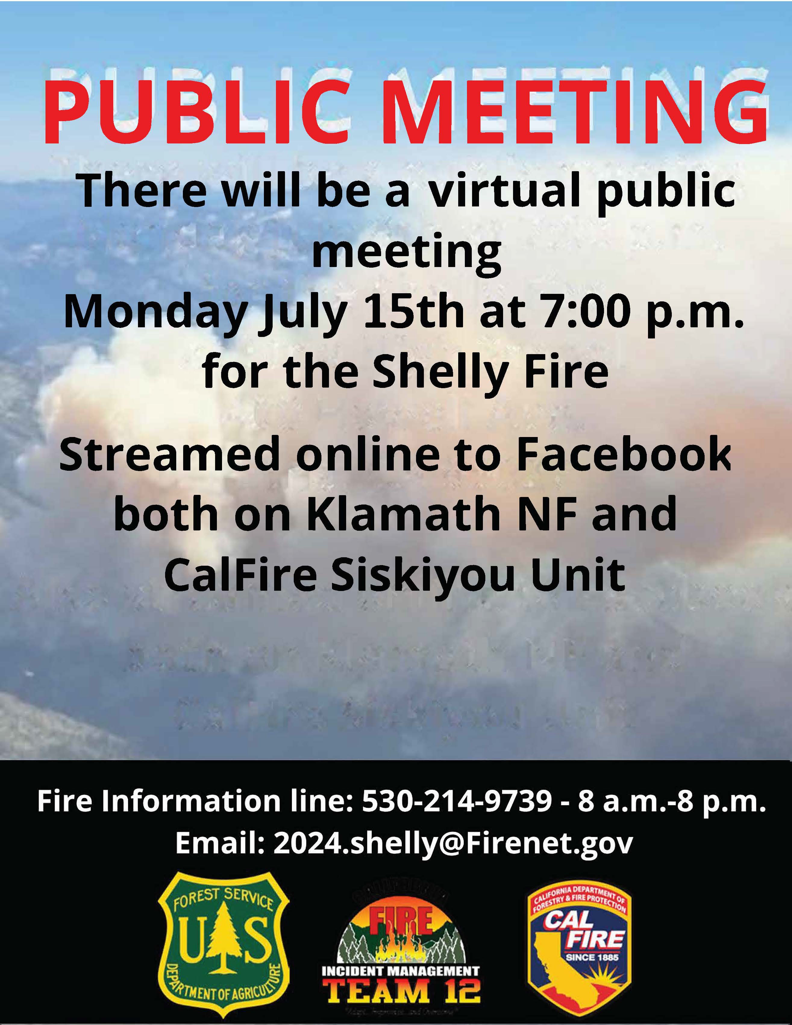
Virtual Community Meeting July 15 2024 07 14 2024
Related Incident: Shelly Fire
Publication Type: Announcement
#Shelly Fire
A virtual community meeting will be held tomorrow Monday July 15, 2024, at 7:00 p.m. This meeting will be livestreamed on both the Klamath NF and CAL FIRE Siskiyou Unit Facebook pages

Level 1 Fire Advisory for Stehekin Area 07 14 2024
Related Incident:
Publication Type: Announcement
Per Chelan County Emergency Management, 7/14/2024:
Chelan County Sheriff's Office has issued a Level 1 Fire Advisory for Stehekin Area. The affected area is Lake Chelan up Lake from Hazard Creek to High Bridge Ranger Station. You will be kept advised as conditions change. Please monitor local radio stations and Chelan County Emergency Management Facebook for updates.
Evacuation Levels Update July 14 2024 07 14 2024
Related Incident: Cow Valley Fire
Publication Type: Announcement
New Evacuation Levels for Cow Valley Fire (3:00pm July 14)
In consultation with fire officials we are issuing the following updates:
Level 1 – Get Ready – Green
• Hwy 26 Corridor (Willow Creek, Jaimeson, Brogan) - Conditions have improved.
• NW of Vale (Graham Blvd and North, Alder road and west) –
• DOWN GRADED to “GET READY” or the lowest level of preparedness. Make plans of where you want to go. Have an overnight bag packed and waiting. If you need to plan for places for livestock, now is the time to work all of that out.
• The City of Vale is not in danger at this time. Only those that live on the Wildland/Urban Interface, northwest of Vale, need to follow these warnings.
Level 2 – Get Set – Yellow
• Westfall area (including Bonita, Indian Valley, Clover Creek areas)
• This area has been UPGRADED to the “Get Set” or the next level of preparedness. Fire activity on the Cow Valley Fire has picked up on the southern side of the fire and preparations should be made in case weather conditions and fire behavior increase. You should have your travel supplies and companion animals ready to go within 10 minutes of notice to evacuate. Plans should be set. Don’t go anywhere yet unless you need extra time to get out and travel.
Evacuees are welcome at the Red Cross Evacuation Shelter in Ontario at the Malheur County Fairgrounds, located at 795 N.W. 9th St. The fairgrounds can accommodate companion animals, large animals and there is space for dry camping in RVs as well as showers, air conditioning and breakfast, lunch, and dinner.
For the most up-to-date evacuation information, please visit the Malheur County Sheriff’s Office page on Facebook.
https://www.facebook.com/profile.php?id=100069245917855
For additional information and updates on the Cow Valley Fire, visit https://www.facebook.com/profile.php?id=61562017027302
Vista Fire Morning Update Spanish Version 07 14 2024
Related Incident: Vista Fire
Publication Type: News
ACTUALIZACIÓN DEL INCIDENTE DE LA MAÑANA
Fecha: 7-14-2024 Hora: 9:00 am
Tamaño: 2887 acres Fecha/hora de inicio: 7-7-24 9:51 a
Contención: 43% Causa: Bajo investigación
Total de personal: 651 Ubicación: Lado sur de Lytle Creek
Estructuras amenazadas: 416
Agencias de Mando Unificado: Equipo 15 de Gestión de Incidentes de California, Departamento de Bomberos del Condado de San Bernardino.
Las líneas de contención en el flanco norte del incendio Vista se pusieron a prueba ayer por la tarde y por la noche con vientos racheados procedentes de tormentas que provocaron vientos erráticos. Los bomberos fueron capaces de mantener el fuego dentro de su huella actual, mientras que el mantenimiento de la preparación de respuesta de ataque inicial. Las cuadrillas en el flanco oriental aseguraron la línea a lo largo de la carretera 3N06, limpiando y cuadriculando para identificar cualquier punto caliente con el aumento del viento. La contención ha aumentado hasta el 43%.
"Nuestro tema de hoy es la gestión de riesgos. En el Bosque Nacional de San Bernardino, estamos agradecidos a las cuadrillas por ser gestores de riesgos, participar activamente en este incidente, y por mantener la cabeza en el pivote", dijo Danelle Harrison, Supervisor del Bosque Nacional de San Bernardino.
El Servicio Meteorológico Nacional ha emitido un aviso de bandera roja que permanecerá vigente hasta las 21.00 horas de esta noche. Visite este enlace para obtener más información: https://www.weather.gov/wrh/fire?wfo=sgx#
Hoy hay un 15 por ciento de probabilidad de tormentas por la tarde con vientos continuos de salida y una disminución de la humedad relativa. Con el potencial de aumento de la actividad del fuego, las tripulaciones de ataque inicial están listos para responder a cualquier nuevo comienzo y complementar los bomberos en el incendio Vista.
Las cuadrillas reanudarán las actividades de limpieza y vigilarán el incendio en busca de humo o focos de calor. En las zonas de terreno escarpado y escarpado a lo largo de los flancos occidental y meridional, los equipos están buscando oportunidades para construir la línea e ir directamente a aumentar la contención.
El Servicio Forestal ha decretado el cierre de la zona afectada por el incendio Vista en los bosques nacionales de San Bernardino y Angeles. El público tiene prohibido recrearse en la zona del incendio y no debe entrar en el bosque en camino Lytle Creek Road. El cierre está en vigor para proteger al personal de bomberos y a las comunidades. Más información sobre la orden de cierre está disponible en los sitios web de los bosques nacionales en https://www.fs.usda.gov/alerts/sbnf/alerts-notices y https://www.fs.usda.gov/alerts/angeles/alerts-notices.
CALIDAD DEL AIRE:
Visite AirNow.gov para obtener información y medidas que puede tomar para protegerse a sí mismo y a sus seres queridos.
CIERRE DE CARRETERAS:
Lytle Creek Road está cerrado al público en general, incluyendo todas las áreas de recreación al norte de Glen Helen Parkway.
EVACUACIONES: Mt. Baldy Resort.
Nota: En un esfuerzo por comunicar rápidamente información sobre peligros inminentes, el Departamento del Sheriff del Condado de San Bernardino y el Departamento de Bomberos del Condado de San Bernardino envían notificaciones masivas de alta velocidad por teléfono y mensajes de texto. Este sistema se conoce como Sistema Telefónico de Notificación de Emergencias (TENS). Para obtener más información sobre este servicio, visite el sitio web: https://sbcfire.org/alertwarning/.
CIERRES:
Orden de cierre en vigor en el Bosque Nacional de San Bernardino y el Bosque Nacional de Angeles. Varias carreteras, campings, áreas de picnic, senderos y áreas recreativas dispersas están cerradas al público para garantizar la seguridad de los bomberos, la comunidad y el público. Las actividades recreativas están prohibidas dentro de la zona de cierre. Más información sobre la orden de cierre está disponible en los sitios web de los bosques nacionales en https://www.fs.usda.gov/alerts/sbnf/alerts-notices y https://www.fs.usda.gov/alerts/angeles/alerts-notices.
RESTRICCIONES CONTRA INCENDIOS:
El Bosque Nacional de San Bernardino ha aumentado las restricciones contra incendios. Las hogueras están restringidas a las zonas urbanizadas enumeradas en el Forest Order.
Oak Ridge Fire Update 07 14 2024
Related Incident: Oak Ridge Fire
Publication Type: News
Oak Ridge Fire Update
Sunday July 14, 2024
Type 3 Incident Management Organization
Pat Seekins, Incident Commander
Location: Three miles northwest of Beulah, CO
Date Reported: June 22, 2024
Cause: Lightning
Size: 1,310 acres
Containment: 89%
Total Personnel: 54
Yesterday, the helicopter was used to complete sling load operations to remove equipment from the fire line. Firefighters are making great progress with chipping operations on the east side of the fire, despite the hot and dry weather. Heavy equipment continues with suppression repair to return the affected area to pre-existing condition to extent possible on the west side of the fire.
The Oak Ridge Fire is 89% contained and the remaining 11% of the fire perimeter has been confined to natural barriers with limited spread potential. These natural barriers combined with suppression efforts as well as recent precipitation have minimized fire spread and potential. The uncontained portion of the fire is also located in an area that is inaccessible due to the steep, rocky, and rough terrain. This area places a high risk to firefighters with a minimal risk to values along with current and expected fire behavior. Due to the extremely rugged terrain and minimal fire activity and potential, approximately 11% of the fire is being managed for confinement to reduce the risk to responders and utilize natural barriers to any potential fire spread in DIV M/K. Both containment and confinement are part of a full suppression strategy.
The Type 3 organization will transition to a Type 4 Incident Management organization on Sunday evening. The new organization will be comprised of a Type 4 Incident Commander and various fire resources. This will be the last daily update on InciWeb and Facebook unless significant changes occur. A Burned Area Emergency Response (BAER) team will arrive on Wednesday. A BAER team addresses post wildfire soil stabilization and other issues that may arise from a wildfire.
Weather & Smoke Information: Isolated to scattered high-based thunderstorms are possible again this afternoon with strong outflow winds and dry lightning. Monsoonal moisture will wrap into the region starting Monday, initiating a major weather change to colder and wetter conditions for at least the next week.
The US Interagency Fire Air Quality Response Program daily smoke outlook report specific to the fire area may be found at https://outlooks.airfire.org/outlook/d9fa3c77
Closures: The San Carlos Ranger District of the Pike and San Isabel National Forests issued an area, trail and road closure effective June 26, 2024. Go to www.fs.usda.gov/alerts/psicc/alerts-notices for the entire order.
Evacuations: There are currently no evacuations from county sheriff offices due to the Oak Ridge Fire.
Temporary Flight Restrictions: The Temporary Flight Restriction (TFR) was rescinded on July 13, 2024.
OAK RIDGE FIRE INFORMATION
Fire Information Phoneline: 719-299-5688 Time: 8:00 a.m. to 4:00 p.m.
Facebook: @OakRidgeFire2024 Email: 2024.oakridge@firenet.gov
InciWeb: www.inciweb.wildfire.gov/incident-information/copsf-oak-ridge-fire
FOREST SERVICE POST FIRE BAER ASSESSMENT REPORT SUMMARY RELEASED 07 14 2024
Related Incident: Post Burned Area Emergency Response--BAER
Publication Type: News
FOREST SERVICE POST FIRE BAER ASSESSMENT REPORT SUMMARY RELEASED
The Forest Service—Los Padres and Angeles National Forests completed a BAER post-fire assessment of the Post burned area and affected watersheds to determine their response, soil conditions, potential threats, and recommended BAER emergency stabilization measures and actions on National Forest System (NFS) lands. BAER emergency treatments and activities are designed to decreased possible impacts to critical values from the burned areas during rainstorm events such as: life and safety, property, critical natural resources, and cultural resources.
NOTE: Attached below as “Related Information” is a PDF document called “Post Fire BAER Assessment Report Summary_PUBLIC”.
BAER SAFETY MESSAGE: Everyone near and downstream from the burned areas should remain alert and stay updated on weather conditions that may result in heavy rains and increased water runoff. Flash flooding may occur quickly during heavy rain events--be prepared to act. Current weather and emergency notifications can be found at the National Weather Service website: www.weather.gov/lox/.
Watch Fire Update Sunday 07 14 2024
Related Incident: Watch Fire
Publication Type: News
Watch Fire: 2,162 acres
Start Date: July 11, 2024
Cause: Human Caused, Under Investigation
Fuels: Cottonwood, Brush, Understory
Containment: 0%
Resources: 178
Location: 7 Mile District of San Carlos Arizona
Overview: Firefighters had a successful day on the Watch Fire. Crews worked between China Town and Peridot Heights to clean up piles of burned vegetation and eliminate hot spots. Crews also continued to eliminate hot spots around the private structures near Jurassic Park. Representatives from the railroad and electric companies were able to begin work to repair infrastructure damaged during the fire. Today, crews will keep working to improve and strengthen containment lines and eliminating residual heat around the Watch Fire. Crews will continue evaluating properties and communities impacted by the fires and assessing damage.
Weather: Watch Fire is expected to see temperatures of 106 degrees in lower elevations with light west/southwest winds and gusts up to 20 mph with a 55 percent chance of rain and increasing cloud cover.
Safety: Additional fire personnel are available to respond to any new fires which may occur in the area. Increased traffic continues to impact roads in and around the fire. Please drive with caution. Please do not fly drones anywhere near the fire. Drones can endanger firefighting aircraft. If you fly, we can’t.
Restrictions/Closures: Peridot Siding Road from Again Bridge is closed. Closures are being adjusted based on fire activity for public and firefighter safety. Please monitor the San Carlos Police Department and San Carlos Apache Tribe Emergency Response Commission (TERC) Facebook Pages (links below) for more information.
Evacuations: At 1:30 P.M., today, TERC announced the evacuation status of the communities of Lower 7 Mile and New Moon Base from “GO” to “SET. The San Carlos Health Care Center was changed from “SET” to “READY.” The remaining community of San Carlos should be ready to evacuate at any notice. Go to the San Carlos Police Department and San Carlos Apache Tribe Emergency Response Commission (TERC) Facebook pages at: https://www.facebook.com//SanCarlosApachePoliceDepartment/. https://www.facebook.com/profile.php?id=100064423850123
Evacuation shelters are located at the San Carlos High School, Apache Gold Casino, and the Michael Noline Peridot Activity Center.