
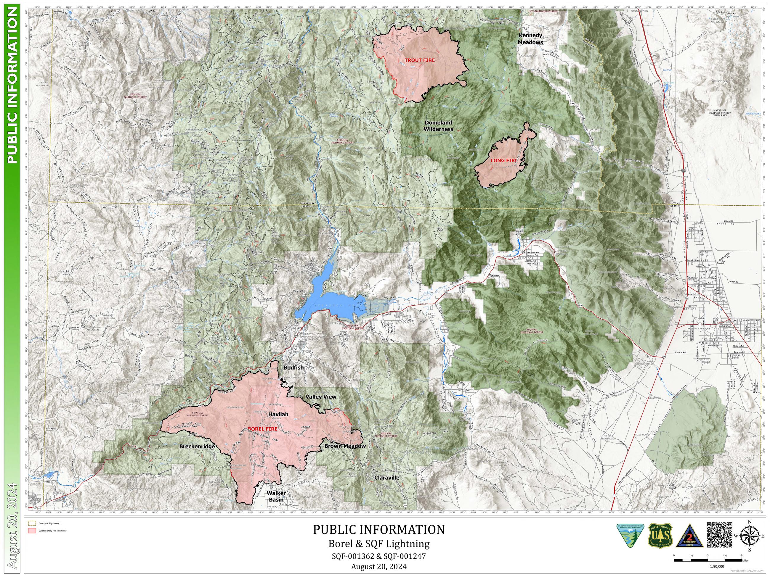
On July 13, 2024, a lightning storm ignited multiple fires on the Sequoia National Forest;
The Trout Fire is northeast of Isabella Lake in the Dome Land Wilderness south of Sherman Pass Road and southwest of Bald Mountain (Tulare County).
The Long Fire is northeast of Isabella Lake in the Dome Land Wilderness southwest of the Rockhouse Meadow (Tulare County).
Information about the Borel Fire can now be found on a separate InciWeb page. Visit Casqf Borel Fire Information | InciWeb (wildfire.gov) for Borel Fire updates.
| Current as of | Sun, 09/15/2024 - 22:56 |
|---|---|
| Incident Time Zone | America/Los_Angeles |
| Incident Type | Wildfire |
| Cause | Lightning |
| Date of Origin | |
| Location | Sequoia National Forest, Kern River Ranger District |
| Incident Commander | Rob Hedlund, ICT4 |
| Incident Description | Acres and containment: Trout Fire (Tulare County): 23,822 acres, 98% contained Long Fire (Tulare County): 9,204 ac, 97% contained |
| Coordinates |
35° 59' 42'' Latitude
-118° 19' 03
'' Longitude
|
| Total Personnel: | 0 |
|---|---|
| Size | 23,822 Acres |
| Percent of Perimeter Contained | 98% |
| Fuels Involved | Long Fire: Mixed conifer overstory, 1-3 feet tall shrubs with moderate grasses and small trees understory, and heavy litter and duff loading. Trout Fire: Primary fuels include mixed conifer overstory, 1-3 feet tall shrubs with moderate grasses, small trees in the understory, and heavy litter and duff accumulation. |
| Significant Events | Long Fire: Fire behavior is minimal. Trout Fire: Fire behavior is minimal. |
| Planned Actions |
Long Fire: Reassess periodically to ensure no changes in status. Trout Fire: Patrol status monitor as needed. Reassess periodically to ensure no changes in status. |
|---|---|
| Projected Incident Activity |
Long Fire: 12/24/48/72 hours: Fire remains inactive with no heat detected and little potential for movement or spread. Trout Fire: 12/24/48/72 hours: Patrol status monitor as needed.
|
| Weather Concerns | Long Fire: Afternoon highs stay a few degrees above normal for the next few day and dry conditions continue. Model guidance shows a warming trend happening through the end of the week, taking afternoon highs 10-12 degrees above normal. Winds are expected to be terrain-driven through the forecast period as well. Trout Fire: Dry conditions over the Trout Fire are expected to continue through the forecast period. Model guidance shows a warming trend happening through the end of the week, taking afternoon highs 10-12 degrees above normal. Winds are expected to be terrain-driven through the forecast period as well. |
|---|