
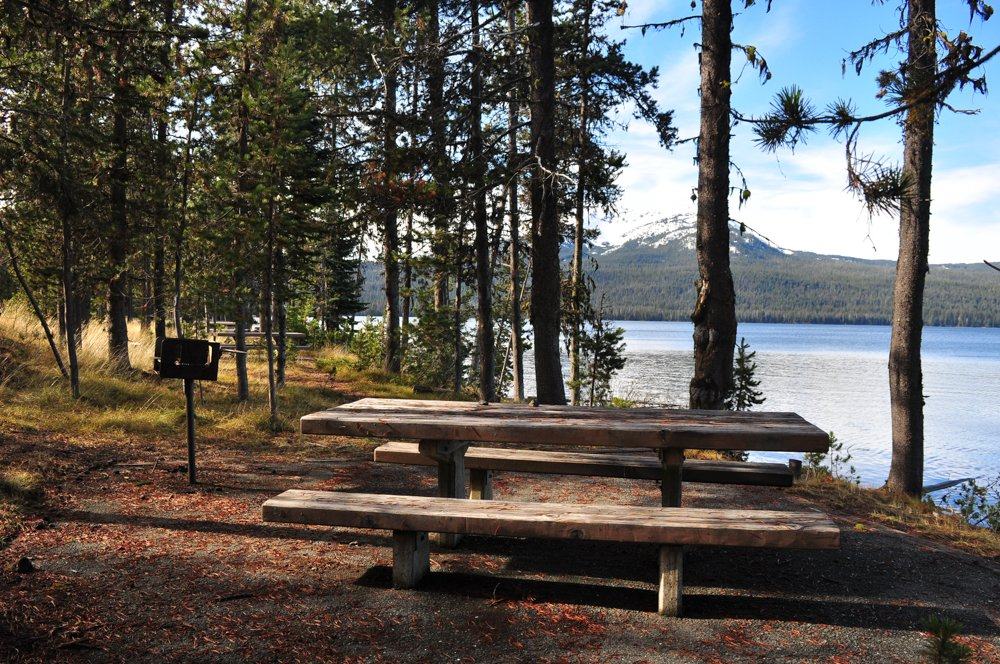
Diamond Lake Thielsen View and Broken Arrow Campgrounds reopened 07 27 2024
Related Incident:
Publication Type: Announcement
Starting today, July 27, 2024, the Administrative Closure for Diamond Lake, Thielsen View, and Broken Arrow Campgrounds has been lifted. Campgrounds will be first-come, first-serve tonight, Saturday, July 27, and tomorrow, Sunday, July 28. And then will go back into reservation status for Monday, July 29. There is still a large closure impacting most recreation sites in the Diamond Lake Ranger District, please stay out of closed areas for your safety as well as firefighter safety. See the closure areas, here: https://www.fs.usda.gov/Internet/FSE_DOCUMENTS/fseprd1194264.pdf
Diamond Lake Campground: https://www.recreation.gov/camping/campgrounds/231980
Broken Arrow Campground: https://www.recreation.gov/camping/campgrounds/231979
Thielsen View Campground: https://www.recreation.gov/camping/campgrounds/251548
Diamond Lake Boat Ramps are OPEN. The Diamond Lake Visitor Center will be staffed as air quality conditions allow, call (541) 793-3310, before visiting. Please check air quality information before traveling to the Diamond Lake area at AirNow.Gov.
To see a full list of recreation sites, visit: https://www.fs.usda.gov/recmain/umpqua/recreation.
This photo does not reflect current conditions. Please check air quality information before visiting the Diamond Lake area at AirNow.Gov.
Actualizacin diaria del incendio Pioneer 27 de julio de 2024 07 27 2024
Related Incident:
Publication Type: News
Actualización diaria del incendio Pioneer
27 de julio de 2024
Tamaño: 32,048 acres
Fecha de inicio: 8 de junio de 2024
Ubicación: 31 millas al NO de Chelan, WA
Contención: 14%
Personnel: 749
Causa: De origen humano, a ser determinada
Recursos asignados: 12 cuadrillas, 4 helicópteros, 24 camiones de bomberos, 27 tanques de agua, 12 maquinarias pesadas
SITUACIÓN ACTUAL: Fue mínimo el crecimiento del incendio Pioneer ayer. Los bomberos respondieron al fuego en el desague de Fourmile vertiendo agua desde helicópteros para frenar la propagación del fuego. Las cuadrillas continuaron patrullando y extinguiendo focos de calor a lo largo de la orilla del lago y los bomberos trabajaron hasta la noche alrededor de la desembocadura del arroyo Fourmile, y protegieron con éxito las estructuras en esa área mediante operaciones de quema estratégicas. En Stehekin, continuaron ampliando y mejorando el cortafuego alrededor del pueblo. El cortafuego permitirá que los bomberos trabajen de manera segura para implementar el trabajo de quema estratégico, y así quemar la vegetación entre el cortafuego y el fuego activo, si llega a ser necesario. Por varios días se ha mantenido en su lugar el extremo sur del incendio en el desague de Lone Fir, y un vuelo de reconocimiento confirmó ayer que no se podía ver rastros de calor en el desague. Al sur del incendio, las cuadrillas continuaron mejorando las carreteras y las líneas de contingencia indirecta. Si las condiciones llegan a cambiar más adelante en la temporada, los bomberos pudieran usar estas líneas de contingencia indirecta para que el fuego no llegue a Manson.
Stehekin está cerrado a los visitantes recreativos mientras que existe una evacuación de nivel 2. La gestión de incendios está coordinando con las empresas locales en Stehekin para brindar comidas y otro tipo de apoyo al personal de bomberos. El extremo sur del incendio está a unas 23 millas al noroeste de Manson. Las comunidades de Chelan y Manson siguen abiertas para los negocios y el turismo.
ACTIVIDADES DE HOY: Los bomberos siguen patrullando y protegiendo las estructuras ubicadas a la orilla del lago, implementando operaciones de quema estratégicas donde sea necesario. Los helicópteros vertirán agua donde sea necesario para reducir la propagación del fuego. Los equipos de bomberos también continuarán mejorando el cortafuego que se construyó alrededor de Stehekin y realizarán otros preparativos, tal como remover árboles caídos e instalarán mangueras y rociadores para proteger Stehekin. También continuarán mejorando las carreteras y las líneas de continencia al sur del incendio y al este de Manson.
CLIMA: Para el día de hoy se prevé un clima cálido y generalmente seco, con temperaturas máximas en los 80 grados. Los vientos serán ligeros e impulsados mayormente por el terreno, y por la tarde cambiarán lago abajo y aumentarán en velocidad hasta la noche. Hay un 10% de probabilidad de una lluvia ligera o una breve tormenta eléctrica.
EVACUACIONES: Los niveles 1, 2 y 3 de evacuación alrededor del incendio Pioneer no han cambiado. Visite https://t.ly/QoH9w para tener más información.
CIERRE DEL BOSQUE: Cierres vigentes del Parque nacional North Cascades: https://www.nps.gov/noca/index.htm
El Bosque Nacional Okanogan-Wenatchee ha emitido una orden de cierre sobre gran parte del área afectada por el incendio: https://bit.ly/PioneerClosure. Las fogatas están prohibidas. Hay una restricción temporal de vuelo (TFR, en inglés) sobre el área del incendio: https://tfr.faa.gov/save_pages/detail_4_6779.html. La actividad de drones no autorizados está prohibida por la TFR.
InciWeb: https://inciweb.wildfire.gov/incident-information/wases-pioneer
Facebook: https://www.facebook.com/profile.php?id=61560760893080
Línea de información sobre el incendio: 541-861-5808, de 8 AM a 8 PM
Correo electrónico: 2024.pioneer@firenet.gov
Diamond Complex and Middle Fork Daily Update 07 27 2024
Related Incident:
Publication Type: News
July 27, 2024
Northwest Team 7 is currently managing the Diamond Complex, estimated at 4,489 acres and 7% contained, and have assumed command of the Middle Fork, 641 acres and 1% contained within Crater Lake National Park. There are currently 25 fires and 570 personnel assigned to the two incidents.
Crews are engaged in a full suppression strategy utilizing direct attack on the fires’ edge where access and firefighter safety allow and implement indirect strategies using constructed control lines or natural barriers where direct attack cannot be done safely. Pacific Power and Light (PP&L) infrastructure within the complex continues to be a top priority for protection as crew attack fires threatening those resources.
The Trail fire, east of Hwy 138 on the west slope of Mt. Thielsen, is 818 acres and 10% contained. Crews have added containment lines on the north and south flanks and continue to fortify those to keep the fire within the current control lines.
The Lemolo fire, north of Lemolo Lake on Bunker Hill, is 734 acres and 0% contained. Crews will continue to secure the dozer line on the east flank and look for opportunities to implement control lines north of the fire to protect recreational values around Lemolo Lake.
The Pine Bench fire, north of Hwy 138 near Dry Creek, is 1,654 acres and 0% contained. Crew will patrol and continue to hold the 4775 road and hold and mop up any new spot fires.
The Watson fire, north of Hwy 138 on Watson Ridge, is 190 acres and 10% contained, and the Loafer fire is at 24 acres and 0% contained. Crews have been making great progress with the limited resources available. They will continue to complete direct line around the fire to keep it within the current footprint.
There are smaller clusters of fires within the complex that consist of: Pig Iron, 27 acres and 90% contained, near Pig Iron Mountain north of Hwy 138; Brodie, 98 acres and 0% contained, about 5 miles south of Hwy 138 and south of Devils Canyon; Trep, 109 acres and 0% contained, about 4 miles south of Hwy 138; Garwood, 5 acres and 90% contained, about 3 miles southwest of Mt. Bailey; Slide, 0.1 acres and 95% contained, northeast of Pine Bench; Potter, 578 acres and 0% contained, north of Hwy 138 about 2 miles southeast of Potter Mountain; Ooya, 158 acres and 0% contained, north of Hwy 138 about 1 mile northeast of Bird Point; Clearwater, 1 acre and 100% contained, south of Hwy 138 about 5 miles northwest of Diamond Lake; Elephant, 0.7 acres and 90% contained, 2 miles southwest of Lemolo Lake; Lost Bear, 0.1 acres and 0% contained, 2 miles south of Hwy 138; Lost, 14 acres and 0% contained, 4 miles south of Hwy 138; Sheep, 0.3 acres and 95% contained, 3 miles north of Diamond Lake; Thin, 0.6 acre and 90% contained, four miles northwest of Diamond Lake; Trap, 4 acres and 0% contained, 1 mile south of Hwy 138 near Trap Mountain; Bear Trap, 45 acres and 0% contained, 2 miles south of Hwy 138 near Bear Trap Mountain; Campwood, 8 acres and 0% contained, 2 miles south of Hwy 138; Rough, 8 acres and 0% contained, two miles south of Hwy 138; Birds, 10 acres and 90% contained; Wood, 8 acres and 0% contains, 2 miles south of Hwy 138, and Mowich, 0.4 acre and 0% contained, 1 mile north of Hwy 138.
The Middle Fork, fire is located in the northwest corner of Crater Lake National Park. Crews will continue to work on the southern perimeter to stop progression toward the historic buildings and infrastructure in the park. They will continue to improve access and create fuel breaks along the Bert Creek Trail to the junction of the Bald Creek Trail.
Today, firefighters will continue direct suppression on accessible fires, and will develop specific suppression strategies for other less accessible fires to be carried out as resources become available.
Nationally and in the Pacific Northwest, fire activity is putting an extreme demand on firefighting resources. The highest priority remains public and firefighter safety and protecting infrastructure and homes.
Weather: Today’s forecast will be in the 74–78-degree range with drier air moving into the region. Lower humidity levels could result in increased fire activity. Cooler temperatures are expected into the weekend which should result in more favorable conditions for firefighting.
Fire Behavior: The fire will likely remain active today and has potential for some torching and uphill runs in areas with heavier fuels and steep slopes. Widespread smoke could have a moderating effect on fire behavior slowing the rate of spread.
Smoke Outlook: Smoke will remain the area and continues to impact the region. For the most up to date information, please visit www.fire.airnow.gov
Closures and Evacuations: Umpqua National Forest has issued two closures across the forest in response to fire activity to protect public and wildland firefighter safety. Emergency Fire Closure ORDER NO. 06-15-24-03 and Emergency Fire Closure ORDER NO. 06-15-02-24-01 impact all of the Cottage Grove Ranger District, most of the Diamond Lake Ranger District, and parts of the Tiller and North Umpqua Ranger Districts. The closure orders can be found here: https://www.fs.usda.gov/alerts/umpqua/alerts-notices. Fire danger is set at Very High and Public Use Restrictions are set at Level 2: https://bit.ly/3xIZZdK.
The Douglas County Sheriff’s Office has downgraded the evacuation order for the Trail fire from a Level 2: BE SET to a Level 1: Get Ready, but the Level 3: GO NOW remains in effect for the Trail fire east of Hwy 138. The Level 2: BE SET and Level 3: GO NOW evacuations for the Lemolo fire remain in place. There is still a Level 2: BE SET for the Pine Bench Fire. For more information visit the Douglas County Sheriff’s Office website: www.dcso.com/evacuations.
Daily Update Swawilla and Bridge Creek Fire July 27 2024 07 27 2024
Related Incident: Swawilla Fire Bridge Creek
Publication Type: Announcement
A return to more seasonable weather is giving firefighters a window of opportunity to gain ground on the fire, but the fire is still moving north and east.
In the area of Buffalo Lake, firefighters were able to advance line along the flank of the fire. While managers are feeling optimistic about this western edge, there is still work to do before the Level 3 Evacuation can be lifted for residents in this area.
On the other side of the fire, fire spread is significantly affected by local winds in the late afternoon which can “pull” fire down the canyons towards the Sanpoil River. Despite protection efforts, structures were burned near French John Lake on Friday. The fire continues to creep around Mt.Tolman and has come to within ¾ mile of Jack Creek Road. Crews worked tirelessly on structure protection in this area and were supported by aerial resources. Other teams completed a dozer line around the town of Keller and put in hoses and sprinklers to help reinforce it. Firefighters are also scouting for areas to put another dozer line slightly further away from Keller creating an additional layer of protection for the community.
Plans are underway for determining when to allow reentry into the burn once it is safe to do so. This includes making sure access roads are free from any dangerous trees, rocks and debris. Operations staff has a goal of opening the Manilla road by the end of the weekend.
Forecasting models continue to indicate a chance that the fire is likely to reach the town of Keller sometime on Sunday. Direct attack on the fire in this area is challenging due to the steep terrain of Mt.Tolman. Additional Hot Shot Crews, who are more accustomed to working in rugged terrain, are arriving and will be a valuable asset in the execution of suppression plans.
Level 3 evacuations remain in place and many roads remain closed in order to prioritize the lives of residents and firefighters. Personnel can fight fire aggressively in dangerous conditions when they can focus on protecting structures, building containment line, spraying water and establishing infrastructure without also worrying about the safety of community members. Getting life “back to normal” is a high priority, but the fire must be contained and dangers mitigated before that can happen. We appreciate the community’s respecting the road closures and evacuations.
An evacuation center is open at the Lake Roosevelt High School gym in Coulee Dam. The shelter at the Paschal Sherman Indian School in Omak is full. Keller Ferry is open only for limited service to assist with evacuations.
Bridge Creek Wildfire
The Bridge Creek Road opened today now that road hazards are complete. The 30 Mile road remains closed as firefighters are conducting burning operations along this northern boarder of the fire. Several resources have been moved from this fire to the Swawilla fire. Evacuations have been lifted.
Additional Information and Maps at https://inciweb.wildfire.gov/, https://www.facebook.com/CCTENV, https://www.facebook.com/CCTBroadcasts
Pyramid and Slate Fire Smoke Outlook 07 27 2024
Related Incident: Pyramid and Slate Fires
Publication Type: Announcement
July 27 Homestead Complex Daily Update 07 27 2024
Related Incident:
Publication Type: News
HOMESTEAD COMPLEX FIRE UPDATE
Saturday, July 27, 2024
Fire Information
Phone: 208-713-9693 (8 a.m. to 8 p.m.)
Email: 2024.homesteadcomplex@firenet.gov
Facebook: www.facebook.com/HomesteadComplexFireInfo
Inciweb: http://inciweb.wildfire.gov/incident-information/orupf-homestead-complex
Hotshot Crew Making Progress Constructing Direct Fireline on Salmon 33 Fire
The seven fires of the Homestead Complex total 1,261 acres this morning, with 4% containment. Suppression tactics are being prioritized by threat to property, infrastructure, industry, and areas with the highest probability of success. There are currently 348 personnel assigned to the Homestead Complex.
A hotshot crew camped out near the Salmon 33 Fire (142 acres) for the last two nights to maximize opportunities to construct fireline during cooler evening and morning conditions, when the fire is less active. They are working with a hand crew to make progress creating direct line on the east side. Today other available resources will be shifted to that area to assist in completing the line on the east flank of the fire.
Heavy equipment crews are working on the east flank of the No Man Fire (424 acres), while crews are working with cooperators on the west flank. The indirect line on the west side of the fire should be completed today, and crews will begin to patrol and improve that line.
The Horse Heaven Creek Fire (371 acres) saw another active day. Crews are working to tie indirect line to existing roads on the south end of the fire. Yesterday an Unmanned Aircraft System (UAS) was used to assist with scouting new opportunities for building line.
Crews have completed indirect line and hoselay around the Reynolds Butte Fire (104 acres). Yesterday’s infrared flight revealed that there was more activity within the fire perimeter than in the last several days. Crews will continue to patrol and improve the indirect line around the fire.
Two heavy equipment resources have begun work on the north side of the Bullpup Fire (125 acres) to improve the 300 Road for use as a containment feature. Fuller Lake Fire (61 acres) remains unstaffed today, but firefighters continue to scout and develop plans for operations, working closely with Resource Advisors. The Lost Bucket Fire (34 acres) saw minimal fire activity yesterday. It remains in patrol and maintain status today. The north side is contained.
Overall fire activity is expected to remain minimal, with weather continuing in a similar pattern over the weekend. You can find your local smoke outlook online at: https://outlooks.airfire.org/outlook/d393fd74.
Forest fire restrictions and danger ratings are as follows: Fire Danger Rating: Very High. Industrial Fire Precaution Levels (IFPLs): 2. Public Use Fire Restrictions (PURs): 2.
CLOSURES: The Bureau of Land Management (BLM), Roseburg District, has issued a closure order for portions of BLM land which border the Umpqua National Forest Emergency Fire Closure north of Steamboat. The closure order can be viewed here: https://www.blm.gov/sites/default/files/docs/2024-07/orwa-fpo-rbg-072624.pdf. Umpqua National Forest Emergency Fire Closure ORDER NO. 06-15-24-03 and ORDER NO. 06-15-02-24-01 remain in effect and can be found here: https://www.fs.usda.gov/alerts/umpqua/alerts-notices
Microwave Tower Fire Update Saturday 07 27 2024
Related Incident: Microwave Tower Fire
Publication Type: News
Fire Information: Phone: (541) 208-1744 daily from 8 a.m. - 8 p.m.
Email: 2024.microwavetower@firenet.gov
Microwave Fire Facebook: https://www.facebook.com/2024MicrowaveTowerFire/
InciWeb: https://inciweb.wildfire.gov/incident-information/or954s-microwave-tower
53% Contained
131 Personnel
806 Acres
5 miles west, southwest of Mosier, OR
Burning in brush, timber, and grass
Highlights
Increased humidity levels played a crucial role in helping firefighters successfully complete yesterday's firing operation. The operation, which began around 11:00 a.m. and continued into the evening, starting on the east side, focused on the north perimeter of the fire, advancing towards the west. As a result, smoke was visible from Interstate 84.
Firefighters made significant progress along the northern edge by utilizing the dozer line, the Columbia River Highway State Trail, and rocky terrain. They effectively connected these lines, with successfully securing the area from east to west.
Today, firefighters will continue their strategic burning operations along the northwest flank in order to complete the containment lines surrounding the Microwave Tower fire. There will likely be smoke and flames visible from within the fire area as firefighters light off fuels along their hand and dozer lines.
Fire Behavior
Low to moderate fire behavior occurred during the firing operations. Smoldering along other flanks of the fire occurred throughout the day and night. Similar fire behavior is expected today during the burning operations. Firefighters will continue to mop-up and patrol the fire area.
Evacuations
Existing Level 3, 2 and 1 evacuations on the east side of the fire area remains in place. For updated information please follow https://www.facebook.com/WascoCountySheriff.
The evacuation preparedness level remains at Level 1 on the west side of the fire area. Please follow https://www.facebook.com/hrcso for additional information. The Red Cross center is available at the Hood River Middle School for anyone needing a place to go.
Red Fire Daily Update 7272024 7272024 07 27 2024
Related Incident: Red Fire
Publication Type: News
Red Fire
July 27, 2024
Daily Fire Update
Online: https://inciweb.wildfire.gov/incident-information/ordef-red-fire
Facebook – 2024 Red Fire Information
Fire Information Line: 541-208-1766, 8:00 AM – 8:00 PM
Email: 2024.red@firenet.gov
Red Fire Quick Facts
Size: 416 acres Origin: 5 miles west of Crescent Lake Junction, Oregon County: Klamath
Start Date: July 17, 2024 Cause: Lightning Containment: 0% Total Personnel: 168
PUBLIC Meeting Announcement: The Eastern Area Complex Incident Management Team (CIMT) will host a Community Meeting Sunday, July 28, 2024, at 6:00 p.m., at the Central Cascades Fire & EMS Community Service Center – 20400 Crescent Lake Hwy Crescent Lake, OR 97733. The meeting will also be viewable live through the Deschutes National Forest Facebook Page at https://www.facebook.com/deschutesnationalforest/.
Operations: Firefighters continued to construct handline around structures near Odell Lake and down to the lake.
Hand crews worked along Forest Service Road 60 to reduce vegetation loading 50 to 100 feet from the road. Heavy equipment and crews continued their progress removing concentrations of vegetation from the east end of the Odell Lake to the south and west. The shaded fuel break construction continued along the Union Pacific railroad lines. Hand crews worked in areas identified for reducing the density of trees. Decreasing dense tree stands will make it more difficult for fire to travel through the crowns of trees decreasing fire intensity.
Humidity levels play an important role in fire management. The higher humidity forecast for today will improve the vegetation moisture levels and help determine how much of the vegetation is available to burn. When vegetation moisture is high, fires are difficult to ignite and burn poorly. With little moisture in the vegetation, fires start easily and other driving forces, such as wind, may cause rapid and intense spread.
Today, firefighters will continue to install a shaded fuel break along the boundary of the Diamond Peak Wilderness separating heavy fuels from the roads, residences, resorts and the community of Crescent Lake Junction. A structure protection crew and a structure specialist will assess critical values in the Crescent Lake area. A timber task force will continue to create defensible space protecting critical structures and other values along the Union Pacific Railroad and structures along Odell Lake. Crews will scout out opportunities to construct control features along Forest Service Road 1610.
Round Mountain Fire – Firefighters continue to work on mop up. The fire remains 108 acres and is 65 percent contained.
Wickiup Fire – Firefighters continue to work on mop up. The fire remains 168 acres and is 75 percent contained.
Closures – The Deschutes National Forest has implemented an emergency closure around Crescent Lake and in the Diamond Peak Wilderness. Closure information is available at: https://www.fs.usda.gov/alerts/deschutes/alerts-notices/?aid=89091
Evacuation Notices – The WILDFIRE! Level 1 – BE READY to Evacuate notice issued by Klamath County Emergency Management for the Crescent Lake, Odell Lake, and Crescent Junction area remains in effect (INCENDIO FORESTAL! Nivel 1 - ESTÉ PREPARADO para evacuar de las siguientes zonas: Crescent Lake, Odell Lake, Crescent Junction). For information, or to sign up for alerts, visit: www.klamathcounty.org/300/emergency-management
Fire Restrictions – Stage 2 Public Use Fire Restrictions which prohibit open fires, including in developed campgrounds, are in effect for the Deschutes National Forest. Visit the Deschutes National Forest’s website fs.usda.gov/detail/deschutes/home/?cid=stelprdb5297376 for more information. The Industrial Fire Precaution Level is currently Level IV “General Shutdown”.
Weather: Humidities are improving, into the 25% range creating damper air for the next 2-3 days. Temperatures will climb into the low 70s near the fire area. Winds will remain very light in the morning hours and will shift to northwest winds in the afternoon, gusting up to 15 mph. An Air Quality Alert is in effect today until noon due to wildfire smoke and forecasted conditions causing the air to reach unhealthy levels.
A Temporary Flight Restriction (TFR) is in place over the fire area. If you fly, we can’t! Unauthorized drone flights pose serious risks to firefighter and public safety and will halt aerial operations and seriously impact fire suppression efforts.
Smoke: Smoke from the Red Fire and other area fires will continue to impact air quality. Air quality information can be found at https://fire.airnow.gov/.
Battle Mountain Complex 07 27 2024
Related Incident: Battle Mountain Complex
Publication Type: News
Firefighters strengthen and connect key lines
UKIAH, Ore. – Firefighters assigned to the Battle Mountain Complex continue to push forward on progress across both zones of the incident. As of this morning, Oregon State Fire Marshal Green Team is unified with ODF in the protection of structures across the incident as ODF Teams 1 and 3 work in cooperation on the fire line. Resources from both agencies continue to arrive, and today, 1,628 personnel are staffed by the ODF Teams and 12 structural task forces were brought in by OSFM.
Fire behavior on the southwestern side of Zone I, near Cupper Creek Road, was active overnight and firefighters focused much of their attention in these areas, protecting structures and building line where possible. Today, these efforts will continue, as this remains the most critical and challenging portion of Zone I. Additional resources will be assigned here today with the goal of holding existing line and constructing more where possible. To the west, windy conditions overnight challenged firefighters around the Ant Hill area, and firefighters on this portion of the fire will continue to build and strengthen line.
To the south on Zone I, containment line was further secured around the town of Monument, which has been a focus for firefighters over the past couple of days. Firefighters spent the early morning hours conducting strategic firing operations in the cooler temperatures, which will help to create a stronger and more secure barrier between the fire and scattered homes in the area.
In Zone II, the eastern half of the complex, firefighters made more progress securing and connecting key lines and even beginning mop up in less-active portions of the fire.
Along the north of the fire, crews established and connected lines from Potamus Creek to Highway 395. Along Highway 395, firefighters continued to remove standing, dead timber and began mop-up operations to remove burning materials close to the line to ensure they don’t flare up when temperatures rise in the coming weeks.
Along the southeast, crews conducted firing operations to remove unburnt vegetation. Structural resources, under the command of the OSFM, continued protecting and mopping up around structures.
Evacuations: Level 1 (Be Ready), Level 2 (Be Set) and Level 3 (Go Now) evacuations are in effect. For updated information, visit:
- For Umatilla County, follow www.facebook.com/UmatillaCountySheriff or sign up for Umatilla County Emergency Alert System at https://member.everbridge.net/index/2590041373147145.
- For Grant County, visit the RAPTOR arcgis site or sign up for alerts at: https://member.everbridge.net/index/825462649520134.
- For Morrow County, visit https://experience.arcgis.com/experience/de78333b0d2544f7a320142174aa20ae
Public Land Closures:
The Bureau of Land Management has closed public lands along the John Day River from Kimberly to Dale, and from Kimberly to Service Creek. More information here: https://www.blm.gov/programs/public-safety-and-fire/fire-and-aviation/regional-info/oregon-washington/fire-restrictions.
The Umatilla National Forest has implemented a closure for public lands within the Heppner Ranger District and the North Fork John Day Ranger District. More information at: https://www.fs.usda.gov/detail/umatilla/news-events/?cid=FSEPRD1194462 and https://www.fs.usda.gov/detail/umatilla/alerts-notices/?cid=stelprdb5286768.
FIRE AT A GLANCE
Total Estimated Complex Size: 159,454 acres
Monkey Creek Fire: 154,970
North Fork Owens: 4,484 acres
Total Containment: 7%
Cause: Under Investigation
Estimated Cost: $13,700,000
All Resources
Hand Crews: 47
Engines: 96
Water Tenders: 41
Dozers: 20
Helicopters: 8
Total Personnel: 1,628
2024 SQF Lightning Daily Incident Update 07 27 2024
Related Incident: 2024 SQF Lightning
Publication Type: News
Trout Fire: 22,660 acres - 25% containment
Long Fire: 9,204 acres - 35% containment
Borel Fire: 31,980 acres - 0% containment
Total Personnel: 1,059
Current Situation: Under red flag weather conditions, the Borel Fire has now burned more than 31,000 acres in less than three days. Hundreds of firefighters are fighting the fire and law enforcement officers are conducting evacuations. Our priority remains the lives and property of all affected. Evacuation warnings and orders don’t just increase the safety of residents, they allow emergency personnel to focus their efforts on stopping the fire. Know the status of your zone by viewing genasys Protect's interactive map (tinyurl.com/jcdv55f9). On Saturday morning, management of the fire changed to unified command between California Interagency Incident Management Team (CIIMT) 14 and Kern County Fire Department. Another federal incident management team—CIIMT 11—is gathering information from and transitioning with CIIMT 14 on Saturday and will be joining unified command of the fire Sunday morning.
Trout Fire: Fire growth was minimal on Friday despite persistent warm, dry, and windy conditions, allowing crews to make significant progress in suppressing hotspots along the fire’s edge. On the southern perimeter, crews that are staying near the fireline overnight in the Domeland Wilderness are extinguishing lingering areas of heat and constructing fireline with hand tools from Sirretta Pass toward Smith Meadow. An infrared flight detected mostly areas of scattered head with pockets of intense heat limited to the fire’s southwestern and northwestern sides.
Long Fire: Fire activity remains moderate, consisting primarily of creeping and smoldering flames. Some unburned vegetation in the fire’s interior may continue to produce smoke, but crews report no heat sources threatening existing containment lines. Today, members of the California National Guard arrived to support ongoing efforts with the Long Fire. Firefighters continue to make progress constructing handlines southwestward from the fire’s northeast side near the Pacific Crest Trail toward Palome Creek.
Borel Fire: The Borel Fire has grown at a pace similar to what one would expect during a severe Santa Anna wind event. After spreading more than five miles Thursday night, it advanced another six miles on Friday. With firefighters deployed around homes and dozers working to construct control lines, the fire swept through the community of Havilah and Piute Meadow Ranches. The northernmost edge of fire remains south of the Cleer Creek subdivision. The fire is spreading southward toward Walker Basin and southeastward toward Thompson Canyon. Today, the fire behavior is expected to be, once again, very extreme under long-term red-flag-warning weather conditions.
Weather & Air Quality: A Red Flag Warning is in effect through 11 p.m. Saturday for low relative humidity and elevated winds. Fire behavior on new and existing fires is expected to be extreme. Hot, dry conditions are expected today with wind gusts up to 35 mph possible. Westerly winds will remain elevated on ridgetops throughout Saturday night. A daily smoke outlook is produced for communities affected by wildfire smoke: tinyurl.com/452x2uzr.
Sequoia National Forest & BLM Closures & Restrictions: Sequoia National Forest lands, roads, trails, and recreation sites around the Trout and Long Fires are temporarily closed under Forest Order No. 0513-24-12. Lands, roads, trails, and recreation sites around the Borel Fire are closed under Forest Order No. 0513-24-14. Fire restrictions are in effect under Forest Order No. 0513-24-10. All orders, maps, and accompanying appendices can be found on the Forest’s website: tinyurl.com/2en2d36k. The Bureau of Land Management’s Bakersfield Field Office has temporarily closed Long Valley Campground, Chimney Creek Campground, and portions of the Pacific Crest Trail. View the emergency closure order here: tinyurl.com/4mprcb9b. The PCT is closed between Hwy 178 at Walker Pass (mile 653) and the South Fork of the Kern River bridge (mile 717.7).
Evacuation Center: Residents under an evacuation warning or order can go to either the Tehachapi Education Center (126 S. Snyder Ave., Tehachapi) or the Lake Isabella Senior Center (6405 Lake Isabella Blvd, Lake Isabella). Animal services will assist with sheltering companion animals at the center.
Large-Animal Assistance: The rodeo grounds in Kernville (467 Scodie Ave., Kernville) is available for residents who need to move large animals or livestock. For more information, contact Orion, Kernville Chamber of Commerce, 661-340-0026.
Road Closures: State Route 178 is closed from 4.1 mi east of the junction of SR 184 to Democrat Springs. View the interactive Caltrans map for the most current road closure information: quickmap.dot.ca.gov/. Portions of Caliente Bodfish Road are also closed. Visit the Kern County Public Works Department website for the most up to date information on county road closures (tinyurl.com/z6crvp6t)
Evacuations: Everyone in areas of active fires should “Know Your Zone.” Go to genasys Protect (tinyurl.com/jcdv55f9) to identify the zone you reside in.
Kern County has multiple evacuation orders and warnings in effect due to the Borel Fire. The following zones are under an evacuation order: KRN-403-A, KRN-403B, KRN-736, KRN-737, KRN-738, KRN-739, KRN-740, KRN-741, KRN-742, KRN-743, KRN-747-A, KRN747-B. The following zones are under an evacuation warning: KRN-734, KRN-735, KRN-748.
Tulare County has evacuation warnings and advisories in effect due to the Trout and Long Fires. The following zones are under an evacuation warning: TLC-E274-B and TLC-E261-B. The following zones are under an evacuation advisory: TLC-E297-A, TLC-E250, TLC-E274-A, and TLC-E261-A.