
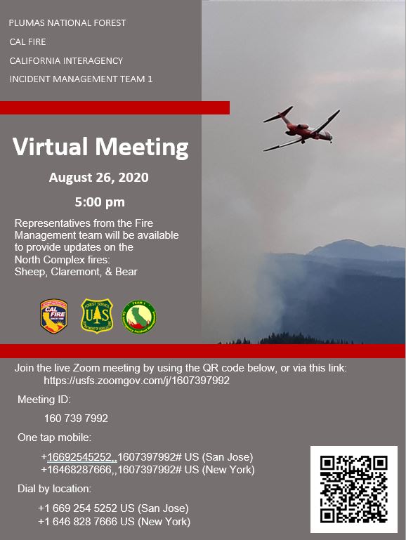
North Complex VIRTUAL COMMUNITY MEETING 8262020
Related Incident:
Publication Type: Announcement
The North Complex is inviting you to a scheduled ZoomGov meeting.
Topic: North Complex Virtual Community MeetingTime: Aug 26, 2020 05:00 PM Pacific Time (US and Canada)
Join ZoomGov Meetinghttps://usfs.zoomgov.com/j/1607397992
Meeting ID: 160 739 7992One tap mobile+16692545252,,1607397992# US (San Jose)+16468287666,,1607397992# US (New York)
Dial by your location +1 669 254 5252 US (San Jose) +1 646 828 7666 US (New York)Meeting ID: 160 739 7992Find your local number: https://usfs.zoomgov.com/u/acuLVPvhPu
Join by SIP1607397992@sip.zoomgov.com
Join by H.323161.199.138.10 (US West)161.199.136.10 (US East)5261100.140Meeting ID: 160 739 7992
North Complex AM UPDATE 8252020
Related Incident:
Publication Type: News
North Complex Resources: 34 dozers, 140 engines, 15 hand crews, 15 helicopters, 22 water tenders
Current Situation on the North Complex: The North Complex consists of multiple lightning caused fires (August 17, 2020) on the Plumas and Lassen National Forests.
Light precipitation and higher relative humidities will give crews a head start today as they continue to build or strengthen dozer and hand line on the Sheep, Claremont, and Bear Fires. Smoke columns could develop this afternoon on the fires, which will lead to erratic, gusty winds challenging crews efforts. To date, the Sheep Fire has destroyed 8 residences and damaged 1 residence. The greatest area of concern for the Claremont Fire is the southeast section about ½ mile west of Hwy 70 and threatening the communities of Cromberg and Sloat. Hwy 70 remains closed but is open by escort provided by California Highway Patrol. The Bear Fire continued to grow overnight with aggressive fire behavior on the west side up Bear Creek.
Of the original 21 fires in the complex, 16 are 100% contained, and others have been encompassed by the remaining larger fires. All smaller contained fires are continuing to be monitored. Those fires ranged in size from .1 acres to 8 acres.
Weather: Lingering moisture and instability will lead to a slight chance of showers and thunderstorms this afternoon into early this evening. The greatest threat for showers and thunderstorms over the North Complex will be in the afternoon hours. It is most likely, however, that showers and thunderstorms will remain north and east of the area similar to Monday. It's still possible that winds could affect the area in the afternoon and building smoke columns are likely to lead to some erratic and gusty winds in the heat of the afternoon and evening.
Air Quality: Heaviest impacts will again be in areas closest to the fires. Lingering smoke may be dense at times in the valleys but thinning is expected, especially south of fires. As fires become more active later in the day, areas will see heavier impacts in the evening into overnight as smoke settles into valleys and local drainages. For a fire and smoke map, go to https://fire.airnow.gov/
Closures/Evacuations: Evacuation Advisory Alert is in effect for the communities of Cromberg and Sloat. Residents there should make preparations to evacuate. Highway 70 remained CLOSED between Spring Garden and La Porte Road, but escorted groups were allowed by the California Highway Patrol as conditions allowed.
Evacuation centers are in place for the following communities: Susanville at the Lassen Community College Dormitories. Large animals can be housed at the Lassen County Fairgrounds; Quincy at the Quincy High School. No small animals are able to be accommodated at the high school; Greenhorn and Spring Garden at the Portola Station Baptist Church.
For immediate text notifications about emergency alerts, residents can sign up for the Plumas and Lassen County’s CodeRed Emergency Alert System from their respective websites: Plumas - https://www.plumascounty.us/; Lassen - http://www.lassencounty.org/dept/sheriffs-office/sheriffs-office
Visit CalTrans at quickmap.dot.ca.gov or call 1-800-427-7623 for the latest maps and information of road closures in your area.
COVID-19: California Interagency Incident Management Team 1 has implemented precautionary measures to prevent the spread of COVID-19 in both fire the surrounding communities.
North Complex Fires:
Claremont Fire – https://inciweb.nwcg.gov/incident/6996/
Bear Fire – https://inciweb.nwcg.gov/incident/7025/
Sheep Fire – https://inciweb.nwcg.gov/incident/7067/
Forest Closures: https://fs.usda.gov/alerts/plumas/alerts-notices
###
North Complex PM UPDATE 8242020
Related Incident:
Publication Type: News
North Complex Resources: 34 dozers, 140 engines, 15 hand crews, 15 helicopters, 22 water tenders
Current Situation on the North Complex: The North Complex consists of multiple lightning caused fires (August 17, 2020) on the Plumas and Lassen National Forests.
A positive break in the weather provided an opportunity today for firefighters to turn their attention to attacking the fires in place of defending structures. Conditions near Susanville allowed multiple fixed wing aircraft to approach the Sheep Fire and drop retardant to bolster the fire line. Increased visibility also allowed helicopters to continue to cool flare-ups. Helicopters and additional crews were also able to amplify efforts on the Claremont and Bear Fires. These fires are discussed in more detail in separate updates.
Of the original 21 fires in the complex, 16 are now 100% contained. The Willard and Fleming burned together with the Sheep. The Iron Fire south of Taylorsville (50 acres) and the Copper Fire (65 acres) north of Greenville are now 100% contained. Crews continue to mop up and reinforce the containment lines on those fires. The Neer, Kessler, Anna, Monitor, Monitor 2, Monitor 3, Paxton, Branch, Little, Loop B, Davis, Davis 2, Evans, and Meyers Fires are all 100% contained and in patrol status. Those fires ranged in size from .1 acres to 8 acres.
Weather: RED FLAG WARNING REMAINS IN EFFECT FOR THE FOOTHILLS AND MOUNTAINS THROUGH THIS EVENING. A threat of isolated dry thunderstorms remains possible in the foothills and mountains through this evening. Lightning from dry thunderstorms will have the potential to start new fires. Dry thunderstorms may also produce gusty wind.
Air Quality: Hazy smoke continued today and was most dense in the valleys. Light winds pushed smoke to the north/northeast and areas nearest the fires saw the greatest impacts, namely Susanville and Quincy. Those areas can expect to see unhealthy/very unhealthy conditions overall. Locations near Reno should have seen some relief today as scattered showers continued to pass through. Smoke was expected to thin/mix out around noon into the early evening. For a fire and smoke map, go to https://fire.airnow.gov/
Closures/Evacuations: Evacuation Advisory Alert is in effect for the communities of Cromberg and Sloat. Residents there should make preparations to evacuate. Highway 70 remained CLOSED between Spring Garden and La Porte Road, but escorted groups were allowed by the California Highway Patrol as conditions allowed.
Evacuation centers are in place for the following communities: Susanville at the Lassen Community College Dormitories. Large animals can be housed at the Lassen County Fairgrounds; Quincy at the Quincy High School. No small animals are able to be accommodated at the high school; Greenhorn and Spring Garden at the Portola Station Baptist Church.
For immediate text notifications about emergency alerts, residents can sign up for the Plumas and Lassen County’s CodeRed Emergency Alert System from their respective websites: Plumas - https://www.plumascounty.us/; Lassen - http://www.lassencounty.org/dept/sheriffs-office/sheriffs-office
Visit CalTrans at quickmap.dot.ca.gov for the latest maps with road closures in your area.
COVID-19: California Interagency Incident Management Team 1 has implemented precautionary measures to prevent the spread of COVID-19 in both fire the surrounding communities.
North Complex Fires:
Claremont Fire – https://inciweb.nwcg.gov/incident/6996/
Bear Fire – https://inciweb.nwcg.gov/incident/7025/
Sheep Fire – https://inciweb.nwcg.gov/incident/7067/
Forest Closures: https://fs.usda.gov/alerts/plumas/alerts-notices
###
North Complex AM UPDATE 8242020
Related Incident:
Publication Type: News
North Complex Resources: 30 dozers, 114 engines, 12 hand crews, 10 helicopters, 16 water tenders
Current Situation on the North Complex: The North Complex consists of multiple lightning caused fires (August 17, 2020) on the Plumas and Lassen National Forests.
All three large fires in the North Complex – Sheep, Claremont, and Bear Fires – experienced pyrocumulus development yesterday leading to vertical smoke columns and significant fire advancement as a result of Red Flag conditions. The Sheep made a strong push to the east towards Hwy 395 in the Wingfield Road area. The Claremont Fire crossed the Middle Fork of the Feather River and aggressively moved eastward. The Bear Fire grew on the north and south sides. Despite significant fire growth in residential areas, there were no reported structure losses from yesterday. More details of these fires are covered in separate updates.
Of the original 21 fires in the complex, 16 are now 100% contained. The Willard and Fleming burned together with the Sheep. The Iron Fire south of Taylorsville (50 acres) and the Copper Fire (65 acres) north of Greenville are now 100% contained. Crews continue to mop up and reinforce the containment lines on those fires. The Neer, Kessler, Anna, Monitor, Monitor 2, Monitor 3, Paxton, Branch, Little, Loop B, Davis, Davis 2, Evans, and Meyers Fires are all 100% contained and in patrol status. Those fires ranged in size from .1 acres to 8 acres.
Weather: There is a Red Flag Warning for Gusty Outflow Winds & Dry Lightning In Effect Until Tuesday Morning. Isolated showers and thunderstorms are expected this morning. In addition to concern for new fire starts, gusty winds and brief light to moderate rainfall will be possible. There's likely to be a break in the weather late morning into the early afternoon before more showers and thunderstorms develop along and near the Sierra Crest. Afternoon to evening thunderstorms east of the North Complex, could cause winds to push into the area.
Air Quality: Smoke impacts to communities are expected to improve somewhat today due to the incoming thunderstorms. However, an increase in fire activity later this afternoon may increase smoke coming into the area. Areas of better air quality are expected above the foothill communities. For a fire and smoke map, go to https://fire.airnow.gov/
Closures/Evacuations: Highway 70 remains CLOSED between Spring Garden and Quincy La Porte Road. Highway 395 is open without restrictions.
Evacuation centers are in place for the following communities: Susanville at the Lassen Community College Dormitories. Large animals can be housed at the Lassen County Fairgrounds; Quincy at the Quincy High School. No small animals are able to be accommodated at the high school; Greenhorn and Spring Garden at the Portola Station Baptist Church.
For immediate text notifications about emergency alerts, residents can sign up for the Plumas and Lassen County’s CodeRed Emergency Alert System from their respective websites: Plumas - https://www.plumascounty.us/; Lassen - http://www.lassencounty.org/dept/sheriffs-office/sheriffs-office
Visit CalTrans at quickmap.dot.ca.gov for the latest maps with road closures in your area.
COVID-19: California Interagency Incident Management Team 1 has implemented precautionary measures to prevent the spread of COVID-19 in both fire the surrounding communities.
North Complex Fires:
Claremont Fire – https://inciweb.nwcg.gov/incident/6996/
Bear Fire – https://inciweb.nwcg.gov/incident/7025/
Sheep Fire – https://inciweb.nwcg.gov/incident/7067/
Forest Closures: https://fs.usda.gov/alerts/plumas/alerts-notices
Smoke Outlook 8242020
Related Incident:
Publication Type: News
See Attached Smoke Outlook for 8-24-2020
Sheep Fire PM UPDATE 82320
Related Incident:
Publication Type: News
Sheep Fire – Evening Update
Acres: 23,423
Resources: 16 dozers, 44 engines, 2 hand crews, 4 helicopters, 9 water tenders, and 335 total personnel.
Current Situation: The Sheep Fire made an aggressive push with a vertical pyrocumulus cloud to the northeast today coming off the Diamond Ridge escarpment. A finger of the fire advanced towards Highway 395 where crews redeployed resources along Wingfield Road, west of Bass Hill, to protect structures. Multiple engines, hand crews, and water tenders also conducted structure protection in the Diane Drive area. Air tankers were again restricted from entering the area due to smoke, but multiple helicopters were used to try to limit the advance of the fire. Currently, there are no known structure loses. Several evacuation advisories were issued including portions of the City of Susanville.
Tonight, crews will continue to defend structures along 395 south of Susanville in the Wingfield Road area and push the fire back when provided an opportunity with cooperative cooling temperatures and light winds.
New Closures/Evacuation Orders and Advisories
Sunnyside Road from Hwy 395 to County Road A-3 is now under Evacuation Warning.
The City of Susanville is issuing an Evacuation Warning for all residences West of Richmond Road Beginning at Hospital Lane extending to Mill Street.
Highway 395 is closed at the intersection of Hwy 36 by Susanville Ford. The alternate route is County Road A-3 to Hwy 395 North.
The south side of Johnstonville Road from the Intersection at Hwy 36 and Hwy 395 North to Airport Road is under Mandatory Evacuation Order.
Highway 36 from Harris Drive west to Devil’s Corral and all road accessed by Highway 36 are under Evacuation Warning.
County Road A-1 to Lake Forest Estates and all roads accessed by A-1 to that point are under Evacuation Warning
Highway 395 North to Leavitt Lake including all subdivisions is now under Evacuation Warning.
Gem Drive, Pearl Circle, and all roads accessed by those roads are under Mandatory Evacuation Order
Wingfield Road west to Bass Hill Road and all connecting roads in between including Wingfield Road east all the way to Main Street Janesville are now under Mandatory Evacuation Order.
South of Richmond Road and west of Diamond Crest and all connecting roads are under Mandatory Evacuation Order
Everything west of Elysian Valley Road and Wingfield Road including all connecting roads are now under Mandatory Evacuation Order.
Main Street Janesville from Highway 395 to Janesville Grade and all roads accessed by Main Street Janesville is under Evacuation Warning.
Main Street Janesville from Highway 395 to Janesville Grade and all roads accessed by Main Street Janesville is under Evacuation Warning.
Everything South of Richmond Road to Highway 395 and all roads in between are under Mandatory Evacuation Order.
Everything West of Highway 395 from Richmond Road to Janesville Grade and all roads in between are under Evacuation Warning.
Residents needing assistance evacuating are asked to call the dispatch center at (530) 257-6121. If you need shelter, go to the Lassen Community College Dormitories. Large animals can be housed at the Lassen County Fairgrounds. Go to the Fair office on Russell Drive first before 5pm. After 5 pm, call the Emergency Shelter Line at (530) 250-9088.
The Lassen County Fairgrounds Parking Lot is OPEN for temporary parking.
Road Closures: The Richmond Road closure from Gold Run Road to just east of Gem Drive. Forest Service road 29N03 near Roxie Peconom is closed at Hwy 36. Biz Johnson Trail remains closed through October 31.
Visit CalTrans at quickmap.dot.ca.gov for the latest maps with road closures in your area.
Weather: There remains a RED FLAG WARNING FOR DRY THUNDERSTORMS THROUGH MONDAY EVENING. Lightning from dry thunderstorms will have the potential to start new fires.
Air Quality: For a fire and smoke map, go to https://fire.airnow.gov/
COVID-19: California Interagency Incident Management Team 1 has implemented precautionary measures to prevent the spread of COVID-19 in the fire camp and the surrounding communities. These measures include daily temperature screenings, mandatory use of face coverings, social distancing, implementing more virtual work, and smaller fire camps. Community and firefighter safety are a top priority of both Team 1 and the National Forests.
###
North Complex PM UPDATE 82320
Related Incident:
Publication Type: News
North Complex Resources: 30 dozers, 114 engines, 12 hand crews, 10 helicopters, 16 water tenders
Current Situation on the North Complex: The North Complex consists of multiple lightning caused fires (August 17, 2020) on the Plumas and Lassen National Forests.
All three large fires in the North Complex – Sheep, Claremont, and Bear Fires – experienced pyrocumulus development today leading to vertical smoke columns and significant fire advancement as a result of Red Flag conditions. The Sheep made a strong push to the east towards Hwy 395 in the Wingfield Road area. The Claremont Fire crossed the Middle Fork of the Feather River and aggressively moved eastward. The Bear Fire grew to 1,661 acres. More details of these fires are covered in separate updates.
Of the original 21 fires in the complex, 16 are now 100% contained. The Willard and Fleming burned together with the Sheep. The Iron Fire south of Taylorsville (50 acres) and the Copper Fire (65 acres) north of Greenville are now 100% contained. Crews continue to mop up and reinforce the containment lines on those fires. The Neer, Kessler, Anna, Monitor, Monitor 2, Monitor 3, Paxton, Branch, Little, Loop B, Davis, Davis 2, Evans, and Meyers Fires are all 100% contained and in patrol status. Those fires ranged in size from .1 acres to 8 acres.
Weather: There remains a RED FLAG WARNING FOR DRY THUNDERSTORMS THROUGH MONDAY EVENING. Lightning from dry thunderstorms will have the potential to start new fires.
Air Quality: For a fire and smoke map, go to https://fire.airnow.gov/
Closures/Evacuations: Highway 70 remains CLOSED between Spring Garden and Quincy La Porte Road. Highway 395 is closed at the intersection of Hwy 36 by Susanville Ford.
For immediate text notifications about emergency alerts, residents can sign up for the Plumas County’s CodeRed Emergency Alert System on https://www.plumascounty.us/2163/CodeRed-Emergency-Alert-System. Evacuation questions should be directed to Plumas County Sheriff’s Office: (530) 283-6375. Evacuation shelter for the Claremont fire is at the Quincy High School. No small animals are able to be accommodated at the High School. Evacuation shelter for the Sheep Fire is located at the Lassen Community college dormitories. Large animals can be housed at the Lassen County Fairgrounds.
Visit CalTrans at quickmap.dot.ca.gov for the latest maps with road closures in your area.
COVID-19: California Interagency Incident Management Team 1 has implemented precautionary measures to prevent the spread of COVID-19 in both fire the surrounding communities.
North Complex Fires:
Claremont Fire – https://inciweb.nwcg.gov/incident/6996/
Bear Fire – https://inciweb.nwcg.gov/incident/7025/
Sheep Fire – https://inciweb.nwcg.gov/incident/7067/
Forest Closures: https://fs.usda.gov/alerts/plumas/alerts-notices
###
EVACUATION INFORMATION UPDATE Lassen County Sheriff 8232020 520PM
Related Incident:
Publication Type: News
The following are new mandatory Evacuation Orders and Warnings for the Sheep Fire for Sunday, August 23rd at 3:15pm:
Highway 395 is closed at the intersection of Hwy 36 by Susanville Ford. The alternate route is County Road A-3 to Hwy 395 North.
The south side of Johnstonville Road from the Intersection at Hwy 36 and Hwy 395 North to Airport Road is under Mandatory Evacuation Order.
Highway 36 from Harris Drive west to Devil’s Corral and all road accessed by Highway 36 are under Evacuation Warning.
County Road A-1 to Lake Forest Estates and all roads accessed by A-1 to that point are under Evacuation Warning
Highway 395 North to Leavitt Lake including all subdivisions is now under Evacuation Warning.
Gem Drive, Pearl Circle, and all roads accessed by those roads are under Mandatory Evacuation Order
The following are new mandatory Evacuation Orders and Warnings for the Sheep Fire for Sunday, August 23rd at 3:15pm:
Corrected: The south side of Johnstonville Road from the Intersection at Hwy 36 and Hwy 395 North to Airport Road is under Mandatory Evacuation Order.
Highway 395 North to Leavitt Lake including all subdivisions is now under Evacuation Warning.
Highway 395 is closed at the intersection of Hwy 36 by Susanville Ford. The alternate route is County Road A-3 to Hwy 395 North.
The following are new mandatory Evacuation Orders and Warnings for the Sheep Fire for Sunday, August 23rd at 3:15pm:
The following are new mandatory Evacuation Orders and Warnings for the Sheep Fire for Sunday, August 23rd at 3:15pm:
EXPANDED EVACUATION ORDERS FOR #SheepFire 8/23 2:30PM
The following is a new EVACUATION ORDER:
Wingfield Road west to Bass Hill Road and all connecting roads in between including Wingfield Road east all the way to Main Street Janesville are now under Mandatory Evacuation Order.
South of Richmond Road and west of Diamond Crest and all connecting roads are under Mandatory Evacuation Order
Everything west of Elysian Valley Road and Wingfield Road including all connecting roads are now under Mandatory Evacuation Order.
The following is a new EVACUATION WARNING: Everything South of Richmond Road to Highway 395 and all roads in between.
Everything West of Highway 395 from Richmond Road to Janesville Grade and all roads in between.
LASSEN COUNTY SHERIFF’S OFFICE EVACUATION UPDATE 8-23-2020 at 2:00 PM
The following are new mandatory Evacuation Orders and Warnings for the Sheep Fire for Sunday, August 23rd at 2pm for the following areas:
South of Richmond Road and west of Diamond Crest and all connecting roads are under Mandatory Evacuation Order
Wingfield Road west to Bass Hill Road and all connecting roads in between are now under Mandatory Evacuation Order.
Everything west of Elysian Valley Road and Wingfield Road including all connecting roads are now under Mandatory Evacuation Order.
The following is a new EVACUATION WARNING:
Everything South of Richmond Road to Highway 395 and all roads in between.
Everything West of Highway 395 from Richmond Road to Janesville Grade and all roads in between.
#SheepFire EVACUATION ORDER 8/23/2020 1:45PM
The following is a NEW EVACUATION ORDER for the Sheep Fire for Sunday, August 23rd at 1:30pm per
Lassen County Sheriff's Office
.
Wingfield Road west to Bass Hill Road and all connecting roads in between are now under Mandatory Evacuation Order.
Everything west of Elysian Valley Road and Wingfield Road including all connecting roads are now under Mandatory Evacuation Order.
People need to leave immediately. Please use caution, drive with your headlights on and yield to emergency personnel. Residents needing assistance evacuating are asked to call the dispatch center at (530)257-6121. If you need shelter, go to the Lassen Community College Dormitories. Large animals can be housed at the Lassen County Fairgrounds. Go to the Fair office on Russell Drive first before 5pm. After 5pm, call the Emergency Shelter Line at (530)250-9088. Liability, feed, and care of large animals is the sole responsibility of the animal’s owner. Deputies will be going door to door to make notification.
Red Flag Warning Weather Update 8232020
Related Incident:
Publication Type: News
RED FLAG WARNING & WEATHER UPDATE
A Red Flag Warning has been issued for Sunday evening into Monday due to a threat of lightning and strong outflow winds. Not the news anyone wants to hear but lightning can create new fires starts and may combine with strong outflow winds to cause a fire to rapidly grow in size and intensity.
The main period of concern for thunderstorms will be Sunday evening through Monday morning. Additional storms are possible Monday and Tuesday mainly across the southern Sierra and western Nevada Basin and Range where a Fire Weather Watch remains in effect.
VIEW the Attachment for a Detailed Report on Conditions.