Stronghold Fire Update for Wednesday 4302025 04 30 2025
Related Incident: Stronghold Fire
Publication Type: News
Stronghold Fire Update for Wednesday, April 30, 2025
Today, crews will continue to go direct around parts of the fire’s edge, including along the southeast side, where they are working to tie in the line established along the east flank near the north portion of Cochise Stronghold Road. The eastern flank is the most active as it burns through heavy fuel, consisting of grass and brush components within Grapevine Canyon. Parts of that area are steep, rugged, and inaccessible by vehicle. Along the south side of the fire, resources are working to establish a contingency line, working up and over to the southwest flank and tying it in with Middlemarch Road. A contingency line acts as a backup or safety net if the fire jumps the main fireline. On the southwest side, within the Dragoons, the hotshot crews will hike in today and work in tandem with aviation resources, if necessary, going direct to establish hand line along the fire’s edge. The hotshot crews are working in steep and difficult terrain, making suppression efforts challenging. On Tuesday, crews were able to put line in on the northwest side of the fire in the Cochise Stronghold area. The fire is 22% contained along the north/northeast side. Overnight, three engines patrolled and monitored the fire’s perimeter, including within the communities and the western flank.
Operations’ incident objectives include full suppression, firefighter and public safety, and minimal suppression impacts to state and federal lands, private residences, and transportation infrastructure. Approximately 240 personnel remain engaged working to protect homes to the northeast and east of the fire and securing the fire on the west side to keep it out of Stronghold Canyon East. Some hand crews and engines are conducting point protection around nearby homes and critical infrastructure within the fire’s perimeter. Other values at risk include recreation sites, livestock infrastructure, wildlife habitats, and watersheds. The fire was mapped on Tuesday at 2,138 acres with no new growth reported overnight. The fire remains under investigation.
Eleven Type 6 engines, 1 Type 3 engine, 4 hotshot crews, 4 state hand crews, 6 water tenders, and an Air Attack platform remain assigned to the incident. Aircraft, including a helicopter, Single Engine Air Tankers, Large Air Tankers, and Very Large Air Tankers, remain available if requested.
Evacuations and Closures: Multiple areas within the Sunsites-Pearce and Cochise communities remain in GO and SET status. The Stronghold Canyon area campgrounds and trailheads are closed due to the fire. For updates on evacuations, check with the Cochise County Sheriff’s Office.
Weather: Sunny with a high near 74. Light and west wind becoming west northwest 6 to 11 mph in the morning. Wednesday night, mostly clear with a low of 46.
Safety: Due to aircraft use, a TFR (Temporary Flight Restriction) is in place over the fire. Firefighting aircraft and drones are a dangerous combination. Drones in the area could lead to accidents or slow down wildfire suppression operations. If you fly…we can’t.
Settings - change map background and toggle additional layers
Filter - control incident types displayed on map.
Zoom to your location
Reset map zoom and position
Could not determine your location.
Show Legend
 Wildfire
 Prescribed Fire
 Burned Area
Response
Burned Area
Response Other
Other
Black Swamp Fire
Unit Information
Incident Contacts
Prescribed Fire Updates 04 30 2025
Related Incident: Mendocino NF Fall 2024/Spring 2025 Prescribed Fire Projects
Publication Type: News
Today firefighters will conduct a pile burn at Wells Cabin, located in the northern part of the forest below Anthony Peak. Some smoke may be visible in the campground, but the piles are small and should consume relatively quickly. Prescribed fire operations are carefully monitored, and firefighters will conduct patrols following burning operations.
Prescribed Fire Updates 04 18 2025
Related Incident: Mendocino NF 2023 RX Fire Projects
Publication Type: News
This week Mendocino National Forest firefighters completed 3.5 acres of burning at the Chico Seed Orchard. Also this week, firefighters from the Upper Lake and Covelo Ranger Districts assisted on a prescribed burn led by Bureau of Land Management in the Black Forest near Soda Bay Road in Lake County.
This collaboration included fire resources from BLM California Fire Information, CAL FIRE Sonoma-Lake-Napa Unit and Tribal EcoRestoration Alliance in an effort to reduce hazardous fuels and protect communities nestled in the unique forest ecosystem of Mt. Konocti, including Buckingham, Riviera Heights and Riviera West.
“Everyone is all in, making sure that this burn could be carried out when it’s safe. My profound gratitude for all the partners coming together, identifying that this project needed to happen and that it needed to happen this spring,” said Jessica Pyska, Lake County District 5 Supervisor while on scene at the Black Forest prescribed burn.
Over the next several weeks, MNF firefighters will look for opportunities to continue pile burning in the North Shore Restoration project on Long Valley Ridge, pending favorable weather conditions, burn windows and resource availability. The units are slash piles in areas that will be replanted with trees. Potentially 10 acres are planned for prescribed burning along Long Valley Ridge above Lakeview Campground.
Prescribed Fire Updates 04 24 2025
Related Incident: Mendocino NF Fall 2024/Spring 2025 Prescribed Fire Projects
Publication Type: News
With incoming cooler temperatures and possible precipitation today and tomorrow, firefighters on the Upper Lake & Covelo Ranger Districts are attempting to burn 16 acres of roadside piles in the North Shore Restoration project along Long Valley Ridge. The units are slash piles that will be replanted.
Resources from North Shore Hogback Ridge Fuels Crew and CAL FIRE Sonoma-Lake-Napa Unit are assisting. Smoke impacts should be minimal. After ignitions are complete, firefighters will patrol the units over the weekend and mop-up any remaining heat next week.
Settings - change map background and toggle additional layers
Filter - control incident types displayed on map.
Zoom to your location
Reset map zoom and position
Could not determine your location.
Show Legend
- Wildfire
- Prescribed Fire
- Burned Area
Response
- Other
Stronghold Fire
Unit Information
Incident Contacts
Prescribed Burn Near Dolores Completed 04 28 2025
Related Incident: 2025 San Juan National Forest Prescribed Fire Program
Publication Type: Announcement
The Dolores Ranger District conducted a prescribed burn in the Boggy Draw area off Forest Service System Road 532 (Cottonwood Road), approximately 16 miles Northeast of Dolores on Tuesday April 29th. Fire personnel continue to patrol the burn area. Residents may continue to see smoke in the coming days as unburned fuel is consumed.
Find updates on either the forest Facebook or Twitter accounts, links below.
The forests in Southwest Colorado are part of a fire-adapted ecosystem, which historically experienced frequent, low intensity fires on a large scale. Prescribed fire replicates that fire regime and increases the area on our landscape that has been burned at low and moderate conditions.
April 26 Prescribed Fire Operations 04 26 2025
Related Incident: Lolo National Forest Prescribed Fire Operations
Publication Type: Announcement
Fire officials on the Lolo National Forest may implement prescribed fire operations today, as weather and fuels conditions allow.
Plains/Thompson Falls Ranger District: Firefighters plan to conduct up to 15 acres of understory burning on the 2 Short units 6 miles west of Thompson Falls. Smoke may be visible from Thompson Falls.
For more information visit: https://inciweb.wildfire.gov/incident-information/mtlnf-lolo-national-forest-prescribed-fire-operations.
UPDATE Prescribed Fire Operations April 25 04 25 2025
Related Incident: Lolo National Forest Prescribed Fire Operations
Publication Type: Announcement
UPDATE
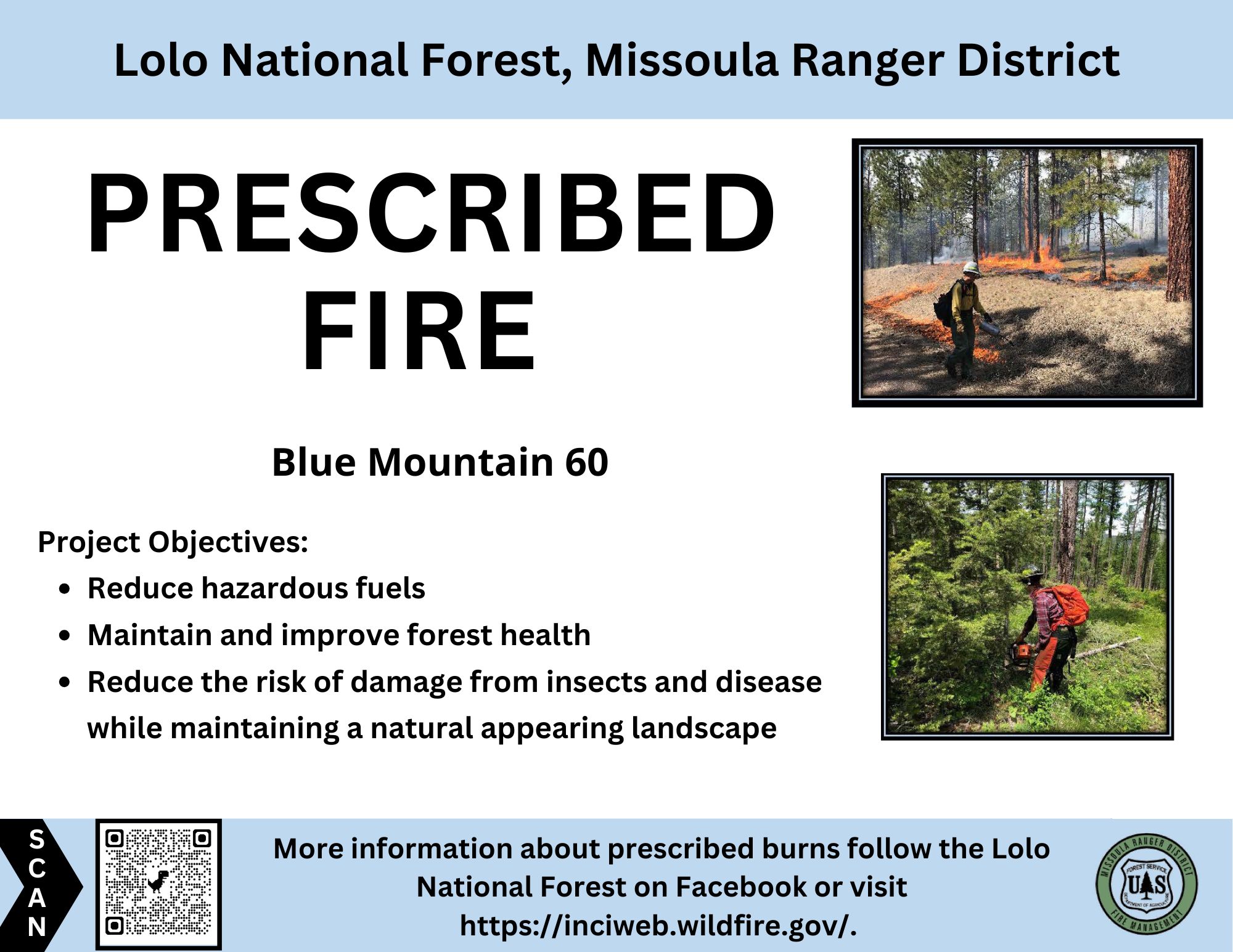
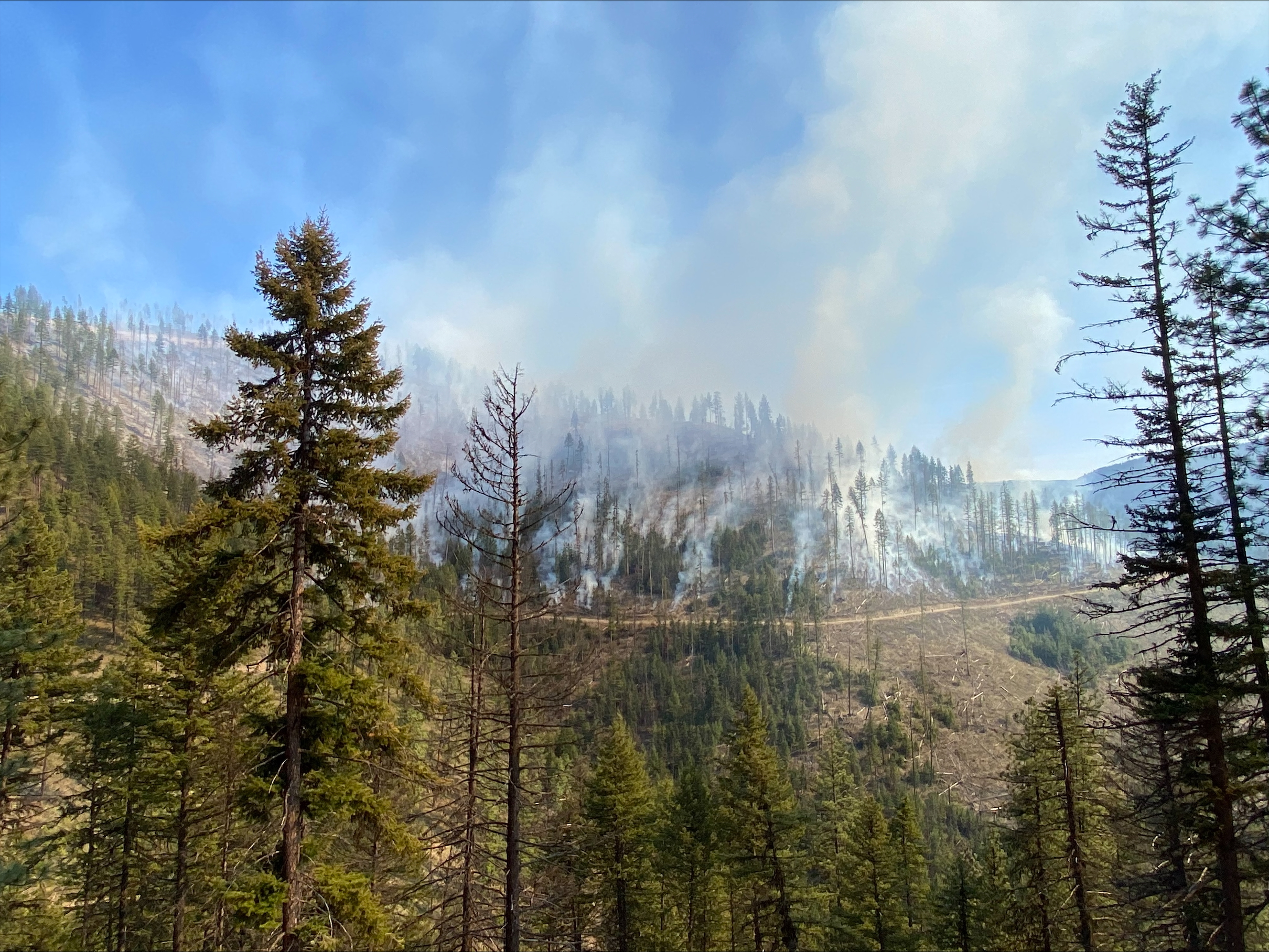
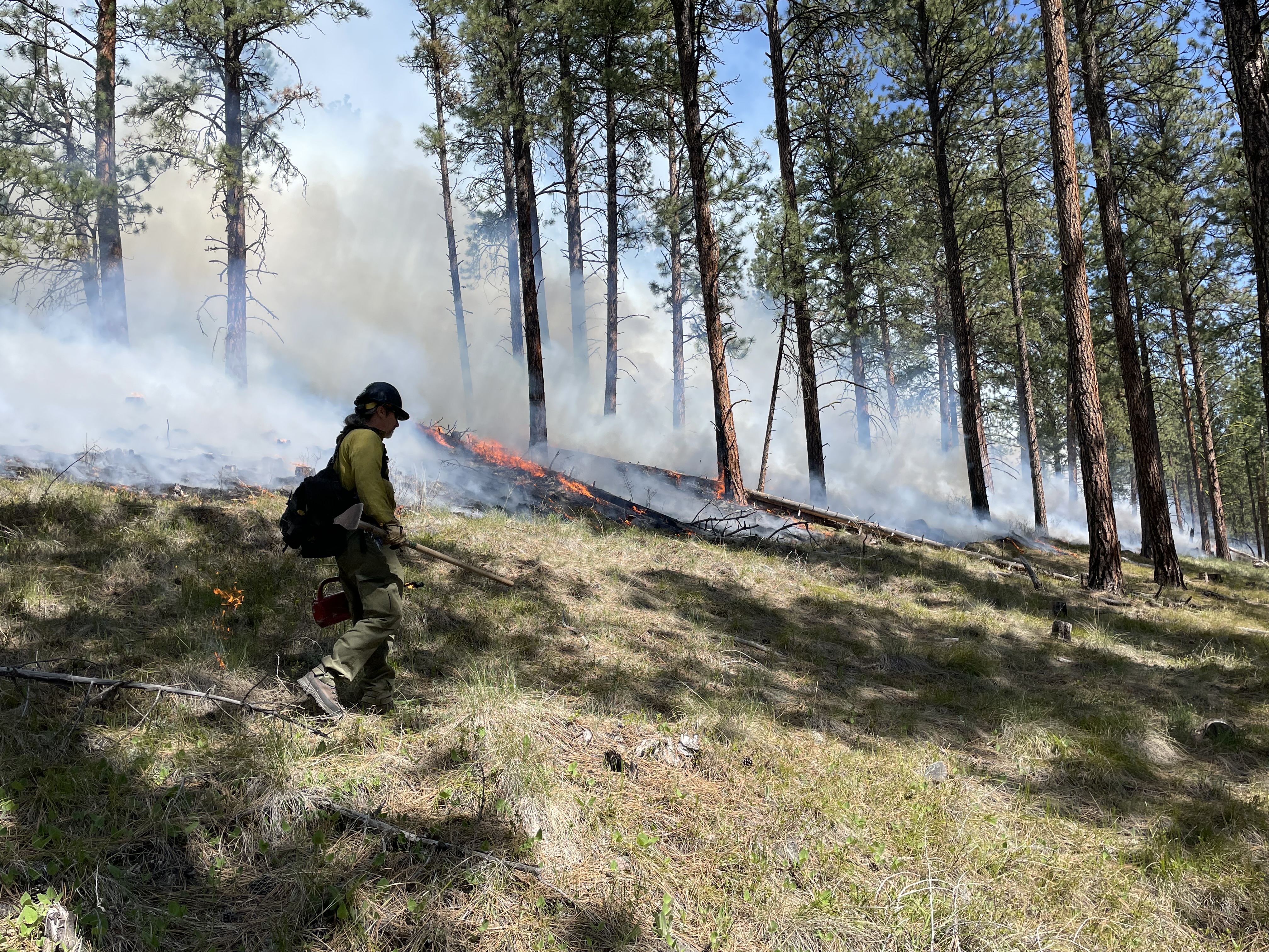
Missoula Ranger District- Blue Mountain: Firefighters completed ignitions on the Blue Mountain prescribed fire this afternoon (April 25). Smoke will likely be visible from Blue Mountain Road, Missoula, and surrounding area. Smoke may pool in lower elevations and along roadways during the evenings and early morning hours; impacts are expected to dissipate in a few days. Firefighters will remain on scene over the next few days.
Fire officials on the Lolo National Forest may implement prescribed fire operations today, as weather and fuels conditions allow.
Missoula Ranger District: The Missoula Ranger Districts plans to burn up to 43 acres on the Blue Mountain Unit 60, adjacent to Forest Service Road 365 and Blue Mountain Road (see map). This understory prescribed burn is part of the Wildfire Adapted Missoula project.
The prescribed burn objective is to reduce hazardous fuels by helping to reduce the risk of severe, wildfires and provide long-term ecosystem health, and help improve wildlife habitat and native plant regeneration.
All burning will be weather and fuel condition dependent. If ignition takes place, there is potential the burning could limit public access in these areas. For public safety, recreationists are asked to be aware of fire crews and vehicles in all prescribed fire areas. Prescribed fire signs will be posted near Maclay Flats on Blue Mountain Road, at the junction of Blue Mountain Road and the locked gate at Forest Service Road 365, and at the Blue Mountain trailhead.
Please avoid traveling in proposed prescribed burn units as well as trails and roads directly adjacent to the units. Please exercise caution as roads and trails could be temporarily impacted by low intensity fire and smoke. Smoke may be visible from Highway 93, Blue Mountain, and surrounding area.
Plains/Thompson Falls Ranger District: Firefighters plan to conduct up to 85 acres of understory burning on the 2 Short units 6 miles west of Thompson Falls. Smoke may be visible from Thompson Falls.