
Highlighted Media
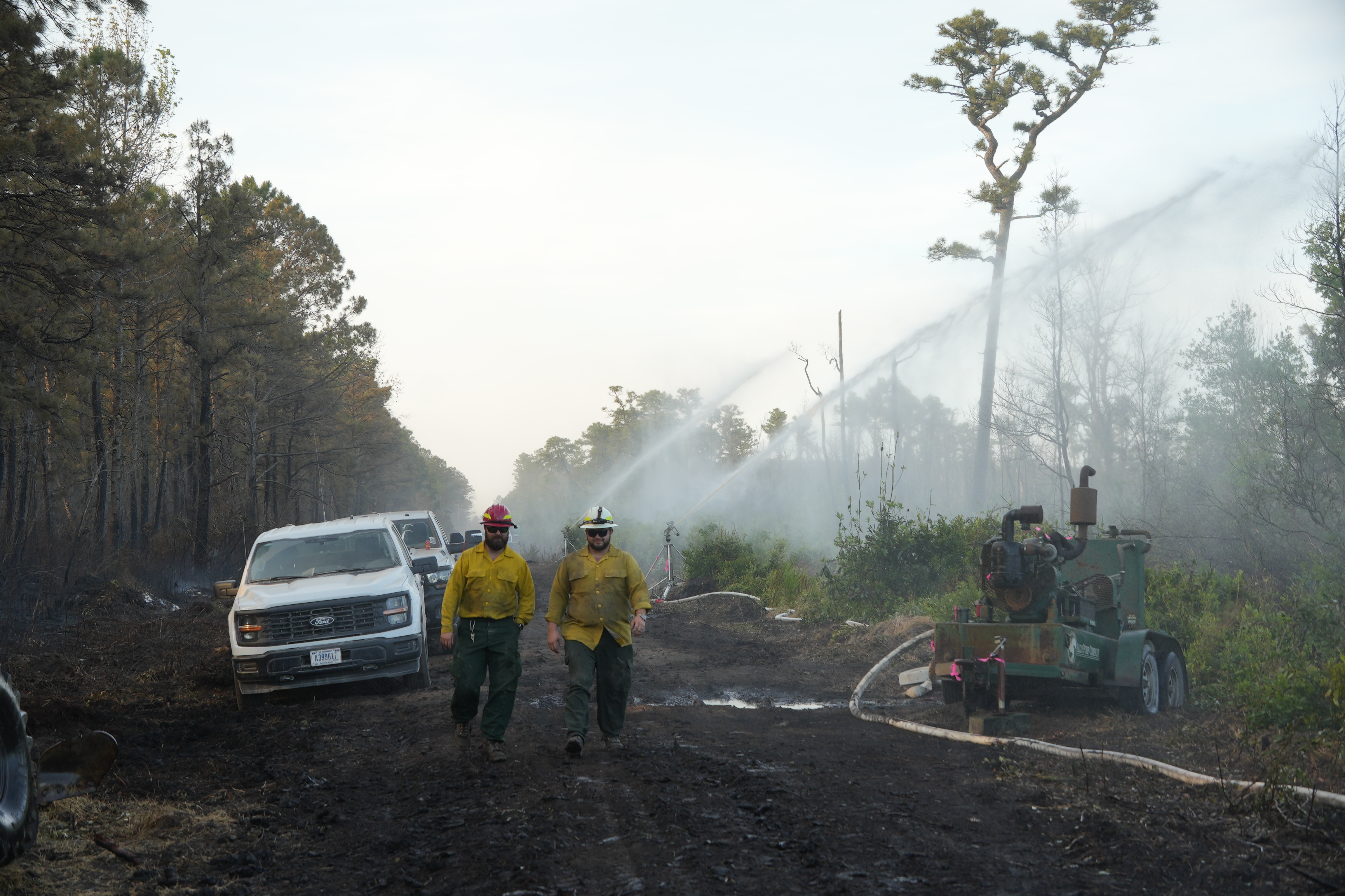
Firefighters walking along containment line
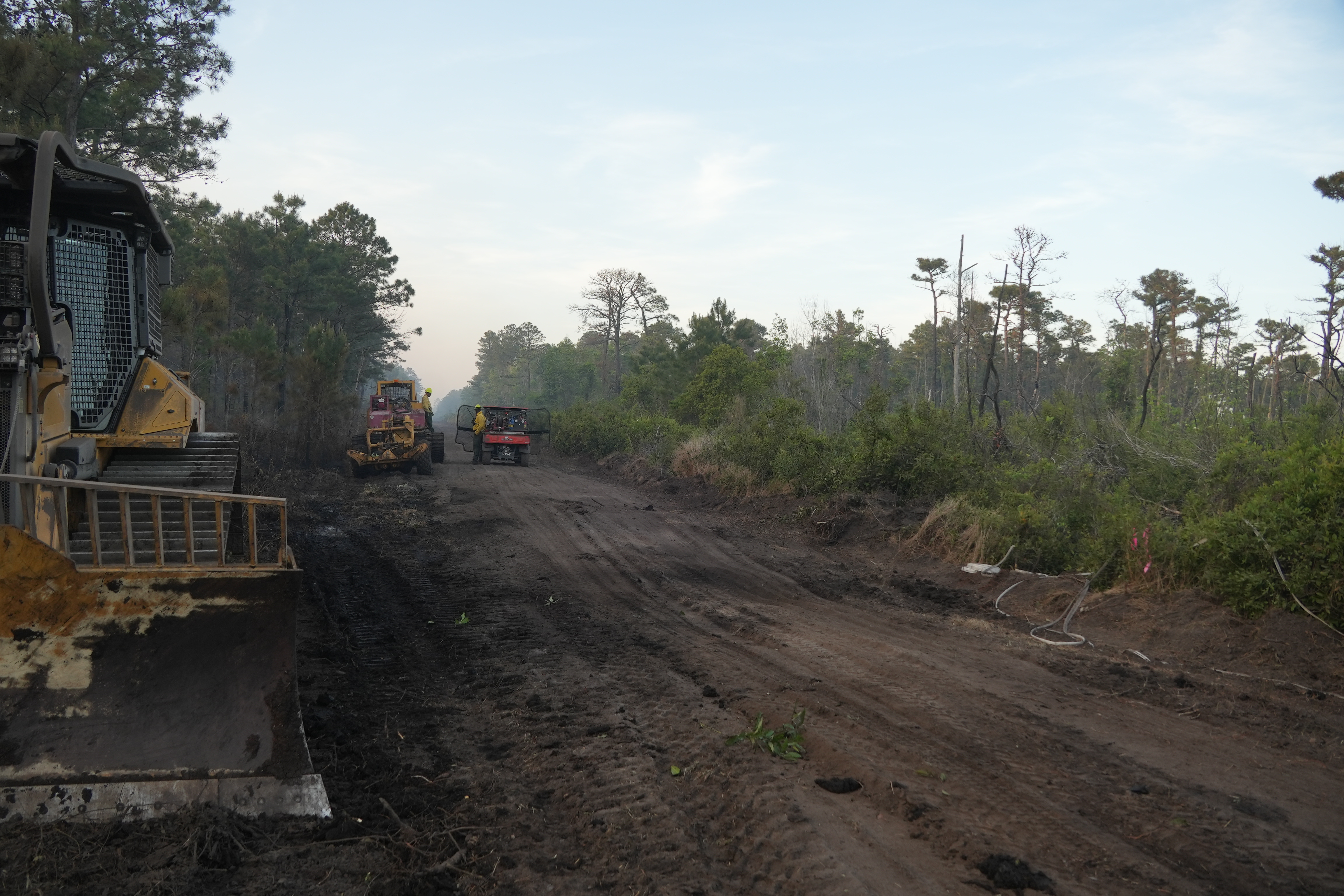
Firefighters from three different state and federal agencies continue their efforts to contain the Black Swamp Fire on the Croatan National Forest.
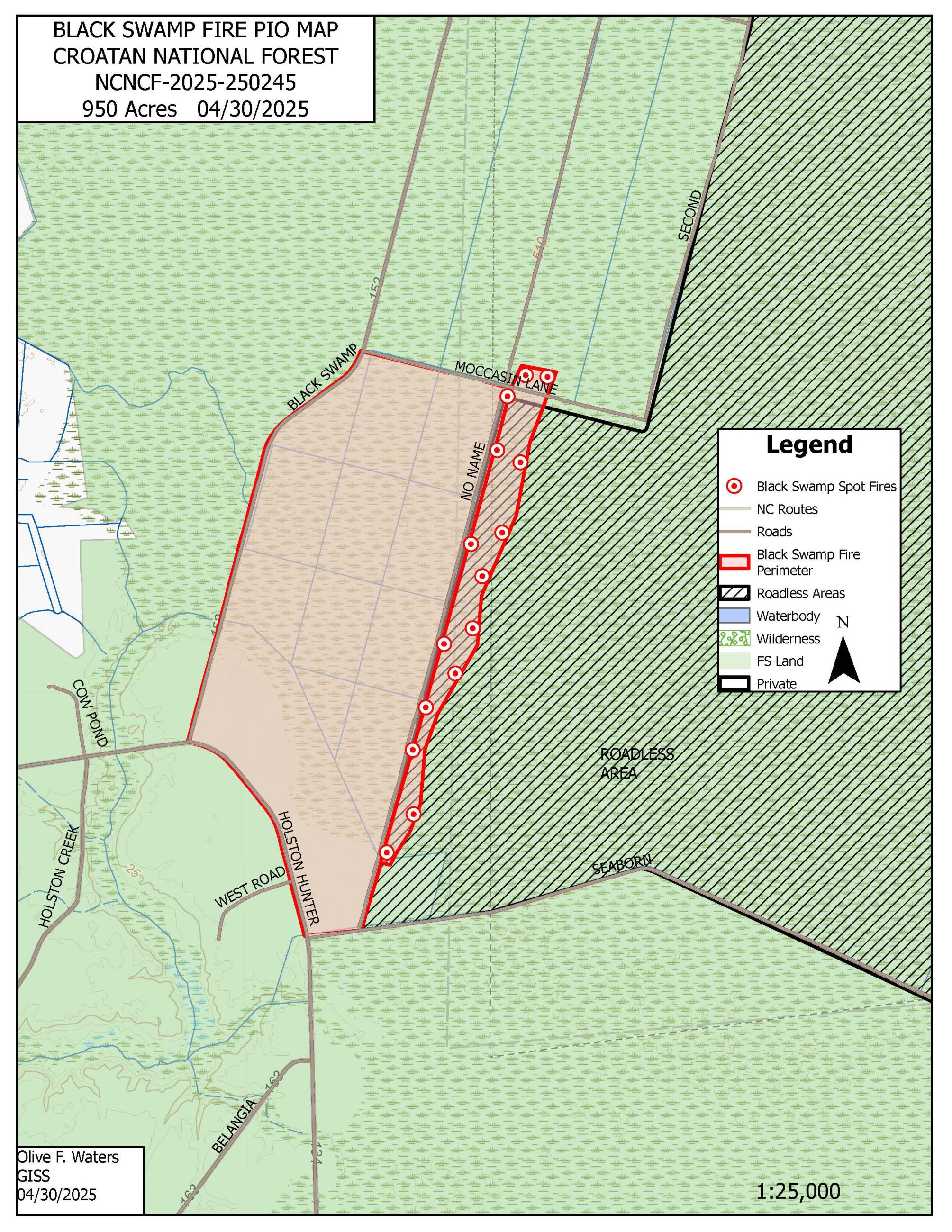
Thanks to a wide range of successful suppression tactics, the fire remained at 950 acres overnight, while containment rose to 60 percent. Personnel from the USDA Forest Service, North Carolina Forest Service and U.S. Fish and Wildlife Service are currently assigned to the fire.
To help improve containment, firefighters placed large agricultural sprinklers to draw water from the No Name Canal, soaking deep into the organic soil to cool burning roots and soil. A Black Hawk and two K-Max helicopters are also dropping water collected from the nearby Great Lake. High volume pumps are being installed to increase water access and aid suppression efforts.
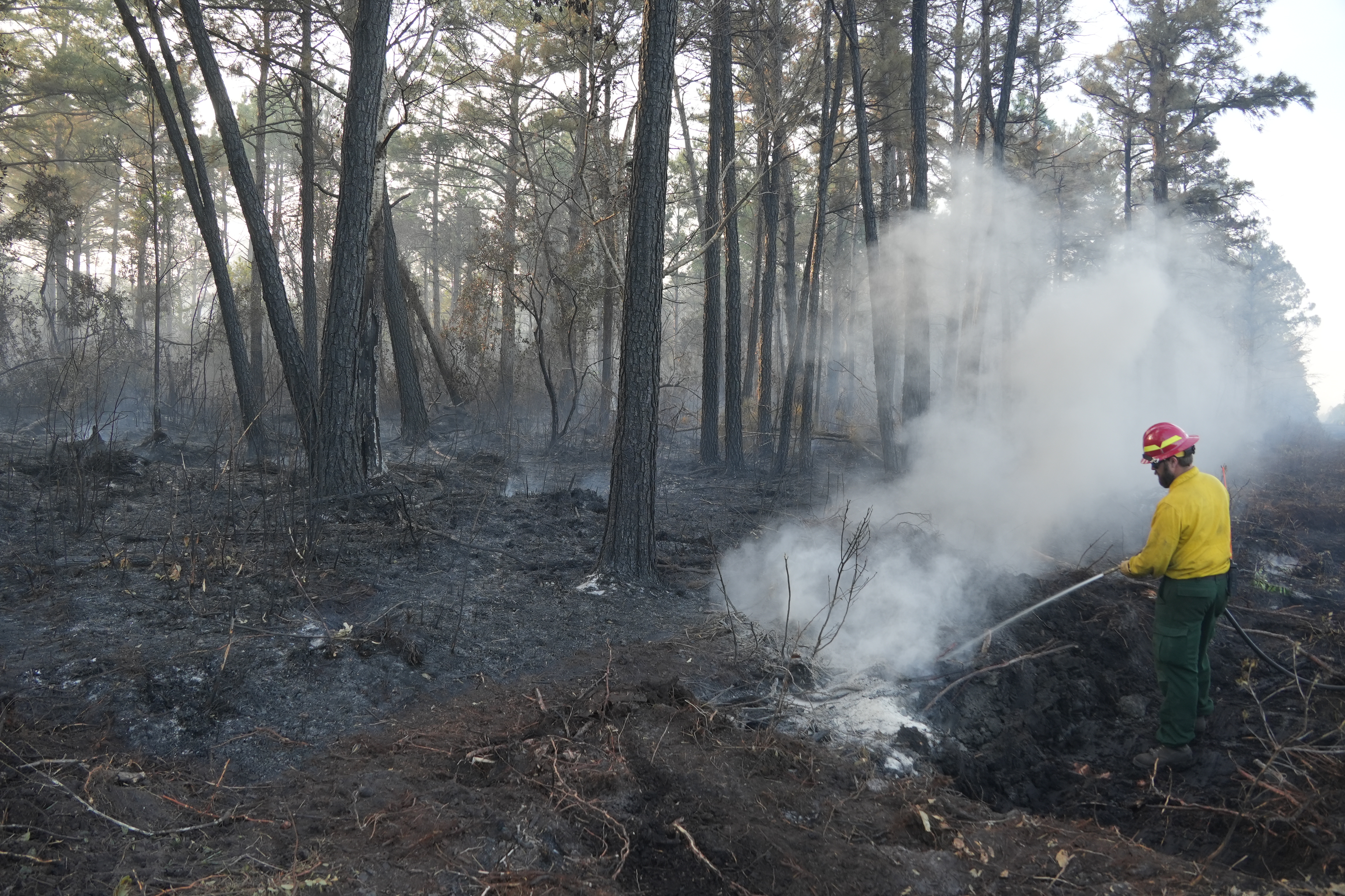
Crews are patrolling containment lines, and are ready to take direct attack, boxing in any potential spot fires that could cross over. Mop up operations are now underway along Moccasin Lane.
In response to the fire, the National Forests in North Carolina today temporarily closed the Great Lake Boating Access Area and Sheep Ridge Wilderness Area, as well as portions of Great Lake Road, Seaborn Road and Holsten Hunter Road. Black Swamp Road and the Black Swamp OHV area remain closed. At this time, the fire poses no risk to nearby communities; however, the public should continue to avoid closed areas.
Smoke from the fire can cause limited visibility and may impact local air quality. Drive slowly and use caution on roads where smoke may be settling. The public can check for air quality alerts at https://airquality.climate.ncsu.edu/ or https://fire.airnow.gov.
For the latest wildfire updates, follow the National Forests in North Carolina on Facebook at U.S. Forest Service - National Forests in North Carolina or visit https://www.fs.usda.gov/r08/northcarolina.
Firefighters from three different state and federal agencies continue their efforts to contain the Black Swamp Fire on the Croatan National Forest.
Thanks to a wide range of successful suppression tactics, the fire remained at 950 acres overnight, while containment rose to 60 percent. Personnel from the USDA Forest Service, North Carolina Forest Service and U.S. Fish and Wildlife Service are currently assigned to the fire.
To help improve containment, firefighters placed large agricultural sprinklers to draw water from the No Name Canal, soaking deep into the organic soil to cool burning roots and soil. A Black Hawk and two K-Max helicopters are also dropping water collected from the nearby Great Lake. High volume pumps are being installed to increase water access and aid suppression efforts.
Crews are patrolling containment lines, and are ready to take direct attack, boxing in any potential spot fires that could cross over. Mop up operations are now underway along Moccasin Lane.
In response to the fire, the National Forests in North Carolina today temporarily closed the Great Lake Boating Access Area and Sheep Ridge Wilderness Area, as well as portions of Great Lake Road, Seaborn Road and Holsten Hunter Road. Black Swamp Road and the Black Swamp OHV area remain closed. At this time, the fire poses no risk to nearby communities; however, the public should continue to avoid closed areas.
Smoke from the fire can cause limited visibility and may impact local air quality. Drive slowly and use caution on roads where smoke may be settling. The public can check for air quality alerts at https://airquality.climate.ncsu.edu/ or https://fire.airnow.gov.
For the latest wildfire updates, follow the National Forests in North Carolina on Facebook at U.S. Forest Service - National Forests in North Carolina or visit https://www.fs.usda.gov/r08/northcarolina.
| Current as of | Wed, 04/30/2025 - 20:39 |
|---|---|
| Incident Time Zone | Eastern Standard Time |
| Incident Type | Wildfire |
| Cause | Under Investigation |
| Date of Origin | |
| Incident Time Zone | Eastern Standard Time |
| Location | Jones County, 6 miles SE of Maysville, NC |
| Incident Commander | Matt Kampf US Forest Service |
| Coordinates |
34° 51' 45'' Latitude
-77° 6' 51
'' Longitude
|
| Total Personnel: | 80 |
|---|---|
| Size | 950 Acres |
| Percent of Perimeter Contained | 60% |
| Estimated Containment Date | 05/02/2025 |
| Fuels Involved | chaparral |
| Significant Events | Smoldering, Flanking, Moderate, Creeping |
| Planned Actions |
Maintain control lines. Go direct with spots outside control lines. |
|---|---|
| Projected Incident Activity |
12 hours: minimal 24 hours: minimal 48 hours: 72 hours: Anticipated After 72: |
| Remarks |
Hot and dry for the next several days, which may cause difficulty maintaining control lines. |
| Weather Concerns | Hot, dry. Sea breeze. |
|---|