
952022 Crockets Knob Fire Update
Related Incident: Crockets Knob Fire
Publication Type: News
Crockets Knob Fire Update
NORTHWEST INCIDENT MANAGEMENT TEAM 12
Incident Commanders: Jeff Dimke and Bobby Shindelar
September 05, 2022
Weather: Dry conditions will continue today but temperatures will be cooler, with highs rising only into the 70s and lower 80s across the fire area. West to northwest winds will be light along ridgetops at less than 10 mph with gusts less than 15 mph.
Operations: Yesterday firefighters made good progress along the western edge of the fire to hold and strengthen containment lines. Slightly lower temperatures and lower wind speeds gave crews an opportunity to create depth in the containment line and cool areas of more intense heat.Work along FSR 45 continues today with heavy equipment and crews moving north to improve the roadway for possible containment line. Several crews will be engaging along the northeastern corner and eastern flank today to construct direct line along the fire edge. Firefighters remain engaged along the northern edge where the fire continues to creep along in the available fuels. Many natural rocky areas on the north end are helping to reduce the rate of spread.Helicopters will continue to support firefighters on the eastern edge, cooling areas of heat and adding moisture to the fuels to slow fire growth. Containment continues to increase along the southern edge of the fire.
Closures and Evacuations: Grant County has issued a Level One evacuation advisory in the area of the fire. Level One means be ready and aware of fire conditions. You can view a map of the evacuation zone on the Grant County Emergency Management Facebook page.
An expanded closure is in effect on the Malheur and Umatilla National Forests today. For complete closure information, please go to: https://www.fs.usda.gov/detail/malheur/notices/...
Smoke may be visible to nearby communities and Forest visitors. Smoke and air quality impacts within the state can be monitored by visiting: http://oregonsmoke.blogspot.com
*A reduction in acreage is due to more accurate mapping.
Quick Facts:
SIZE: 4,265 Acres
*CONTAINMENT: 20%
CAUSE: LightningPERSONNEL: 612
LOCATION: 19 miles north of Prairie City
FIRE INFORMATION: 541-625-0892
2022.crocketsknob@firenet.gov
FACEBOOK: https://www.facebook.com/CrocketsKnobFire
INCIWEB: https://inciweb.nwcg.gov/incident/8355/
TEMPORARY FLIGHT RESTRICTION
There is a Temporary Flight Restriction over the Crockets Knob Fire area. Wildfires are a No Drone Zone - if you fly, we can’t.
942022 Crockets Knob Fire Update
Related Incident: Crockets Knob Fire
Publication Type: News
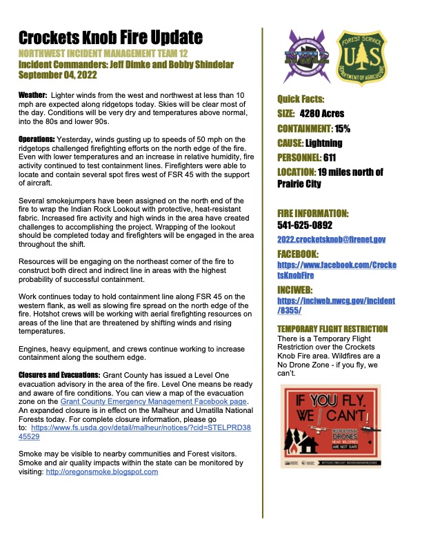
Crockets Knob Fire Update
NORTHWEST INCIDENT MANAGEMENT TEAM 12
Incident Commanders: Jeff Dimke and Bobby Shindelar
September 04, 2022
Weather:Lighter winds from the west and northwest at less than 10mph are expected along ridgetops today. Skies will be clear most of the day. Conditions will be very dry and temperatures above normal, into the 80s and lower 90s.
Operations: Yesterday, winds gusting up to speeds of 50 mph on the ridgetops challenged firefighting efforts on the north edge of the fire. Even with lower temperatures and an increase in relative humidity, fire activity continued to test containment lines. Firefighters were able to locate and contain several spot fires west of FSR 45 with the support of aircraft. Several smokejumpers have been assigned on the north end of the fire to wrap the Indian Rock Lookout with protective, heat-resistant fabric. Increased fire activity and high winds in the area have created challenges to accomplishing the project. Wrapping of the lookout should be completed today and firefighters will be engaged in the area throughout the shift.Resources will be engaging on the northeast corner of the fire to construct both direct and indirect line in areas with the highest probability of successful containment. Work continues today to hold containment line along FSR 45 on the western flank, as well as slowing fire spread on the north edge of the fire. Hotshot crews will be working with aerial firefighting resources on areas of the line that are threatened by shifting winds and rising temperatures. Engines, heavy equipment, and crews continue working to increase containment along the southern edge.
Closures and Evacuations: Grant County has issued a Level One evacuation advisory in the area of the fire. Level One means be ready and aware of fire conditions. You can view a map of the evacuation zone on the Grant County Emergency Management Facebook page. An expanded closure is in effect on the Malheur and Umatilla National Forests today. For complete closure information, please go to: https://www.fs.usda.gov/detail/malheur/notices/...
Smoke may be visible to nearby communities and Forest visitors. Smoke and air quality impacts within the state can be monitored by visiting: http://oregonsmoke.blogspot.com
Quick Facts:
SIZE: 4280 Acres
CONTAINMENT: 15%
CAUSE: Lightning
PERSONNEL: 611
LOCATION: 19 miles north of Prairie City
FIRE INFORMATION: 541-625-0892
2022.crocketsknob@firenet.gov FACEBOOK: https://www.facebook.com/CrocketsKnobFire INCIWEB: https://inciweb.nwcg.gov/incident/8355/
TEMPORARY FLIGHT RESTRICTION
There is a Temporary Flight Restriction over the Crockets Knob Fire area. Wildfires are a No Drone Zone - if you fly, we can’t.
Malheur Umatilla National Forests Expand Temporary Closure Area
Related Incident: Crockets Knob Fire
Publication Type: Closures
September 3, 2022 - Malheur & Umatilla National Forests Expand Temporary Closure Area Surrounding Crockets Knob Fire
The Malheur and Umatilla National Forests have temporarily expanded the Closure Area surrounding the Crockets Knob Fire.An area closure is in effect starting on County Road 20 at Sunshine Guard Station, northwest on County Road 20 to the Malheur National Forest boundary, north along the Forest boundary to the Umatilla National Forest boundary, east along the Forest boundary to Forest Service Road (FSR) 3988080, continuing east along FSR 3988080 to FSR 3988084, east to the Sharp Ridge Trail #3026, east to FSR 45, north on FSR 45 to the junction of Blue Mountain Trailhead #6141, southeast on Blue Mountain Trail #6141 to Sunrise Butte Trail #255, southwest to the Sunrise Butte Trailhead, southwest on FSR 4555 to the junction of FSR 4550, then back southwest to County Road 20 at Sunshine Guard Station. All boundary roads, trails, and campgrounds will be closed EXCEPT County Road 20 from Sunshine Guard Station northwest to the Malheur National Forest boundary, which will remain open.
For full area closure information and map, please visit: https://www.fs.usda.gov/malheur.Closure signs will be posted on the ground and detailed maps of the closure information will be available on the Forest website and at any Forest office. Forest officials advise the public to use caution when traveling on the Forest as roads and trails could be impacted by hazards such as trees, rocks or boulders. There will also be an increase in fire vehicles and fire traffic. Forest conditions can be dynamic this time of year and likely to change throughout the day and week.Visitors should contact their local ranger district prior to starting their trip. Many places in the Blue Mountains have limited or no cell phone coverage. Forest visitors should always be prepared to spend the night in the forest with warm clothing, food, personal hygiene items and plenty of water.
The public is encouraged to monitor the Malheur National Forest Facebook page for updates on forest conditions and the current fire activity: https://www.facebook.com/MalheurNationalForest/.
The public are encouraged to be aware of the elevated fire danger on the Malheur National Forest.
Current public use restrictions can be found on the Forest webpage: https://www.fs.usda.gov/malheur.
For #CrocketsKnobFire updates, please also visit the Crockets Knob Fire Facebook Page and Inciweb: https://inciweb.nwcg.gov/incident/8355/.
932022 Crockets Knob Fire Update
Related Incident: Crockets Knob Fire
Publication Type: News
Crockets Knob Fire Update
Incident Commanders: Jeff Dimke and Bobby Shindelar
CONTAINMENT: 10%
CAUSE: Lightning
TEMPORARY FLIGHT RESTRICTION
Grant County Level 1 Evacuation NoticeGet Ready
Related Incident: Crockets Knob Fire
Publication Type: Announcement
A Level One evacuation (be ready) advisory has been issued in Grant County for the #CrocketsKnobFire. Level one advisory indicates that projected threats from hazards associated with the approaching fire(s) are severe. This is the time for preparation, and precautionary movement of persons with special needs, and (under certain circumstances) pets and lives stock. You will be kept advised as conditions change. Please see the attached map and watch for updates.
922022 Crockets Knob Fire Update
Related Incident: Crockets Knob Fire
Publication Type: News
Smoke may be visible to nearby communities and Forest visitors. Smoke and air quality impacts within the state can be monitored by visiting: http://oregonsmoke.blogspot.com
912022 Crockets Knob Fire Update
Related Incident: Crockets Knob Fire
Publication Type: News
Closures: Current area closure information and map for both Malheur and Umatilla Forests can be found here: https://www.fs.usda.gov/malheur Smoke may be visible to nearby communities and Forest visitors. Smoke and air quality impacts within the state can be monitored by visiting: http://oregonsmoke.blogspot.com
8312022 Crockets Knob Fire Update
Related Incident: Crockets Knob Fire
Publication Type: News
Closures: Current area closure information and map for both Malheur and Umatilla Forests can be found here: https://www.fs.usda.gov/malheur
8302022 Crockets Knob Fire Update
Related Incident: Crockets Knob Fire
Publication Type: News
Crockets Knob Fire Update
SIZE: 1,859 Acres
CONTAINMENT: 0%
CAUSE: Lightning
PERSONNEL: 438
LOCATION: 19 miles north of Prairie City
A community meeting will be livestreamed on Facebook tonight at 6:00 PM, Tuesday, August 30th. https://www.facebook.com/CrocketsKnobFire
Weather: Tuesday and Wednesday will bring higher temperatures and lower fuel moisture to the fire area, along with gusty and erratic winds from a cold front moving into the area. These conditions could lead to an increase in fire behavior over the next few days.
Operations: Firefighters are utilizing a full suppression strategy to contain the Crockets Knob Fire. Yesterday work continued along FSR 45, using masticators and heavy equipment to thin brush and remove dead and down timber. Crews continue work in roadless areas along the north and east edges to construct handline, utilizing terrain features to aid in containment. The Structure Group is staffed with engines that are working primarily on the southern edge of the fire to identify any potential future structure and infrastructure protection needs, based on predicted weather events, fuel types and terrain that could contribute to fire growth.
Closures: Road, trail, campground, and area closures are in effect. An area closure is in effect starting at the junction of County Road 20 and FSR 45, east to Sunshine Guard Station, north on FSR 2000909 to the junction at FSR 4550, northeast on FSR 4555, then northeast to Sunrise Butte Trail #255, northeast to the junction with Princess Trail #251, east to Blue Mountain Trail #6141, northwest to FSR 45, and back south to the junction of County Road 20. All boundary roads and trails will be closed EXCEPT County Road 20 from the junction of FSR 45 to the junction of FSR 2000909 at Sunshine Guard Station. For full area closure information and map, please visit https://www.fs.usda.gov/malheur
Smoke may be visible to nearby communities and Forest visitors. Smoke and air quality impacts within the state can be monitored by visiting: http://oregonsmoke.blogspot.com
Fire Information:
FACEBOOK: https://www.facebook.com/CrocketsKnobFire
INCIWEB: https://inciweb.nwcg.gov/incident/8355/
TEMPORARY FLIGHT RESTRICTION: There is a Temporary Flight Restriction over the Crockets Knob Fire area. Wildfires are a No Drone Zone - if you fly, we can’t.
8292022 Crockets Knob Fire Update
Related Incident: Crockets Knob Fire
Publication Type: News
Crockets Knob Fire Update
CONTAINMENT: 0%
CAUSE: Lightning
PERSONNEL: 352
LOCATION: 19 miles north of Prairie City
A community meeting will be livestreamed on Facebook tomorrow at 6:00 PM, Tuesday, August 30th. A Facebook account is not required to view the meeting: https://www.facebook.com/CrocketsKnobFire
Weather: Temperatures will increase again today, following a warming trend that began yesterday. A cold front moving into the area may produce gusty winds that could increase fire behavior in the next few days in combination with rising temperatures and lower humidity.
Operations: Yesterday, crews and heavy equipment made good progress, improving road systems as containment line on the western flank. Masticators are being utilized to reduce fuel loads along FSR 45, removing brush and dead and down timber litter. Additional resources have been arriving to the fire to aid with line construction ahead of hotter and drier weather this week that could contribute to fire growth. A division of firefighting resources has been established which is dedicated to identifying potential structure or infrastructure protection needs and initial attack for new starts in the area. Scouting continues in roadless areas for opportunities to construct hand line with a high probability of slowing fire spread using natural terrain features.
Closures: Road, trail, campground, and area closures are in effect. An area closure is in effect starting at the junction of County Road 20 and FSR 45, east to Sunshine Guard Station, north on FSR 2000909 to the junction at FSR 4550, northeast on FSR 4555, then northeast to Sunrise Butte Trail #255, northeast to the junction with Princess Trail #251, east to Blue Mountain Trail #6141, northwest to FSR 45, and back south to the junction of County Road 20. All boundary roads and trails will be closed EXCEPT County Road 20 from the junction of FSR 45 to the junction of FSR 2000909 at Sunshine Guard Station. For full area closure information and map, please visit https://www.fs.usda.gov/malheur
Smoke may be visible to nearby communities and Forest visitors. Smoke and air quality impacts within the state can be monitored by visiting: http://oregonsmoke.blogspot.com
Fire Information:
FACEBOOK: https://www.facebook.com/CrocketsKnobFire
INCIWEB: https://inciweb.nwcg.gov/incident/8355/
TEMPORARY FLIGHT RESTRICTION: There is a Temporary Flight Restriction over the Crockets Knob Fire area. Wildfires are a No Drone Zone - if you fly, we can’t.