
Single Publication
Could not determine your location.
 Wildfire
 Prescribed Fire
 Burned Area
Response
Burned Area
Response Other
Other
Broom Canyon Fire Update 08-15-2024
Broom Canyon Fire
Publication Type: News - 08/15/2024 - 15:30
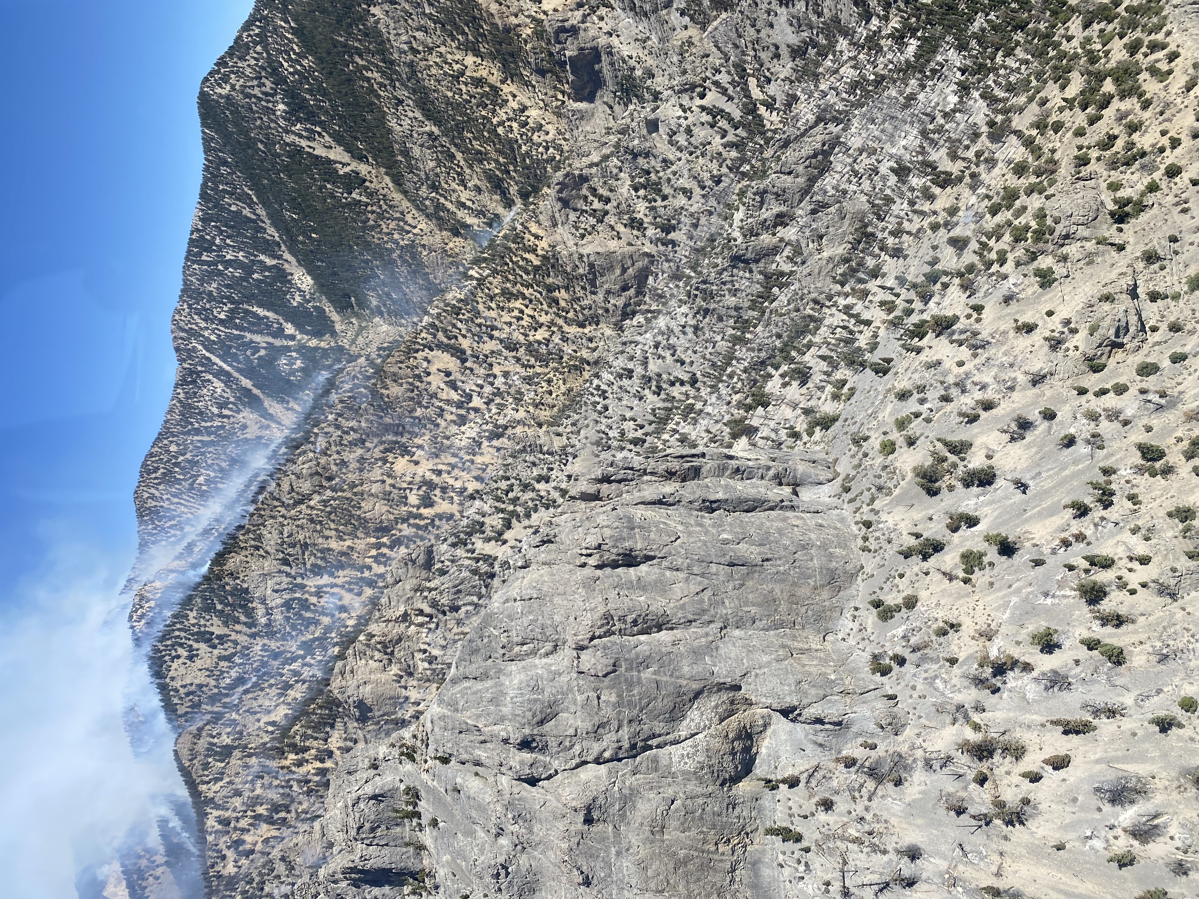
The 4,273-acre Broom Canyon Fire located nine miles east of Duckwater or 60 miles southwest of Ely, Nevada, continues to burn in steep, rugged, and inaccessible terrain, on Currant Mountain within the Currant Mountain Wilderness. This lightning-caused fire is currently located in an area where firefighter safety mitigations cannot be achieved therefore fire suppression actions are not being taken.
Our wildland firefighters risk their lives every day to protect communities, critical infrastructure, and natural resources,” said Ely District Ranger Jose Noriega. “It is extremely important to know when it is safe and not safe to deploy firefighting resources.”
The Ely Ranger District is managing the Broom Canyon Fire under a confine and contain strategy. A planning boundary has been established for areas which provide safe opportunities for suppression actions. Firefighters are also improving roads that have been identified as contingency fire lines should the fire move outside the planning boundary to the west.
The Broom Fire, which was first reported at approximately 8 p.m. on Monday, July 29, continues to smolder and produce isolated torching with moderate fire activity. Over the past several days, the fire has made runs to the north and south depending upon the wind direction. The fire is burning in white fir, pinyon pine and juniper, but also leaving lots of unburned vegetation resulting in a mosaic pattern.
Smoke is very visible during the day to residents of Currant, Duckwater and surrounding areas as well as motorists on U.S. Highway 6. On days where there is increase fire activities the smoke is visible in Ely. Smoke and fire activity will likely be seen into September and October until the first snow hits the mountain. For updates on air quality, visit: www.fire.airnow.gov.
Ely Ranger District (Aug. 15, 2024, at 3:30 p.m.)
- Acres: 4,273
- Location: Burning on Currant Mountain in the Currant Mountain Wilderness, which is nine miles east of Duckwater or 60 miles southwest of Ely, Nevada.
- Start Date: July 29, 2024
- Cause: Lightning
- Containment: 0%
- Personnel: 20
Fire Information:
- Inciweb: https://inciweb.wildfire.gov/incident-information/nvhtf-broom-canyon-fire
- Facebook: https://www.facebook.com/HumboldtToiyabeNF #BroomCanyonFire
- X (formerly Twitter): https://x.com/HumboldtToiyabe #BroomCanyonFire